
Abandoned & Little-Known Airfields:
Southwestern Pennsylvania
© 2002, © 2026 by Paul Freeman. Revised 5/17/26.
This site covers airfields in all 50 states: Click here for the site's main menu.
____________________________________________________
Please consider a financial contribution to support the continued growth & operation of this site.
Allegheny Valley Airport / Remich Airport / West Penn Airport (revised 8/8/25) - Aliquippa-Hopewell Airport (revised 11/7/20)
Altoona Airport (original location) / Altoona-Duncansville Airport (revised 11/6/20) - Brennan Airfield (revised 11/15/25)
Burgess Field (revised 9/30/18) - Glade Mill Airport (revised 11/15/25) - Greensburg City Airport / Carbon Airport (revised 5/26/21) - Irwin Airport (added 2/25/25) - Leechburg Airport (revised 11/15/25) - Mayer Field (revised 4/23/24)
Monessen Airport (revised 11/14/25) - Rodgers Field (revised 6/30/23) - Seven Springs Airport (revised 3/14/24) - Vandergrift Airport (revised 6/14/25) - Wilkinsburg Airport (revised 11/13/20)
____________________________________________________
40.331, -79.721 (Southeast of Pittsburgh, PA)
Irwin Airport, as depicted on the June 1948 Cleveland Sectional Chart.
This small general aviation airport southeast of Pittsburgh was evidently established at some point in 1948,
as it was not yet depicted on the January 1948 Cleveland Sectional Chart.
The earliest depiction which has been located of Irwin Airport was on the June 1948 Cleveland Sectional Chart.
It depicted Irwin as a commercial/municipal airport.
Bob Lindh recalled, “The man who invented fly-by airmail pick up was a dentist in Irwin, Doc Adams and he did his early experiments at Irwin Airport.”
An article in the 5/12/02 TribLive described how All-American Aviation (which eventually became today's US Airways) conducted air mail pickup experiments:
“Lytle Adams was the developer of the pickup technology. He carried out his experiments on the 'flying pickup' at an Irwin-area field.”

The earliest photo which has been located of Irwin Airport was a 10/27/49 aerial view (from PennPilot).
It depicted 2 unpaved runways, with 3 light single-engine planes & a few small buildings on the west side.
Bob Lindh recalled, “I was at [Irwin] airport as a young boy playing [circa early 1950s]. It was already shut down & just weeds.
One small block building still standing, no windows no door… but will never forget inside still sat one of those old Link Trainers.”

The last aeronautical chart depiction which has been located of Irwin Airport was on the January 1954 Cleveland Sectional Chart.
It depicted Irwin as having a mere 1,700' unpaved runway.
Irwin Airport was evidently closed (for reasons unknown) at some point in 1954, lasting only 6 years,
as it was no longer depicted on the June 1954 Cleveland Sectional Chart.

The earliest topo map depiction which has been located of Irwin Airport was on the 1955 USGS topo map.
It depicted 2 unpaved runways & a few small buildings on the west side.
The 1964 USGS topo map depicted Irwin Airport in an unchanged fashion.
The 1970 USGS topo map depicted residential streets having covered the site of Irwin Airport.

A 2024 aerial view showed no trace remaining of Irwin Airport. The property's history is commemorated via one of the residential street names: Airview Drive.
Thanks to Bob Lindh for pointing out this airfield.
____________________________________________________
Monessen Airport, Monessen, PA
40.14, -79.84 (Southeast of Pittsburgh, PA)
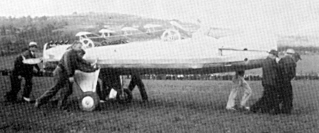
A 1935 photo of Bemis Johnston's 'Wingless Airplane”, presumably taken at Monessen Airport (courtesy of Tim Shaffer).
The date of establishment of this small general aviation airport southeast of Pittsburgh has not been determined.
The earliest reference which has been located to Monessen Airport was an article in the 9/21/29 Monongahela Daily Republican (courtesy of Tim Shaffer),
entitled “Monessen Airport to Resume Sunday”, which described how after being closed for several weeks, the airport would resume activities including exhibition flying.
The earliest dated depiction which has been located of Monessen Airport was a 1935 photo of Bemis Johnston's 'Wingless Airplane” (courtesy of Tim Shaffer),
which was tested at Monessen Airport, but the planned test flight was precluded by federal officials.
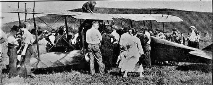
A circa 1930s a crowd around a Curtiss Jenny biplane at Monessen Airport (courtesy of Tim Shaffer).
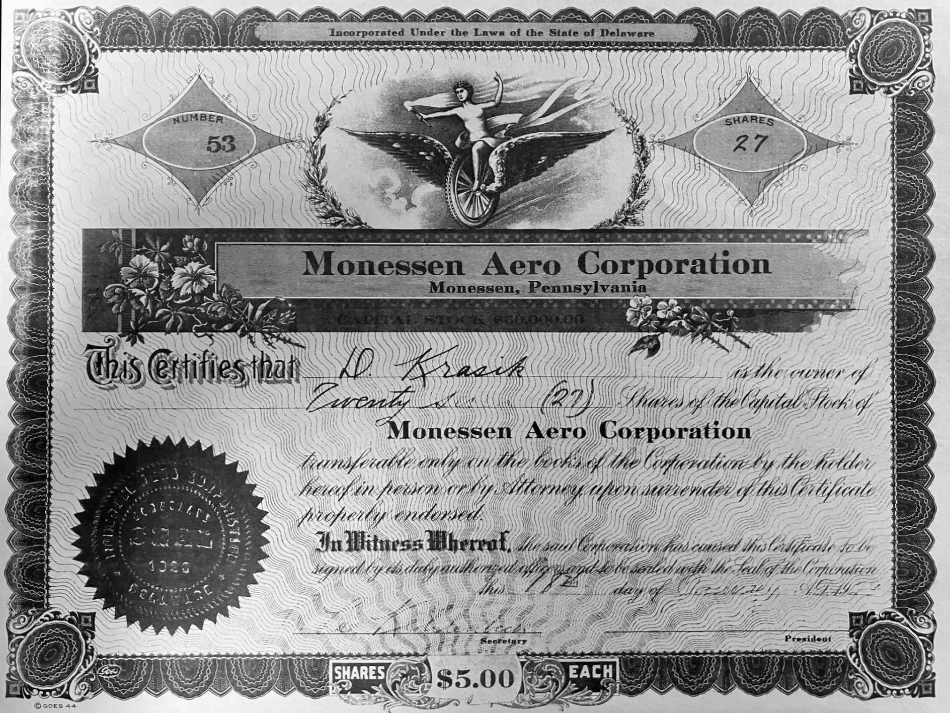
A circa 1930s stock certificate for the Monessen Aero Corporation (courtesy of the Rostraver Township Historical Society, via Tim Shaffer).
Monessen Airport was not depicted at all on 1930s/40s/50s USGS topo maps, or on 1935/40/47 Cleveland Sectional Charts.
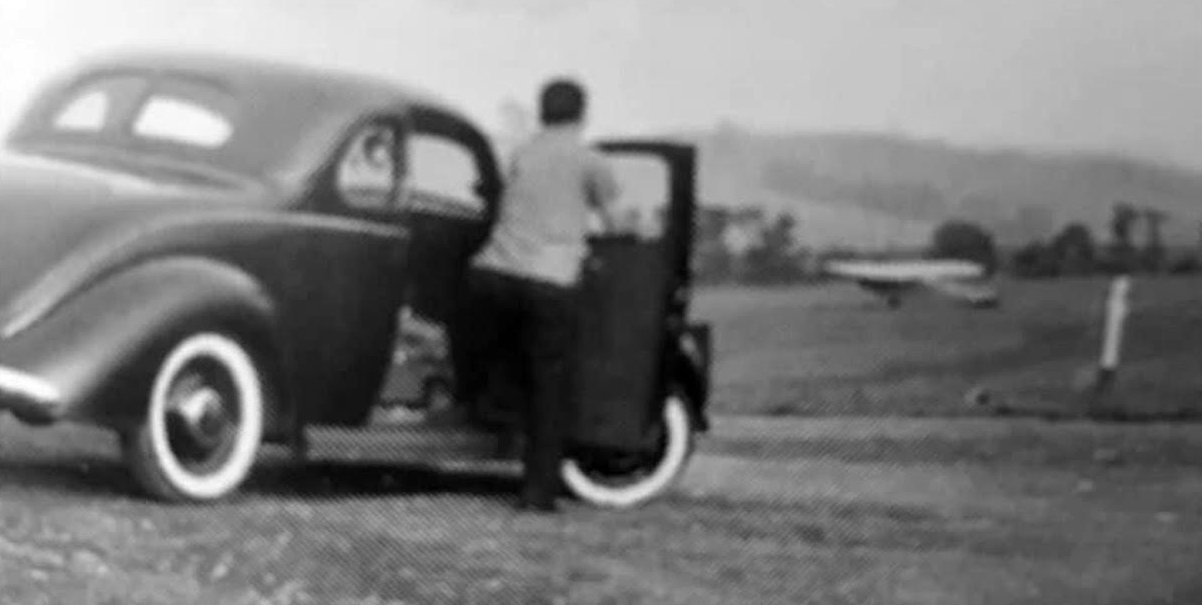
A circa 1930s/40s photo of a spectator & a plane at Monessen Airport (courtesy of Tim Shaffer).
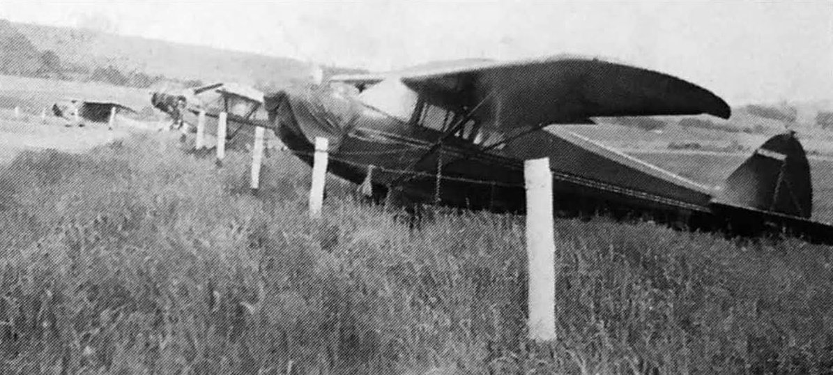
A circa 1930s/40s photo of 3 single-engine taildraggers at Monessen Airport (courtesy of Tim Shaffer).
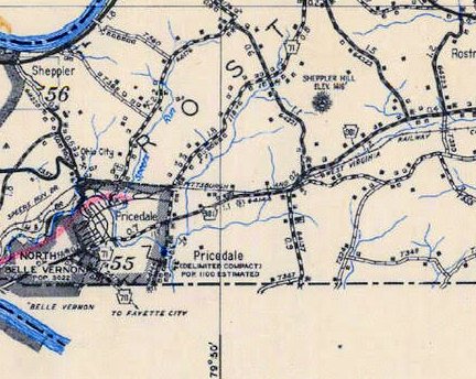
The only map depiction which has been located of Monessen Airport was on a 1941 road map (courtesy of Tim Shaffer).
The last reference which has been located of an aircraft using Monessen Airport came from Tim Shaffer, who recalled:
“Around 1943, an Army Air Force bomber (B-25?) made an emergency landing there, a huge sensation for us locals.
I was 6 or 7 at the time. People came from far & wide to see it.”
A 1952 aerial photo did not show any recognizable trace of Monessen Airport.
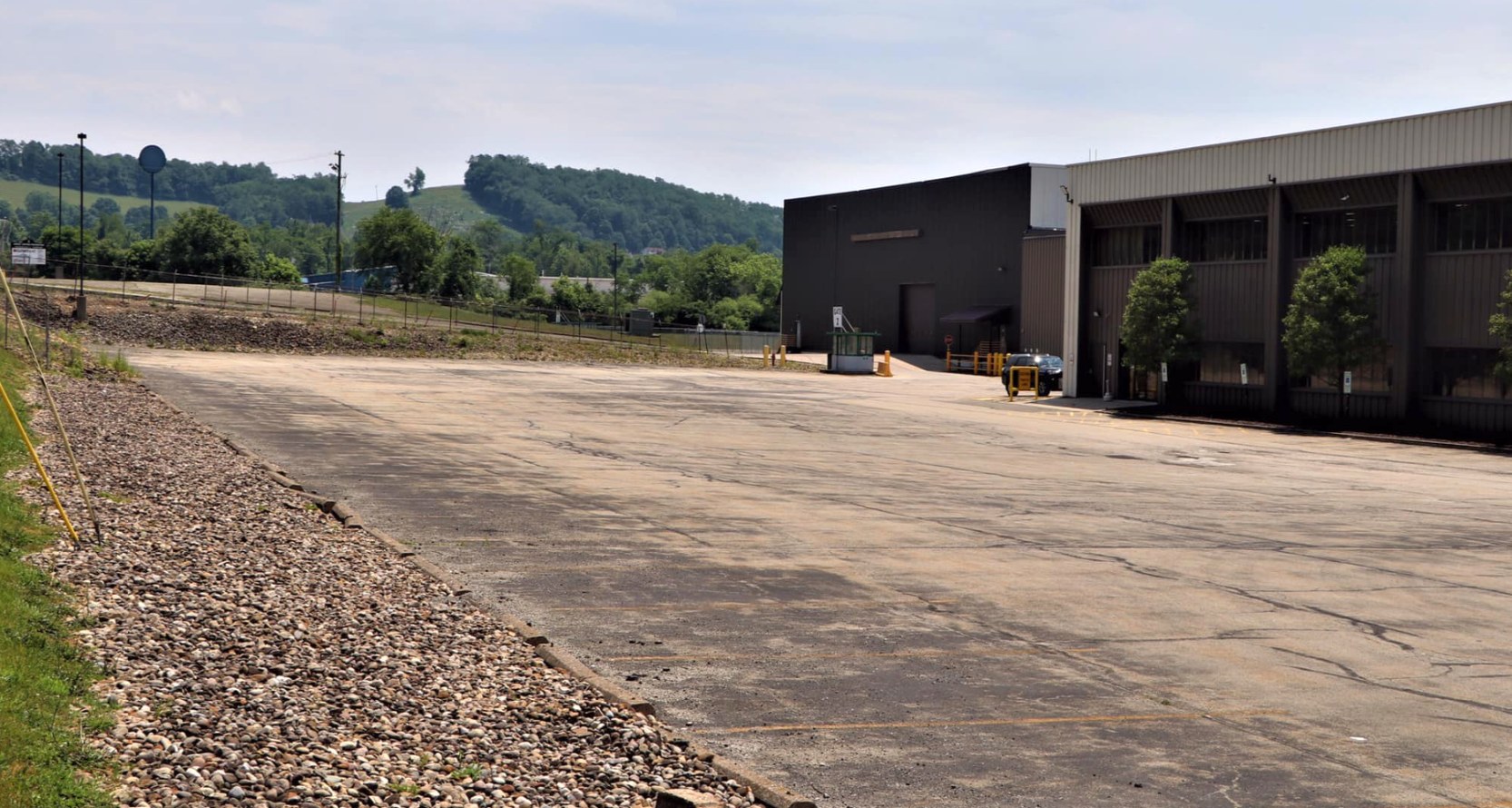
An undated photo (posted in 2022) of the site of Monessen Airport (courtesy of Tim Shaffer), showing no trace of the former airport.
Thanks to Tim Shaffer for pointing out this airfield.
____________________________________________________
Vandergrift Airport, Vandergrift, PA
40.601, -79.603 (Northeast of Pittsburgh, PA)
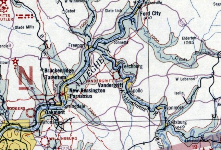
Vandergrift Airport, as depicted on the December 1932 Cleveland Sectional Chart.
The date of establishment of this small general aviation airport northeast of Pittsburgh has not been determined.
The earliest depiction which has been located of Vandergrift Airport was on the December 1932 Cleveland Sectional Chart,
which depicted Vandergrift as a commercial/municipal airport.
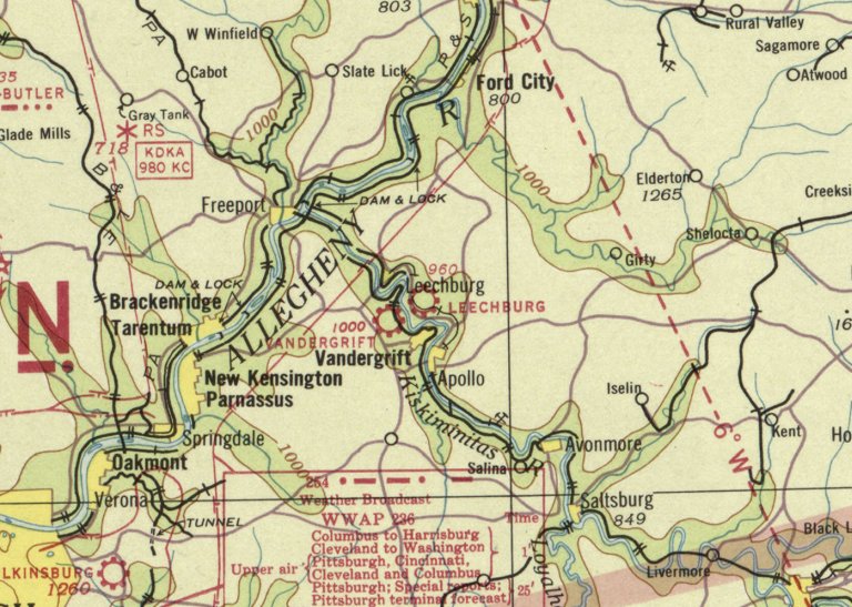
Vandergrift Airport, as depicted on the July 1938 Cleveland Sectional Chart.
Tom Imrich recalled, “Frank Mattis ran Vandergrift Airport.
Frank had an incredible inventory of aircraft spare parts there for sale, sold out of his big high-bay hangar.
It was the ultimate aircraft junkyard, even better than Milt Barkley's collection at Mt. Pleasant PA.
Frank had entire fuselages, fuselage sections, wings, props, struts, engines, landing gears, and probably much much more,
all salvaged from from Cubs, Aeroncas, Stinsons, and just about anything else that was flying back then.
All were neatly stored in bins & holding frames, and stacked like chord wood, with many parts hung from the hangar ceiling. It was amazing to even see.
I used to fly up there with Dad from Latrobe, in our 1939 Aeronca Chief, to visit Frank, when dad needed some particular aircraft part.”
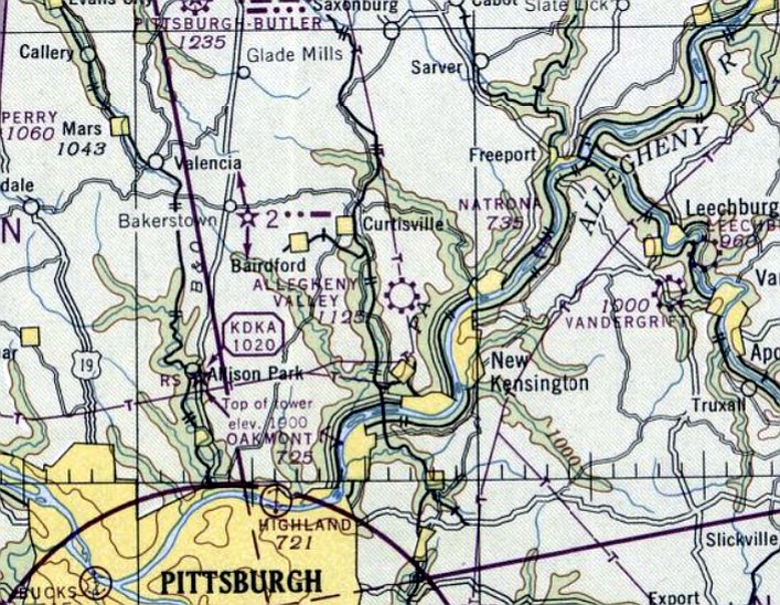
The January 1947 Cleveland Sectional Chart depicted Vandergrift as a commercial/municipal airport.
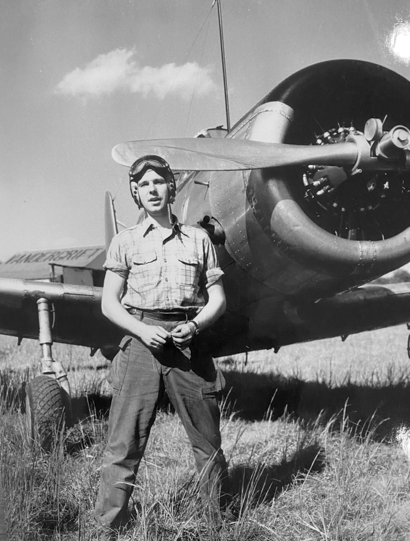
The earliest photo which has been located of Vandergrift Airport was a 1947-48 photo of James Woods (courtesy of his sons Chuck & Jim Woods), in front of a Vultee BT-13 & a hangar which had the airport name painted on its roof.
Chuck recalled, “He was a B-24 bomber pilot during WW2 & processed out of the Army Air Corps following WW2 (but later was called back to fly).
He & a friend started an advertising company to fly banners over stadiums, and I think they flew out of Culmerville Airport. Not sure how/why he visited Vandergrift.”
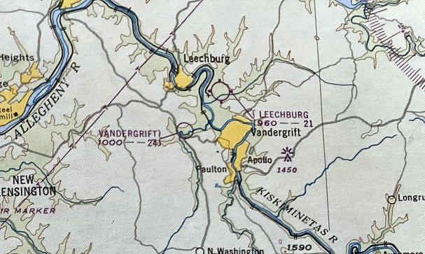
The January 1948 Pittsburgh Local Aeronautical Chart (courtesy of Tom Imrich) depicted Vandergrift Airport as having a 2,400' unpaved runway.
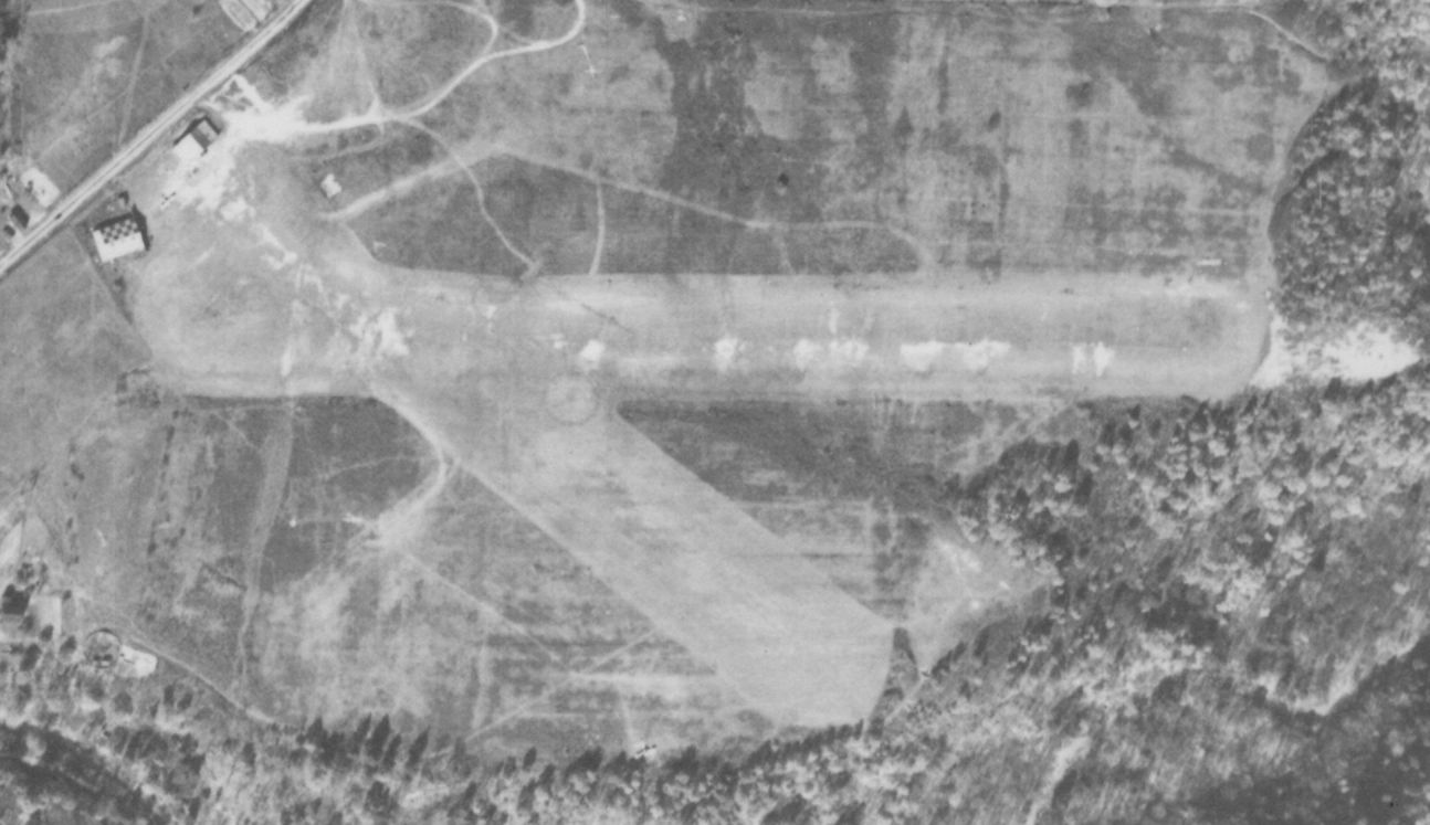
The last photo which has been located showing Vandergrift Airport was a 10/27/49 aerial view.
It depicted Vandergrift Airport as having 2 unpaved runways, with 1 or 2 light planes parked near 2 small hangars on the northwest side.

The earliest topo map depiction which has been located of Vandergrift Airport was on the 1953 USGS topo map.
It depicted Vandergrift Airport as having 2 unpaved runways, with 2 small buildings on the northwest side.
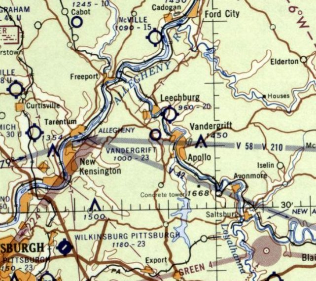
The last aeronautical chart depiction which has been located of Vandergrift Airport was on the January 1961 Cleveland Sectional Chart,
which depicted Vandergrift as having a 2,300' unpaved runway.
Tom Imrich reported, “My guess is that Vandergrift Airport was closed after Frank Mattis died.”
Vandergrift Airport was evidently closed at some point between 1961-62,
as a 1962 aerial photo showed construction of a school having erased all traces of the airport.
Vandergrift Airport was no longer depicted on the May 1963 Cleveland Sectional Chart.
The 1969 USGS topo map showed several school buildings covering the site of Vandergrift Airport.
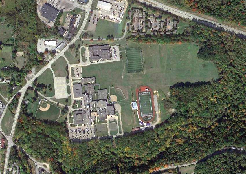
A 2020 aerial view showed the site of Vandergrift Airport covered by the Kiski Area High School.
Thanks to Tom Imrich for pointing out this airfield.
____________________________________________________
Wilkinsburg Airport, Wilkinsburg, PA
40.452, -79.855 (East of Pittsburgh, PA)
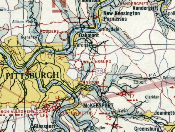
Wilkinsburg Airport, as depicted on the December 1932 Cleveland Sectional Chart.
This short-lived general aviation airport on the east side of Pittsburgh apparently lasted less than a decade.
The earliest photo which has been located of Wilkinsburg Airport was on the December 1932 Cleveland Sectional Chart.
A 7/9/34 Pittsburgh Press article (courtesy of Win Bryson) described how 1,000 spectators tragically saw 21 year old Lois Marshall
plunge to her death at Wilkinsburg Airport when both of her parachutes failed to open.
Pioneering female aviator Teresa James learned to fly at age 19 in an OX-5 Travel Air, soloing in four hours & 20 minutes at Wilkinsburg Airport,
so that she could impress a handsome pilot that she had a major crush on.
Despite an extreme fear of flying, Teresa obtained her private license on October of 1934.
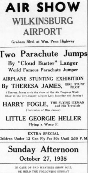
A advertisement for a 10/27/35 Air Show at Wilkinsburg Airport, featuring parachute jumps & “Girl Stunt Pilot” Theresa James.
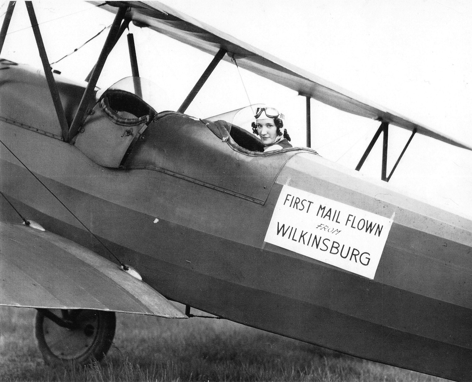
A 1938 photo of Theresa James in a Travelaire biplane, marked for the occasion of the first Air Mail flown from Wilkinsburg (courtesy of Win Bryson).
On 5/19/38, Teresa flew Air Mail for the National Air Mail Week Campaign from Wilkinsburg
in commemoration of the 25th Anniversary of Air Mail Service in the U.S. while working as a florist at her family’s flower shop.
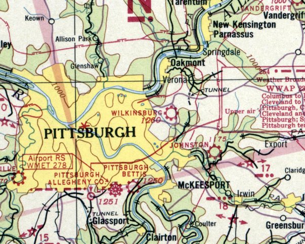
The last depiction which has been located of Wilkinsburg Airport was on the July 1938 Cleveland Sectional Chart.
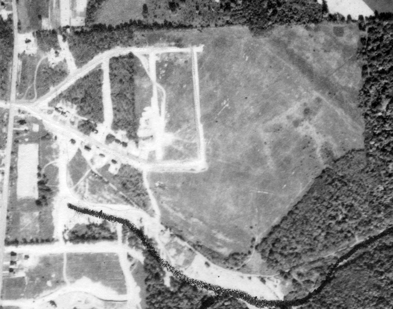
A 10/2/38 aerial view showed residential construction starting to cover the site of Wilkinsburg Airport.
Wilkinsburg Airport was no longer depicted on the March 1940 Cleveland Sectional Chart.
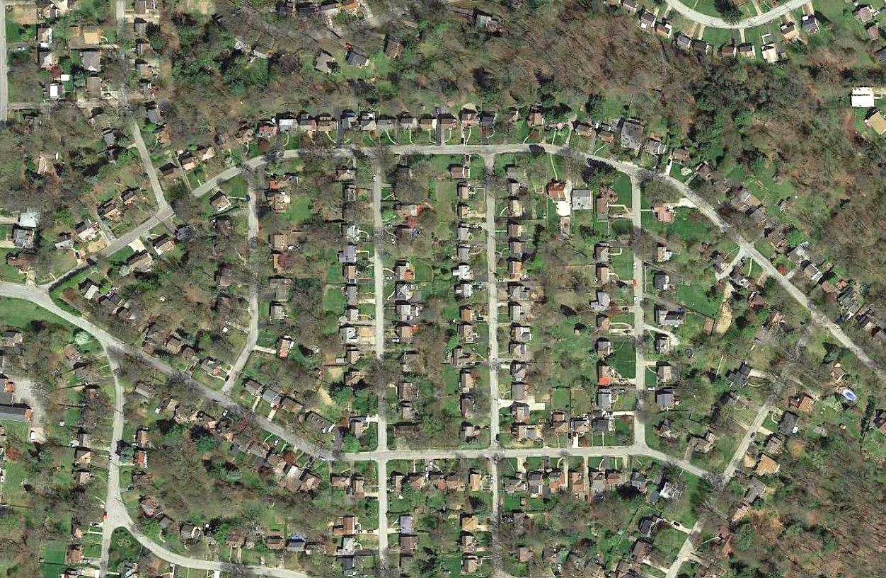
A 2016 aerial view showed that no trace remaining of Wilkinsburg Airport.
The site of Wilkinsburg Airport is located east of the intersection of Orlando Place & Hollywood Drive.
Thanks to Travis Hunt for pointing out this airfield.
____________________________________________________
Greensburg City Airport / Carbon Airport, Greensburg, PA
40.29, -79.555 (East of Pittsburgh, PA)
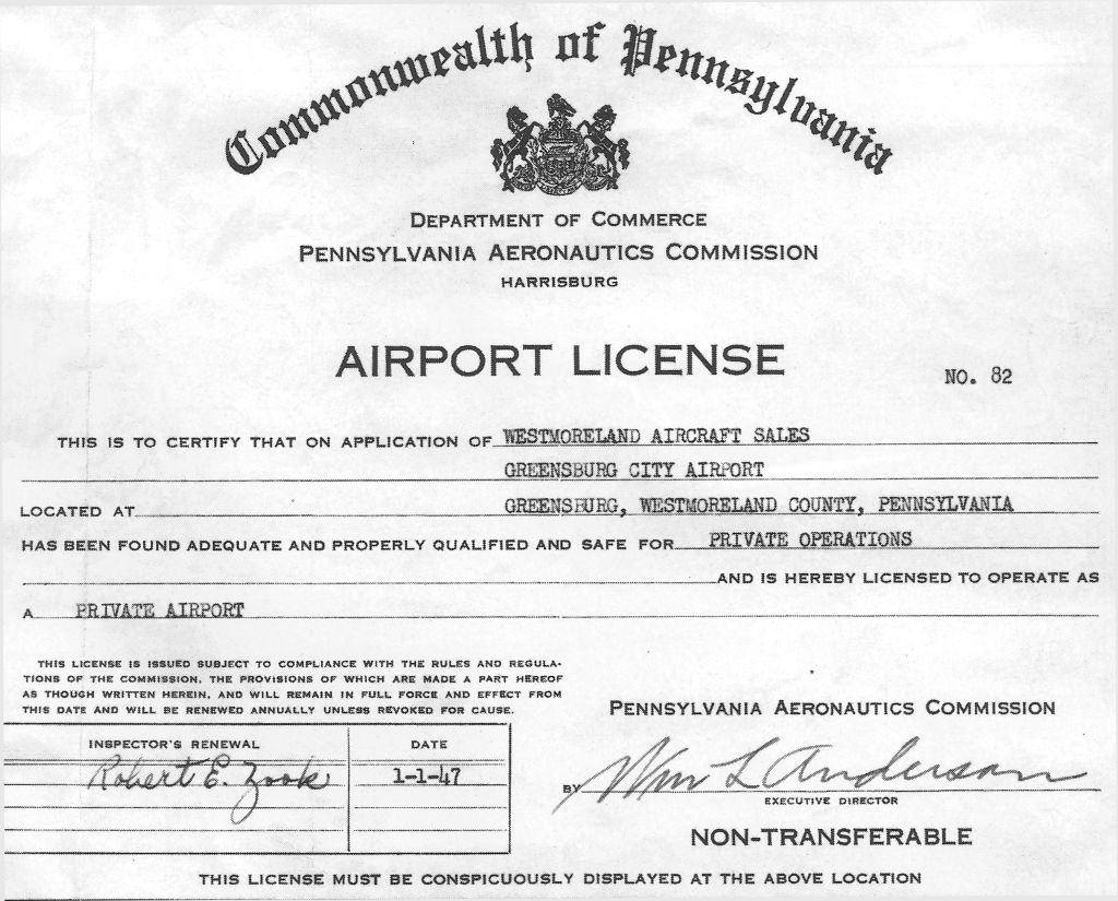
The 1/1/47 Airport License for the new Greensburg City Airport (courtesy of Thomas Imrich).
According to Thomas Imrich, “I believe construction of Carbon [Airport] probably started in late 1946.”
The PA Aeronautics Commission granted Westmoreland Aircraft Sales an Airport License for the new Greensburg City Airport on 1/1/47 (courtesy of Thomas Imrich).
Greensburg City Airport was not yet depicted on the July 1947 Cleveland Sectional Chart.
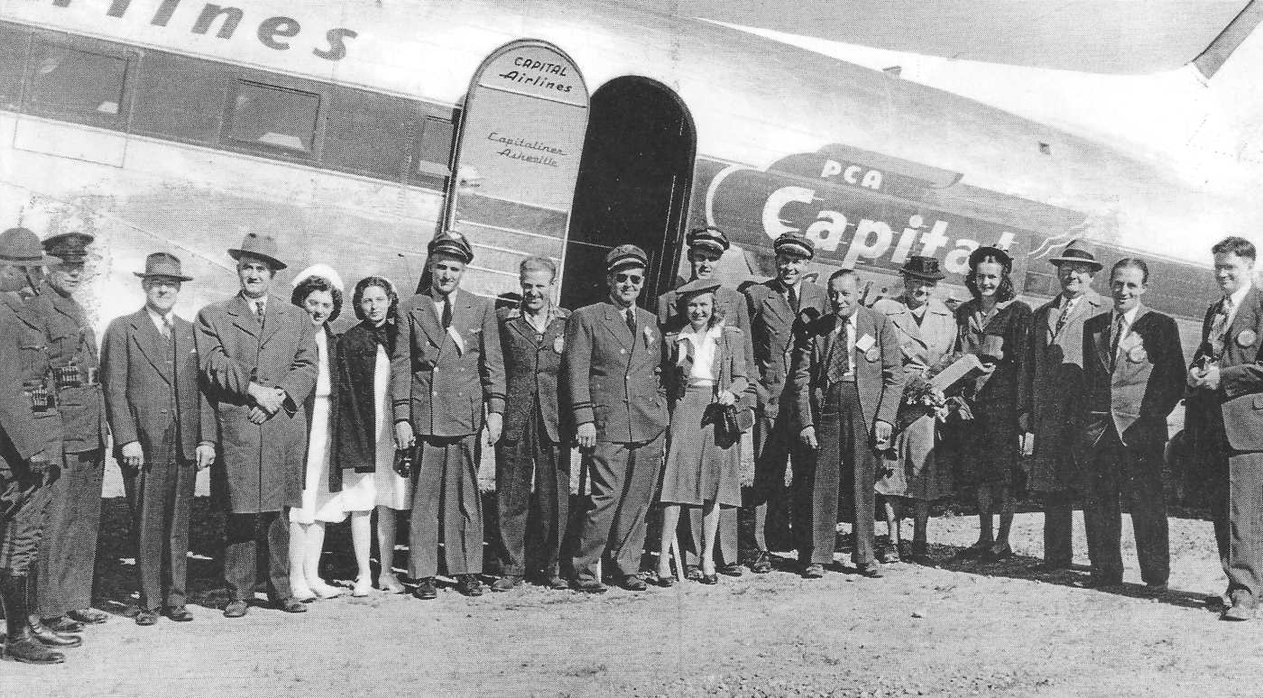
The earliest depiction which has been located of Greensburg City Airport was a 9/28/47 photo of Captain Frank Fox & First Officer William Richey with a crowd of spectators
in front of a Capital Airlines DC-3 upon its landing on the occasion of the opening of Greensburg City Airport.
According to Thomas Imrich, “Photos in 'A Place in the Sky' by Robert Wissolik show All American Aviation Captain Lloyd Santmyer handing flowers
to Westmoreland County Commissioner Jean Whitehead at the ceremony marking the formal opening of the Carbon (Greensburg City) Airport.”
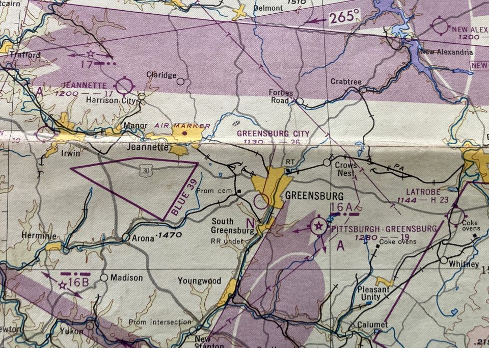
The earliest aeronautical chart depiction which has been located of Greensburg City Airport was on the January 1948 Pittsburgh Local Aeronautical Chart (courtesy of Tom Imrich).
It depicted Greensburg City Airport as having a 2,600' unpaved runway.
A circa 1948-50 photo of the small original Hangar at the Carbon / Greensburg City airport".
Tom Imrich reported, “Note a windsock on the hangar roof, and the airport office which was located in the hangar's basement below.
An airport checkerboard pattern was later painted on the hangar roof.
That building was the first hangar at the airport.
It also contained the airport office, a meeting room, and the restrooms, on the lower level, (in the partial basement),
with the entrance at the left, under the section of the building help up by those 2 big piers.
This photo of the first hangar was taken before the hangar had its checkerboard painted on the roof, which I clearly remember,
so the photo must date to before about 1948, or no later than 1950.”
Thomas Imrich reported that Clyde Hauger started Carbon Airport, and his father, Stephen Imrich, “managed Carbon Airport in the late 1940s & early 1950s.
Carbon [Airport] was an airmail-pickup location.
But the Carbon Airport was embroiled in local politics of the time, that likely affected how the airports were viewed by the CAA, were charted, and were marketed.
It never surprised me that the Greensburg City airport (i.e., Carbon) was only actually on the Cleveland Sectionals for a short time.
But it was the Carbon (Greensburg-City) Airport that hosted the AAA airmail pickup for the city of Greensburg, not the Pittsburgh-Greensburg airport.
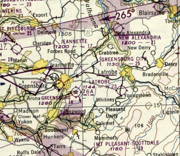
The last aeronautical chart depiction which has been located of Greensburg City Airport was on the November 1950 Cleveland Sectional Chart.
It depicted Greensburg City Airport as having a 2,500' unpaved runway.
Greensburg City Airport was not depicted on the 1951 USGS topo maps (or later topo maps from 1955, 1963, etc).
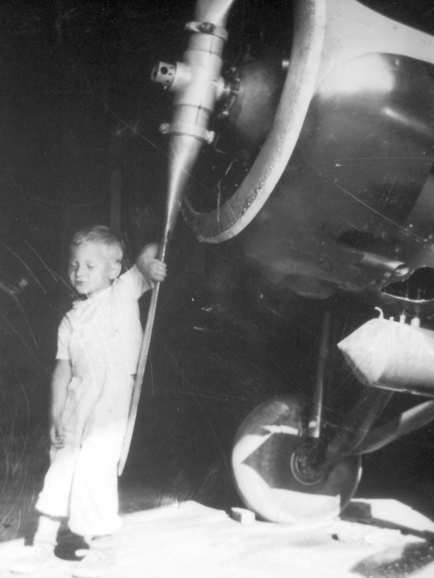
A circa summer 1951 or 1952 photo of Tom Imrich in the shadow of Carbon Airport hangar's main door, with Joe Reedy's Great Lakes 2T-1E.
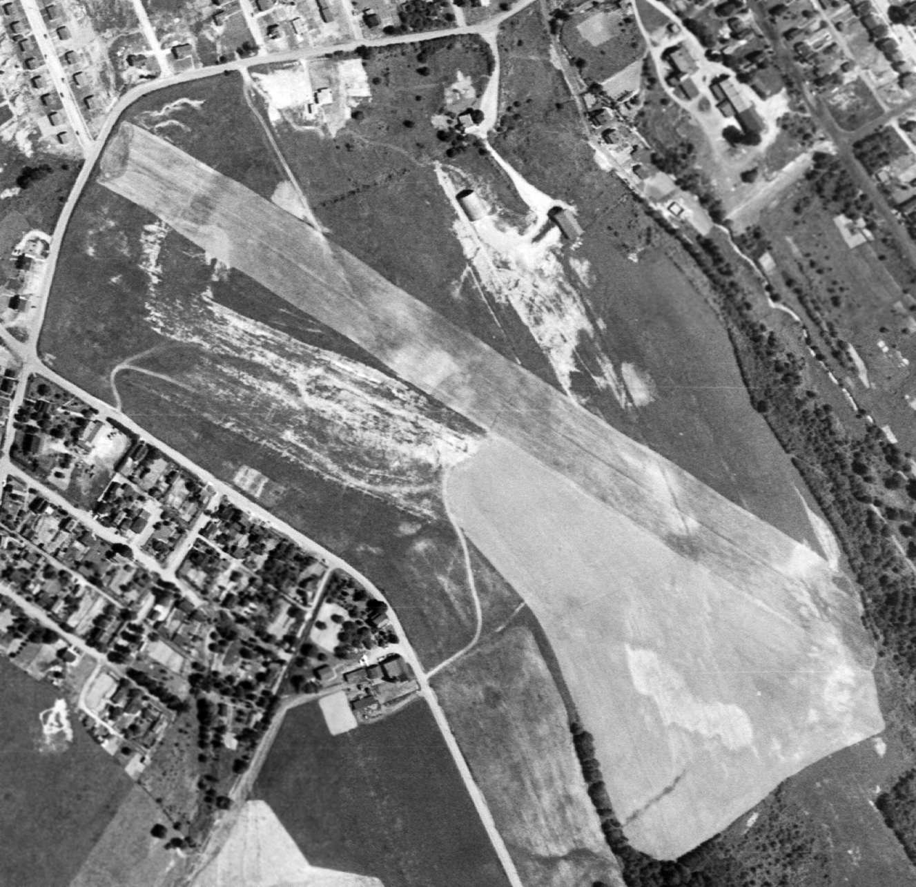
The earliest photo which has been located of Greensburg City Airport was a 6/8/52 USGS aerial view.
It depicted Greensburg City Airport as having a single unpaved northwest/southeast runway.
Two small hangars were located on the north side of the field, but there were no aircraft visibile.
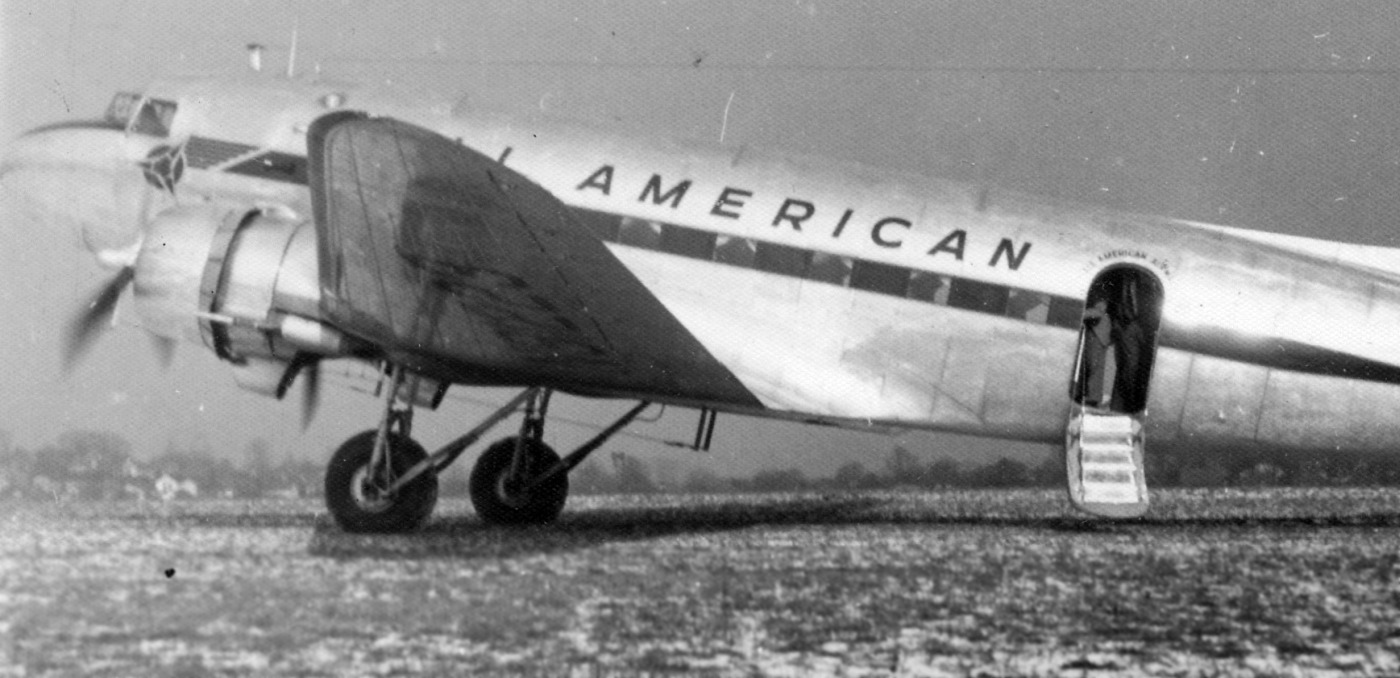
A 1953 photo (courtesy of Thomas Imrich) of Stephen Imrich bringing an All American Aviation Douglas DC-3 into the Carbon / Greensburg City Airport.
Thomas Imrich noted the landed was “during some AAA proving runs, for prospective AAA service there.”
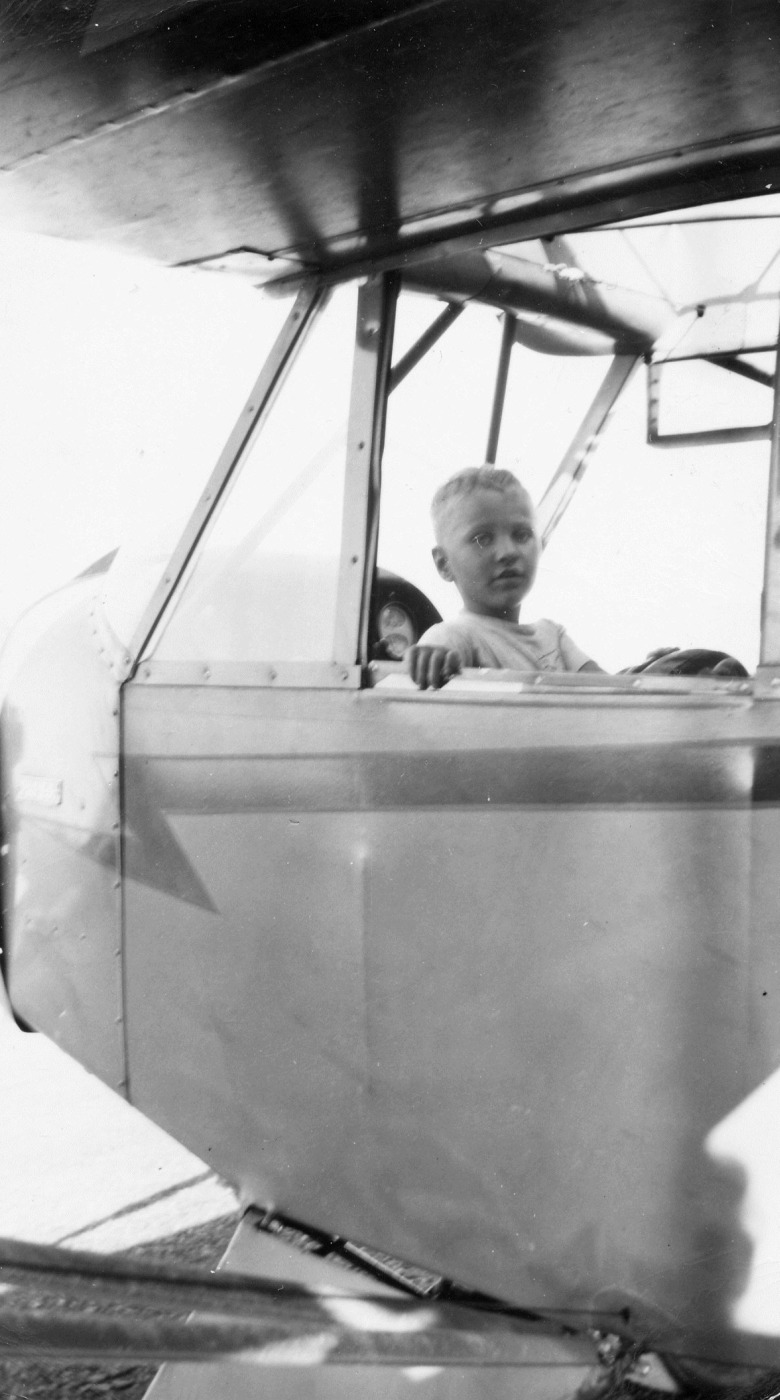
A circa 1953 photo of Thomas Imrich “sitting in one of our airport-owned J-3 Cubs, at the Carbon Airport,
that dad (as both the Airport Manager & flight instructor) used to teach students in.”
According to Thomas Imrich, “Carbon Airport was constructed on leased land from the Repasky brothers.
So the economics of the airport were critical, and politics of the property status & land value was a factor.
So when Clyde Hauger & Lloyd Santmyer’s respective roles at All-American diminished,
and particularly when All-American finally looked like they were going to make the move to Greater Pittsburgh airport,
the rug was pulled out from beneath the long term vision & support for the Carbon Airport.
Then as the WWII 'GI Bill' students dried up too, in the mid-1950s, the economics of the Carbon Airport were stressed to the point of failure.
So Dad & Mom closed the airport in about 1954.
They only fully closed our airport after Allegheny Airlines moved from Allegheny County Airport to the new Greater Pittsburgh Airport,
and there was no longer any hope of getting Allegheny (or Capital Airlines either) into making a route stop station in Greensburg.
Carbon Airport had a much longer life than the Sectionals of the time indicated.
Carbon Airport remained open until just shortly before Pittsburgh-Greensburg Airport also closed, which was in about 1955.”
Tom Imrich recalled, “The big metal dome hangar was was later used by the Repasky's, for their Greensburg Concrete Block Company, after the Carbon airport closed.”
Greensburg City Airport was no longer depicted on the January 1955 Cleveland Sectional Chart,
which instead only depicted the Greensburg Airport on the southeast side of the town.
A 1955 aerial view appeared to show Greensburg City Airport after its closure.
The length of the runway remained clear, but land along the northwestern portion appeared to be in the process of being redeveloped,
and there were no aircraft visible on the field.
A 1962 aerial view showed that a school had been built over the southeastern portion of the Greensburg City Airport site,
but the 2 former hangars remained standing on the northern side.
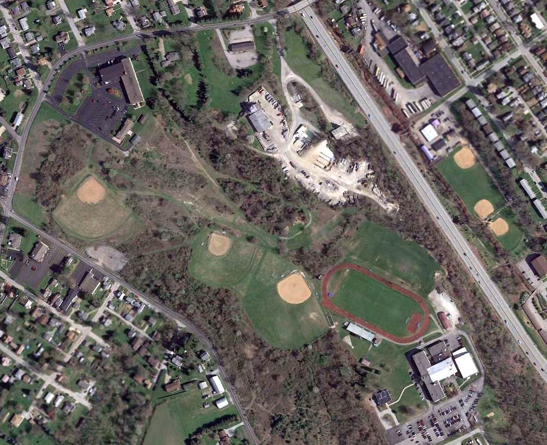
Amazingly a 2016 aerial view showed that 1 of the 2 hangars remained standing on the north side of the Greensburg City Airport site.
Greensburg Central Catholic High School occupied the southeastern portion of the airport site.
The site of Greensburg City Airport is located southwest of the intersection of Carbon Road & Route 30.
Thanks to Thomas Imrich for pointing out this airfield.
____________________________________________________
Burgess Field / Burgess-Summit Hotel Airport, Uniontown, PA
39.86, -79.74 (South of Pittsburgh, PA)
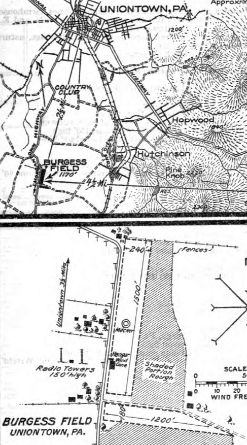
Burgess Field, as depicted in the 1927 Commerce Department Airway Bulletin.
The date of establishment of this early general aviation airport to the south of Pittsburgh has not been determined.
The earliest depiction which has been located of Burgess Field was in the 1927 Commerce Department Airway Bulletin.
It depicted Burgess as having 2 perpendicular unpaved runways, measuring 1,500' north/south & 1,200' east/west,
and a marker, hangar, and wind cone on the west side.
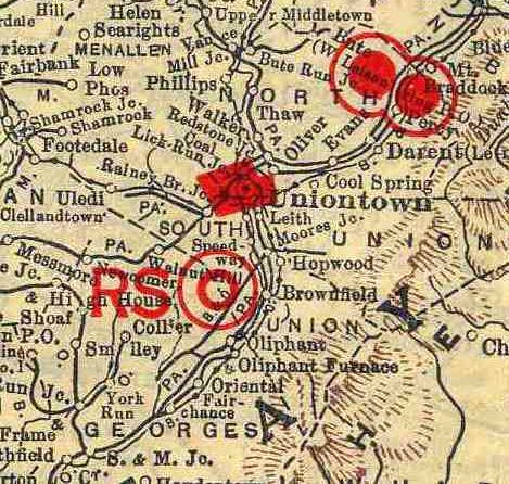
Burgess Field, as depicted (the “RS” symbol) on the 1929 Rand McNally Air Trails (courtesy of Chris Kennedy).
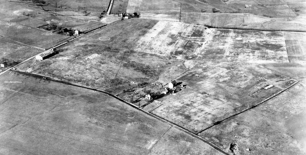
The earliest photo which has been located of Burgess Field was a 1/25/27 aerial view looking northwest.
It depicted Burgess Field as an irregularly-shaped grass field with a checkerboard-pained hangar on the west side, and an airport circle marking along the west side.
There were no aircraft visible on the field.
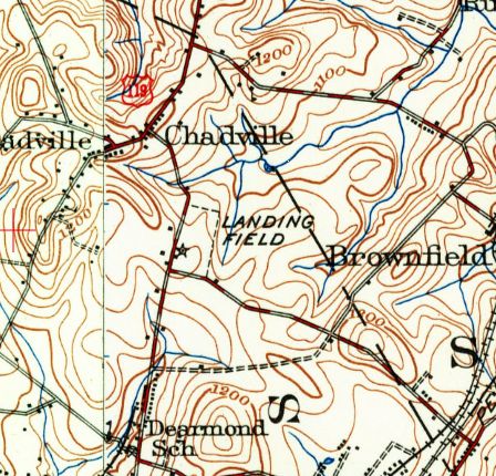
The earliest topo map depiction which has been located of Burgess Field was on the 1931 USGS topo map.
It depicted a rectangular outline, labeled simply as “Landing Field”, with an airport beacon on the southwest side.
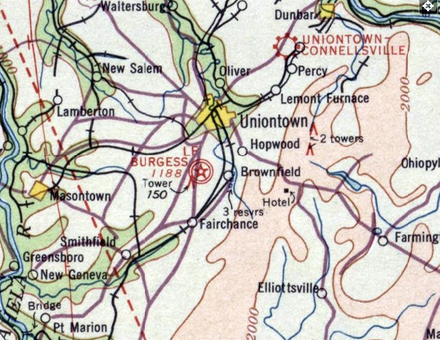
The earliest aeronautical chart depiction which has been located of Burgess Field was on the February 1934 Huntington Sectional Chart.
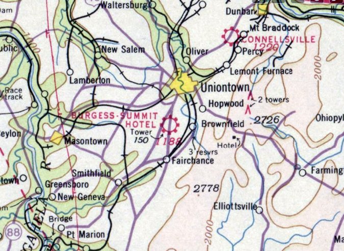
The last aeronautical chart depiction which has been located of Burgess Field was on the December 1938 Huntington Sectional Chart.
It had evidently been renamed to “Burgess-Summit Hotel” Airport.
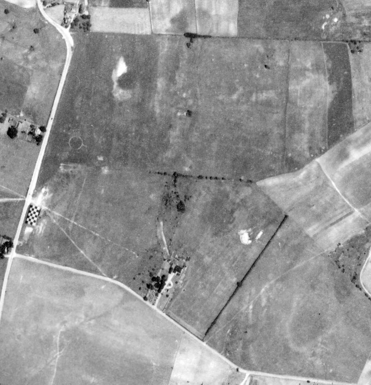
The last photo which has been located which appears to show Burgess Field still intact was a 6/15/39 aerial view.
It depicted Burgess Field as an irregularly-shaped grass field with a checkerboard-pained hangar on the west side, and an airport circle marking along the west side.
There were no aircraft visible on the field.
Burgess Field was evidently closed (for reasons unknown) at some point between 1938-40,
as it was no longer depicted on the January 1940 Huntington Sectional Chart.
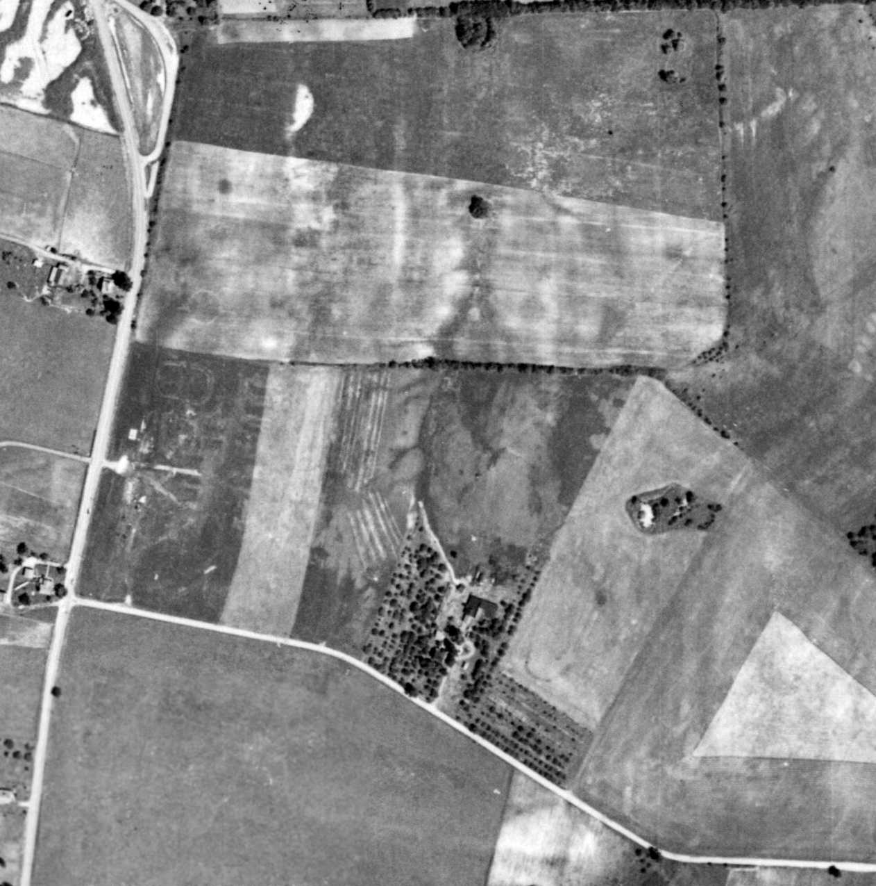
A 7/7/59 aerial view showed Burgess Field after it had been abandoned. The hangar had evidently been removed at some point between 1939-59.
A 1993 aerial view showed that a vocational training school had been built over the northern portion of the Burgess Field site at some point between 1959-93.
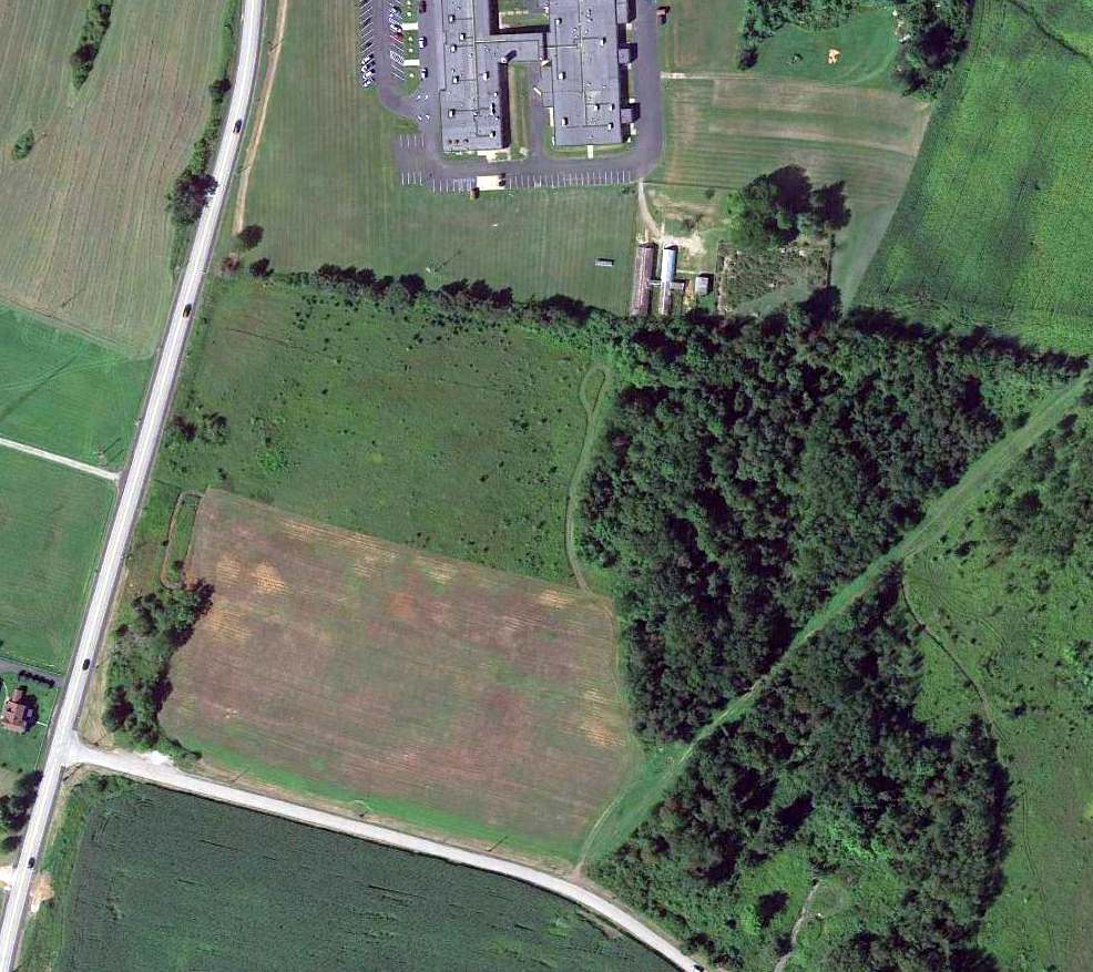
A 2013 aerial view shows that the majority of the site of Burgess Field remained clear, though a vocational training school occupied the northern portion of the airport site.
The site of Burgess Airfield is located northeast of the intersection of George Faircloth Road & Burgess Field Road, appropriately enough.
____________________________________________________
Allegheny Valley Airport / Remich Airport / West Penn Airport, Tarentum, PA
40.61, -79.82 (Northeast of Pittsburgh, PA)
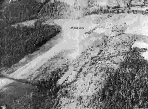
A 10/4/43 aerial view looking north at Allegheny Valley Airport from the 1945 AAF Airfield Directory (courtesy of Scott Murdock).
This small general aviation airport on the northeast side of Pittsburgh was evidently established at some point between 1940-43,
as it was not yet depicted on the March 1940 Cleveland Sectional Chart.
The earliest depiction which has been located of Allegheny Valley Airport was a 10/4/43 aerial view from the 1945 AAF Airfield Directory (courtesy of Scott Murdock).
It depicted Allegheny Valley Airport as having several unpaved runways.
The 1945 AAF Airfield Directory (courtesy of Scott Murdock) described Allegheny Valley Airport
as a 121 acre L-shaped property having 3 sod runways, with the longest being a 2,400' north/south strip.
The field was said to have a single 100' x 60' wood & metal hangar, and to be owned & operated by private interests.
The earliest aeronautical chart depiction which has been located of Allegheny Valley Airport was on the January 1947 Cleveland Sectional Chart.
It depicted Allegheny Valley as a commercial/municipal airport.
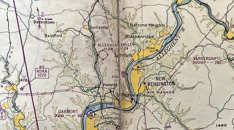
The January 1948 Pittsburgh Local Aeronautical Chart (courtesy of Tom Imrich) depicted Allegheny Valley as having a 2,400' unpaved runway.
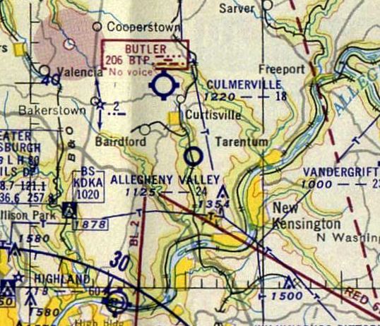
The 1953 Cleveland Sectional Chart depicted Allegheny Valley as having a 2,400' unpaved runway.
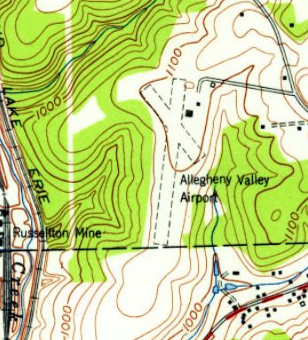
The 1953 USGS topo map depicted Allegheny Valley Airport as having 2 unpaved runways, with 2 small buildings on the northeast side.
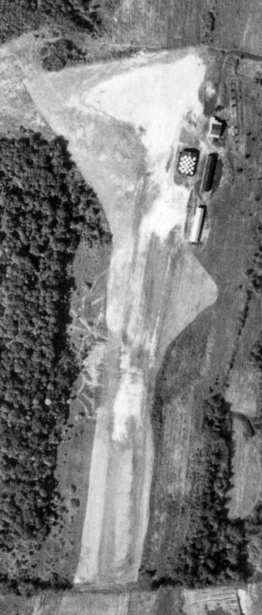
A 9/21/56 USGS aerial view showed Allegheny Valley Airport to have an unpaved northeast/southwest runway,
with a row of 4 hangars on the northeast side, one of which had a checkerboard-painted roof.
At some point between 1952-56, a U.S. Army Nike surface-to-air missile launch battery
was constructed directly adjacent to the south side of Allegheny Valley Airport's runway.
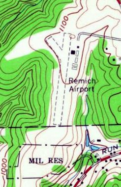
The airport was evidently renamed Remich Airport at some point between 1953-60,
as that is how it was labeled on the 1960 USGS topo map.
The number of buildings had increased to 6, with several having been built over the southwest portion of the northwest/southeast runway.
Also note the property outline of the Nike missile launch battery depicted as “Mil Res” to the south.
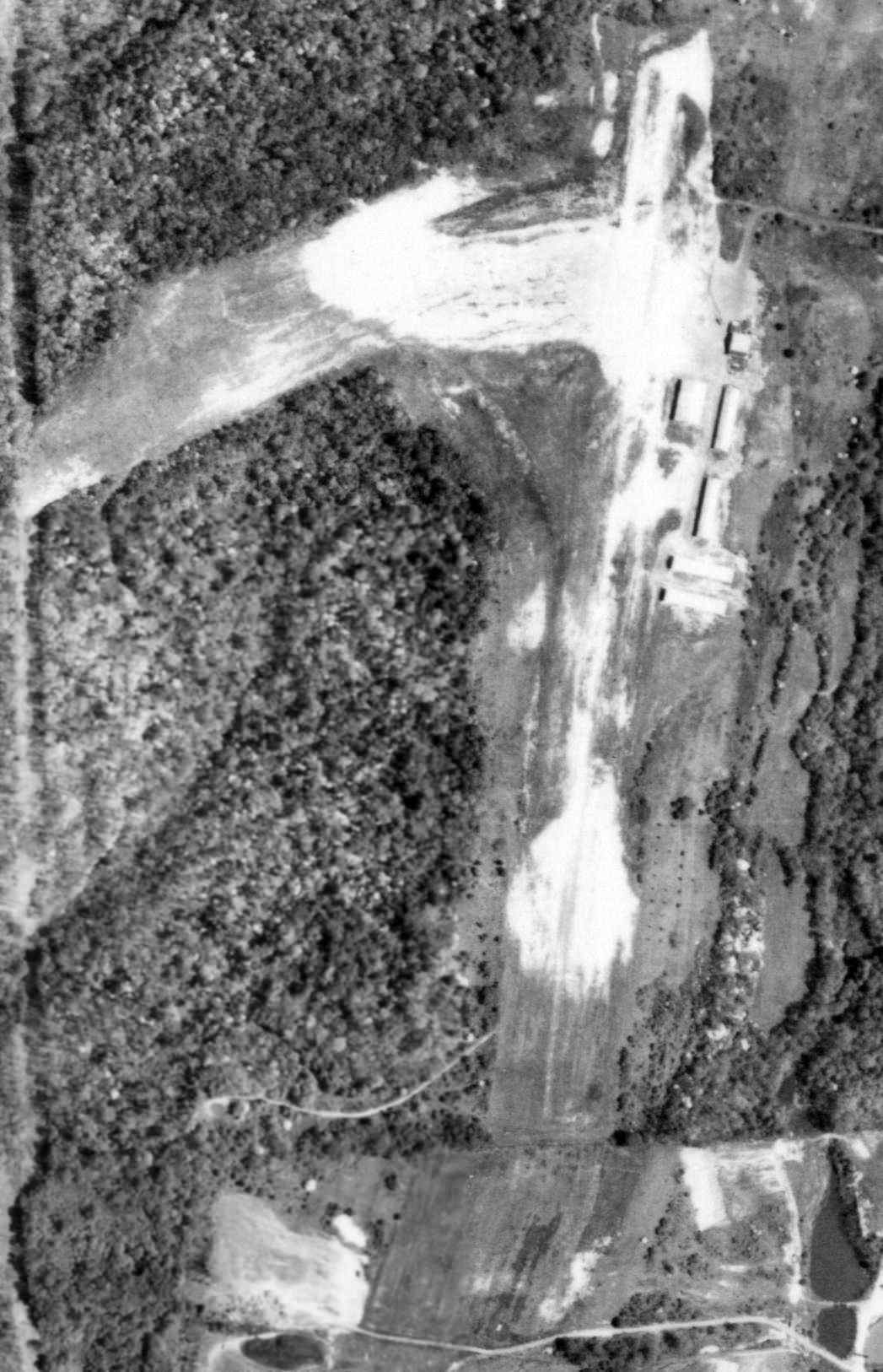
A 5/26/67 USGS aerial view showed Remich Airport to have 6 buildings on the northeast side of its unpaved runway.
But no aircraft were visible on the field.
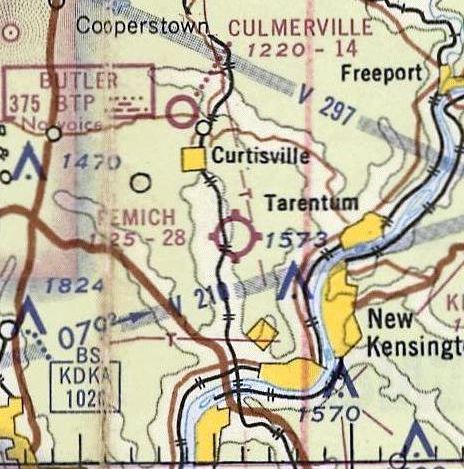
The May 1968 Cleveland Sectional Chart depicted Remich Airport as having a 2,800' unpaved runway.
Remich Airport evidently gained a paved runway at some point between 1968-69,
as a 1969 aerial photo depicted it as having a single paved northeast/southwest runway.
A total of 5 light single-engine planes were visible parked amongst the hangars on the northeast side.
It was still labeled Remich Airport on the 1979 USGS topo map.
The airport was evidently renamed West Penn Airport at some point between 1979-83, as that is how it was labeled on the 1983 USGS topo map.
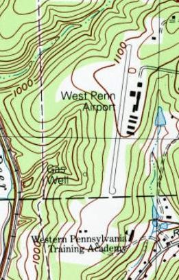
The 1993 USGS topo map depicted West Penn Airport as having a paved northeast/southwest runway.
The number of buildings on the northeast side had increased to 7.
Also note the former Nike missile launch battery adjacent to the south side of the runway was labeled “Western PA Training Academy”.
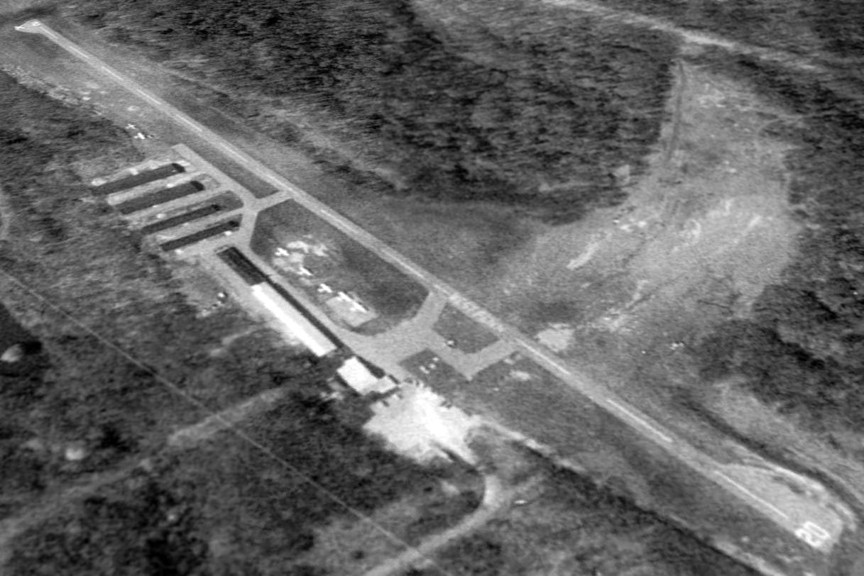
The last photo which has been located showing West Penn Airport in operation was a 1997 aerial view looking southwest.
It showed 7 light single-engine aircraft parked on the east side of West Penn Airport.
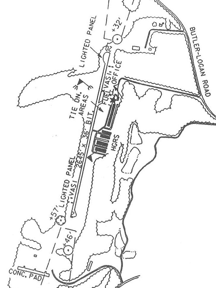
The 1997 PA Airport Directory (courtesy of John Clifford) depicted West Penn Airport as having a 2,645' bituminous Runway 2/20.
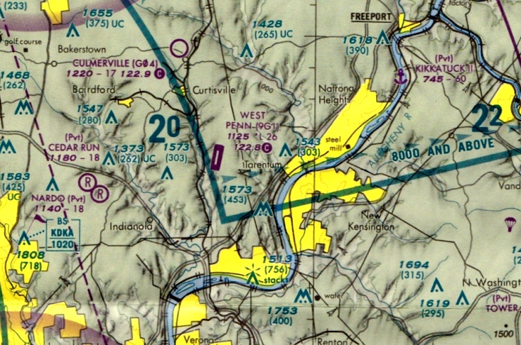
The last aeronautical chart depiction which has been located of West Penn Airport was on the March 1999 Pittsburgh Terminal Chart.
It depicted West Penn as having a 2,600' paved runway.
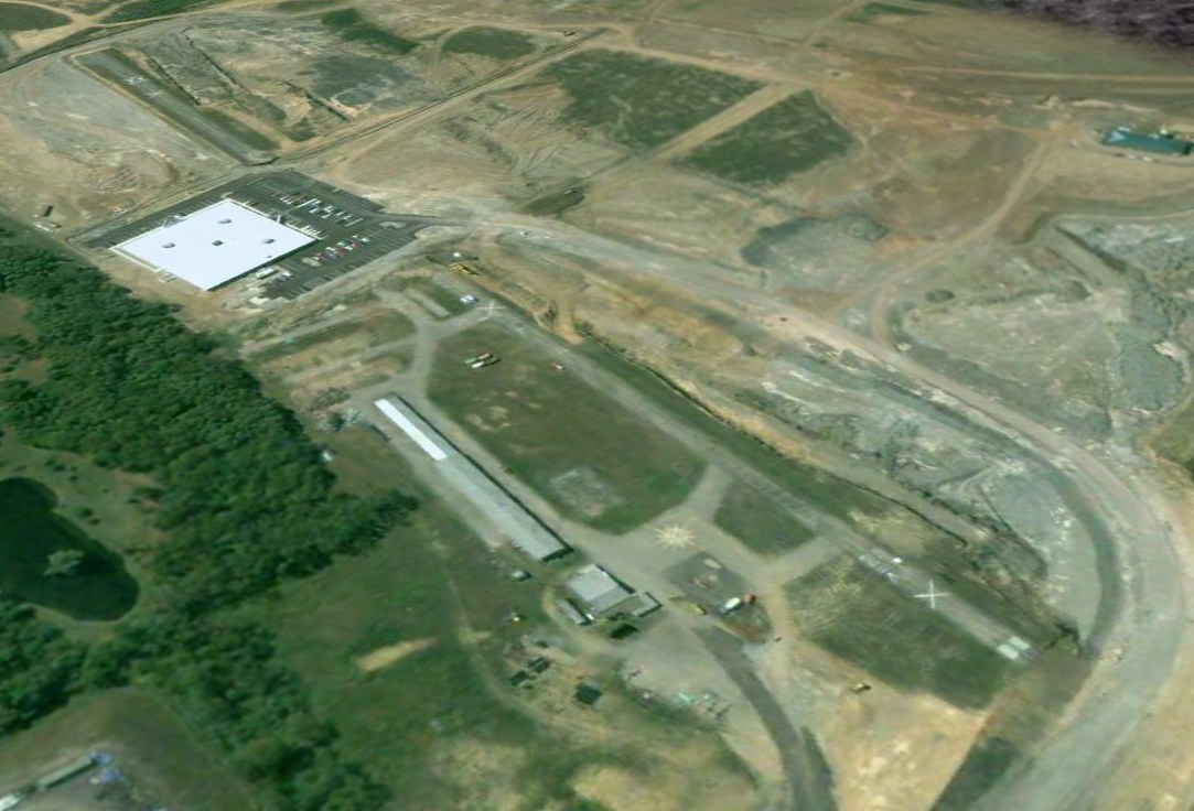
West Penn Airport was evidently closed at some point between 1997-2002,
as a 2002 aerial view looking southwest showed an industrial building had been built over the middle portion of the runway.
The majority of the runway still remained, marked with closed-runway “X” symbols, along with 2 of the hangars.
West Penn Airport was evidently removed as part of the construction of the new Rock Airport only a half-mile to the west.
Why destroy a perfectly-good airport in order to build another one right next door?
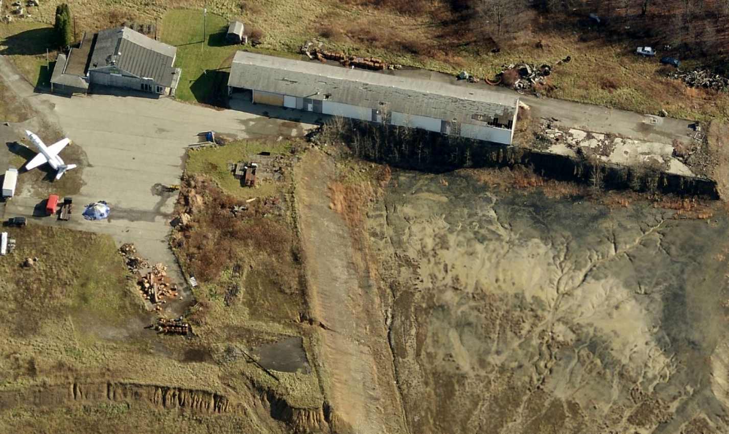
A strange sight: a circa 2010 aerial view looking east showed the only remains of West Penn Airport – 2 hangars & a ramp segment, on which was parked a “marooned” Jet Commander private jet!
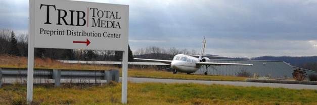
A circa 2013 photo of the curious sight of the Jet Commander private jet which remained parked on the remaining portion of the West Penn Airport ramp,
after the rest of the airport had been removed.
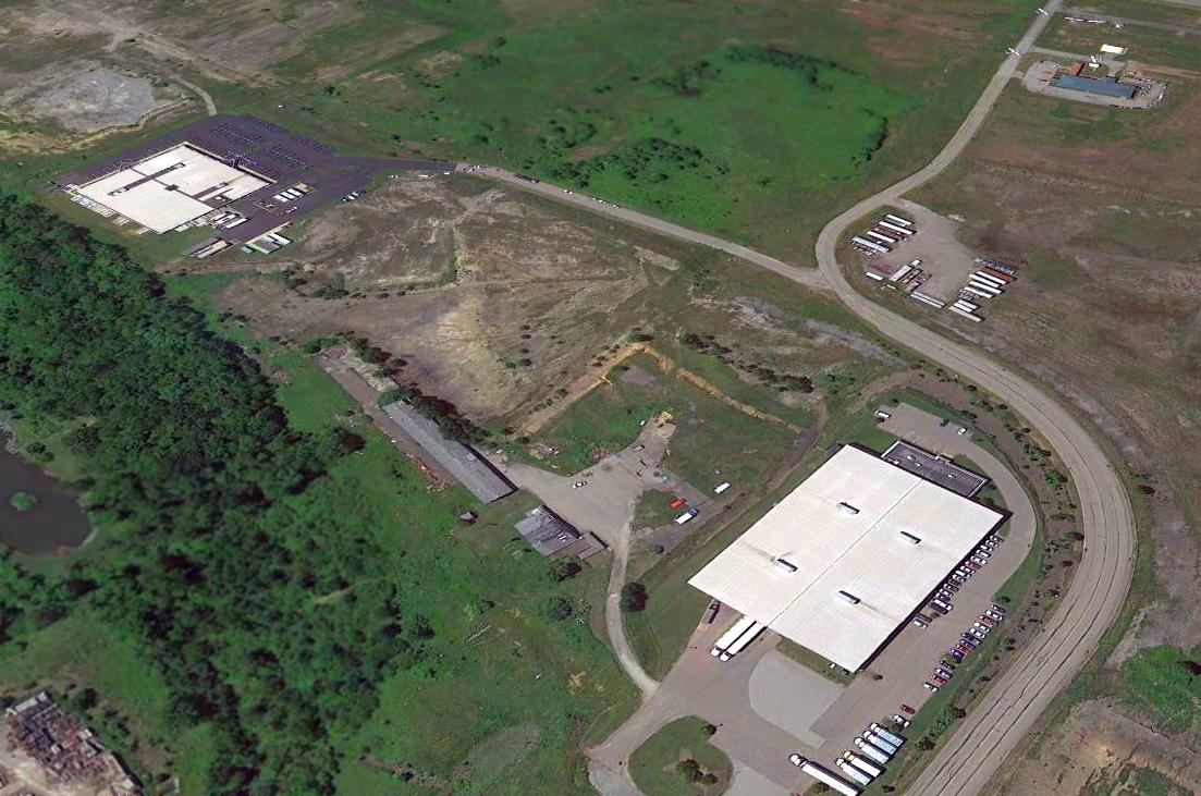
A 2014 aerial view looking southwest at the site of West Penn Airport, showing the 2 hangars & ramp which remain as the last traces of this small airport.
The Jet Commander previously seen on the ramp had been removed at some point. Also note the aircraft at top-right parked at the adjacent Rock Airport.
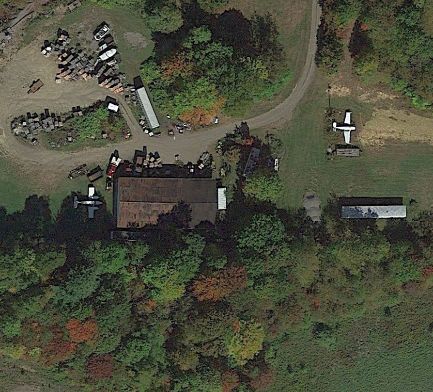
A 2020 aerial view of the last planes at the site of West Penn Airport: a twin-engine & single-engine plane parked near a former hangar on the northeast side, at the terminus of Airport Drive.
A 2021 aerial view showed the last 2 planes were removed from the West Penn Airport site at some point between 2020-2021.
The site of West Penn Airport is located at the western terminus of Mesa Drive.
____________________________________________________
Brennan Airfield (2PN7), Evans City, PA
40.85, -80.07 (North of Pittsburgh, PA)
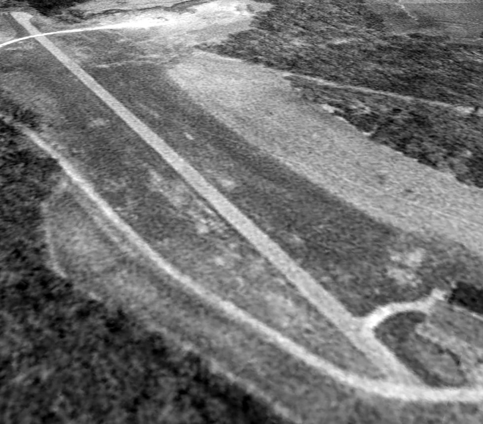
A 1993 USGS aerial view looking southwest at the Brennan Airfield.
This small private airfield was evidently constructed at some point between 1970-75, as it was not yet present on a 1970 aerial photo.
The earliest depiction which has been located of Brennan Airfield was on a 1975 aerial photo.
It depicted a single northeast/northwest paved runway, with a paved ramp leading to a house on the southeast side.
Richard Finley recalled, “In 1979, I was the Civil Air Patrol Pennsylvania Wing Group 50 Operations Officer.
We got an Emergency Locator Transmitter mission.
I knew it was coming because we started getting ELT reports at work a little before 1pm.
The call came in about midnight from the Group 50 Commander.
He said the Franklin/Oil City Squadron had been working the mission for a couple of hours but were getting nowhere.
They wanted us to bring the Direction Finder equipped airplane down. I invited the Commander to be part of the crew.
He agreed & I called one of the senior members to be the back seat spotter.
We met out at the airplane about 1am. It took us until a little after 2am to get the aircraft airborne.”
Richard continued, “The weather was clear so we headed south & just kept climbing.
Bill, the Group 50 Commander, got in touch with the other searchers on the CAP frequency.
They were working in the vicinity of Clarion VOR where most of the aircraft reporting the ELT were when they heard it.
We were up to 9,000' just south of Franklin when we started getting an indication on the DF.
It pointed us south. By following the signal, we were aimed right at the rotating beacon of Butler Graham Airport.
We told the other searchers our observation. I started a slow descent but as we got closer to Butler, the needle began to creep more to the right.
At first I thought maybe I was too hasty with my Butler Graham estimate. I told Bill the actual source may be Butler Farm Show Airport.
This idea soon faded as the needle kept drawing us more and more to the west. The closer we got to Butler, the more westerly it was turning us.
By the time we were in the vicinity of Butler, we were heading almost 90 degrees to our original heading.”
Richard continued, “We were heading away from Butler. Suddenly, in the middle of nowhere, we got station passage.
I made a circle to the left trying to see if there was any sign of an airport. Nobody could detect any sign of an airfield.
I contacted Pittsburgh Approach & asked them to establish radar contact with us so I could fly a rose-petal pattern & see if they knew of any airfields in that area.
They were marking our flightpath on the radar screen with a grease pencil.
After a few petals had been flown they had a pretty good idea of the location of the ELT. The problem was they knew of no airports around there.”
Richard continued, “I told them we would be circling the area for a while while we tried to get the local CAP squadron to send out a ground team.
We had been circling for about 20 minutes. The local squadron was putting a ground search team together.
I began to notice the fore glow of dawn creeping over the horizon. I told my crew that we should begin to pick up details on the ground soon.
That could be helpful. About that time, I saw something. I thought I could make out a runway pattern on the ground.
I made a couple more circles and I was sure. I said, 'There's a runway down there. It's an airport.'
We continued to circle for another 15 minutes. The light of dawn was beginning to brighten up the landscape.
I told the crew, 'I am going to try it. I think there is enough light to land.'”
Richard continued, “It was a tabletop airport built on a hilltop. It was a little over 1,400' long (I found out later) with a drop off at each end.
The runway was gravel. I knew I had to do a short-field landing. I set up an approach at minimum speed with full flaps.
I touched down early & got right on the brakes. It still required moderate braking to get stopped before getting too close to the drop off at the other end.”
Richard continued, “I turned around & taxied back. It was a beautiful setup.
There was a very nice house, a barn & a rather large garage/equipment shed.
It was 5am & I intended to get these people up. As I pulled up in the driveway, the family came out of the house fully dressed.
I shut down & we got out. The gentleman who seemed to be leading the group said, 'You know this is a private airport, don't you?'
I said, 'I am sorry to get you up at this hour', He interrupted me to say, 'That's all right. We were already up. We have to feed the cattle.'
I told him, 'I was pretty certain it was a private field before I landed but we are from Civil Air Patrol
and you appear to have an ELT that is blocking the emergency frequency in this area.'
He asked his family to take care of the animals while he tended to this problem.”
Richard continued, “I asked him if he was flying the previous day around noon or a little after.
He said he was & the landing was a little hard. I said, 'Can we check it out?' He said, 'Sure.'
I was expecting, with an airport like he had, to find an Aeronca Champ or Piper J-3 or maybe a Super Cub, possibly a Citabria or a Maule.
It could even a be Cessna 172 or 182, better yet, a Cessna 180. As he continued to roll the door open, I almost fell over.
The opening door revealed a Beechcraft BE55 Baron. I asked him how he got a Baron in & out of an airport like his.
He said when he landed, he just got it down in the valley a little bit then pulled it up as he approached the runway
and stalled it right on to the end of the runway & climbed on the brakes.
For takeoff, he ran it full power right off the end of the runway.
As he went over the end, he would ease back on the yoke a little & pull up the gear.
The airplane would sink into the valley a little then he would initiate a climb as the aircraft gained proper climb speed.”
Richard continued, “He got into his plane & silenced the ELT. I fired up the radio in 30F & confirmed the ELT was off.
He said, since he put us to all that trouble, would we care to come in & have some breakfast.
He said they were just about to have breakfast & there was plenty to go around.
We said no we did not want to be a bother but he insisted so we agreed.
The house was absolutely beautiful. It was situated on the cusp of a hill.
The living room was 2 stories high with a glass wall on the west side.
It had large wooden beams with lots of stone & stucco done in a southwestern motif.
He was a builder who built many of the developments around that area north of Pittsburgh. This was his 'hobby farm'.
They treated us very well with on-the-spot hospitality that just could not be expected anywhere.
We had the traditional bacon & eggs breakfast with toast & hash browns, coffee & juice.
They just could not have been nicer. We had breakfast, chatted briefly then said we had to be on our way.”
Richard continued, “We went out & started up. We waved goodbye to everyone & started to taxi out.
Everybody at the ranch went back into the house. I turned the radios on as we were beginning to taxi and, to my surprise, the ELT was back on.
I taxied back onto the driveway & shut down. I went up & rang the doorbell.
Our new friend answered the door. He looked surprised. 'Did you forget something?', he said.
I told him the ELT was back on. He said he would probably have to take the battery out of it & take the unit to the avionics shop.
He said he would do that & we headed back to Erie with some fond memories of the experience.”
Brennan Airfield was not yet depicted on the October 1985 Detroit Sectional Chart.
The earliest depiction which is available of Brennan Airfield was a 1993 USGS aerial view,
which depicted a single northeast/northwest paved runway.
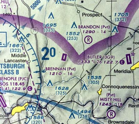
The only aeronautical chart depiction which has been located of Brennan Airfield was on the 2009 Pittsburgh Terminal Aeronautical Chart,
which depicted Brennan as having a single northeast/northwest paved 1,600' runway.
The 2013 USGS topo map depicted “Brennan Personal Use Airport” as having a single paved northeast/southwest runway.
The Brennan Airfield was evidently closed at some point between 2009-2015, as it was no longer depicted on 2015 aeronautical charts.

A 2025 aerial view looking northwest showed the Brennan Airfield runway remained intact though deteriorated, with objects being stored on the north end of the runway.
Brennan Airfield is located at the eastern terminus of Brennan Lane.
____________________________________________________
Glade Mill Airport, Valencia, PA
40.72, -79.89 (Northeast of Pittsburgh, PA)
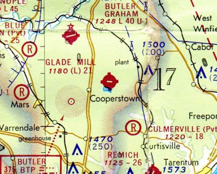
Glade Mill Airport, as depicted on the November 1972 Detroit Sectional Chart (courtesy of Richard Finley).
Photo of the airport while open has not been located.
According to an article entitled “Former Glade Mill airport for sale, Owners set selling price on 130 acres in Middlesex at $3.7 million”
by Shari Berg in the 12/30/07 Pittsburgh Post-Gazette (courtesy of Richard Finley),
the land of this small airport “has been owned by the Brantner family, of Shaler, since the 1960s.”
A 1969 USGS aerial photo showed the start of an east/west runway being constructed.
Glade Mill Airport was evidently opened at some point between 1969-72.
The earliest depiction which has been located of Glade Mill Airport was on the November 1972 Detroit Sectional Chart (courtesy of Richard Finley).
It depicted Glade Mill as having a single paved east/west 2,100' runway.
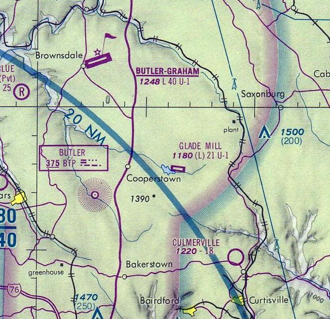
The May 1975 Pittsburgh Terminal Aeronautical Chart (courtesy of Mitchell Hymowitz) depicted Glade Mill Airport as having a 2,100' paved runway.
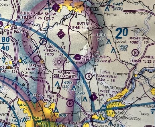
The last aeronautical chart depiction which has been located of Glade Mill Airport was on the October 1985 Detroit Sectional Chart.
It depicted Glade Mill as a private airfield having a single 2,100' paved east/west runway.
According to Richard Finley, Glade Mill Airport “was a relatively short-lived enterprise.”
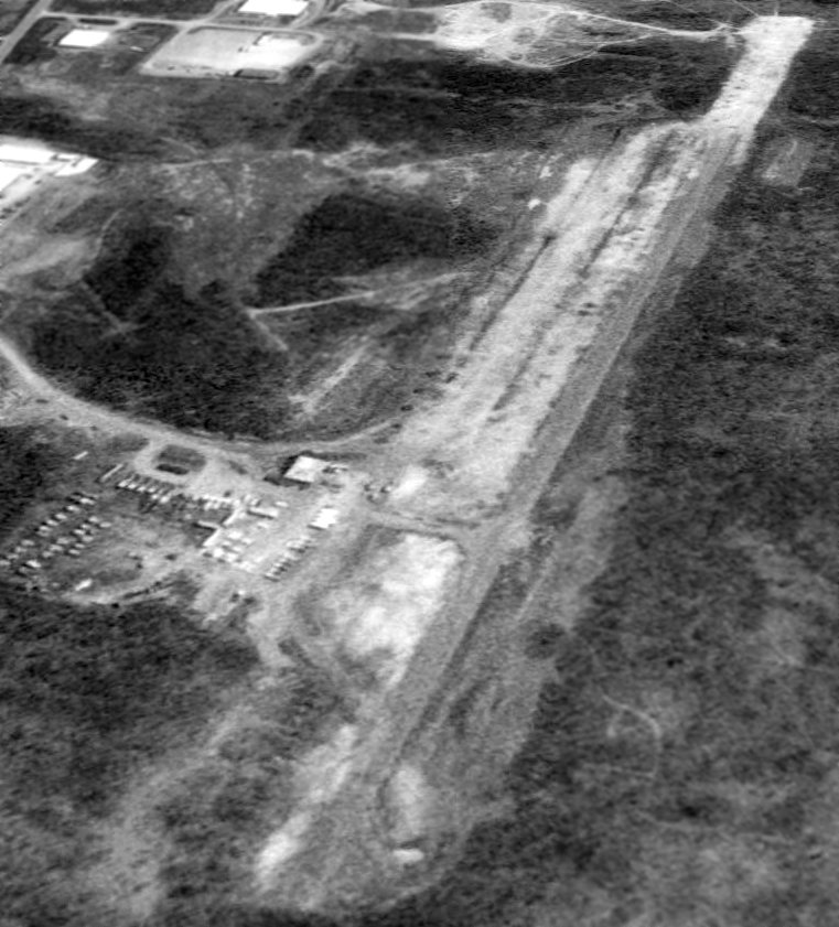
The earliest photo which is available of Glade Mill Airport was a 4/22/93 USGS aerial view looking northeast, after the airport had evidently been abandoned.
It had a single paved east/west runway, with a single building on the north side.
An article entitled “Former Glade Mill airport for sale, Owners set selling price on 130 acres in Middlesex at $3.7 million”
by Shari Berg in the 12/30/07 Pittsburgh Post-Gazette (courtesy of Richard Finley) said,
“The land that once was home to Glade Mill Airport in Middlesex is up for sale.
Located just off Route 228 behind Marshall Stamping on Glade Mills Road, the vacant 130 acres has caught the eye of several developers.
The land has been owned by the Brantner family, of Shaler, since the 1960s.
The family wants to sell the property intact and has no plans to subdivide it, said Greg Broujos, with NAI Pittsburgh Commercial, the agent in charge of the listing.
The family hopes to sell the property for an estimated $3.7 million according to the listing for the site.
Mr. Broujos said his agency is intent on selling the property for light industrial use, which is how it currently is zoned by the township.
Because the former private air strip is overgrown, it is doubtful anyone would use it for that purpose again, he said.”
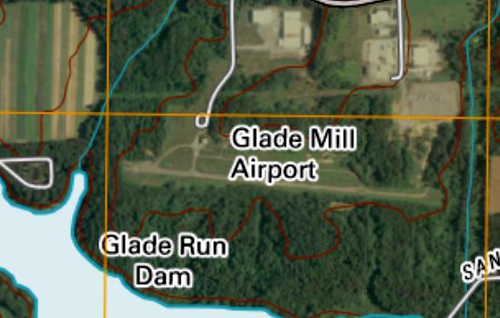
Glade Mill Airport was still labeled on the 2010 USGS topo map, even though the airport had already been closed for years by that point.
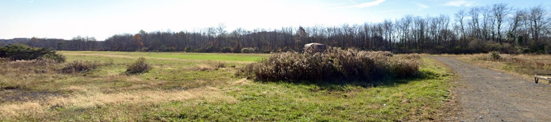
A 2023 photo looking southeast showed the Glade Mill Airport site to remain clear.
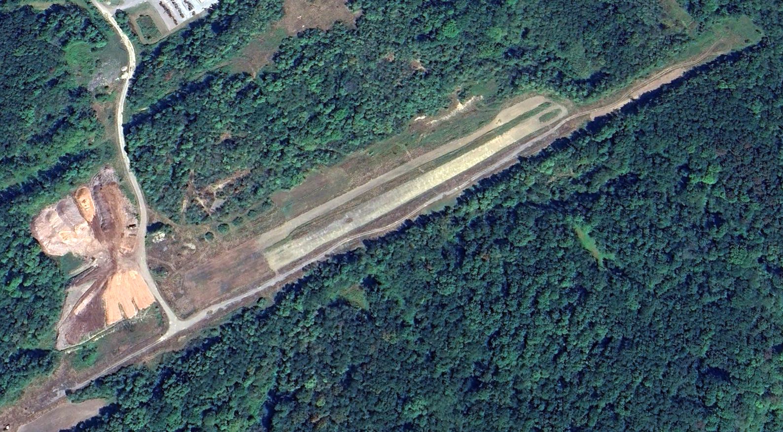
A 2025 aerial view looking northeast showed the Glade Mill runway & building remained intact though very deteriorated.
The site of Glade Mill Airport is located south of the intersection of Glade Mill Road & Clifford Lane.
____________________________________________________
Altoona Airport (original location) / Altoona-Duncansville Airport, Duncansville, PA
40.52, -79.87 (Northeast of Pittsburgh, PA)
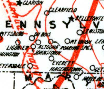
The original Altoona Airport, as depicted on a 1920 Army Air Service Map of Landing Fields (courtesy of David Brooks).
The original airport for the town of Altoona was located 4 miles to the southwest,
adjacent to the southwest side of the little hamlet of Duncansville.
The date of construction of Altoona Airport has not been determined.
The earliest depiction which has been located of Altoona Airport in Duncansville
was on a 1920 Army Air Service Map of Landing Fields (courtesy of David Brooks).
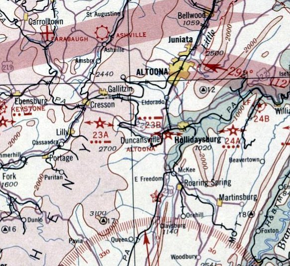
The earliest aeronautical chart depiction which has been located of Altoona Airport was on the December 1932 Cleveland Sectional Chart.
It depicted Altoona as a commercial/municipal airport, adjacent to the southwest of the town of Duncansville.
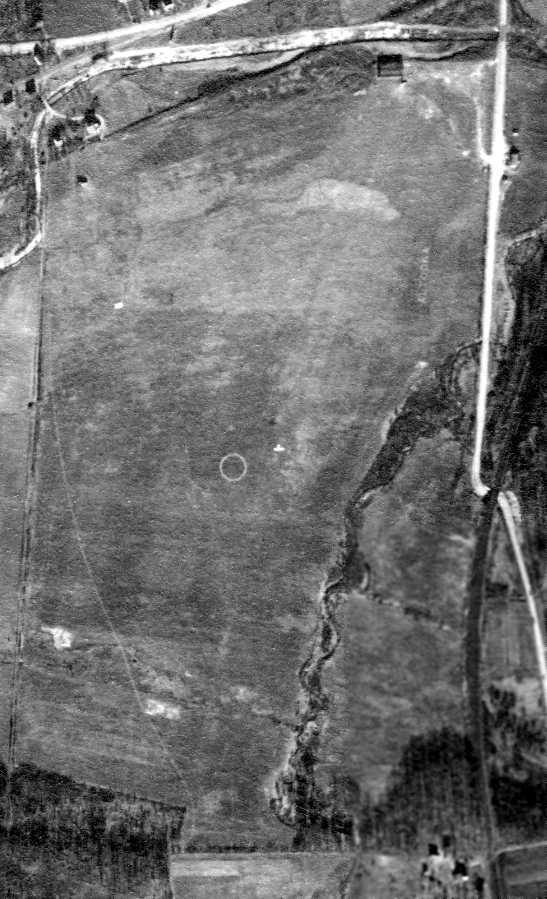
The earliest photo which has been located of Altoona Airport was a 12/16/38 aerial photo (from the Pennsylvania Geological Survey).
It depicted Altoona Airport as an irregularly-shaped grass property,
with a hangar on the northeast corner, and an airport circle marking in the center.
Remarkably, a single airplane was seen in flight at low altitude just to the right of the airport circle marking.
Richard Finley also observed, “This typical little airport boasted some fancy artwork on the surface of the field that included the airport name”, on the northeast side.
Inexplicably, the Altoona Airport in Duncansville was not depicted on USGS topo maps from 1938, 1943, 1953, 1956, or 1964.
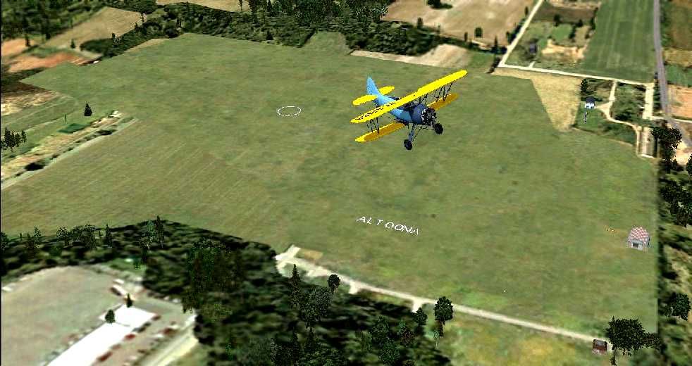
A flight simulator scenery depiction by Richard Finley looking southwest at a Stearman overflying the Altoona Airport.
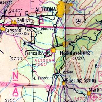
The March 1940 Cleveland Sectional Chart depicted Altoona as a commercial/municipal airport.
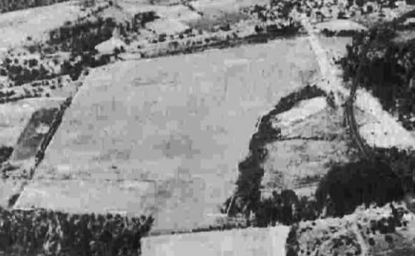
A 9/30/43 aerial view looking north from the 1945 AAF Airfield Directory (courtesy of Scott Murdock)
depicted Altoona Airport as having an irregularly-shaped grass field.
The 1945 AAF Airfield Directory (courtesy of Scott Murdock) described Altoona Airport
as a 90 acre irregularly-shaped property having a “clay, sand, and sod (rough)” all-way landing area, with the longest dimension being 3,600' north/south.
The field was said to have a single 80' x 54' wooden hangar, and to be owned & operated by private interests.
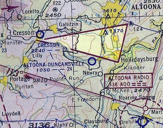
The last aeronautical chart depiction which has been located of Altoona-Duncansville Airport was on the 1953 Cleveland Sectional Chart.
It depicted Altoona-Duncansville as having a 2,400' unpaved runway.
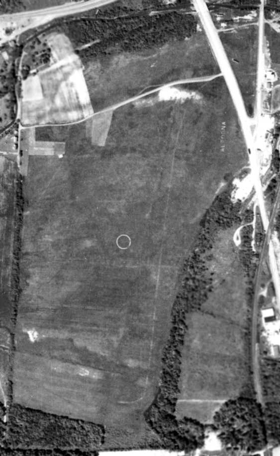
A 5/24/58 aerial photo (from the Pennsylvania Geological Survey)
appeared to show the Altoona Airport after it had been abandoned, with the newly-constructed Route 220 having been cut through the northeastern corner of the field,
over the site of the former hangar.
However the airport circle marking remained in the center of the field,
along with the faded “Altoona” marking on the northeast corner.
By the time of the 1960 Cleveland Sectional Chart (courtesy of Mike Keefe), the Altoona Airport in Duncansville was no longer depicted.
A 9/4/67 aerial photo showed that a large industrial building had been built over the northeasten portion of the Altoona Airport site at some point between 1958-67.
However, a faint trace of the airport circle marking was still recognizable in the center of the field.
Ironically, the Altoona Airport site continued an aviation role,
as a short runway for constructing model aircraft had been constructed on the middle portion at some point between 1958-67.
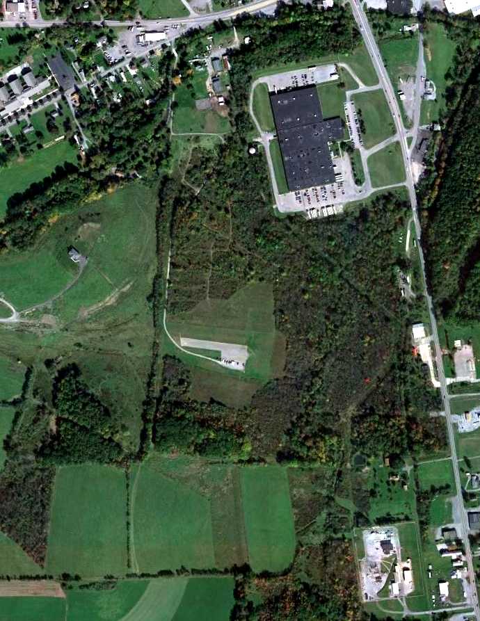
A 10/6/11 aerial photo showed no remaining trace of the Altoona Airport,
but ironically a small paved east/west runway for model aircraft could be seen in the middle of the site.
As of 2013, the model aircraft runway at the Altoona Airport site was operated by the Altoona Radio Control Club.
The site of Altoona Airport is located south of the intersection of Route 22 & Runway Lane, appropriately enough.
____________________________________________________
40.52, -79.87 (Northeast of Downtown Pittsburgh, PA)
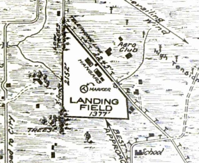
Rodgers Field, as depicted in the 8/20/25 Commerce Department Airway Bulletin (courtesy of Mike Denja).
Nothing was depicted at this location on the 1922 USGS topo map.
According to pghbridges.com, “Rodgers Field opened in 1925.”
The earliest depiction which has been located of Rodgers Field was in the 8/20/25 Commerce Department Airway Bulletin (courtesy of Mike Denja).
It described Rodgers Field as an Army airdrome, consisting of a triangular field measuring 2,152' north/south,
with 2 Government hangars along the northeast side, and an Aero Club located across the street to the northeast.
According to Richard Finley, Rodgers Field was “named after Cal Rodgers ([who flew the] first transcontinental airplane flight in the Wright biplane named 'Vin Fizz').
It was a joint city-county airport. There was an Army officer in charge of it.
Rodgers Field soon became Pittsburgh’s first municipal airport.
The National Air Tour landed in Pittsburgh in the summer of 1927.
It was 7/2/27 when the National Air Tour landed at Rodgers Field.
Several of the pilots on the 1927 Tour were sponsored by local clubs including the Mercater Club & the Harvard Club of Western Pennsylvania.
A committee of the Pittsburgh Association of Credit Men gave a dinner at the Nixon Hotel for Tour pilot Frank Hawks & his wife.
Other pilots ate an informal dinner at Hotel Schenley & enjoyed a theater party at Duquesne Garden.
Locals took particular interest in talking with E.W. Cleveland who was from Bridgeville.”
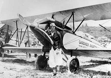
The earliest photo which has been located of Rodgers Field was a 7/28/28 photo of Lt. Marion Grevemburg in front of a Lincoln-Page LP-3 of Gardner Aviation at Rodgers Field (courtesy of Richard Finley).
On 8/31/28 Amelia Earhart & non-pilot publisher, George Putnam, flew from Bellefonte, PA & landed at Rodgers Field.
During the landing Amelia hit a hidden ditch revealing the weakness of the Avian II's landing gear.
The gear collapsed, the plane went up on its nose, and the next day & a half were spent in a herculean effort the get the Avian flying again as soon as possible.
The Avian was repaired in record time and they departed on 9/2/28 for for Dayton.
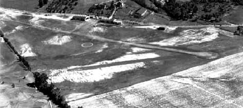
An undated aerial view looking west at Rodgers Field (courtesy of Richard Finley), showing a hangar & 2 grass runways.
Richard observed, “The airport looks like it is at its zenith. The trees are in full foliage. A lot of activity apparent at the field.
Probably in those heady days just before the stock market crash. Maybe the summer of 1928 or 1929.”
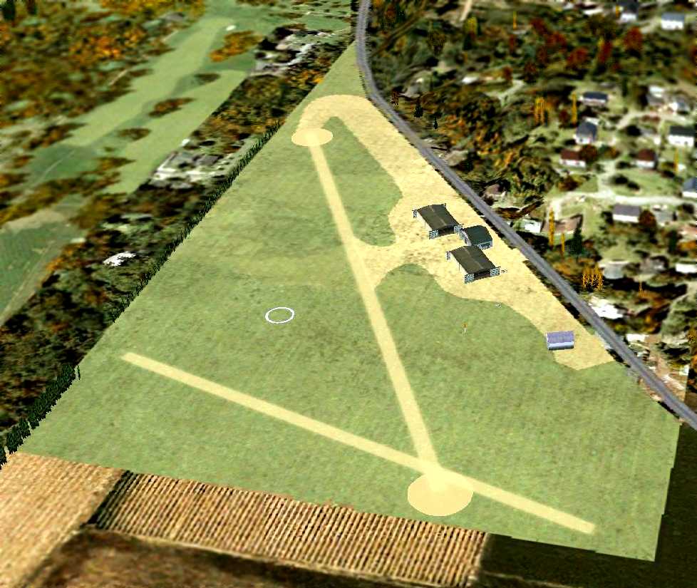
A flight simulator scenery depiction by Richard Finley looking north at Rodgers Field circa 1920s,
showing 2 unpaved runways with 4 hangars on the northeast side.
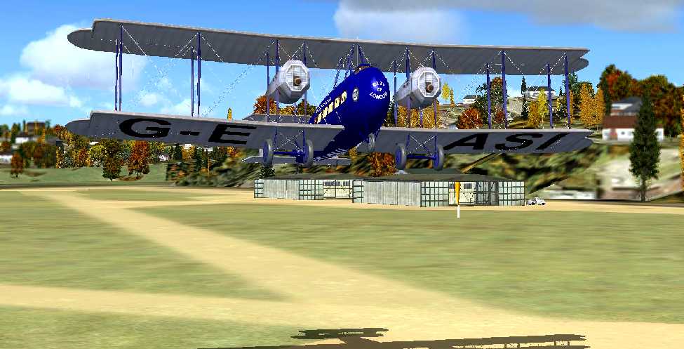
A flight simulator scenery depiction by Richard Finley looking north at a Vickers Vimy biplane departing Rodgers Field circa 1920s,
No airfield was depicted at this location on the 1930 USGS topo map.
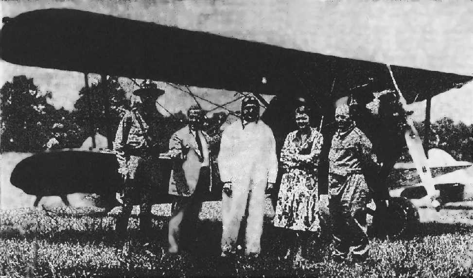
A 1931 photo of Lt. L.M Watson, Seth Hughes, F.A Kummer, Helen MacCloskey, and pilot Walter Lees at Rodgers Field (courtesy of Richard Finley).
Mark Lincoln noted, “The airplane looks like the Waco HSO powered by a Packard Diesel DR980, NR4N, c/n X-3101.”
According to Richard Finley, “An estimated 5,000 people witnessed the 1931 National Air Tour visit to Rodgers Field.
One of the 'hits' of the visit was a Bellanca aircraft powered by a Packard diesel engine & flown by Walter Lees.
Lees & Frederick Brossy had just established a world's record non-refueling endurance flight of 84 hours & 33 minutes.
Local George 'Speed' Dickson, a resident of Pittsburgh was given a standing ovation at the field.”
According to Richard Finley, “They discontinued support for the field in 1931 since Allegheny County Airport was being built.”
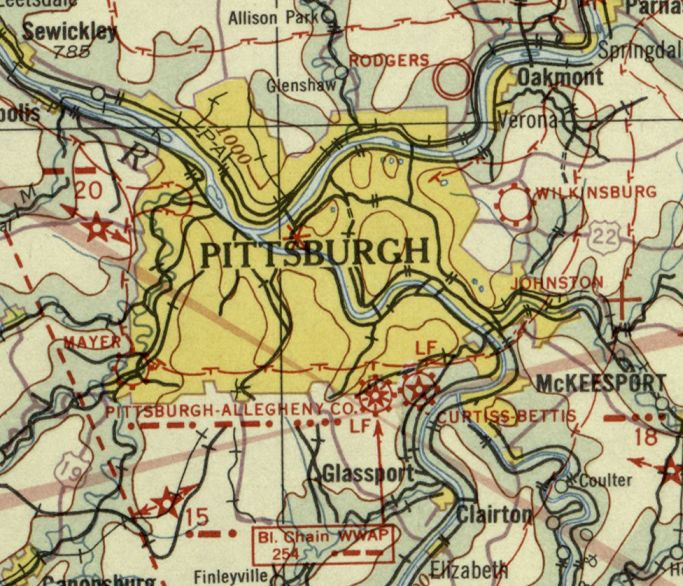
The earliest aeronautical chart depiction which has been located of Rodgers Field was on the December 1932 Cleveland Sectional Chart.
It depicted Rodgers Field as a military airfield.
According to Richard Finley, “It must have still been there in 1934 because there was an aero club trying to raise the money to keep it open in early 1934.”
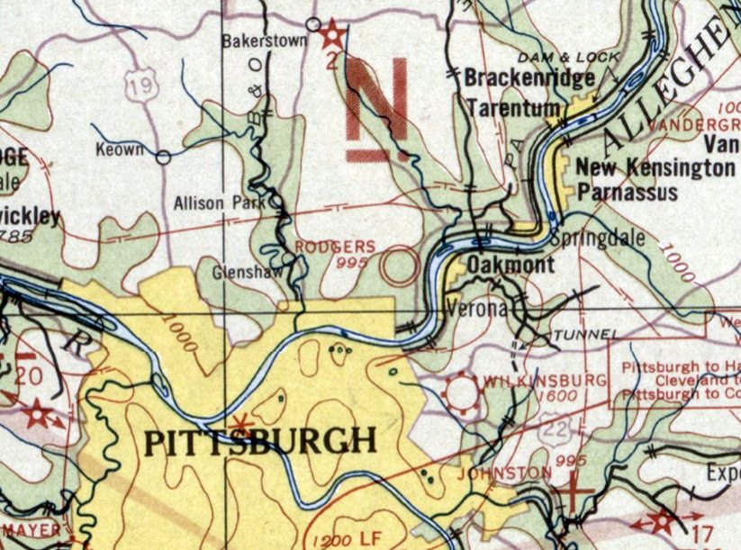
The last aeronautical chart depiction which has been located of Rodgers Field was on the May 1934 Cleveland Sectional Chart.
It depicted Rodgers Field as a military airfield.
Rodgers Field was evidently closed (for reasons unknown) at some point between 1934-35,
as it was no longer depicted on the February 1935 Cleveland Sectional Chart.
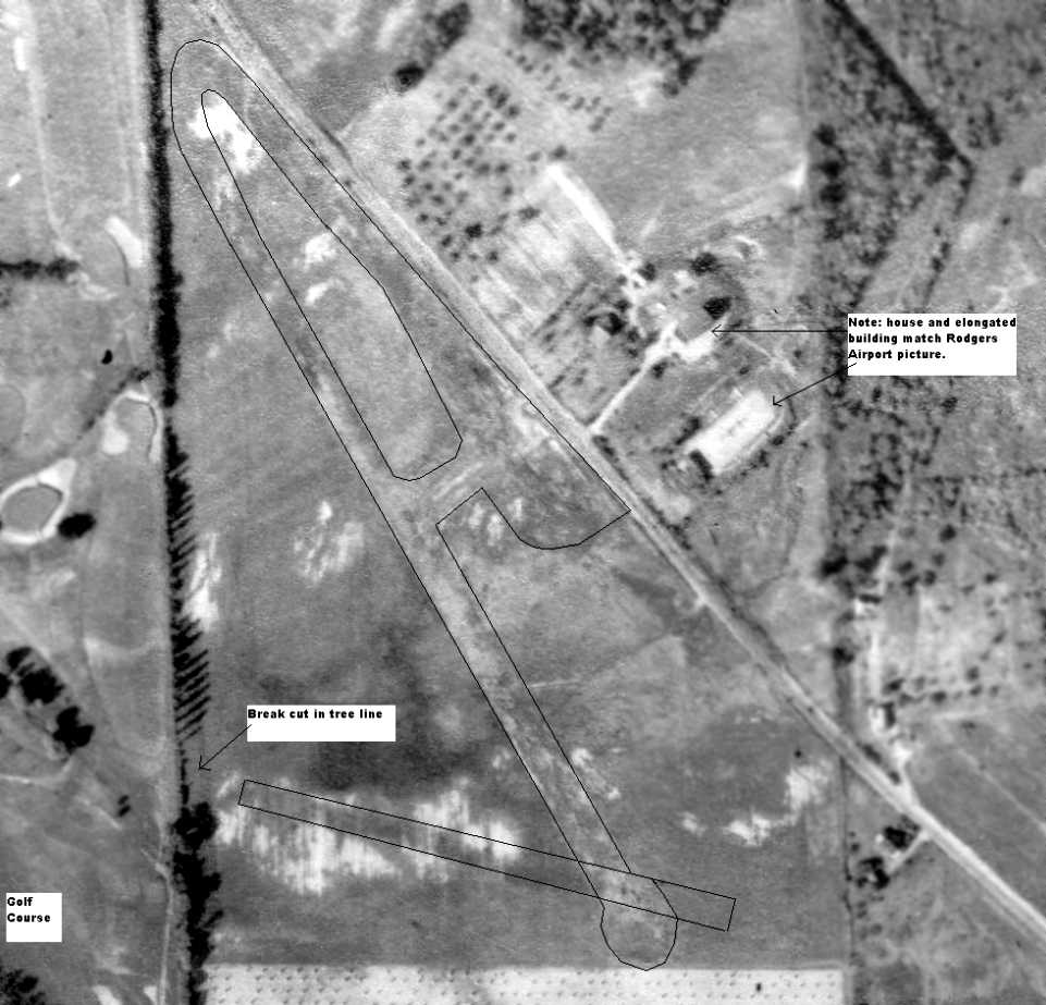
A 10/2/38 aerial photo annotated by Richard Finley to show the location of Rodgers Field, along with several identifying landmarks which correlate with the 1928/29 photo.
Richard observed, “It was primarily in an triangular area just north of the Fox Chapel High School.
The field location is a triangular area between the golf course & Powers Run Road.
There is a house & an elongated building across the road from Rodgers Field that appears both in the [1928/29] Rodgers Field picture & the 1938 aerial picture.
In the area on the left side of the Rodgers Field picture there is a tree line that has been cut down in one spot for what I see as a second runway.
To the left of the tree line in that picture is the golf course.”
No airfield was depicted at this location on the 1939 USGS topo map.
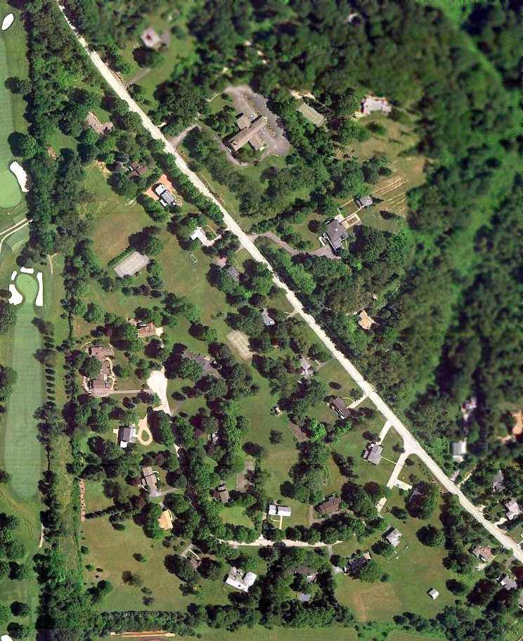
A 7/3/10 aerial photo of the site of Rodgers Field shows the triangular outline of the airfield property to remain recognizable, but no elements of the airfield itself remain.
The site of Rodgers Field is located west of the intersection of Powers Run Road & Yorkshire Drive.
A residential street named Rodgers Drive located on the opposite side of Powers Run Road.
____________________________________________________
Seven Springs Airport (7SP), Seven Springs, PA
40.01, -79.32 (Southeast of Pittsburgh, PA)
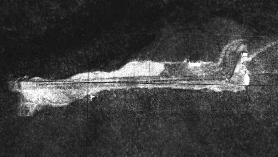
A 4/1/77 USGS aerial photo depicted Seven Springs Airport as having a single east/west runway, with a single small building at the northeast corner.
Seven Springs Airport was not yet depicted on a 1967 aerial photo
nor on the February 1969 Huntington Sectional Chart.
According to its FAA Airport/Facility Directory entry, Seven Springs Airport was activated in 12/70.
It was built to support the Seven Springs ski resort, a mile to the northeast.
Seven Springs Airport was not yet depicted on the 1973 USGS topo map.
The earliest depiction which has been located of Seven Springs Airport was a 4/1/77 USGS aerial photo,
which depicted a single east/west runway, with a single small building at the northeast corner.
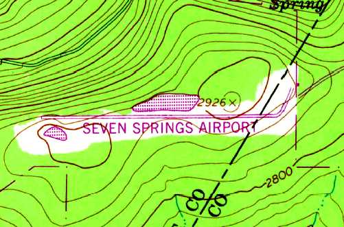
The 1981 USGS topo map depicted Seven Springs Airport as having a single east/west runway, with a single small building at the northeast corner.
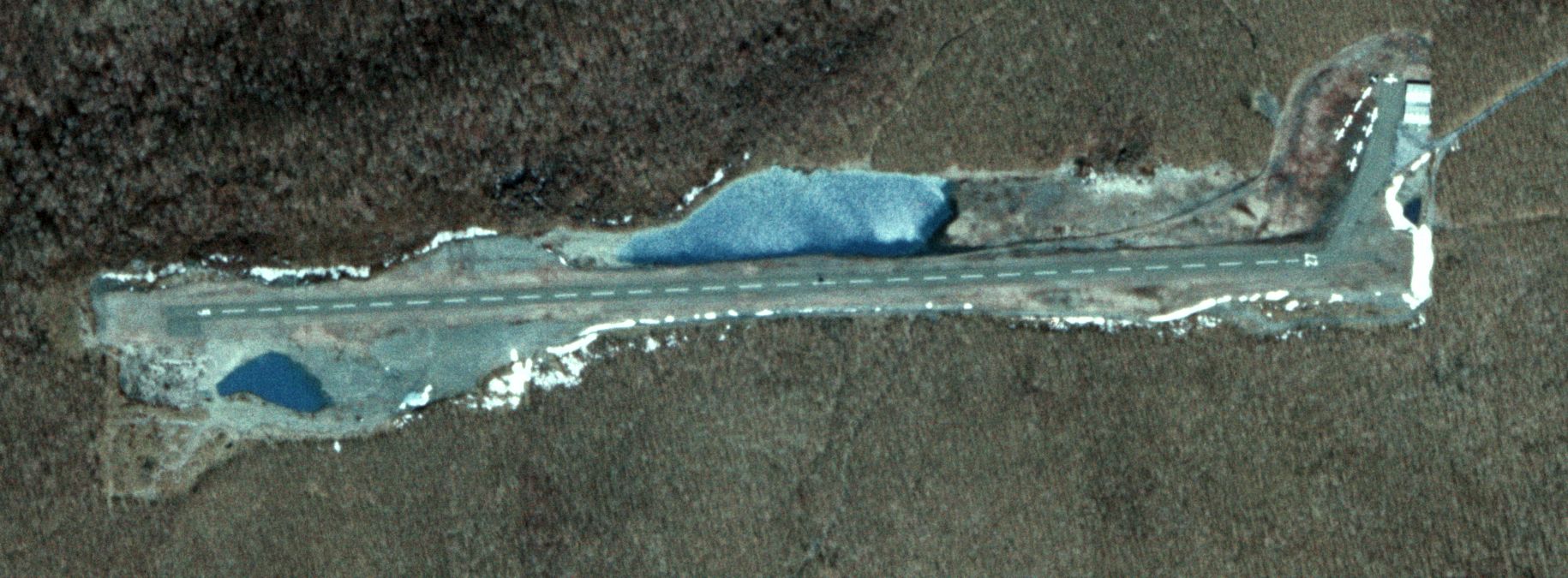
The earliest photo which has been located showing aircraft at Seven Springs Airport was a 4/15/82 USDA Farm Service aerial view (courtesy of Matt Snyder) which showed no less than 10 planes on the northeast ramp,
perhaps the zenith of popularity of this little airport.
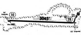
A 1994 airport directory depicted Seven Springs as having a single 3,045' paved Runway 10/28,
with a taxiway leading to a few small buildings on the northeast side.
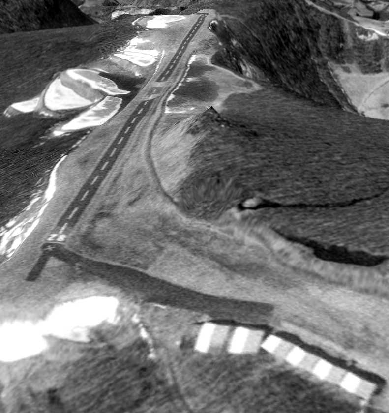
A March 1995 USGS aerial view looking southwest depicted Seven Springs Airport as having a single asphalt Runway 10/28,
with an asphalt taxiway leading to several hangars on the northeast side.
A hill & a significant drop-off were visible very close to the north & northwest sides of the runway.
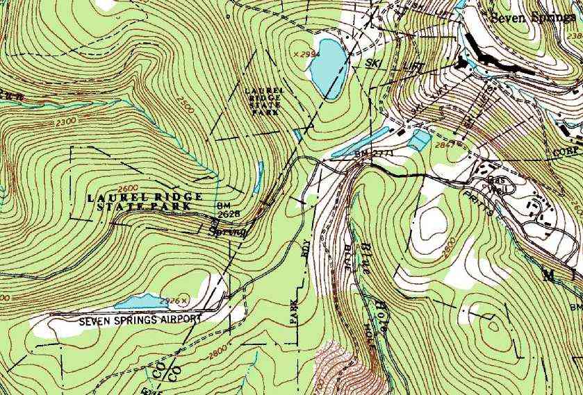
The 1996 USGS topo map depicted Seven Springs Airport as having a single paved east/west runway.
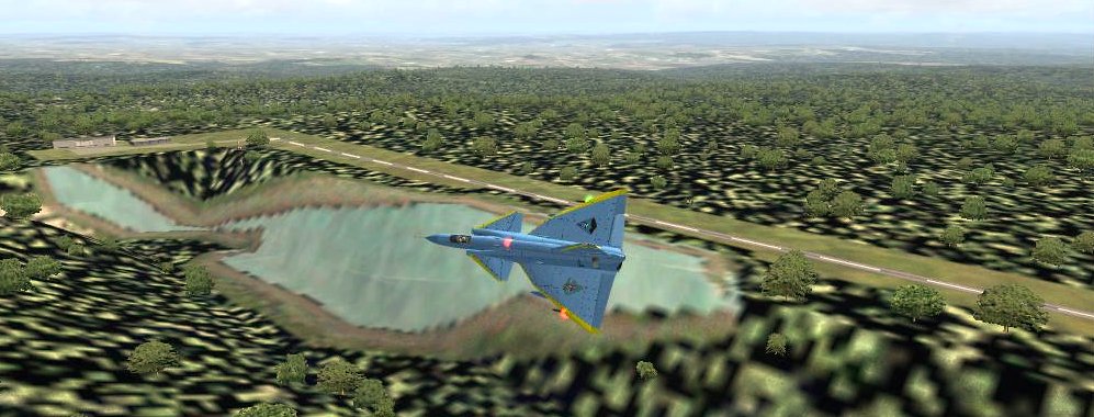
A flight simulator scenery depiction of a Saab Viggen jet fighter overflying Seven Springs Airport.
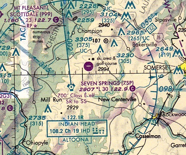
The earliest aeronautical chart depiction which has been located of Seven Springs Airport
was on the July 1999 Cincinnati Sectional Chart (courtesy of Ron Plante).
It depicted Seven Springs as having a single east/west 3,000' paved runway.
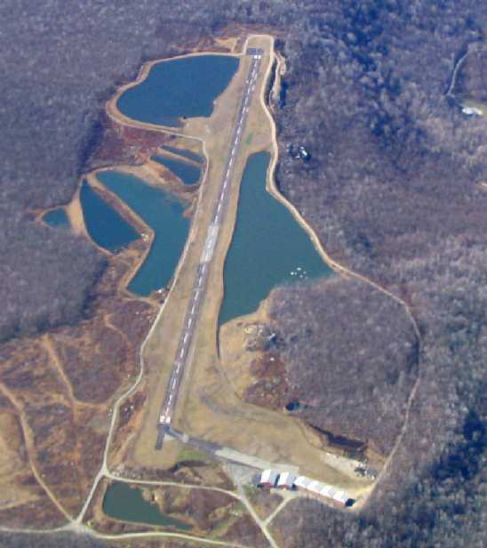
A November 2003 aerial view by Paul Freeman looking west along Seven Springs' Runway 28.
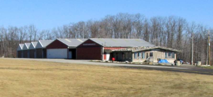
A November 2003 photo by Paul Freeman looking north at Seven Springs Airport's hangars & office.
A landing at the field found it unattended.
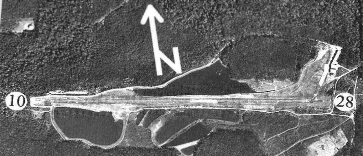
The last airport directory listing which has been located of Seven Springs Airport was in the 2005 PA Airport Directory (courtesy of John Clifford).
The directory described Seven Springs as having a 3,045' asphalt Runway 10/28, and listed the manager as John Mates.
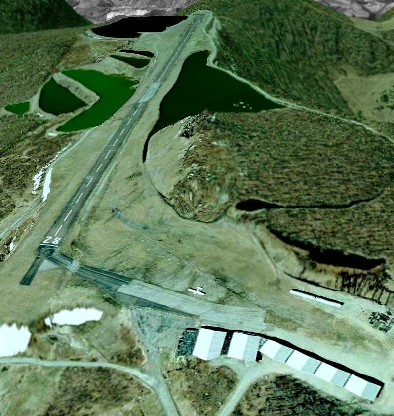
An April 2005 aerial view looking southwest showed 1 single-engine aircraft parked along the Seven Springs ramp.
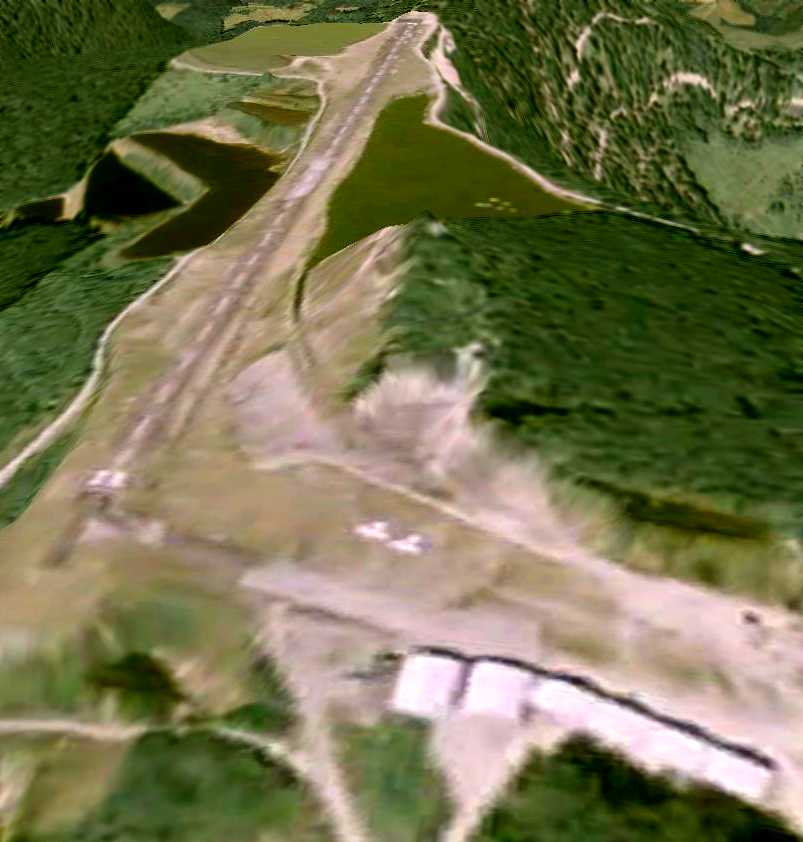
An August 2007 aerial view looking southwest showed 2 aircraft along Seven Springs' ramp.
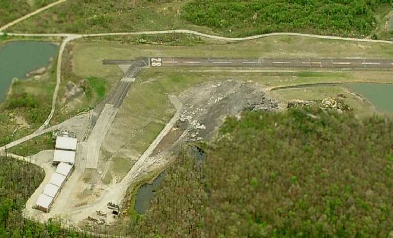
A circa 2007-2011 aerial view looking south at the Seven Springs Airport ramp.
NOTAM 03/014 declared Seven Springs Airport closed (for reasons unknown) on 3/3/09.
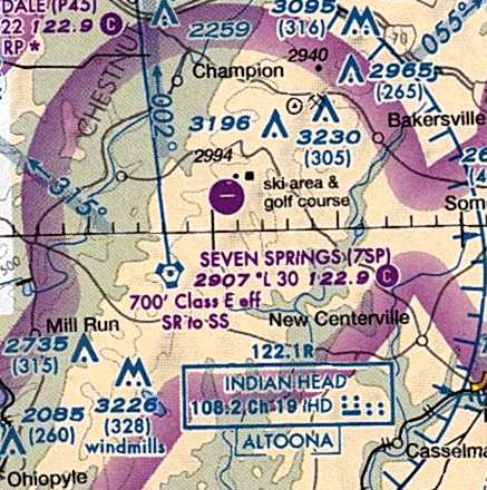
Seven Springs Airport was still depicted on the 2011 Sectional Chart, even though it had been NOTAMed closed since 2009.
Depicting an airport as open more than 2 years after it had been closed would seem to be a safety issue.
Seven Springs Airport continued to be listed in the FAA Airport/Facility Directory as of 2011, although with the status of “Closed indefinitely”.
It was described as having a single 3,045' asphalt Runway 10/28,
and having 2 based aircraft: 1 single-engine aircraft & 1 helicopter.
The field was said to conduct an average of 23 takeoffs or landings per week.
The owner was listed as “Seven Springs Airport Authority”, and the manager was listed as John Mates.
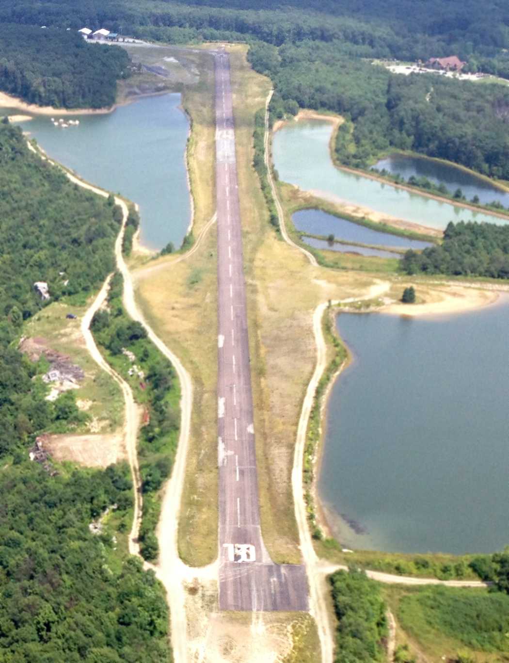
An 8/10/14 aerial view by Paul Freeman looking east along Seven Springs Airport's abandoned Runway 10.
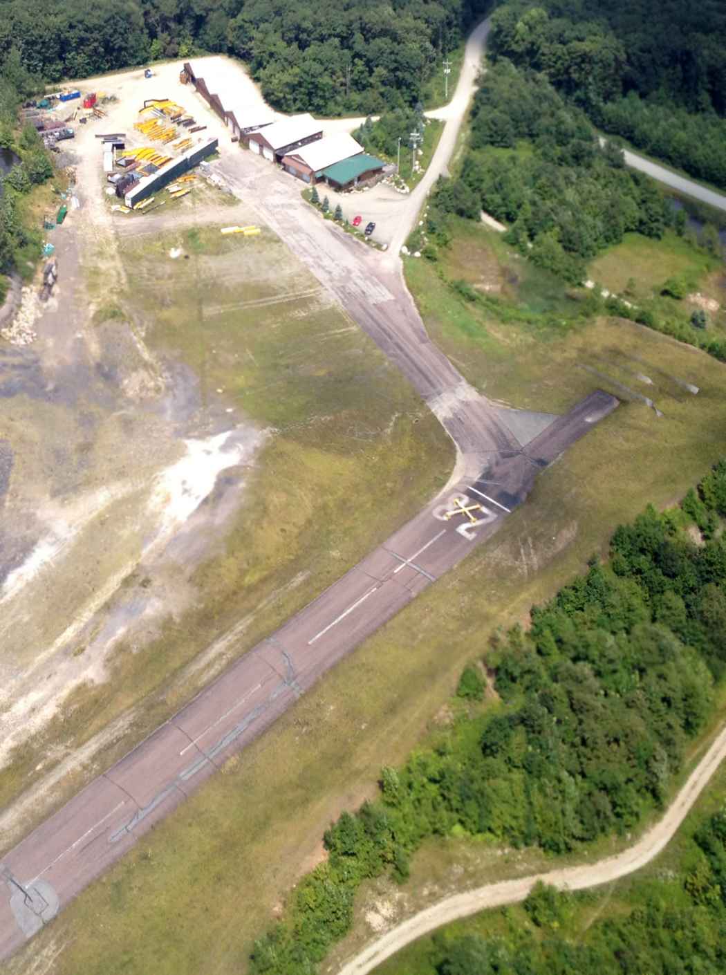
An 8/10/14 aerial view by Paul Freeman looking northeast at the former Seven Springs Airport office & hangars.
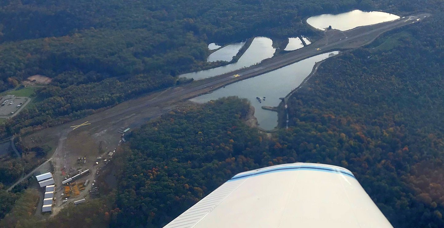
A 10/19/17 aerial view by Adam Norris looking southwest at the former Seven Springs Airport.
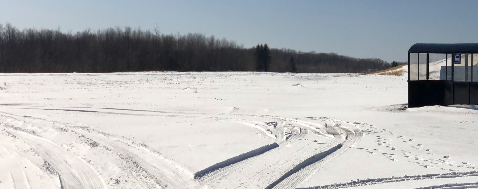
A 2/2/20 photo by Paul Freeman looking southwest along the snow-covered Seven Springs' Runway 28, along with the shuttle bus stop that used to allow pilots to easily get to the resort's ski slopes.
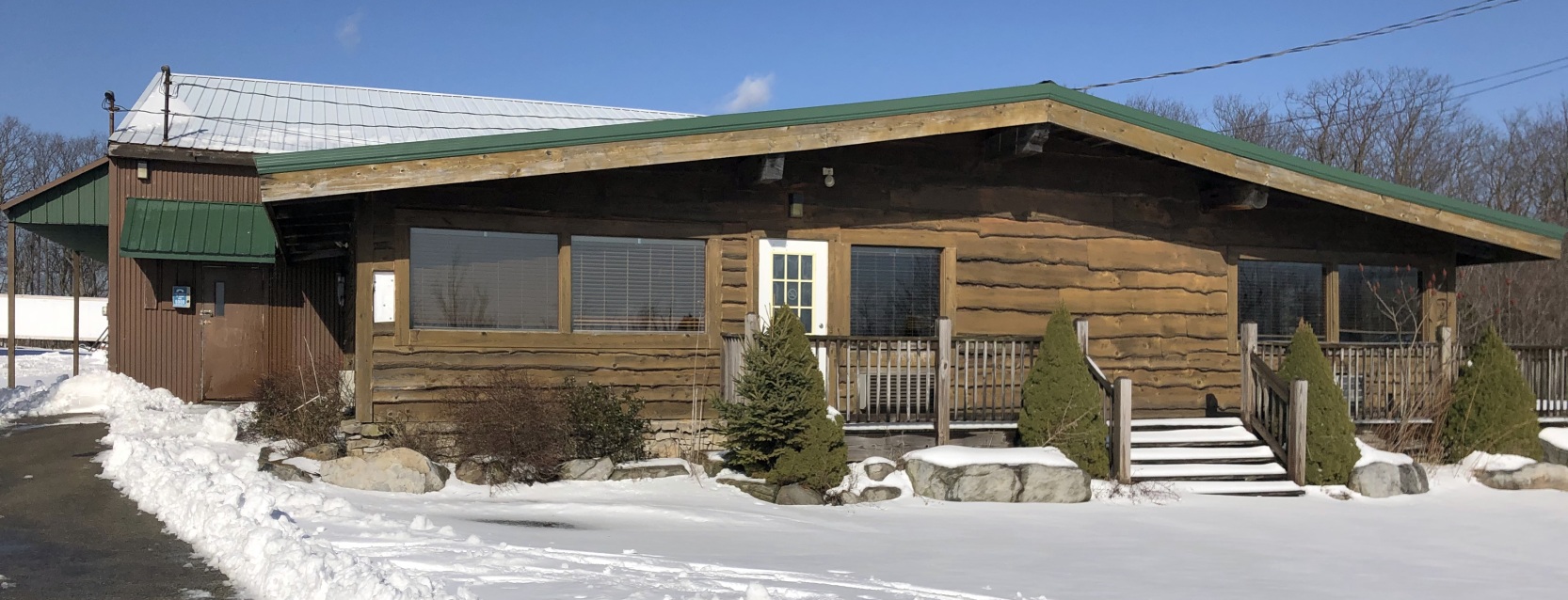
A 2/2/20 photo by Paul Freeman looking north at the former Seven Springs Airport office.
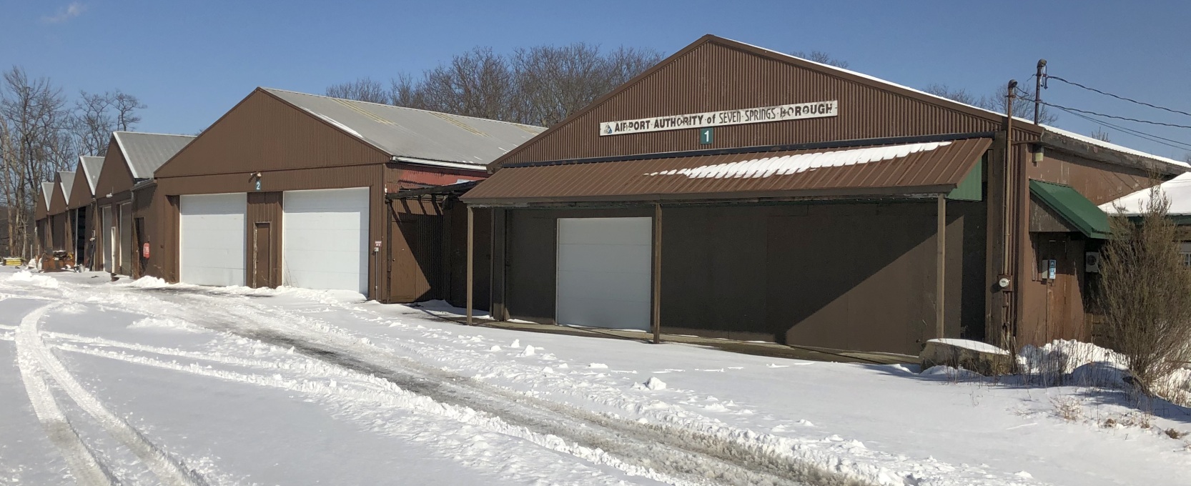
A 2/2/20 photo by Paul Freeman looking northeast at the 6 former hangars which remain at the former Seven Springs Airport,
with the southern-most hangar having a sign reading “Airport Authority of Seven Springs Borough”.
What a shame to see all this nice aviation infrastructure going to waste, with pilots previously able to fly in to the adjacent ski resort.
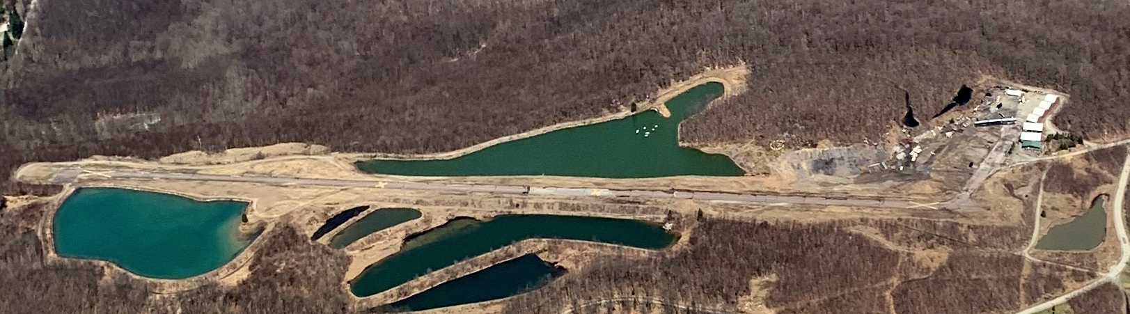
An April 2020 aerial view by Cameron Pritts looking north at Seven Springs Airport.
____________________________________________________
Leechburg Airport, Leechburg, PA
40.63, -79.57 (Northeast of Pittsburgh, PA)
Leechburg Airport, as depicted on the July 1938 Cleveland Sectional Chart.
According to an article entitled “EPA to test Kiskimere well water” in the 5/8/11 Aspinwall Herald (courtesy of Ron Plante),
“[Gib] Querio's grandfather, Gilbert Meyers bought the 80 acres along Airport Road in 1929.”
"My grandfather always wanted to fly," Querio said. "He drove truck, hauling steel."
Meyers developed his site into an airport, flying to deliver the U.S. mail & housing other small aircraft, according to Querio.
Leechburg Airport was not yet depicted on the February 1935 Cleveland Sectional Chart.
The earliest depiction which has been located of Leechburg Airport was on the July 1938 Cleveland Sectional Chart.
It depicted Leechburg as a commercial/municipal field.
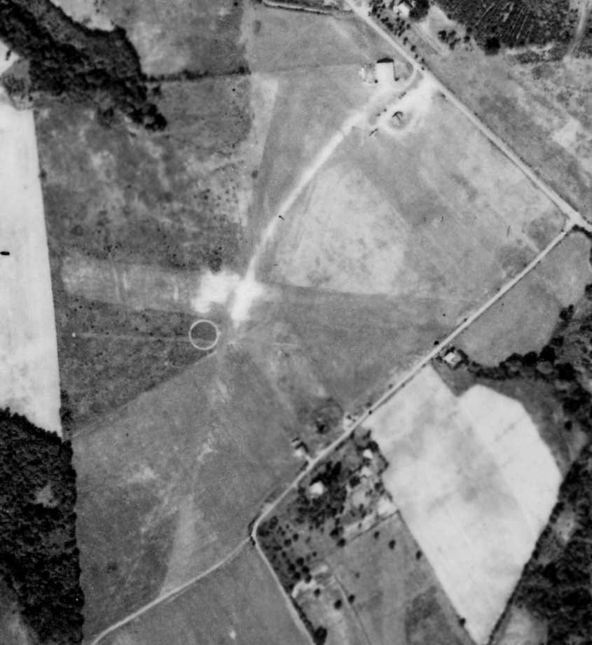
The earliest photo which has been located of Leechburg Airport was a a 9/25/38 aerial view (from Penn Pilot).
It depicted the field as having 2 grass runways with an airport circle marking,
and 2 light planes parked near a hangar & another small building on the northeast corner.
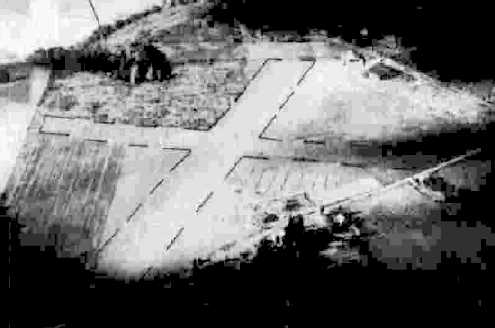
A 10/4/43 aerial view looking north from the 1945 AAF Airfield Directory (courtesy of Scott Murdock)
depicted Leechburg Airport as having 2 unpaved runways, with a hangar on the northeast side.
The 1945 AAF Airfield Directory (courtesy of Scott Murdock) described Leechburg Airport
as a 120 acre L-shaped property having 2 sod runways, the longest being the 3,000' NNE/SSW strip.
The field was said to have 2 hangars, the largest being an 80' x 61' wood, metal, and concrete structure.
Leechburg Airport was described as being owned & operated by private interests.
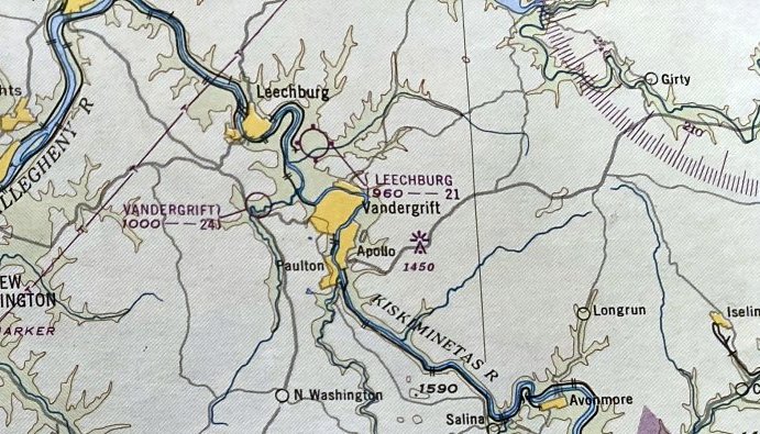
The January 1948 Pittsburgh Local Aeronautical Chart (courtesy of Tom Imrich) depicted Leechburg Airport as having a 2,100' unpaved runway.
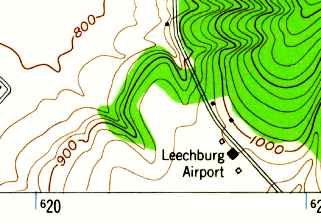
The 1954 USGS topo map depicted Leechburg Airport as having 3 small buildings on the northeast side of an open field.
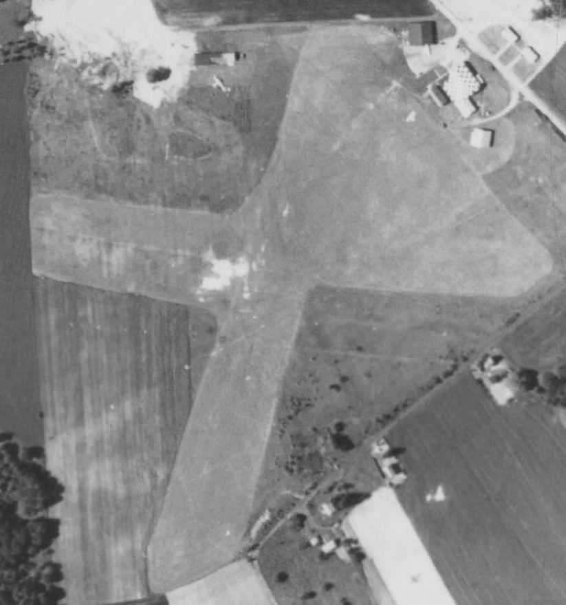
A 6/15/58 aerial view (from Penn Pilot) depicted Leechburg Airport as having 2 grass runways.
A checkerboard-roof hangar had been added at some point between 1938-58,
and 2 light planes were visible on the field.
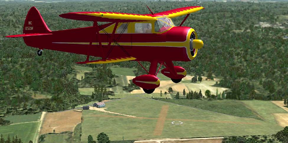
A Flight Simulator scenery re-recreation by Richard Finley of a Waco SRE Aristocrat overflying Leechburg Airport.
Wes Grady recalled, “Leechburg Airport... In the early 1960s, Gil was a Piper Training Center.
He had 2 PA-11 Super Cubs that were used for primary instruction & an instrument-equipped PA-22 Tri Pacer for more advanced training.
The photo showing the 2 hangars & the house next to them is the way I remember the airport. Gil & his wife lived in the house.
The hangar with the checkerboard pattern contained his classroom, a small office that the flight instructor (Chuck Watovich) used.
The other hangar, which is cocked a bit, contained his instruction aircraft.
There was a fuel pump in front of this hangar & a place to the side away from the road where planes were washed.
I worked at the airport from 1962-64. First pumping gas, washing planes & spinning props on the PA-11s.
I started my instruction with Chuck, who was a great instructor but a lousy bookkeeper.
I devised a system for him that guaranteed he got paid for all instruction & the student got credit for all hours flown, and only for hours flown.
I ended up getting free instruction in return.
The runways were grass (I know because I cut them with Gil's tractor).
Landing involved coming around a hilltop & then straightening out for touchdown.
Too high & you had to really slip it in & too low and you would be picking oak leaves out of your teeth.
The first time I ever got it perfect, Chuck got out of the plane & told me to go solo. I lost a really good shirt that day!”
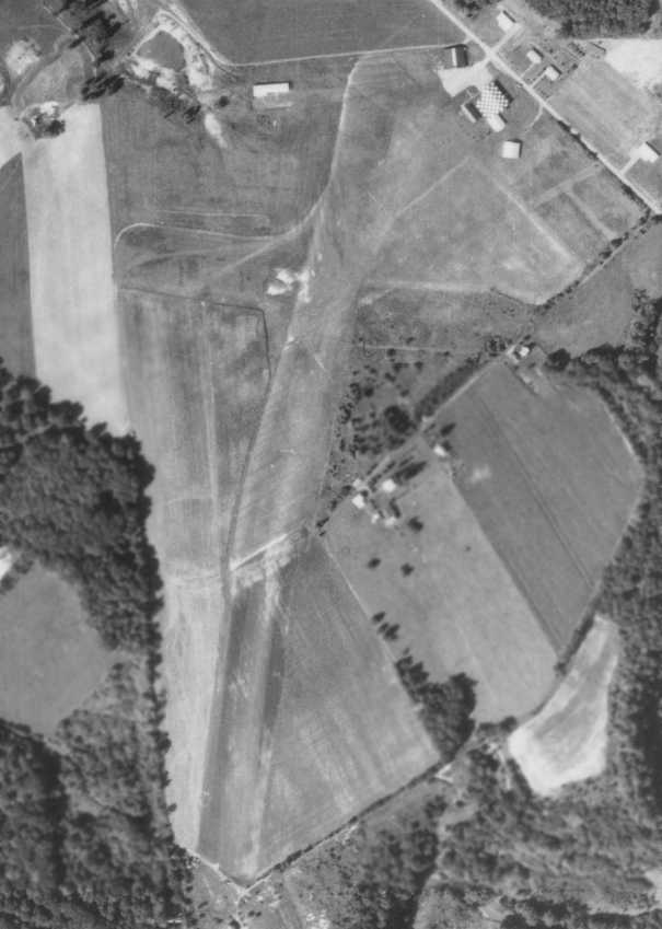
A 9/11/67 aerial view (from Penn Pilot) showed that Leechburg Airport's primary NNE/SSW runway
appeared to have been lengthened on the south side at some point between 1958-67.
But there were no aircraft visible on the field.
The Aerodromes table on the May 1968 Cleveland Sectional Chart (courtesy of Ron Plante)
described Leechburg as having 2 turf runways, with the longest being 2,350'.
According to an article entitled “EPA to test Kiskimere well water” in the 5/8/11 Aspinwall Herald (courtesy of Ron Plante),
“In the 1960s, when the Nuclear Materials & Equipment Corporation opened its plutonium plant
and started discarding nuclear waste from its Apollo plant into its nuclear dump in Parks,
Querio's family opened a mobile home park next to the airport.”
A 1969 aerial view showed that Leechburg Airport appeared to be closed,
with trailers or other unidentified objects being stored on the eastern part of the airfield.
The checkerboard hangar remained intact, but there were no aircraft visible on the field.
The November 1972 Cleveland Sectional Chart (courtesy of Ron Plante) depicted Leechburg as having a 3,300' unpaved runway.
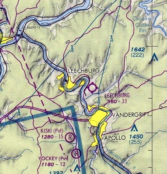
The last aeronautical chart depiction which has been located of Leechburg Airport
was on the May 1975 Pittsburgh Terminal Aeronautical Chart (courtesy of Mitchell Hymowitz).
It depicted Leechburg as having a 3,300' unpaved runway.
According to an article entitled “EPA to test Kiskimere well water” in the 5/8/11 Aspinwall Herald (courtesy of Ron Plante),
“It was just a few decades ago that skydivers dropped in
and ultralights buzzed the rural hillsides to cheering crowds for air shows at the Leechburg Airport in Parks Township.”
In the 1980s, “Querio was still trying to build up his airport operations,
which included a Cessna pilot training school, repair shop, offices & other businesses
with plans for building homes for people who could taxi their plane to their front door.
When Babcock & Wilcox proposed installing a waste incinerator at the Parks site in the 1980s,
an avalanche of public protest & bad publicity erupted & never really stopped.”
"When all the stuff came out in the paper, no one wanted to live here," Querio said. "I didn't want to live here."
Leechburg Airport was no longer depicted on the October 1990 Cleveland Sectional Chart (according to Richard Finley).
According to an article entitled “EPA to test Kiskimere well water” in the 5/8/11 Aspinwall Herald (courtesy of Ron Plante),
Gib “Querio closed his airport facilities in the early 1990s
and sold 73 of his 80 acres to Butler man for a housing development.”
The 4/7/93 USGS aerial photo showed the airfield remained intact.
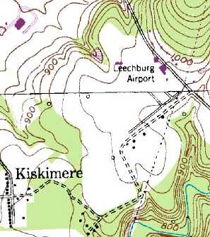
Leechburg Airport was still depicted on the 1996 USGS topo map, with a few small buildings on the east side of a clearing
Wes Grady recalled, “If I had know the airport was for sale back in the 1990s, I would have bought it without a second thought & opened the airport.
The last time I was up there, the hangars were still there,
and the wind sock, or at least a few shreds of it, was still flying from the top of the canted hangar, in 1999 or 2000.”
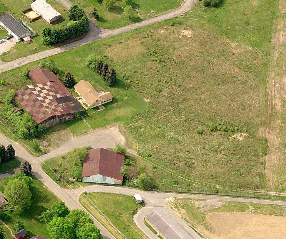
A circa 2005-2010 aerial view looking south at the checkerboard-roofed hangar at the site of Leechburg Airport.
According to an article entitled “EPA to test Kiskimere well water” in the 5/8/11 Aspinwall Herald (courtesy of Ron Plante),
“An airplane hangar, faded to sky blue with rust-burnt edges, and an idle office building is about all that is left of Gib Querio's dream of a residential air park.
Financial & legal problems, coupled with the airport's location next to a nuclear dump & plutonium plant, sunk more than Querio's business plans.
He is among about 15 residents who have requested that the EPA test their well water
for contaminants that might have traveled from the nuclear operations in the village of Kiskimere in Parks.
Although the plutonium plant, owned by Babcock & Wilcox & predecessors Atlantic Richfield Company & the Nuclear Materials and Equipment Corporation
is long gone, the legacy of potential nuclear & chemical contamination remains.
And the last vestige of the nuclear operations, a nuclear waste dump, will soon be excavated by the Army Corps of Engineers,
who will send the contaminated dirt & debris to a dump in Utah.
Querio suspects the well water at his former airport site, flight school & trailer park
might have had something to do with the birth defects of his second child and his wife's premature death.
Querio was one of several hundred plaintiffs who settled lawsuits for close to $90 million
with Babcock & Wilcox & the Atlantic Richfield Company several years ago on claims of loss of life, personal injury and property damage.
The companies have always maintained that their operations did not cause the illnesses and damages alleged in the 14-year federal court lawsuit.
Now, Querio is trying to sell his land & fix his natural gas wells, which he says are filling with ground water & producing less.”
The article continued, “Querio's settlement for personal injury & property damage of about $120,000 from Babcock & Wilcox,
according to court records & a lesser amount from the Atlantic Richfield Co. was not a windfall, according to Querio.
Some of the money paid for the legal expenses when Querio got sued.
The new landowner alleged that Querio didn't disclose that a nuclear dump was next to the airport property.
The case didn't make it to court & was discontinued in 2002, according to Armstrong County Court records,
but Querio said he paid considerable legal expenses to defend himself.”
What's left of his airport land, Querio said, "The property now is a liability."
And the rumors surrounding contamination outside the nuclear dump area, Querio said, "are killing me."
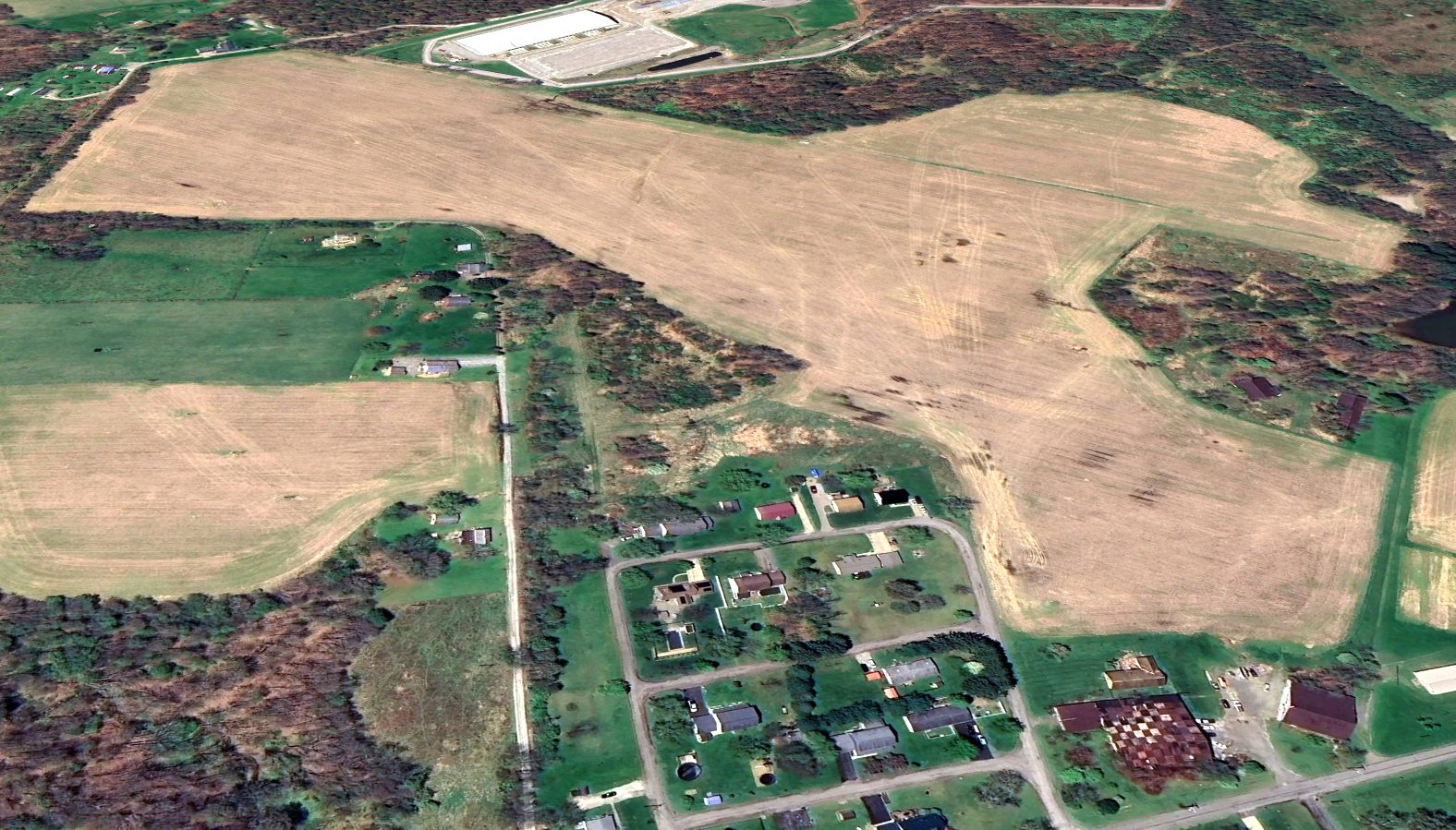
A 2024 aerial view looking southwest at the former Leechburg Airport showed the field remained intact, including the checkerboard-roofed hangar at bottom-right.
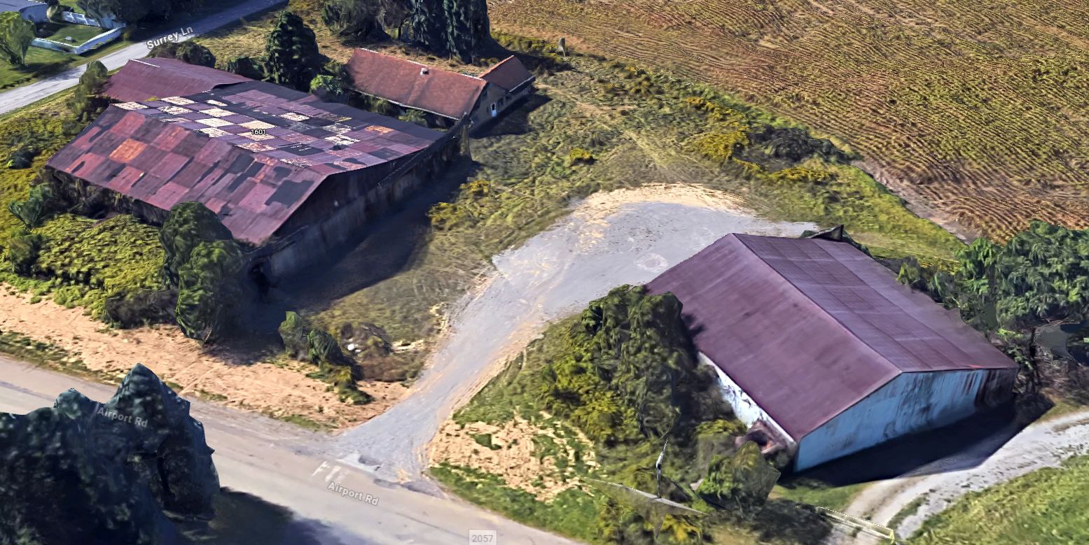
A 2025 3-D aerial image looking southwest at the former Leechburg Airport hangars.
The site of Leechburg Airport is located west of the intersection of Surrey Lane & Airport Road, appropriately enough.
____________________________________________________
Aliquippa-Hopewell Airport, Aliquippa, PA
40.59, -80.29 (Northwest of Pittsburgh, PA)
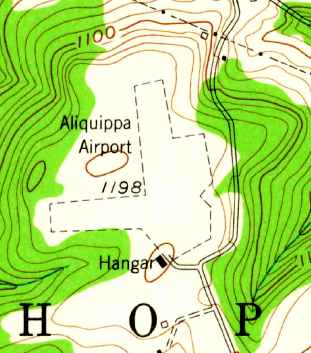
The 1954 USGS topo map depicted Aliquippa Airport as having 2 unpaved runways, with a single hangar at the south end.
This small general aviation airport was evidently established at some point between 1947-52,
as it was not yet listed among active airfields in the 1945 AAF Airfield Directory (courtesy of Scott Murdock),
and a 1947 aerial photo depicted nothing but farming fields.
The earliest depiction which has been located of Aliquippa-Hopewell Airport was a 1952 aerial photo.
It depicted the field as having 2 perpendicular grass runways, with a single hangar at the south end.
Aliquippa Airport was not yet depicted on the 1953 Cleveland Sectional Chart.
The 1954 USGS topo map depicted Aliquippa Airport as having 2 unpaved runways, with a single hangar at the south end.
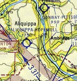
The earliest aeronautical chart depiction which has been located of Aliquippa-Hopewell Airport
was on the January 1955 Cleveland Sectional Chart (courtesy of Chris Kennedy).
It depicted Aliquippa-Hopewell as having a 2,000' unpaved runway.
A severe thunderstorm caused significant damage at Aliquippa-Hopewell Airport on 5/12/56.
A 1956 aerial photo showed Aliquippa-Hopewell had gained a second building on the southeast side at some point between 1952-56,
and a single light plane was visible on the field.
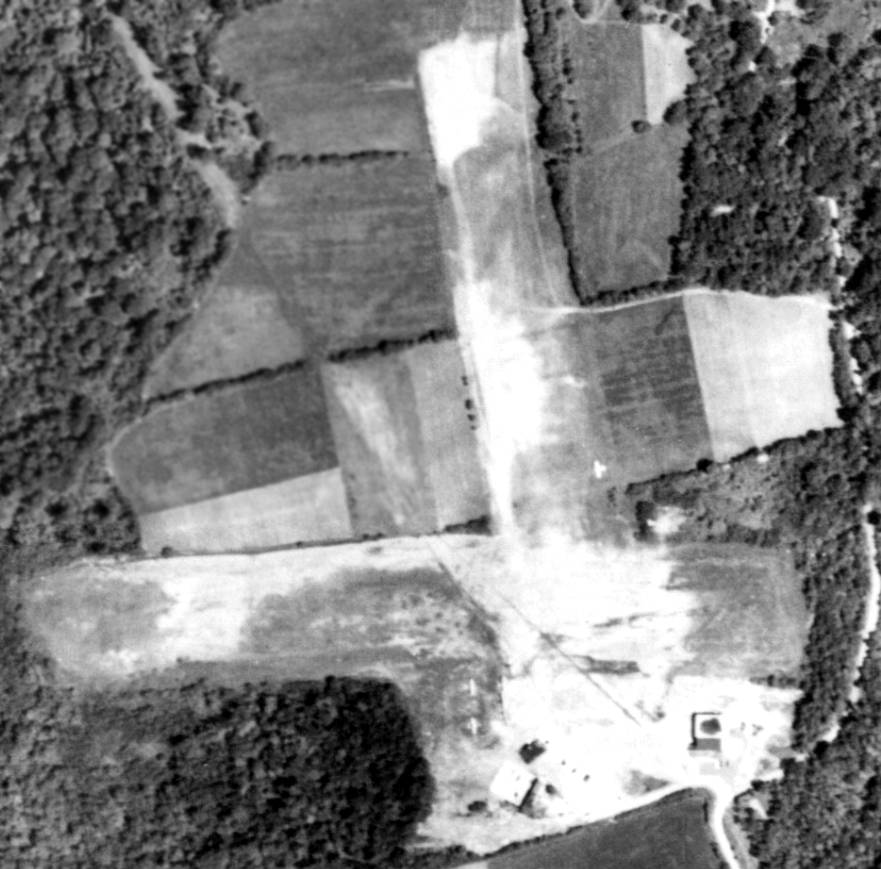
A 3/3/58 aerial view (from Penn Pilot) showed Aliquippa-Hopewell Airport to consist of 2 grass runways, with several small buildings at the south end.
At least 3 light aircraft were visible on the field.
According to the book “High Frontier: A History of Aeronautics in Pennsylvania”,
the Chief Engineer of Taylorcraft, Jack Gilberti, assembled enough capital to organize his own firm, Volaircraft Inc. at the Aliquippa-Hopewell Airport.
The company was established in 1958.
Ken Hendrickson recalled, “I helped build the Volaire factory at Aliquippa as I was also an investor in the project.
Jack Gilberti was responsible for the updates to the airplane.
Jack designed the Volaire & we had about 50 airplanes in parts built when we ran out of money.
We were saved from bankruptcy when Rockwell bought us out. I flew the Volaire several times during the flight testing.”
A 1959 aerial photo showed a total of 7 light aircraft at Aliquippa-Hopewell.
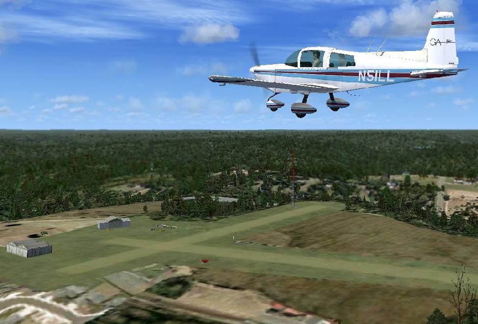
A Flight Simulator scenery re-creation by Richard Finley of a Grumman Tiger overflying Aliquippa-Hopewell Airport.
Gilberti designed & built a prototype Volaire 10, a 3-seat, all-metal high-wing aircraft which first flew in 1960.
The production version, the Volaire 1035, received its Type Certificate in November 1961.
The 1961 Pittsburgh Local Aeronautical Chart (courtesy of Mike Keefe) depicted Aliquippa-Hopewell as having a 2,000' unpaved runway.
An improved 4-seat version, the Volaire 10A (or 1050), went into limited production at Aliquippa in 1963.
Within a year, Volaircraft had attracted the interests of Pittsburgh's Rockwell Standard Corporation,
whose Aero Commander Division lacked lower-priced models.
On 7/12/65 Rockwell acquired Volaircraft for $1.6 million & merged it along with Meyers Aircraft Company into the Aero Commander operations.
Before Rockwell consolidated their light aircraft production in OK & GA in 1966,
the Aliquippa plant, which Gilberti continued to manage, turned out 60 examples of the Volaircraft 1050,
with a 150 hp engine, and sold them as Aero Commander 100s.
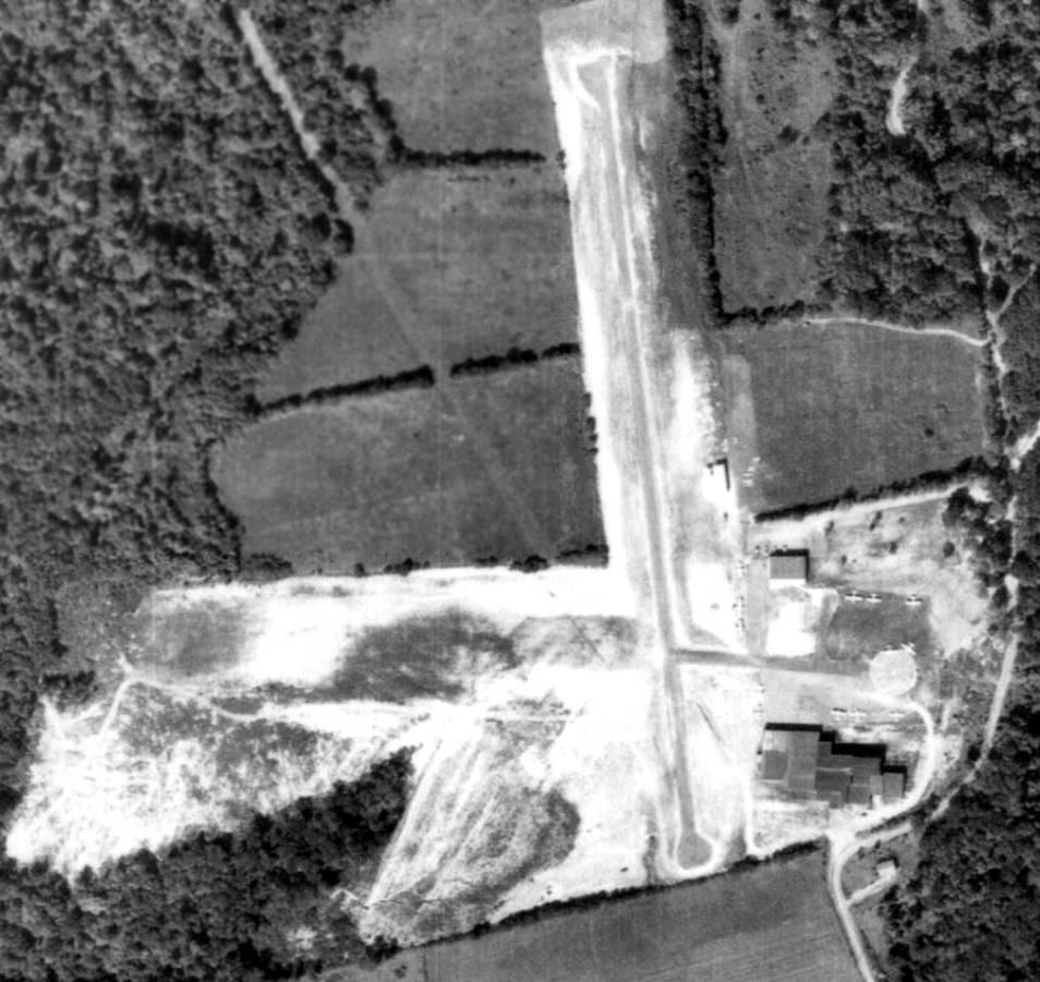
A 9/15/67 aerial view (from Penn Pilot) depicted a considerable transformation of Aliquippa-Hopewell Airport compared to the 1958 photo.
A portion of the north/south runway had been paved, and the Volaire factory buildings had been added at the southeast side of the field.
At least 9 light aircraft were visible on the field.
The May 1968 Cleveland Sectional Chart (courtesy of Ron Plante) depicted Aliquippa-Hopewell as having a single north/south paved 1,700' runway.
The November 1968 Cleveland Sectional Chart (courtesy of Richard Finley)
depicted Aliquippa-Hopewell as having a single north/south paved 1,700' runway.
A 1969 aerial view showed a total of 9 light aircraft parked around the factory buildings.
A row of T-hangars had been added on the northeast side at some point between 1967-69.
According to Richard Finley, “When Volaire closed, they sold the factory to a company that produced modular houses.
I was working at Greater Pittsburgh tower from June 1973 to September 1976.
At some point during that period I made a small field trip with one of our supervisors to investigate rumors we had heard at PIT approach
that the airport [Aliquippa-Hopewell] was now closed & they were building modular homes at the old aircraft factory.
Between August & December of 1973, I carpooled with this supervisor.
I suspect that field trip may have occurred on the way home while we were carpooling.
We looked into the old hangar & found they were indeed building modular homes & there were no aircraft to be seen on the field.”
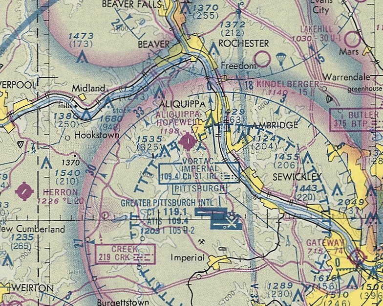
The last aeronautical depiction which has been located of Aliquippa-Hopewell Airport was on the November 1974 Cleveland Sectional Chart (courtesy of Ron Plante).
It depicted Aliquippa-Hopewell as having a single north/south paved 1,700' runway.
Aliquippa-Hopewell Airport was no longer depicted on the May 1981 Detroit Sectional Chart (courtesy of Ron Plante).
On 9/28/81, some or all of the former airport property was purchased
by the Department of Labor's Mine Safety & Health Administration to house its emergency mine operations.
The Township of Hopewell invested some $225,000 in infrastructure improvements
in anticipation of the commencement of operations of this Federal facility.
However, the facility never opened, as the field operation was transferred to a neighboring state.
Subsequently, the Mine Safety & Health Administration reported the property as excess & it was transferred to GSA.
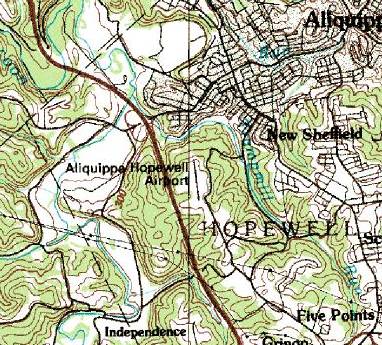
The 1983 USGS topo map still depicted the Aliquippa-Hopewell Airport, with a single north/south runway,
but the field may have been closed by that point.
The 4/7/93 USGS aerial photo showed that several buildings had been built over much of the airport property,
including one which replaced the former factory on the southeast side.
The former T-hangar remained on the northeast side.
As of 9/23/93, the airport property was designated as surplus & placed in GSA's surplus property inventory.
The “Hopewell Township Investment Act of 1995” required the General Services Administration
to transfer this land to the Beaver County Corporation for Economic Development.
The goal of the Corporation is to utilize this property as the centerpiece of a Hopewell Aliquippa Airport Industrial Park
and thereby promote economic development & create needed jobs for the people of Hopewell Township.
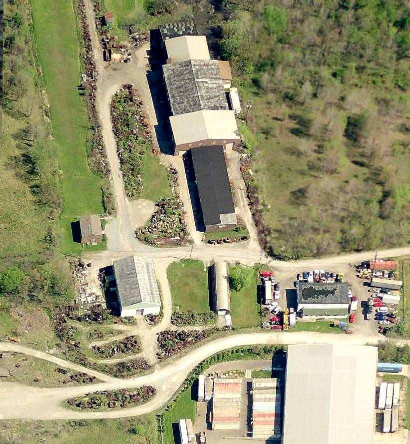
A circa 2005-2010 aerial view looking north at the site of Aliquippa-Hopewell Airport,
showing the remains of the paved north/south runway, and the row of T-hangars which remains on the northeast side.
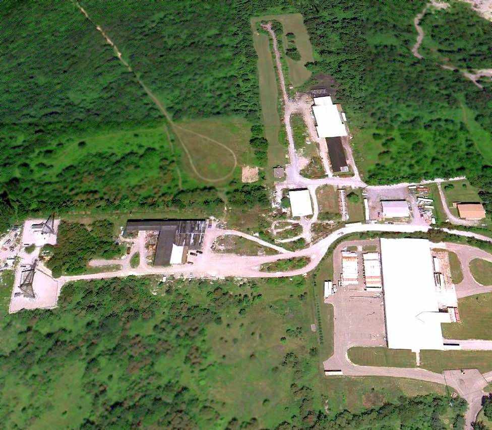
A 7/3/10 aerial view looking north at the site of Aliquippa-Hopewell Airport,
showing the remains of the paved north/south runway, and the row of T-hangars which remains on the northeast side.
George Wolf reported in 2010, “My college roommate has just built a house near Aliquippa, and one of the roads leading to his home is 'Airport Road'.
You can see the runway appears to have trees / brush growing at it's edges, and a turnaround point at its northern end.
Some of the buildings appear as though they could be old hangars, as well.”
Bill Johnson reported in 2014, “Regarding the old Aliquippa-Hopewell Airport...
There is a MacDonalds located just off Interstate 376 at an exit a few miles north of the airport site.
Inside there are numerous pictures of the airport, and a historical review of the airplane manufacturing there.”
The site of Aliquippa-Hopewell Airport is located west of the intersection of Kane Road & Airport Road, appropriately enough.
____________________________________________________
40.37, -80.1 (Southeast of Pittsburgh, PA)
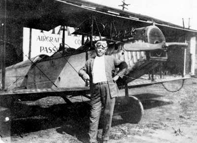
The earliest depiction which has been located of Mayer Field
was a 1922 photo of Casper Mayer in front of an unidentified biplane (courtesy of Kenneth Scholter).
Aviation pioneer Casper Mayer established Mayer Field in 1919.
Mayer Field was one of the first commercial airfields in the Pittsburgh area.

The location of “Mayer Aircraft Corporation Field” as depicted on the 7/15/23 Commerce Department Airway Bulletin (courtesy of Mike Denja).

The 7/15/23 Commerce Department Airway Bulletin (courtesy of Mike Denja) described “Mayer Aircraft Corporation Field”
as a commercial airfield owned by the Mayer Aircraft Corporation.
It was depicted as an irregularly-shaped outline, measuring 1,360' northeast/southwest,
described as “A small field for fast landing ships. Planes of the De Haviland type of faster should use the field with great care.”
One hangar was depicted on the east corner.
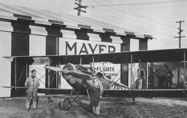
A circa 1920s photo of pilots Ed "Dutch" Schultz & Frank Mayer in front of Mayer's first airplane (a Laird Swallow) at Mayer Field.
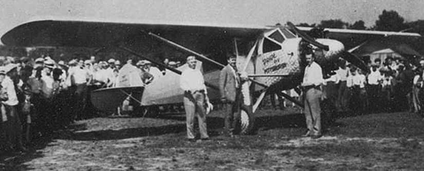
A 1928 photo of a Ryan NC4398 the “Pride of Pittsburgh” amongst an admiring crowd at Mayer Field (courtesy of Richard Finley).
The original caption read, "Casper Mayer’s first Ryan, Mahoney-Ryan B-1, Wright R-790 (J-5-9) 220 HP, C4398 c/n 71,
Mr. Mayer, Walt Chambers and Mayer’s pilot, J. Warren Smith. Mayer Field Bridgeville, PA 1928".
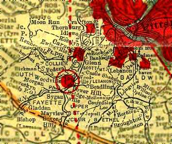
The earliest chart depiction which has been located of Mayer Field
was in the 1929 Pennsylvania Rand McNally Standard Indexed Map with Air Trails (courtesy of Chris Kennedy).
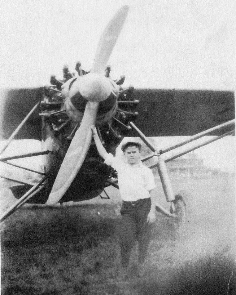
A 1929 photo of a man in front of a high-wing monoplane (model unidentified) at Mayer Field (courtesy of Denise Capurso).
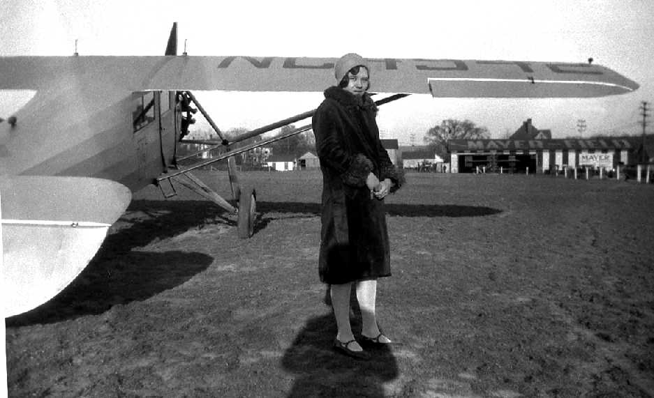
A 1931 photo by August Katrencik of Theresa Misanik at Mayer Field in front of a Ryan B-1 Brougham (Charles Lindbergh's 'Spirit of St. Louis' was a modified version of this type).
Note the Mayer Field name on the hangars at right.
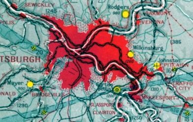
The earliest aeronautical chart depiction which has been located of Mayer Field was on the December 1932 Cleveland Sectional Chart.
It depicted Mayer as a commercial/municipal field.
The Airport Directory Company's 1937 Airports Directory (courtesy of Bob Rambo) described Mayer Field as a commercial airport,
consisting of a 40-acre rectangular sod field having 3 cinder runways, with the longest being the 1,625' northeast/southwest strip.
A hangar was said to be marked with “Mayer Field Bridgeville PA”.
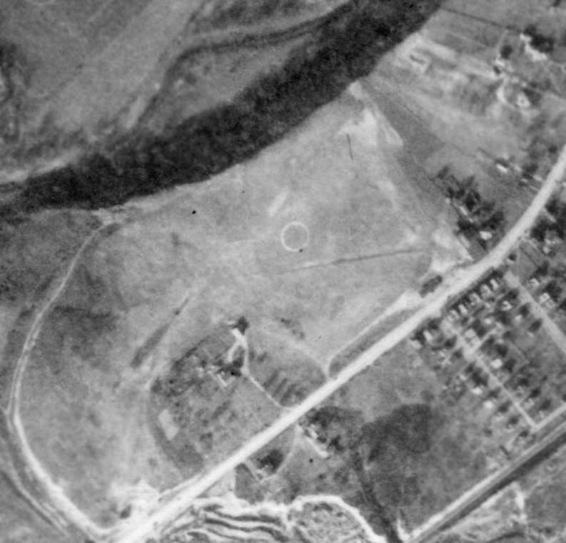
An 11/9/38 aerial view depicted Mayer Field as an open grass area, with at least 2 runways, oriented east/west & northeast/southwest.
A circular airport marking was in the center of the field, and several buildings were located on the eastern corner of the field.
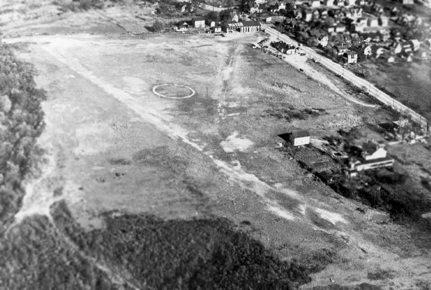
An undated aerial view of Mayer Field (courtesy of Joe Fife).
Three planes were visible on the field at the top-right, including one visible inside a hangar, which was marked with “Mayer” on the roof.
The field appeared to consist of a single unpaved runway.
Joe recalled, “I grew up in Bridgeville & went there as a small boy to look at airplanes. These pictures came from an aviation historian in Bridgeville - John Bennett.
He owned a drug store in Bridgeville, and flew out of Mayer Field.”
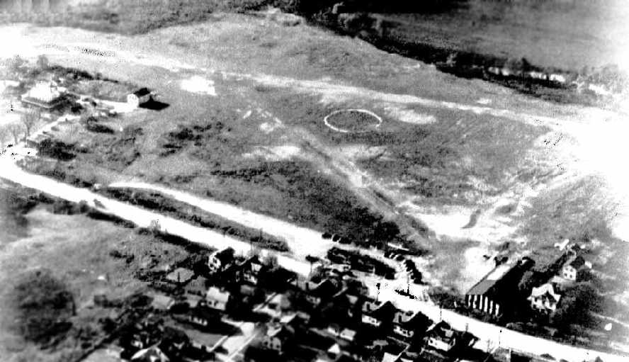
A circa 1920s/30s aerial view of Mayer Field (courtesy of Jack Haller).
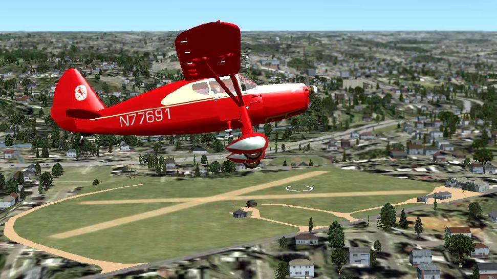
A Flight Simulator scenery re-creation by Richard Finley of a Fairchild 24 overflying Mayer Field.
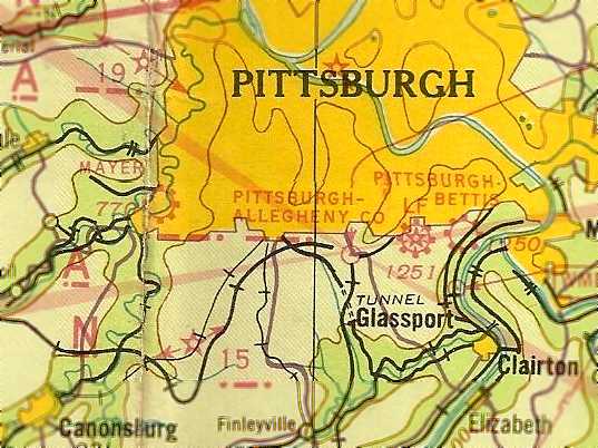
The March 1940 Cleveland Sectional Chart (courtesy of Richard Finley) depicted Mayer as a commercial/municipal field.
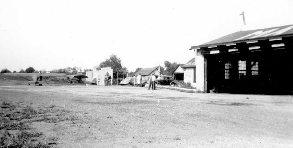
A circa 1940 photo by William Mason looking northeast at 2 Piper Cubs near Mayer Field's hangar (courtesy of Edward Wolf).
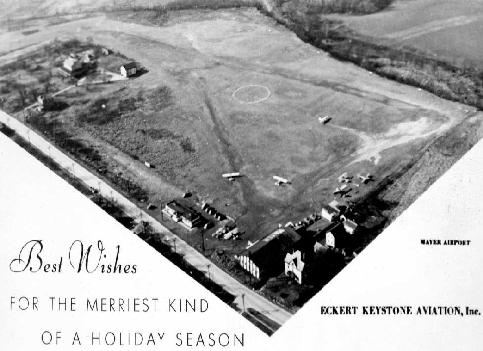
An undated aerial view looking west at Mayer Field from a circa 1940s Christmas Card from Eckert Keystone Aviation Inc. (courtesy of Edward Wolf).
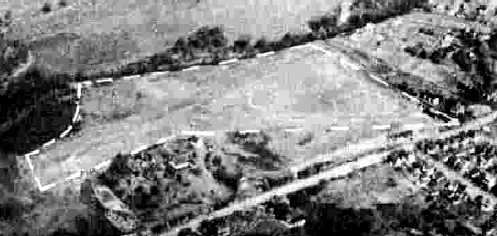
A 10/29/43 aerial view looking north from the 1945 AAF Airfield Directory (courtesy of Scott Murdock)
depicted Mayer Field as an irregularly-shaped grass landing area.
The April 1944 US Army/Navy Directory of Airfields (courtesy of Ken Mercer) described Mayer Field as having a 1,600' unpaved runway.
Glenn Shaw recalled, “My mother soloed at Mayer Field in a Piper Cub circa 1945.”
The 1945 Haire Publishing Company Airport Directory (courtesy of Chris Kennedy)
described Mayer Airport as a “class s-1” airfield, owned by Eckert Keystone Aviation, Inc., and operated & managed by George Eckert.
The airport was said to consist of a 26 acre rectangular field,
which had a 2,000' cinder southwest/northeast runway & a 1,600' sod east/west runway.
The field was also said to have a 110' x 60' hangar, and to offer training, fuel, and service.
Ben Jones recalled, “I learned to fly at Mayer Airport: 1945 first solo & 1946 Private.
At that time the field was active with GI Bill training, and employees included 3 instructors.
Time in a Cub was $9 dual & $7 solo. When my savings ran out I worked for the airport for 75 cents/hour, payable in flying time.
We stored J3 Cubs in the large hangar as follows: The plane was moved in nose first as far as it would go.
The tail was then lifted until the prop could be rested on the padded end of a nail keg.
The next Cub would then be placed behind the first as close as possible. Using this method, we could store 3 planes in the space normally occupied by one.
This took advantage of the high overhead structure of the hangar (the same one shown in pictures).
To recover the plane from the tail-high position, we had a 6' pole with a hook which was used to catch the handle on the rear fuselage.
This was unique enough to get a brief article with a picture in an aviation publication of the time.”
The 1945 AAF Airfield Directory (courtesy of Scott Murdock) described Mayer Field
as a 62 acre irregularly-shaped property within which were 2 sod runways: 1,625' northeast/southwest & 1,080' north/south.
The field was said to have 2 metal hangars, the largest measuring 100' x 50',
and it was described as being owned & operated by private interests.
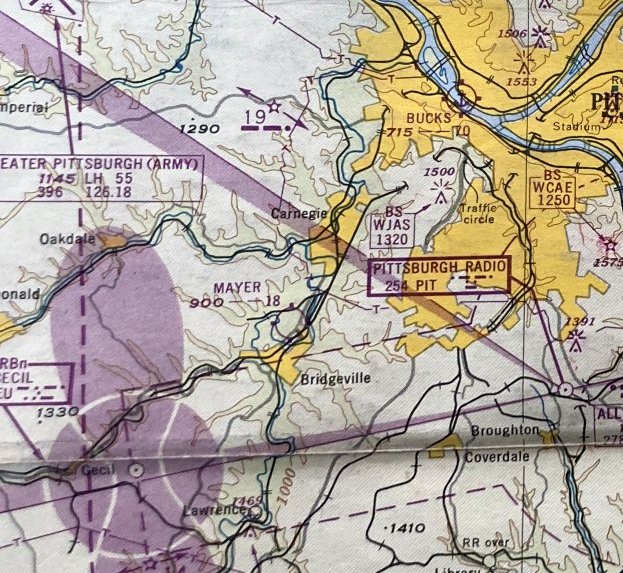
The January 1948 Pittsburgh Local Aeronautical Chart (courtesy of Tom Imrich) depicted Mayer as having a 1,800' unpaved runway.
Ginnie Wauthier recalled, “I lived directly across the street from the airport & my husband lived right next to the hangar.
I have pictures from 1949 of my dad holding me outside our home & in the back ground was Mayer airport.”
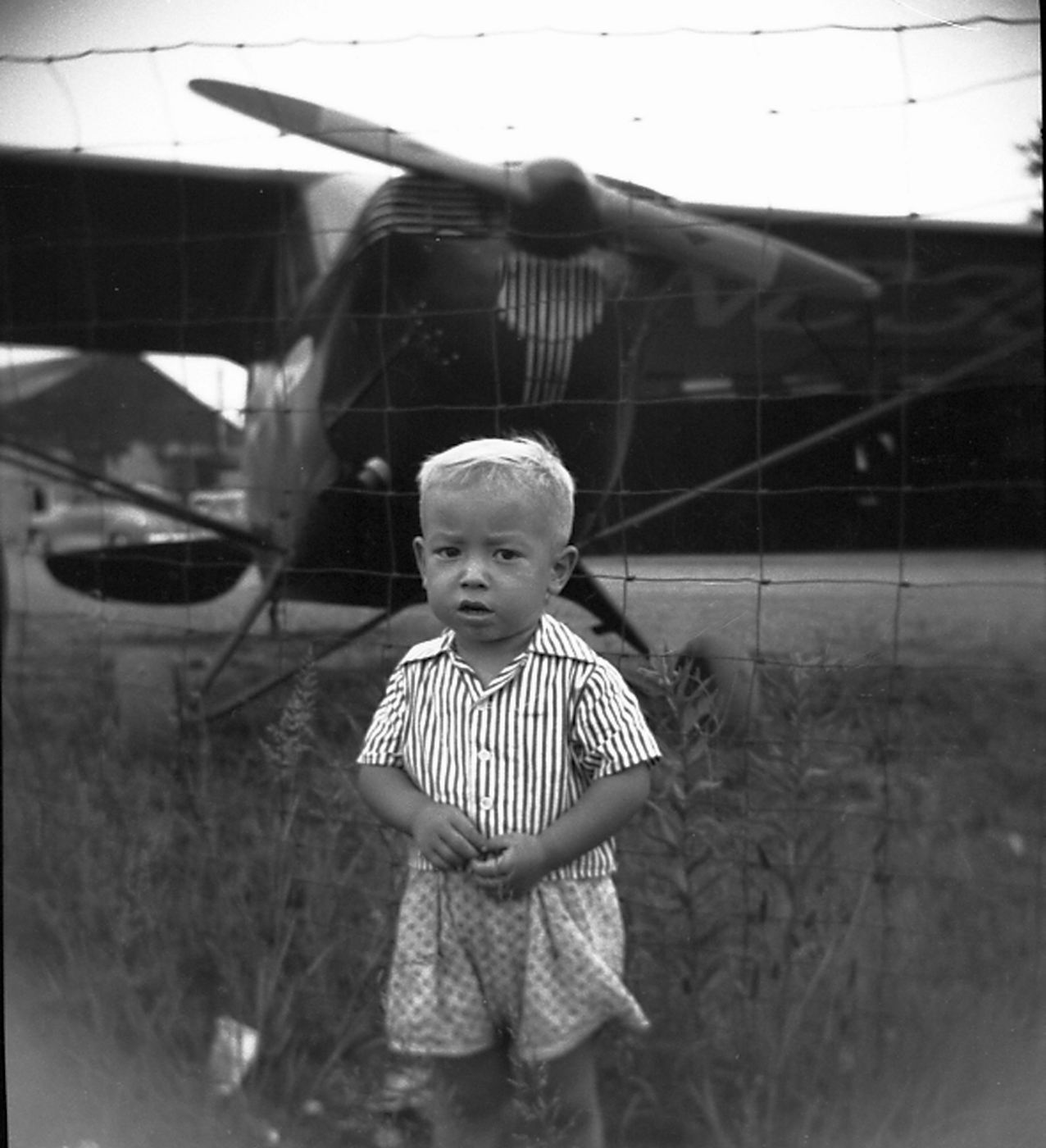
A 1949 photo by Joe Katrencik Sr. of son Joey in front of an unidentified single-engine aircraft at Mayer Field.
The last photo which has been located of Mayer Field was a 1952 aerial view.
It depicted the runways as remaining clear, but no aircraft were visible on the field.
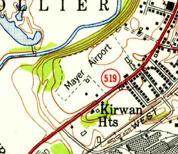
The 1953 USGS topo map depicted Mayer Airport as having an irregularly-shaped outline with several buildings along the southeast corner.
Ben Jones recalled, “By the time I got back in 1954, the airport was closed.”
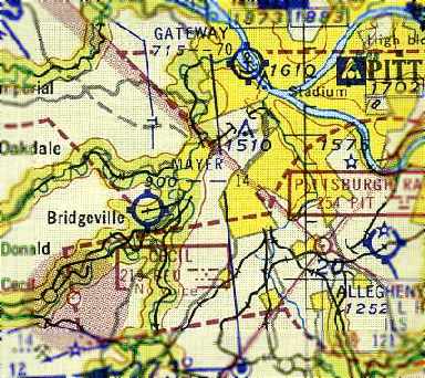
The last depiction which has been located of Mayer Field was on the January 1955 Cleveland Sectional Chart (courtesy of Chris Kennedy).
It depicted Mayer as having a 1,400' unpaved runway.
Mayer Field was no longer depicted at all on the December 1955 Cleveland Sectional Chart (according to Chris Kennedy).
According to resident Ginnie Wauthier, “Mayer airport was sold so that the shopping center [the Geat Southern Shopping Center] could be built.”
By the time of a 5/7/57 aerial photo, the shopping center had been built over the site of Mayer Field,
and there was no longer any trace remaining of the former airport.
Joe Fife reported in 2006 that the site of the airport “is now the Great Southern Shopping Center.”
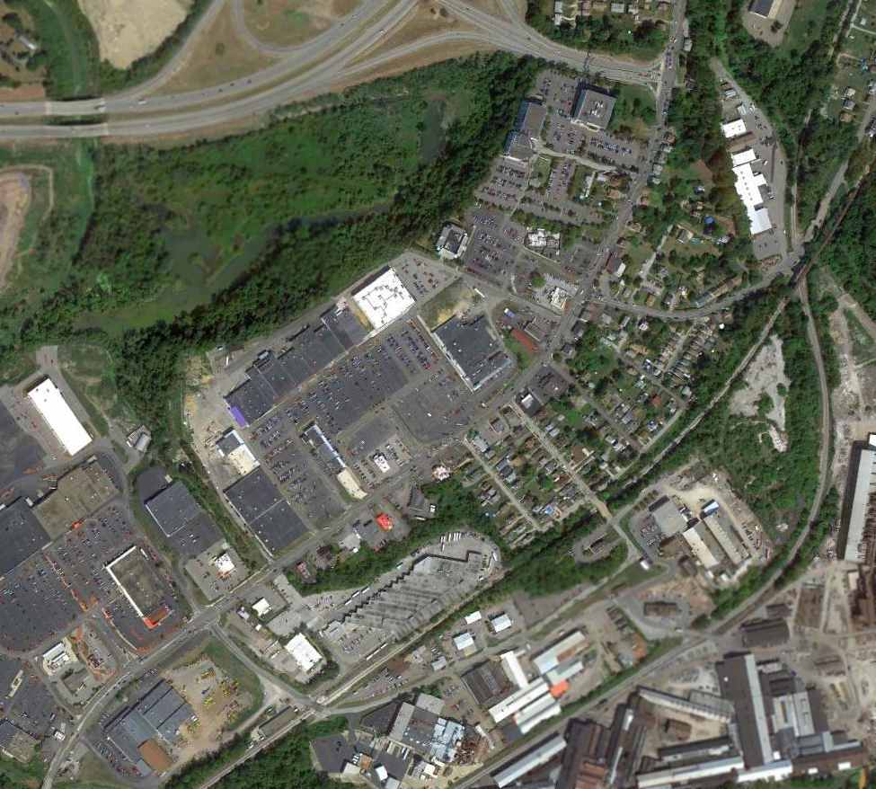
An 8/29/12 aerial photo did not show any trace remaining of Mayer Field.
The site of Mayer Field is located north of the intersection of Route 50 & Mayer Road, appropriately enough.
____________________________________________________
Or if you prefer to contact me directly concerning a contribution (for a mailing address to send a check),
please contact me at: paulandterryfreeman@gmail.com
If you enjoy this web site, please support it with a financial contribution.
____________________________________________________
This site covers airfields in all 50 states.