Abandoned & Little-Known Airfields:
Eastern Oregon
© 2002, © 2025 by Paul Freeman. Revised 12/11/25.
This site covers airfields in all 50 states: Click here for the site's main menu.
____________________________________________________
Please consider a financial contribution to support the continued growth & operation of this site.
Burns Junction Airfield (added 12/11/25) - Burns Junction BLM Airfield (added 12/11/25) - Pendleton Intermediate Field (added 12/8/16) - Umatilla Army Airfield (revised 1/20/25)
____________________________________________________
Burns Junction Airfield, Burns Junction, OR
42.775, -117.852 (Southeast of Portland, OR)
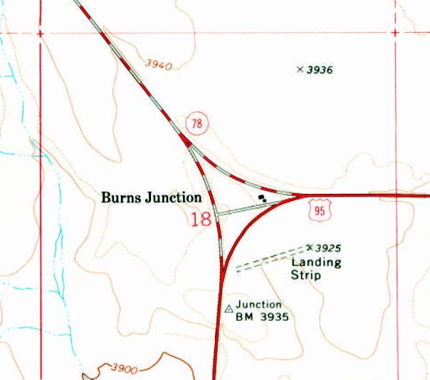
Burns Junction Airfield, as depicted on the 1975 USGS topo map.
The name or purpose of this small rural airfield has not been determined.
It was evidently established at some point between 1946-71, as it was not yet depicted on a 1946 aerial photo or the 1969 Boise Sectional Chart.
The earliest depiction which has been located of this airfield was a 1971 aerial photo,
which depicted a single 1,100' unpaved northeast/southwest runway, with no hangars or any other improvements.
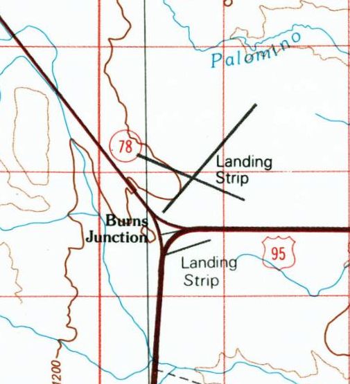
The 1994 USGS topo map depicted both the original “Landing Strip” south of Burns Junction, along with a newer & larger 2-runway “Landing Strip” which had been established north of the Junction.
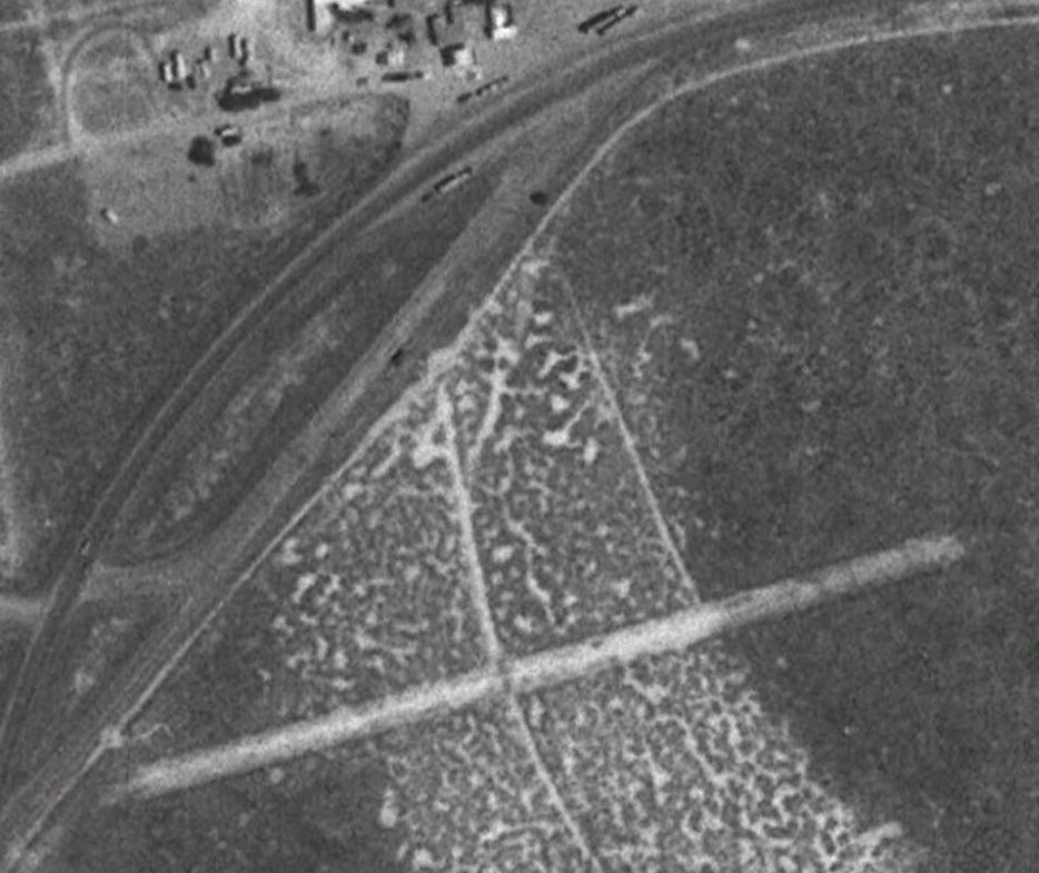
The earliest photo which is available of Burns Junction Airfield was a 1994 USGS aerial view.
which depicted a single 1,100' unpaved northeast/southwest runway, with no hangars or any other improvements.
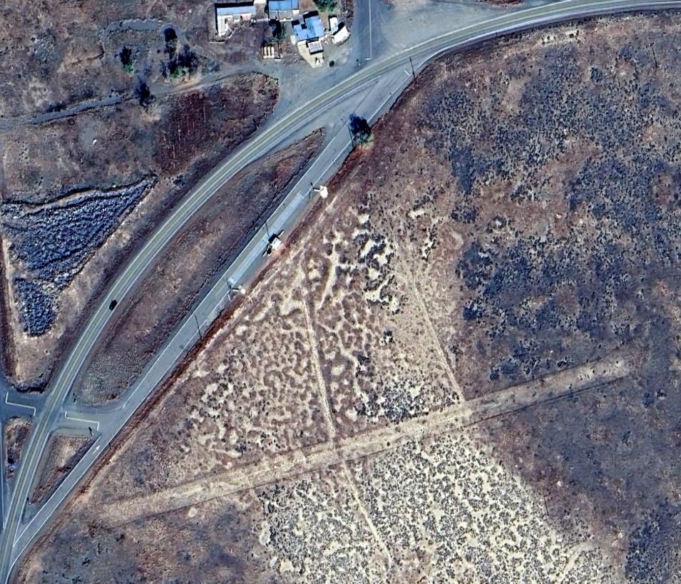
A 2023 aerial view showed the Burns Junction Airfield remained intact though deteriorated, with no sign of recent aviation use.
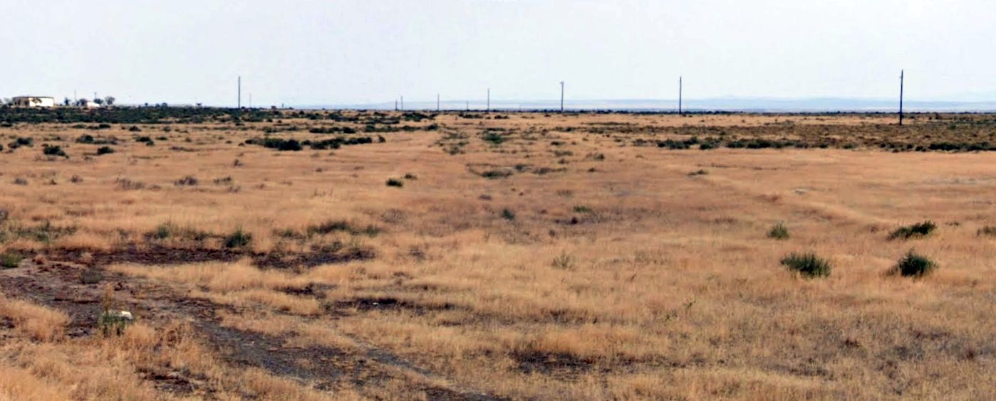
A 2025 photo looking northeast showed the Burns Junction Airfield runway alignment remained barely recognizable.
The Burns Junction Airfield was not depicted on the 2025 Sectional Chart, but it was labeled “Historic Burns Junction Airstrip” on 2025 road maps.
Thanks to James Simms for pointing out this airfield.
____________________________________________________
Burns Junction BLM Airfield, Burns Junction, OR
42.784, -117.849 (Southeast of Portland, OR)
The Burns Junction BLM Airfield, as depicted on the 1994 USGS topo map.
The name or purpose of this small rural airfield has not been determined.
It was evidently established at some point between 1975-93, as it was not yet depicted on the 1969 Boise Sectional Chart, a 1971 aerial photo, or the 1975 USGS topo map.
The earliest depiction which has been located of this airfield was a 1983 aerial photo,
which depicted a fairly extensive airfield, with 2 paved runways, with the longest being 6,000' northeast/southwest.
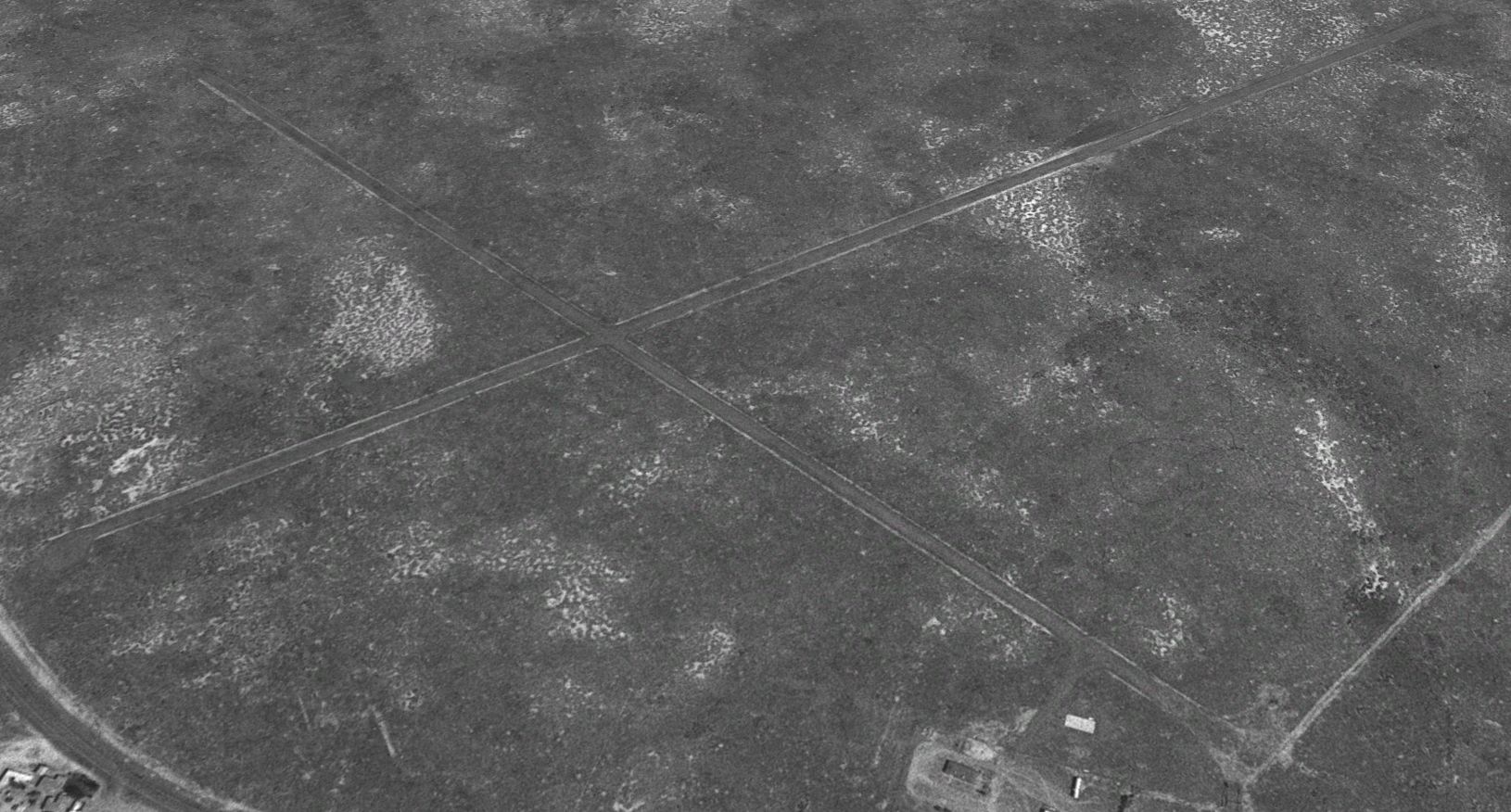
The earliest photo which is available of the Burns Junction BLM Airfield was a 1994 USGS aerial view looking northwest.
It depicted 2 paved runway, with a small compound of buildings on the southeast side.
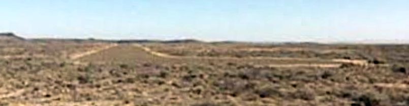
A 2007 photo looking northeast along the Burns Junction BLM Airfield's northeast/southwest runway.
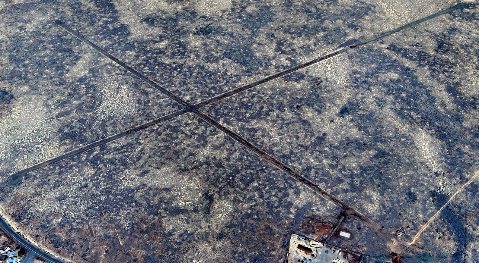
A 2023 aerial view looking northwest at the Burns Junction BLM Airfield.
A 2025 photo looking northeast along the Burns Junction BLM Airfield's northeast/southwest runway.
The Burns Junction BLM Airfield was depicted as an “Unverified” airfield on the 2025 Sectional Chart, but was not labeled on 2025 road maps.
Thanks to James Simms for pointing out this airfield.
____________________________________________________
Pendleton Intermediate Field, Pendleton, OR
45.67, -118.712 (East of Portland, OR)
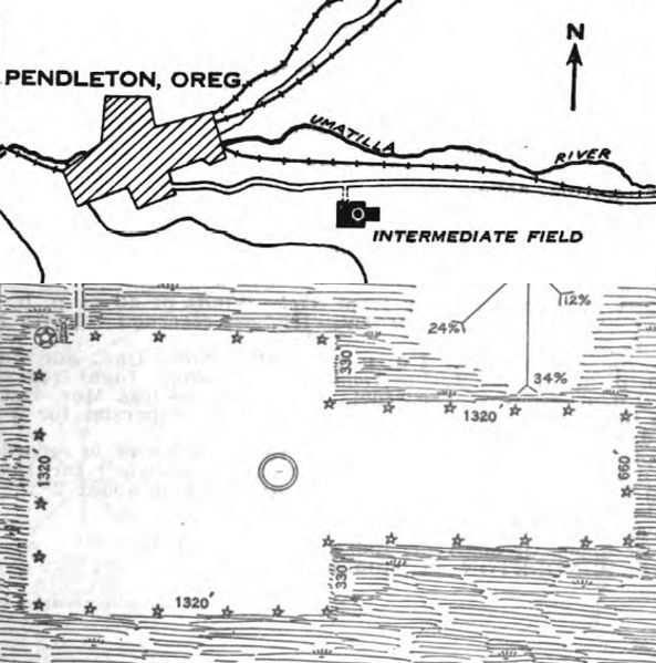
The location & layout of Pendleton Intermediate Field, as depicted on the 10/26/28 Commerce Department Airway Bulletin #478.
This small airfield was evidently established as one of the Commerce Department's network of Intermediate Fields,
which were built for potential emergency use by airliners flying along airways between major cities.
The date of construction of Pendleton Intermediate Field has not been determined.
The earliest depiction which has been located of Pendleton Intermediate Field
was on the 10/26/28 Commerce Department Airway Bulletin #478.
It described Pendleton as Site #48 along the Salt Lake City – Pasco Airway.
It was said to be leased to the government, and operated by the Commerce Department.
The field was described as a 60 acre rectangular grass field, measuring 2,640' east/west by 1,320' north/south.
An airfield circle marking was depicted in the center of the field, but it was said to not have any hangars.
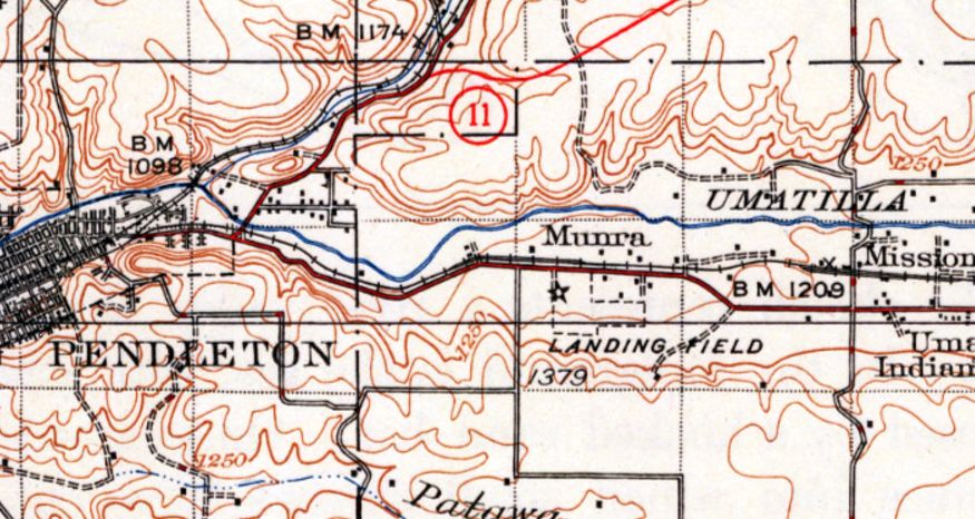
The earliest topo map depiction which has been located of Pendleton Intermediate Field was on the 1935 USGS topo map.
It depicted Pendleton as a T-shaped property outline, labeled simply as “Landing Field”, with an airway beacon along the west edge.
Pendleton Intermediate Field was evidently closed at some point between 1928-36,
as it was no longer depicted on the February 1936 La Grande Sectional Chart,
which instead depicted a replacement Pendleton Airport on the opposite (northwest) side of the town.
The 1948 USGS topo map depicted Pendleton Intermediate Field in the same fashion as the 1935 topo map.
Pendleton Intermediate Field was no longer depicted on the 1953 USGS topo map.
A 1964 aerial view showed no recognizable trace remaining of Pendleton Intermediate Field.
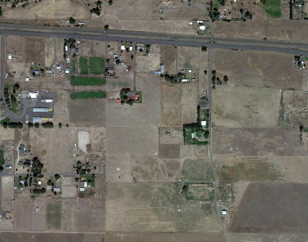
A 2016 aerial view showed no recognizable trace remaining of Pendleton Intermediate Field.
The site of Pendleton Intermediate Field is located south of the intersection of Mission Road & Purchase Lane.
____________________________________________________
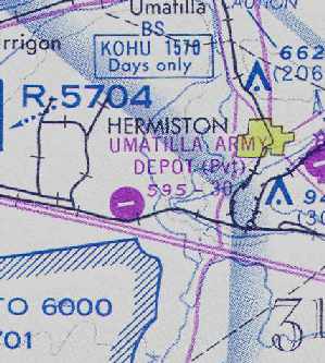
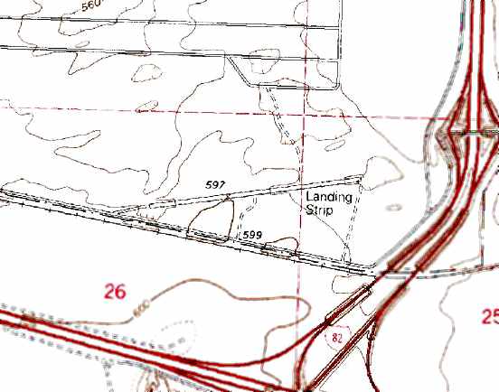
Umatilla Army Airfield (S41), Umatilla, OR
45.803, -119.396 (Southeast of Seattle, WA)
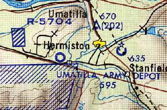
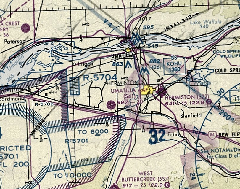
Umatilla Army Airfield, as depicted on the October 1964 USAF Operational Navigation Chart (courtesy of Chris Kennedy).
This military airfield was located on the grounds of the 19,728-acre Umatilla Army Depot.
The Umatilla Depot was established in 1941 to store conventional munitions in support of the United State's entry into WW2.
The Umatilla Depot evidently gained an airfield at some point between 1959-64,
as it was not depicted on the October 1959 La Grande Sectional Chart.
The earliest depiction which has been located of the Umatilla Army Depot Airfield was on the October 1964 USAF Operational Navigation Chart (courtesy of Chris Kennedy).
The March 1966 USAF Operational Navigation Chart (courtesy of Chris Kennedy) described the "Umatilla Army Depot Airstrip" as having a 3,000' runway.
The earliest photo which has been located of the Umatilla Army Depot Airfield was a 7/6/70 USGS aerial view,
which depicted the field as having an asphalt Runway 6/24 with a small ramp & a single small building on the south side.
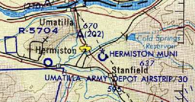
The January 1975 Seattle Sectional Chart (courtesy of Chris Kennedy)
depicted the "Umatilla Army Depot" Airfield as having a single 3,000' paved east/west runway.
However, the Umatilla Army Depot Airfield may have been closed within the next 2 years, as it was labeled simply "Airfield" on the 1977 USGS topo map.
The Base Realignment & Closure Commission listed the Umatilla Army Depot for closure in 1988.
Umatilla was labeled simply as "Landing Strip" on the 1991 USGS topo map.
It depicted a single paved east/west runway, with no buildings.
The last aeronautical chart depiction which has been located of the Umatilla Army Depot Airfield was on the January 1994 Seattle Sectional Chart (courtesy of Ron Plante).
It depicted "Umatilla AAF" as having a single 3,000' paved east/west runway.
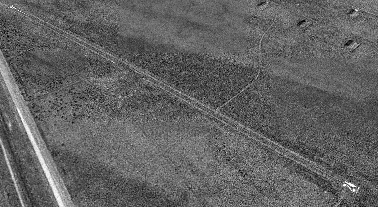
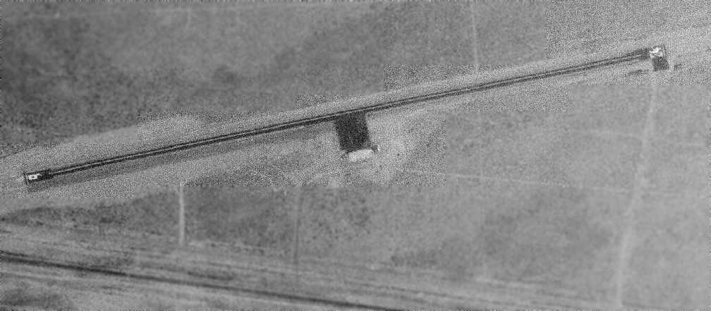
A 1994 USGS aerial view looking northwest showed Umatilla AAF to consist of a single 3,100' paved Runway 6/24, with no other facilities - no taxiway, ramp, hangar, buildings, etc.
The airfield appeared to still be open - it was marked as an active runway.
A road led away from the end of Runway 24 to the south, and another road led away from the middle of the runway toward the ammunition bunkers to the north.
The Umatilla airfield was definitely closed by 1998, as it was labeled "Umatilla AAF (Closed)" on the 1998 World Aeronautical Chart.
The closure of the Umatilla Army Depot was scheduled to occur in 2004.
A Superfund cleanup project at Umatilla Depot had been attempting to clean up the site for eventual reuse.
The property was planned to be made available for wildlife management,
commercial & industrial development, and, possibly for agricultural use.
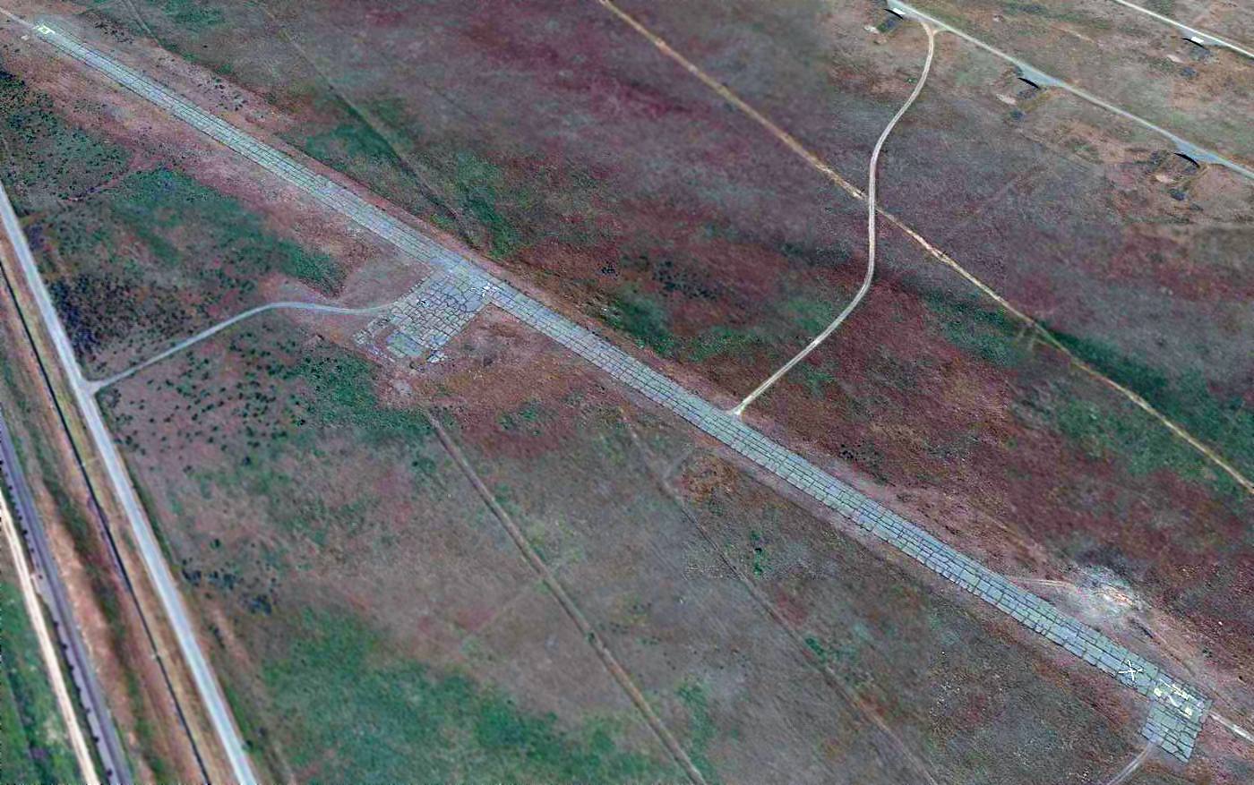
A 2015 aerial view looking northwest at the former Umatilla AAF showed the airfield remained completely intact, including the paved Runway 6/24 & paved ramp.

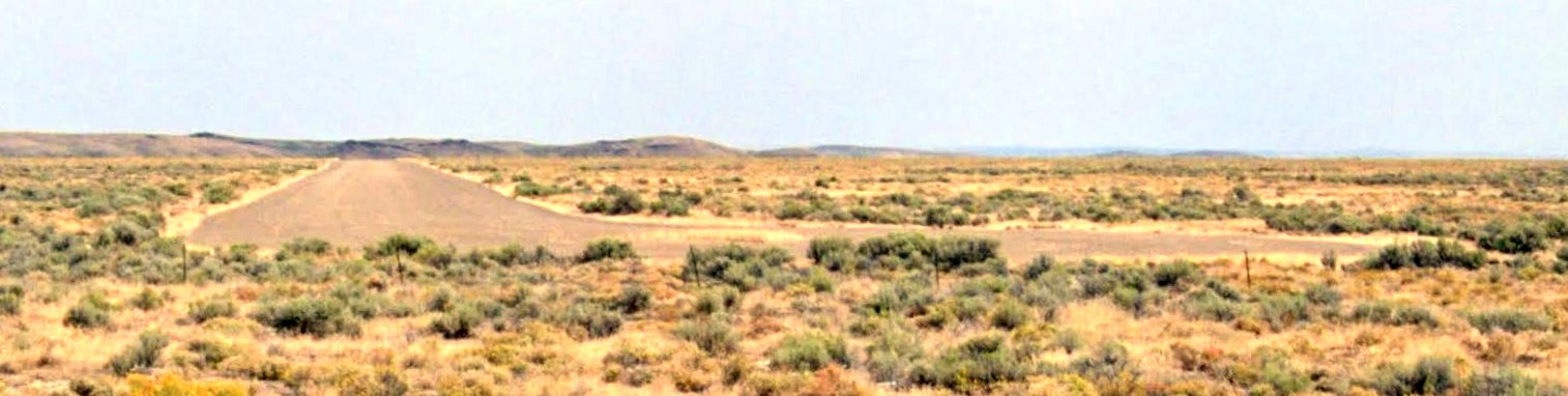
A 2023 photo looking west along the remains of the former Umatilla AAF Runway 24.
Umatilla AAF is located northwest of the intersection of Interstate 82 & Interstate 84.
Thanks to Chris Kennedy for pointing out this airfield.
____________________________________________________
Or if you prefer to contact me directly concerning a contribution (for a mailing address to send a check),
please contact me at: paulandterryfreeman@gmail.com
If you enjoy this web site, please support it with a financial contribution.
____________________________________________________
This site covers airfields in all 50 states.