Abandoned & Little-Known Airfields:
Georgia: Southern Atlanta area
© 2002, © 2026 by Paul Freeman. Revised 10/6/26.
This site covers airfields in all 50 states: Click here for the site's main menu.
____________________________________________________
Please consider a financial contribution to support the continued growth & operation of this site.
Bellah Field (revised 8/16/24) - Bishop Airfield (revised 3/18/22) - City-County Airport / Carrollton Municipal (revised 8/16/24) - Cline Ranch Strip (revised 3/18/22)
Cole Field (revised 11/22/25) - Edwards Sky-Port / South Fulton Airport / South Fulton Skyport (revised 11/14/23)
Gunn Airfield (revised 3/18/22) - Lakewood Airport (revised 7/5/26) - Morris AAF (revised 3/18/22) - South Expressway Airport (revised 10/6/26) Sunset Strip (revised 10/10/25)
____________________________________________________
33.71, -84.394 (South of Downtown Atlanta, GA)
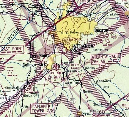
Lakewood Airport, as depicted on the October 1942 Birmingham Sectional Chart (courtesy of Jim Daigneau).
This small general aviation airport on the south side of Atlanta was evidently established at some point between 1941-42,
as it was not yet depicted on a 1940 GA land use map (courtesy of Jim Daigneau) or the 1941 Birmingham Sectional Chart.
The earliest depiction which has been located of Lakewood Airport was on the October 1942 Birmingham Sectional Chart (courtesy of Jim Daigneau).
It depicted Lakewood as a commercial/municipal airport.
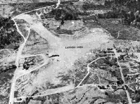
The earliest photo which has been located of Lakewood Airport was a 4/16/43 aerial view from the 1945 AAF Airfield Directory (courtesy of Scott Murdock).
It depicted Lakewood Airport as having 2 unpaved runways.
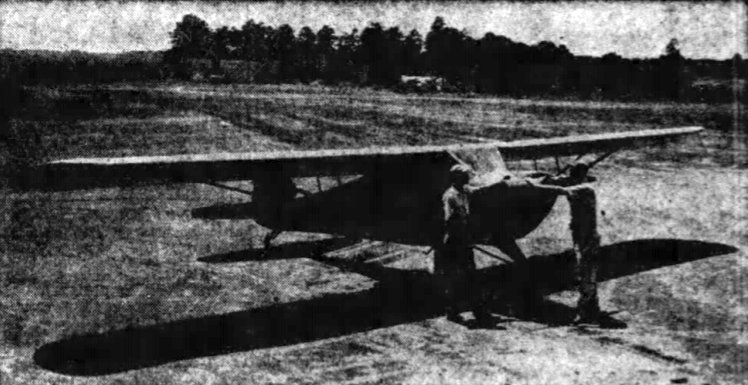
An undated photo from a 8/14/44 article of Lakewood Airport manager Bob Wylie & instructor A.H. Johnson with a Taylorcraft (courtesy of Jim Daigneau).
The 1945 AAF Airfield Directory (courtesy of Scott Murdock) described Lakewood Airport as a 74 acre property having 2 sod runways, the longest measuring 1,400' east/west.
The field was said to have 2 hangars, and to be owned & operated by private interests.
Jim Daigneau reported, “I talked to Ed Cole... he remembered 2 runways with one long & one short.
He said the short one was a real challenge because there was a church at one end that you'd had to slip around to get on the ground in time & bushes at the other end.
He said that he started flying when he came home on leave from the Merchant Marine. One of his dad's friends had a Cub there at Lakewood & he got the friend to take Ed for a ride.
Ed said he was afraid of heights but he got in the back seat of the Cub anyway. He said he closed his eyes & held on to the structure.
The pilot looked back & yelled at to open his eyes & look out or he would roll the airplane upside down.
Ed opened his eyes & looked down on the trailer trucks on Stewart Avenue & was struck by the fact that they looked like toys. And that was that... he was hooked.
He flew everyday & soloed before he had to go back from leave. Then, whenever he had time in port, he would rent an airplane & build time.”
Jim continued, “After the war, he said his dad had bid on 2 T-6s being auctioned off by the government.
He was a successful bidder & got the 2 airplanes for $300 a piece.
He went down to Augusta to retrieve the first one & was horrified that it cost him $50 to top off the fuel.
He never went to get the other one figuring that he couldn't afford to fly them.
But then, Ed said a South American government offered him 'a large amount of money for the airplane.'
Ed said his dad replied with an astonished 'Are you kidding?'
Language being what it is, the government thought Ed's dad was angry at a low offer & came back with an even higher offer.”
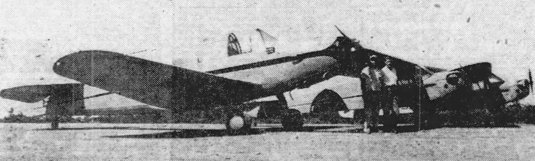
An undated photo printed in 7/18/45 of a PT-19 & 2 Taylorcrafts at Lakewood Airport (courtesy of David Henderson).
Originally captioned: “New planes at Lakewood Airport –
Among the several new planes purchased by the Lakewood Airoirt are the PT-19 & 2 Taylorcrafts shown with 2 of the field's instructors, Al Johnson & Pete Eberhart.”

An undated photo from a 2/24/46 article of instructor Albert Johnson, Paul Reynolds, and Ollie Goings at Lakewood Airport (courtesy of Jim Daigneau).
Reynolds & Goings were the first veterans in GA to solo under the GI Bill.
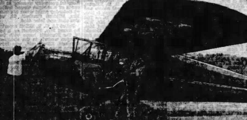
An undated photo from a 6/17/46 article of a student pilot & a Piper Cub at Lakewood Airport (courtesy of Jim Daigneau).
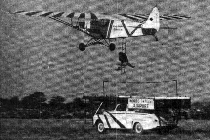
An undated photo from an 11/21/48 article of the Thrasher Brothers performing a pick-up in a Piper Cub as part of Lakewood Airport's Air Circus (courtesy of Jim Daigneau).
Charlie Brown recalled, “Lakewood Airport [was] on a hill overlooking Lakewood Park.
It had 3 dirt runways, and the end of one overflew the Lakewood Fairgrounds.
My Dad was leasing the airport & doing aircraft maintenance there until the owner, Mr Vandiver, sold in 1948 to the City of Atlanta (or state), and government housing was built.”
Jim Daigneau reported, “Charlie said the east side of the airport was bounded by Pryor Road.”
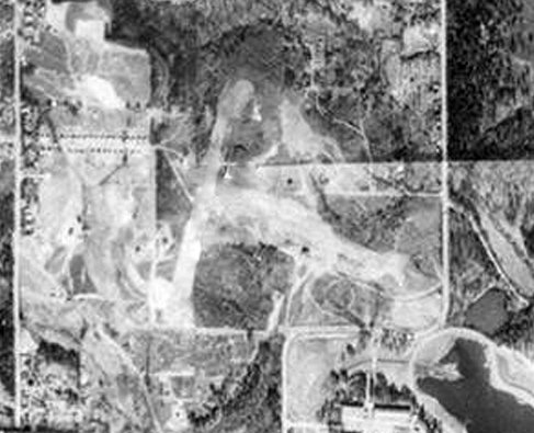
A 1949 aerial view (courtesy of David Henderson) depicted Lakewood Airport as having 2 unpaved runways, oriented northeast/southwest & northwest/southeast,
with a few small buildings on the south side.
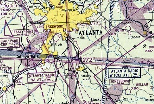
The last aeronautical chart depiction which has been located of Lakewood Airport was on the February 1950 Birmingham Sectional Chart (courtesy of Jim Daigneau).
It depicted Lakewood as having a 2,800' unpaved runway.
Lakewood Airport was evidently closed at some point between 1950-51,
as it was no longer depicted on the 1951 Birmingham Sectional Chart (according to Jim Daigneau).
It was evidently overtaken by construction in the rapidly-developing Atlanta metro area.
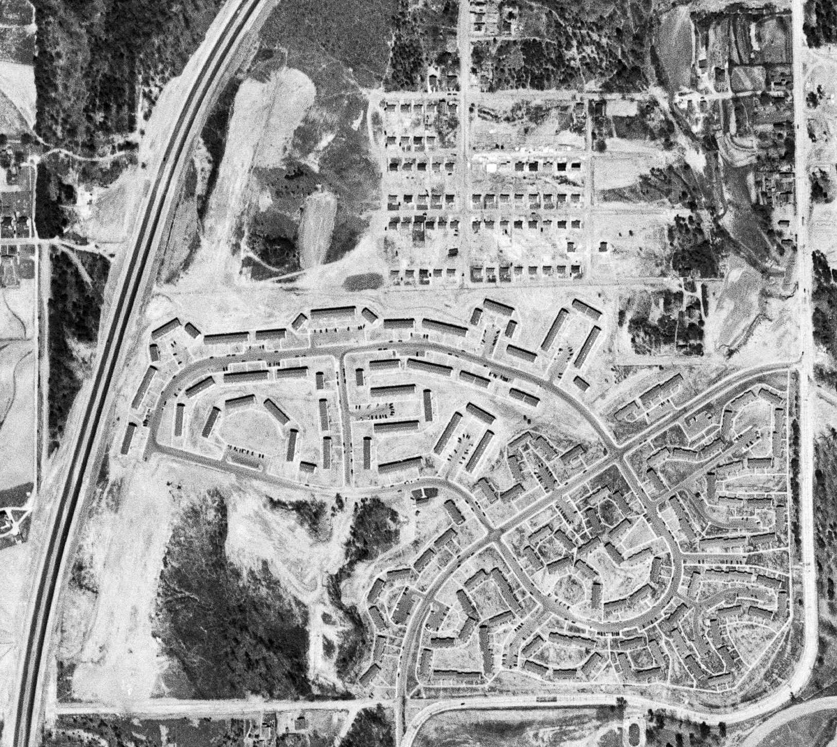
A 1952 aerial photo (courtesy of David Henderson) showed dense apartment construction having covered the Lakewood Airport site,
but the remains of the northeast/southwest airport were still visible on the west side, just east of the new highway.
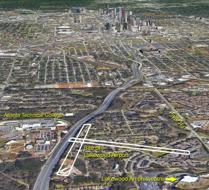
A 2018 aerial view looking north, annotated by David Henderson to show the site of the Lakewood Airport runways.
No trace of Lakewood Airport appeared to remain.
Thanks to Jim Daigneau for pointing out this airfield.
____________________________________________________
Edwards Sky-Port / South Fulton Airport / South Fulton Skyport (8A9), Palmetto, GA
33.538, -84.638 (Southwest of Atlanta, GA)
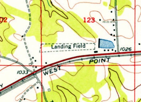
Edwards Sky-Port, as depicted on the 1954 USGS topo map.
Yet another of America's disappearing small grassroots airports.
The date of construction of Edwards Sky-Port has not been determined.
The earliest depiction which has been located of Edwards Sky-Port was on the 1954 USGS topo map.
It depicted a single unpaved east/west runway, labeled simply as “Landing Field”, with 1 small building on the southeast side.
Edwards Sky-Port was not yet depicted on the January 1955 Birmingham Sectional Chart.
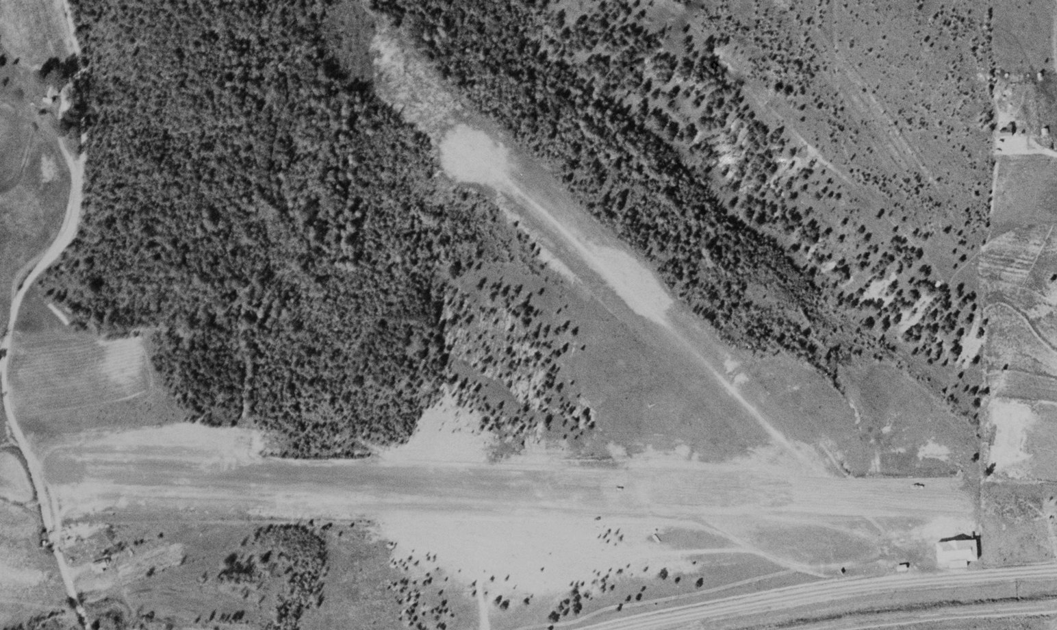
The earliest photo which has been located of Edwards Sky-Port was a 1955 aerial view (courtesy of David Henderson).
It depicted Edwards Sky-Port as having 2 unpaved runways, with a building on the southeast corner. No aircraft were visible on the field.
According to its FAA Airport/Facility Directory data, Edwards Sky-Port (South Fulton Airport) was activated in March 1957.
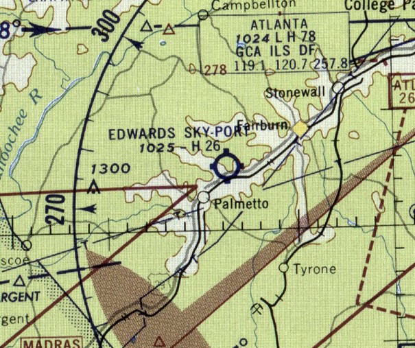
The earliest aeronautical chart depiction which has been located of Edwards Sky-Port was on the August 1957 Birmingham Sectional Chart.
It had apparently gained a paved runway at some point between 1954-57, as it was depicted as having a 2,600' paved runway.
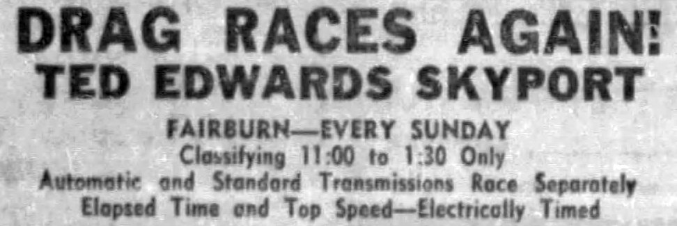
A 1958 advertisement (courtesy of David Henderson) touted drag races at “Ted Edwards Skyport”.
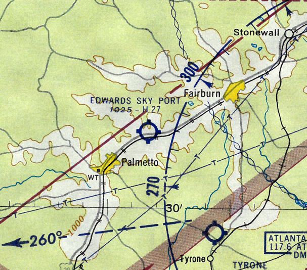
The 1959 Atlanta Local Aeronautical Chart (courtesy of Tim Zukas) depicted Edwards Sky-Port as having a 2,700' paved runway.
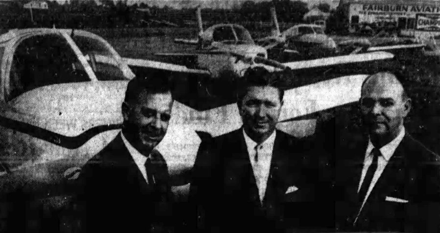
An undated photo from a November 1964 article (courtesy of David Henderson) showed Ted Edwards, Thomas Carey, and Tom Florence of Ted Edwards Skysports Inc. in front of 3 new Pipers.

A February 1965 advertisement (courtesy of David Henderson) for Ted Edwards Skyport.
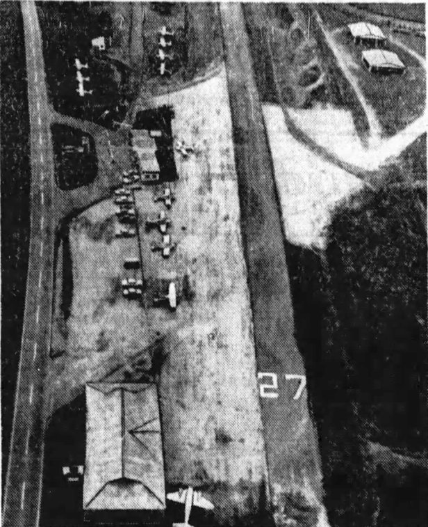
An undated aerial view from a June 1965 article (courtesy of David Henderson) looking west at Ted Edwards Skyport.
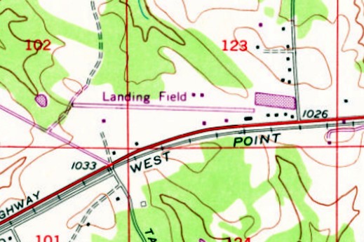
The 1968 USGS topo map depicted Edwards Sky-Port as having a single paved east/west runway, labeled simply as “Landing Field”.
A few more small buildings had been added on the south & north sides of the runway.
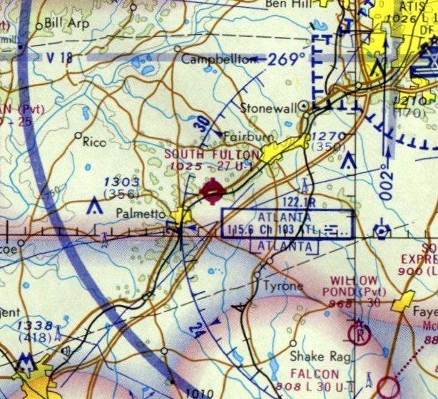
Edwards Sky-Port was evidently renamed South Fulton Airport at some point between 1957-71, as that is how it was labeled on the 1971 Atlanta Sectional Chart.
It depicted South Fulton as having a single 2,700' paved northeast/southwest runway.
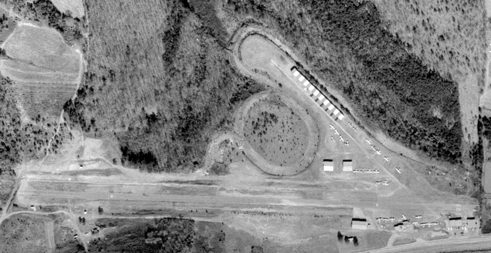
A 1972 aerial view (courtesy of David Henderson) depicted South Fulton Airport as having a paved Runway 9/27, with a row of hangars having been built along the former crosswind runway.
A total of 27 light single-engine aircraft were seen parked on the field.
David Henderson recalled, “South Fulton Airport... We used to fly into it in the late 1970s / early 1980s.
There was a huge tree behind a house on the east end of the runway & you'd have to slip around it sometimes.
The owners at the Fixed-Base Operator, a husband & wife, seemed insulted that anyone would slip their plane on landing.
I remember the woman shook her head & said, 'We just cut all those branches!'
She also told me that there were wild dogs in the woods north of the field & tearfully said they had killed her cat. I was nervous to go out on the ramp after that!”
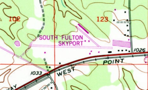
The 1982 USGS topo map showed “South Fulton Skyport” had gained northwest/southeast taxiway, along with a long hangar on the north side.
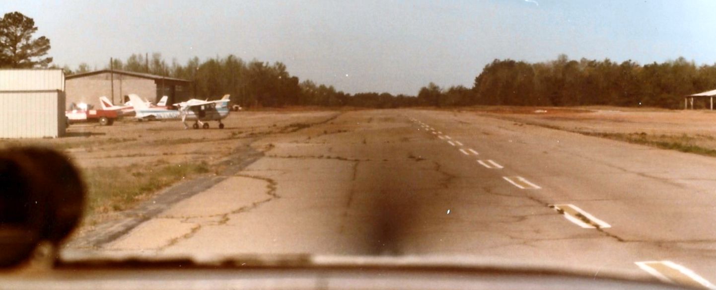
A 1982 photo by Charlie Evans looking down South Fulton Airport's Runway 9/27.
Charlie recalled, “My father & I bought a 1962 Cessna 172D in early 1982; the first 3 months we tied it down at [Hoppy’s] South Fulton Sky Port.”
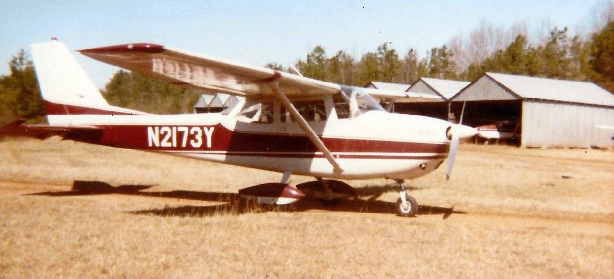
A 1982 photo by Charlie Evans of his 1962 Cessna 172D in front of the South Fulton Airport hangars.
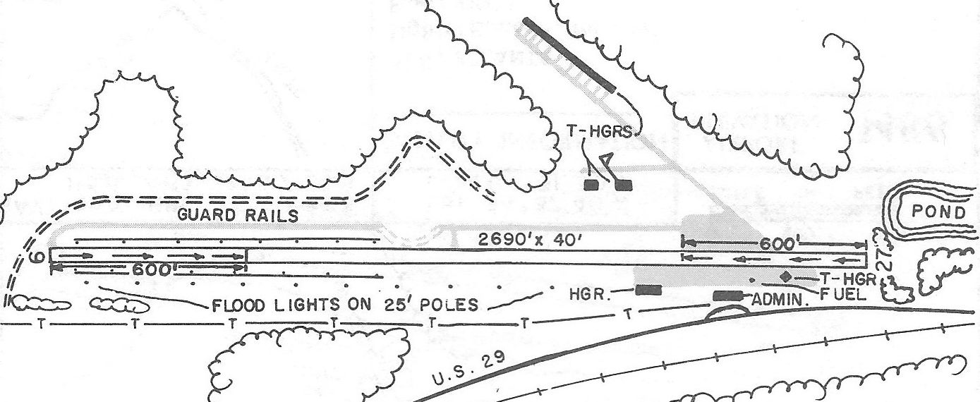
The 1985 GA Airport Directory (courtesy of Charlie Evans) depicted South Fulton Airport as having a 2,960' Runway 9/27, with hangars & an administration building on the southeast side & T-hangars on the northeast side.
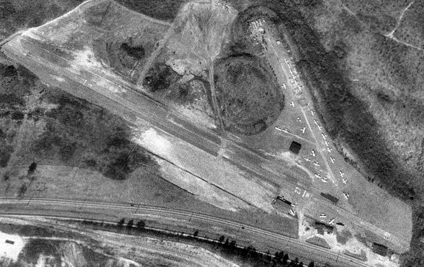
A 1993 USGS aerial view looking northwest depicted South Fulton Airport as being very popular, with 30 light single-engine aircraft parked on the airport.
However, the long hangar depicted on the 1982 topo map was gone.
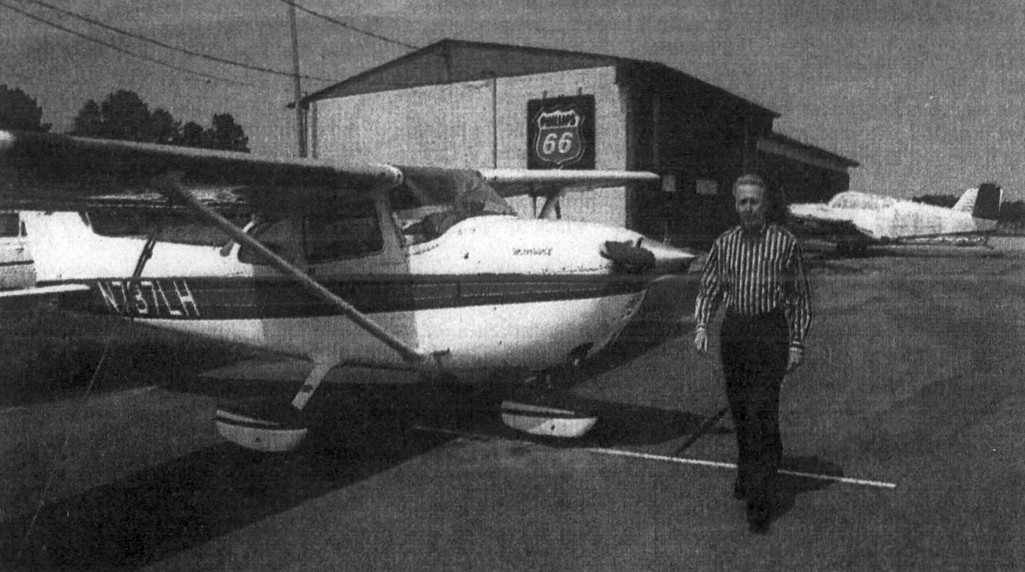
An undated photo from a June 1999 article (courtesy of David Henderson) of South Fulton Airport owner Ron Gause in front of a Cessna 172.
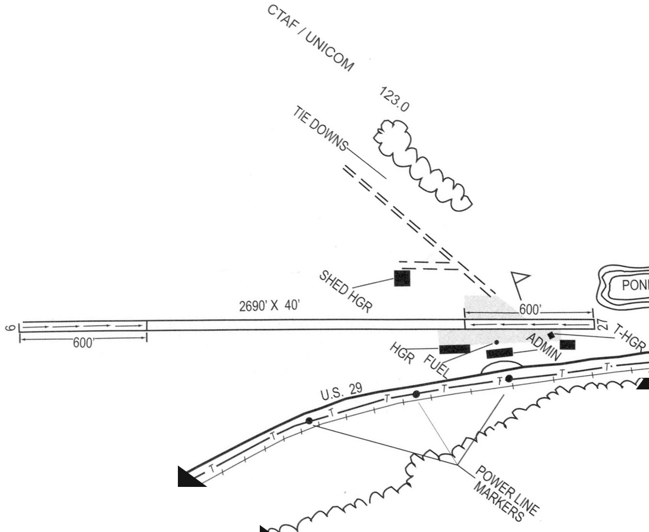
The 2001 GA Airport Directory (courtesy of David Henderson) depicted South Fulton as having a 2,690' Runway 9/27, with hangars & an administration building on the east side.
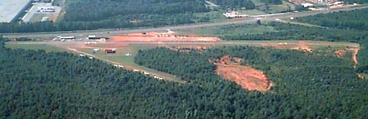
A 2005 aerial view looking south showed a number of light aircraft parked at South Fulton Airport.
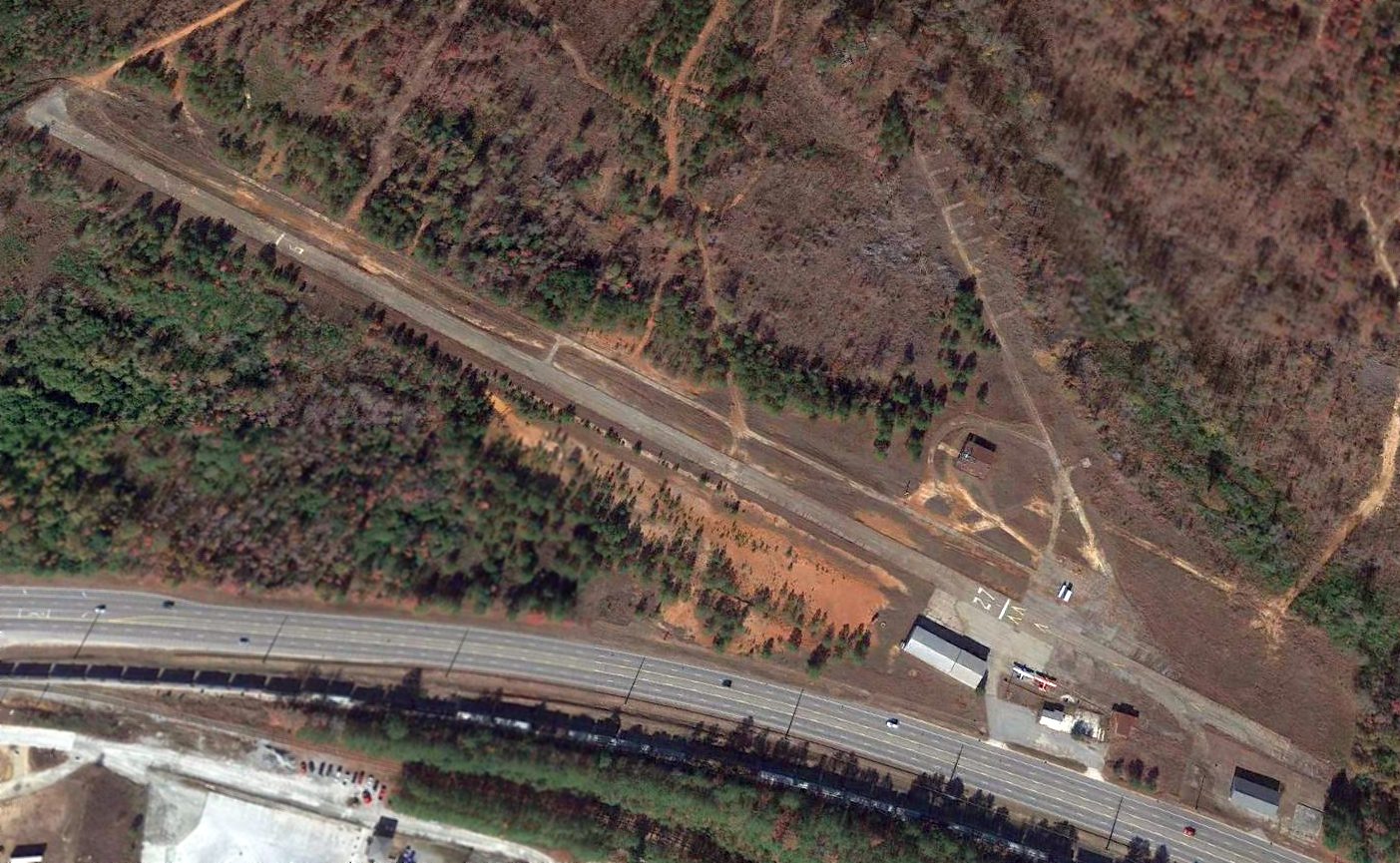
A 2016 aerial view looking northwest showed South Fulton Airport in a sad state, with the number of aircraft visible having fallen to only 2.
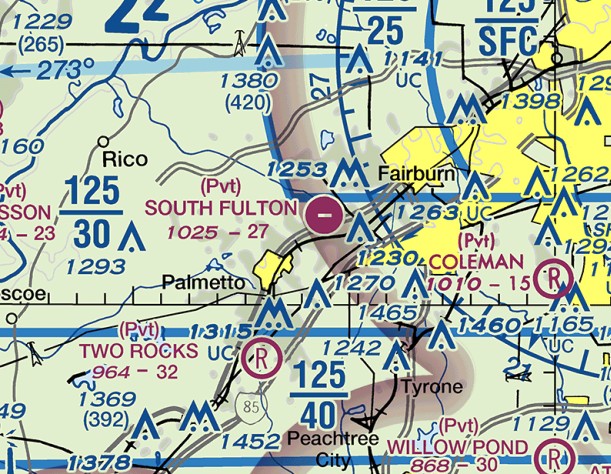
The last aeronautical chart depiction which has been located of South Fulton Airport was on the August 2016 Atlanta Sectional Chart.
It showed that South Fulton's status had changed to a private airfield, having a 2,700' paved east/west runway.
As of 2016, South Fulton Airport's FAA Airport/Facility Directory data described it as having a 2,690' asphalt Runway 9/27,
“in poor condition”, with “extensive cracking throughout paved areas”.
The owner & manager was listed as Lynn Gause.
Jim Daigneau reported, “Scott Gerkin flew quite a bit out of South Fulton in the 1990s doing fire patrols for the state in a Cessna 172.
He remembered that Ron Gause, the owner, had started talks with FedEx about expanding the runway in length & width to handle their small cargo carriers, Caravans I assume.
He said that when the discussion was brought up to the FAA, ATL operations said that it was too close to the big airport & they would not release the required airspace. So the idea died quickly & quietly.”
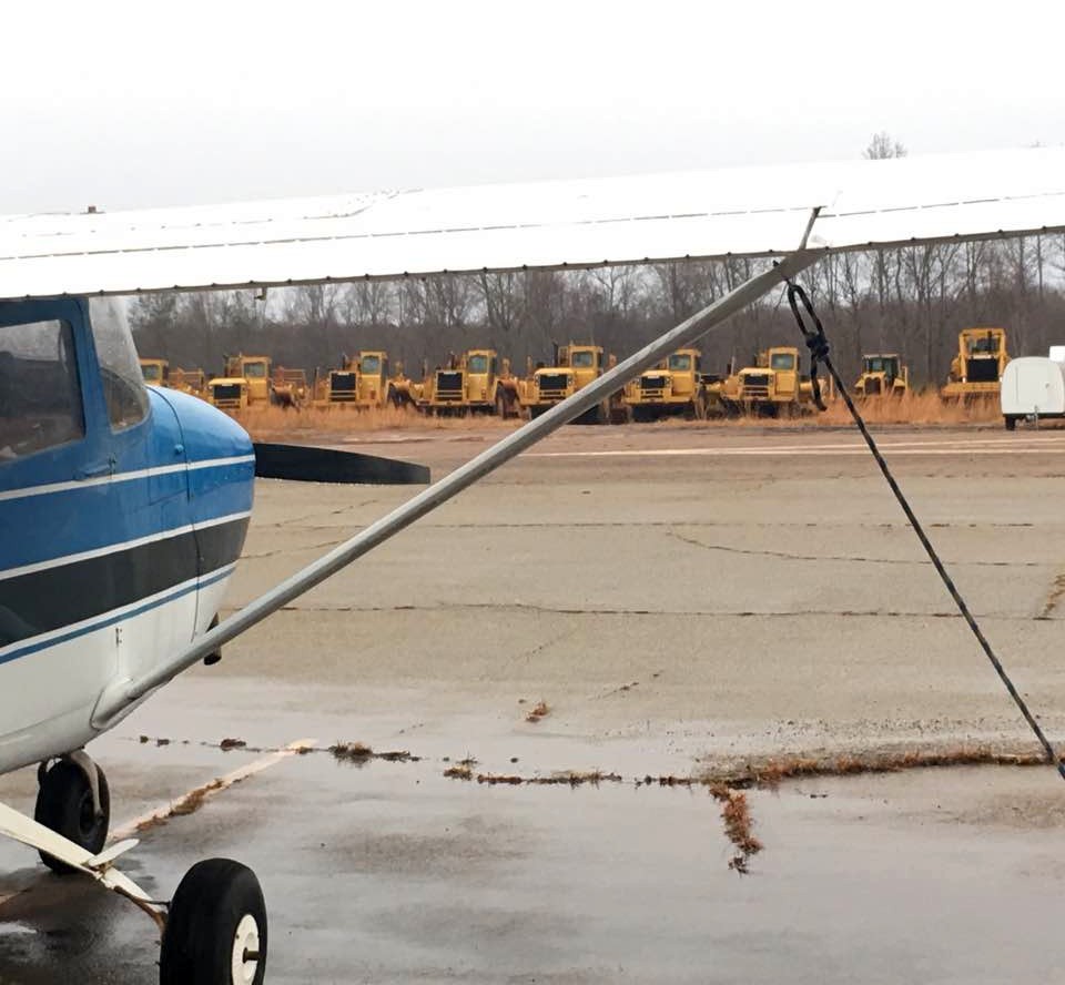
A sad sight: a December 2016 photo of a Cessna 172 looking across the runway at the bulldozers which were gathered to remove South Fulton Airport.
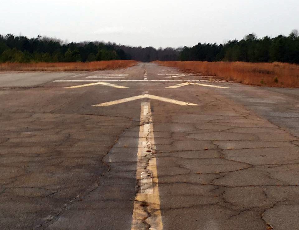
A December 2016 photo looking along South Fulton Airport's forlorn Runway 27.
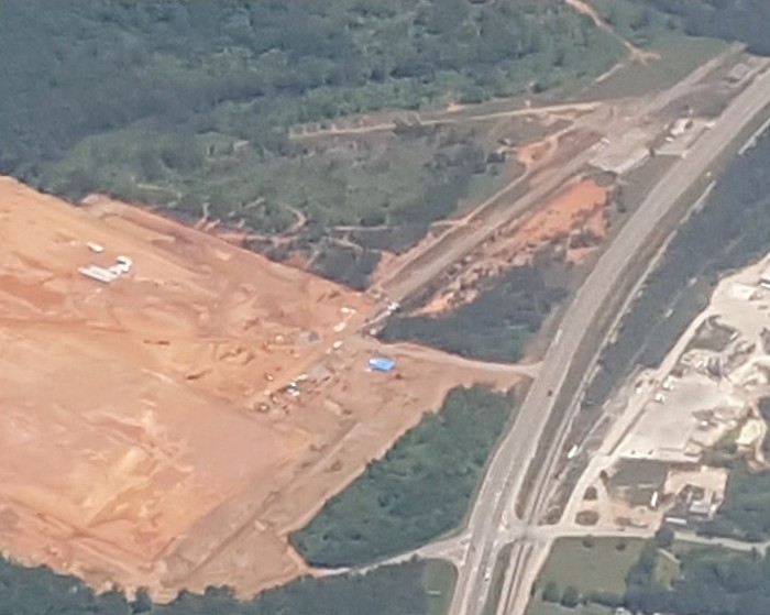
A 5/8/17 aerial view by Jim Daigneau looking northeast at the demolition of South Fulton Airport. Jim observed, “It's being plowed up for, it looks like, another warehouse.”
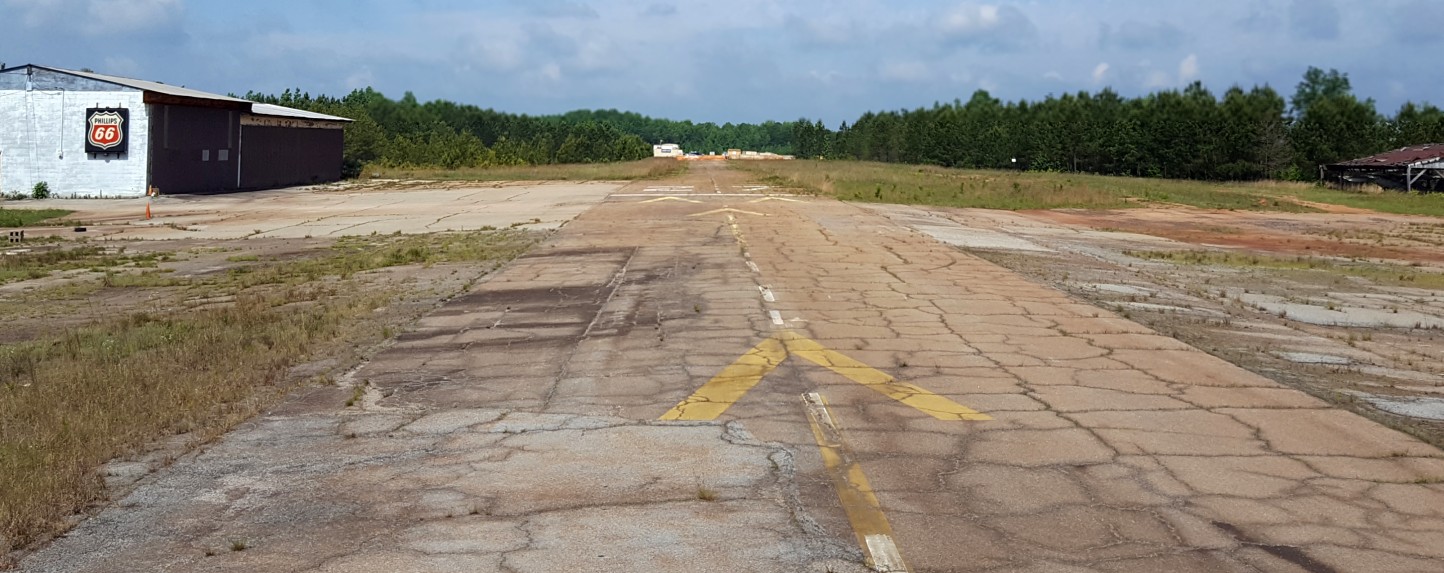
A 5/12/17 photo by Jim Daigneau looking west along South Fulton Airport's Runway 27.
Jim observed, “The larger hangar south of the runway is closed up tight with no easy view points.
The small T-hangar is empty except for trash, an aileron & a seat.”
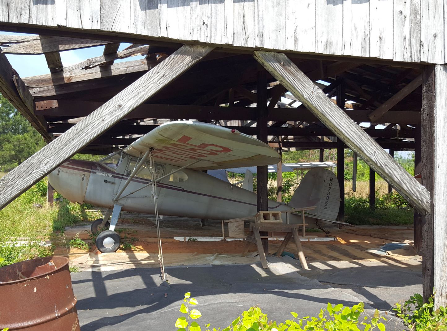
A 5/12/17 photo by Jim Daigneau of a Cessna 140 inside the open hangar on the north side of South Fulton Airport.
Jim observed, “ The open hangar on the north side contains the 2 abandoned airplanes & 1 ultralight. The Cessna 140 is still registered.”
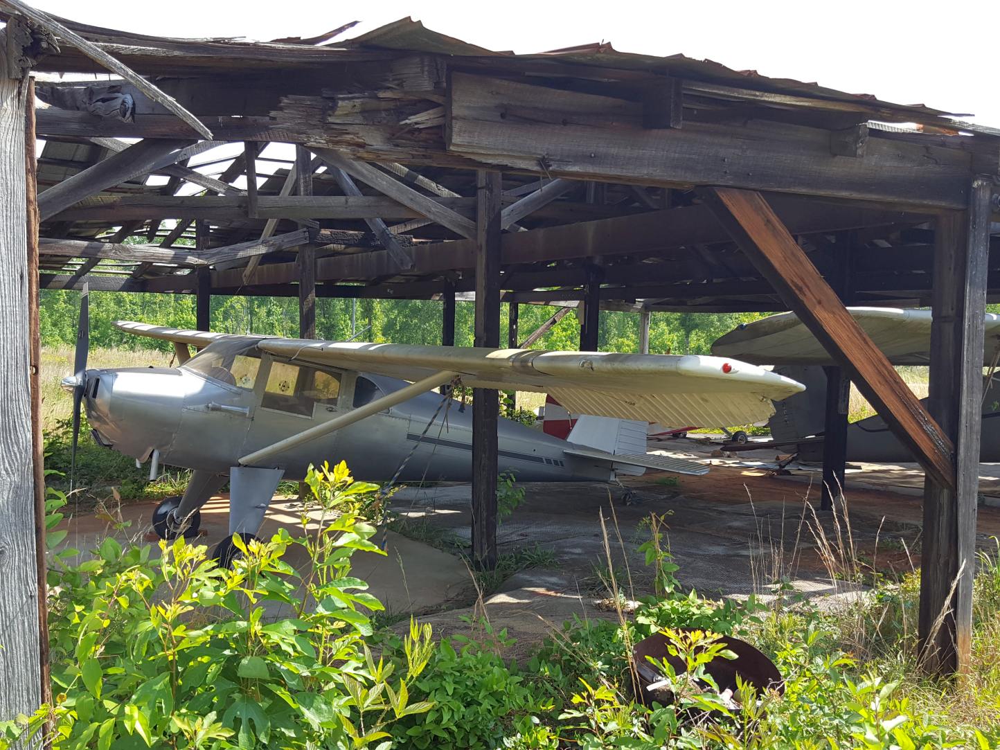
A 5/12/17 photo by Jim Daigneau of a Taylorcraft inside the open hangar on the north side of South Fulton Airport.
Jim observed, “The other airplane had no obvious registration. I think it is a Taylorcraft or a Luscombe.
All 3 look mostly stripped & derelict, although the Taylorcraft/Luscombe tires looked normally inflated.”
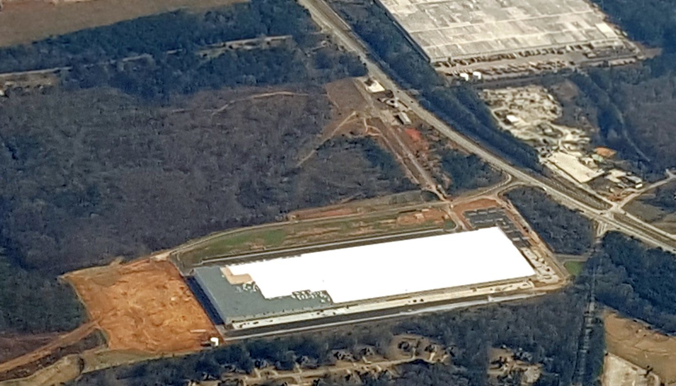
A 12/14/17 aerial view by Jim Daigneau looking east at the warehouse built over the site of South Fulton Airport.
Jim observed, “Atlanta has a bumper crop of warehouses coming in, regardless of the growing season!”
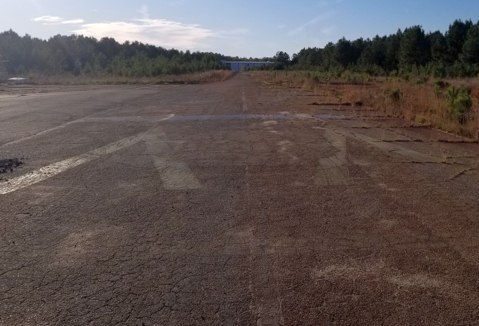
An 11/3/19 photo by John Evans looking along the remains of South Fulton Airport's runway.
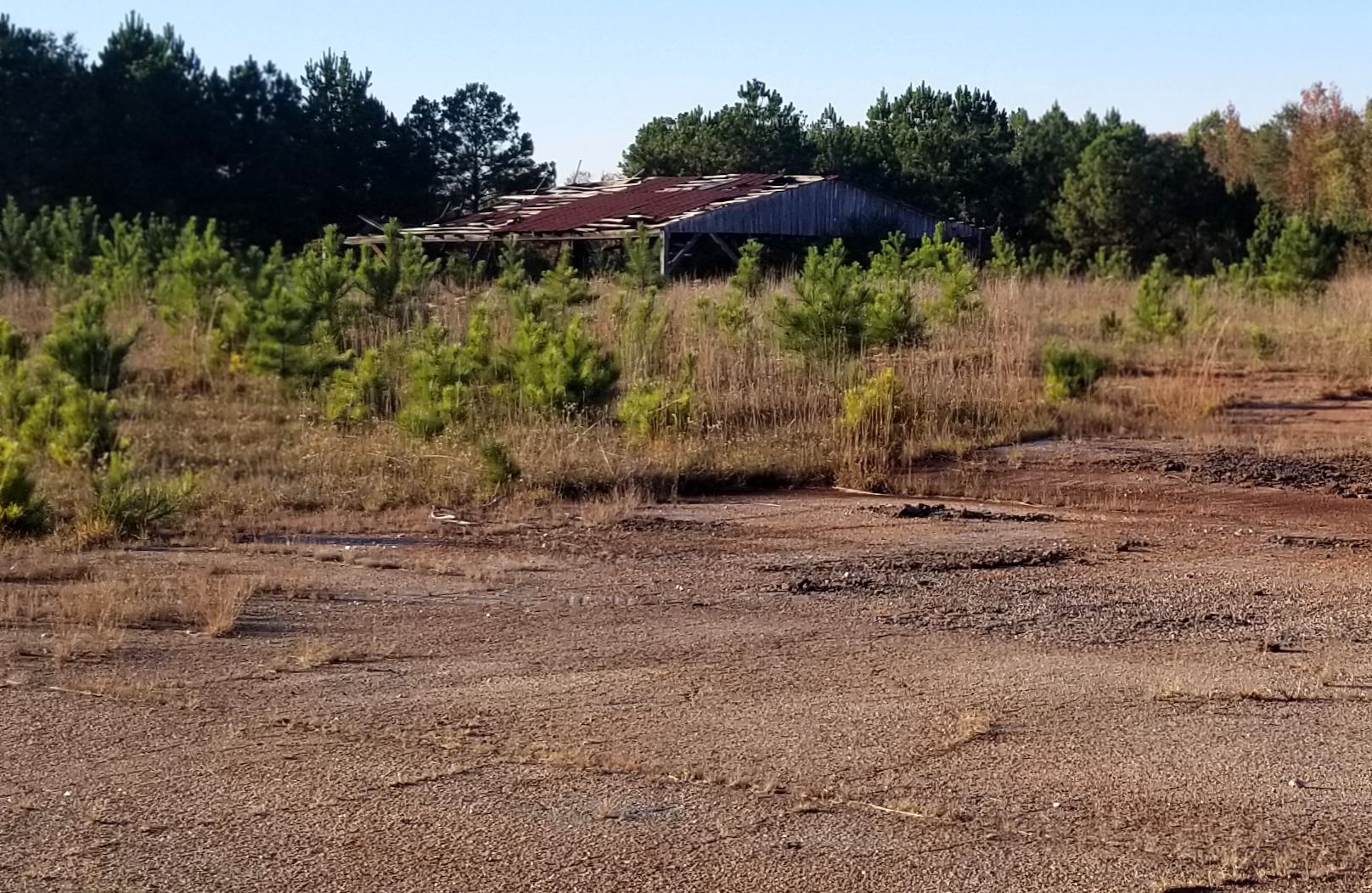
An 11/3/19 photo by John Evans of the remains of a South Fulton Airport hangar.
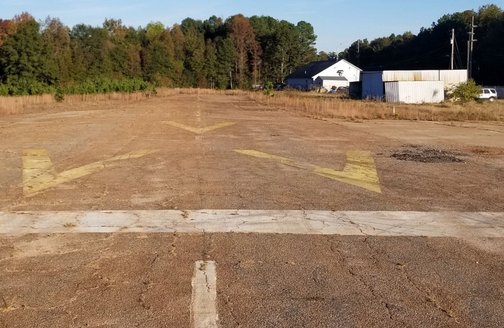
An 11/3/19 photo by John Evans of the former South Fulton Airport office building.
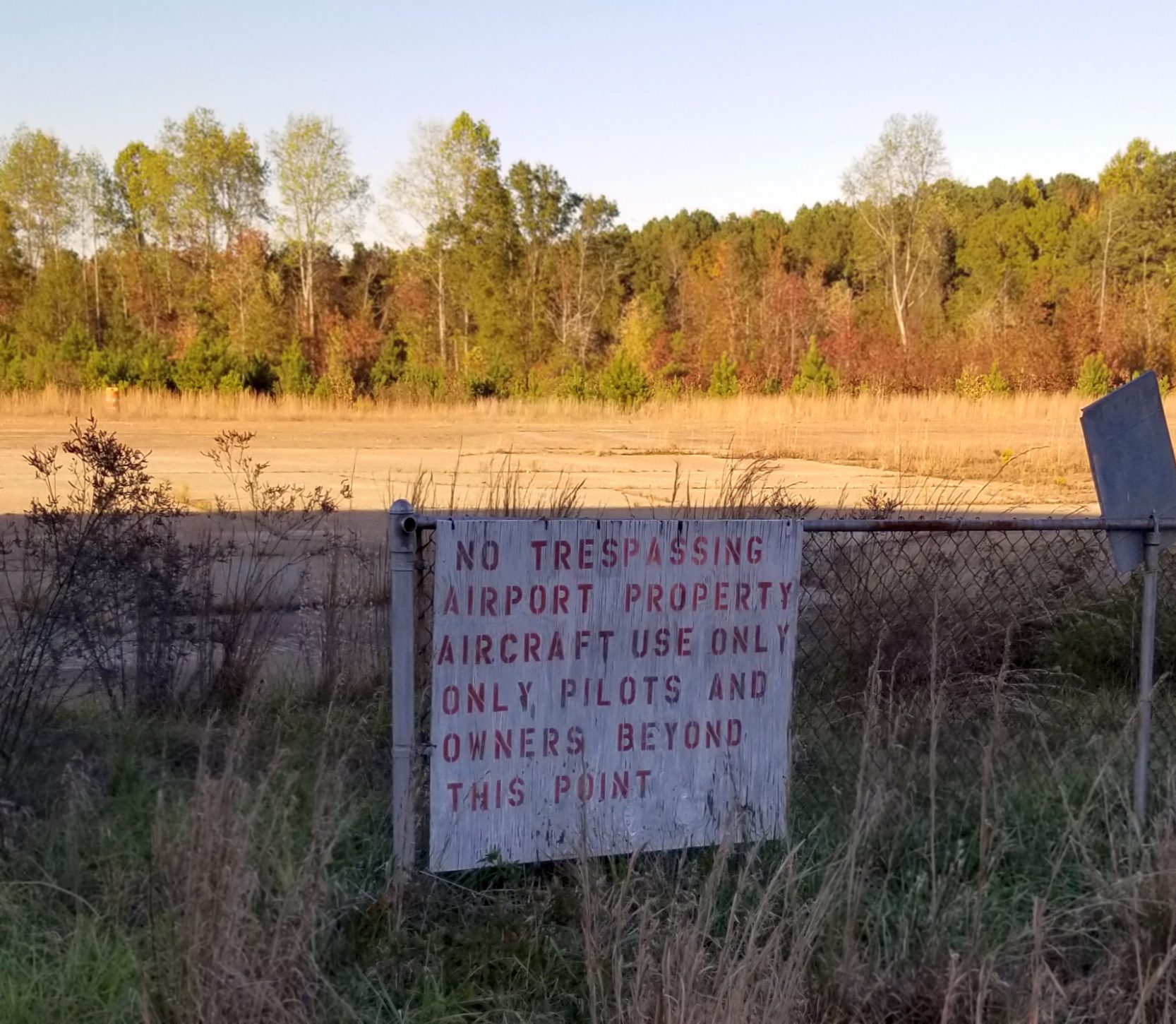
An 11/3/19 photo by John Evans of a sign at the site of South Fulton Airport.
A 2023 aerial view showed no trace remaining of South Fulton Airport, with 2 large warehouses covering the site.
The site of South Fulton Airport is located northwest of the intersection of Route 29 & Hobgood Road.
Thanks to Jim Daigneau for pointing out this airfield.
____________________________________________________
Cline Ranch Strip (GA81), Social Circle, GA
33.618, -83.782 (East of Atlanta, GA)
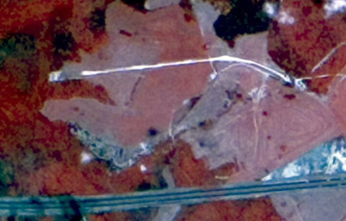
A 1974 infrared aerial photo of Cline Ranch Strip (courtesy of David Henderson).
No airfield was yet depicted at this location on a 1962 aerial photo, the 1966 USGS topo map, or the September 1968 Savannah Sectional Chart.
The single runway airfield was evidently constructed at some point between 1968-74.
David Henderson reported, “Cline Ranch Strip was a private grass airstrip located between Covington & Social Circle, about 35 miles east of Atlanta.
A 1974 infrared aerial clearly showed the runway. It appears as a white stripe north of Interstate I-20.”
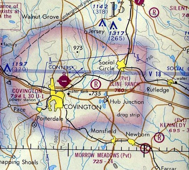
The earliest aeronautical chart depiction which has been located of Cline Ranch Strip was on the 1974 Atlanta Sectional Chart.
It depicted Cline Ranch as a private airfield having a 3,000' unpaved runway.
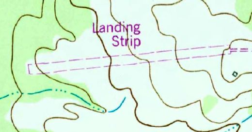
The 1986 USGS topo map depicted Cline Ranch Strip as a single unpaved east/west runway, labeled simply as “Landing Strip”.
David Henderson reported, “In a 2/12/88 aerial photo, the runway appears as an extension of the road leading to the airport.
A building that may have served as a hangar is just south of the field.”
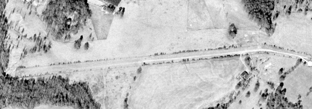
The last photo which has been located showing Cline Ranch Strip still relatively intact was a 2000 aerial view (courtesy of David Henderson).
David Henderson observed, “Trees were beginning to sprout along the runway edges. The runway still appeared to be in good condition.”
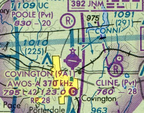
The last aeronautical chart depiction which has been located of Cline Ranch Strip was on the September 2003 Atlanta Sectional Chart (courtesy of David Henderson).
David Henderson observed, it depicted “the runway length as 2,800', down from 3,000' on the 1978 chart.”
David Henderson reported, “By 2005 [an aerial photo showed] the airport was being transformed into the River Cove subdivision with single family houses on multi-acre lots.”
Cline Ranch Strip was no longer depicted on the March 2009 Atlanta Terminal Chart.
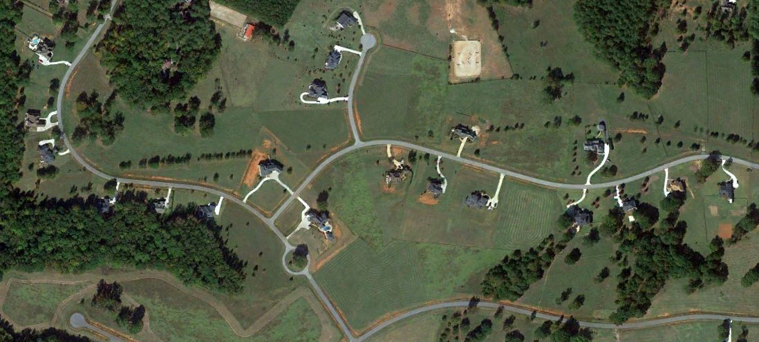
A 2011 aerial view (courtesy of David Henderson) showed that houses covered the site of Cline Ranch Strip, but the alignment of the runway was still barely recognizable.
The site of Cline Ranch Strip is located at the intersection of River Cove Road & River Cove Meadows.
____________________________________________________
Bishop Airfield, Fayetteville, GA
33.446, -84.406 (South of Atlanta, GA)
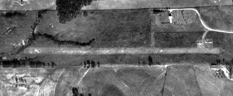
A 1968 aerial photo (courtesy of David Henderson) depicted Bishop Airfield.
This small private airfield was evidently built at some point between 1965-68,
as it was not yet depicted on a 1965 aerial photo (according to David Henderson).
The earliest photo which has been located of Bishop Airfield was a 1968 aerial view (courtesy of David Henderson).
David Henderson remarked, “The 1968 photo shows a single unpaved east/west runway with 3 light aircraft at the northeast corner of the field.
One of the planes appears to be missing a wing.”
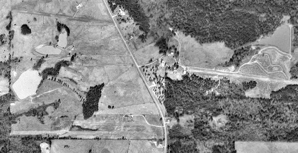
A 1971 aerial photo (courtesy of David Henderson) depicted Bishop Airfield.
David Henderson remarked, “It was obviously a popular neighborhood with pilots:
three private airstrips are seen within a half-mile of each other. Bishop is at bottom left.”
Bishop Airfield was not yet depicted on the 1974 Atlanta Sectional Chart.
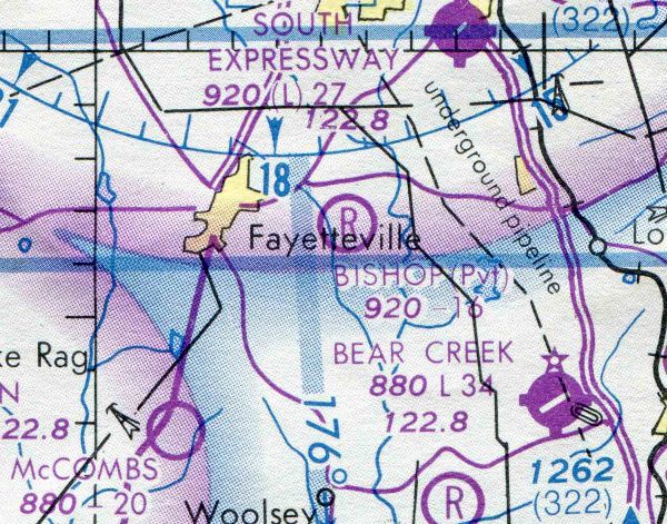
The earliest aeronautical chart depiction which has been located of Bishop Airfield was on the 1978 Atlanta Sectional Chart (courtesy of David Henderson).
It depicted Bishop as a private airfield with a 1,600' unpaved runway.
Three light aircraft could be seen at Bishop Airfield on an 1978 aerial photo (courtesy of David Henderson).
Bishop Airfield was not depicted on the 1979 USGS topo map.
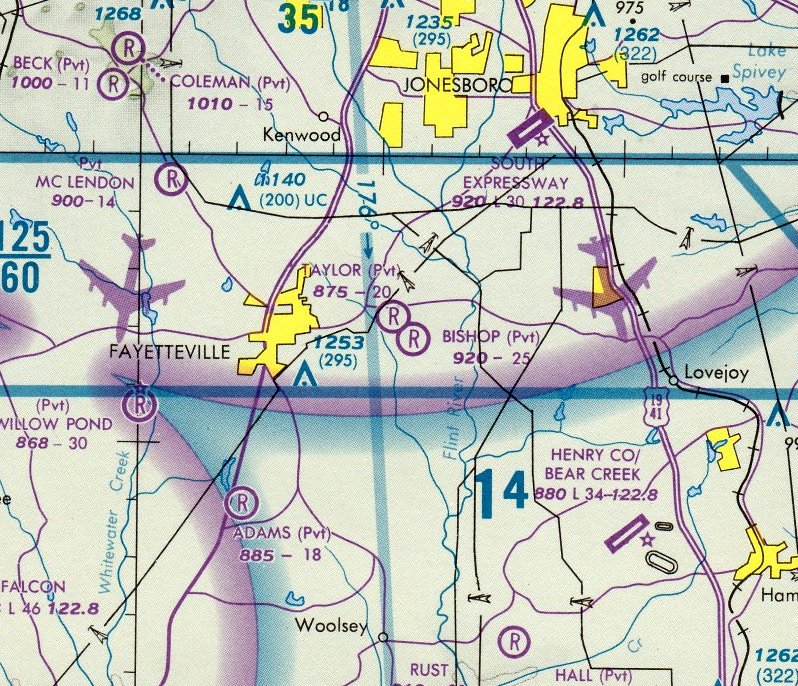
The September 1986 Atlanta Terminal Chart depicted Bishop as a private airfield having a 2,500' unpaved runway.
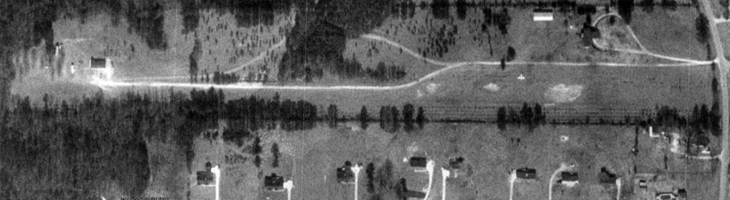
The last photo which has been located depicting an aircraft at Bishop Airfield was a 1/26/93 aerial photo (courtesy of David Henderson),
which depicted one single-engine aircraft.
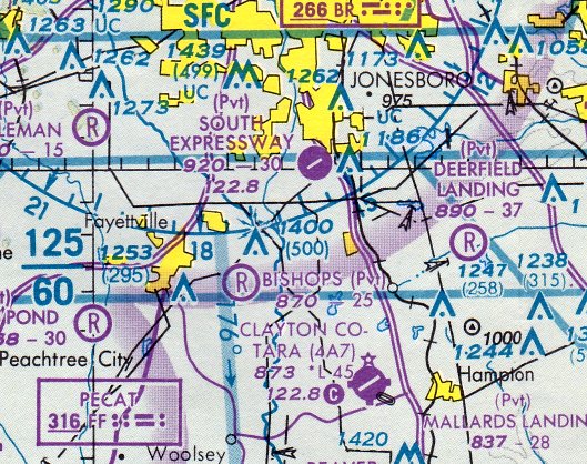
The last aeronautical chart depiction which has been located of Bishops Airfield was on the March 1995 Atlanta Sectional Chart.
It depicted Bishops as a private airfield having a 2,500' unpaved runway.
A 1999 aerial photo showed the airfield remained intact, but no aircraft were visible on the field.
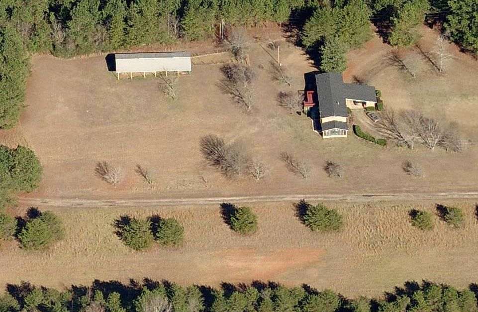
A circa 2005 aerial view looking north (courtesy of David Henderson).
David remarked, the photo “shows the runway still in good condition although there was no evidence that it was still being used as an airfield.”
A 2006 aerial photo showed the airfield remained intact.
David Henderson reported, “Construction of a new subdivision on the site of Bishop airfield began in 2007 with a road built parallel to the former runway.
I presume the development fell victim to the real estate crash because work on the site stopped after the road was built.”
Bishops Airfield was no longer depicted on the 2009 Atlanta Terminal Chart.
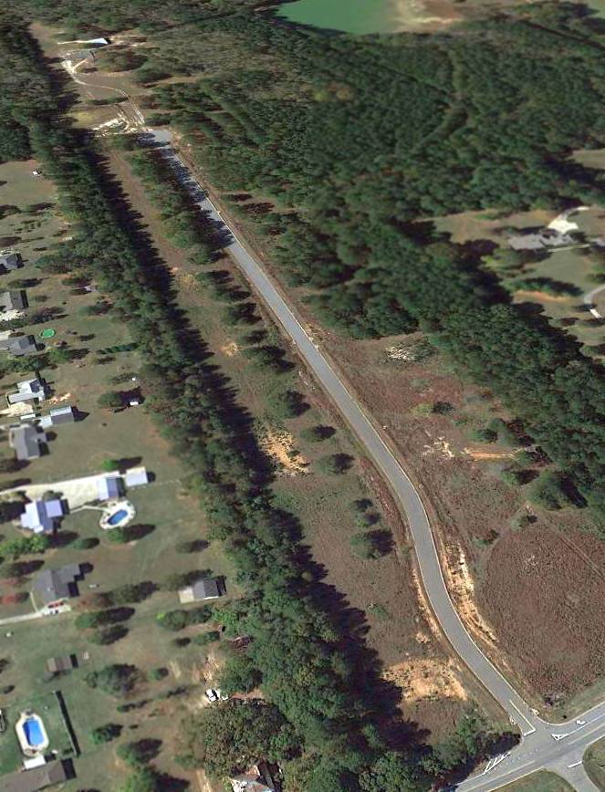
A 10/31/12 aerial view looking northwest at the site of Bishop Airfield.
What a shame – a nice little airfield was abandoned for housing construction that never happened.
David Henderson reported in 2013, “Today the runway is still clearly visible.”
The site of Bishop Airfield is located west of the intersection of County Line Road & County Line Court.
____________________________________________________
Cole Field / Coles Field (GA88), Stockbridge, GA
33.637, -84.207 (Southeast of Atlanta, GA)
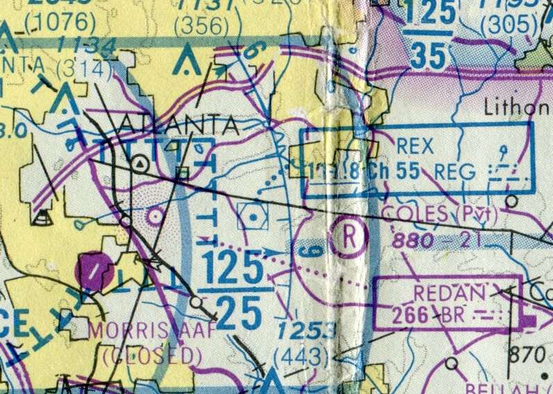
Coles Field, as depicted on the 1978 Atlanta Sectional Chart (courtesy of David Henderson).
Jim Daigneau reported, “Ed Cole grew up on a farm in south Fulton County.
He was featured in the winter, 2020 edition of the Henry County Magazine, from which this information was taken.
After serving in the Merchant Marine & Air Force, Ed & his wife Ruth bought land just south of Panola Road in the mid-1960s.”
Cole Field was not yet depicted on a 1972 aerial photo or the 1975 Atlanta Terminal Aeronautical Chart (according to Jonathan Westerling).
Jim Daigneau continued, “Fortunately, Ed’s father had a beloved D-9 Caterpillar bulldozer. Ed remembered that his father used a compass to help cut the northeast-southwest runway out of the trees.
With a creek running just north of the runway area, there was a fair amount of leveling to do also. Ed remembered that his father had backed into something with the bulldozer.
There were magnesium parts that caught fire & nearly burned the vehicle to the ground.
Fortunately the fire department was able to extinguish the fire, but not before it had caused extensive damage.
Ed helped with the restoration, and with much work & skillful welding, brought the old dozer back to a productive life.”
Jim continued, “Ed remembered that getting the FAA to recognize his airport in the 1970s was a challenge.
There were many pasture runways, especially on the south side of Atlanta, and the FAA likely didn’t want to be bothered.
He said he got a little 6 inch ruler & a pen, went to the county & drew the runway on a county map, basically editing the official plat.
When the FAA said they wouldn’t recognize his airport, he showed them it was right there on the plat.
That’s when it was added to the Sectional chart noted as a private field at 2,100' in length.”
The earliest aeronautical chart depiction which has been located of Cole Field was on the 1978 Atlanta Sectional Chart (courtesy of David Henderson).
It depicted Coles as a private airfield with a 2,100' unpaved runway.
The earliest photo which has been located of Cole Field was a 1978 aerial view.
It depicted Cole Field as having 2 unpaved northeast/southwest runways, with 2 light single-engine aircraft on the northwest side.
There were no buildings on the field.
Cole Field was not yet listed in the 1978 AOPA Airport Directory (according to Jonathan Westerling).
The earliest airfield directory listing which has been located of Cole Field was in the 1979 AOPA Airport Directory (courtesy of Jonathan Westerling).
It described Coles Field as a private airfield having 2 turf runways: 2,100' Runway 8/26 & 1,200' Runway 4/22.
Jim Daigneau reported, “The Coles were very active in EAA Chapter 468.
As an EAA pilot, Ed restored & built small general aviation airplanes both on his own & with the EAA group. Over time, Ed owned an Aeronca Champ & Aeronca Chief.
He built & flew an RLU-1 Breezy homebuilt. Rogers Martin remembered that Ed repurposed Cessna 120 wings for the Breezy.
Ed delighted in giving rides in the Breezy as it was literally 'breezy'.
It would fly at 60 mph & there was no cockpit: the tandem seats were bolted to keel spar & the pilot & passenger were open to the breeze.
When Ed was president, Chapter 468 built a Pietenpol Air Camper but sold the airframe before it was completely finished.
Mary Cole Braun remembered that Ed & her brother built a BD-5 their basement.”
Jim continued, “Ed also was a flight instructor & said that teaching some of the homebuilt aircraft was a special challenge since some models had but one seat.
He remembered a young man had bought a single seat ultalight but had no flying experience. Ed told him to first get used to taxiing & slowly increase speed.
Then, he should get just airborne & fly in ground effect for a bit to get the feel of the controls. Good progress was made & the young pilot was ready to fly.
Ed remembered telling him not to fly too far from the field because everything looked different from the air & trees obscure many landmarks that are easily seen from ground level.
The pilot assured Ed that he was very familiar with the area & subsequently got lost. He did eventually find Cole Field & saw a relieved Ed Cole standing by the runway awaiting his return.”
Cole Field was not depicted at all on the 1981 or 1983 USGS topo maps.
The last airfield directory listing which has been located of Cole Field was in the 1983 AOPA Airport Directory (courtesy of Jonathan Westerling).
It described Coles Field as a private airfield having 2 turf runways: 2,100' Runway 8/26 & 1,200' Runway 4/22.
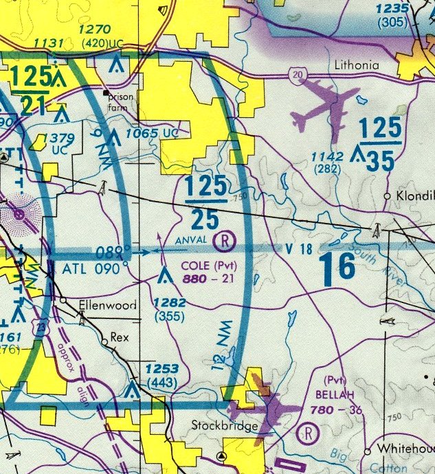
The September 1986 Atlanta Terminal Chart (courtesy of Stu Sibitzky) depicted Cole as a private airfield having a 2,100' unpaved runway.
Cole Field was no longer listed in the 1988 AOPA Airport Directory (according to Jonathan Westerling).
Jim Daigneau reported, “Gloria Barlow remembered that around 1989, she met Bruce Erion, a local reporter at a school event.
At the time, Bruce was the Channel 11 reporter & helicopter pilot (he was also a West Point graduate & Vietnam veteran).
She invited him to fly the 'Channel 11 Alive' helicopter in for the EAA picnic.
He accepted & it was such a success the next year Gloria invited WSB Channel 2 & WAGA Channel 5, Atlanta TV stations with helicopters, to fly in.”
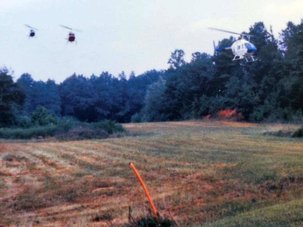
A 1989 photo by Gloria Barlow (courtesy of Jim Daigneau) of 3 Bell JetRangers (news helicopters from Channels 2, 5, and 11) making a formation approach to Cole Field.
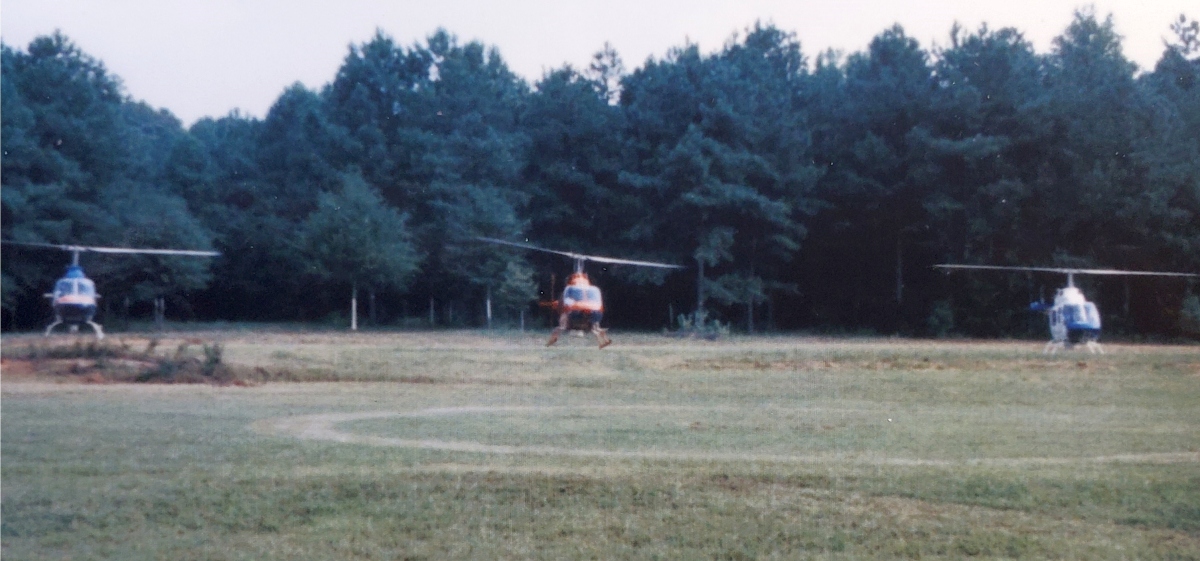
A 1989 photo by Gloria Barlow (courtesy of Jim Daigneau) of 3 Bell JetRangers (news helicopters from Channels 2, 5, and 11) making a formation landing at Cole Field.
Jim Daigneau recalled, “They flew in & landed in formation, conducting a formation bow while hovering just before touching down.”
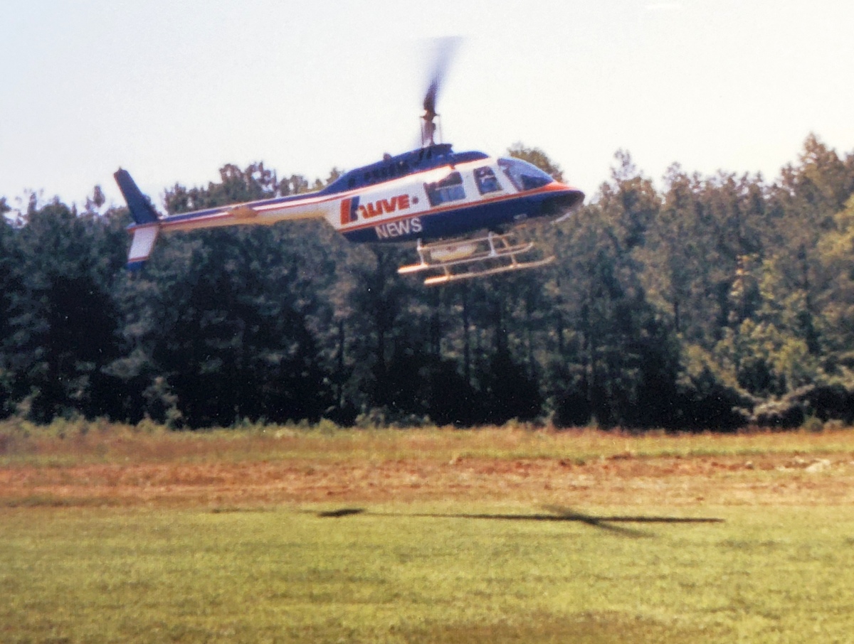
A 1989 photo by Gloria Barlow (courtesy of Jim Daigneau) of the Bell JetRanger from 11 Alive landing at Cole Field.
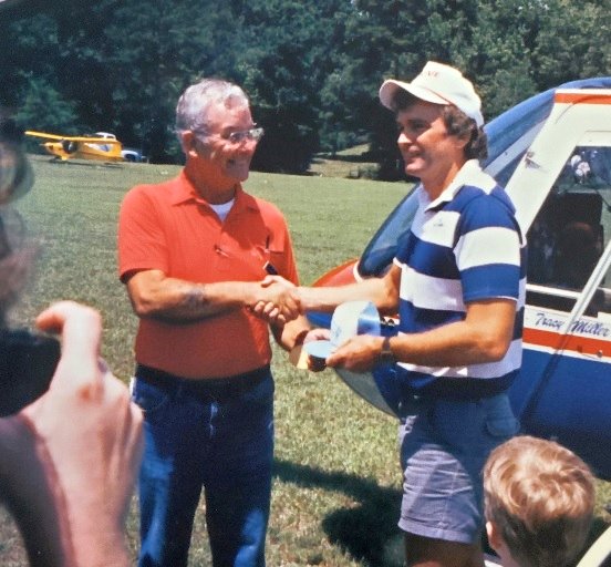
A 1989 photo by Gloria Barlow (courtesy of Jim Daigneau) of Ed Cole presenting Channel 11 reporter Bruce Erion with an EAA ball cap at Cole Field, with Ed’s Cub in the background.
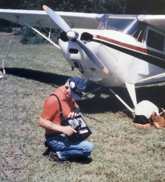
A 1989 photo by Gloria Barlow (courtesy of Jim Daigneau) of Ed Cole with video camera in hand, in front of his Aeronca Chief at Cole Field.
Jim Daigneau reported, “Rogers Martin remembered flying into to Ed’s field to pick up one or two of Ed’s daughters to take them flying.
For one such excursion, Rogers was flying a Cessna 206 for a local construction company & flew into to Cole Field.
Ed was a little concerned that Rogers would not be able to the relatively large airplane safely over the trees.
Rogers said, with a light load, the airplane handled the confines of Cole Field with no problem.
Rogers Martin grew up and flew out of his father’s Sunset Strip, just a few miles to the west of Cole Field.”
Jim continued, “Ed [reluctantly] remembered a story about propping his Aeronca Chief.
He had found a bird’s nest in the intake & cleaned it out before he started up to go flying. He throttled up at the end of the runway to pivot around for takeoff.
As he turned he smelled smoke & immediately cut the mags off to kill the engine. He went out to inspect the engine again but realized it was 'his neighbors were burning weeds.'
Relieved, he went back to turn the mags on but didn’t adjust the throttle. When he pulled the prop through it started up & immediately started to move forward with the extra throttle.
Ed couldn’t get to the door so he just held on to the strut to get one wheel off the ground.
As he drug the airplane around in circles, he looked at the windsock & figured 'if he let go at the right time, the airplane would take itself into the pine trees & not the neighbor’s house.'
It was a good plan: when he let go he was able to get to the door & pull the throttle back & kill the engine. He then 'looked around to see if anyone had seen' the proceedings.”
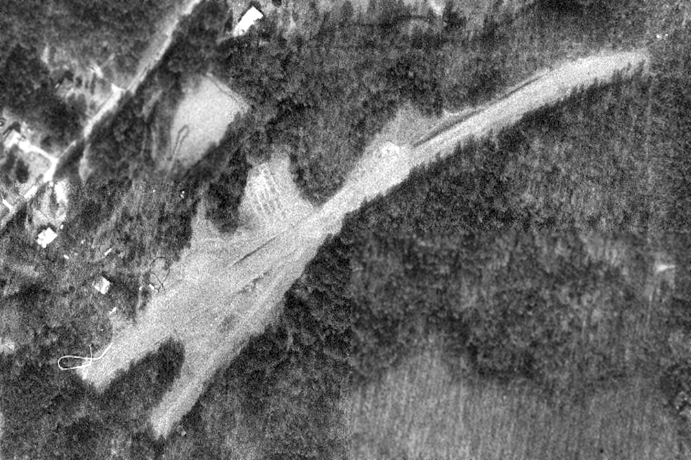
The last photo which has been located of Cole Field was a 1993 aerial view.
The 2 unpaved northeast/southwest runways were still intact, but the airfield may have been closed by that point, as there were no aircraft visible on the field.
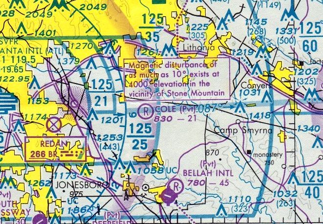
The last aeronautical chart depiction which has been located of Cole Field was on the March 1995 Atlanta Sectional Chart.
It depicted Cole as a private airfield having a 2,100' unpaved runway.
Jim Daigneau reported, “Ed sold the property in 1997. It was quickly converted into the current Waverly Place subdivision: a fate common to many small, private airfields.”
A 1999 aerial photo showed the housing development having erased all traces of Cole Field.
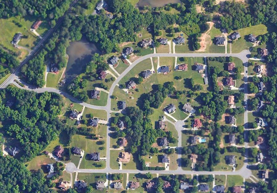
A 2018 aerial photo showed no trace of Cole Field.
Jim Daigneau reported, “Ed & Ruth’s old home is still visible on the south corner of Waverly Boulevard & Panola Road.”
____________________________________________________
33.623, -84.26 (Southeast of Atlanta, GA)
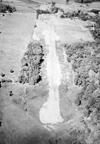
A 1962 aerial view by Rogers Martin looking north at Sunset Strip under construction, with the house having just been started (courtesy of Jim Daigneau).
Jim Daigneau reported, “Sunset Strip was owned by Ken Martin, an aircraft mechanic, businessman and pilot.
Ken started a small company named 'Piedmont Engineering' which rebuilt engines & performed aircraft maintenance & inspections.
Rogers Martin, Ken’s son, grew up on the field with a wrench in his & followed in his father’s footsteps as an aircraft mechanic.”
The earliest depiction which has been located of Sunset Strip was a 1962 aerial view by Rogers Martin (courtesy of Jim Daigneau),
which showed the airfield under construction & the adjacent house having just been started.
According to David Henderson, “One of the distinguishing features in the airport photos is the semi-circular building with a zig-zag roofline adjacent to the runway.”
Jim Daigneau reported, “The semi-circular building is the house that Ken built.
It had a long connecting hallway & picture windows on the west side that looked out to a pond & mansion that are visible in aerial photos.”
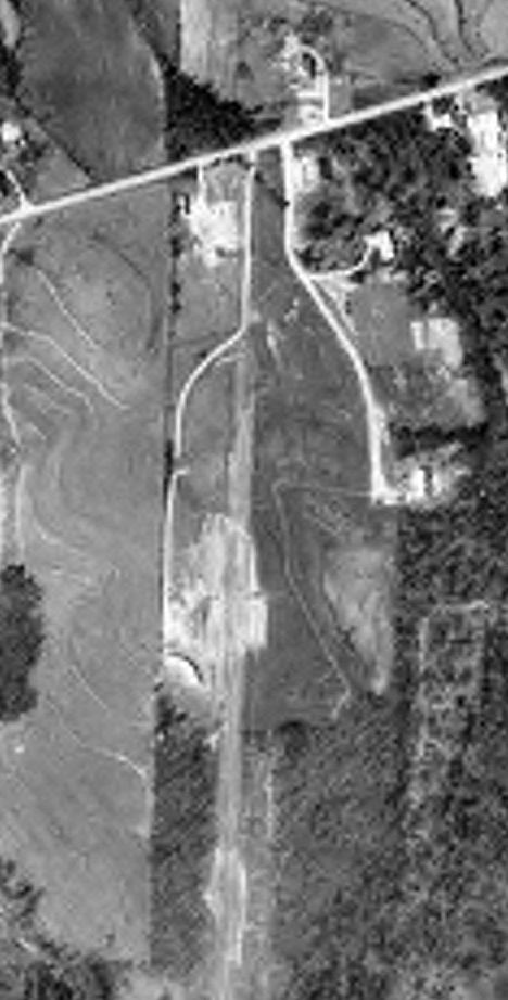
Sunset Strip, as depicted on a 3/9/66 USDA aerial photo (courtesy of David Henderson).
David Henderson observed, “The airport had a single 2,100' north/south grass runway
and was located about 9 miles directly east of Atlanta Hartsfield-Jackson Airport & 3.5 miles east of the old Ft. Gillem Airport.”
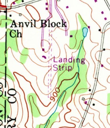
The 1968 USGS topo map depicted Sunset Strip as a single unpaved north/south runway, labeled simply as “Landing strip”, with 2 small buildings along the west side.
Sunset Strip was not yet depicted on the 1974 Atlanta Sectional Chart (or subsequent aeronautical charts from 1978 or 1986).
David Henderson recalled, “The airport is shown as 'Private landing strip' on a 1978 Atlanta street atlas.”
A 1978 aerial photo showed the airfield configuration remained unchanged.
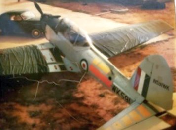
An undated photo by Rogers Martin of N591WK, one of the Martin's Chipmunks (courtesy of Jim Daigneau).
Jim Daigneau reported, “There are many stories to tell from the 1970s & 1980s when general aviation was very popular.
The south side of Atlanta was particularly suited to a robust general aviation community with plentiful, generally level & obstacle-free pasture
as well as two major & several smaller airlines with large bases at Atlanta International Airport.
If you could find a few thousand feet of turf or dirt, you could build yourself an airport. Many smaller general aviation airplanes do quite well operating from such fields.
But Rogers remembered when Sunset would get too muddy, the airplanes would disperse to other close fields that had better surfaces such as Berry Hill & Bellah.
Rogers recalled that the family owned several de Havilland Chipmunks, a Thorp 18, a 1953 Beechcraft Bonanza, a gyrocopter & various light sport aircraft.
Sunset Strip was located one mile due south of the old REX VOR, right under the west approach path to Atlanta Airport.
He noted that one had to be careful when Atlanta was landing to the west because the big airplanes could be as low as 2,000' above going overhead.
He said he was rocked numerous times by wake turbulence from jets passing close by.”
Jim continued, “Rogers said his father was pretty picky about who he allowed to land at his airport.
He recalled one pilot clipped the trees on landing & flipped the airplane over on its back.
Ken & Rogers were able to fix the airplane but then the pilot tried to sue the Martins.
Subsequently, Mr. Martin let it be known that his airport was 'invitation only', or in today’s term Prior Permission Required.
Rogers also remembered that a pilot, who was somewhat notorious around the country, arrived at Sunset Strip by spinning down nearly to the runway, recovering extremely low but in time to land.
Mr. Ken was not impressed; the pilot was 'banished' from Sunset.”

A circa 1983 photo by Rogers Martin of Kristy & Kerry Martin & their dog Kitty (the dog) in front of a Sunset Strip hangar (courtesy of Jim Daigneau).
Jim Daigneau reported, “Visible in the hangar is N8476Q the Cessna 206 Stationair the Rogers flew for a local construction company.”
A 1988 aerial photo showed that a hangar had been added at some point between 1978-88 nested adjacent to the semi-circular structure.
Jim Daigneau reported, “There was a disagreement with the neighbors, so Ken built the hangar in the curve of the house to block the view.”
David Henderson recalled, “The airport was still clearly visible in a 1993 USGS aerial photo but the runway doesn't appear to have been mowed.
By 1999, the runway had largely disappeared beneath the trees.”
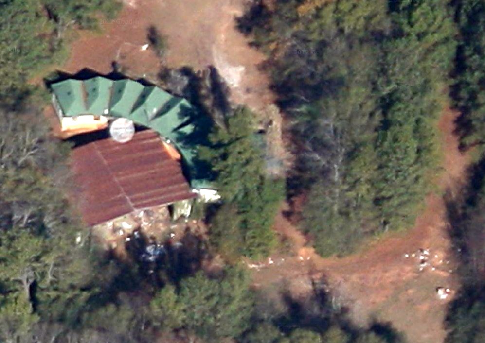
A circa 2012 aerial view looking west (courtesy of David Henderson) at Sunset Strip. David remarked, “The odd semi-circular building & hangar are still present.”
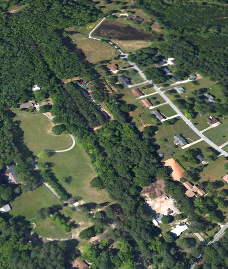
A 2/8/13 aerial view looking southwest at the site of Sunset Strip.
David Henderson observed, “It's easy to find the former runway in the recent aerial views... It can be spotted by the straight line of pines in an otherwise mostly hardwood canopy.
It appears that the center of the runway is maintained as a private road.”
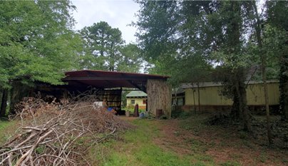
A 2020 photo (courtesy of Jim Daigneau) showing the overgrowth around Sunset Strip's house & hangar.
Jim Daigneau reported, “The property was sold in 2020 & the disposition of the land & buildings are unknown.”
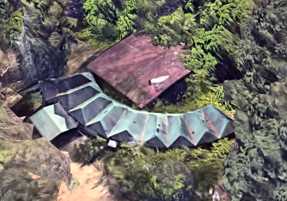
A 2025 3-D aerial image looking southwest at the odd semi-circular building & hangar on the Sunset Strip site.
The site of Sunset Strip is located southwest of the intersection of Anvil Block Road & Fairview Road.
____________________________________________________
South Expressway Airport (9A7), Jonesboro, GA
33.505, -84.36 (South of Atlanta, GA)
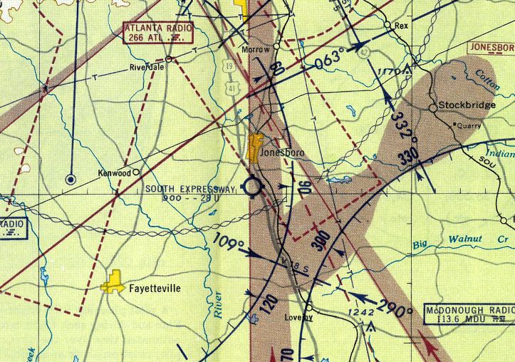
South Expressway Airport, as depicted on the 1959 Atlanta Local Aeronautical Chart.
This general aviation airport was not yet depicted on the 1958 USGS topo map or the January 1958 Birmingham Sectional Chart.
The origins of the field were described by Ed Bernd. He recalled that airport owner-manager W.H. 'Bill' Galloway “has been flying forever.
He met up with a farmer who owned some land in Jonesboro, and they went into a partnership on the airport.
Galloway & the farmer each owned 40% of the business, and their wives each owned 10%.
The idea was to have a grass strip, but they never could get grass to grow.
Before I showed up there, they had fertilized the runway to get grass to grow.
It rained & the wet fertilizer got throw all over the place very time a plane landed.
They had to wash every plan that landed during that time. So they stuck with the dirt strip.”
According to the 1966 “Atlanta Metropolitan Region Comprehensive Plan” (courtesy of David Henderson),
“South Expressway Airport... was developed in the late 1950s.”
The earliest depiction which has been located of South Expressway Airport was on the 1959 Atlanta Local Aeronautical Chart.
It depicted South Expressway Airport as having a 2,800' unpaved runway.
Ed Bernd recalled of South Expressway Airport, “I first stopped at the field in October of 1960.
Just a single dirt strip about the length [2,600'], and talked with the owner-manager, W.H. 'Bill' Galloway.
I didn't take my first lesson that afternoon despite the great selling job that Bill Galloway did on me... but I came back the next day.
He told me a 'secret' about the best time to learn to fly: 'Today, because that's the only time you can ever do it.'
I could hardly sleep that night. The next day of course the weather was horrible.
The radio said wind gusts to 50 mph (perhaps they exaggerated somewhat).
It was very late afternoon by the time I got back over there.
By that time I was scared that he might not take me up because of the lateness & the weather.
But he was too good a salesman for that.
We climbed into his personal plane, a Cessna 140 complete with wheelpants, and I got my first lesson.”
Ed continued, “When I first went there, they owned 4 airplanes: Galloway's personal Cessna 140;
2 Cessna 120's that were used to train students (he never let me in his 140 again); and a Piper J3 Cub.
I don't know why they had the J3, but I finally talked them into checking me out in it & I loved it.”
Ed continued, “I got my private license on 7/13/61. Somewhere along the way I went to work at the airport, as a line boy.
Somehow it seemed better than being managing editor of our family newspaper.”
Ed continued, “When the Cessna 150 first came out, they bought one.
That might have been in late 1961, or it might have been 1962.
They sold one of the 120's, and then one of his flight instructors flipped the other 120 one day.
So all he had left was the 150 & the Cub, until he got the 120 fix.
Later they bought a Air Coupe - not the old Ercoupe with the controls tied together,
but a nice low wing airplane with a bubble canopy & a 90 hp engine... I loved to fly it.
He had about 3 flight instructors there as I recall.”
Ed Bernd recalled, “Finally they had a strip of asphalt laid over the dirt. I'd guess that could have been 1962.
They had one hangar, on the south side of the airport, and one mechanic. They tied down airplanes on both sides.
I remember at one time race driver Joe Weatherly hid his airplane way back at the back of the tiedown area for a couple of months
until he made enough money to get caught up on the payments.
It was an interesting layout: The airport was right up against the southern edge of the Atlanta control zone,
so we had to fly all our patterns on the south side of the airport.
At the east end of the runway was a 4-lane highway.
There were power lines, a fence, and the runway went downhill for the first few hundred feet.
It was a bit of a challenge to land that way. After that first few hundred feet the runway leveled out.
At the west end, the ground dropped off again... and there was a big stand of tall Georgia pine trees.”
Ed continued, “Naturally we preferred to land uphill... heading east.
The wind would come down the runway, then across the area that had been cleared, and then hit those pines...
giving us a stiff updraft just before we got to the end of the runway.
We'd drop a ways (depending on how strong the wind was of course)
so we'd juice the throttle to keep from dropping to far, then settle down & land.”
Ed continued, “We had one really nice airplane based there, a Piper Cherokee.
It was the only plane they kept in the hangar.
One day the owner came in a little too low - landing downhill - and sat it down on the fence.
The fence posts punched holes in the wings, but didn't hurt them.
They hustled it into the hangar very quickly so nobody would know.
I was working there at the time & didn't even know about it for several days.”
Ed continued, “Like most businesses in the South back then,
they got the sign for the establishment from the Cocoa Cola company.
They would provide a big red sign with the big red Coca Cola log & big red letters that said 'Drink Coca Cola',
and leave you a little white space to put the name of your business.
I think all that he had there was the word 'Airport' in the biggest letters he could fit on there.
So we always loved to tease the Chief about his 'Cocoa Cola Airport'."
The earliest directory listing of South Expressway Airport which has been located was in the 1962 AOPA Airport Directory,
which described the field as having a single 2,600' paved Runway 6/24.
The operator was listed as South Expressway Airport Inc.
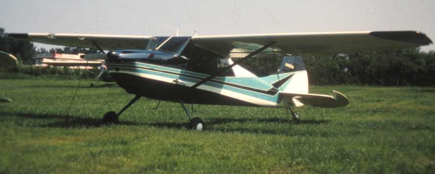
The earliest photo which has been located of South Expressway Airport was a 1963 photo (courtesy of John Lipscomb) of John's father's Cessna 170.
The airport office is visible in the background.
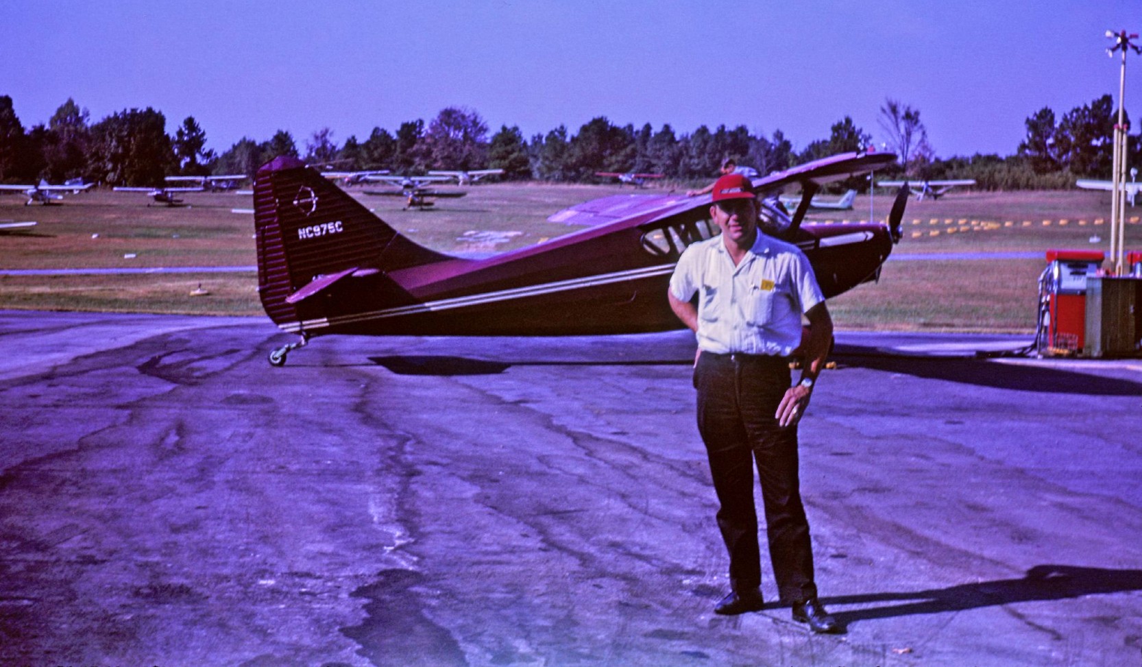
A 1963 photo of an unidentified man in front of a Stinson at the South Expressway Airport avgas pump.
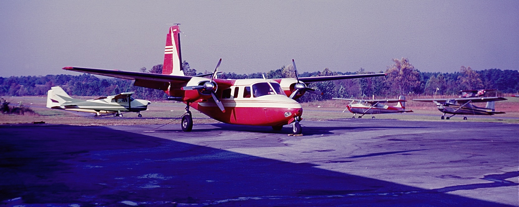
A 1963 photo of a Twin Commander & other general aviation aircraft at South Expressway Airport.
David Bryan recalled, “My Dad learned to fly at South Expressway back in the late early 1960s
in an Aeronca Champ that belonged to the Hill Hoppers Flying Club, which had a lot of Delta Airlines people in it.
When he got his ticket he bought the Cessna 140 from Galloway & had the good fortune of having a good friend, Dick Borrelli who flew for Eastern.
Dick got hurt & was on leave, so they flew like maniacs off South Expressway for about 2 months obtaining Dad's licenses.
I fondly remember sitting on the hill (where they put the school in the late 1980s) watching him do touch & goes.
Dad was able to transition from maintenance to flying at Delta due to this.”
Dick Borrelli recalled, “I was just a friend of Gerald’s, doing him a favor. I didn’t charge him for the instruction.
The gentleman who owned the airport got really mad that Gerald wasn’t using one of his instructors
and put Gerald on a cash-only basis & refused to let him run a tab like everyone else. They were pretty nasty to him.
We went out every morning & flew from South Expressway – MCN – CSG - South Expressway
on a flight plan with multiple variations & then flew every approach to every airport we visited.
Every other day we reversed it. We always stopped in CSG to refuel & have lunch with his sister.
At the end of the summer he got his commercial & his instrument ratings & got hired a few months later by Delta. & retired as a Delta pilot.”
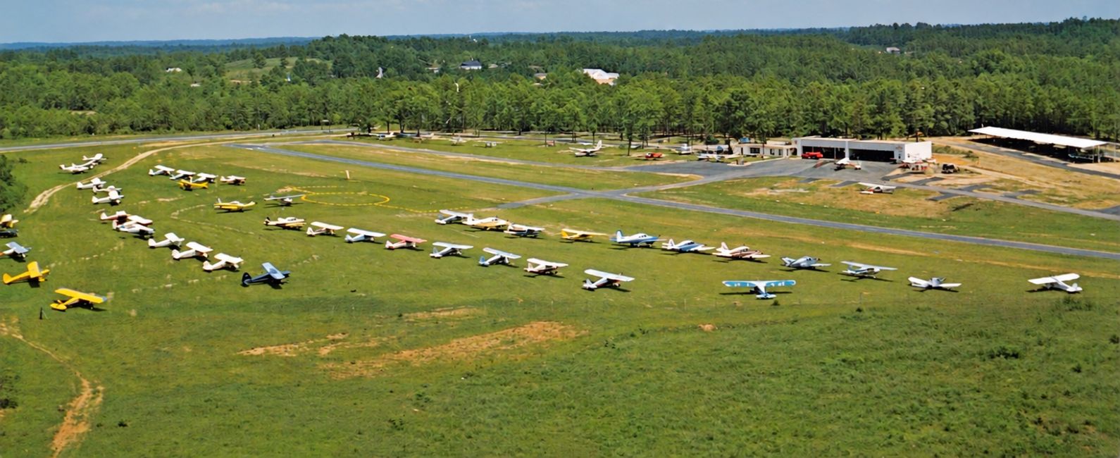
A circa 1960s aerial view looking south at South Expressway Airport (enhanced by David Henderson).
John Lipscomb recalled, “I grew up near the South Expressway Airport in the 1960s.
My father had a Cessna at the airport. Later my dad bought a Piper Comanche from Mr. Galloway.
He missed the fun of the Cessna so much he sold the Piper & bought back the Cessna.
My Father was Bill Galloway’s doctor & Mr. Galloway lived across the street from us.
I remember going to the airport to fly with my father & I always remember Mr. Galloway fondly.
I remember Mr. Galloway used to take me to the airport with him in the summer time before I started elementary school.
I used to tell my mother I was going to work.
I’m sure she enjoyed someone taking a rambunctious little 6 year old off of her hands for a few hours.
The airport office was a small building with model airplanes hanging from the ceiling.
I provided the Sopwith Camel biplane model to the collection.
This was also the first place I learned to put peanuts in my bottle of Coke.
Mr. Galloway was teaching me the southern traditions every little boy needs to learn.
One of the ways Mr. Galloway made money was to take aerial photos.
I can still remember going up with him during those times.
I bet I logged just as many hours as he did during those summer days.”
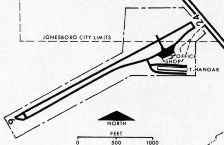
The 1966 “Atlanta Metropolitan Region Comprehensive Plan” (courtesy of David Henderson)
depicted South Expressway Airport as having a single Runway 6/24, with an office, shop, and T-hangar on the southeast side.
The 1966 “Atlanta Metropolitan Region Comprehensive Plan” (courtesy of David Henderson)
described South Expressway Airport as the “Busiest privately-owned general aviation field in the metropolitan area.
The 50-acre airport site fronts on U.S. Highways 19 & 41, a major regional thoroughfare,
about 6 miles south of its interchange with Interstate 75.
The most heavily developed & rapidly growing part of Clayton County extends northward from Jonesboro,
and the area around the airport is still relatively open; however, almost all of the development in its immediate vicinity has occurred during the past 10 years.
Despite the relative absence of suburban encroachment, there appears to be little possibility for a large scale expansion of the airport.
A highway is immediately to the east, and westward extension of the runway would require substantial fill & a culvert or bridge to cross Swamp Creek
and the adjoining marshy areas (which are 1,000' or more in breadth & up to 40' lower than the end of the runway).
The runway already runs downhill in this direction, with approximately 35' difference in elevation between its highest & lowest points.
It is 2,700' long & 150' wide, turf, with pavement 30' wideband is equipped with medium intensity runway lights, operated from dusk to 9PM (later on request).
The field is attended from 8:30AM-9PM. There are underground tanks for storage of aviation gasoline, with a capacity of 3,980 gallons.”
The 1966 “Atlanta Metropolitan Region Comprehensive Plan” (courtesy of David Henderson) continued,
“These general aviation facilities & services are provided:
Major & minor repair to power plant, airframe, radio & accessories, Aircraft services: painting, stripping, washing, waxing,
Aircraft storage: hangar 6 spaces, T-hangars 10 spaces, ramp 46 spaces, tie-down 80 spaces,
Aircraft for lease - 2 planes, charter - 6 planes, rental - 9 planes, air taxi - 3 planes, sight-seeing - 2 planes,
Sales of new & used aircraft, accessories, radio, instruments.
Ground school & flight instruction for all ratings except glider & helicopter flying: Instructors – 6, Aircraft – 10,
Aerial photography (color, black & white).
In 1965, the following general aviation aircraft were reported based at the airport: single-engine 1-3 places (68);
single-engine, 4 or more places (34); multi-engine (6).”
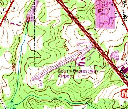
The earliest topo map depiction which has been located of South Expressway Airport was on the 1968 USGS topo map.
It depicted the field as having a paved northeast/southwest runway with a parallel taxiway, and several buildings on the southeast side.
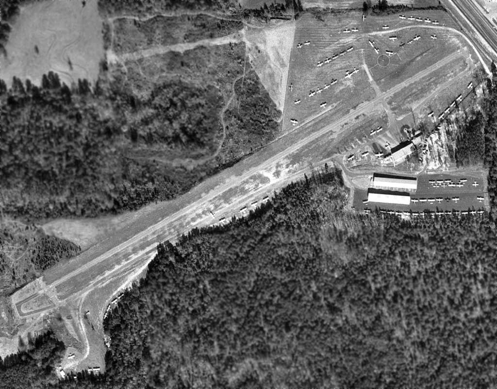
The earliest aerial photo which has been located of South Expressway Airport was a 1968 USGS aerial view (courtesy of David Henderson).
It depicted a very popular general aviation airport, with nearly 100 light aircraft parked all around the field.
The 1968 Flight Guide (courtesy of Robert Levittan) depicted the South Expressway Airport as having a single 2,700' paved Runway 6/24.
A parallel taxiway on the south side of the runway led to 2 ramps, along which were 3 buildings (hangars?).
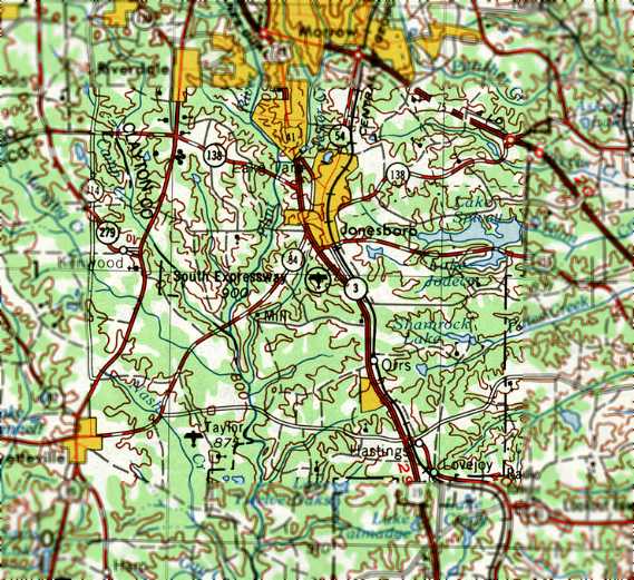
South Expressway Airport, as depicted on the 1970 USGS topo map.
John Lipscomb recalled, “Mr. Galloway died of a sudden heart attack in the mid-1970s at his home.
I used to cut the grass for Mrs. Galloway until I went off to college in 1979.”
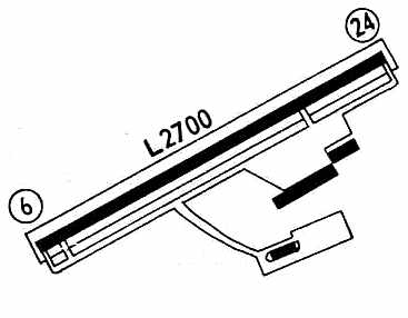
The 1972 Flight Guide (courtesy of Chris Kennedy) depicted the South Expressway Airport
as having a single 2,700' paved Runway 6/24.
A parallel taxiway on the south side of the runway led to 2 ramps, along which were 3 buildings (hangars?).
Trish Phillips recalled, “In the mid-1970s, I was a passenger in a friend's Luscombe & we landed at South Expressway Airport.
I remember how friendly the folks were & we were even loaned a station wagon so we could drive to lunch.”
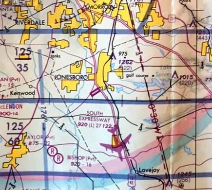
The 1978-79 GA Aeronautical Chart (courtesy of David Stevenson) depicted South Expressway Airport as having a single 2,700' paved runway.
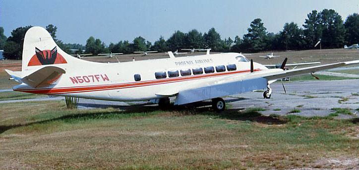
An October 1980 photo (courtesy of David Henderson) of a Pheonix Airlines De Havilland Heron N507FW at South Expressway Airport.
David recalled, “Phoenix airlines parked their de Havilland Heron there for a few months after they went out business in 1980.”
David Bryan recalled, “In 1980, I learned to fly there also & we [he & his father] taught students together in the early 1980s.”
South Expressway Airport was described in an unchanged same manner in the 1982 AOPA Airport Directory (courtesy of Ed Drury).
Charlie recalled, “My father & I bought a 1962 Cessna 172D in early 1982. We moved it from South Fulton Sky Port to South Expressway Airport where it was kept in a T-hangar until selling it.”
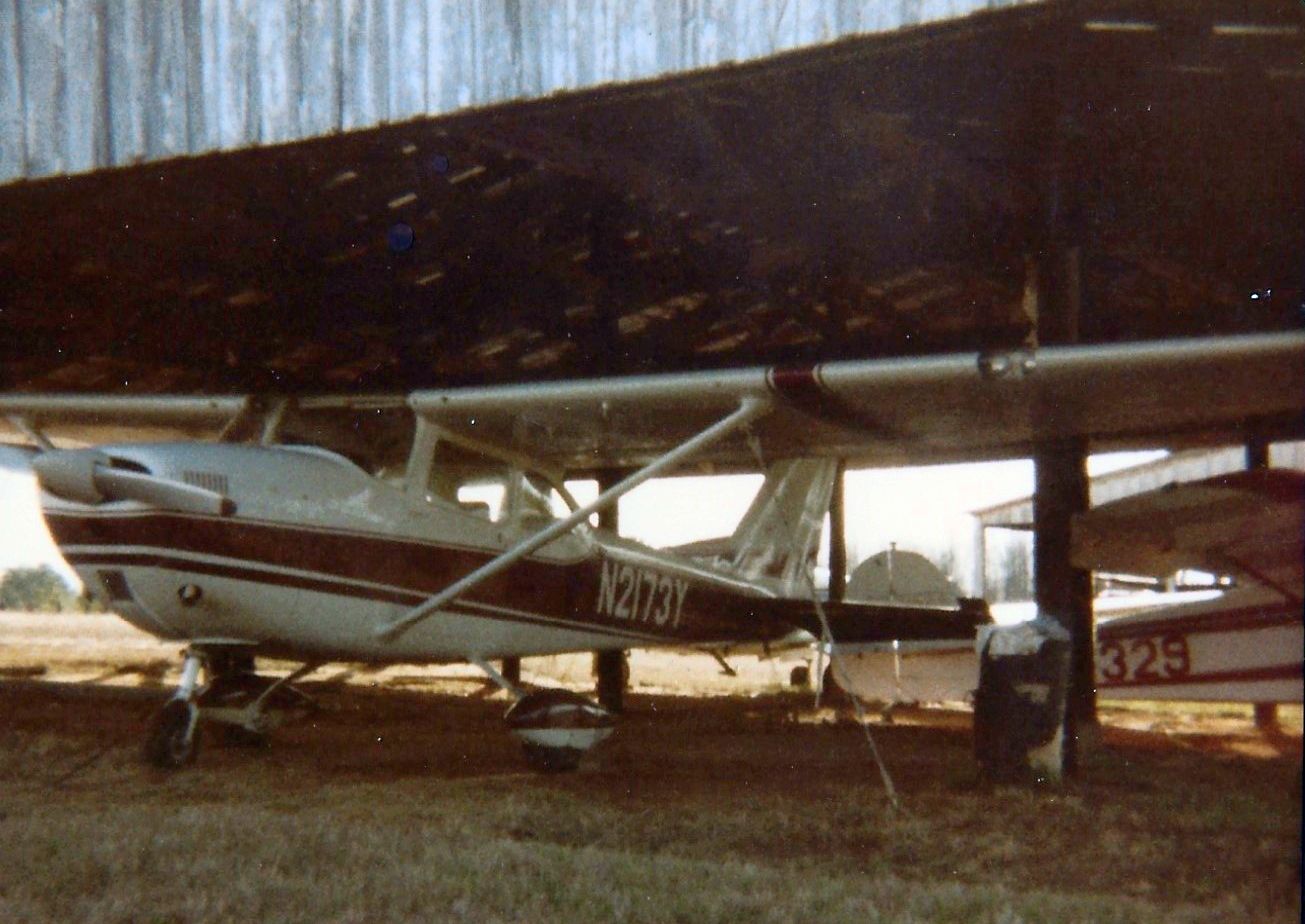
A circa mid-1980s photo by Charlie Evans of his 1962 Cessna 172D under a South Expressway Airport shade hangar.
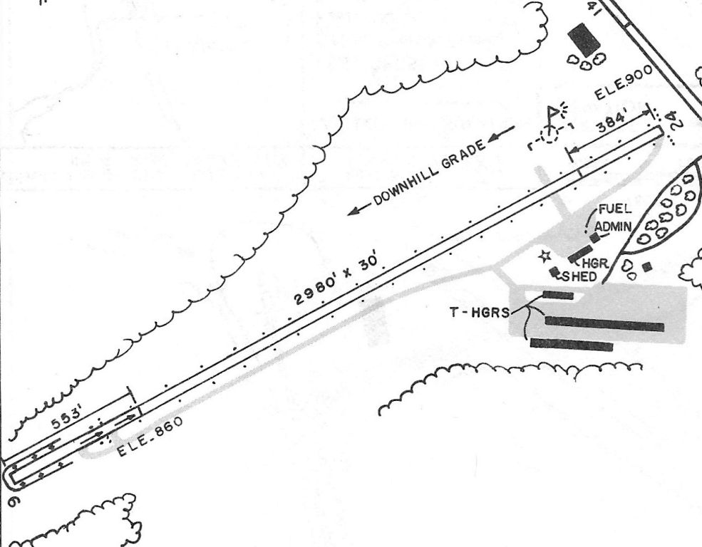
The 1985 GA Airport Directory (courtesy of Charlie Evans) depicted South Expressway Airport as having a 2,980' Runway 6/24, with hangars & an administration building on the southeast side.
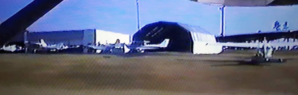
A still from a November 1987 movie by Charlie Evans showing aircraft parked at Expressway Airport.
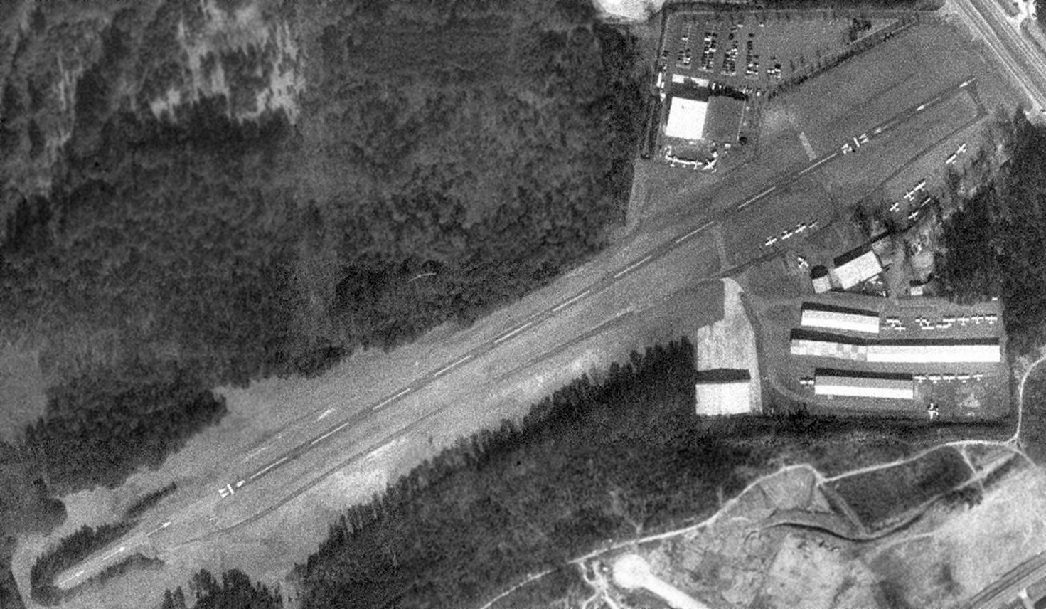
As of the 1993 USGS aerial photo, South Expressway Airport was apparently quite healthy,
as a total of 30 aircraft were visible parked outside, in addition to the 4 hangars which were at the airport.
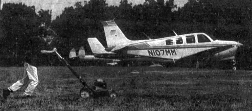
An undated photo of Jason Porter mowing the grass in front of a Beech Bonanza at South Expressway Airport, from an 8/13/93 article (courtesy of David Henderson).
The article entitled “Days numbered for airport” described how Clayton County was about to complete a deal
that would close the privately-owned South Expressway Airport & relocate operations to the county-owned Tara Field.
South Expressway Airport was owned by Lucy Huie & her husband.
David Lopez reported that he flew into & out of South Expressway Airport in the early 1990s.
He recalled, “This airport was unlike many of our current airports in that it was 'Spectator Friendly'.
If you went out to this airport on a weekend, you would find open hangars
with lawn chairs strewed about facing the runway & bar-b-q grills scenting the air with the aroma of hotdogs & hamburgers.
Kids, parents, family & friends would gather to watch as the planes would take-off & land.”
David Bryan recalled, “Some lawyer owned it for awhile then it was acquired by Delta pilot Ron Smith.
Ron built a large hangar there where he ran a cargo op with D18s & turboprops.
Later, Ron moved his operation to Tara Field, and flying at South Expressway dried up.
When Ron died is when it was sold to the county.”
According to Glen Boyd (manager of LaGrange-Callaway Airport),
a fairly large tract of houses was located on the opposite (northeast) side of Route 19-41,
"from which the usual barrage of complaints often came.
Off-airport emergency landings didn't help much,
especially one that crashed on the roof of a house in the development
(yes, of course the airport was there LONG before the development)."
According to Ronald Willard, "South Expressway Airport closed in approximately 1994
as part of a transaction brokered between Henry & Clayton counties
over the use of then named Bear Creek Airport (now known as Tara Field),
located less than 10 miles south of South Expressway Airport just off Highway 19-41.
Most private pilots who once used South Expressway likely now use Tara.
Tara Field doesn’t have quite the character South Expressway had.
There was nothing like the sight of cruising up Highway 19-41
and suddenly having a small plane zip across just overhead on final approach."
The last aeronautical chart depiction which has been located of South Expressway Airport was on the March 1995 Atlanta Sectional Chart.
It depicted South Expressway Airport as a private airfield having a 3,000' paved runway.
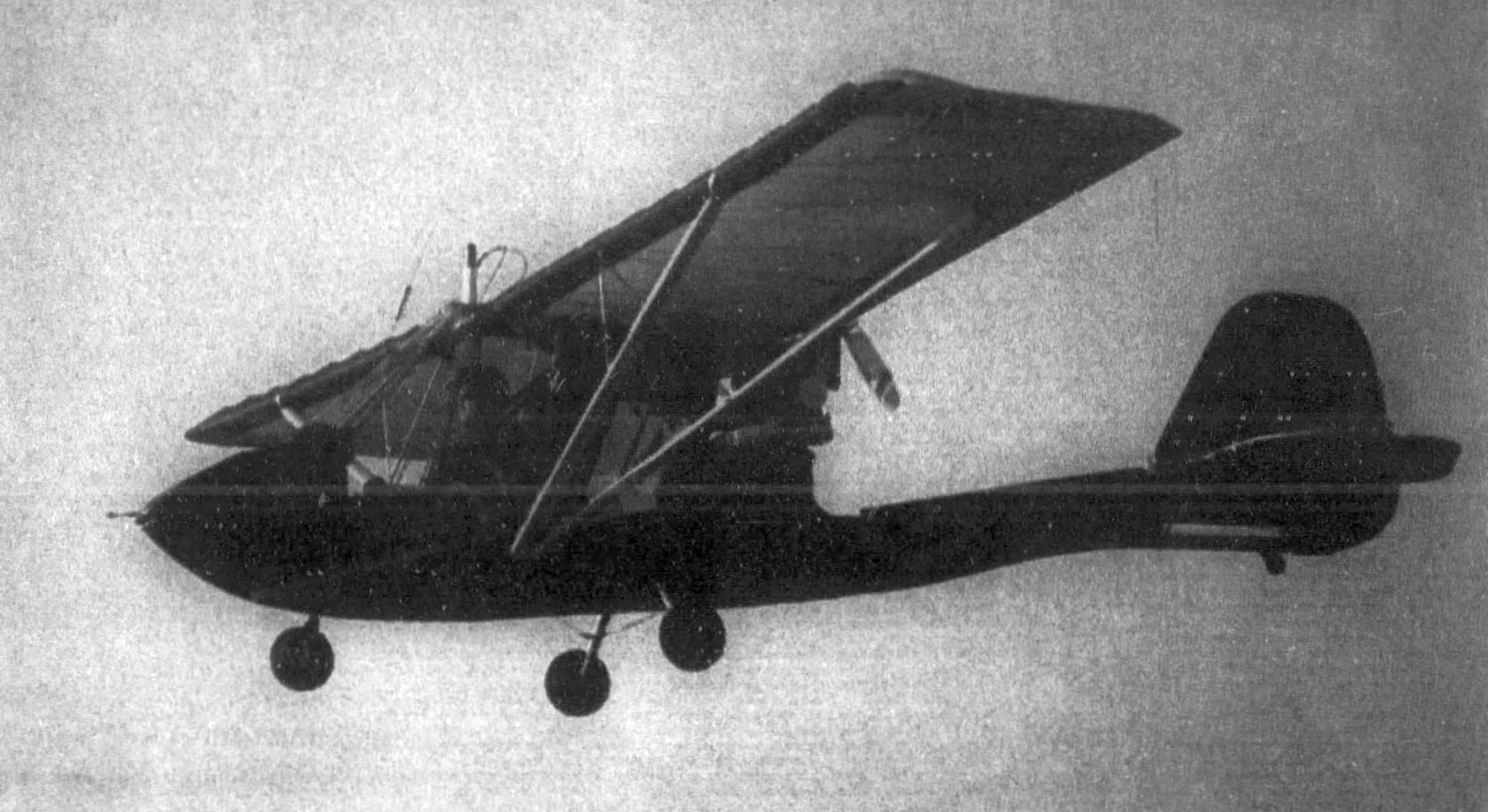
The last photo which has been located of an aircraft flying from South Expressway Airport was an undated photo of Ken Lamarca flying his ultralight from a 2/26/98 article (courtesy of David Henderson).
The land of the former South Expressway Airport was purchased in 1998,
and construction began that same year to build the Clayton County Justice Center on the site.
Glen Boyd points out the irony in how the complaints of neighboring residents
contributed in replacing an airport with a prison:
"I often wonder about how happy having a penal institute in this location makes residents of that development."
In the words of Ronald Willard, "The community should have left well enough alone,
a small airfield is a much better neighbor than a jail."
A 2002 USGS aerial view showed South Expressway Airport's runway had been removed,
and the building of the Justice Center had been constructed over most of the former airport property.
However, note the 8 airplanes that were still parked around the former airport building northeast of the center of the photo.
According to Glen Boyd, the building was the Clayton College & State University A&P school.
These were apparently the aircraft which were used in maintenance instruction at the school.
Boyd notes that the A&P school itself has recently been threatened with closure,
so it may not still be operational.
Ronald Willard reported in 2004,"I was at the old site of South Expressway [Airport] earlier today
and found that a portion of the old runway is still in place.
It is cracked, of course, with a lot of grass growing through but an old bed is still there."
According to David Lopez, “I miss this kind of atmosphere & I'm pretty sure that we have seen the last of such public airports.
Apparently the local community preferred a prison instead of a small airstrip.”
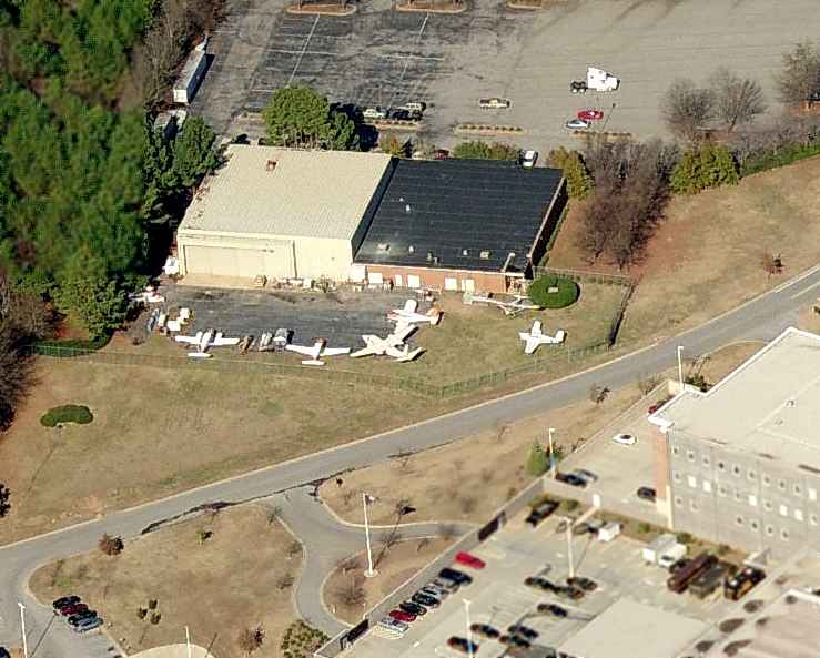
A circa 2008 aerial photo looking north at the 6 airplanes that were still parked around the Clayton College & State University A&P school at the South Expressway Airport site.
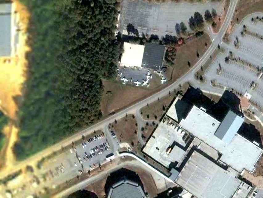
An 8/19/05 aerial photo showed 6 airplanes that were still parked around the former South Expressway Airport building
on the north side of the runway (even after the runway had been removed).
According to Glen Boyd, the building was the Clayton College & State University A&P school.
These were apparently the aircraft which were used in maintenance instruction at the school.
Boyd notes that the A&P school itself has recently been threatened with closure, so it may not still be operational.
A 6/15/06 aerial photo still showed 6 airplanes parked around the A&P school building.
A 6/25/07 aerial photo showed that the planes had been removed from the A&P school building, erasing this curious trace of the South Expressway Airport.
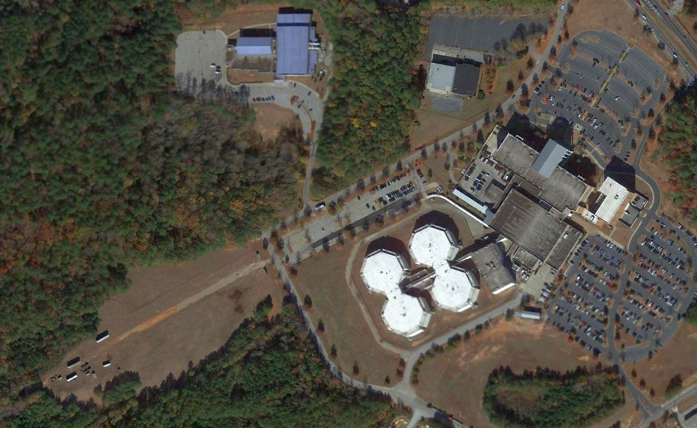
A 2016 aerial view showed that the last remaining traces of the South Expressway Airport were the southwest end of the runway, and the former A&P school building on the north side.
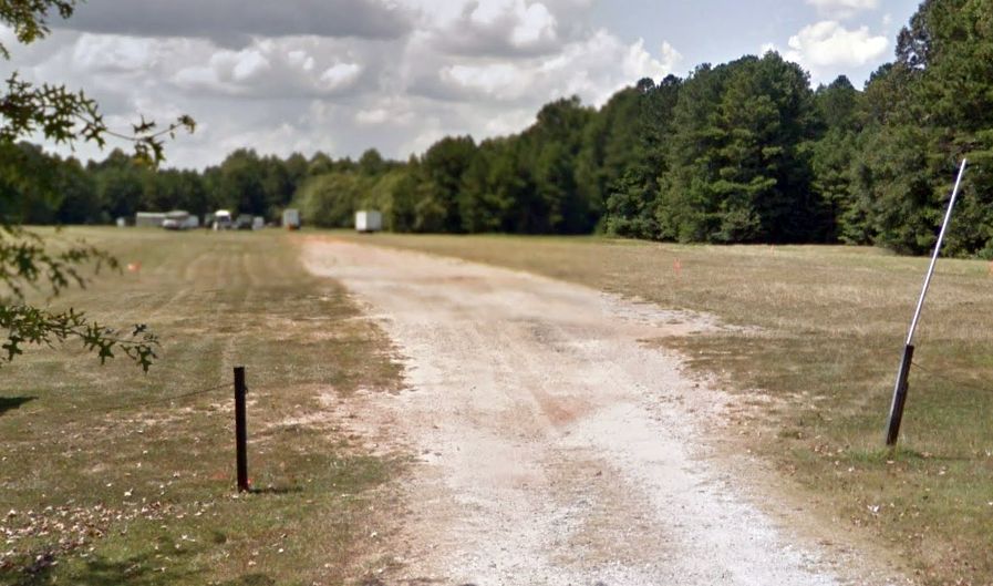
A 2018 photo looking west at a small remaining trace of South Expressway Airport: the southwest end of the runway.
The site of South Expressway Airport is located west of the intersection of Tara Boulevard & Poston Road.
Thanks to Larry Judy for pointing out this airfield.
____________________________________________________
33.55, -84.17 (Southeast of Atlanta, GA)
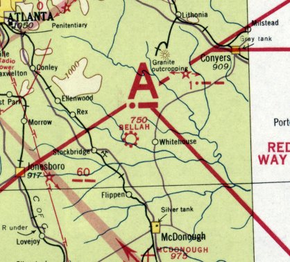
Bellah Field, as depicted on the April 1938 Birmingham Sectional Chart.
Bellah Field was dedicated on 7/10/32, according to an article in the 7/11/32 The Palm Beach Post (courtesy of David Henderson).
According to Gordon Bellah's obituary (courtesy of David Henderson),“Early in his career, he built Bellah Airport at his home on a 2,300' pasture.
It was traditional for pilots from far & near & from other countries to gather at his airport on Sunday afternoons for 'Hangar Flying,'
and to mingle with skydivers who used his airfield as a base.
As 'Dean' of aviation at the Bellah School of Aeronautics in Stockbridge,
Bellah was credited with turning out more fledglings than any other pilot in the southeast.
One of the first skydiving schools in the south was at Bellah Field.
It is believed that the modern parachute evolved based on what was leaned there.
The jumpers were protective of their silk parachutes.
They packed & sewed & made repairs themselves until finally the 'chutes' became more fragile & smaller.
They discovered that some maneuvering was possible & they could land where they wanted to land.
A traditional story is that at one point, Gordon’s group challenged the Army to a contest to see who could land more accurately.
The Army jumped first & they never hit their target, but everyone of Bellah’s boys landed on their target.”
Bellah Field was not yet depicted on the April 1933 or October 1935 Birmingham Sectional Chart.
The earliest depiction of Bellah Field which has been located was on the April 1937 Birmingham Sectional Chart.
It depicted Bellah as a commercial/municipal airport.
Bellah Field was still depicted on the October 1942 Birmingham Sectional Chart.
Bellah Field may have gone through a period of closure during WW2 (like many other small civilian airfields near the coasts due to wartime restrictions),
as it was not depicted on the April 1945 or April 1946 Birmingham Sectional Charts.
Bellah Field was evidently reopened at some point between 1946-48,
as it was once again depicted on the October 1948 Birmingham Sectional Chart.
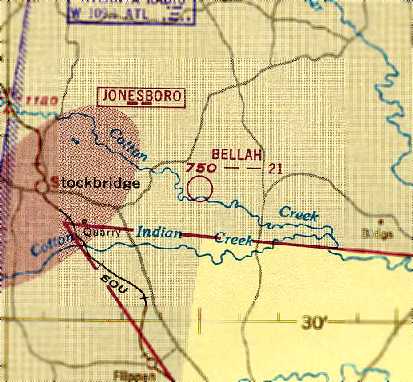
The August 1951 Atlanta Local Aeronautical Chart (courtesy of Chris Kennedy) depicted Bellah as having a 2,100' unpaved runway.
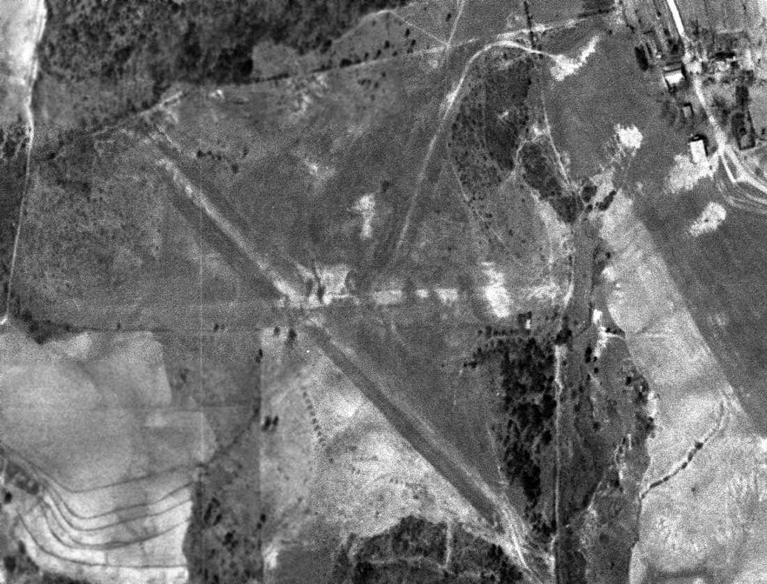
The earliest photo which has been located of Bellah Field was a 3/9/55 USGS aerial view (courtesy of David Henderson).
It depicted Bellah as having 3 unpaved runways, with a few small buildings (hangars?) along the northeast side.
No aircraft were visible on the field.
According to Jeremy Pirtle, the field was listed at one point as the "Gerald E. Bellah International Airport...
which was obviously a joke since the now-deceased owner operated a small light aircraft out of there.”
Bellah Field may have gone through a period of closure, as it was not depicted at all on the 1959 Atlanta Local Aeronautical Chart (courtesy of Tim Zukas).
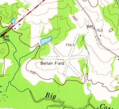
The 1964 USGS topo map depicted Bellah Field t depicted the field as having 3 unpaved runways,
and 3 small buildings along the east side.
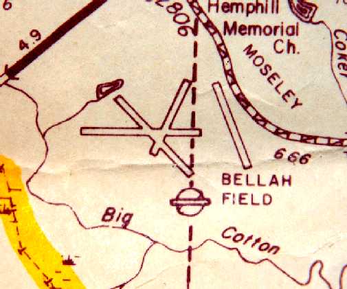
Bellah Field had gained a 4th runway along its east side at some point between 1964-80,
as that is how it was depicted on a 1980 highway map (courtesy of Jeremy Pirtle).
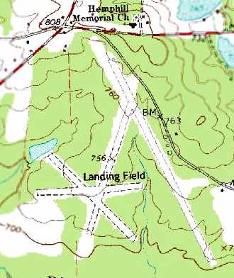
The 1982 USGS topo map labeled Bellah Field simply as “Landing Field”.
It depicted the field as having a total of 4 unpaved runways, with a few small buildings along the east side.
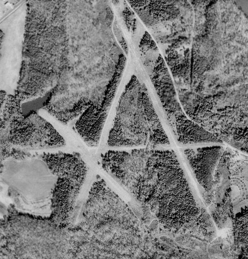
The 2/12/88 USGS aerial photo depicted the runways of Bellah Field, but did not show any aircraft or other signs of recent aviation usage.
The buildings seen in earlier photos along the east side appeared to have been removed.
According to Gordon Bellah's obituary (courtesy of David Henderson), “Gordon Bellah continued to promote aviation until his death at age 90 in 1996.
Many aviation careers were launched under his tutelage.”

The last aeronautical chart depiction which has been located of Bellah Field was on the September 2004 Atlanta Terminal Aeronautical Chart (courtesy of Chris Kennedy).
It depicted “Bellah International” as a private field having a 4,500' unpaved runway.

An 11/30/05 aerial view looking south showed the Bellah Field runways continued to be kept clear.
Bellah Field was evidently closed at some point between 2004-2009, as it was no longer depicted on the March 2009 Atlanta Terminal Aeronautical Chart.
Jeremy Pirtle visited the site of Bellah Field in 2009 & reported, “The airstrip has been mauled in preparation for yet another subdivision, but the general layout is still discernible.
There is nothing that looks like removed paving, other than a couple of piles that probably came from 2 smallish concrete slabs.
No evidence remains of any runways visible from ground level.
I was able to locate an elderly gentleman from another nearby strip who told me that the former owner was an old barnstormer
who just wanted a large airfield of his own & had the ability to build one himself.”
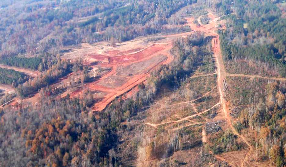
A 2009 aerial view by Jeremy Pirtle looking north at the site of Bellah Field shows that the property is being cleared for construction.
Jeremy noted, “The devastation is worse from the air than I thought, but you can still sort of see the layout.”
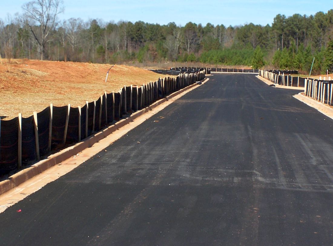
A 12/7/14 photo by David Henderson “looking northeast along a new road that parallels the old southwest/northeast runway” of the former Bellah Field.
David reported “The runway would have been immediately to the left of the road in this shot. The roads have aviation-themed names.
The subdivision construction [Bellah Landing] is in full swing. There is enough space for hundreds of homes.”
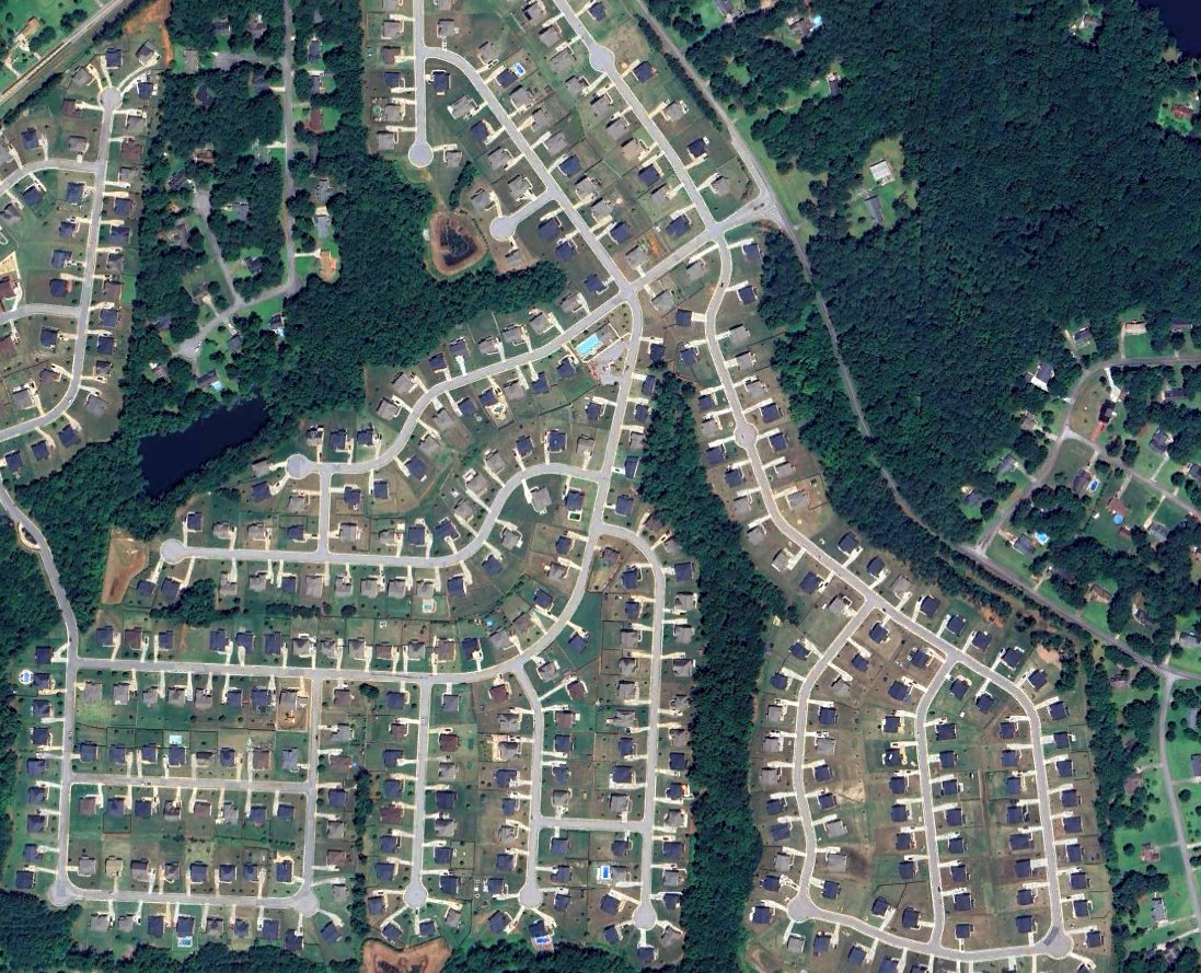
A 2024 aerial view showed sadly no trace remained of Bellah Field.
The site of Bellah Field is located south of the intersection of Hemphill Road & Moseley Road.
____________________________________________________
33.728, -84.161 (East-southeast of Atlanta, GA)
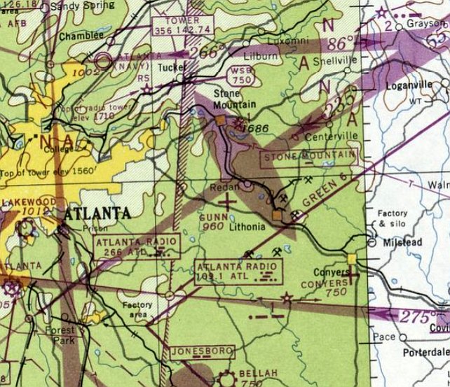
Gunn Airfield, as depicted on the October 1948 Birmingham Sectional Chart.
According to an article (courtesy of David Henderson), Gunn Airfield was built in 1945 by George Gunn for his own use in a field behind his house.
Gunn Airfield was not yet depicted on the October 1947 Birmingham Sectional Chart.
The earliest depiction of Gunn Airfield which has been located was on the October 1948 Birmingham Sectional Chart.
It depicted Gunn as an auxiliary airfield.
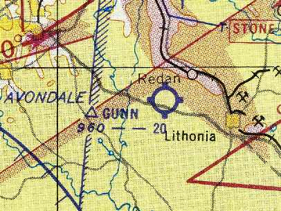
The August 1954 Birmingham Sectional Chart (courtesy of Chris Kennedy) depicted Gunn as having a 2,000' unpaved runway.
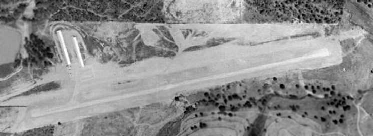
The earliest photo which has been located of Gunn Airfield was a 1955 aerial view.
It depicted the field as having a single unpaved northeast/southwest runway.
Two rows of T-hangars sat on the northwest side of the field, near which were 2 light aircraft.
John Wyrick recalled, “My Aunt, Uncle & 2 cousins learned to fly & all soloed at Gunn Field in the mid 1950s.
I flew with them a lot. It was quite an adventure.
One of the perils was that quite often there was a pretty good cross wind too!
If you learned to fly at Gunn you could fly anywhere!”
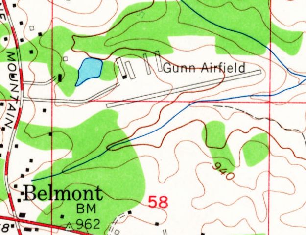
The 1956 USGS topo map depicted "Gunn Airfield" as having a northeast/southwest runway,
with 4 rows of hangars on the north side.
John Towler recalled, “I soloed a Piper Super Cub N2779A on 9/20/58 at Gunn Field.
My instructor was Red Goodman. The Super Cub & a Navion belonged to the Atlanta Army Depot Flying Club.”
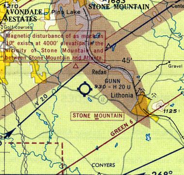
The 1959 Atlanta Local Aeronautical Chart (courtesy of Tim Zukas) depicted Gunn as having a 2,000' unpaved runway.
Gunn apparently gained a paved runway at some point between 1959-60,
as the 1960 USDA aerial photo (courtesy of David Henderson) depicted the field as having a single paved runway,
with 4 rows of T-hangars on the northwest corner of the field.
The 1961 Great Smoky Mountains World Aeronautical Chart (courtesy of Chris Kennedy)
depicted Gunn as having a 2,000' hard-surface runway.
The 1962 AOPA Airport Directory described Gunn as having a single 2,100' asphalt Runway 8/26.
The operator was listed as George Gunn.
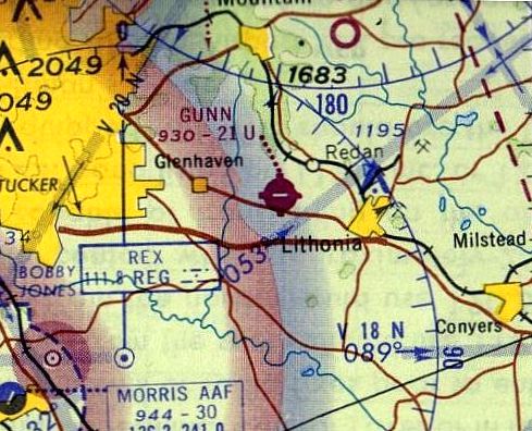
The 1963 Birmingham Sectional Chart depicted Gunn as having an east/west 2,100' paved runway.
Fred Bieser recalled, "I have memories of going to Gunn Airfield with my dad when I was young.
It looked to me to be the world's most dangerous airport.
It seemed to be short, bumpy & with trees way too close to the runway."
Dave Forrest recalled, “I flew several airplanes in & out of Gunn, including the P-51 shown in the Stone Mountain photo.
During the 1960s & 1970s I flew a Beech 18, T-6,and the P-51 at Gunn Field.
During that same time frame there was a Delta pilot Bob Jenkins that owned a Stearman, a PT-22, and a T-6, all were based at Gunn.”
Gunn was described on the 1964 Savannah Sectional Chart (courtesy of Chris Kennedy)
as having a single 2,100' hard-surfaced runway.
According to the 1966 “Atlanta Metropolitan Region Comprehensive Plan” (courtesy of David Henderson),
“The following aircraft were reported based at Gunn in 1965:
single-engine, 1-3 places (16); single-engine, 4 or more places (49).”
Thom Riddle recalled, “I got my private ticket in 1966 at Gunn Airfield in Lithonia.
I was a member of the Georgia Tech Flying Club which leased an old straight-tail Cessna 150 from George Gunn.
We paid $7/hour wet plus $4/hr for the instructor.”
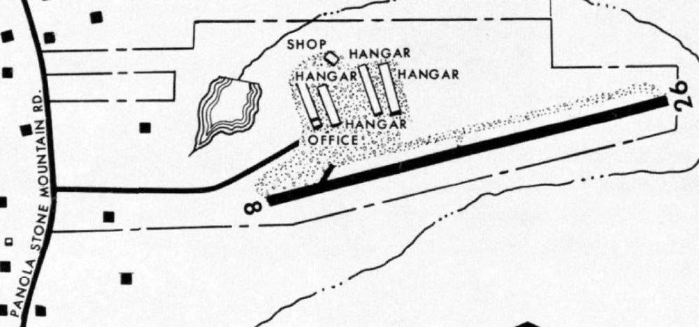
The 1966 “Atlanta Metropolitan Region Comprehensive Plan” (courtesy of David Henderson)
depicted Gunn Air Field as having a single Runway 8/26, with an office, shop, and hangars on the north side.
The 1966 “Atlanta Metropolitan Region Comprehensive Plan” (courtesy of David Henderson)
described Gunn as the “Second busiest of the privately-owned general aviation fields in the region.
The field is accessible via Panola-Stone Mountain Road, a regional thoroughfare, approximately 1.5 miles north of its interchange with Interstate highway 20.
DeKalb County's suburban growth has spread farther to the north & east,
and intensive subdivision development has not yet reached the vicinity of the field.
However, the 60-acre site is insufficient. The airport is handling as many aircraft as can be accommodated, and cannot be expanded.
The single paved runway is 2,130' long & 30' wide, and is equipped with low intensity lights.
Its grade is pronounced & runs downward to the east, with an overall difference in elevation of approximately 51'.
Because the approaches are extremely restricted by trees near the ends of the runway, lights are operated only on call for pilots who are familiar with the airport.
The field is normally attended during daylight hours.
There are underground storage tanks for 4,000 gallons of aviation gasoline.”
The 1966 “Atlanta Metropolitan Region Comprehensive Plan” (courtesy of David Henderson) continued,
“Other facilities & services for general aviation aircraft & pilots include:
Major & minor repair of power plant, airframe, Aircraft services: washing, waxing,
Aircraft storage: T-hangar - 37 spaces, Tie-down - 40 spaces,
Aircraft for rental & sight-seeing use, Sale of new & used aircraft & accessories,
Sale of used instruments & radios, Ground school & flight instruction for all ratings except glider & helicopter flying: Instructors 2, Aircraft 7.”
Tom Abarr recalled, “I began hanging out at Gunn Field around 1967.”
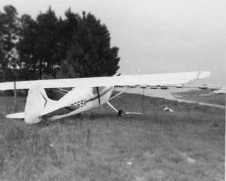
An August 1969 photo by Tom Abarr of a Cessna “170 that has been ripped from its tiedown,
blown across the driveway, and is resting against the fence abutting George Gunn's back pasture Gunn Field.”
This was from a tornado that hit Gunn Field.
Tom Abarr recalled, “About 1970, Mr. Gunn leased the airport to Johnny Allison (not the race car driver),
who subsequently sub-leased to Harold Dean.
Mr. Dean ran Dean Aviation, Inc., a flight school that was FAA & VA approved.
The school provided flight instruction from primary to advanced
using a fleet of C150's, C172's, a C182, Mooney Executive, and a Beech B95 Travelair.
I started working for Mr. Dean in 1970 as counter clerk, fuel jockey,
floor sweeper, etc., and soloed in 1971 at age 16.”
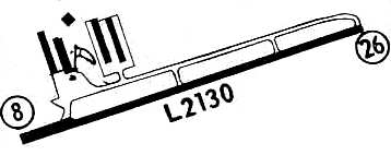
A 1971 airfield directory (courtesy of Chris Kennedy) described Gunn as having a parallel taxiway on the north side of the runway,
leading to a ramp area with four rows of t-hangars.
The remarks said, "Due to obstructions in approach, landings are limited to pilots familiar with airport."
In the words of Chris Kennedy, "I got a kick out of the comment about limited landings. I wonder how you get familiar with an airport without landing there?"
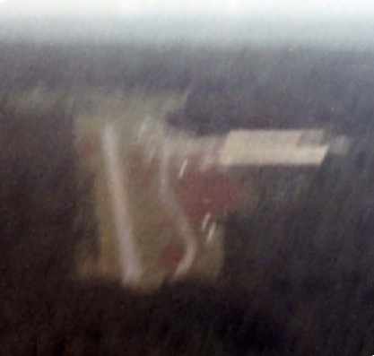
A circa 1971 aerial photo by Tom Abarr, “that I took as I turned final for Runway 26 in a Cessna 150.
You can see the taxiway & T-hangars just to the north of the runway.
Trees were very close to the approach end of Runway 26, which had an uphill slope.
Taking off on Runway 9 could be an adventure, downhill aiming for the trees,
but not as much of one as taking off from Runway 26 on a hot day; uphill all the way!
We did not fill fuel tanks during the summer & paid close attention to density altitude & gross weights.”
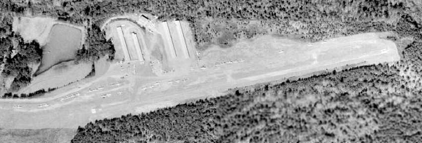
The last photo which has been located of Gunn Airfield was a 1972 aerial view.
It depicted an amazing number of aircraft at such a small airport – a total of at least 43 light aircraft.
Tom Abarr recalled, “The flight school stayed quite busy with returning Vietnam War vets.
George Gunn took the field back from Allison around 1974, ran everybody off & sold the property. He retired to Florida.”
Jon Berndsen recalled, “In the early 1970s Gunn Field was closed & my glider club, Mid Georgia Soaring Association,
bought the large 50x50 hangar that was there (depicted on the north end of airport in the diagram),
dismantled it, and re-erected it at the Monroe (GA) Airport.”
Fred Bieser recalled, "I remember watching the runway being dug up to make way for the subdivsion."
Gunn Airfield was no longer depicted on the October 1978 Atlanta Sectional Chart (courtesy of Jonathan Westerling).
A 1978 aerial view showed that all of Gunn's hangars & other airport buildings had been removed.
It appeared as if the runway pavement had been removed as well, but the property was otherwise not yet redeveloped.
Moser recalled, “Gunn Airfield... I used to live near this airfield from about 1978-81, when the area was first being developed for subdivisions.
I recall seeing the airfield on an older topo map in either the summer of 1979 or 1980.
Curious, I found the entrance to the airfield, which was relatively overgrown & abandoned, and I raced my motorcycle up & down the runway.
I don't recall there being any buildings (hangars) around at all, just the runway.
A police officer one time pulled in to see what I was up to, but didn't mind that I was running up & down it.
I recall that the runway surface was poor, but obviously not bad enough for me to have a little fun.”
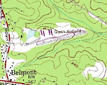
"Gunn Airfield" was still depicted on the 1983 USGS topo map.
Note that the depiction of the 4 hangars was erroneous, as photos showed they had all been removed since at least 1978.
A 1/25/93 aerial photo showed that the site of the former airport had been completely redeveloped with housing.
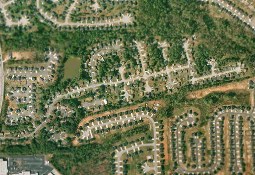
As can be seen in the 2005 USGS aerial photo,
the site of the former airport had been completely redeveloped with housing.
Jon Berndsen reported in 2005, “That old hangar is still being used by MGSA to this day [at the Monroe Airport] to house its fleet of sailplanes.
So, a little piece of Gunn Field lives on today.”
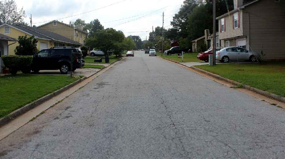
An 8/4/12 photo by Graham Watkins of the site of Gunn Field, “looking west from the location of the taxiway.
The bumps & hills are still there & the trees at the end have grown up even taller by now.”
John Towler reported in 2015, “Now the old runway is a part of a large subdivision. I go & drive down this street often. My wife thinks I am crazy.”
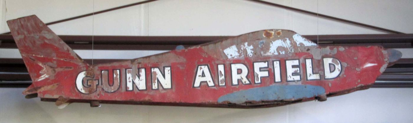
A 2016 photo by Robert Brown of a vintage sign for Gunn Airfield,
which Robert noted, “is reported to be in a secure location from whence it will emerge on the day
when developers begin tearing down shopping centers & subdivisions to make room for general aviation airports.”
The site of Gunn Field is located northeast of the intersection of Covington Highway & Panola Road.
____________________________________________________
City-County Airport / Carrollton Municipal Airport, Carrollton, GA
33.597, -85.047 (Southwest of Atlanta, GA)
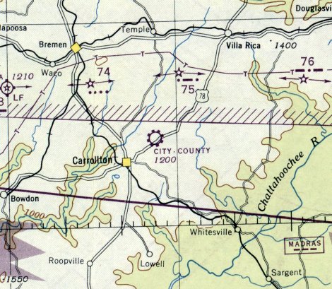
City-County Airport, as depicted on the April 1946 Birmngham Sectional Chart.
This general aviation airport was apparently built at some point between 1945-46,
as it was not yet depicted on the April 1945 Birmingham Sectional Chart.
The earliest depiction of City-County Airport which has been located was on the April 1946 Birmingham Sectional Chart
It depicted City-County as a commerical/municipal airport.
City-County Airport was evidently renamed Carrollton Airport at some point between 1946-48,
as that is how it was labeled on the October 1948 Birmingham Sectional Chart.
The August 1954 Birmingham Sectional Chart (courtesy of Chris Kennedy) depicted Carrollton as having a 2,300' unpaved runway.
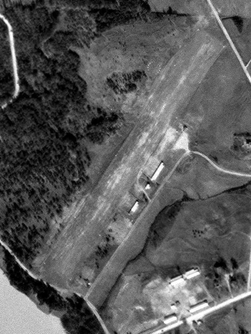
The earliest photo of Carrollton Municipal Airport which has been located was a 1/20/55 USGS aerial view (courtesy of David Henderson).
It depicted Carrollton as having a single unpaved northeast/southwest runway, with 3 small hangars along the southeast side.
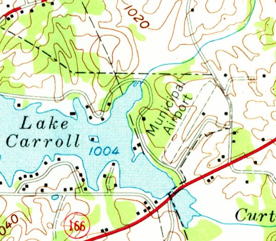
The 1958 USGS topo map depicted Carrollton as having a northeast/southwest unpaved runway.
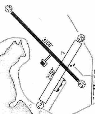
Carrollton Airport apparently gained a paved runway at some point between 1958-60,
as the 1960 Jeppesen Airway Manual (courtesy of Chris Kennedy)
depicted the field as having a 3,100' paved Runway 13/31 & a 2,300 unpaved Runway 2/20.
A taxiway led to a hangar on the west side of Runway 13/31, and a ramp just south of the runway intersection had a few small hangars.
The 1961 Great Smoky Mountains World Aeronautical Chart (courtesy of Chris Kennedy) depicted Carrollton Airport as having a 3,100' hard-surface runway.
The 1962 AOPA Airport Directory described Carrollton as having a 3,100' asphalt Runway 14/32 & a 2,300' sod Runway 3/21.
The operator was listed as Carroll Flying Service.
Kenneth Husby recalled, “The old airport in Carrollton... where I grow up at. My parents ran the airport from 1965.
We use to live in a trailer house that was beside the operations building.
I was able to meet many politicians while my parents operated the airport.
I met Jimmy Carter there when he was a Representative for Georgia;
he had flown in to go to a Jaycee's meeting with a lawyer friend that lived in Carrollton.
My mother became known as one of the few women to operate an airport when they first took over operating the airport,
because at first my father stayed employed as a mechanic with Delta.”
Tony Garrett recalled, “I flew out of the Carrollton Airport from 9/20/66-9/18/67 when I got my Private Pilot license.
Bob Husby was my instructor & managed the airport.
It was a beautiful sight flying left downwind over Lake Carroll for Runway 30.”
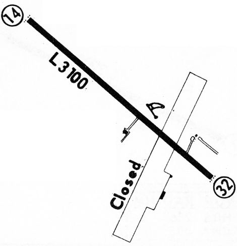
The 1968 Flight Guide (courtesy of Robert Levittan) depicted Carrollton Municipal Airport
as having a 3,100' paved Runway 14/32 & a closed unpaved crosswind runway.
Three small buildings were depicted around the periphery of the field.
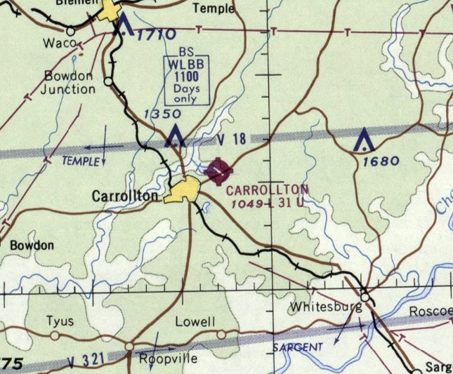
The last aeronautical chart depiction which has been located of Carrollton Airport was on the 1963 Birmingham Sectional Chart.
It depicted Carrollton Airport as having a northwest/southeast 3,100' paved runway.
Kenneth Husby recalled, “My parents ran the airport until it was closed when West Georgia Regional Airport opened up in 1969.
The old airport was closed because of the increased concerns of the residents around Lake Carroll
about the air traffic that was coming in & the airport authority wanting to get it moved to a more rural area.”
Carrollton Airport was still depicted on the 1970 USGS topo map,
and was still listed as an active airfield in the 1971 Flight Guide (according to Chris Kennedy).
Carrollton Municipal Airport was apparently closed at some point between 1971-72,
after it was replaced by the new West Georgia Regional Airport, a few miles west.
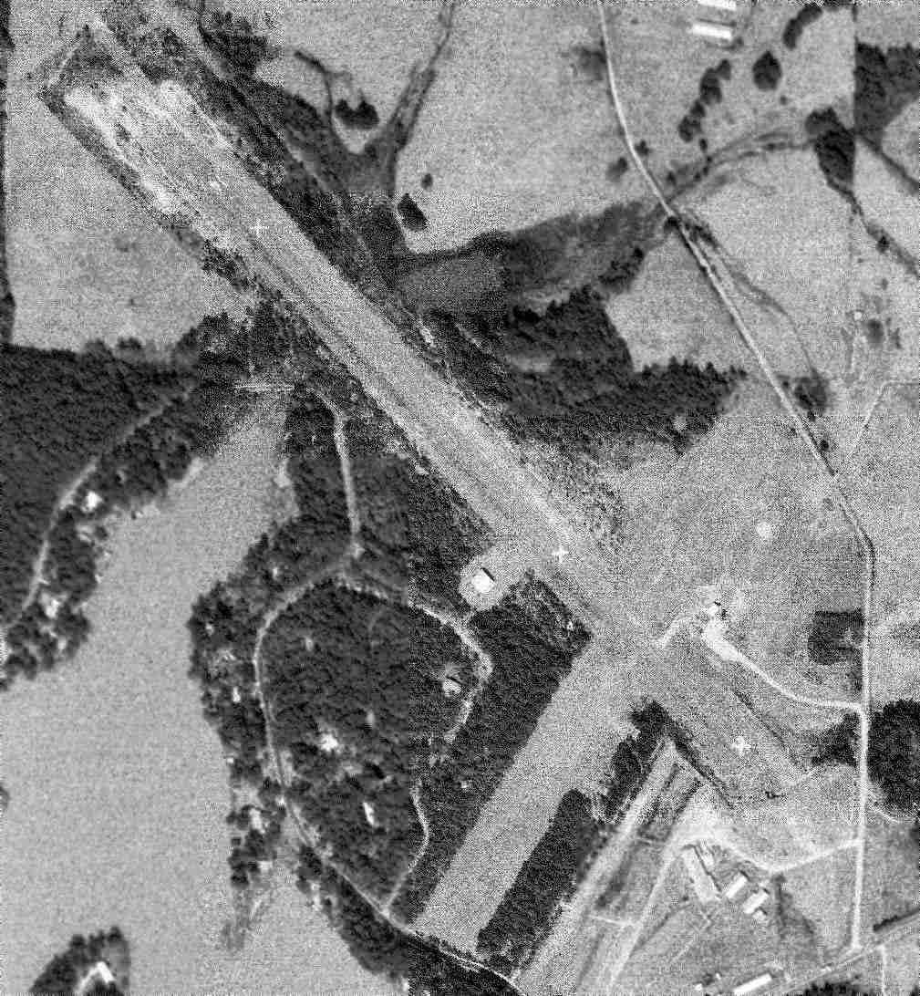
A 2/10/72 USGS aerial view (courtesy of David Henderson) depicted Carrollton shortly after its closure, with closed-runway “X” symbols painted along Runway 13/31.
Carrollton Municipal Airport was depicted as an abandoned airfield on the October 1975 Atlanta Sectional Chart (courtesy of Chris Kennedy).
According to Mike Carpenter (who has lived in Carrollton since 1967), the building west of the runway is a hangar once owned by Southwire,
since it had the name of that company written all over it.
The terminal was located just north of the southeast end of the runway, up until the late 1970s when it was serving as a driving range shop.
After the ballfields were built the terminal was torn down, in the 1980s.
The buildings adjacent to the southeast runway end are modern buildings not related to the airfield.
There was up to the late 1980s a small control tower located west of the runway midpoint.
It was used in the 1980s for a truck driver training facility.
The property adjacent to the south side of the airport was previously a fairgrounds, but it is now occupied by a shopping mall.
The 1982 USGS topo map depicted the paved northwest/southeast runway & unpaved northeast/southwest runway, labeled “Airport (Abandoned)”.
In a 1/27/93 aerial photo, the areas of the 2 runways were still cleared, although most of the pavement of Runway 14/32 had been removed.
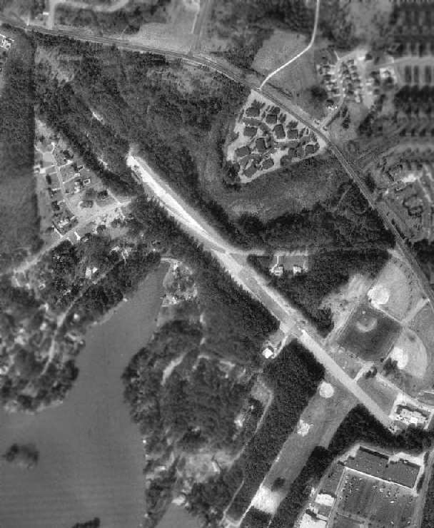
In the 1998 USGS aerial photo, the areas of the 2 runways were still cleared,
although most of the pavement of Runway 14/32 had been removed.
The airport was no longer depicted at all (even as an abandoned airfield) on the 2002 aeronautical charts.
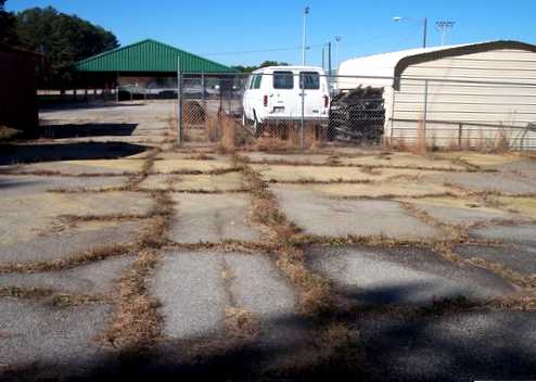
A 2006 photo by Graham Watkins at the site of Carrollton Municipal Airport, showing “the yellow X over the old runway, facing northwest.”
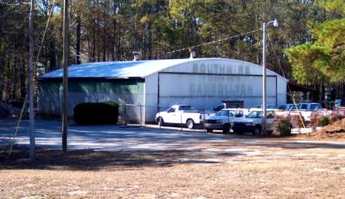
A 2006 photo by Graham Watkins at the site of Carrollton Municipal Airport, “of the old hangar, now a city building.”
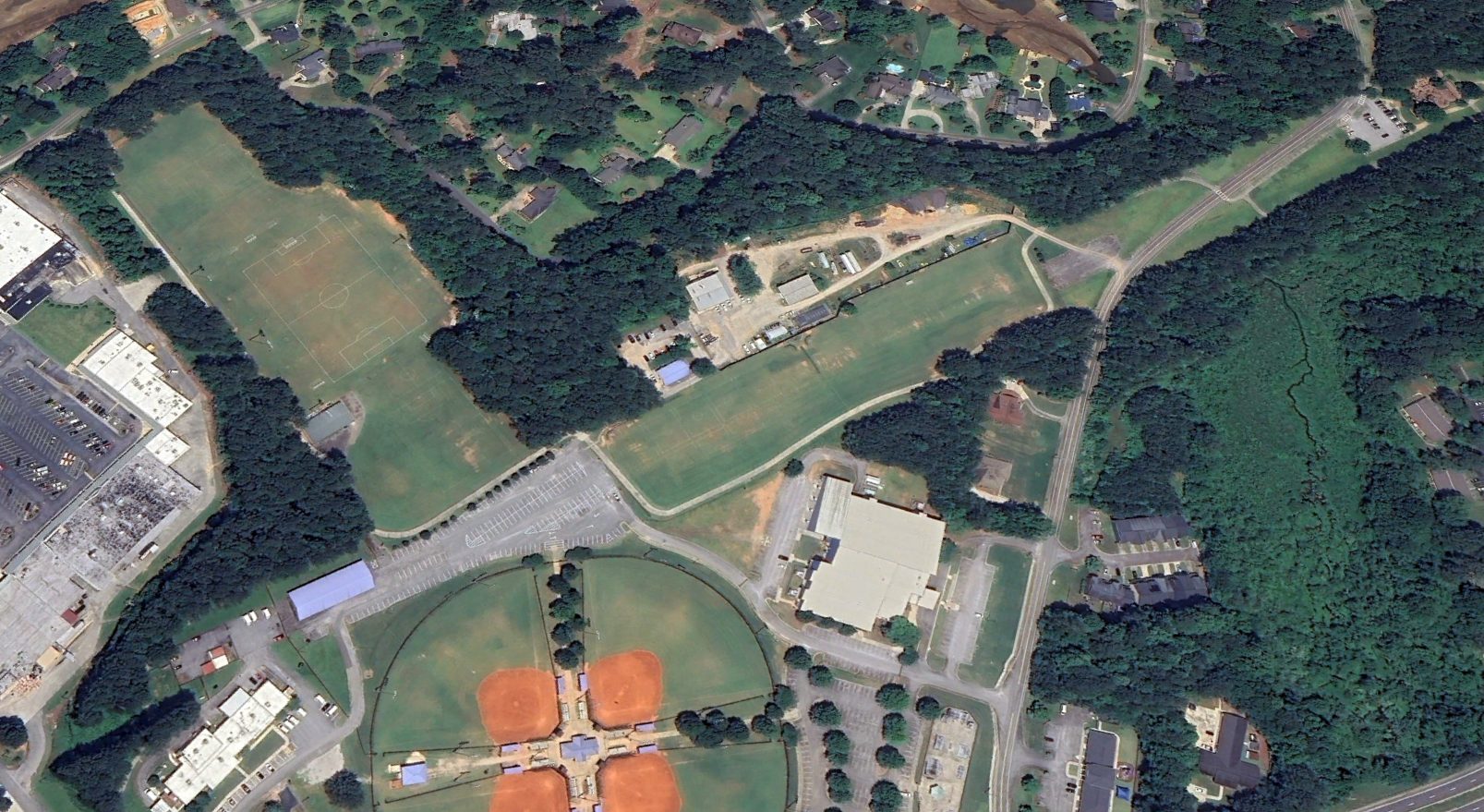
A 2023 aerial view looking west showed the 2 former Carrollton Municipal Airport runways to remain recognizable, and the former hangar still remained standing (center of photo).
The site of Carrollton Municipal Airport is located northwest of the intersection of Route 166 & Airport Road (appropriately enough), adjacent to the fairgrounds to the south.
Thanks to Lee Parmeter for pointing out this field.
____________________________________________________
Morris Army Airfield (AGD), Forest Park, GA
33.623, -84.34 (Southeast of Atlanta, GA)
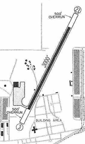
Morris AAF, as depicted in the 1959 Jeppesen Airway Manual (courtesy of Chris Kennedy)..
This military airfield was located on the property of Fort Gillem, also known as the Atlanta General Depot.
The Depot was built in 1941, and specialized in repairing equipment for the Engineer & Ordnance Corps.
It also expanded into aircraft maintenance in the post-WW2 era.
No airfield at this location was yet depicted on a 1955 aerial photo.
According to Thomas Houston, the airfield at Morris AAF originally was a grass strip.
He worked on the construction of the paved runway at Morris AAF in 1958.
"At the time the airfield was built, the Atlanta General Depot was an aircraft rework & maintenance facility for all Army Aircraft in Third U. S. Army.
The fixed-wing aircraft that were stationed at the field & were transitory there
were the Cessna O-1 Birddog, the deHavilland U-1 Otter, the deHavilland U-6 Beaver,
the deHavilland CV-7 Carribou, and the Beech U-8 Seminole.
The rotary wing aircraft that were there were the Hiller OH-23, the Bell H-13,
the Piasacki CH-21, the Sikorsky CH-25, CH-37, and CH-41."
Houston continued, “As I recall it was a very short strip.
A Bird Dog (Cessna O-1) could get in & out OK but Seminole was very tricky.
Of Course the Otter & the Beaver could get in & out easily. I don't know when the grass strip was built.
It was less than 2,000' long , and the Southern Railroad telegraph wires were across the South end.
The new strip made life a lot easier for the Army Aviator of that day!
One incident I remember, was that they had to go to Fort Benning to pick up a 1957 Chevrolet sedan with a Mohave helicopter.
They had hauled 1956 Chevrolets in them before but not a 1957.
The Airfield Ops Officer Major asked to borrow my Government 1957 Chevy sedan
to try to load to be sure that the nose doors would close on the helicopter,
before they made the trip to Benning. It worked with 2 inches to spare.”
According to the New Georgia Encyclopedia, Morris AAF was dedicated on 9/22/59.
Inexplicably, Morris AAF was still not yet depicted on the 1959 Atlanta Local Aeronautical Chart.
The 1959 Jeppesen Airway Manual (courtesy of Chris Kennedy)
depicted Morris AAF as having a single 3,000' paved Runway 3/21,
with a taxiway leading to a ramp on the southwest side with a single building (a hangar?).
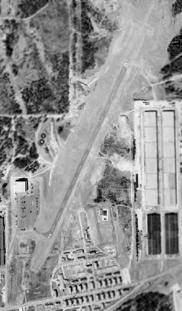
A 1960 USDA aerial photo (courtesy of David Henderson) depicted Morris AAF as having a single paved Runway 2/20,
with a hangar on the west side of the field.
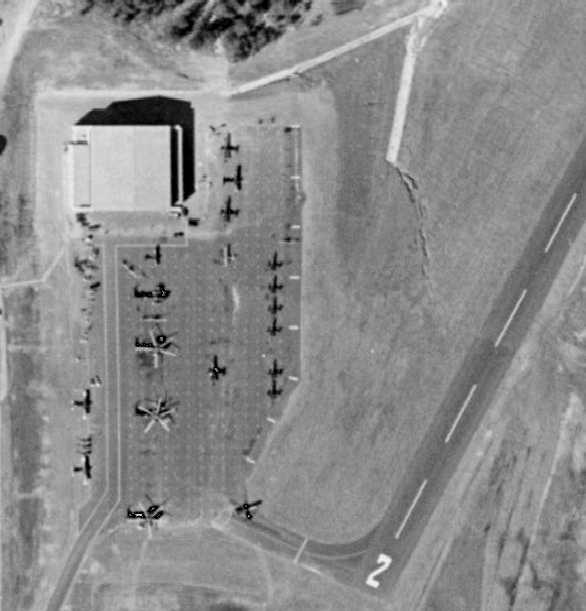
A closeup of the 1960 aerial view depicted a total of 17 aircraft on the ramp at Morris AAF,
including 3 large Sikorsky CH-37 Mojave helicopters.
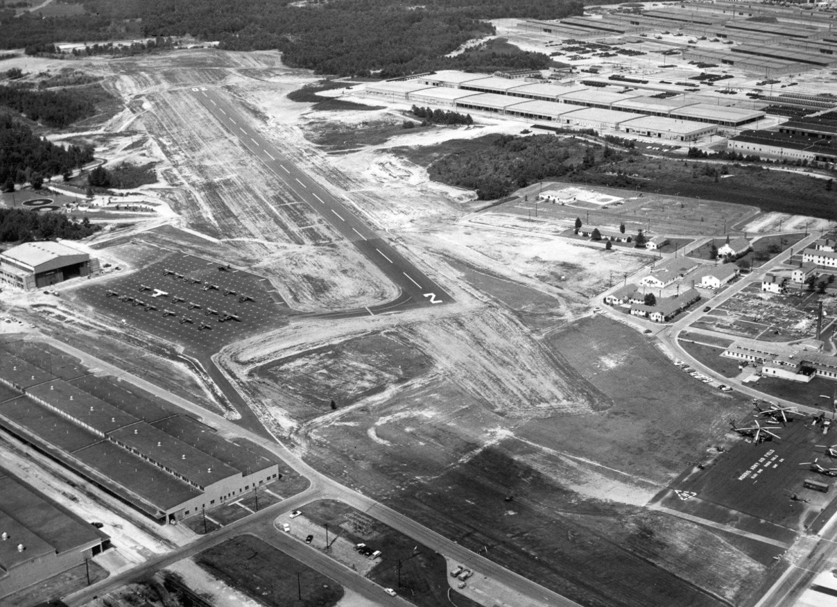
An early 1960s aerial view looking northeast at Morris AAF,
depicted 4 helicopters on the southern ramp (bottom-right) & 21 fixed-wing aircraft on the ramp next to the hangar.
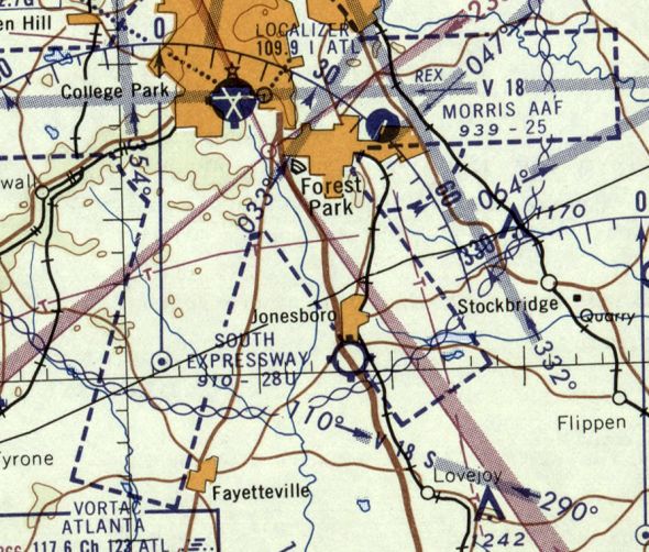
The earliest aeronautical chart depiction which has been located of Morris AAF
was on the February 1960 Birmingham Sectional Chart.
It depicted Morris as having a single 2,500' paved northeast/southwest runway.
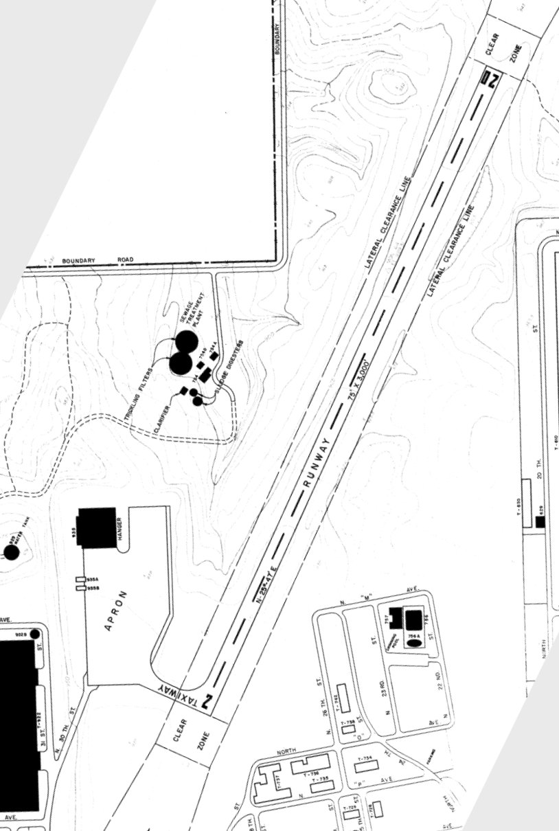
A 9/15/66 Army map (courtesy of Ron Plante) depicted Morris AAF as having a 3,500' runway plus an apron with a hangar & 2 smaller structures."
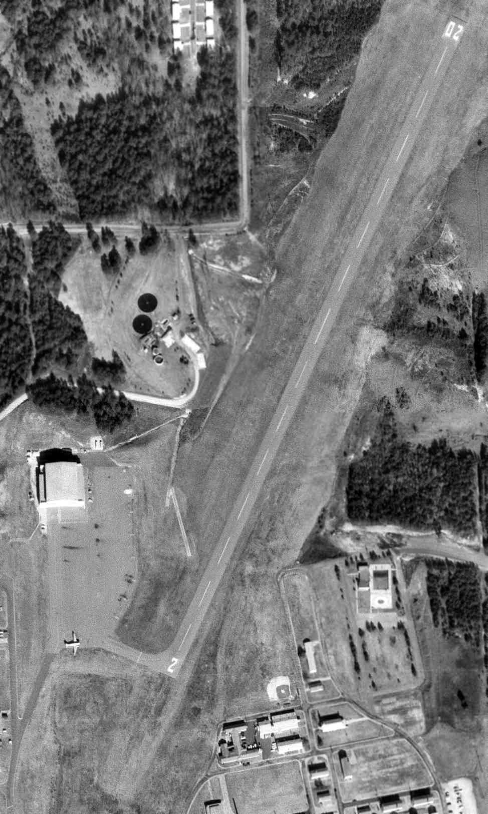
A 1968 USGS aerial view of Morris AAF (courtesy of David Henderson) showed a single C-47 on the ramp.
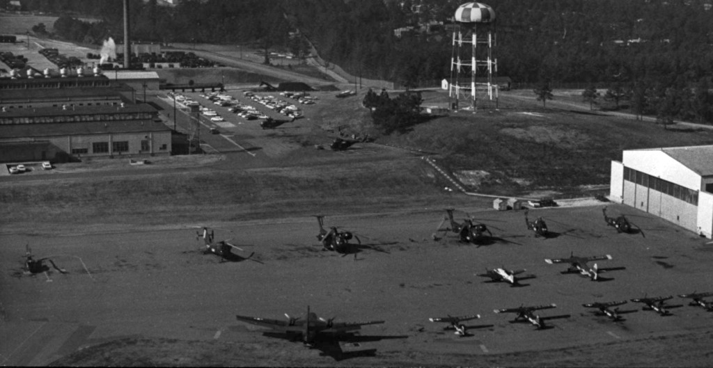
A 12/17/68 aerial view looking west at the ramp of the Atlanta Army Depot's Air Maintenance Division (courtesy of David Henderson),
showing 14 fixed-wing aircraft & helicopters (including 2 large CH-37 Mojaves).
The original caption read, “Aerial View of Air Maintenance Division where 10 of 18 different types of Army planes await attention of personnel.
Planes of the National Guard & Reserve of this region as well as those of Puerto Rican National Guard serviced here.”
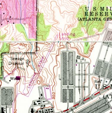
The 1968 USGS topo map depicted Morris AAF as a northeast/southwest runway labeled simply as “Landing Strip”.
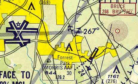
Morris AAF was depicted as an active airfield on the 1971 Sectional Chart (courtesy of Robert Brown),
which described the field as having a single 3,000' paved runway.
A 1972 aerial photo showed 11 aircraft & 3 fixed-wing aircraft on the Morris AAF ramp.
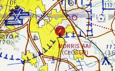
Morris AAF was evidently closed at some point between 1972-74, as it was labeled "Closed" on the April 1974 Atlanta Sectional Chart (courtesy of Chris Kennedy).
The closure of this airfield was no doubt ensured by its location,
a mere 4 miles east of what has become one of the world's busiest airports, Atlanta's Hartsfield International.
Thomas Houston said, "After the airfield was closed, they used the runways to store mobilization trailers.
There were inklings that FAA didn't want the airfield there before we finished it. The mission was moved to Lawson Field at Fort Benning."
Morris AAF was still depicted but labeled "Closed" on the 1978 Atlanta Sectional Chart (courtesy of David Henderson).
Edward Shelton recalled, “Back in 1987, I was involved in a major furniture installation project at Ft. McPherson.
The product had to be shipped to & stored at Ft. Gillem in Forest Park, just to the east of Hartsfield.
I was there every day for several weeks. As you entered the base, you could see the airfield on the left.
It was obvious it was no longer in use as there were several trailers & other equipment parked either on the strip or right next to it.
I came to find out later through a friend of mine that did some contract work for FEMA,
that these were trailers used for temporary shelter during national emergencies during floods, hurricanes, tornadoes, etc.
They were old trailers refitted & stored on the airstrip until needed.
Hartsfield Airport underwent a transformation in 1980 which relocated its star-type runways crossing diagonally, to 4 parallel runways running east/west.
This put the Morris AAF right in the landing pattern for air traffic into Hartsfield.
You could stand & watch an almost endless parade of commercial jets fly low over Ft. Gillem in 2 lines, 4-5 planes deep when they landed to the west.”
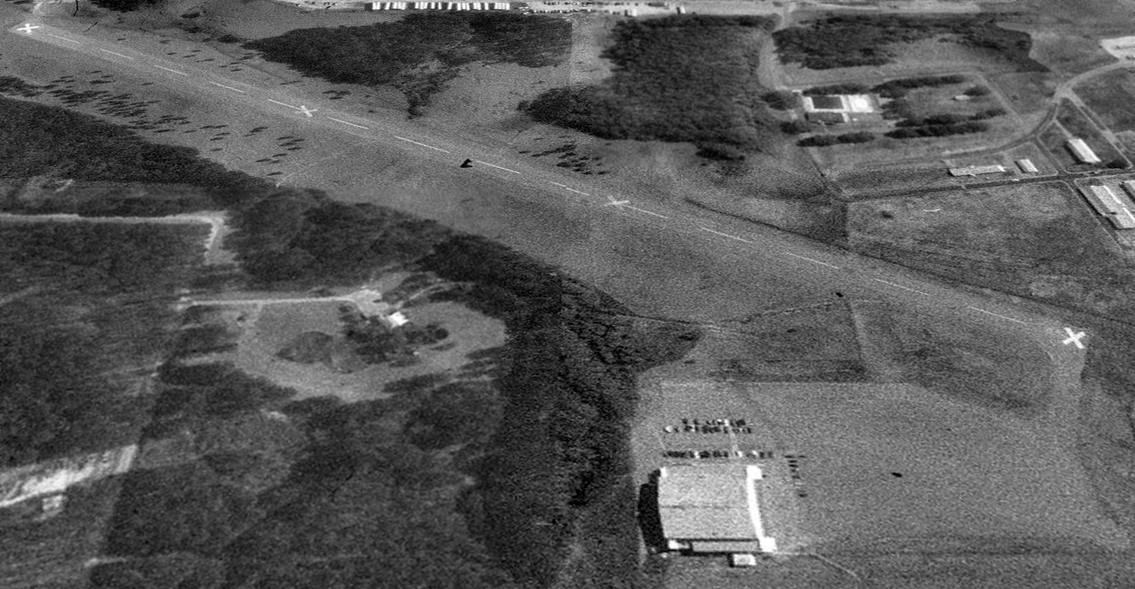
A 1993 USGS aerial view looking east showed Morris AAF remained intact, though the runway was marked with closed “X” symbols.
The 1995 USGS topo map depicted the runway, ramp, and hangar, labeled “Landing Strip (Abandoned)”.
A 2002 aerial view showed that the Morris AAF hangar had been removed at some point between 1995-2002.

A 2004 photo by Chris Ness looking southwest at Morris AAF, showing the runway & ramp remained intact.
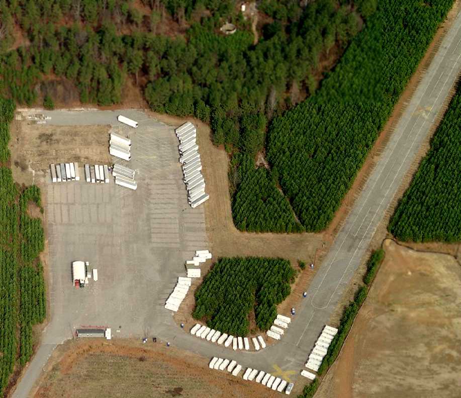
A circa 2007 aerial view looking north at the closed runway at Morris AAF, the ramp, and the foundation of the hangar.
Brian Fasano reported in 2005, “I flew over it last week, and it was full of RVs & campers.”
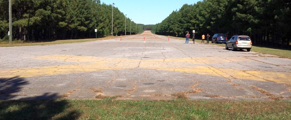
A 11/3/14 photo by Ron Plante looking along the closed runway at Morris AAF.
Ron reported, “Although Ft. Gillem was closed under BRAC, a small area remains under Army control as the Gillem Enclave with a mix of active duty & reserve component units.
The airstrip is inside this area, and a military ID is required to enter the post. After a few wrong turns, I found the ramp & then the runway.
The yellow 'X' & '2' markings are still visible, and the runway has been converted into a Physical Training / running area for the soldiers.”
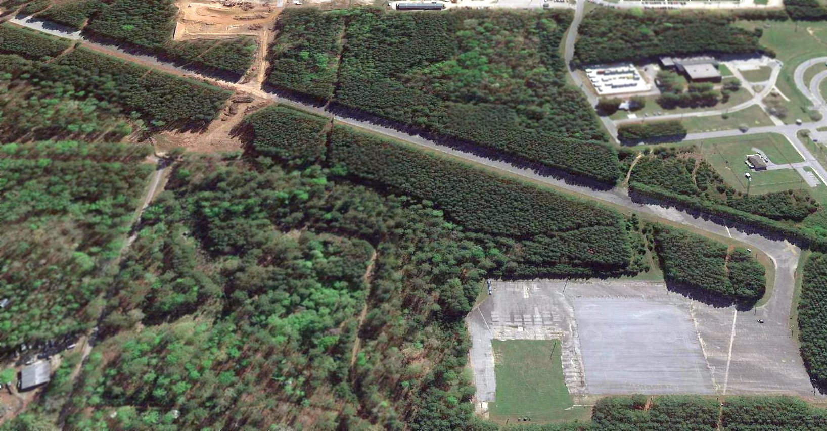
A 2017 aerial view looking east showed Morris AAF's runway & ramp remained intact, with the hangar foundation in the foreground.
A 2025 aerial view showed a large Convenant Logistics warehouse had been constructed at some point between 2017-2025 over the northern portion of the former Morris AAF runway.
____________________________________________________
Or if you prefer to contact me directly concerning a contribution (for a mailing address to send a check),
please contact me at: paulandterryfreeman@gmail.com
If you enjoy this web site, please support it with a financial contribution.
____________________________________________________
This site covers airfields in all 50 states.