Abandoned & Little-Known Airfields:
Texas, Northeastern Houston area
© 2002, © 2024 by Paul Freeman. Revised 11/11/24.
This site covers airfields in all 50 states: Click here for the site's main menu.
____________________________________________________
Please consider a financial contribution to support the continued growth & operation of this site.
Evadale Airfield / Ben Bruce Memorial Airpark (revised 11/11/24) - Humble Airport (revised 6/18/16) - Piney Woods Airport (revised 11/11/24) - Williams Airport / North Houston Airport (revised 11/11/24)
____________________________________________________
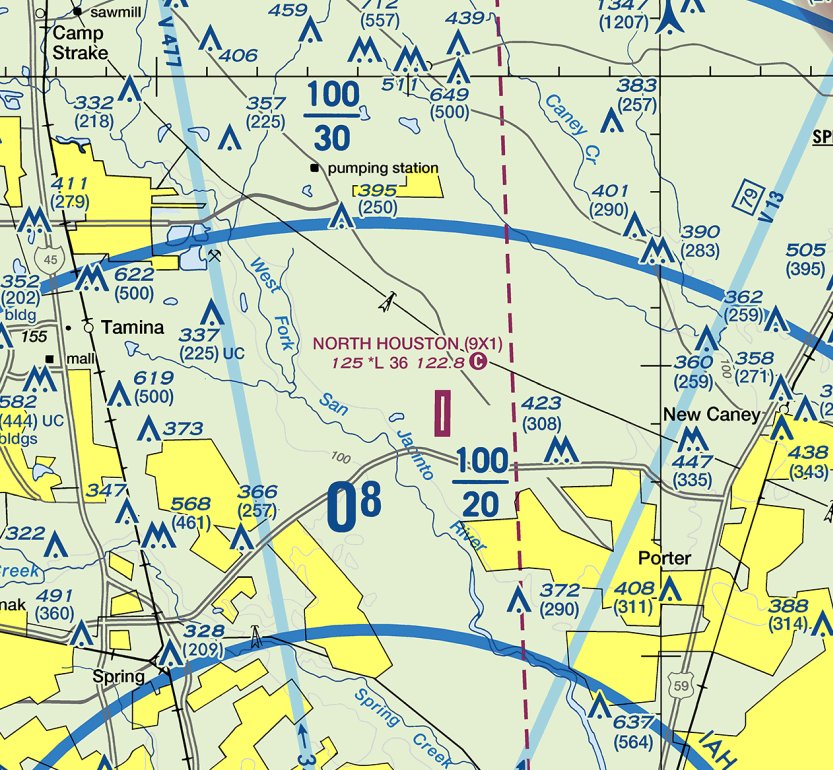
Williams Airport / North Houston Airport (9X1), Houston, TX
30.153,-95.322 (Northeast of Houston Intercontinental Airport, TX)
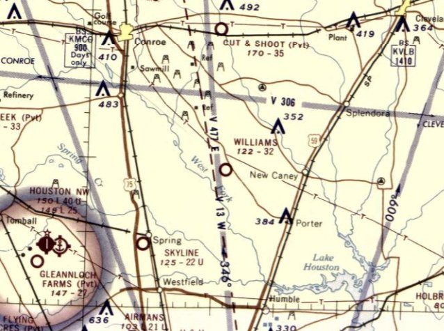
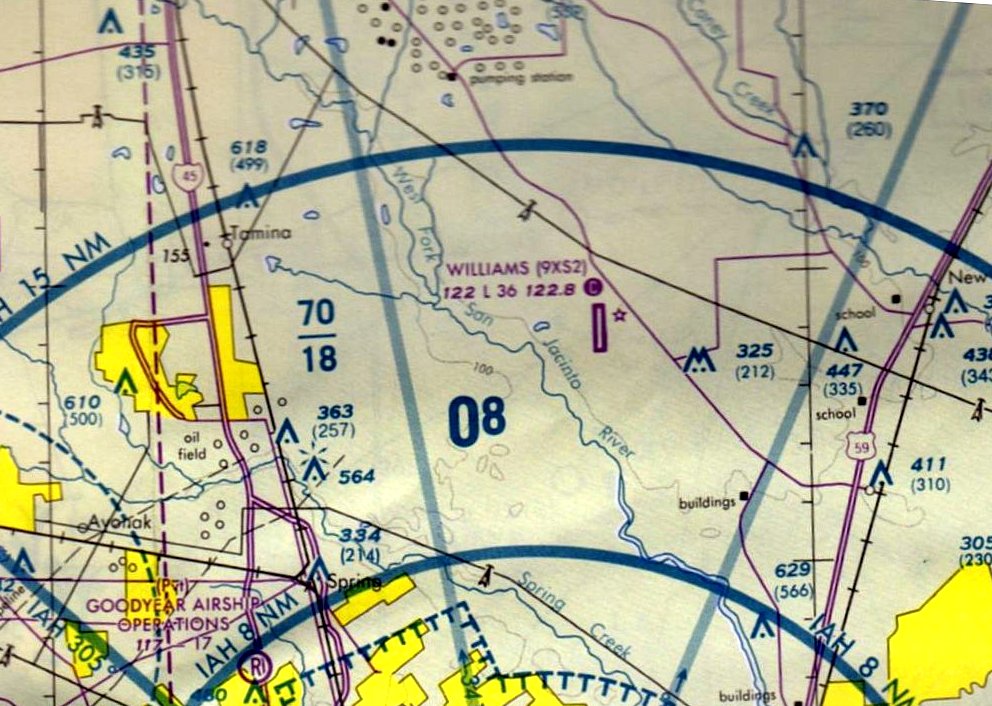
Williams Airport, as depicted on the March 1967 Beaumont Sectional Chart.
This small general aviation airport was evidently established at some point between 1966-67,
as it was not yet depicted on a 1958 aerial photo or the 1966 Beaumont Sectional Chart.
The earliest depiction which has been located of Williams Airport was on the March 1967 Beaumont Sectional Chart.
It depicted Williams as having a 3,200' unpaved runway.
Williams Airport was still depicted on the September 1970 Houston Sectional Chart.
Williams Airport was evidently temporarily closed (for reasons unknown) at some point in the next year,
as it was not depicted at all on the April 1971 Houston Sectional Chart.
According to its FAA Airport/Facility Directory data, Williams Airport was established in July 1971.
According to a Montgomery County Police Reporter article (courtesy of Chris Hulen), “It was sold in 1973 and the grass strip was soon upgraded to a caliche runway.
A pilot there owned an auto repair shop. He would spray the old motor oil on the runway to keep down the dust.
It was soon upgraded to an asphalt runway. It was complete with fuel & a flight school.”
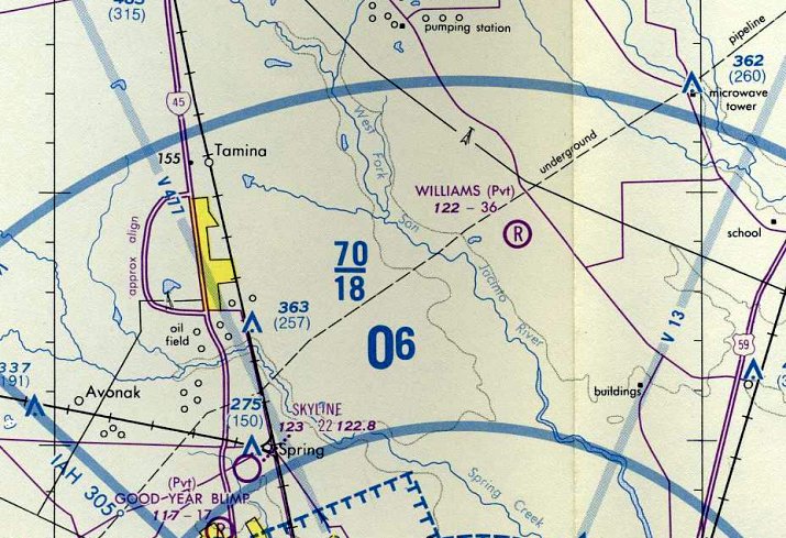
The 1977 Houston Terminal Chart depicted Williams as a private airfield having a 3,600' unpaved runway.
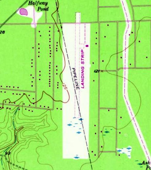
The 1979 USGS topo map depicted Williams Airport as a single north/south unpaved runway, labeled generically as “Landing Strip”, with 1 small building on the northeast side.
The earliest photo which has been located of Williams Airport was a 1982 aerial view.
It depicted Williams as having a single paved north/south runway, with several hangars & dozens of light aircraft on the northeast & east sides.
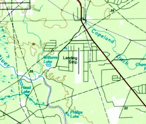
The 1985 USGS topo map depicted Williams Airport as a single north/south runway, labeled generically as “Landing Strip”.
The 1992 Houston Terminal Chart depicted Williams as a public-use airport having a single north/south paved 3,600' runway.

The earliest photo which has been located of Williams Airport was a 1995 aerial view looking southwest.
It depicted Williams as having a single north/south paved runway, with 6 hangars & 2 light single-engine aircraft on the northeast side.
Williams Airport was depicted on the March 2009 Houston Terminal Chart as having a single 3,600' paved north/south runway.
According to a Montgomery County Police Reporter article (courtesy of Chris Hulen), “In 2008 it was sold to Herbert & Mary Jeffries.
Jeffries owned a tower business & saw the need for a local airport. They owned a plane which helped with the decision to have an airport closer to home.
Just after the purchase, [Hurricane] Ike destroyed most of the buildings but soon Jeffries had it back up to speed with several improvements, fencing, fuel pumps, and new hangars.
He also purchased an extra almost 100 acres & cleared the trees.”
The article also mentioned that Jeffries planned to lengthen the runway to 6,000', but that did not come to fruition.
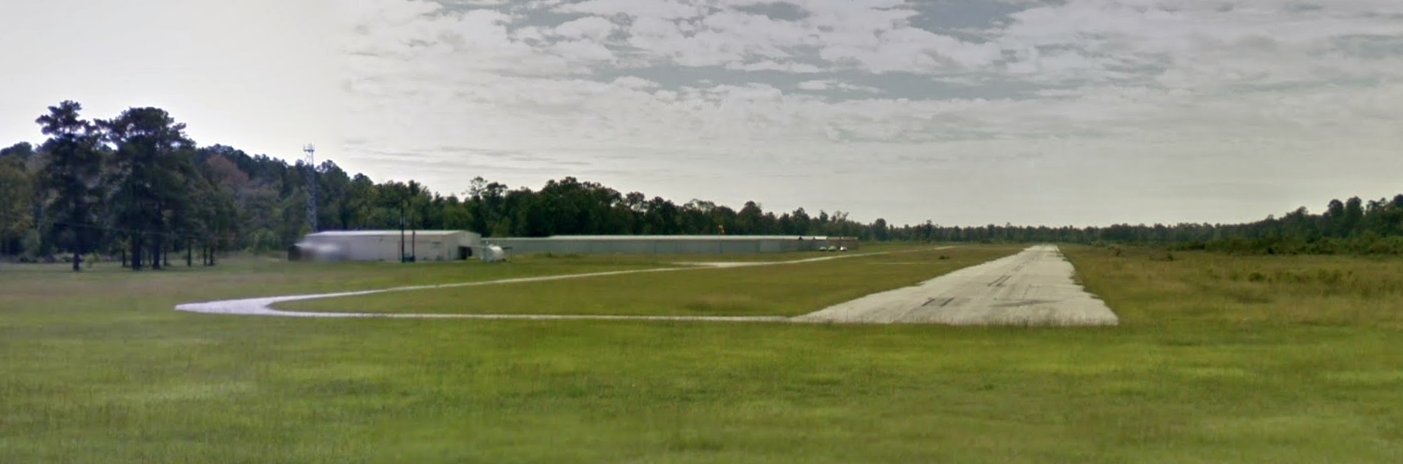
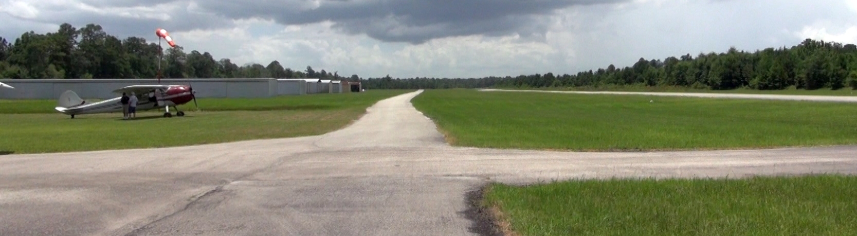
A September 2013 photo looking south along Williams Airport's runway & hangars. No aircraft were visible on the field.
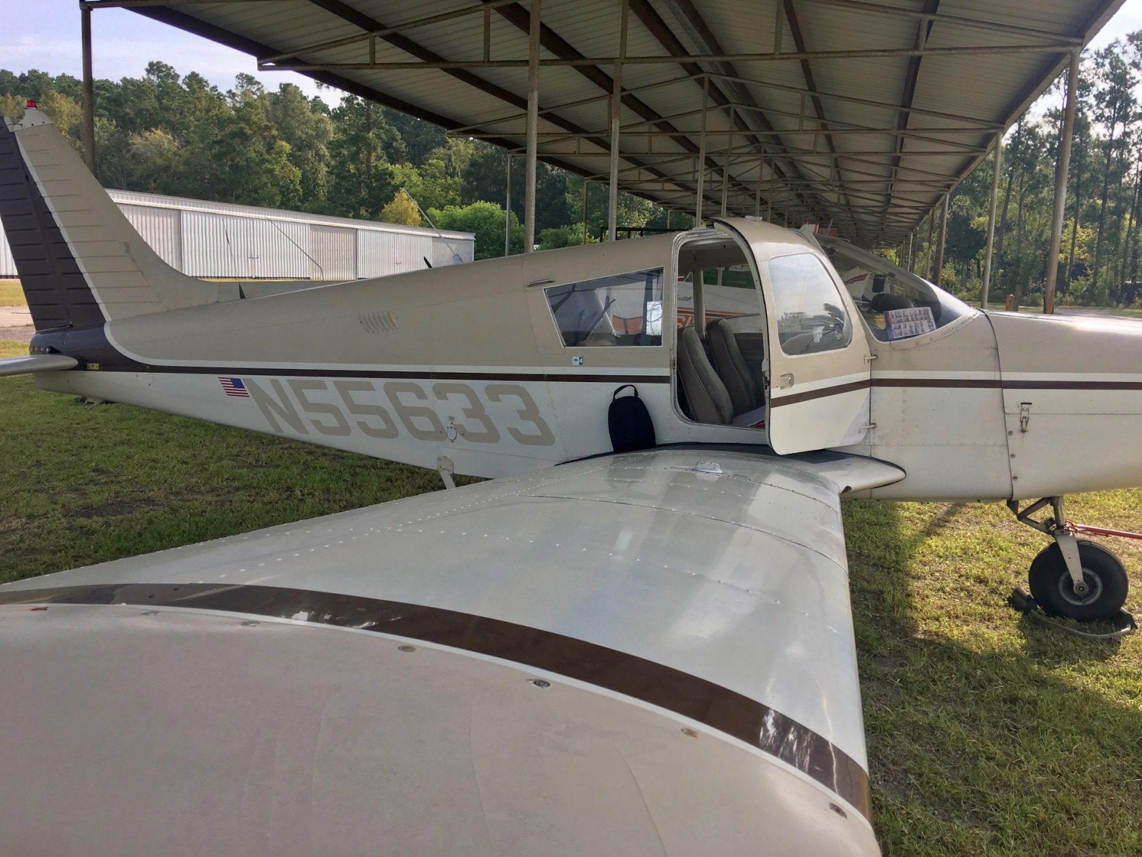
A 9/13/17 photo by Chris Hulen of a Piper under a shade hangar at North Houston Airport.
Chris recalled, “Being based out of the Conroe Airport to the north of the North Houston Airport, I visited this airport only infrequently.
I would take students to the North Houston airport a few times a year, or would go by myself to stay sharp.
Williams was home to many of my friends & their aircraft, and occasionally I would tag along.”
According to a Montgomery County Police Reporter article (courtesy of Chris Hulen), “In 2014 Jeffries sold the airport to a group of investors.”
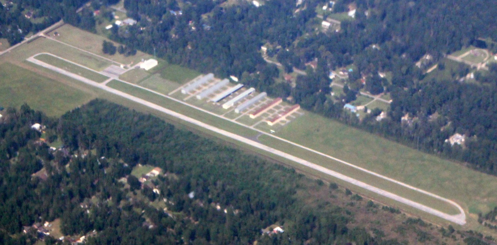
A 9/15/17 aerial view looking northeast at North Houston Airport showed 8 hangars on the northeast side of the paved runway, but just 1 single-engine light aircraft.
Williams Airport was renamed North Houston Airport at some point between 2009-2018,
as that it how it was labeled on the September 2018 Houston Terminal Chart.
According to a Montgomery County Police Reporter article (courtesy of Chris Hulen), “In June of 2019, it was sold to Maple Heights Development.”
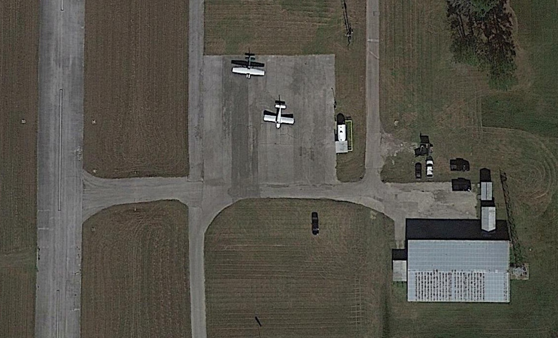
A 2019 aerial view showed 2 light single-engine aircraft on North Houston Airport's northeast ramp.
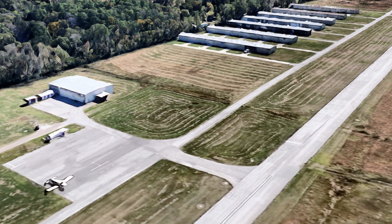
A circa 2020 aerial view 3-D depiction looking southeast at North Houston Airport showed 8 hangars & 1 light single-engine aircraft on the northeast side of the paved runway.
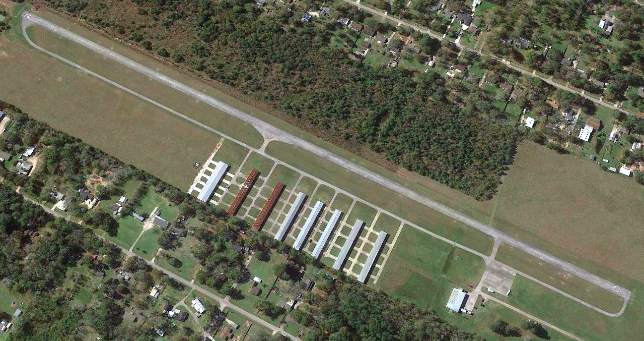
A 2020 aerial view looking southwest at North Houston Airport showed 9 hangars on the northeast side of the paved runway, but the field was devoid of aircraft.
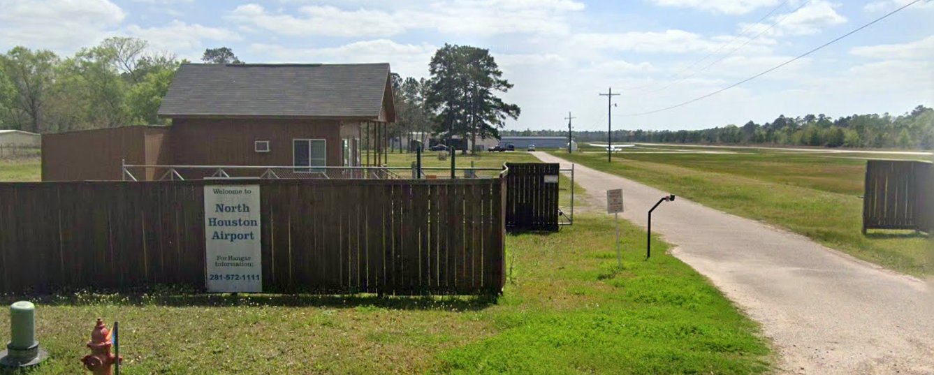
A 2020 photo looking south at North Houston Airport's entrance, showing 1 light single-engine aircraft on the northeast ramp.
For the year ending 4/26/20, the FAA Airport/Facility Directory said North Houston Airport conducted an average of 27 takeoffs or landings per day.
It was said to have a single 3,594' asphalt Runway 17/35, “in poor condition”, to be owned by North Houston Airport Aviation LLC,
managed by William Harkness, and to have 60 single-engine based airplanes.
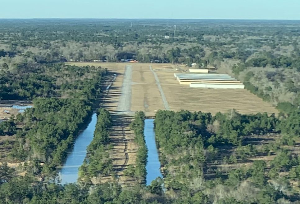
A 1/2/21 aerial view by Scott Koelbel looking north from final approach to North Houston Airport's Runway 35 from his Cessna 170.
Scott observed, “Jeffries intended to extend the runway after purchasing the property south of the runway but never finished it.
He had built up the land by taking dirt from either side of it, which made the two long lakes, but that’s as far as it got.
The woods to the southwest of the runway [were] being cleared for the upcoming development.”
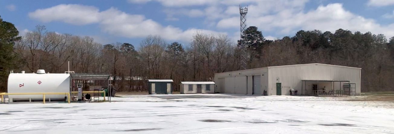
A 2/15/21 photo by Scott Koelbel looking east at North Houston Airport's self-serve fuel tank & main building, after a rare Houston snowfall.
The 2021 Houston Terminal Chart depicted North Houston Airport as having a single north/south paved 3,600' runway.
Chris Hulen reported, “Up until the day the airport closed a fairly busy flight school, Gulf Coast Aero, operated out of North Houston.”
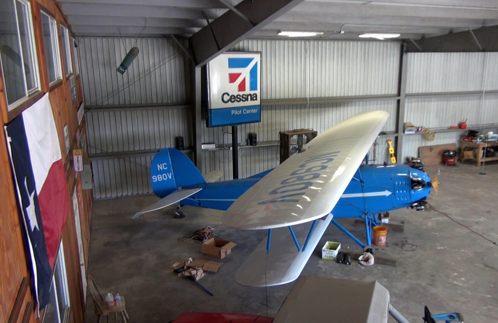
A 2021 photo of a pretty blue biplane (model unidentified) inside a North Houston Airport hangar.
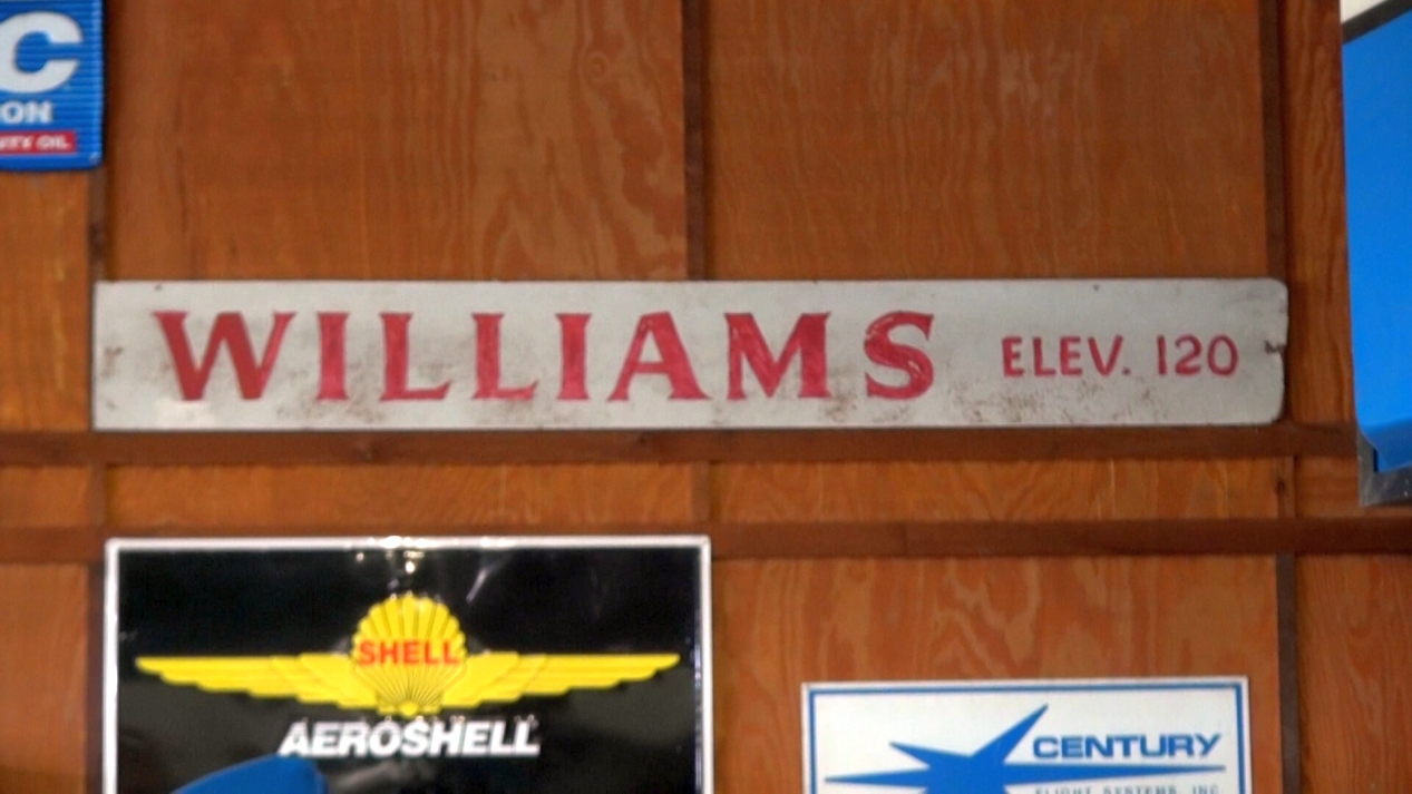
A 2021 photo of a Williams Airport sign inside a North Houston Airport office.
A 2021 photo of a Cessna 195 at North Houston Airport.
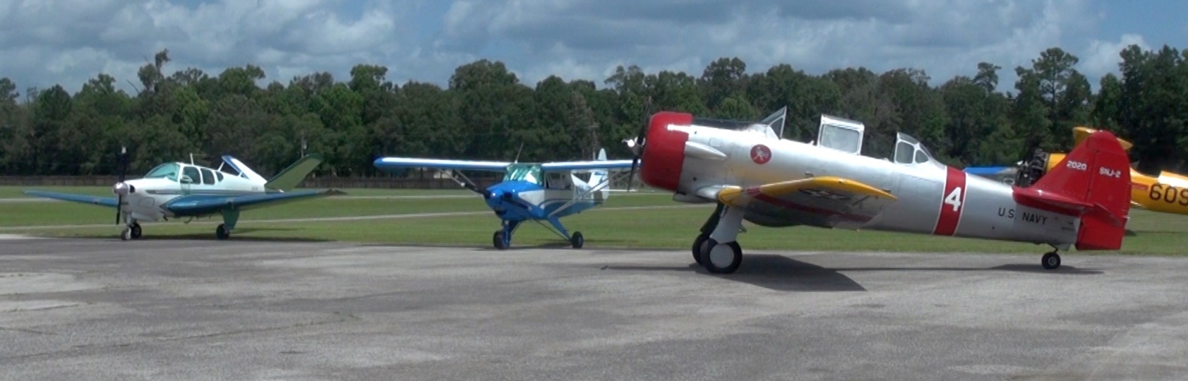
A 2021 photo of Bonanza, Tri-Pacer, North American SNJ-2 Texan, and a Stearman at North Houston Airport.
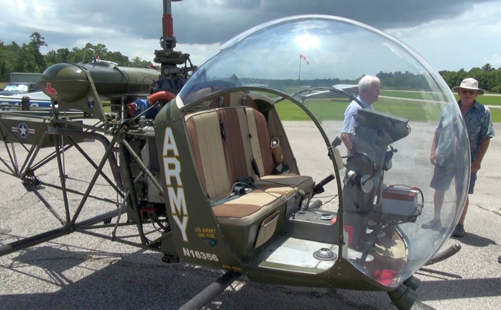
A 2021 photo of a restored Bell OH-13E helicopter at North Houston Airport.
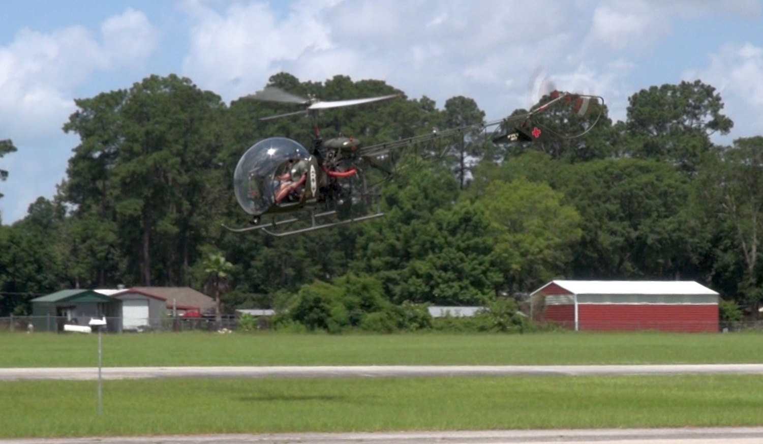
A 2021 photo of a restored Bell OH-13E helicopter flying over North Houston Airport.
According to a 2021 Montgomery County Police Reporter article (courtesy of Chris Hulen), “At midnight Wednesday, the airport officially closed.
Century Development has been clearing land behind the airport for the new Porter Heights Subdivision.
The subdivision will include over 3,000 homes of $300,000 plus. Demolition of the airport is scheduled to start immediately & will be part of the subdivision for home lots.
On 6/26/21, a going-away party of sorts was held complete with music & food.”
A sad 2023 photo looking south at the former North Houston Airport, showing the field devoid of aircraft & the runway marked with a yellow closed-runway “X” symbol.
Thanks to Chris Hulen for pointing out this airfield.
____________________________________________________
Evadale Airfield / Ben Bruce Memorial Airpark (4TE8), Evadale, TX
30.321, -94.074 (Northeast of Houston, TX)
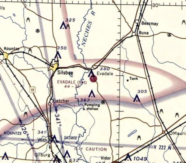
Evadale Airfield, as depicted on the April 1965 Beaumont Sectional Chart.
According to its FAA Airport/Directory data, this airport was established in June 1960.
Evadale Airfield was not yet depicted on the February 1961 Beaumont Sectional Chart.
The earliest depiction which has been located of Evadale Airfield was on the April 1965 Beaumont Sectional Chart.
It depicted Evadale as a private airfield having a 3,200' paved northwest/southeast runway.
The November 1967 Beaumont Sectional Chart still depicted Evadale as a private airfield, but the runway had been slightly lengthened to 4,000'.
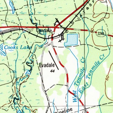
The earliest topo map depiction which has been located of Evadale Airfield was on the 1978 USGS topo map.
It depicted Evadale as having a paved northwest/southeast runway.
The 1984 USGS topo map depicted Evadale as a paved northwest/southeast runway, labeled simply as “Air Strip”.
Two small buildings were depicted on the east side.
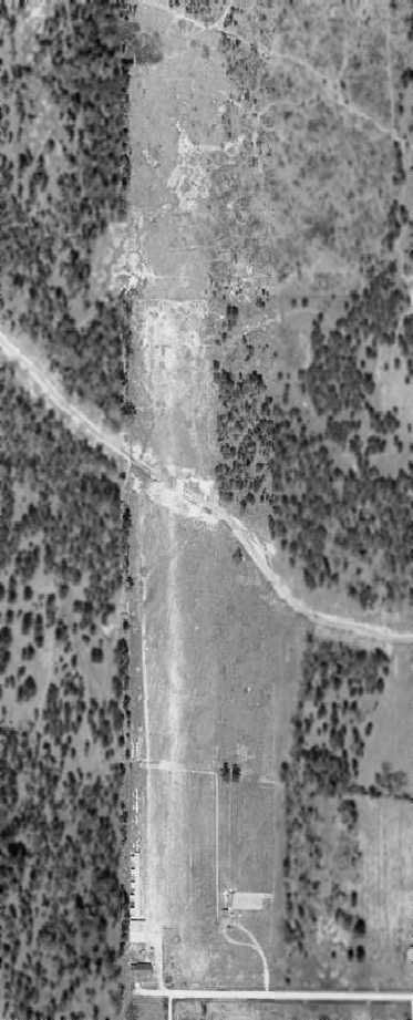
The earliest photo which has been located of Evadale Airfield was a 1996 USGS aerial view looking southeast.
It depicted Evadale as having a paved northwest/southeast runway, with a ramp & small hangar on the east side.
At some point after 1978 the Evadale Airfield was evidently renamed Ben Bruce Memorial Airpark.
According to drag racing historian Bret Kepner, “The airport was originally named Ben Bruce Memorial Airpark.
The airport closed at the end of 2002. In 2003, it was converted to Ben Bruce Memorial Airpark Raceway.
My first trip there was in 2004 but I met the airport owners who decided there was far more money to be made in drag racing than in commercial aviation.
When I was there, the surface seemed in great shape.”
The only photo which has been located showing an aircraft at Evadale Airfield was a 2004 aerial view.
One single-engine light aircraft was depicted on the ramp next to the hangar on the east side.
However, the runway had already been painted with markings for a drag strip, which would eventually replace the small airport.
A circa 2004 aerial view looking north at the Evadale Airport hangar, after use of the runway as a dragstip had begun.
A 2006 aerial photo showed Evadale Airfield in the same fashion as seen in the 2004 photo,
with the runway painted with drag strip markings, but presumably still serving aircraft as well.
A 2009 aerial view showed a drag strip grandstand had been built over the middle of the runway, adjacent to the hangar,
presumably spelling the end of this aviation days of this little airport.
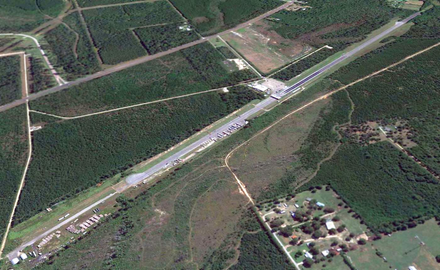
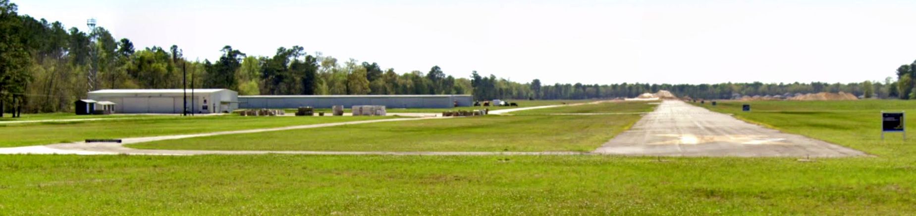
A 2014 aerial view looking southeast showed the former Evadale Airfield runway being reused as a drag strip.
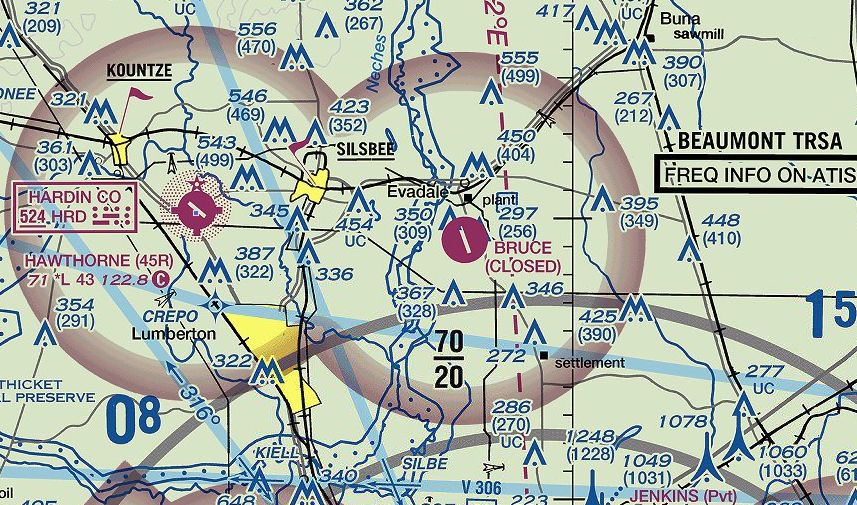
The 2016 Sectional Chart depicted the “Ben Bruce Memorial Airpark” as having a single paved northwest/southeast runway, but being closed.
As of 2016, Ben Bruce Memorial Airpark's FAA Airport/Directory data described the as having a single 6,000' asphalt Runway 15/33.
It listed the owner & manager as Mike Bruce, and said there was only a single based aircraft. However it also listed the airport's status as “Closed Permanently”.
As of 2016, the former runway is still in use as the “Evadale Raceway”.
Drag racing historian Bret Kepner reported in 2016, “The track is well-run & draws a decent crowd considering its location.”
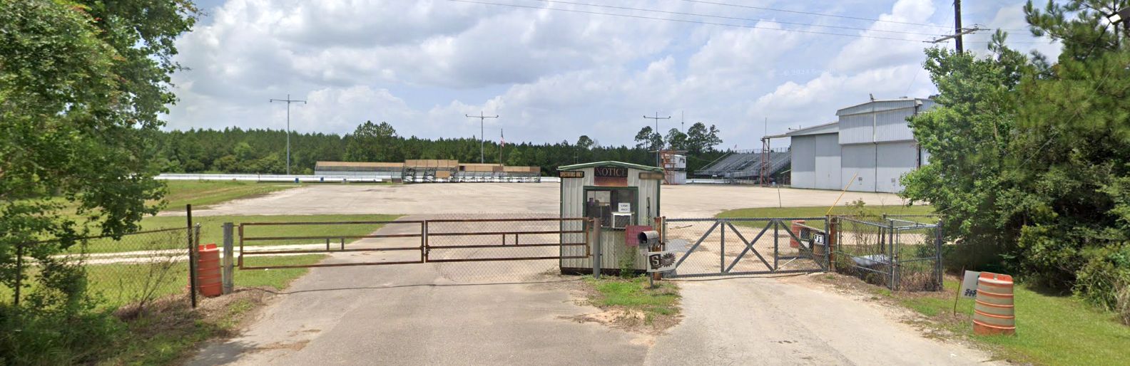
A 2023 photo looking west at the Evadale Raceway gate, with a former Evadale Airfield hangar visible at right.
The site of Ben Bruce Memorial Airpark is located at the western terminus of Airport Road, appropriately.
Thanks to Rick Tallent for pointing out this airfield.
____________________________________________________
29.98, -95.29 (Northeast of Houston, TX)
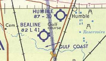
A 1954 aerial view depicted Humble Airport as having a single unpaved north/south runway.
This short-lived little general aviation airport was evidently established at some point between 1944-54,
as it was not yet depicted on a 1944 aerial photo.
The earliest depiction of Humble Airport which has been located was on a 1954 aerial view.
It depicted the field as having a single unpaved north/south runway.
A row of T-hangars & 4 aircraft were visible on the southwest side of the field.
However, Humble Airport was not yet depicted at all on the August 1954 San Antonio Sectional Chart (according to Chris Kennedy).
Perhaps if was overlooked as a relatively small airfield.
The earliest aeronautical chart depiction which has been located of Humble Airport
was on the June 1958 San Antonio Sectional Chart (courtesy of David Brooks).
It depicted Humble Airport as having a 3,000' unpaved runway.
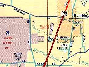
The 1962 Humble Oil Company Map of Houston depicted Humble Airport just to the east of the huge "Jetero Airport Site"
(which eventually became today's Houston George Bush Intercontinental Airport).
The 1962 AOPA Airport Directory described Humble Airport as having a single 3,000' turf Runway 18/36.
The field was said to offer fuel, minor repairs, hangars, tiedowns, and charter,
and the operator was listed as Mr. & Mrs. Earl Bardwell (Cessna dealers).
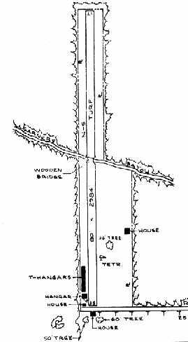
The most detailed depiction of Humble Airport which has been located
was in the 1963 TX Airport Directory (courtesy of Steve Cruse).
It depicted Humble as having a single 2,984' turf Runway 17/35,
the middle of which used a wooden bridge to span Garner's Bayou.
A row of T-hangars & another hangar were situated adjacent to the southwest side of the runway.
The manager was listed as Earl Bardwell.
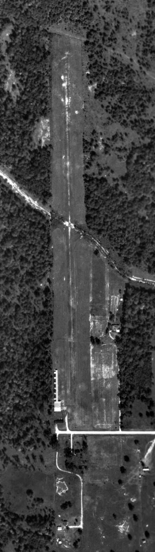
The last photo which has been located showing Humble Airport while it was still intact was a 10/8/64 aerial view (courtesy of David Owens).
It showed the field to have a single north/south grass runway, which crossed a stream via a bridge.
A row of T-hangars sat southwest of the runway.
There were no planes visible on the field.
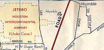
The 1965 Humble Oil Company Map of Houston depicted Humble Airport,
along with the adjacent “Jetero Houston Intercontinental Airport” which was shown as being under construction.
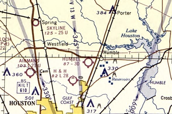
The last aeronautical chart depiction which has been located of Humble Airport was on the April 1965 Beaumont Sectional Chart.
It depicted Humble Airport as having a 3,000' unpaved runway.
The 1966 AOPA Airport Directory (according to David Brooks) described Humble as having a single 2,984' turf Runway 18/36.
The airfield was said to offer fuel, major repairs, and was operated by a Mr. &Mrs. Earl Bardwell (Cessna dealers).
Humble Airport apparently closed within 1966, as it was no longer depicted on the 1966 Beaumont Sectional Chart (courtesy of John Price).
The airfield's fate was no doubt sealed by the construction in the 1960s
of the massive Houston Intercontinental Airport right next door.
In 1972 one of the buildings of the former Humble Airport was relocated to the east
onto the property of Houston Intercontinental Airport to become Houston Fire Station #63.
A 1973 aerial view showed that 2 of the former hangars still stood at the site, but the former runway was overgrown.
A 1981 aerial view showed that Will Clayton Parkway had been built right through the center of the former runway.
The former hangars had been removed at some point between 1973-81.
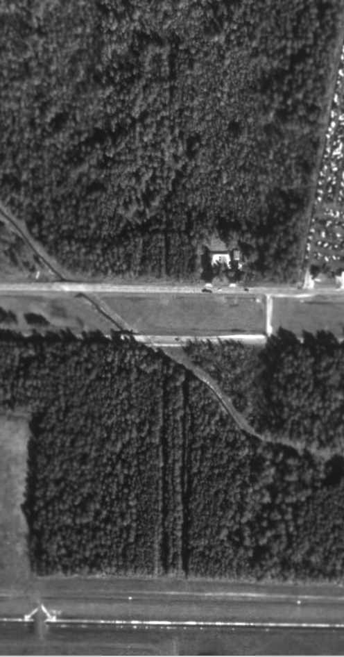
In the 1995 USGS aerial photo, the north/south outline of the Humble Airport runway was still barely recognizable,
even though the majority of the runway had become grown over with trees.
Will Clayton Parkway is seen crossing over the center of the former runway.
No trace remained apparent of the former hangars or other airport buildings.
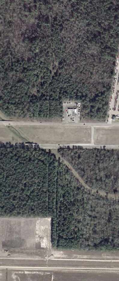
In a January 2002 USGS aerial photo, the outline of Humble Airport's north/south runway was still just barely recognizable.
The site of Humble Airport is located east of the intersection of Will Clayton Parkway & Kenswick Drive.
The name of Humble Airport has been somewhat commemorated
by the name of the VORTAC navigational beacon at the adjacent Houston George Bush Intercontinental Airport,
which is named Humble VORTAC.
Thanks to Steve Cruse for sponsoring the research about this airfield.
____________________________________________________
Piney Woods Airfield (41R), Jasper, TX
30.86, -93.97 (Northeast of Houston, TX)
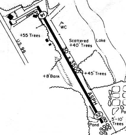
Piney Woods Airport, as depicted in the 1978 TX Airport Directory (courtesy of Chris Kennedy).
Photo of the airfield while open has not been located.
This private airfield was evidently constructed at some point between 1967-76,
as it was not yet depicted on a 1958 aerial photo or the September 1967 Beaumont Sectional Chart or the 1973 USGS topo map.
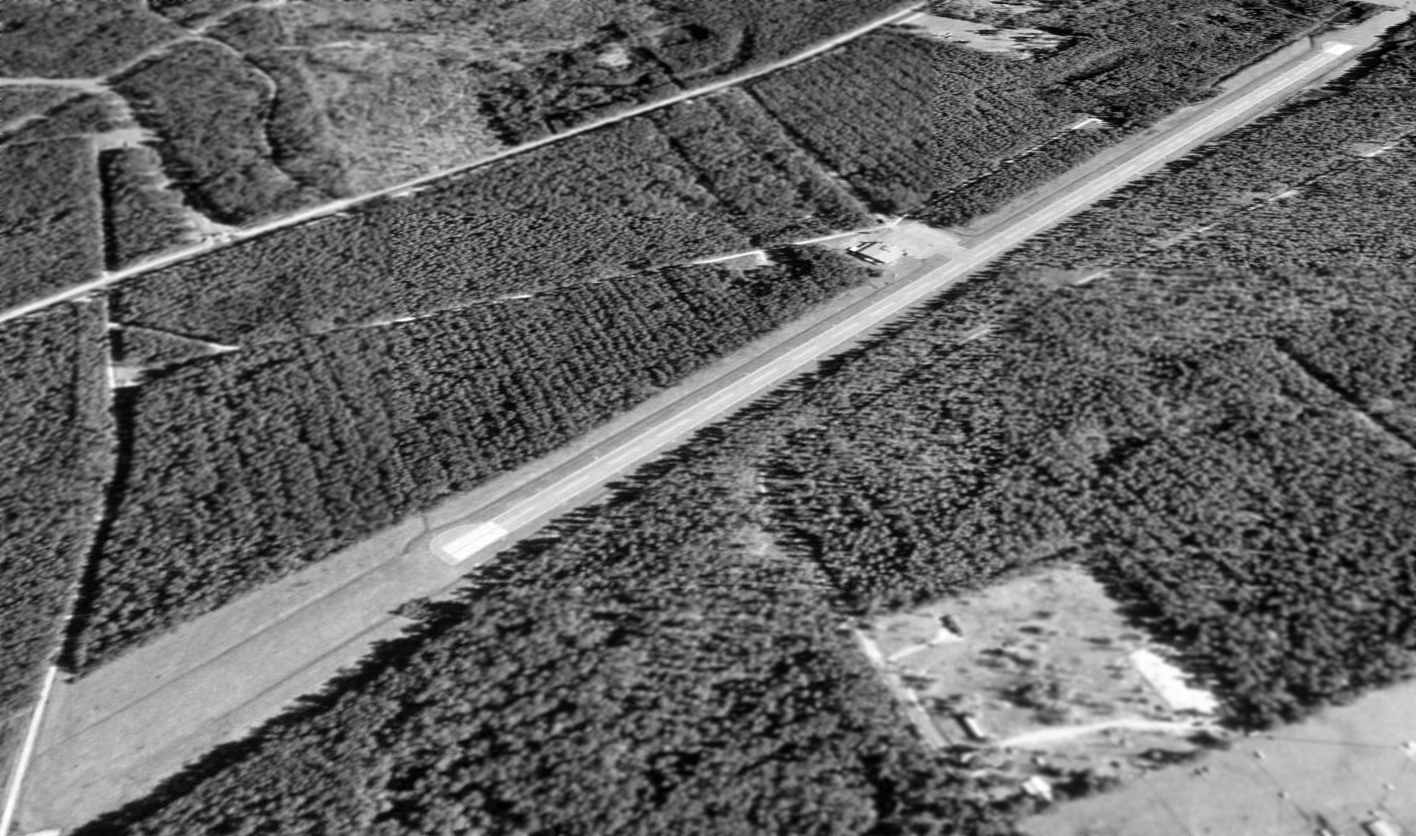
The earliest depiction of Piney Woods Airport which has been located was a 1976 aerial photo.
It depicted Piney Woods as having a single paved northwest/southeast runway, with some small buildings on the northwest side.
The earliest depiction which is available of Piney Woods Airport was in the 1978 TX Airport Directory (courtesy of Chris Kennedy).
It depicted Piney Woods as having a single 3,500' asphalt Runway 14/32.
The operator was listed as Jasper Aviation Inc., and the manager was listed as E. Marshall.
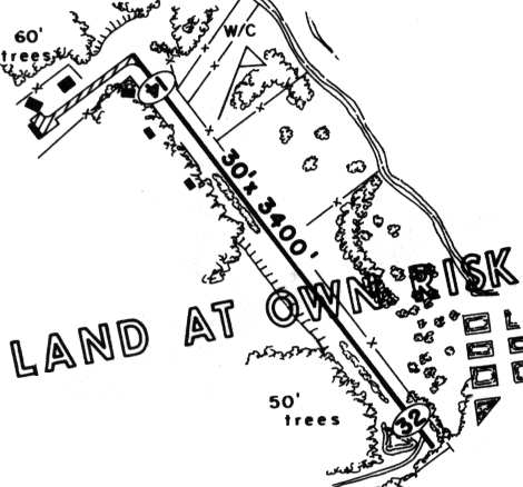
The 1982 AOPA Airport Directory (courtesy of Ed Drury) described Piney Woods as having a single 3,500' asphalt Runway 14/32.
The operator was listed as Jasper Aviation, Inc.
Piney Woods Airfield was described in basically an unchanged manner in the 1985 TX Airport Directory (courtesy of Steve Cruse).
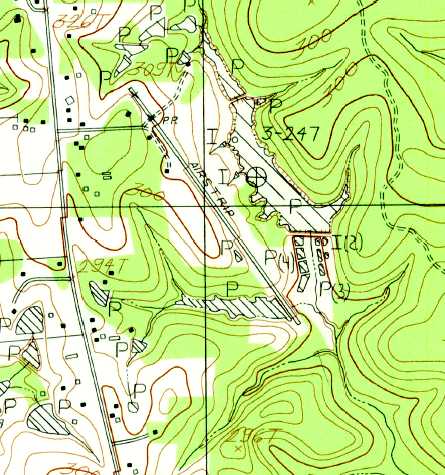
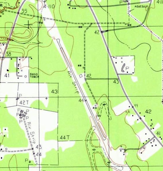
The 1985 USGS topo map depicted Piney Woods Airport as single northwest/southeast runway, labeled simply as “Airstrip”.
Piney Woods Airport apparently closed at some unknown date between 1985-98,
as it was depicted as an abandoned airfield on the 1998 World Aeronautical Chart.
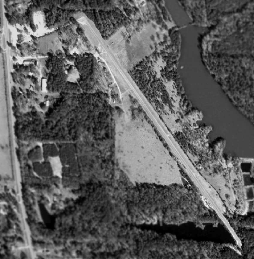
In the 1995 USGS aerial photo, the Piney Woods Airfield runway still remained, apparently without any change.
Piney Woods Airfield was still depicted as an abandoned airfield on 2002 aeronautical charts.

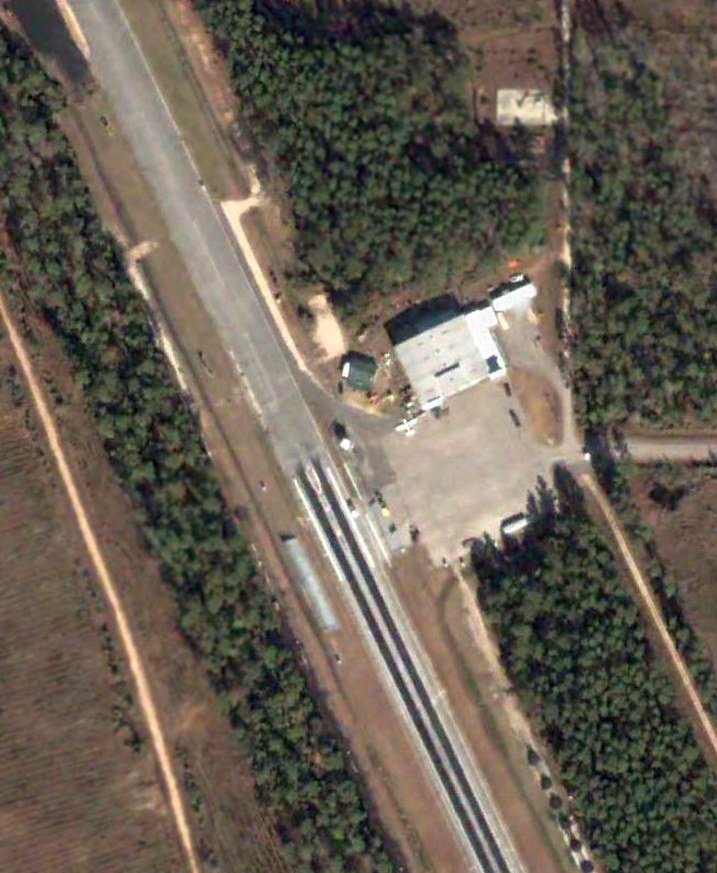
A circa 2007 aerial view showed the former Piney Woods runway as well as several small buildings.
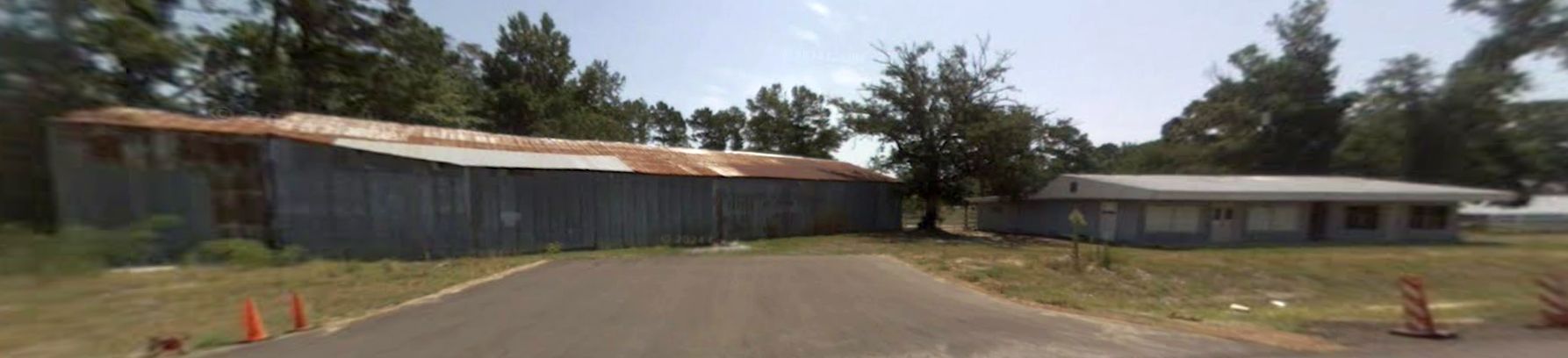
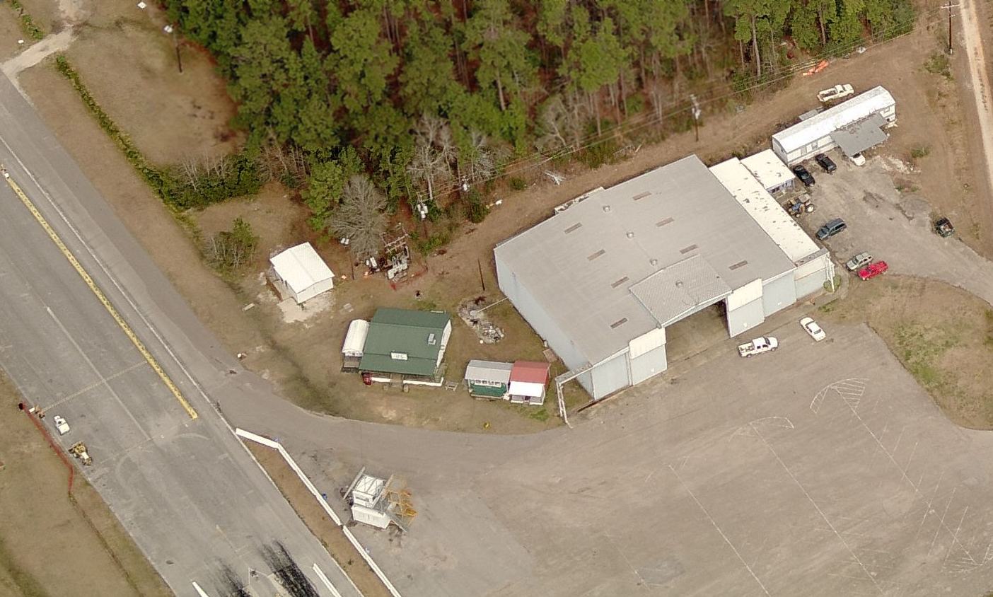
A 2008 photo looking east at the former hangar & airport office building on the northwest side of the Piney Woods Airport site.
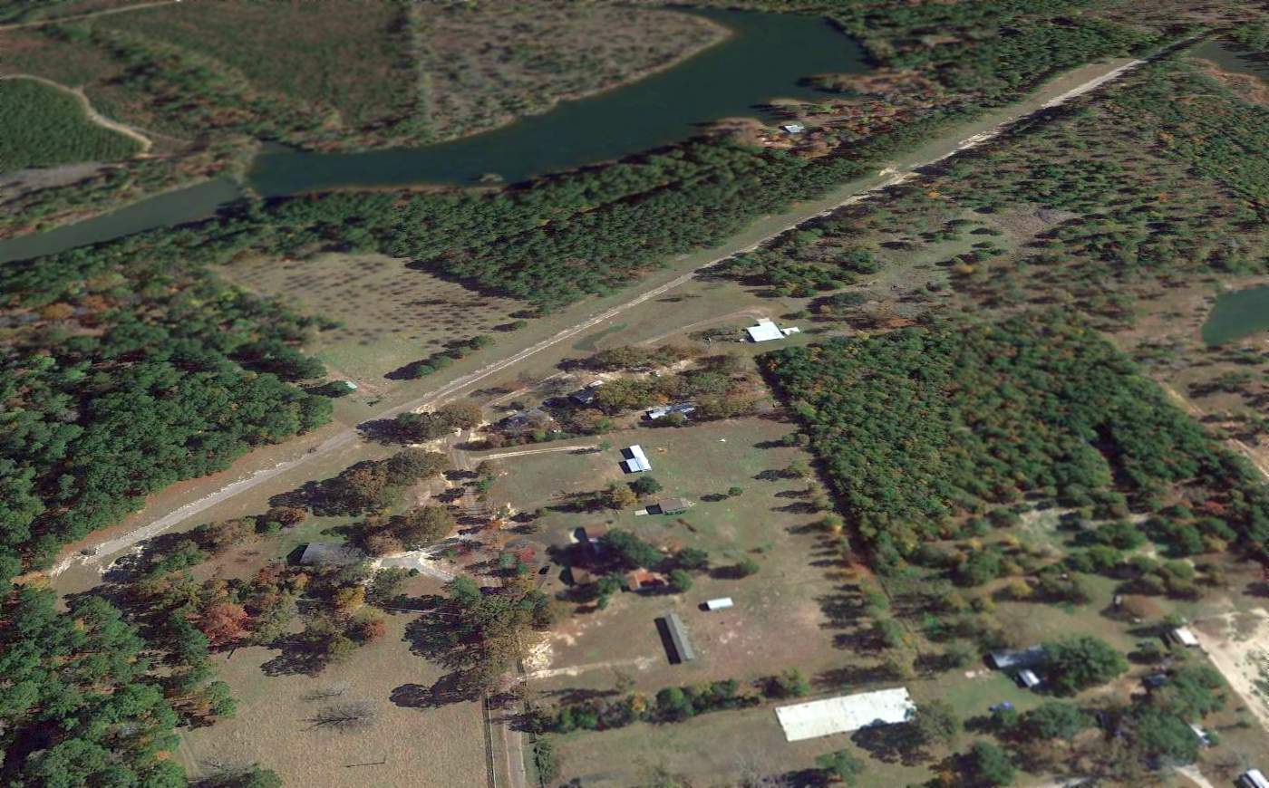
A 2014 aerial view looking southeast showed the Piney Woods runway remained intact.
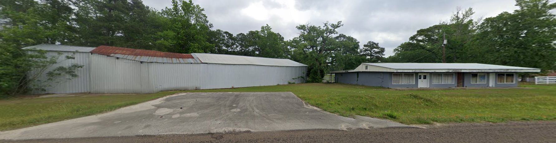
A 2024 photo looking east at the former hangar & airport office building on the northwest side of the Piney Woods Airport site.
The site of Piney Woods Airfield is located along the east side of Route 96, south of its intersection with Brewster Road.
____________________________________________________
Since this site was first put on the web in 1999, its popularity has grown tremendously.
If the total quantity of material on this site is to continue to grow,
it will require ever-increasing funding to pay its expenses.
Therefore, I request financial contributions from site visitors,
to help defray the increasing costs of the site
and ensure that it continues to be available & to grow.
What would you pay for a good aviation magazine, or a good aviation book?
Please consider a donation of an equivalent amount, at the least.
This site is not supported by commercial advertising –
it is purely supported by donations.
If you enjoy the site, and would like to make a financial contribution,
you
may use a credit card via
![]() :
:
Please consider checking the box to make a monthly donatation.
For a mailing address to send a check, please contact me at: paulandterryfreeman@gmail.com
If you enjoy this web site, please support it with a financial contribution.
please contact me at: paulandterryfreeman@gmail.com
If you enjoy this web site, please support it with a financial contribution.
____________________________________________________
This site covers airfields in all 50 states.