Abandoned & Little-Known Airfields:
Western Puerto Rico
© 2002, © 2023 by Paul Freeman. Revised 7/24/23.
This site covers airfields in all 50 states: Click here for the site's main menu.
____________________________________________________
Please consider a financial contribution to support the continued growth & operation of this site.
Losey AAF (revised 12/11/21) - Mona Airport (revised 5/25/15) - Mona Island Auxiliary Army Airfield (added 5/24/15) - Vega Baja Aux Airdrome / Tortuguero Airfield (revised 7/24/23)
____________________________________________________
Mona Island Auxiliary Army Airfield, Mona Island, PR
18.08, -67.94 (West of San Juan, PR)
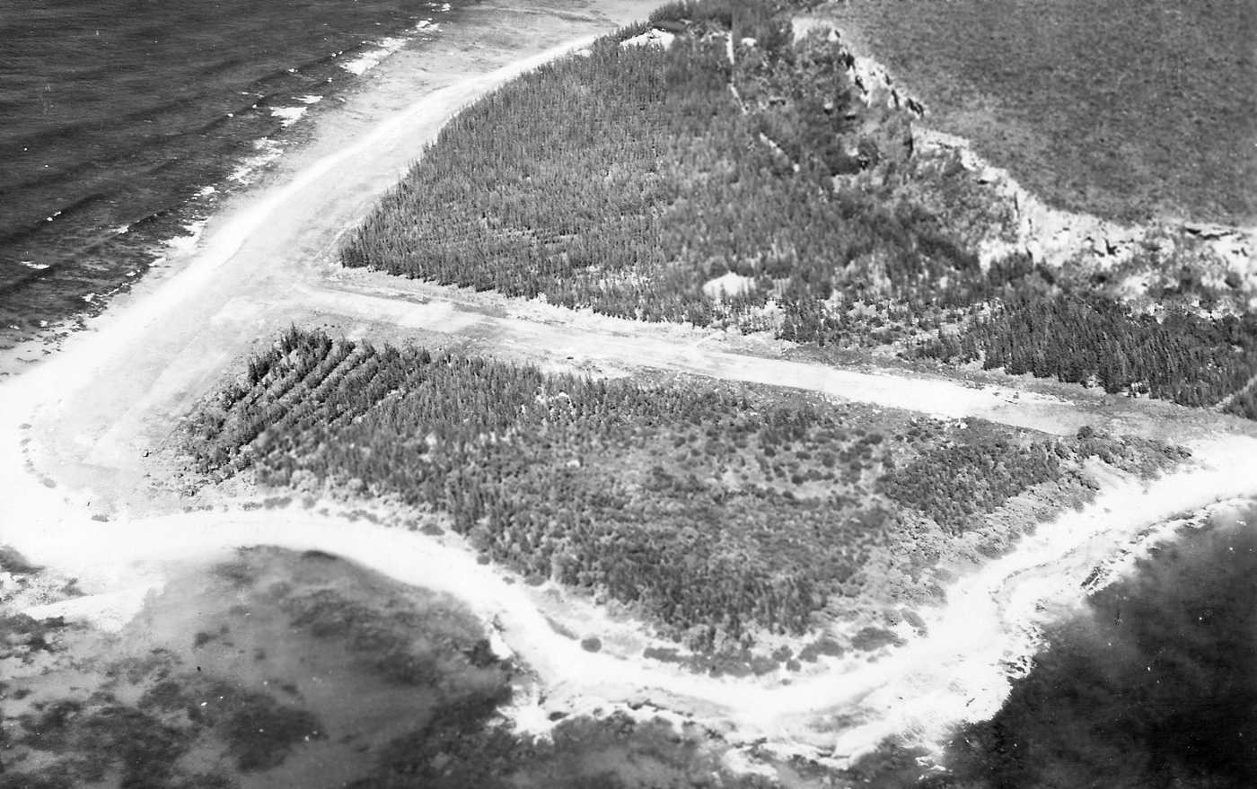
A 1/13/42 U.S. Government aerial view looking east at the “Auxiliary Field, Mona Island” (courtesy of Garred Giles).
Mona Island is a 22 square mile historically uninhabited island halfway between the west coast of Puerto Rico & the Dominican Republic.
The date of construction of the Mona Island Auxiliary Army Airfield has not been determined.
It was presumably built at the start of World War 2.
The earliest depiction which has been located of Mona Island Auxiliary Army Airfield
was a 1/13/42 U.S. Government aerial view looking east (courtesy of Garred Giles).,
which depicted 2 short unpaved perpendicular runways on the western tip of the island.
There were no aircraft visible on the field, nor any buildings directly associated with the airfield, or any other improvements.
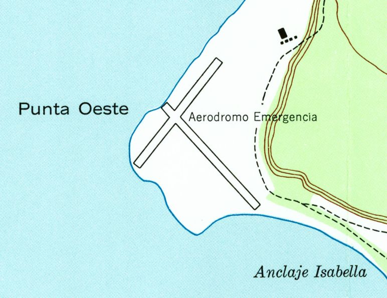
The 1944 USGS topo map depicted Mona Island Auxiliary Army Airfield as 2 perpendicular runways on Punta Oeste, labeled simply as “Aerodromo Emergencia”.
No airfield was depicted on Mona Island on the November 1944 Hispaniola AAF Aeronautical Chart.
It is not known if any aircraft ever operated from the Mona Island Auxiliary Army Airfield during WW2.
It was presumably abandoned at the end of WW2.
Mona Island Auxiliary Army Airfield was not depicted at all on a 1965 Aeronautical Chart (courtesy of Kevin Walsh)
or the November 1993 Puerto Rico Terminal Aeronautical Chart (courtesy of Ron Plante).
At some point between 1993-2004 a replacement Mona Airport was established less than a half-mile to the southeast.
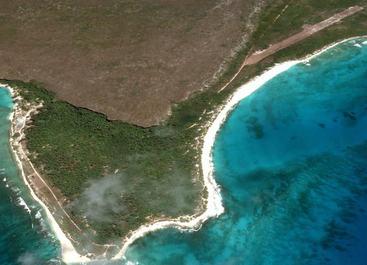
A 2004 aerial view showed Mona Island Auxiliary Army Airfield's northwest/southeast runway was no longer recognizable, being completely overgrown.
But the area of the northeast/southwest runway along the coast was still clear.
Amazingly a 2014 aerial view looking east finally shows an aircraft at the site of the Mona Island Auxiliary Army Airfield about 69 years after it presumably closed:
what appears to be a Sikorsky UH-60 Blackhawk helicopter is visible on a small rectangular clearing on the site of the northeast/southwest runway along the coast (left side of picture).
Thanks to Garred Giles for pointing out this airfield.
____________________________________________________
18.07, -67.93 (West of San Juan, PR)
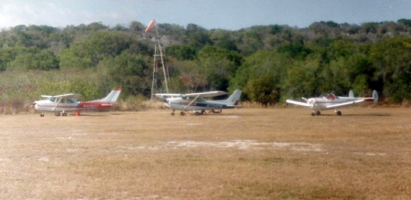
An April 1992 photo by Garred Giles of 2 Cessnas & his Forney from their flight to Mona Airport.
Mona Island is a 22 square mile historically uninhabited island halfway between the west coast of Puerto Rico & the Dominican Republic.
No airfield was depicted on Mona Island on the November 1944 Hispaniola AAF Aeronautical Chart or a 1965 Aeronautical Chart (courtesy of Kevin Walsh).
Mona Airport, an upaved single northwest/southeast runway, was established at some point between 1965-78
less than a half-mile to the southeast of the former Mona Island Auxiliary Army Airfield.
The earliest reference which has been located of Mona Airport came from Allyson Ault, who recalled,
“My family lived in Mayaguez from 1973-80 & made several trips in private aircraft to Mona Island from the Mayaguez Airport, including a crash landing in 1978.
Luckily, the only serious injury was to the plane. As we were traveling with friends in a second aircraft, we were able to make it back to Mayaguez.”
The earliest depiction which has been located of Mona Airport was an April 1992 photo by Garred Giles of 2 Cessnas & his Forney from their flight to Mona Airport.
Mona Airport was not depicted at all on the November 1993 Puerto Rico Terminal Aeronautical Chart (courtesy of Ron Plante).
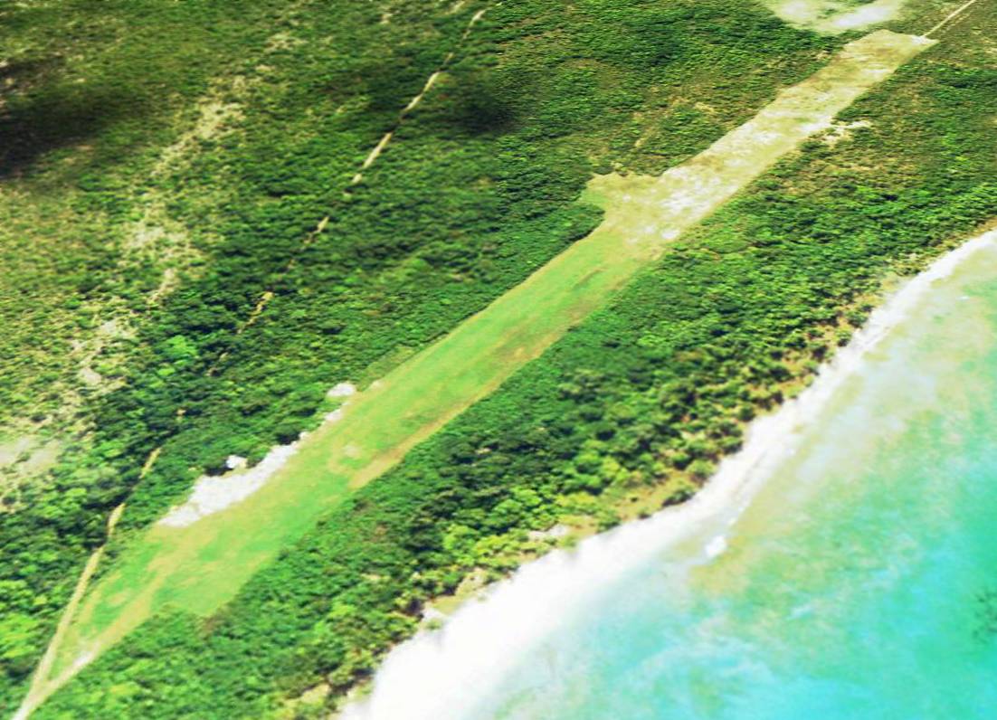
A 2004 aerial view looking depicted Mona Airport as having a single unpaved northwest/southeast runway,
with possibly a shed or other small buildings on the north side. There were no aircraft visible on the field.
The October 2008 Puerto Rico Terminal Aeronautical Chart did not depict any airfield on Mona Island.
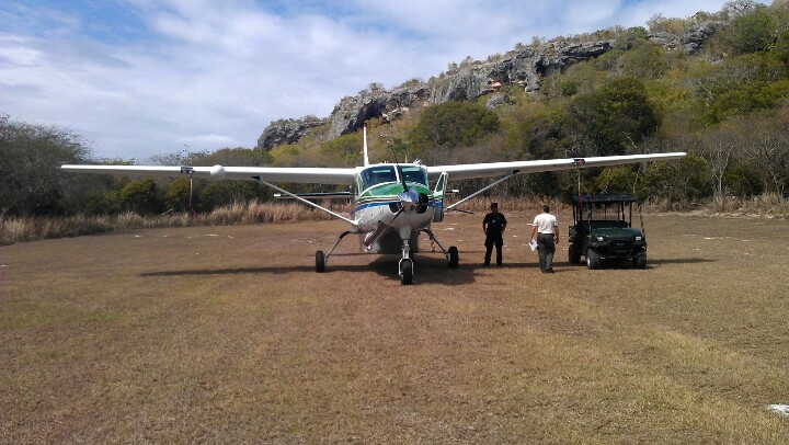
A circa 2013 photo of a Cessna Caravan turboprop on Mona Airport's grass runway.
The last photo to be located showing an aircraft at Mona Airport is a circa 2014 photo of a Cessna Caravan turboprop on Mona Airport's grass runway.
A 2014 aerial view looking east shows the Mona Airport (at top-right) to remain intact though deteriorated.
The 2015 San Juan Terminal Aeronautical Chart depicted Mona Airport as an “Unverified” unlabeled airfield.
According to Wikipedia, as of 2015, “Private & commercial flights require a permit for use of the landing strip.
The permit can only be acquired through the Puerto Rico Department of Natural & Environmental Resources.
The airport is also available to planes for emergency purposes.
Mona Island is a natural reserve & there are no permanent inhabitants.
Rotating rangers from the Department of Natural & Environmental Resources reside on the island to manage visitors & take part in research projects.”
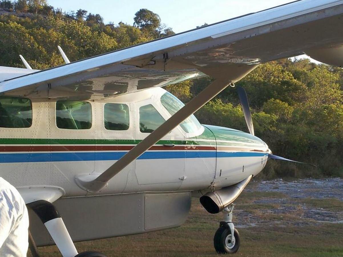
Garred Giles reported in 2015 of Mona Airport, “I landed at he newer one years ago
and it was a bit hairy in that on approach one must cozy up to the cliff face as the prevailing winds are from the east.”
Thanks to Garred Giles for pointing out this airfield.
____________________________________________________
Losey Army Airfield, Juana Díaz, PR
18, -66.5 (Southwest of San Juan, PR)
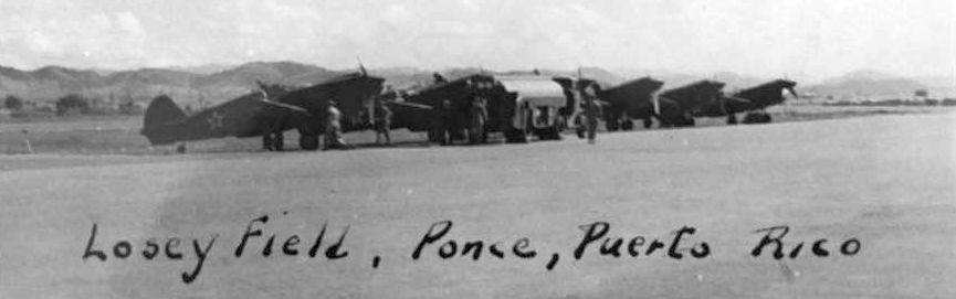
A 11/29/41 photo of a row of Army Curtiss P-40 Warhawk fighters at Losey Field.
This Army Airfield on the southern coast of Puerto Rico was established by the Army Air Corps in 1941.
According to Wikipedia, Losey Field was named for Captain Robert Losey, an aeronautical meteorologist who in April 1940 became the United States' first military casualty in World War II.
Units assigned to Losey Field during WW2 were:
4th Tactical Reconnaissance Squadron (13th Composite Wing, 72nd Observation Group) 4/1/41 – 10/27/1943,
20th Troop Carrier Squadron (6th Air Force Base Command) May – June 1942,
36th Fighter Group (Headquarters), January 1941 - May 1943,
22nd Fighter Squadron, 1/6/41-12/13/41 (P-40 Warhawk),
23rd Fighter Squadron, 1/6/41-5/31/41; 11/15/41-12/13/41(P-40 Warhawk),
32nd Fighter Squadron, 1/6/41-2/19/42; 3/9/43-6/14/43 (P-40 Warhawk),
417th Bombardment Squadron (25th Bombardment Group) 5/29/43 – 3/24/44 (B-18 Bolo).
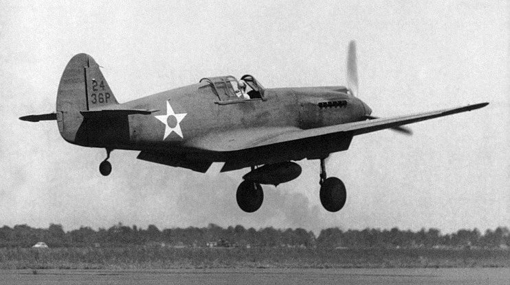
A circa 1941-42 photo of an Army 36th Pursuit Group Curtiss P-40C Warhawk fighter landing at Losey Field.
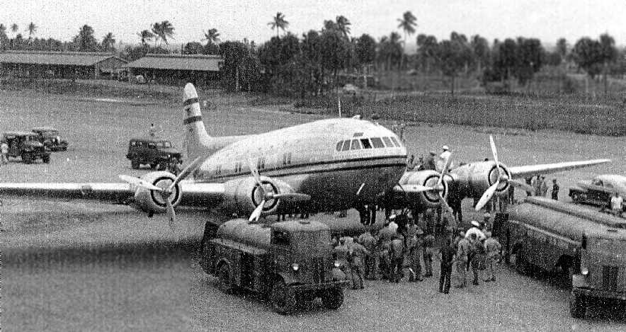
A circa 1941-42 photo of a rare Boeing Stratoliner visiting Losey Field (courtesy of Ricardo Medina).
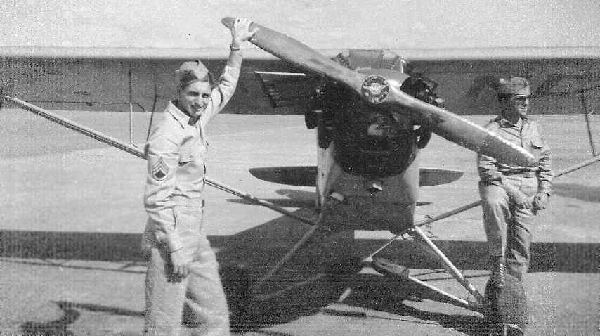
A circa 1941-42 photo of two Army personnel in front of a Piper Cub at Losey Field (courtesy of Ricardo Medina).
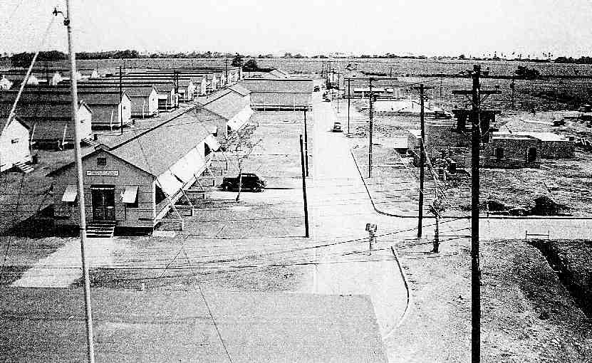
A circa 1941-42 photo of barracks at Losey Field (courtesy of Ricardo Medina).
The last photo which has been located showing Losey Field in use was an 8/20/42 USGS aerial photo (courtesy of Brian Rehwinkel).
It depicted Losey Field as having a single wide, paved runway, with a crosswind runway under construction.
There did not appear to be any hangars, but a series of revetments along the south side held a number of aircraft,
mostly single-engine, with at least one twin-engine aircraft.
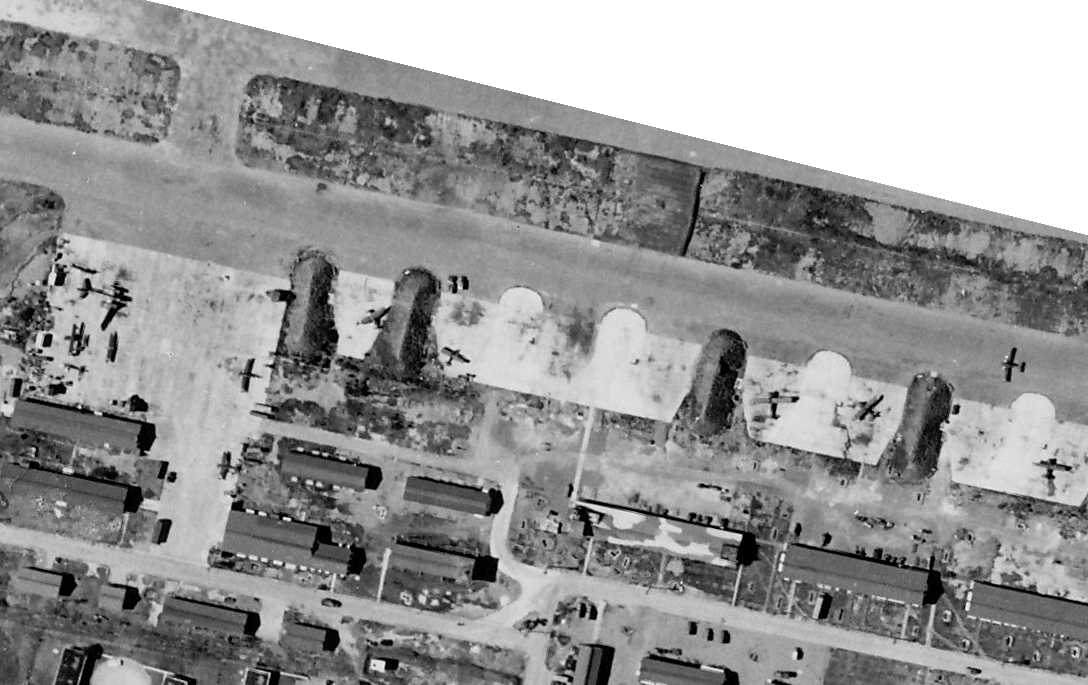
A closeup from the 8/20/42 USGS aerial photo (courtesy of Brian Rehwinkel),
showing a number of single-engine & twin-engine aircraft parked within revetments along the south side of Losey Field.
Notably the twin-engine aircraft on the left appears to have most of its left wing missing.
Chris Brame pointed out that this plane most likely was a B-18 bomber, s/n 36-295, which had an accident there 4 days earlier.
The only aeronautical chart depiction which has been located showing Losey Field in operation was on the April 1944 Virgin Islands AAF Aeronautical Chart (courtesy of Leon Cleaver).
It depicted “Losey (Aux)” as a military airfield.
After the departure of the 417th Bombardment Squadron in 1944, Losey Field was turned over to Army ground forces.
Losey Field was renamed Camp Losey in 1950.
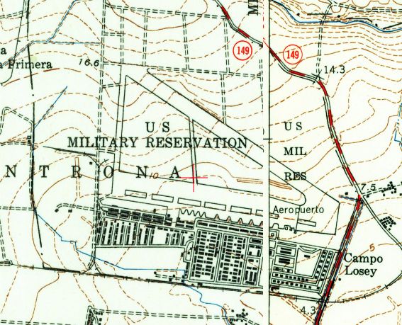
The 1952 USGS topo map depicted the “Aeropuerto” on the “Campo Losey” Military Reservation as having 2 runways connected by a north/south taxiway.
A 1/23/59 USGS aerial photo depicted Losey Field as having 2 wide, paved runways, with a ramp with revetments on the south side.
The southern runway was marked with 2 large closed-runway X symbols.
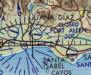
The US Army Caribbean Signal Agency was officially activated in 1959, and Camp Losey was renamed Fort Allen.
The U.S. Navy began operating communication facilities at Fort Allen in 1962,
and Fort Allen was redesignated US Naval Radio Station Fort Allen in 1963.
The property was transferred to the Navy as a component of US Naval Communication Station Puerto Rico.
A single runway at "Fort Allen" was depicted on the May 1964 USAF Operational Navigation Chart (courtesy of Chris Kennedy),
but it was labeled "Closed".
No airfield at this location was depicted on a 1965 Aeronautical Chart (courtesy of Kevin Walsh).
In 1970, the Headquarters & Communication Center of the Naval Communication Station Puerto Rico relocated from San Juan to Fort Allen.

The 1977 USGS topo map labeled the site as “Fort Allen Naval Radio Station”.
It appeared to depict 2 runways, oriented northwest/southeast & east/west, connected by a north/south taxiway.
The Headquarters & Communication Center of the Naval Communication Station Puerto Rico
relocated from Fort Allen to Roosevelt Roads in 1980.
In 1980, under a presidential order, Fort Allen was reconfigured into a receiving center for Cuban & Haitian refugees.
The current 921 acres of Fort Allen were transferred back to the US Army in early 1983.
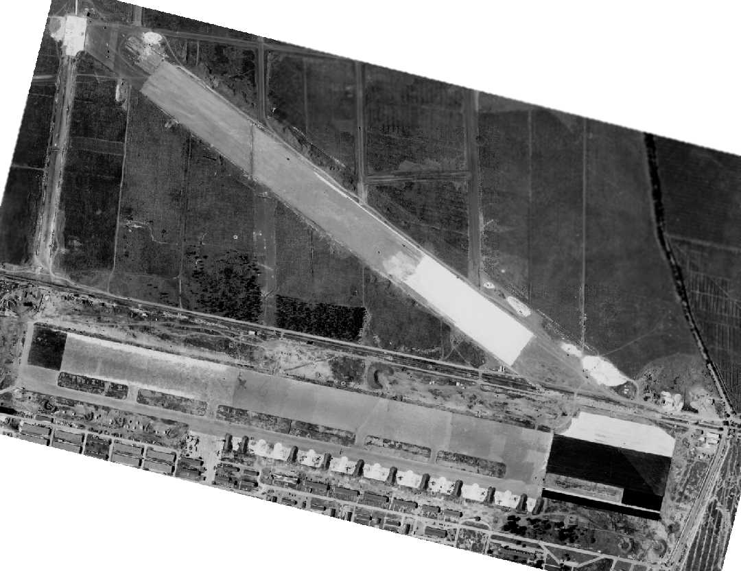
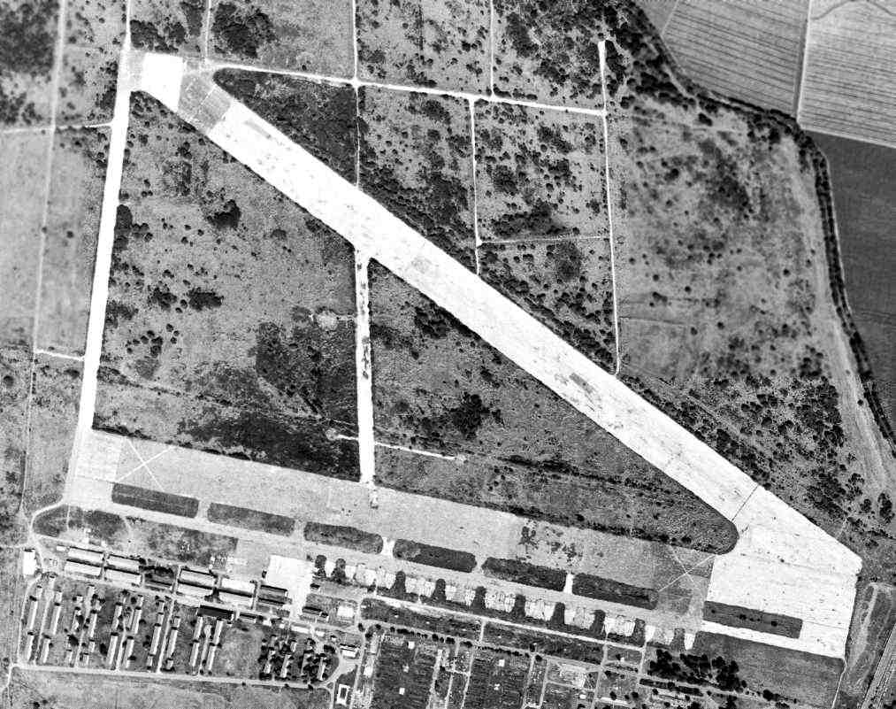
A 1995 USGS aerial view looking north at the site of Losey Field showed the remains of the east/west 5,400' runway (along with a paved parallel taxiway or runway on its south side) remained fairly well intact,
but the northwest/southeast runway had only a faintly recognizable outline.
What appeared to be the foundations of a row of hangars was visible along the southern side of the runway.
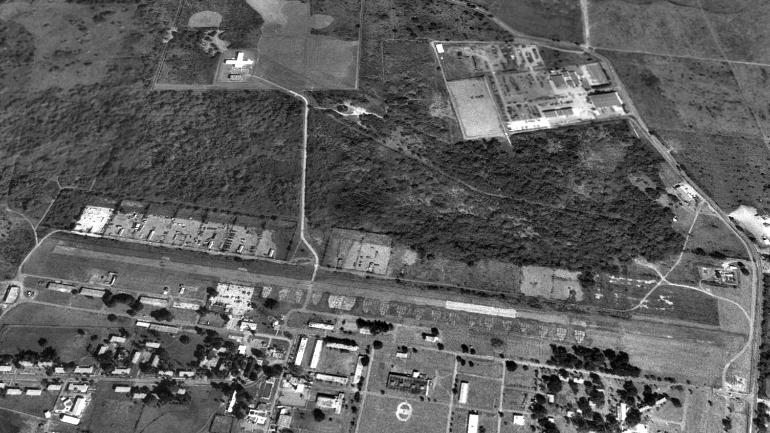
As of 2003, Fort Allen serves as an educational & support facility (logistics, facilities, utilities, maintenance, and efficiency)
for both the Army Reserve & the PR National Guard.
The Army Reserve utilizes the light maneuver area located within Fort Allen's A/I range area
to conduct night training & perimeter defense training.
A 2016 aerial view looking north at the site of Losey Field showed the remains of the east/west runway & the foundations of the adjacent hangars remained fairly well intact.
But the orientation of the northwest/southeast runway was only barely recognizable.
A long east/west grass clearing with an adjacent paved road had been built at some point between 1995-2004 over the site of the northwest/southeast runway.
Losey AAF is located northwest of the intersection of Route 149 & Avenida D.
Thanks to Scott Murdock for pointing out this airfield.
See also: http://www.globalsecurity.org/military/facility/fort-allen.htm
____________________________________________________
Vega Baja Auxiliary Airdrome / Tortuguero Airfield, Vega Baja, PR
18.48, -66.43 (West of San Juan, PR)
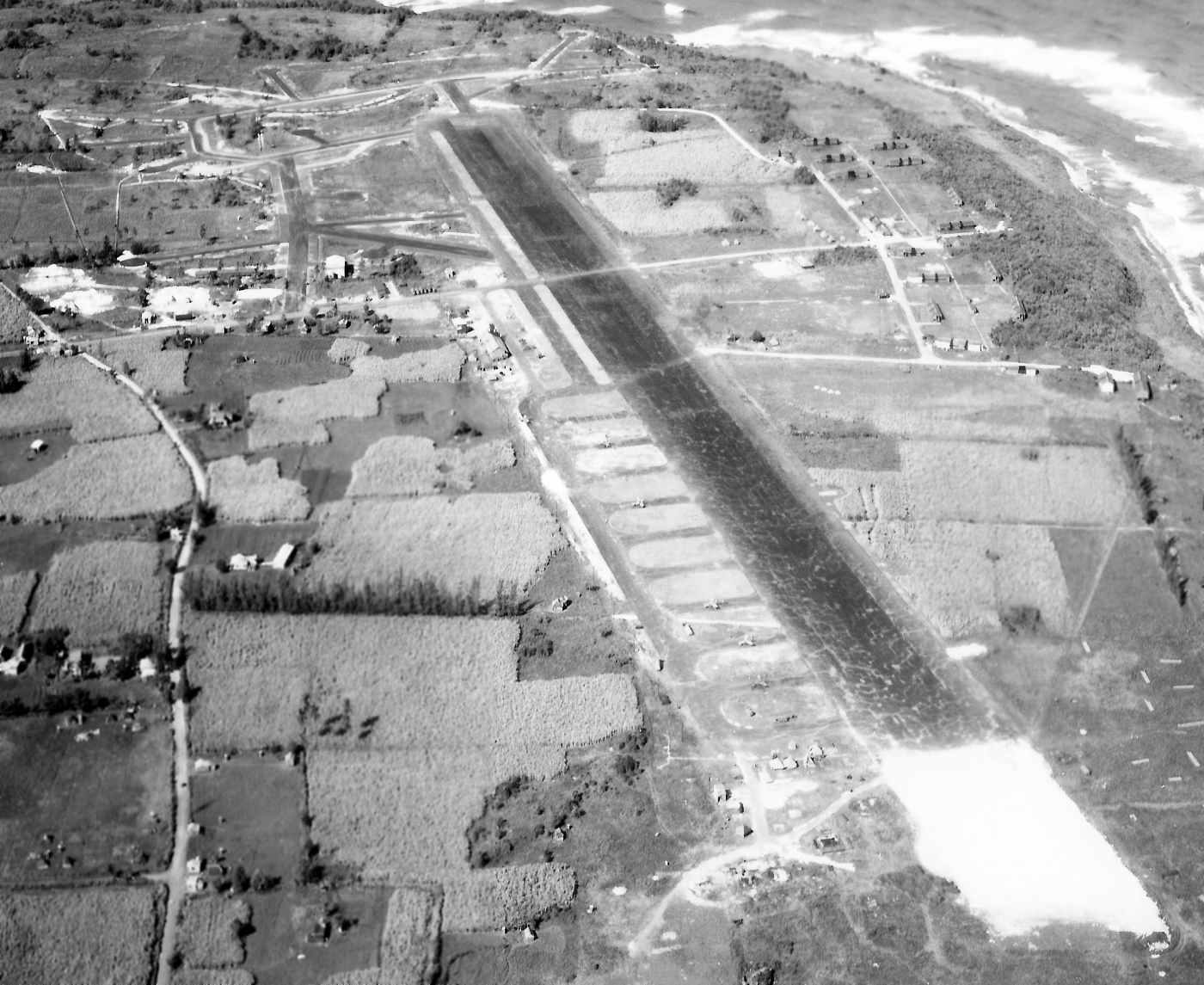
A 2/10/43 U.S. Government aerial view looking west at Vega Baja Field (courtesy of Garred Giles).
A total of 554 acres was acquired by the Federal Government in 1941 to develop the Vega Baja Auxiliary Airdrome.
The Army constructed a runway, taxiway, roads, utilities, and several buildings.
The field was used as an auxiliary airfield to Borinquen Field during the war years, which was used for training by units with P-36, P-39 & P-40 fighters, among others.
The earliest depiction which has been located of Vega Baja was a 2/10/43 U.S. Government aerial view looking west (courtesy of Garred Giles).
It depicted the field as having a single paved northwest/southeast runway,
with a light-colored square patch on the western end of the runway – a feature common to the nearby Salinas Airfield – what purpose did this serve?
A paved parallel taxiway was located on the south side, along with 11 paved connecting taxiways on the southeast side, on which were parked 5 single-engine aircraft.
Vega Baja was more elaborate than other Puerto Rico auxiliary airfields,
with a network of taxiways extending from the west end of the runway toward a number of dispersal parking pads.
The only aeronautical chart depiction which has been located showing Vega Baja Field in operation was on the April 1944 Virgin Islands AAF Aeronautical Chart (courtesy of Leon Cleaver).
It depicted Vega Baja as a military airfield.
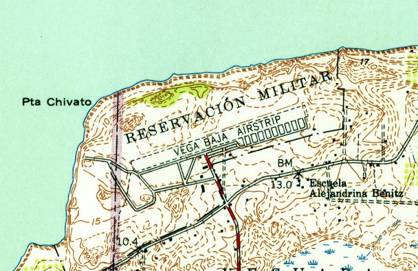
The earliest topo map depiction which has been located of Vega Baja Field was on the 1953 USGS topo map.
It depicted “Vega Baja Airstrip” as having a single southwest/northwest runway,
with multiple taxiways on the southeast side.
Vega Baja was an active installation until 1956, when its functions were no longer required.
According to Garred Giles, “Vega Baja Airfield [was] also known as Tortuguero Airfield back in the day due to a swampy lake nearby of that name.”
Between 1956-1975, the Puerto Rico National Guard utilized the property for training purposes.
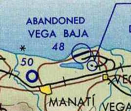
A single runway at Vega Baja was still depicted on the May 1964 USAF Operational Navigation Chart (courtesy of Chris Kennedy),
but it was labeled as "Abandoned".
No airfield at this location was depicted on a 1965 Aeronautical Chart (courtesy of Kevin Walsh).
An 11/22/67 USGS aerial view depicted Vega Baja to have a single paved northeast/southwest runway,
with a network of taxiways extending from the west end of the runway toward a number of dispersal parking pads.
In 1976, the Vega Baja Field property was conveyed to the Commonwealth of Puerto Rico.
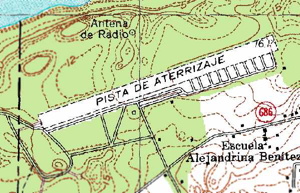
The 1977 USGS topo map depicted Vega Baja as having a single southwest/northwest runway (labeled “Pista de Aterrizaje”, or Landing Strip),
with multiple taxiways on the southeast side.
Ricardo Medina reported in 2005, “Twenty five years ago the strip was used by apprentice drivers
to practice for their license driving test (I was one of them)
and at night on certain weekends it was used for illegal drag racing.”
A 1992 Army Corps of Engineers report stated that part of the Vega Baja Field site is currently used as a public park,
and the remainder of the site is still undeveloped.
The Vega Baja airfield property was used in 1992 by NASA to launch sounding rockets for atmospheric research.
The airfield has apparently never been reused for civilian aviation.

A 1995 USGS aerial view looking northeast showed that several buildings had been placed over the Vega Baja runway's middle section at some point between 1967-95.
The remains of the taxiways extending from the west end of the runway toward a number of dispersal parking pads were still recognizable.
Vega Baja was depicted on the 1998 World Aeronautical Chart as an abandoned airfield.
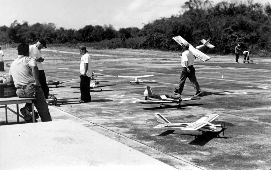
A 2000 photo by Ricardo Medina of model airplanes on the runway at Vega Baja.
Ricardo Medina reported in 2005, “The airfield is still used as a airfield
but ironically used by a model airplane association group that fly remote controlled aircrafts on weekends.
In recent years, the airstrip was used on several occasions as drop-off place for drugs by cartel members,
forcing the authorities to divide the airstrip in half by means of a cyclone fence to prevent its further use.
Very few structures remain of that era, and the surrounding vicinity is being rapidly developed with residences.”
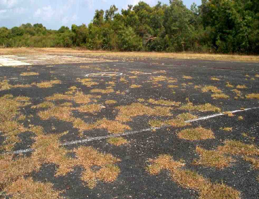
A 2012 photo by Paul Betancourt of Vega Baja, “Looking northwest to the end of the strip.
It appears from some of the exposed areas that the original runway surface was mix of tar & crushed local rock & coral, like the ones the 20th Air Force would construct.”
Paul Betancourt reported in 2012 of the Vega Baja airfield, “I gained access from the Parks & Recreation Department for a tour of the easiest end of the field.
The model airplane club has since been banned from the area for being problem residents.
As we saw & the superintendent pointed out, they weren't treading lightly: there's a whole lot of trash by the fence and I found stuff like broken tools.
Particularly along the western access roads & the east half of the strip, it's beginning to be reclaimed and looks similar to the strips on Bougainville, etc.
I did spend a good amount of time trying to find anything that the 22nd & 23rd Fighter Squadrons may have left behind with no results other than a sunburn.
The end of the strip is beginning to be retaken by flamboyan trees, and the auxiliary roads to the main gate, radio tower, and launch site are turning to gravel.
The taxi strip has become the park's parking lot, and the one remaining structure is being maintained.
The east end maintains the outline, but is almost completely overtaken by grass.
The Parks & Recreation guy said that they want to commemorate the field somehow, but the east end will likely become a small wind farm.”
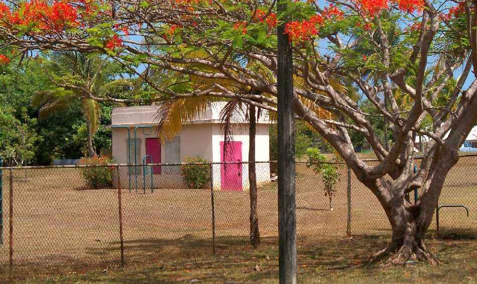
A 2012 photo by Paul Betancourt of Vega Baja, of “the one surviving structure, near where the entrance road meets the taxiway.”
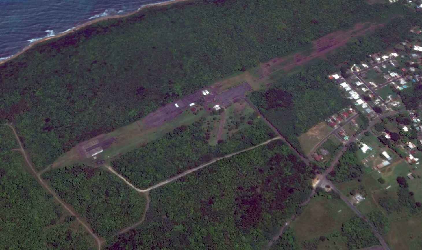
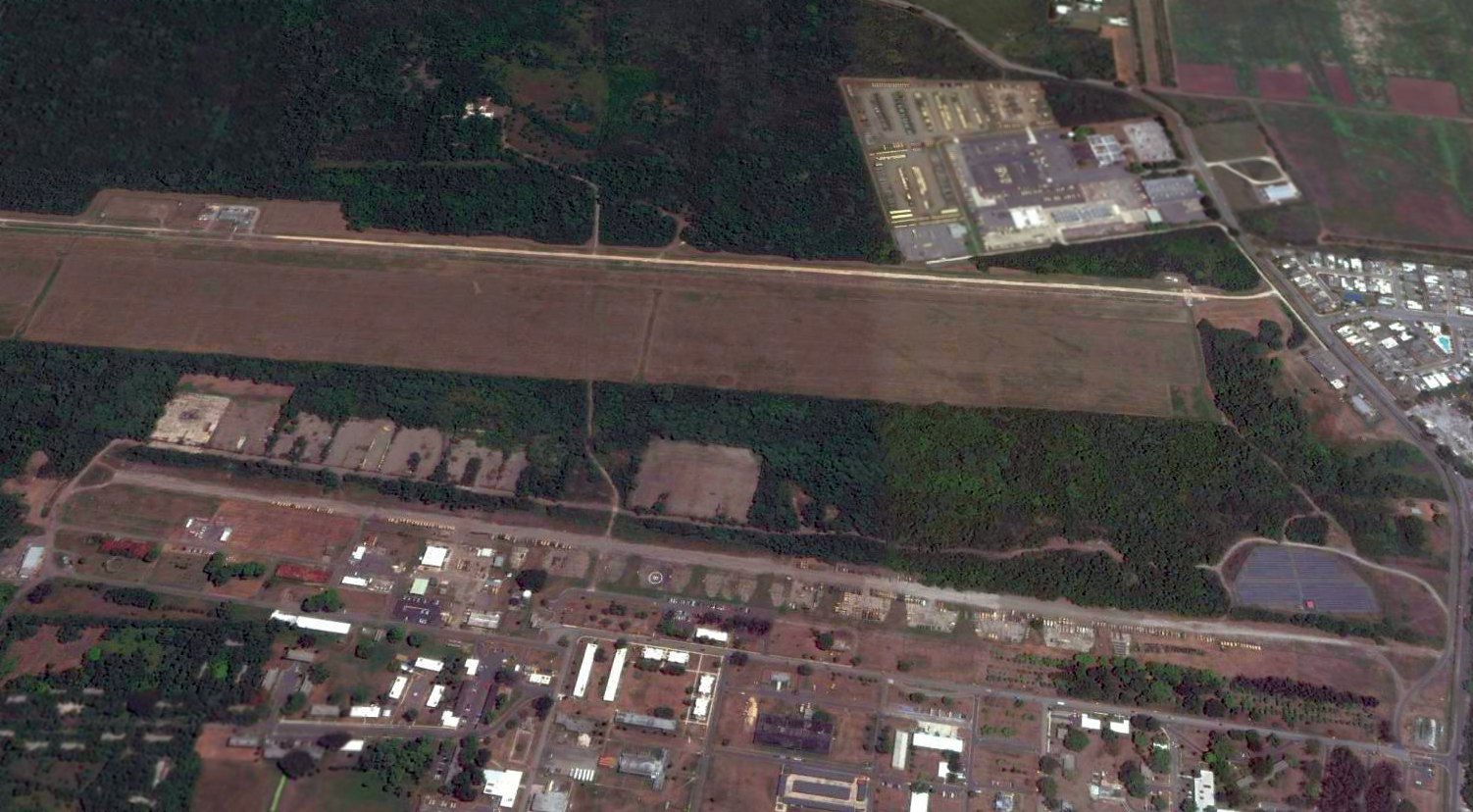
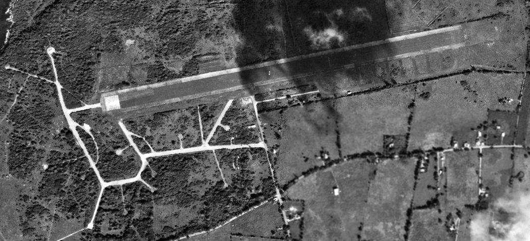
A 2016 aerial view looking northeast at the site of the Vega Baja airfield,
showing the model aircraft runway which has been overlaid on the west end of the former runway.
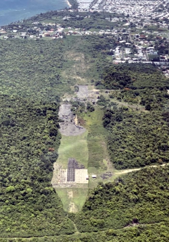
A 7/22/23 aerial view by Arnaldo Collazo looking northeast at the Vega Baja Auxiliary Airdrome.
Arnadlo reported, “The place is maintained by the municipality but abandoned at the same time.”
____________________________________________________
Since this site was first put on the web in 1999, its popularity has grown tremendously.
If the total quantity of material on this site is to continue to grow,
it will require ever-increasing funding to pay its expenses.
Therefore, I request financial contributions from site visitors,
to help defray the increasing costs of the site
and ensure that it continues to be available & to grow.
What would you pay for a good aviation magazine, or a good aviation book?
Please consider a donation of an equivalent amount, at the least.
This site is not supported by commercial advertising –
it is purely supported by donations.
If you enjoy the site, and would like to make a financial contribution,
you
may use a credit card via
![]() :
:
Please consider checking the box to make a monthly donatation.
For a mailing address to send a check, please contact me at: paulandterryfreeman@gmail.com
If you enjoy this web site, please support it with a financial contribution.
please contact me at: paulandterryfreeman@gmail.com
If you enjoy this web site, please support it with a financial contribution.
____________________________________________________
This site covers airfields in all 50 states.