Abandoned & Little-Known Airfields:
Western Oklahoma
© 2002, © 2024 by Paul Freeman. Revised 2/25/24.
This site covers airfields in all 50 states: Click here for the site's main menu.
____________________________________________________
Please consider a financial contribution to support the continued growth & operation of this site.
Canton Airpark (revised 2/25/24) - Waynoka Airport (original location) (revised 1/30/22)
Waynoka-Kelsey Airport (revised 1/30/22) - Woodward Municipal Airport (original location) (revised 2/26/21)
____________________________________________________
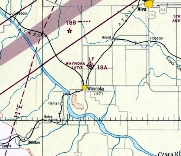
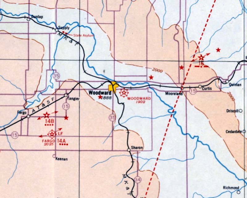
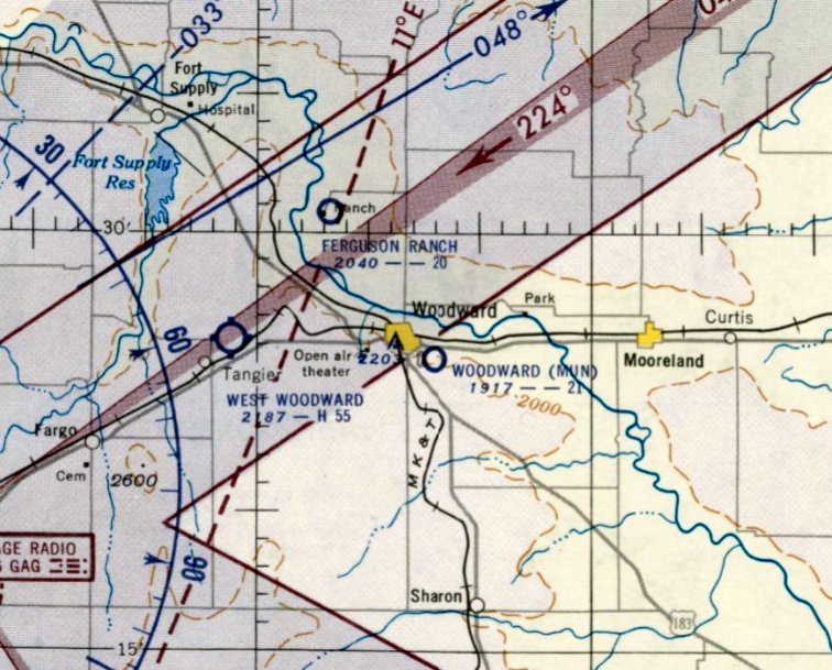
36.087, -98.609 (Northwest of Oklahoma City, OK)
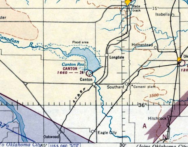
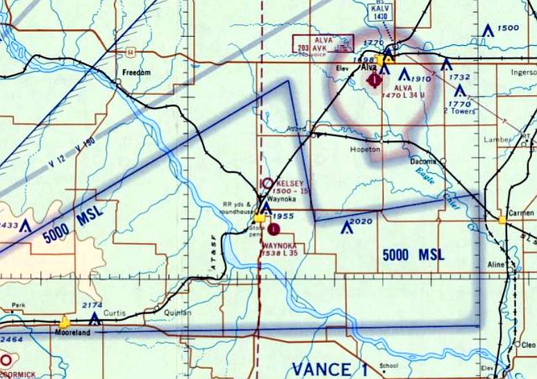
Canton Airpark, as depicted on the May 1951 Wichita Sectional Chart.
Canton Airpark was evidently constructed at some point between 1950-51,
as it was not yet depicted on the October 1950 Wichita Sectional Chart.
The earliest depiction which has been located of Canton Airpark was on the May 1951 Wichita Sectional Chart.
It depicted Canton Airpark as having an unpaved 2,400' runway.
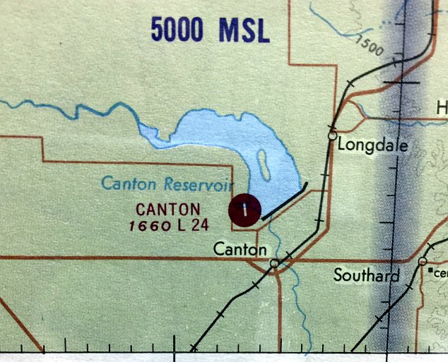
The last aeronautical chart depiction which has been located of Canton Airpark was on the December 1969 Sectional Chart (courtesy of Chuck Lipps).
It depicted Canton Airpark as having a single paved 2,400' north/south runway.
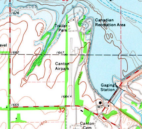
The 1971 USGS topo map depicted Canton Airpark as having a single paved north/south runway, with a paved ramp & a small building on the northeast side.
Garen Martens recalled, “Canton Airport... I landed there often in the mid-1970s.
The airstrip was built & maintained by the OK Aeronautics Commission for the use of tourism at Canton Lake.
There was a small administration building & a parking ramp.
There were never any planes permanently based there, but there was one local guy who tied down a Tri-Pacer for extended periods of time. It finally rotted away then disappeared.
The airport was used a little bit on weekends. There were privately-owned trailer houses just to the north of the runway & some folks would fly in for the weekend.
Canton Airport was a place to do touch & goes or to eat a hamburger at the nearby Overlook Café.”
An undated aerial view of Canton Airpark from the 1978 OK Airport Directory (courtesy of Garen Martens).
It described Canton Airpark as having a 2,400' asphalt Runway 17/35.
Garen Martens recalled, “The airport was closed around 1972-82 because of deterioration of the runway & lack of use.”
Tom Solinski recalled, “My one & only cross-country flight to Canton Airpark was on 7/22/81.
It sticks out in my mind because the NOTAM for the airport read ‘Caution concrete runway interspersed with grass clumps.'
When I landed, my first thought was they should change it to 'Caution grass runway has lumps of concrete.'
Although as I was leaving a brush hog tractor was pulling out to mow the concrete runway.”
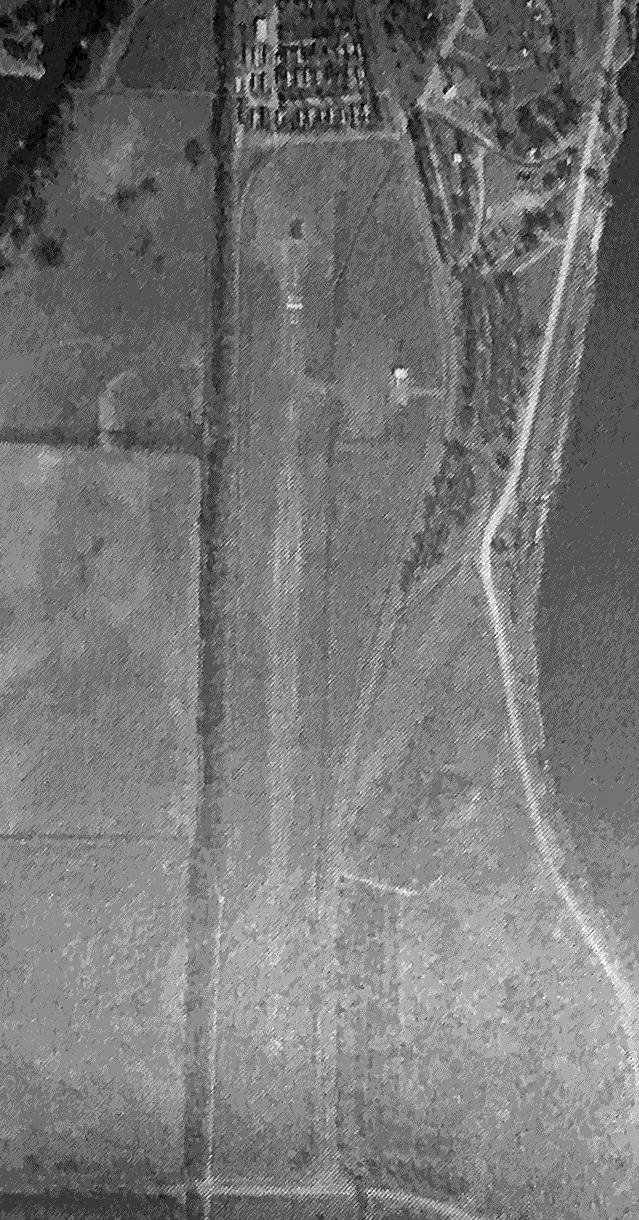
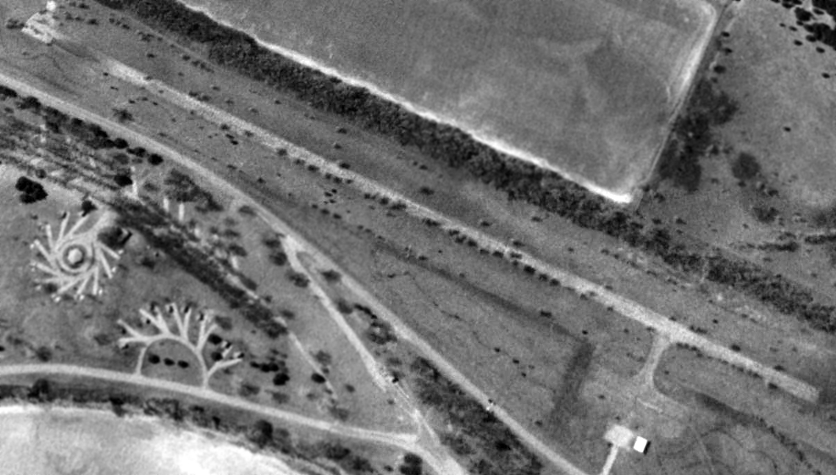
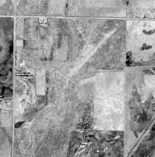
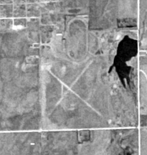
A 1981 aerial photo showed Canton Airpark remained intact,
but the runway was unmarked, and there were no aircraft on the field or any other indication of recent use.
A 1995 USGS aerial view looking southwest at the site of Canton Airpark showed it remained intact, including the ramp & a small building,
but the paved runway was starting to become overgrown with trees.
Chuck Lipps reported that Canton Airpark was hit by a tornado on 5/24/11: “It blew a lot of trailers & things into the lake.”
Garen Martens recalled, “The administration building blew away during the tornado.”
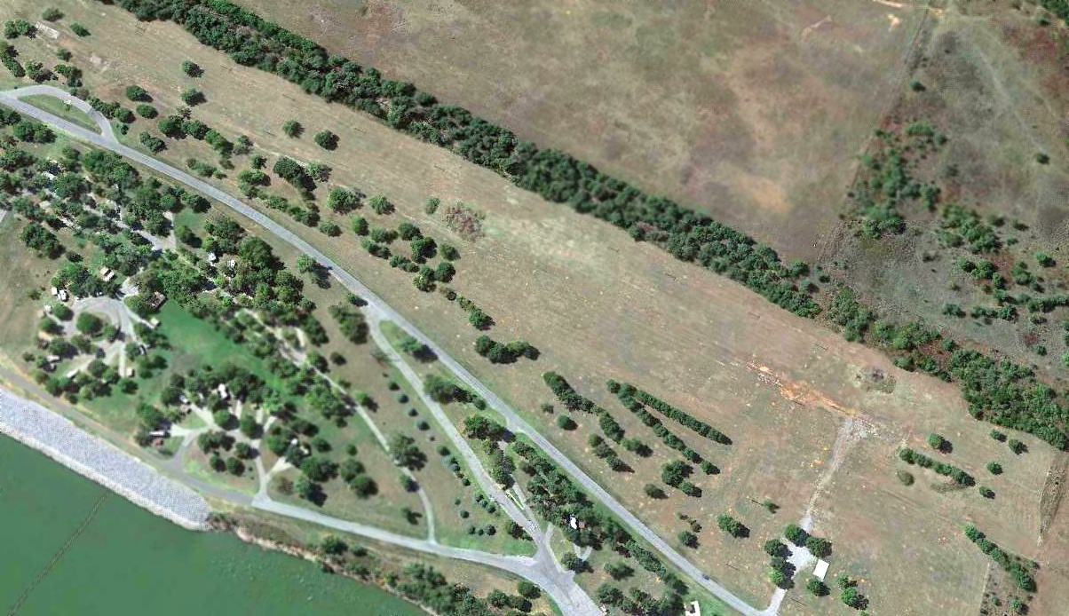
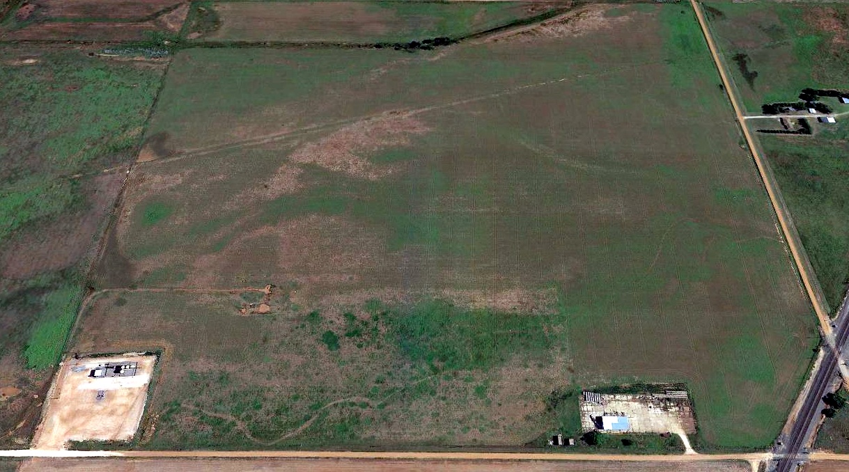
A 2019 aerial view looking southwest at the site of Canton Airpark showed the runway pavement had been largely removed,
and the site was no longer recognizable overall as a former airfield.
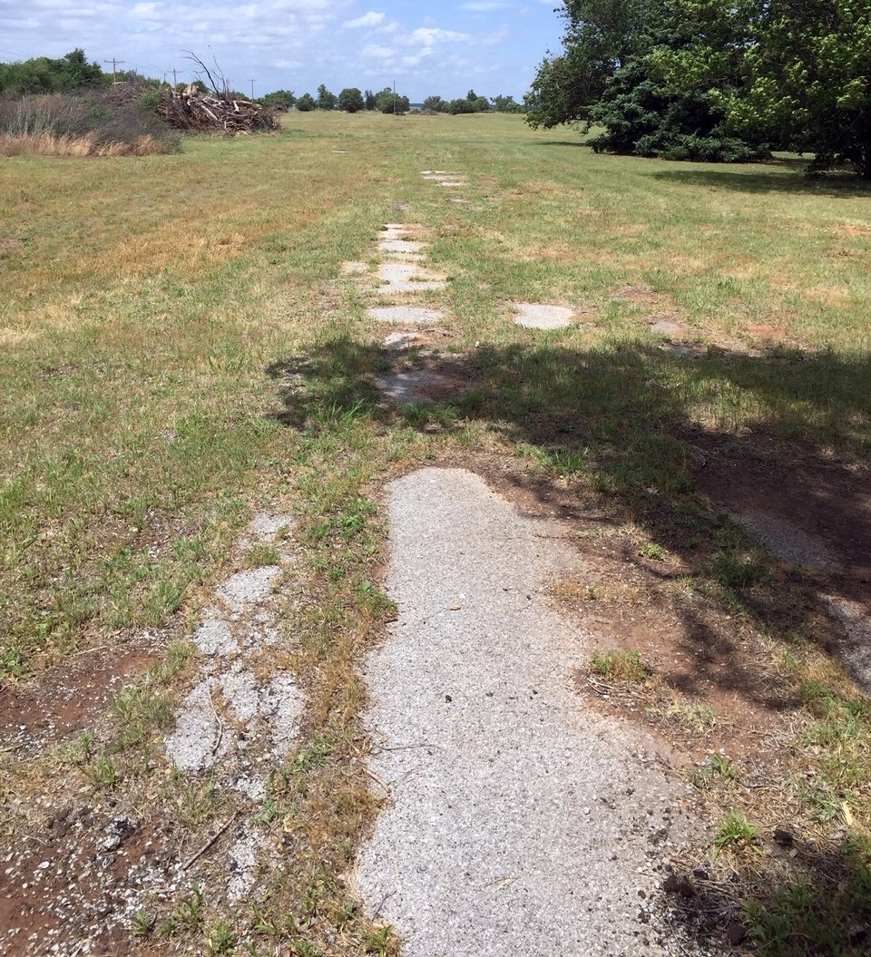
A 5/24/20 photo by Chuck Lipps looking north from midfield along the remains of the Canton Airpark runway pavement.
Chuck reported, “You can still see asphalt in a lot of areas but there are large trees grown up through it.”
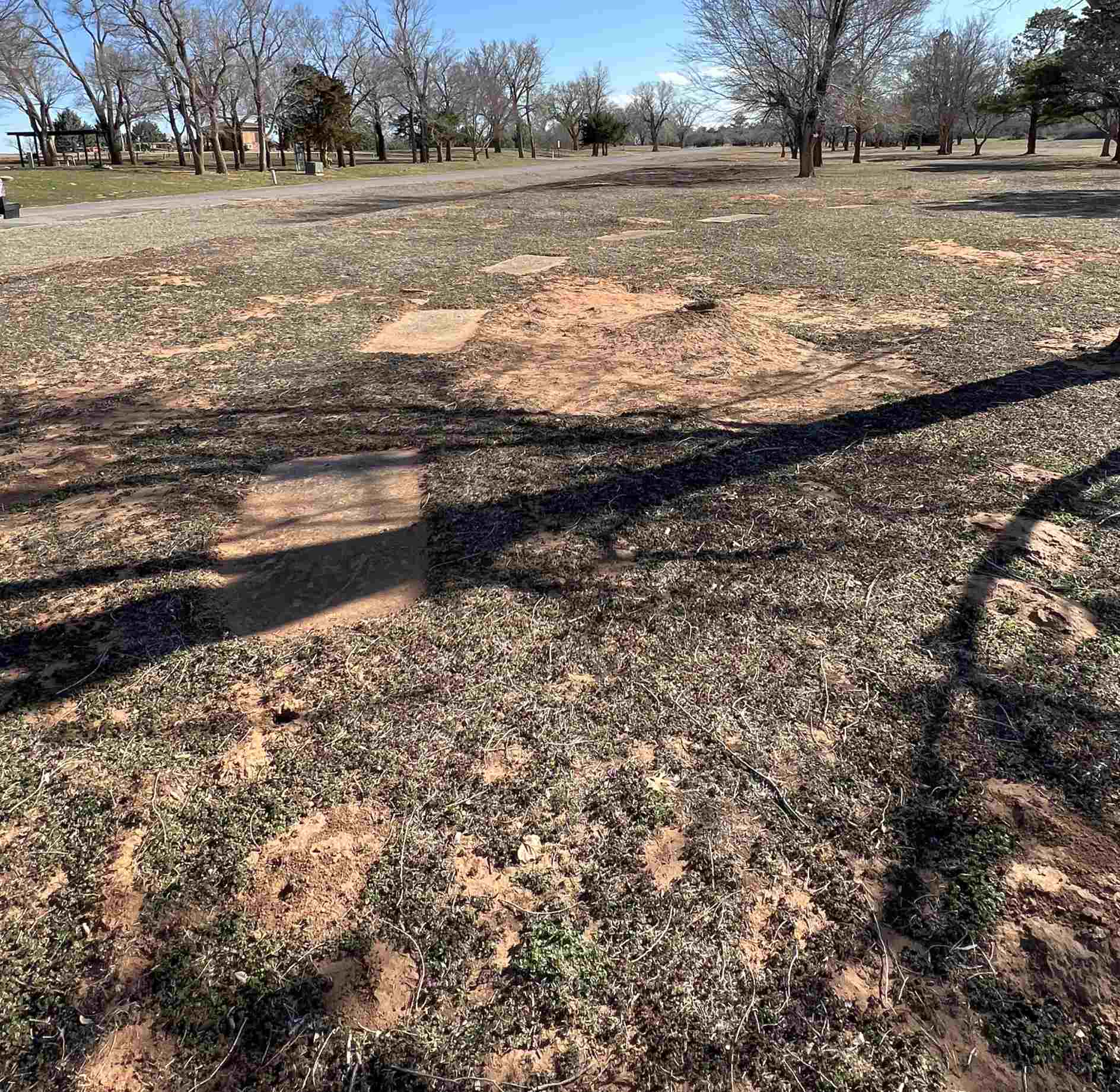
Garen Martens reported of Canton Airpark in 2020, “The runway still has a few spots of asphalt, but is basically non-existent.
The grounds are now a large prairie dog town.”
A 3/18/23 photo by Chuck Lipps of the remains of the Canton Airpark segmented circle.
Chuck reported, “It could have been a small tetrahedron also, but it’s not very big, and you can see the blocks in a circle.
The ground is terrible spongy & riddled with prairie dog tunnels & holes.”
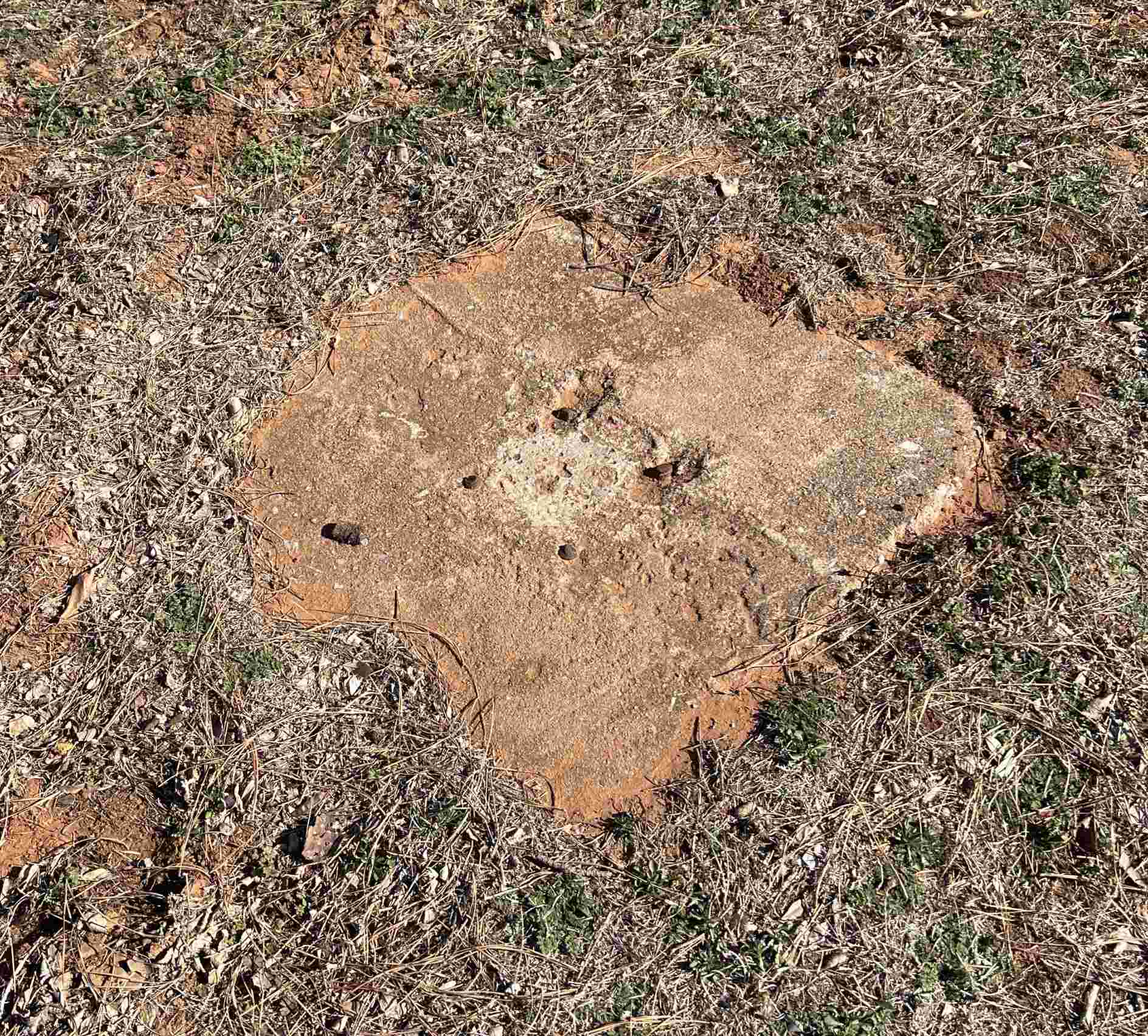
A 3/18/23 photo by Chuck Lipps of the remains of the Canton Airpark “windsock mounting pad at the center.”
Thanks to Chuck Lipps for pointing out this airfield.
____________________________________________________
Waynoka Airport (original location), Waynoka, OK
36.643, -98.849 (Northwest of Oklahoma City, OK)
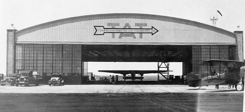
A circa 1929-39 photo of a Trimotor inside Waynoka Airport's Transcontinental Air Transport hangar (courtesy of John Humphrey).
The original airport for the town of Waynoka was located northeast of the town.
The earliest photo which which has been located of Waynoka Airport
was a circa 1929-39 photo of a Trimotor inside Waynoka's Transcontinental Air Transport hangar (courtesy of John Humphrey).
As of 1929, Waynoka's hangar was reportedly the 3rd largest hangar in the U.S.
The earliest aeronautical chart depiction which has been located of Waynoka Airport was on the June 1933 Witchita Sectional Chart.
It depicted Waynoka Airport on the west side of the railroad tracks, northeast of the town of Waynoka, and having Beacon #18 along the airway.
The 1/1/38 Commerce Department Airway Bulletin #2 (courtesy of Barry Chrenen) described Waynoka Airport as having 3 runways, oriented Northeast/Southwest, North/South, and East/West.
A beacon tower was described as being in the southeast corner, and a pole line to the east.
According to John Humphrey, “In the 1940s when Transcontinental Air Transport pulled out, the hangar that existed at this airport was dismantled & moved to Little Rock, AR.”
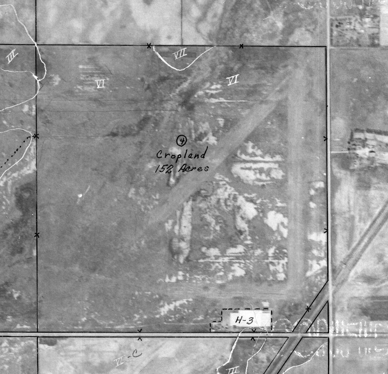
A 4/1/42 Woods County aerial view (courtesy of Barry Chrenen) depicted Waynoka Airport perhaps after its closure.
The 3 previously-noted unpaved runways, were evident, along with perhaps the foundation of the previously-removed hangar (labeled as “H-3” at the southeast).
The airport was no longer labeled, the property instead being noted as “Cropland 152 acres”.
The last aeronautical chart depiction which has been located of Waynoka Airport was on the February 1944 Wichita Sectional Chart.
It depicted Waynoka Airport on the west side of the railroad tracks, northeast of the town of Waynoka, and having Beacon #18A along the airway.
Waynoka Airport was evidently closed at some point in 1944, as it was no longer depicted on the August 1944 Wichita Sectional Chart,
listed among active airfields in the 1945 AAF Airfield Directory (courtesy of Scott Murdock),
or depicted on the March 1946 Wichita Sectional Chart.
At some point between 1946-47, Waynoka-Kelsey Airport was opened adjacent to the southwest.
It is not known why a different airport had to be established right across the road.
A 2017 aerial view looking north showed no trace of the original Waynoka Airport runways, but the concrete hangar foundation remained quite prominent on the southeast corner.
Thanks to John Humphrey for pointing out this airfield.
____________________________________________________
Waynoka-Kelsey Airport, Waynoka, OK
36.637, -98.857 (Northwest of Oklahoma City, OK)

Waynoka-Kelsey Airport, as depicted on the September 1947 Wichita Sectional Chart.
Waynoka-Kelsey Airport was evidently established at some point between 1946-47,
as it was not yet depicted on the March 1946 Wichita Sectional Chart.
The earliest depiction which has been located of Waynoka-Kelsey Airport was on the September 1947 Wichita Sectional Chart.
Note that a predecessor Waynoka Airport was located immediately adjacent to the northeast.
It is not known why a different airport had to be established right across the road.
A 6/4/54 USGS aerial view depicted Waynoka-Kelsey Airport as having an unpaved northeast/southwest runway.
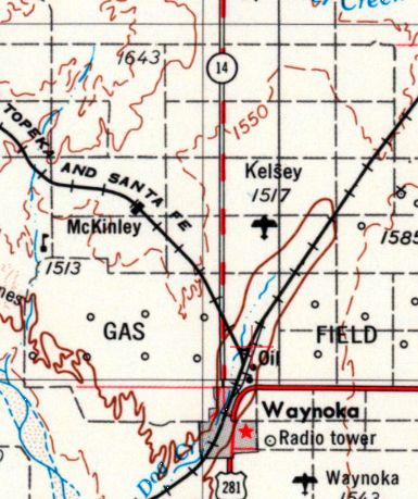
Kelsey Airport, as depicted on the 1955 USGS topo map.
The last aeronautical chart depiction which has been located of Kelsey Airport was on the January 1969 Wichita Sectional Chart.
It depicted Kelsey Airport as having a mere 1,500' unpaved runway.
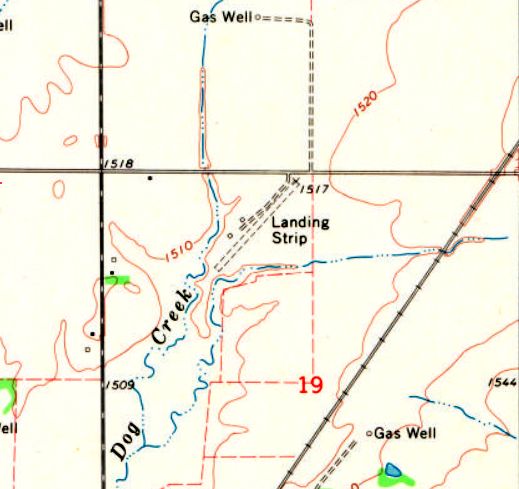
The 1969 USGS topo map depicted Kelsey Airport as a single unpaved northeast/southwest runway,
labeled simply as “Landing Strip”, with 2 small buildings on the west side.
Kelsey Airport was evidently closed (for reasons unknown) at some point between 1969-85,
as it was no longer depicted on the 1985 USGS topo map.
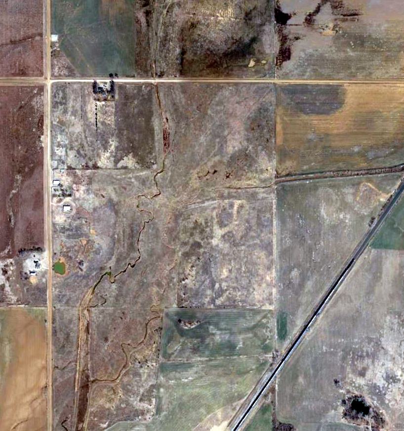
A slight trace of a northeast/southwest runway was still recognizable at the site of Kelsey Airport on a 2014 aerial view.
No airfield was depicted at the site of Kelsey Airport on the July 2016 Wichita Sectional Chart.
The site of Kelsey Airport is located southeast of the intersection of North 2330 Road & East 0260 Road.
Thanks to John Humphrey for pointing out this airfield.
____________________________________________________
Woodward Municipal Airport (original location), Woodward, OK
36.42, -99.38 (Northwest of Oklahoma City, OK)
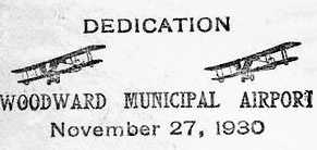
A postmark commemorating the 11/27/30 dedication of Woodward Municipal Airport.
The original municipal airport for Woodward was located adjacent to the southeast side of the town.
Woodward Airport was not yet depicted on the 1929 Rand McNally Air Trails map (according to Chris Kennedy).
A postmark commemorated the 11/27/30 dedication of Woodward Municipal Airport.
The earliest depiction of Woodward Municipal which has been located was on the March 1933 Wichita Sectional Chart.
The Airport Directory Company's 1933 Airport Directory (courtesy of Chris Kennedy)
described Woodward Municipal Airport as having a 2,100' x 1,993' rectangular sod landing area.
The Airport Directory Company's 1941 Airport Directory (courtesy of Chris Kennedy) depicted Woodward Municipal Airport as having 3 sod runways,
with the longest being the 2,200' northwest/southeast runway.
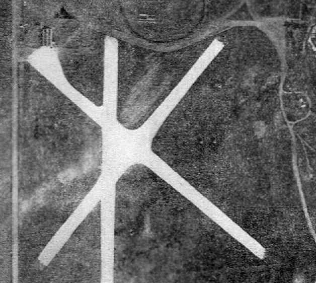
A circa 1943-45 aerial view looking north at the Woodward Municipal Airport from the 1945 AAF Airfield Directory (courtesy of Scott Murdock).
The directory described “Woodward Municipal Airport #1” as a 160 acre square property having 3 sod runways,
with the longest being the 2,100' northeast/southwest strip.
The field was said to have a single 120' x 60' steel hangar, to be owned by the City of Woodward, and operated by private interests.
The October 1950 Wichita USAF Sectional Chart (courtesy of Chris Kennedy) depicted Woodward Municipal as having a 2,200' unpaved runway.
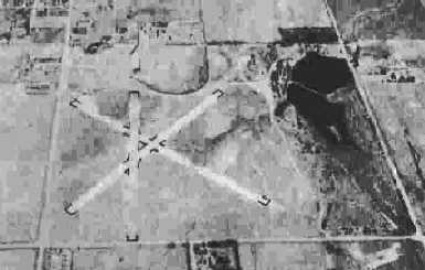
An aerial view looking south at the Woodward Municipal Airport from the 1950 OK Airport Directory (courtesy of Chris Kennedy).
The directory described Woodward Municipal as having 3 sod runways, with the longest being the 2,200' northwest/southeast & northeast/southwest strips.
The field was said to offer repairs, fuel, and hangars, and the manager was listed as Burrell Tibbs.
George D Welsch recalled, “My father, G.W. (Jack) Welsch was the manager of the airport when it closed & he moved to the 'West' airport.
He offered maintenance, fuel, flight instruction, charter & probably any other aviation service that might turn a buck.
He also operated a spray operation & often flew spotter flights for coyote hunts.”
The last aeronautical chart depiction which has been located of the original Woodward Municipal Airport was on the December 1953 Wichita Sectional Chart.
It depicted Woodward Municipal as having a 2,100' unpaved runway.
The last photo which has been located of the original Woodward Municipal Airport was a 6/4/54 USGS aerial view.
It depicted Woodward as having 3 runways.
The original Woodward Municipal Airport was evidently closed at some point between 1953-54,
as it was no longer depicted at all on the June 1954 Wichita Sectional Chart or the 1955 USGS topo map.
It had evidently been replaced by the much larger former Woodward Army Airfield (a few miles west of the town),
which had been released by the military & reused as a civilian airport.
By the time of the 2/11/68 USGS aerial photo, the site of the original Woodward Municipal Airport had been reused as a golf course,
with no trace of the runways remaining.
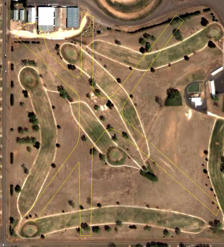
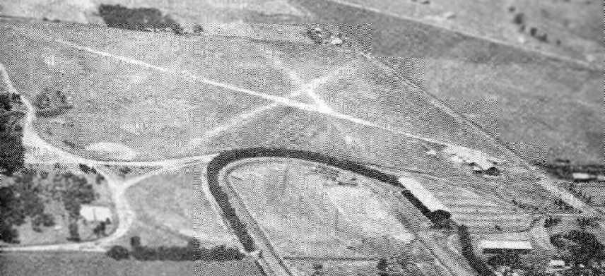
A 2004 aerial photo, annotated by Chris Kennedy to show the runway layout of the original Woodward Municipal Airport.
The 3rd-from-the-left building at the northwest corner is an original hangar
(the same building was visible in the photo from the 1941 airport directory).
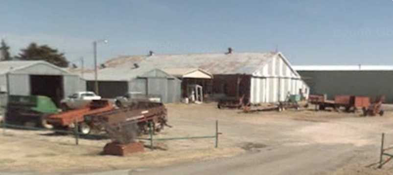
A circa 2004-2010 photo looking northeast at the former hangar which remains at the site of the original Woodward Municipal Airport.
The former Woodward Municipal Airport hangar was still standing in a 2013 aerial photo.
A 2015 aerial photo showed the former Woodward Municipal Airport hangar had been removed at some point between 2013-2015,
erasing the last trace of the airport.
The site of the original Woodward Municipal Airport is located southeast of the intersection of 1st Street & Temple Houston Drive.
____________________________________________________
Since this site was first put on the web in 1999, its popularity has grown tremendously.
If the total quantity of material on this site is to continue to grow,
it will require ever-increasing funding to pay its expenses.
Therefore, I request financial contributions from site visitors,
to help defray the increasing costs of the site
and ensure that it continues to be available & to grow.
What would you pay for a good aviation magazine, or a good aviation book?
Please consider a donation of an equivalent amount, at the least.
This site is not supported by commercial advertising –
it is purely supported by donations.
If you enjoy the site, and would like to make a financial contribution,
you
may use a credit card via
![]() :
:
Please consider checking the box to make a monthly donatation.
For a mailing address to send a check, please contact me at: paulandterryfreeman@gmail.com
If you enjoy this web site, please support it with a financial contribution.
please contact me at: paulandterryfreeman@gmail.com
If you enjoy this web site, please support it with a financial contribution.
____________________________________________________
This site covers airfields in all 50 states.