Abandoned & Little-Known Airfields:
Southeastern Ohio
© 2002, © 2024 by Paul Freeman. Revised 9/1/24.
This site covers airfields in all 50 states: Click here for the site's main menu.
____________________________________________________
Please consider a financial contribution to support the continued growth & operation of this site.
Athens Municipal Airport / (Original) Ohio University Airport (revised 10/2/22) - (Original) Jefferson County Airport / Friendship Airpark (revised 9/1/24)
Lore City Airport (revised 1/9/22) - Marietta Airport (revised 10/2/22) - Twin City Airport / Holzer Airport (revised 4/10/20)
____________________________________________________
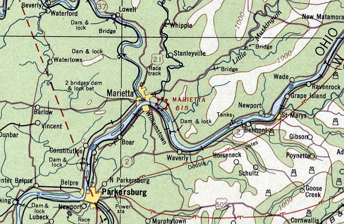
Marietta Airport, Marietta, OH
39.405, -81.419 (East of Columbus, OH)
Marietta Airport, as depicted on the November 1934 Sectional Chart (courtesy of Rob Grant).
The date of establishment of Marietta Airport has not been determined.
The earliest depiction which has been located of Marietta Airport was on the November 1934 Sectional Chart (courtesy of Rob Grant).
It depicted Marietta Airport as a commercial/municipal airport.
The 1938 Descriptions of Airports & Landing Fields (courtesy of Rob Grant)
described Marietta Airport as a municipal airport, consisting of an irregularly-shaped sod field having one 3,150' northwest/southeast runway.
One hangar was said to be marked with the field's name.
The 1947 Directory of CAA Approved Ground & Flight Schools (courtesy of Rob Grant)
described Marietta Airways Inc as conducting primary flight instruction at Marietta Airport.
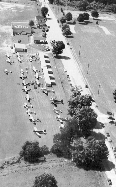
A 1947 aerial view looking west at Marietta Municipal Airport (courtesy of Rob Grant),
showing one hangar with “Marietta” painted on the roof, a row of T-hangars, and over 2-dozen light aircraft.
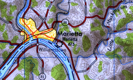
The only topo map depiction which has been located of Marietta Airport was on the 1949 USGS topo map (courtesy of Rob Grant).
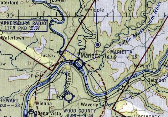
The last depiction which has been located of Marietta Airport was on the July 1953 Sectional Chart (courtesy of Rob Grant).
It described Marietta Airport as a commercial airport having 2 unpaved runways, with the longest being 2,800'.
Marietta Airport evidently closed (for reasons unknown) at some point between 1953-57,
as a 1957 aerial view showed the row of hangars having been replaced by other small buildings.
Marietta Airport was no longer depicted on the 1960 USGS topo map.
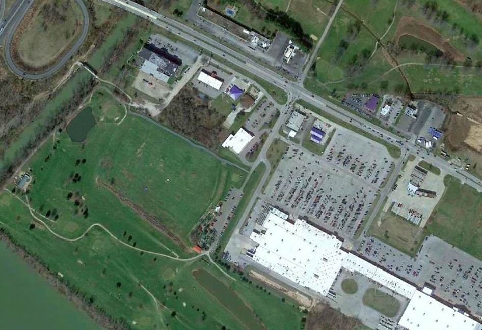
A 2021 aerial view shows no trace remaining of Marietta Airport, with the property covered by retail buildings & the Pioneer Family Golf Range.
Thanks to Rob Grant for pointing out this airifeld.
____________________________________________________
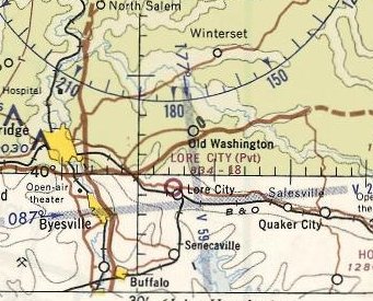
Lore City Airport, Lore City, OH
39.99, -81.46 (East of Columbus, OH)
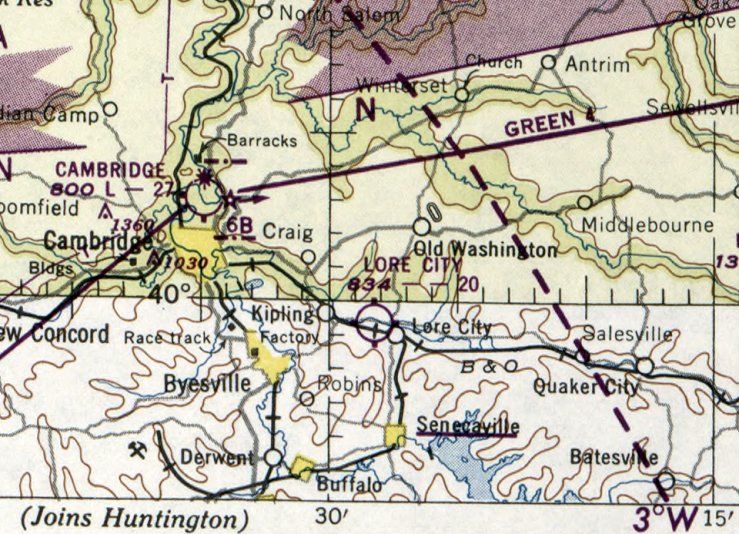
Lore City Airport, as depicted on the November 1950 Cleveland Sectional Chart.
Lore City Airport was evidently established at some point between 1947-50,
as it was not yet depicted on the 1947 Cleveland Sectional Chart.
According to Elizabeth Duchè, the Lore City Airport office building “was originally built in the 1940s
when pilots were trained from the hangar & landing strip on the property.
Lore City Flying Service operated from there in the 1950s.”
The earliest depiction of the Lore City Airport which has been located was on the November 1950 Cleveland Sectional Chart.
It depicted Lore City Airport as having a 2,000' unpaved runway.
Lore City Airport was not depicted at all on the 1956 USGS topo map.
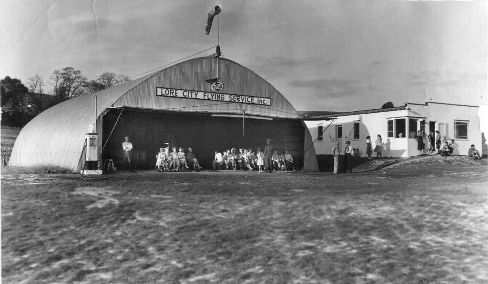
The earliest photo which has been located of the Lore City Airport was a circa 1950s photo looking northeast
at a gathering inside the Lore Flying Service hangar (courtesy of Ken Lane), with the airport office to the right.
Ken Lane recalled, "My grandfather used to own an airport outside of Lore City.
It was a grass strip & according to my dad, it was called 'Lore City Flying Service' & my grandfather sold Cessna 120s & 140s.”
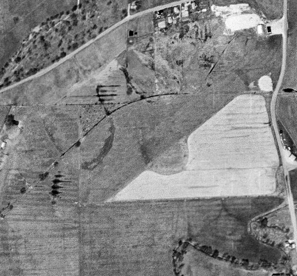
A 4/19/60 USGS aerial photo depicted Lore City Airport as having a hangar at the northeast corner of a northeast/southwest grass runway.
The last depiction which has been located of the Lore City Airport was on the May 1968 Cleveland Sectional Chart.
It depicted Lore City as a private airfield having a mere 1,800' unpaved runway.
Lore City Airport was evidently closed (for reasons unknown) at some point between 1968-70,
as it was no longer depicted on the 1970 Cleveland Sectional Chart.
Ken Lane reported, "The hangar has been torn down. The FBO building is now a restaurant/bar."
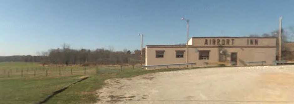
At some point the former airport office was reused as a restaurant, the Airport Inn.
The Airport Inn has been owned by Donald & Elizabeth Duchè since 1993.
A 1994 USGS aerial photo showed that the arched-roof hangar adajcent to the office building had been removed,
and replaced with a peaked-roof pavilion/shed, used by the restaurant.
A circa 2005-2011 photo looking west at the Airport Inn, the former Lore City Airport office.
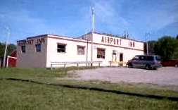
A circa 2005-2011 photo looking northwest at the Airport Inn, the former Lore City Airport office.
A 2008 photo showed the Airport Inn in an unchanged fashion.
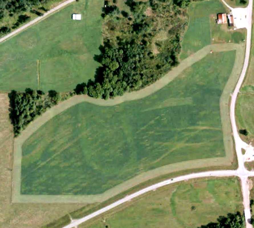
A 6/5/09 aerial view shows the Lore City Airport grass airfield area remained clear, and the office building at the northeast corner remained standing.
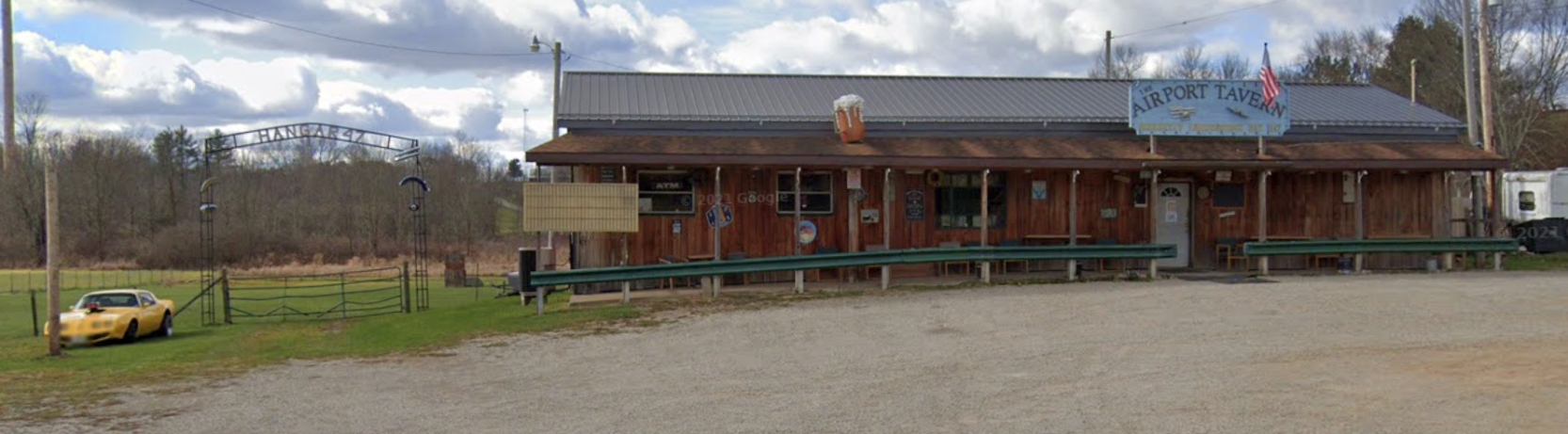
A November 2021 photo looking west at the Airport Tavern, the former Lore City Airport office, having been upgraded at some point between 2008-2021.
The site of the Lore City Airport is located northwest of the intersection of Route 285 & Wintergreen Road.
Thanks to Ken Lane for pointing out this airifeld.
____________________________________________________
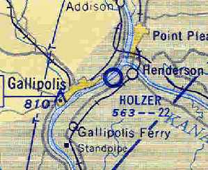
Twin City Airport / Holzer Airport, Gallipolis, OH
38.823, -82.17 (Southeast of Columbus, OH)
Twin City Airport, as depicted on the February 1934 Huntington Sectional Chart.
The date of construction of the Twin City airport has not been determined.
The earliest reference to the field which has been located
was in The Airport Directory Company's 1933 Airports Directory (courtesy of Chris Kennedy).
It described Twin City as a municipal airport, having 2 sod runways: 4,000' northeast/southwest & 2,000' north/south.
The earliest depiction of the Twin City Airport which has been located was on the February 1934 Huntington Sectional Chart.
It depicted Twin City as a commercial/municipal airport.
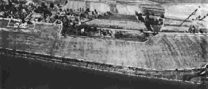
The earliest photo which has been located of Twin City Airport was an undated aerial view looking northeast
from The Airport Directory Company's 1937 Airports Directory (courtesy of Bob Rambo).
The photo was presumably taken during some kind of airshow,
as there were a large number of planes parked on the left side of the picture, along with hundreds of cars.
The Airport Directory Company's 1937 Airports Directory (courtesy of Bob Rambo) described Twin City Airport as having 3 sod runways.
The Airport Directory Company's 1941 Airports Directory (courtesy of Chris Kennedy)
described Twin City as having 2 sod runways: 3,000' northeast/southwest & 1,200' northwest/southeast.
A 9/30/43 aerial view looking north from the 1945 AAF Airfield Directory (courtesy of Scott Murdock)
depicted Twin Cities Airport as an irregularly-shaped grass field.
The 1945 AAF Airfield Directory (courtesy of Scott Murdock) described Twin Cities Airport
as a 93 acre L-shaped property having 2 sod runways, measuring 3,000' ENE/WSW & 1,200' north/south.
The field was said to have 2 wooden 50' square hangars,
to be owned by private interests, but not to be currently in operation.
The Haire Publishing Company's 1945 Airports Directory (courtesy of Chris Kennedy)
described "Twin Cities Airport" as a "Class 2" facility, owned by Dr. C. E. Holzer.
The field was said to have 2 sod runways (3,000' east-northeast/west-southwest & 1,200' north/south),
along with 2 hangars.
According to Mark Phillips, airport owner Dr. C. E. Holzer was a prominent area physician.
The airport was evidently renamed after its owner at some point between 1945-54,
as it was labeled as "Holzer" Airport on the July 1954 Huntington Sectional Chart (courtesy of Chris Kennedy).
It was depicted as having a 2,200' unpaved runway.
A 4/13/56 USGS topo map depicted one single-engine aircraft on the Holzer grass runway,
and a few small hangars on the west side.
The January 1957 Huntington Sectional Chart (courtesy of Chris Kennedy)
depicted Holzer Airport as having a 2,200 unpaved runway.
The 1960 USGS topo map depicted Holzer Airport's single grass runway, labeled simply as "Airstrip".
A 1967 USGS topo map depicted 3 single-engine aircraft parked next to a T-hangar.
At some point between 1967-75, the Holzer Airport was replaced by the Gallia-Meigs Regional Airport,
just across Route 7 to the north, which boasted a paved runway.
The precise date of closure of Holzer Airport has not been determined.
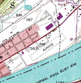
The 1975 USGS topo map still depicted Holzer Airport's single grass runway, labeled simply as "Airstrip".
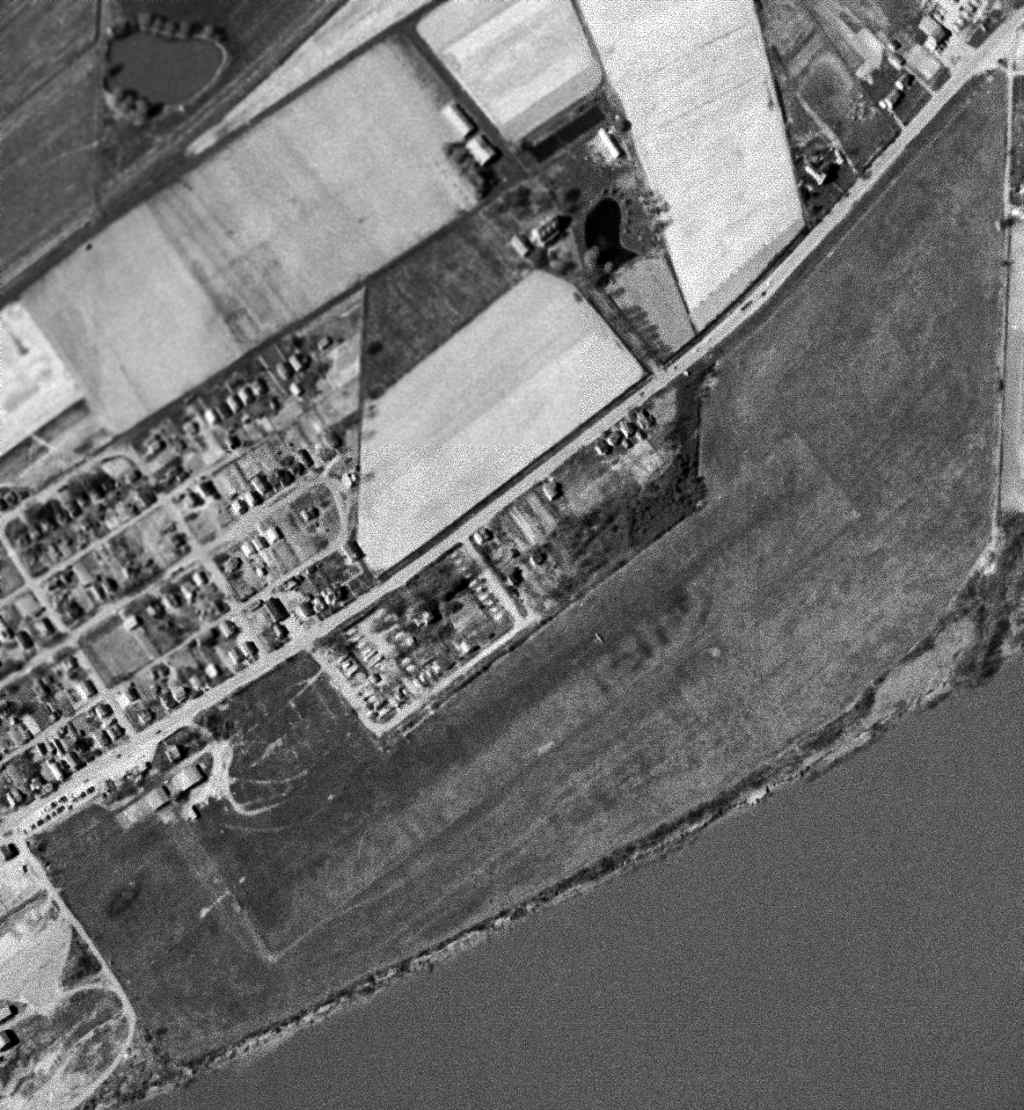
A 1988 USGS aerial view looking north showed the site of Holzer Airport was remarkably undisturbed.
It is unknown if any of the buildings surrounding the field date from its airport days.
According to Mark Phillips, “the airstrip figured prominently in the local legend of 'Mothman',
the creature for which there was a movie released in 2002, starring Richard Gere & Laura Linney.
According to old press clippings, a few men were awaiting a friend's landing.
A large winged profile appeared, but not a plane; a creature, some sort of strange bird. Just part of Mothman lore.”
Mark Phillips reported in 2005 that “The southwest portion of the airstrip was sold for a Wal-Mart Supercenter,
which was finished about 4 or 5 years ago.”
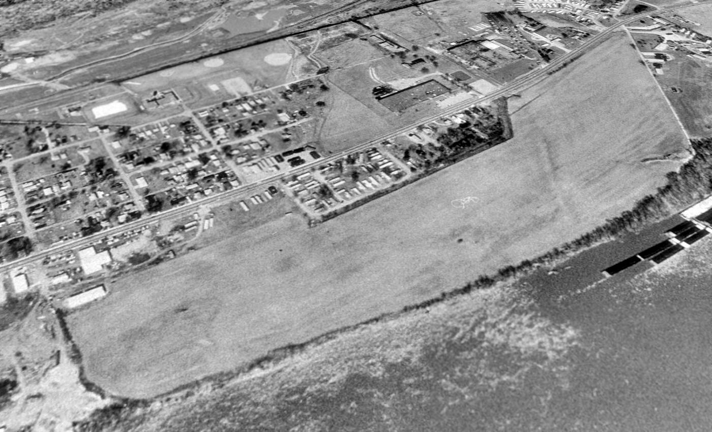
A 2015 aerial view looking north showed the site of Holzer Airport to be completely redeveloped, erasing any trace of the airport.
The site of the former Twin City / Holzer Airport is located south of the intersection of Route 7 & Old Airport Road, appropriately enough.
____________________________________________________
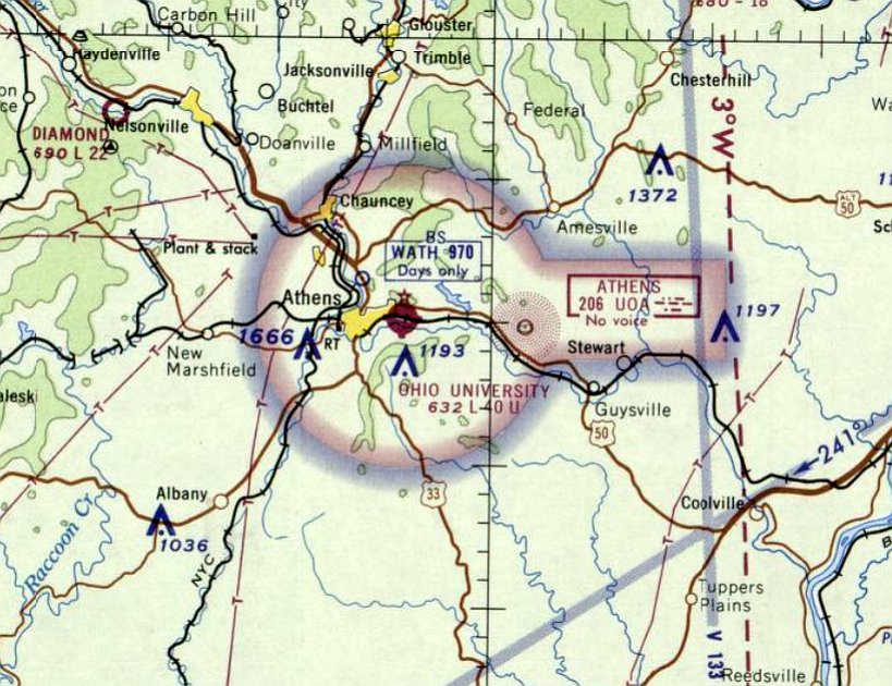
Athens Municipal Airport / (Original) Ohio University Airport, Athens, OH
39.336, -82.07 (Southeast of Columbus, OH)
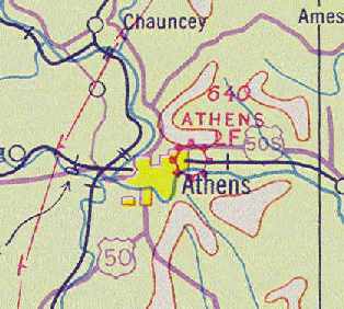
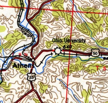
Athens Airport, as depicted on the February 1934 Huntington Sectional Chart.
The first airfield in Athens was located on East State Street.
The date of establishment of Athens Municipal Airport has not been determined.
The earliest depiction which has been located of Athens Airport was on the February 1934 Huntington Sectional Chart.
According to Mark Hess, “Athens Municipal Airport... was built with Federal funds.”
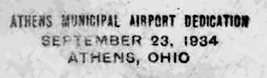
A postmark commemorated the 9/23/34 Athens Municipal Airport Dedication.
The earliest photo which has been located of Athens Municipal Airport was undated aerial view looking northwest
from The Airport Directory Company's 1937 Airports Directory (courtesy of Bob Rambo).
It depicted a single hangar at the northwest corner of the field, which was described as having "Athens" painted on the roof.
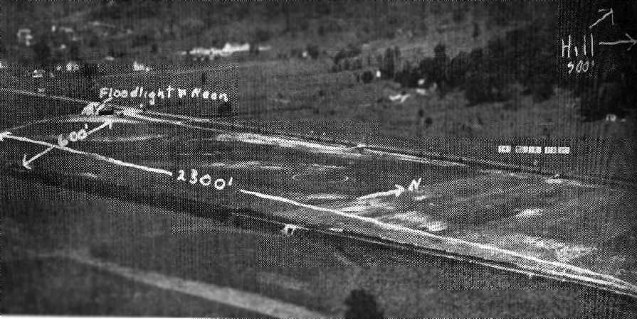
The directory described Athens Municipal Airport as having a 2,300' x 600' sod landing area.
The 1938 Directory of Airports & Landing Fields (courtesy of Rob Grant) described Athens Airport as a municipal airport
consisting of a 2,300' x 700' rentangular sod field, with ATHENS painted on its hangar roof.
Athens Airport, as depicted on the June 1939 Huntington Sectional Chart (courtesy of Chris Kennedy).
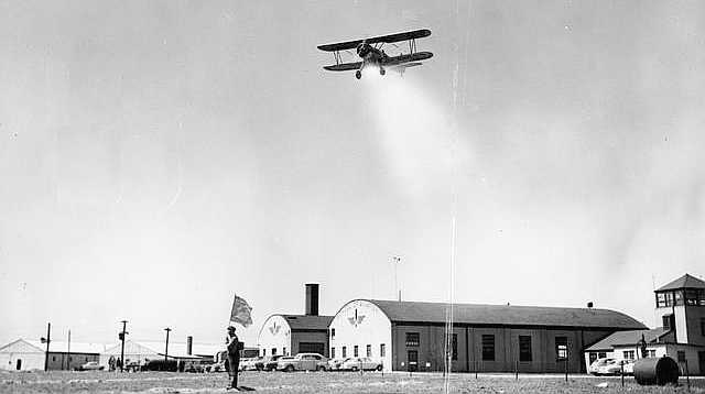
A 1942 photo of a biplane overflying some type of ceremony at Athens Municipal Airport (courtesy of Mark Hess),
showing several hangars & a control tower.
The airport was owned by the Rowland Family until 1943, when Ohio University purchased it.
The airfield was initially used for the Civilian Air Patrol & eventually for the University's aviation training program.
A 10/10/43 aerial view looking north from the 1945 AAF Airfield Directory (courtesy of Scott Murdock)
depicted OH University Airport as having a single east/west runway.
The airport was still depicted as "Athens" on the May 1944 Huntington Sectional Chart (courtesy of Chris Kennedy),
but by the time of the November 1944 Huntington Sectional Chart (according to Chris Kennedy),
it was labeled "Ohio University".
The 1945 AAF Airfield Directory (courtesy of Scott Murdock) described OH University Airport
as a 62 acre irregularly-shaped property having a single 4,000' east/west sod runway.
The field was said to have 3 metals hangars (the largest measuring 80' x 60'),
and to be owned & operated by Ohio University.
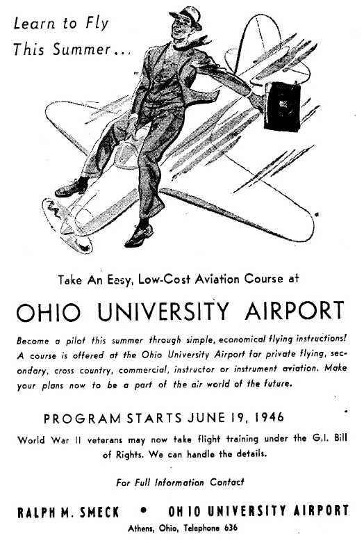
A 5/12/46 advertisement for flight training at Ohio University Airport (courtesy of Mark Hess).
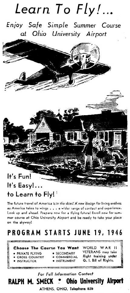
A 5/14/46 advertisement for flight training at Ohio University Airport (courtesy of Mark Hess).
According to Ohio University, “Joan Mace began work as a flight instructor at the Ohio University Airport in 1946.”
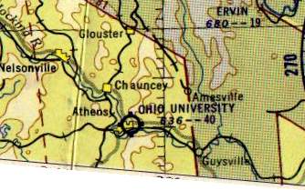
Ohio University Airport as depicted on the 1947 USGS topo map.
The 1947 CAA Directory of Ground & Flight Schools (courtesy of Rob Grant)
described Athens Airport as being operated by Smeck Flying Service, which provided primary flight instruction.
As depicted on the 1953 Flight Chart (courtesy of Scott O'Donnell), Ohio University Airport had a 4,000' unpaved runway.
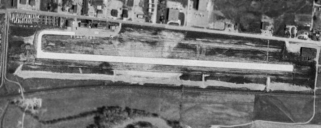
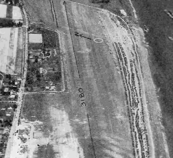
A 4/23/60 aerial photo depicted the original Ohio University Airport as having a single paved east/west runway, with several small hangars & 5 light aircraft on the northwest side.
In the 1962 AOPA Airport Directory, the Ohio University Airport was described as having a single 3,200' concrete Runway 9/27.
The operator was listed as Ohio University.
According to Ohio University, “Joan Mace took an academic position in the flight instruction program in 1963.
Mace would eventually become the first woman to chair the Fritz & Dolores Russ College of Engineering & Technology's Department of Aviation.”
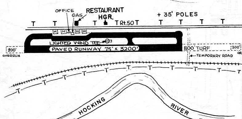
The layout of the Ohio University Airport, as depicted on the 1966 OH Airport Directory (courtesy of Chris Kennedy).
Showing that you can't always trust the USGS topo maps,
the 1967 USGS topo map actually depicted the Ohio University Airport in the wrong location -
on the opposite (south) side of the Hocking River!
The Ohio University Airport was still depicted on the 1967 Huntington Sectional Chart (according to Chris Kennedy).
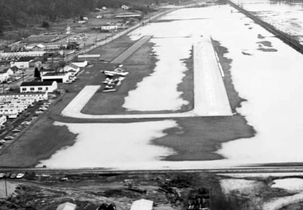
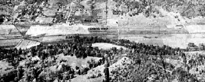
A circa 1960s aerial view (courtesy of Rob Grant) looking east at a partially-flooded Ohio University Airport.
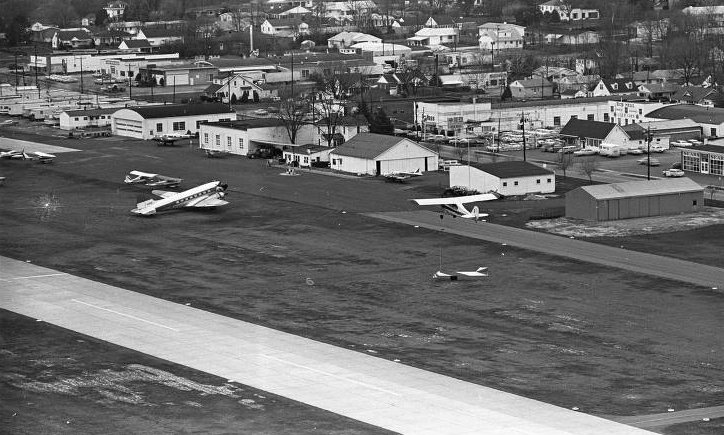
A circa 1960s aerial view (courtesy of Rob Grant) looking northwest at the Ohio University Airport, showing a DC-3 & several other aircraft.
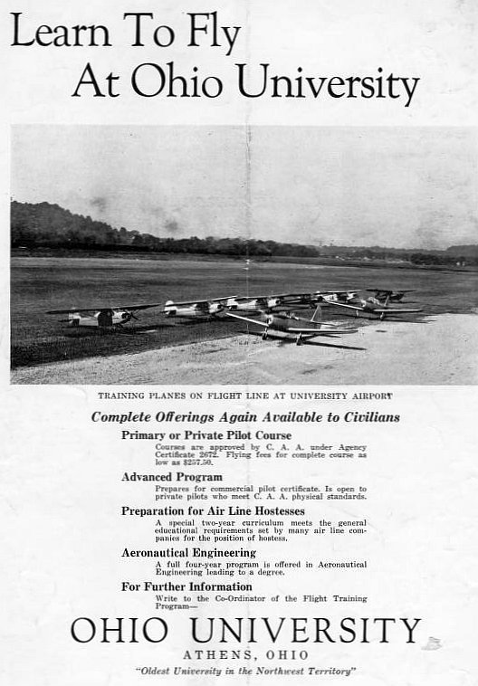
A circa 1960s advertisement (courtesy of Rob Grant) for Ohio University's flight training program.
The last aeronautical chart depiction which has been located of the original Ohio University Airport was on the February 1969 Huntington Sectional Chart,
which depicted Ohio University Airport as having a single 4,000' paved northwest/southeast runway.
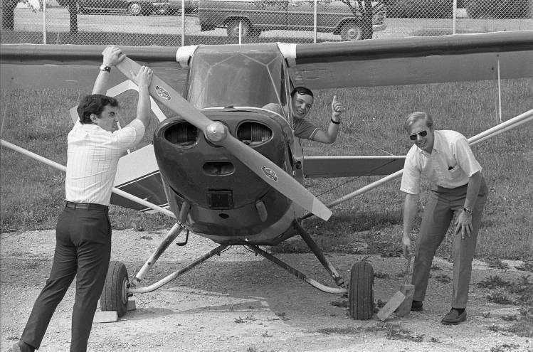
A 1969 photo (courtesy of Rob Grant) of 3 men & a Taylorcraft at the Ohio University Airport, captioned “Flying Bobcats prepare for flight.”
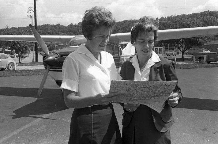
The last photo which has been located of the original Ohio University Airport was a 1969 photo (courtesy of Rob Grant) of Joan Mace & another woman studying an aeronautical chart in front of a Cessna.
In the late 1960s, with planning taking place for a new highway to be built nearby,
the University was forced to find another location for its airfield.
After exploring nine sites, Albany was selected as the site of the new Gordon Bush Regional Airport.
The original airport in Athens presumably closed when the new airport opened (in the 1970s?).
The original Ohio University Airport was closed prior to 1972,
as only the new airport was listed in the 1972 Flight Guide (according to Chris Kennedy).
Even though the original Ohio University Airport had already been closed for 3 years, it was still depicted on the 1975 USGS topo map.
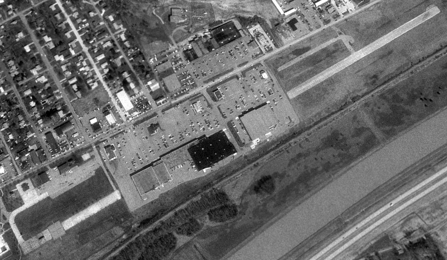
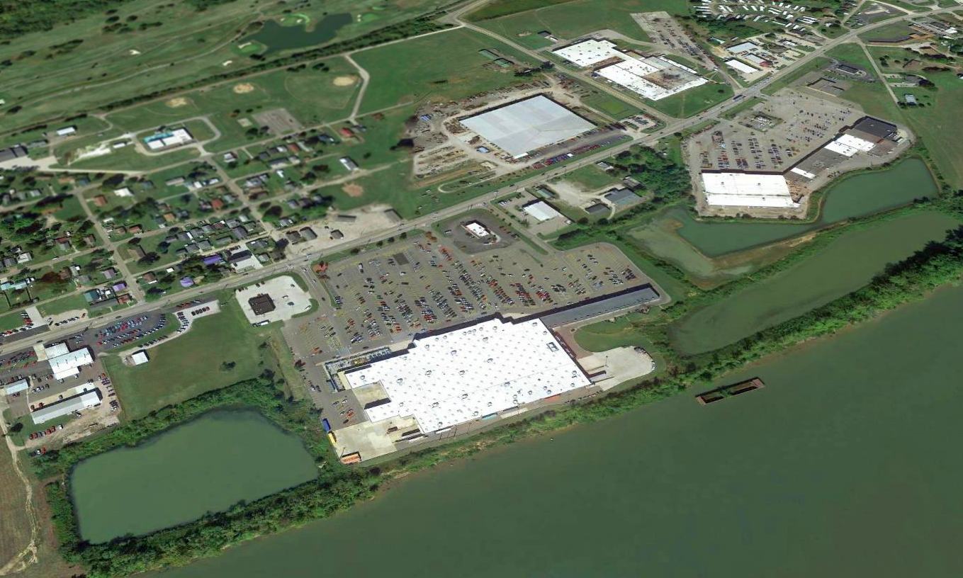
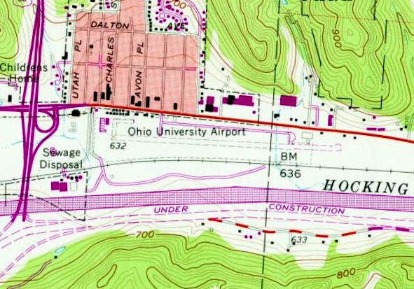
A 1994 USGS aerial view looking northeast showed the site of the original Ohio University Airport had become the Athens Mall Shopping Center.
The center portion of the former runway had become the site of a Kroger & Ames stores, and their parking lots covered a large portion of the former airport.
However, significant portions of the former runway & taxiway still extended outward on both the western & eastern end, reaching a total runway length of 4,000'.
Several former hangars still stood on the former ramp area, north of the western end of the runway.
Brian Pralgo recalled, "From 1996-97 I lived across the street from the old airfield.
I remember seeing people use their radio-controlled cars & planes there. Also, student drivers practicing their parking skills."
Jason Hitesman reported that "The old airfield is still used for driver training & by locals as a place to run RC cars & planes.
Some of the old hangars are now used as county support buildings & there is a farmers market that is held in some of them.
I had used the eastern portion of the old runway for RC cars & launching model rockets quite often while a student at OU from 93-98
but had never noticed that there were still remains of the runway to the west as well as the old airport buildings.
The southwest corner of the old runway I had actually visited but never realized it was a runway.
The extreme western edge is now basketball courts and just east of that is a set of handball courts.
The Hocking River runs just south of the airfield & the entire area floods fairly often which along with the encroaching town
probably were why the school abandoned the field and built a new one some miles south of town along Route 33."
Brian Pralgo reported in 2004, "I believe that the remaining remnants of the old runway are now gone. Walmart came to town.
At the very least, the part that is east of the Kroger shopping center is gone."
Steve Perry reported in 2007, “The field is now entirely gone.
The east end has been developed by Walmart, Lowes, etc and the west end is now a community center, pool, tennis courts, and green space.
The central Kroger was still there in June 2007, but the Ames center has been redeveloped again & now is a strip mall from which Ames is absent.”
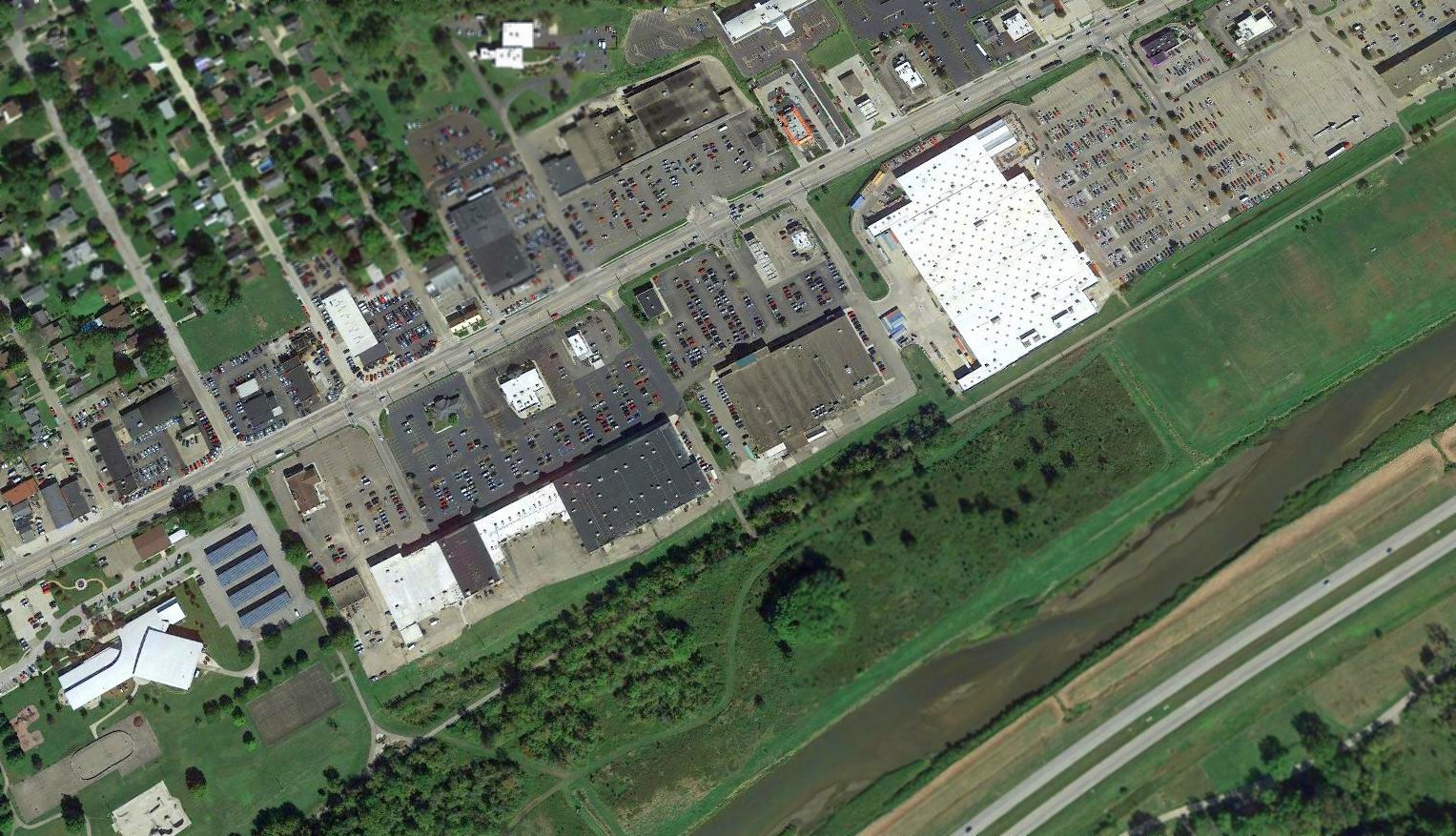
A 2015 aerial view looking northeast showed no trace remaining of the original Ohio University Airport.
The site of the original Ohio University Airport is located south of East State Street, east of Route 33.
____________________________________________________
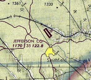
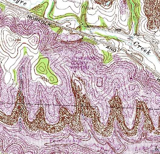
(Original) Jefferson County Airport (44D) / Friendship Airpark, Smithfield, OH
40.29, -80.78 (Southwest of Pittsburgh, PA)
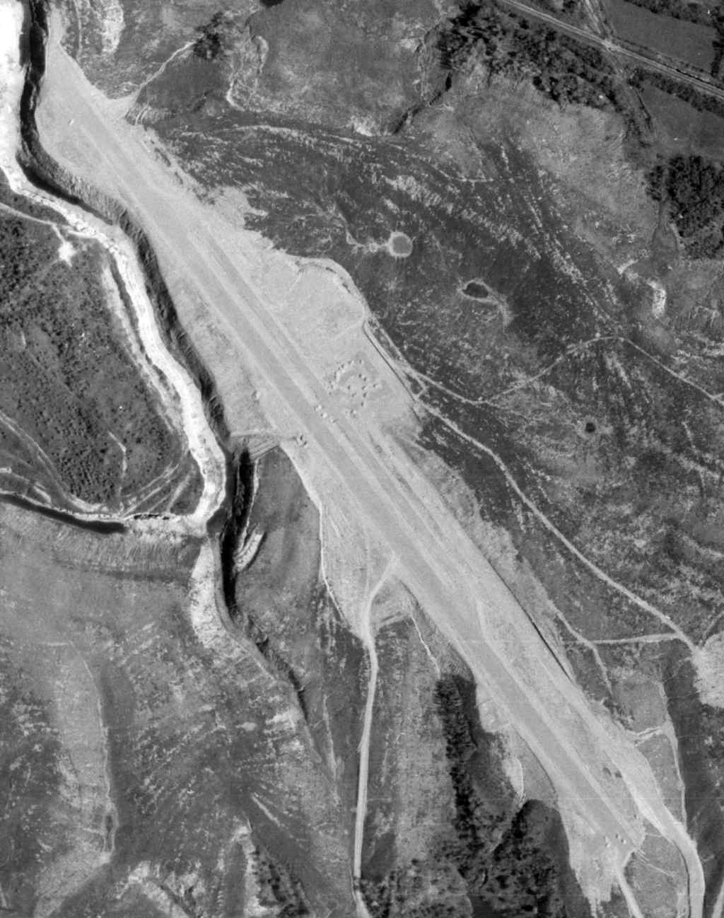
The original Jefferson County Airport, as depicted on a 5/11/72 USGS aerial photo.
Jefferson County Airport was evidently built at some point between 1972-76,
as it was not yet depicted on a 1959 aerial hoto, listed among active airfields in the 1972 Flight Guide (according to Chris Kennedy),
or depicted on the November 1972 Detroit Sectional Chart (courtesy of Richard Finley).
The 5/11/72 USGS aerial photo depicted a single northwest/southeast paved feature, which may have been a drag strip or a runway.
The 1973 USGS topo map depicted a northwest/southeast feature labeled “drag strip”.
The earliest aeronautical chart depiction of the Jefferson County Airport which has been located
was on the 1976 Pittsburgh Local Aeronautical Chart (courtesy of Mike Keefe), which depicted it as having a single 3,500' paved runway.
Jefferson County Airport was reportedly located on a former coal mine.
David Straka recalled, “I learned to fly there back in the late 1970s.
There was a flying club located there. One of the members was Bill Ralston.
He & his entire family and a friend were killed in Colorado when one of the club's plane crashed out there.
The white building in the center [of the field] was kind of a flight office or Fixed Base Operator's office.
They never did have hangars out there. It is in the middle of nowhere.
There was a big to-do when the airport was built in the first place.”
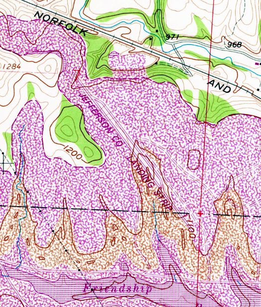
The 1978 USGS topo map depicted a single northwest/southeast runway, labeled “Jefferson Co Landing Strip”.
The 1982 AOPA Airport Directory (courtesy of Ed Drury)
which described the Jefferson County Airport as having a single 3,500' asphalt Runway 15/33.
The 1984 USGS topo map depicted a single northwest/southeast runway, but did not label the site at all.
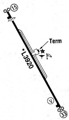
The 1985 Flight Guide (courtesy of Chris Kennedy) depicted the Jefferson County Airport
as having a parallel taxiway on the east side of the runway, leading to a small ramp with a single small "terminal" building.
It did not depict any hangars.
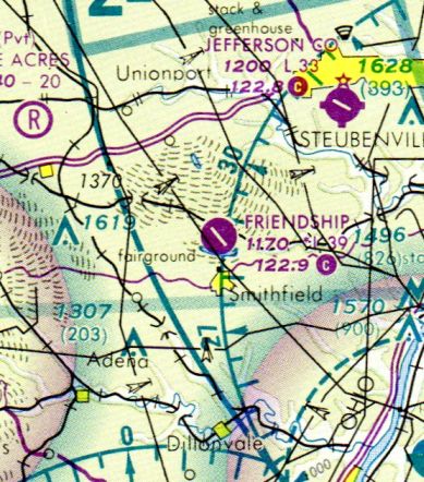
At some point between 1985-90 this airport was evidently renamed Friendship,
as that is how it was labeled on the October 1990 Detroit Sectional Chart (courtesy of Richard Finley).
The name of Jefferson County Airport had evidently been transferred to the former Steubenville-Pier Airport as few miles to the northeast.
Reportedly the original Jefferson County Airpark was replaced due to its very remote location -
being about 20 miles from county’s largest city, Steubenville.
Furthermore, the airport reportedly had no resident aircraft, and county couldn’t afford to have full-time security.
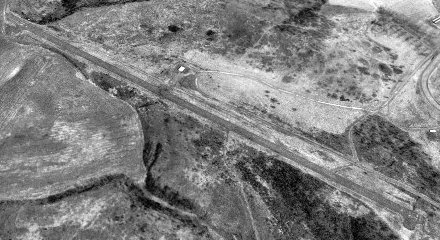
A 1994 USGS aerial view looking northeast showed the original Jefferson County Airport consisted of the single 3,500' asphalt Runway 15/33,
and the former airport office building (the white building) north of the runway midpoint.
There were no aircraft visible on the field.
The legend “Jefferson County Airport” was barely visible on 1995 USGS topo map.
According to Bob Jankowski, from 1998-2003 the former runway of the original Jefferson County Airport
was reused for drag racing, as the Friendship Park Raceway.
Friendship Airpark was depicted as an abandoned airfield on the March 1999 Pittsburgh Terminal Aeronautical Chart (courtesy of Ron Plante).
It was also formerly known as "Steel Valley Dragway".
The “1/8 mile asphalt drag strip” was listed as being for sale in 2005.
As of 2011-2014, the site was labeled “Friendship Airpark” on street maps.
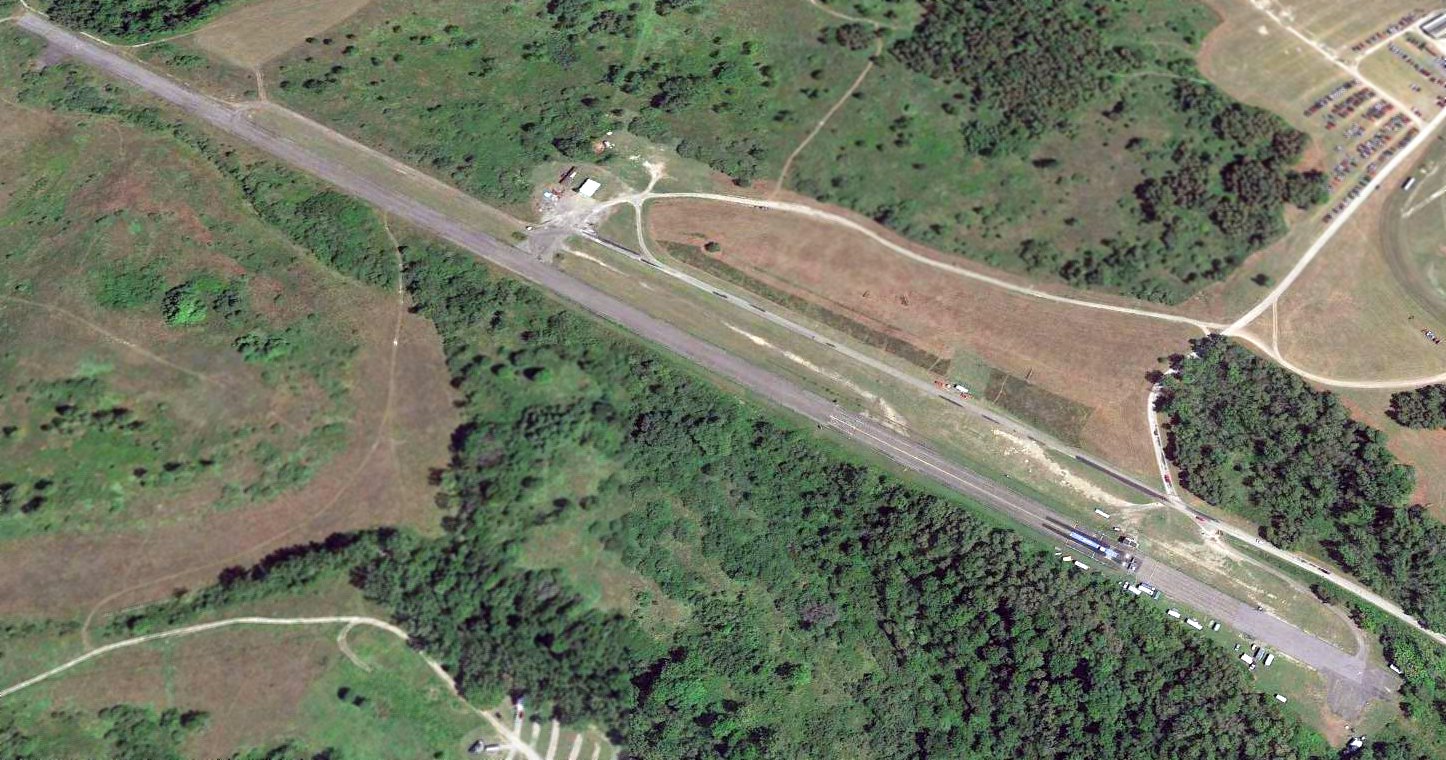
A 2015 aerial view looking northeast along the runway of the former Jefferson County Airport, showing the portion in the foreground which was reused as a drag strip.
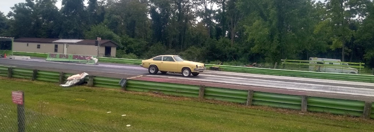
A 2022 photo of a mighty Chevy Vega on the Freebird Dragway, on the former Jefferson County Airport runway.
The original Jefferson County Airport is located northwest of the intersection of Friendship Park Road & Township Highway 191.
Thanks to Funneman1 for pointing out this airfield.
____________________________________________________
Since this site was first put on the web in 1999, its popularity has grown tremendously.
If the total quantity of material on this site is to continue to grow,
it will require ever-increasing funding to pay its expenses.
Therefore, I request financial contributions from site visitors,
to help defray the increasing costs of the site
and ensure that it continues to be available & to grow.
What would you pay for a good aviation magazine, or a good aviation book?
Please consider a donation of an equivalent amount, at the least.
This site is not supported by commercial advertising –
it is purely supported by donations.
If you enjoy the site, and would like to make a financial contribution,
you
may use a credit card via
![]() :
:
Please consider checking the box to make a monthly donatation.
For a mailing address to send a check, please contact me at: paulandterryfreeman@gmail.com
If you enjoy this web site, please support it with a financial contribution.
please contact me at: paulandterryfreeman@gmail.com
If you enjoy this web site, please support it with a financial contribution.
____________________________________________________
This site covers airfields in all 50 states.