Abandoned & Little-Known Airfields:
Central Ohio
© 2002, © 2024 by Paul Freeman. Revised 8/21/24.
This site covers airfields in all 50 states: Click here for the site's main menu.
____________________________________________________
Please consider a financial contribution to support the continued growth & operation of this site.
Ashland Municipal Airport (original location) (added 5/23/22) - August Acres Airport (revised 12/1/23) - Circleville Municipal Airport / Elsea Airport (added 6/13/22) - Clark's Dream Airport (revised 10/29/21)
Clickenger Airport / South Columbus Airport (revised 12/1/23) - Columbus Air Terminal / Norton Field (revised 3/30/23) - Columbus Airport (original location) / Sullivant Avenue Airport (revised 11/6/22)
Columbus Inc Airfield / Columbus Airpark (added 8/21/24) - Columbus Southwest Airport (added 5/4/20) - Josephinum Airfield (added 6/9/23) - Kearns Airport (revised 9/11/22)
Northway Air Park / North Columbus Airport (added 9/2/17) - Plain City Airport (revised 9/3/22) - Pleasant Hill Airfield (added 7/22/22) - Price Field (revised 6/10/23)
Snook Airport / Snook Field (added 12/10/18) - (Original) Springfield Municipal Airport (revised 6/10/23) - Vaughn Airport (added 4/29/22)
____________________________________________________
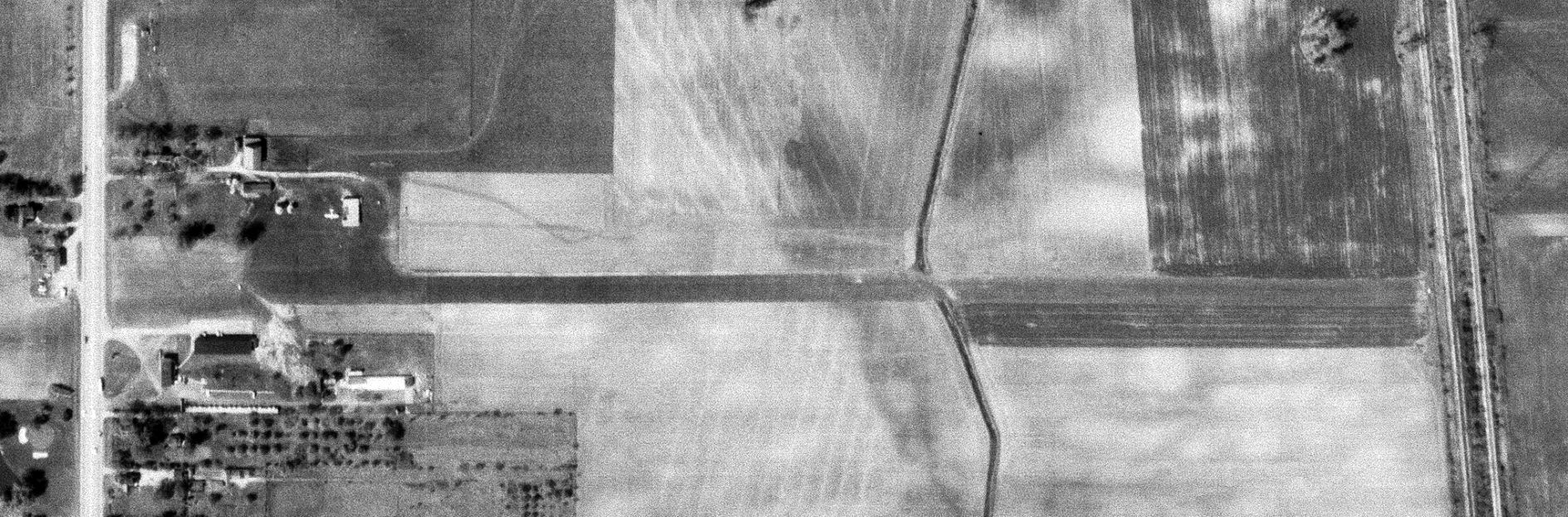
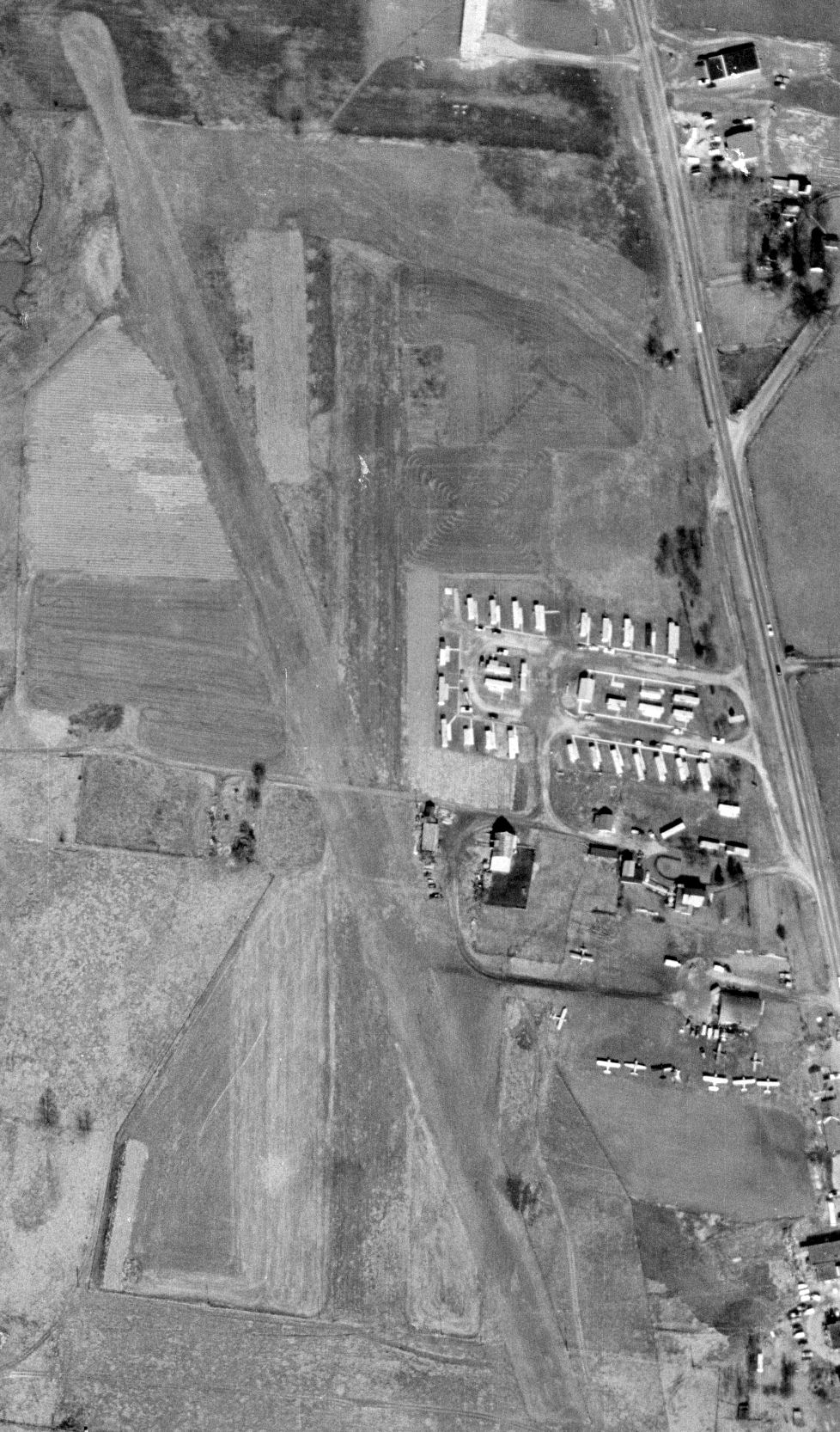
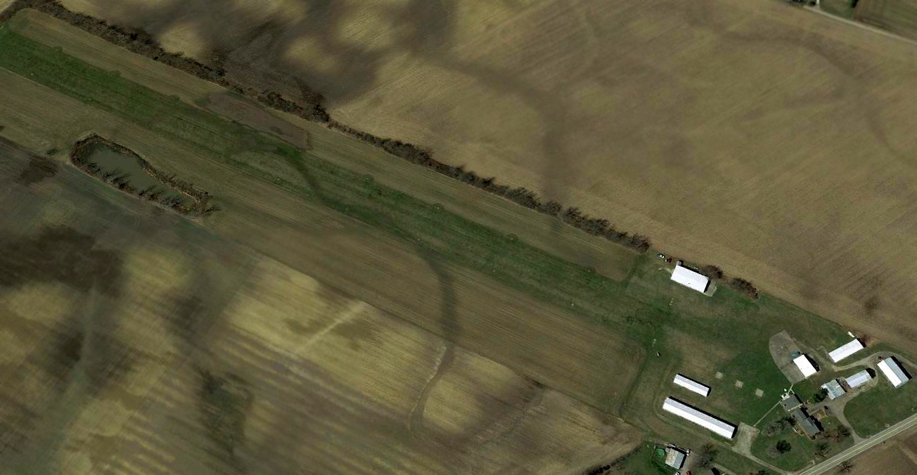
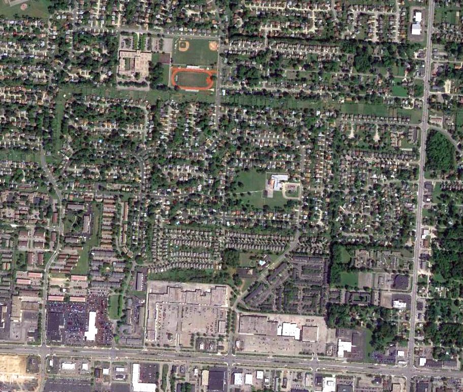
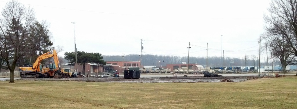
Columbus Inc Airfield / Columbus Airpark, Galloway, Ohio
39.972, -83.214 (West of Columbus, OH)
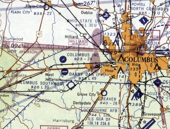
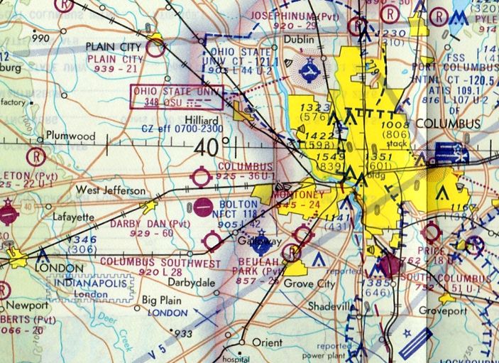
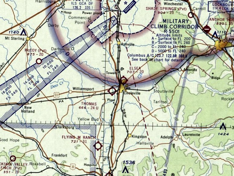
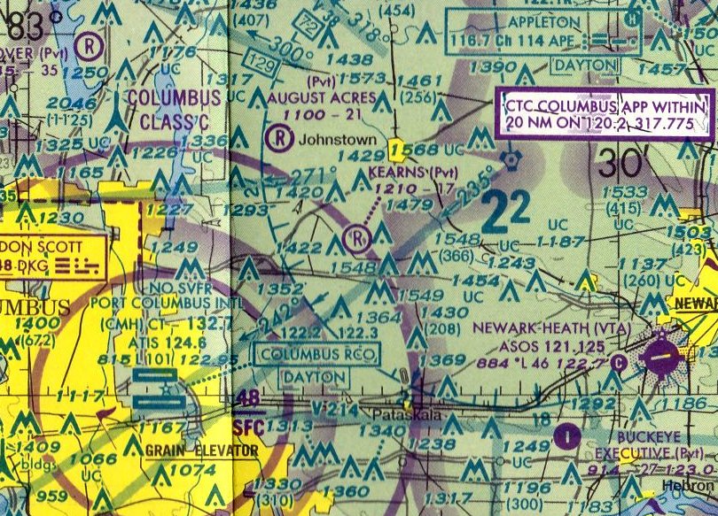
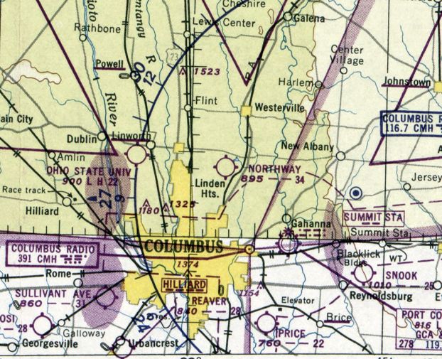
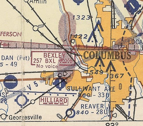
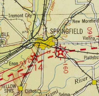
Columbus Inc Airfield, as depicted on the July 1960 Cincinnati Sectional Chart.
This small general aviation airfield was evidently established at some point between 1959-60, as it was not yet depicted on a 1957 aerial photo or the 1959 Cincinnati Sectional Chart.
The earliest depiction which has been located of Columbus Inc Airfield was on the July 1960 Cincinnati Sectional Chart.
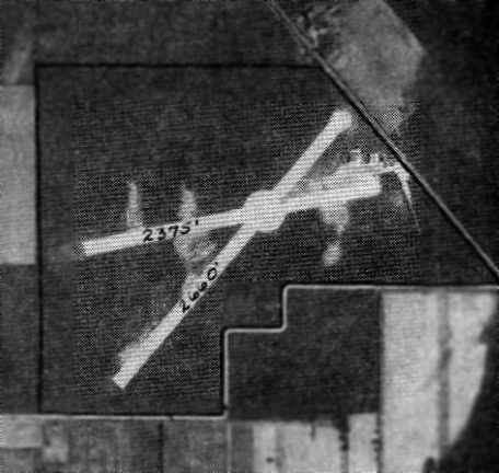
It depicted “Columbus Inc” as having a 2,400' paved northeast/southwest runway.
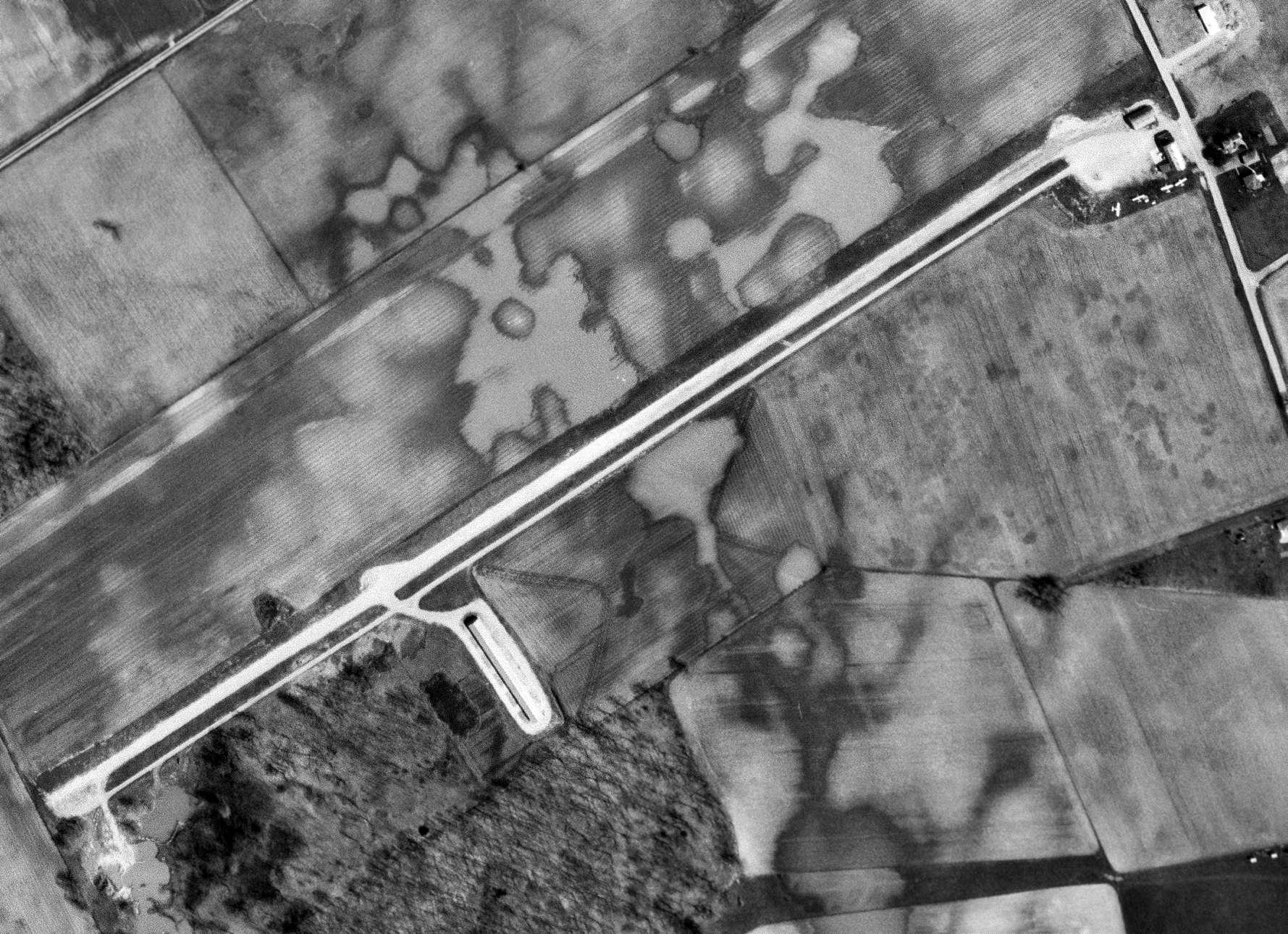
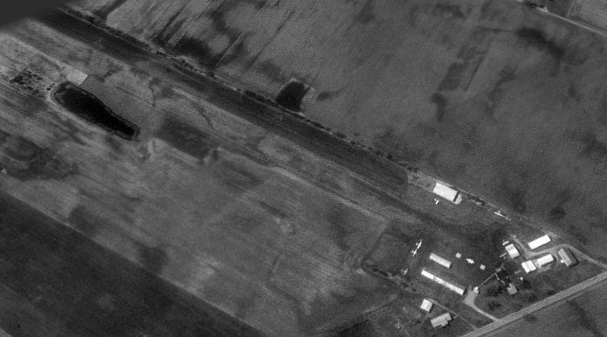
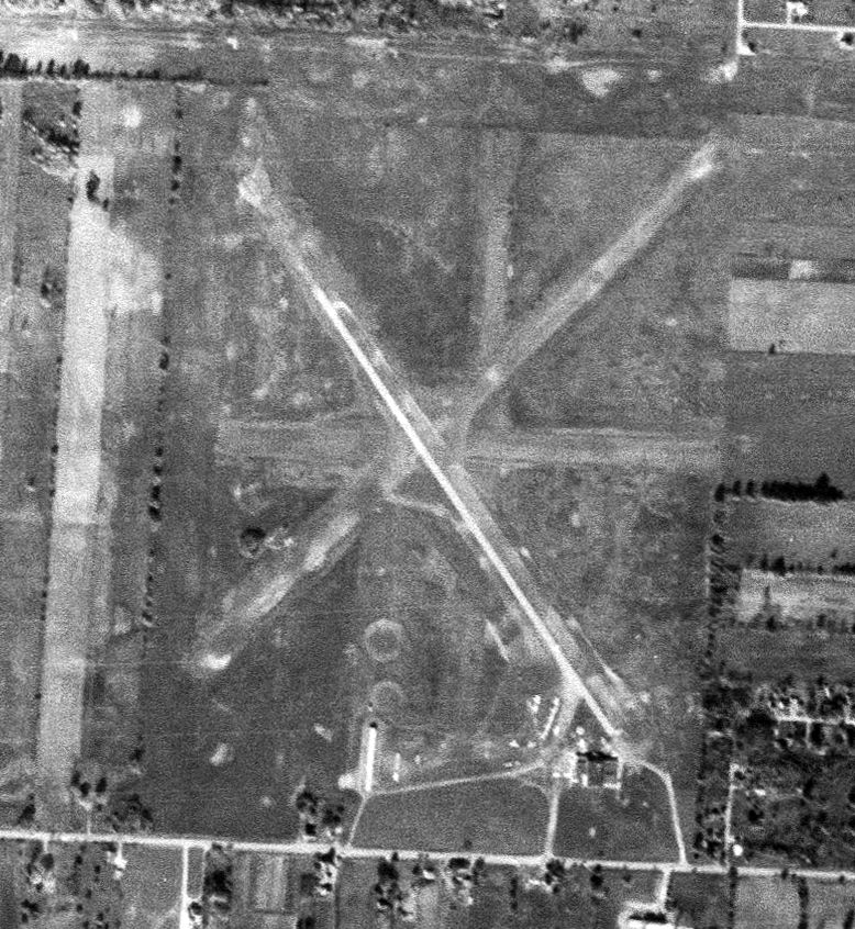
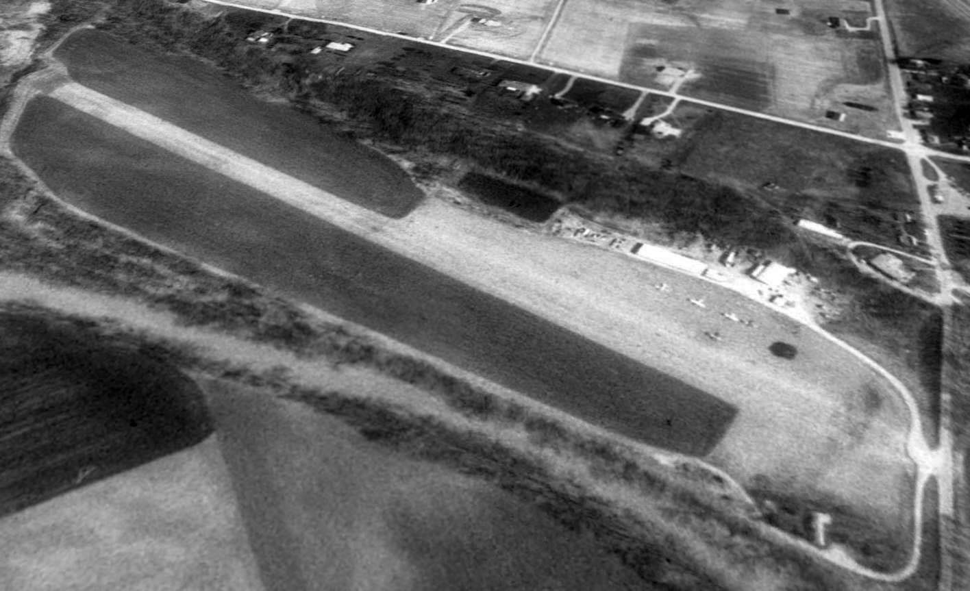
The earliest photo which has been located of Columbus Inc Airfield was a 4/20/65 USGS aerial view.
It depicted the field as having a paved northeast/southwest runway with a parallel taxiway, a long hangar on the south side, and 4 light single-engine planes parked near 2 small buildings on the east side.
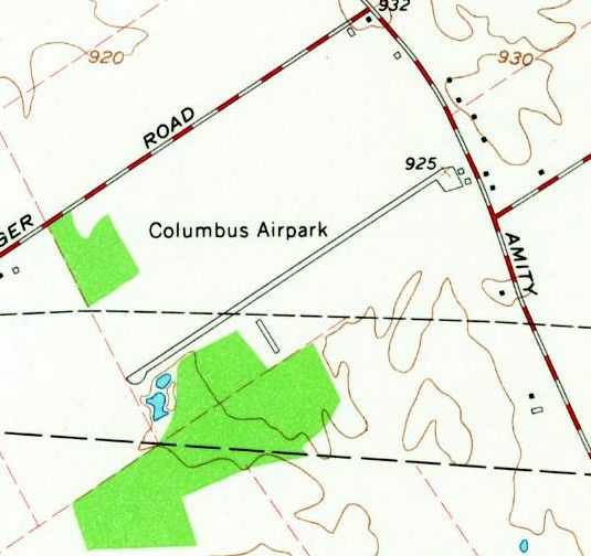
Columbus Inc Airfield was evidently renamed Columbus Airpark at some point between 1960-68,
as that is how it was depicted on the 1968 USGS topo map.
The February 1969 Cincinnati Sectional Chart depicted “Columbus” as having a 3,600' unpaved runway, in contrast to the previous paved-runway depiction.
The last aeronautical depiction which has been located of Columbus Airpark was on the February 1971 Cincinnati Sectional Chart.
It depicted “Columbus” as having a 3,600' unpaved runway.
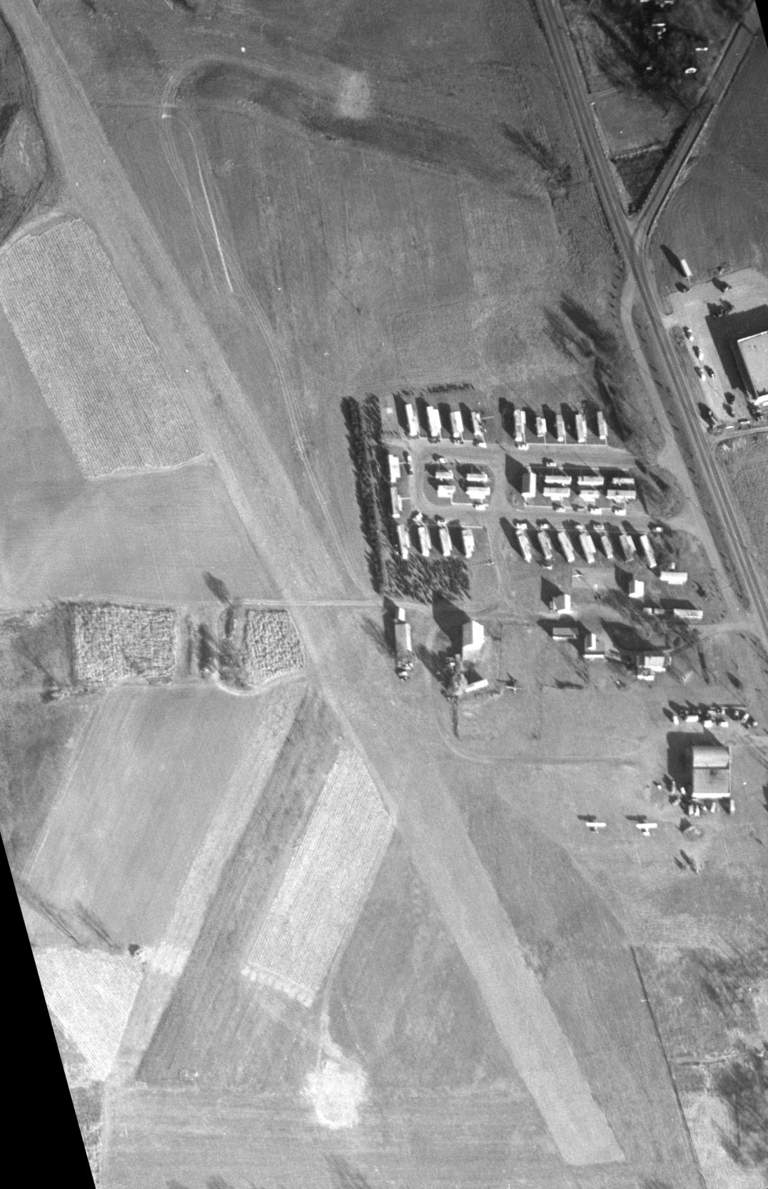
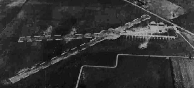
The last photo which has been located showing an aircraft at Columbus Airpark was a 1971 aerial photo.
It depicted 1 light single-engine plane parked near the hangar on the south side, but there were no aircraft parked on the east side.
Mike Jasiewicz recalled, “I remember seeing Columbus Airpark on a sign or perhaps the side of a hangar at that airport.
When we were teens in the early 1970s, we spent a lot of time driving around the local countryside. That's when I first saw this airport.”
Columbus Airpark was evidently closed (for reasons unknown) at some point between 1971-76,
as it was no longer depicted on the December 1976 Cincinnati Sectional Chart.
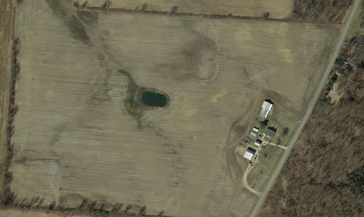
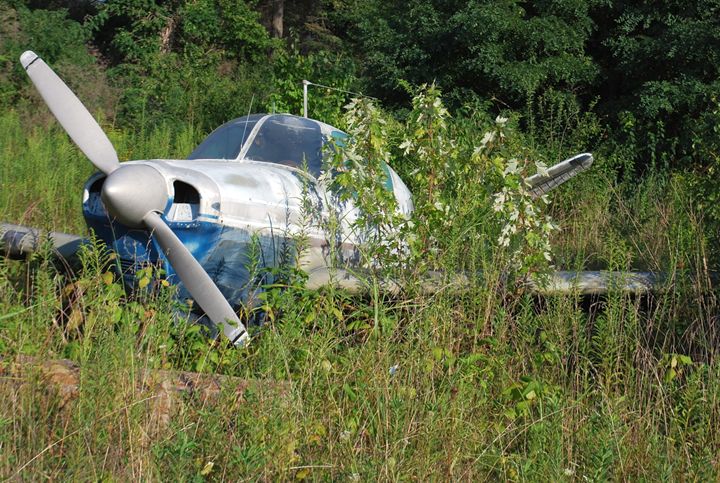
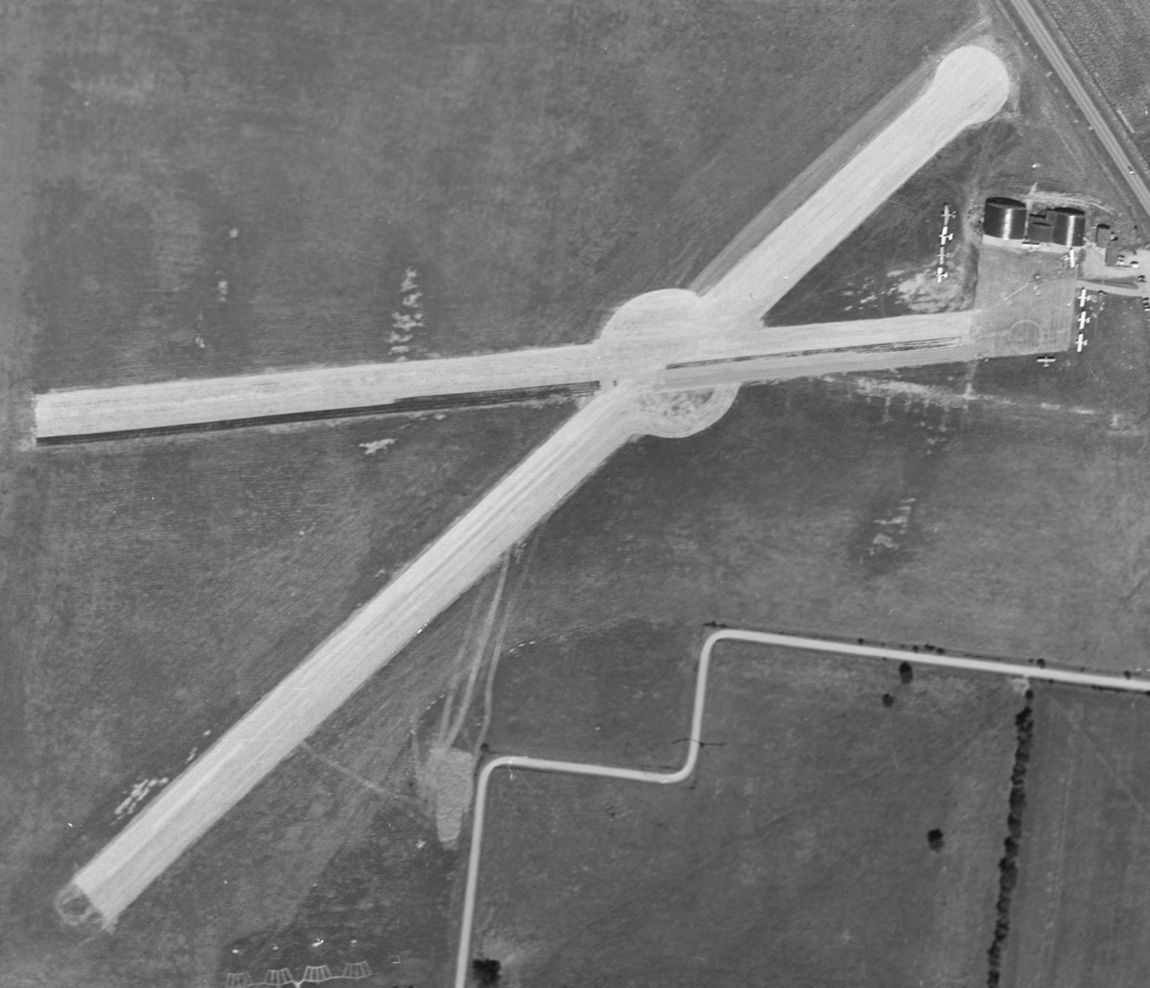
A 1980 aerial photo showed Columbus Airpark devoid of aircraft, and the runway was deteriorated.
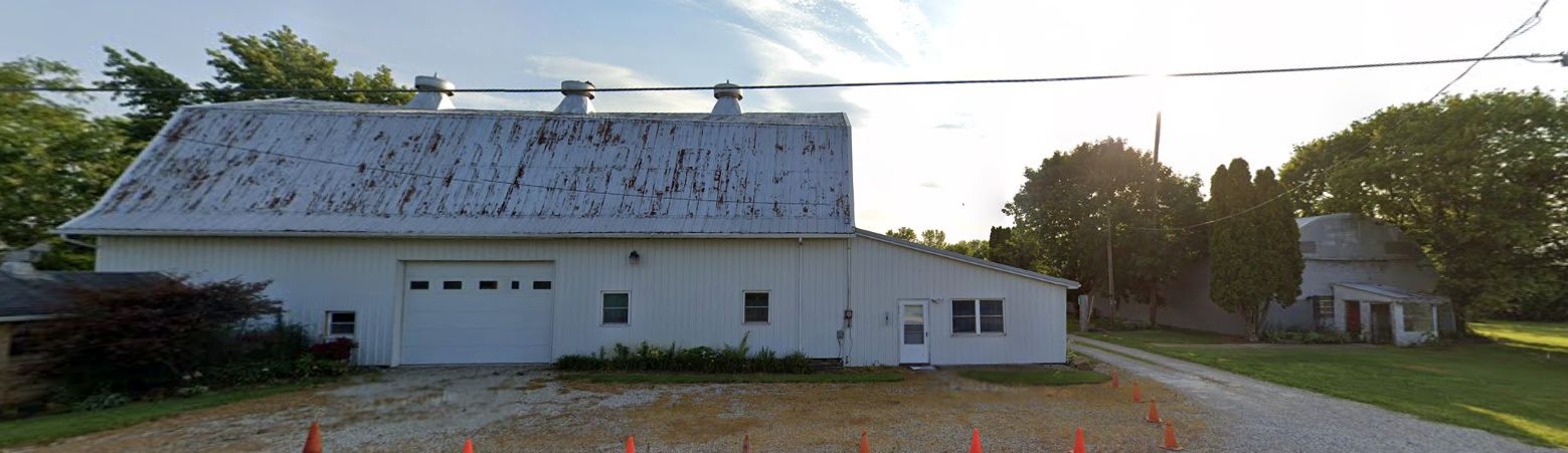
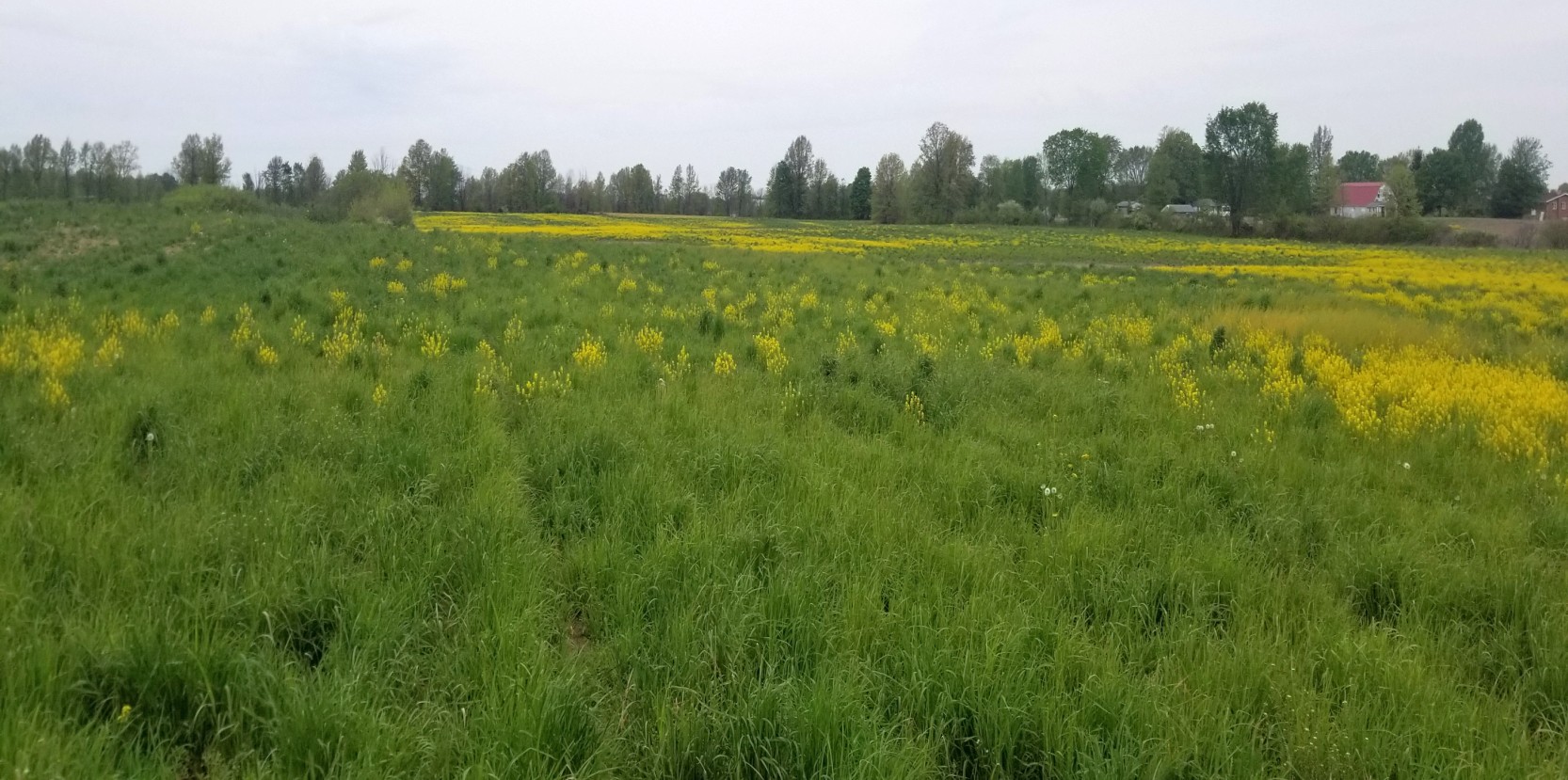
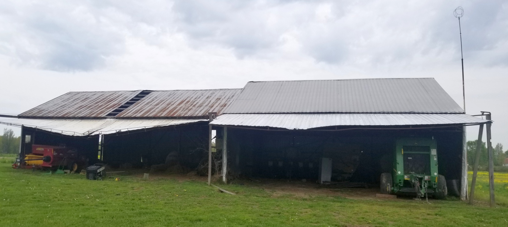
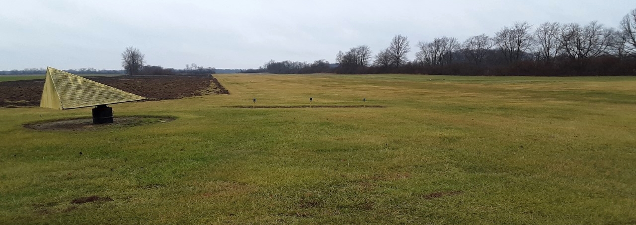
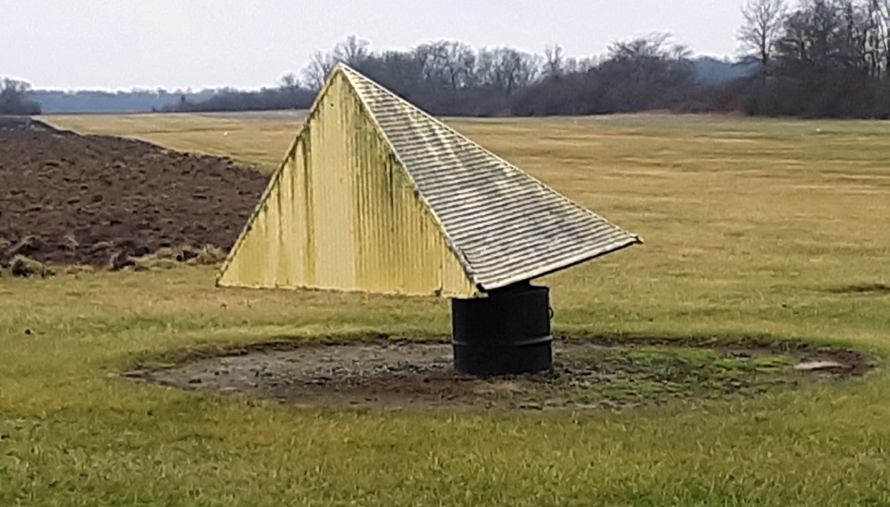
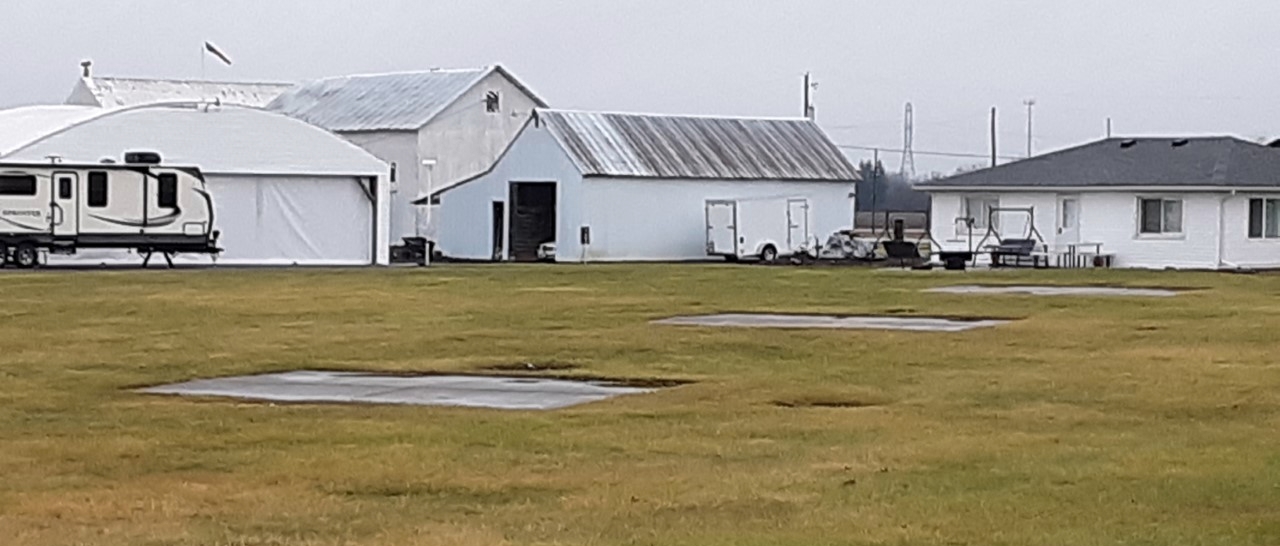
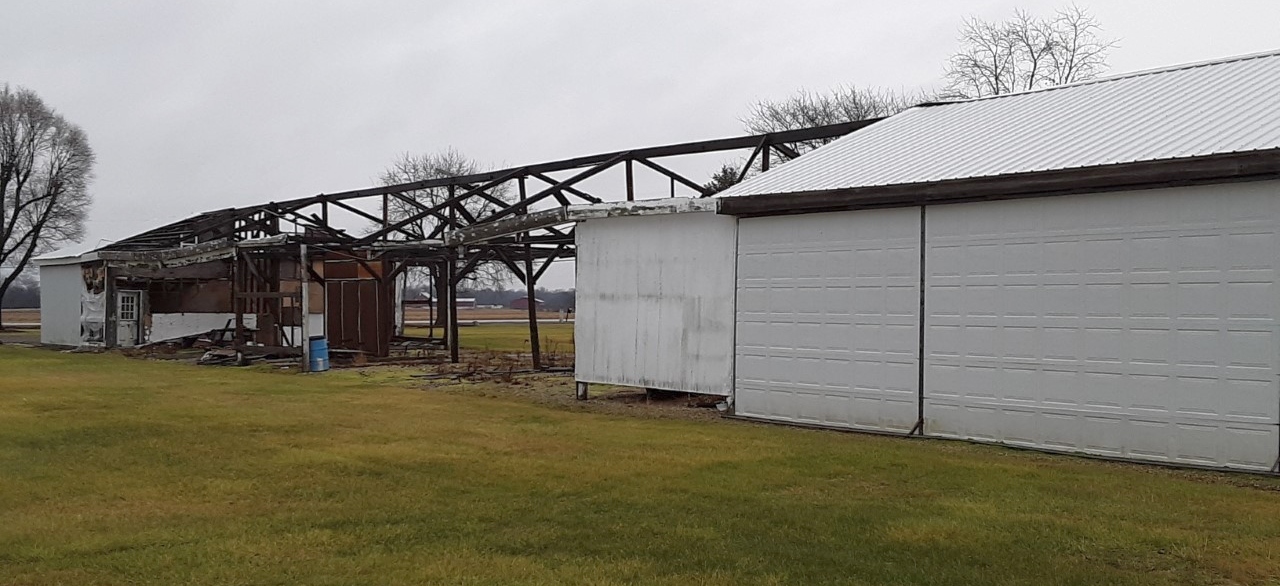
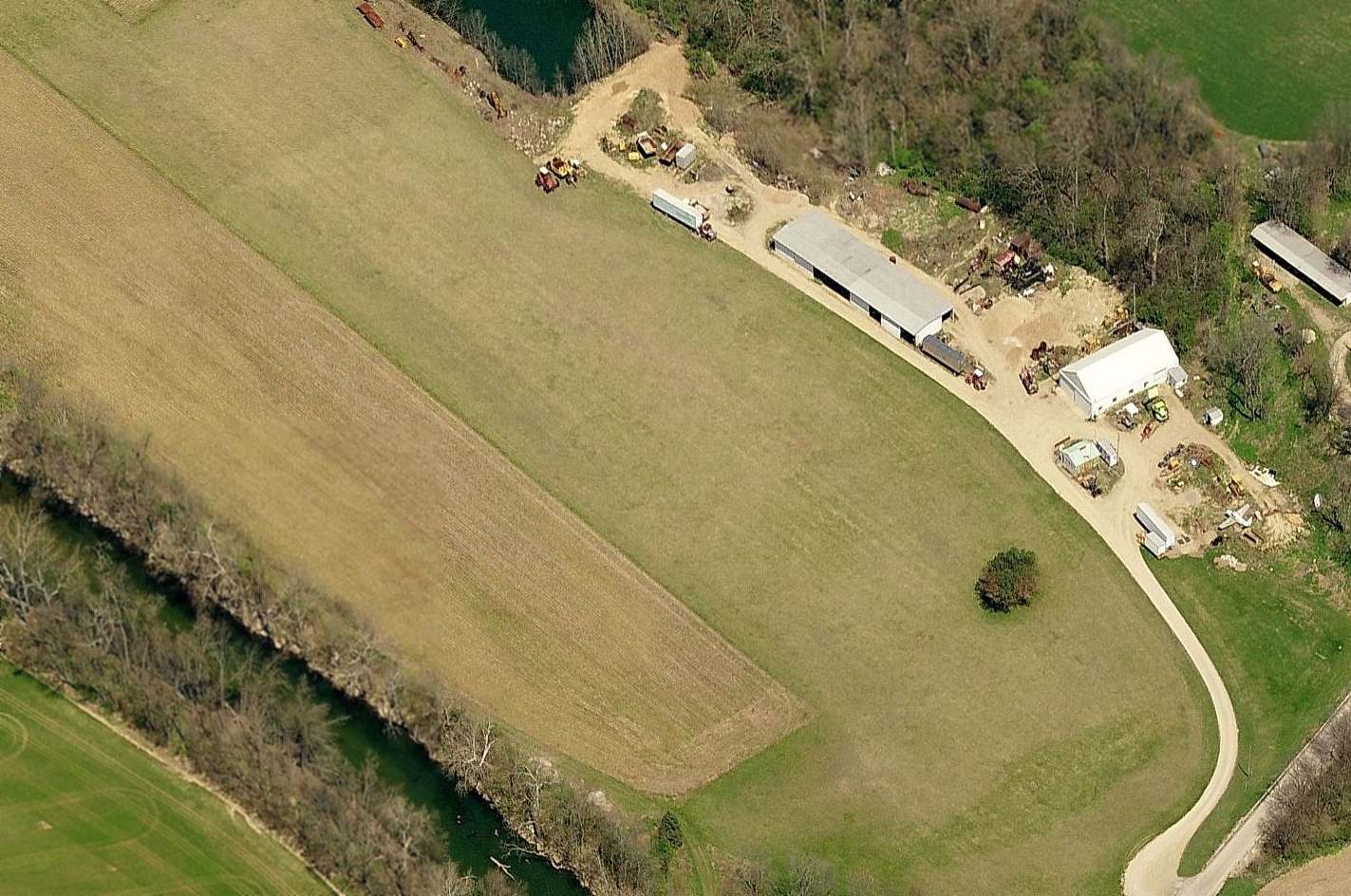
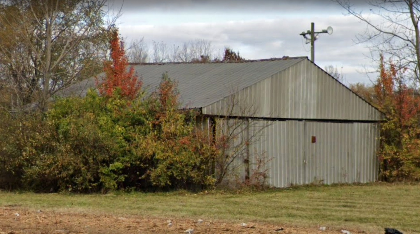
A 2021 photo looking southwest at the barn & Quonset Hut which remain on the east side of the Columbus Airpark site.
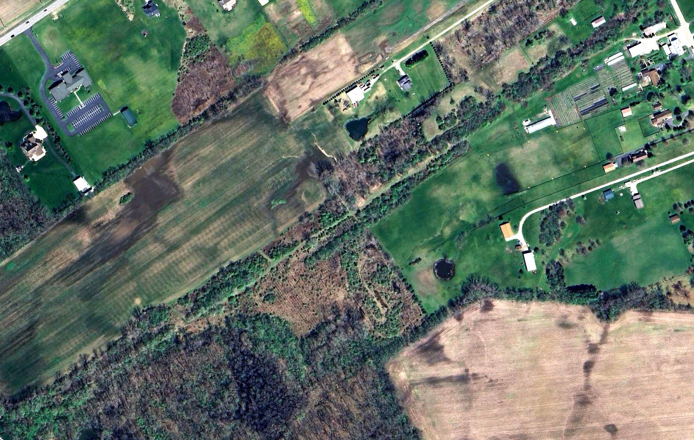
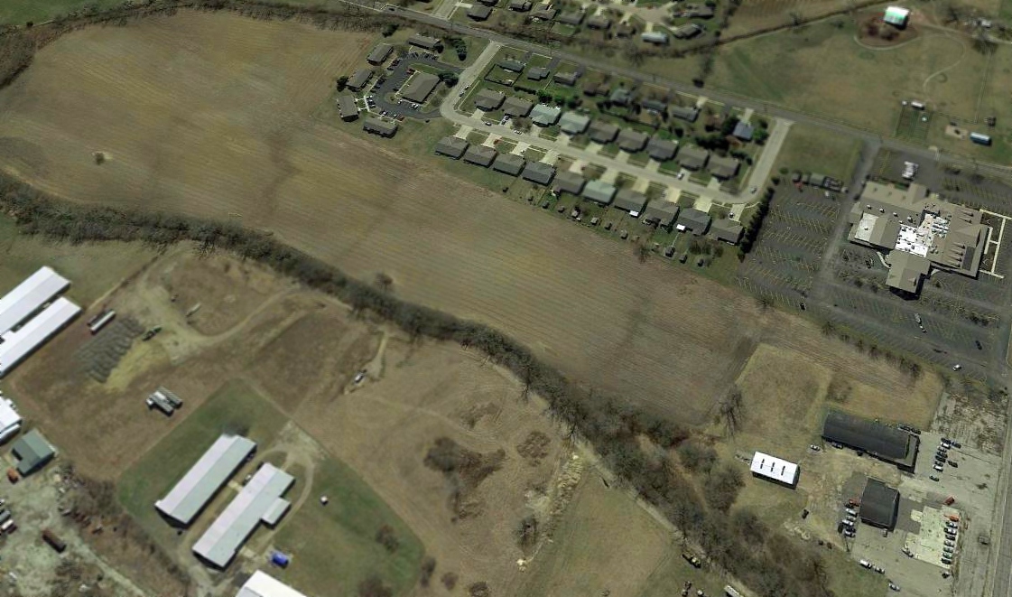
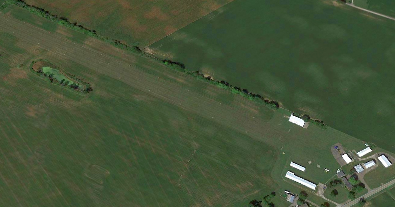
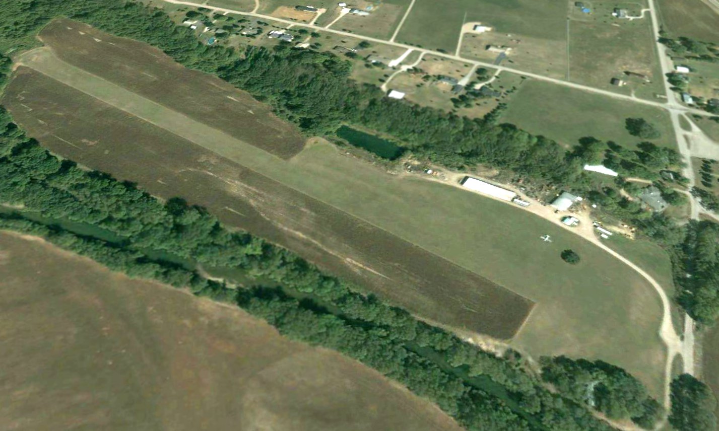
A 2024 aerial view showed the northeast/southwest runway alignment of Columbus Airpark remained recognizable 5 decades after the airport's closure.
Thanks to Mike Jasiewicz for pointing out this airfield.
____________________________________________________
Josephinum Airfield, Worthington, Ohio
40.117, -83.013 (North of Columbus, OH)
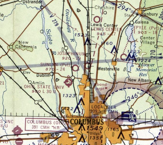
Josephinum Airfield, as depicted on the May 1963 Cleveland Sectional Chart.
This small general aviation airfield was evidently established at some point between 1953-57, as it was not yet depicted on a 1953 aerial photo.
The earliest depiction which has been located of Josephinum Airfield was on a 1957 aerial photo,
which depicted a single grass east/west runway, with 1 T-hangar on the northwest side.
Bob Pautsch recalled, “As a kid growing up in Worthington [1957-71], I knew of an airport on North High Street (US23).
It intrigued me but I never went to it though we drove by it many times.
I think it was affiliated with the Josephinum College across the street.”
Josephinum Airfield was not yet depicted on the 1961 Cleveland Sectional Chart.
The earliest aeronautical chart depiction which has been located of Josephinum Airfield was on the May 1963 Cleveland Sectional Chart.
It depicted Josephinum Airfield as having a 2,900' unpaved runway.
The earliest photo which is available of Josephinum Airfield was a 5/1/63 USGS aerial view.
It depicted Josephinum Airfield as having a single east/west grass runway, with 1 light single-engine plane & 1 small hangar on the northwest side.
The earliest topo map depiction which has been located of Josephinum Airfield was on the 1965 USGS topo map.
It depicted a single upaved east/west runway, generically labeled “Landing Strip”, with a parking area & 1 small building on the northwest side.
The last photo which has been located showing planes at Josephinum Airfield was a 1966 aerial view.
It depicted 2 light single-engine planes on the northwest side, and a 2nd small hangar had been added at some point between 1963-66.
Andy Gelston recalled, “I lived just north this strip & would ride by it on the school bus 1970-72.
I always sat on the side of the bus that would be closest to it so I could see if there was any activity. There rarely was.
There was a building facing the road, on the north side of the runway, that had EAA Chapter XXX painted on it.
I'd stopped by on my bicycle a few times, but there was nobody around during my visits.
I believe the plane parked outside was a homebuilt & the hangar was used by the EAA members for aircraft building & meetings.”
A 1971 aerial photo showed Josephinum Airfield's runway & hangars remained intact, but no planes were visible.
The last aeronautical chart depiction which has been located of Josephinum Airfield was on the August 1976 Cincinnati Sectional Chart.
It depicted Josephinum Airfield as a private airfield having a 3,000' unpaved runway.
A 1980 aerial photo showed Josephinum Airfield's runway & hangars remained intact, but no planes were visible.
Josephinum Airfield was evidently closed (for reasons unknown) at some point between 1976-81,
as it was no longer depicted on the 1981 Cincinnati Sectional Chart.
A 1995 aerial photo showed several buildings had covered most of the Josephinum Airfield property.
A 2022 aerial photo showed no trace remaining of Josephinum Airfield.
Thanks to Bob Pautsch for pointing out this airfield.
____________________________________________________
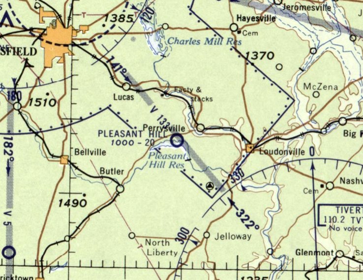
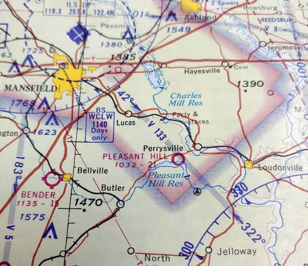
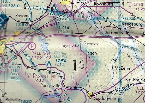
Pleasant Hill Airfield, Perrysville, Ohio
40.645, -82.35 (Northeast of Columbus, OH)
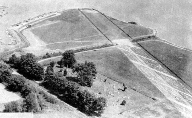
An undated aerial view looking southeast at Pleasant Hill Airfield, from a June 1955 Flying Magazine article (courtesy of Robert Koontz).
The earliest reference which has been located of Pleasant Hill Airfield was a June 1955 Flying Magazine article (courtesy of Robert Koontz).
It described how the 2,000' runway, with a parking area large enough to accommodate 50 aircraft,
was built with funds raised by taxing private aircraft.
Within walking distance was described a boat rental dock, sandy swimming beach, and 12 rental cabins.
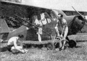
An undated photo of Bob & Paul Spear in front of their Aeronca, getting ready to go swimming at Pleasant Hill Airfield, from a June 1955 Flying Magazine article (courtesy of Robert Koontz).
Pleasant Hill Airfield was not yet depicted on the January 1958 Cleveland Sectional Chart.
The earliest aeronautical chart depiction which has been located of Pleasant Hill Airfield was on the July 1958 Cleveland Sectional Chart.
It depicted Pleasant Hill Airfield as having a 2,000' unpaved runway.
A 1960 aerial photo depicted Pleasant Hill Landing Strip as having a single northwest/southeast unpaved runway.
There were no aircraft visible on the field.
Robert Koontz recalled, “I landed at the Pleasant Hill reservoir landing strip as a student on my first dual cross country on 8/8/63 in a Piper Colt.
It was on a peninsula that juts out of the North side of the lake with a cemetery right beside it.”
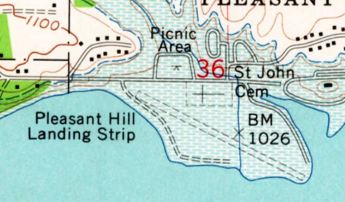
The earliest topo map depiction which has been located of Pleasant Hill Airfield was on the 1961 USGS topo map.
It depicted Pleasant Hill Landing Strip as having a single northwest/southeast unpaved runway.
The 1970 Sectional Chart (courtesy of Robert Koontz) depicted Pleasant Hill Airfield as having a 2,100' unpaved runway.
The last aeronautical chart depiction which has been located of Pleasant Hill Airfield was on the May 1977 Detroit Sectional Chart.
It depicted Pleasant Hill Airfield as having a 2,100' unpaved runway.
A 1981 aerial photo depicted Pleasant Hill Landing Strip's runway as being well maintained, along with a cleared parking area to the northeast.
But there were no aircraft visible on the field.
Pleasant Hill Airfield was evidently closed (for reasons unknown) at some point between 1977-81,
as it was no longer depicted on the May 1981 Detroit Sectional Chart.
A 1994 aerial photo depicted Pleasant Hill Landing Strip's runway as being overgrown.
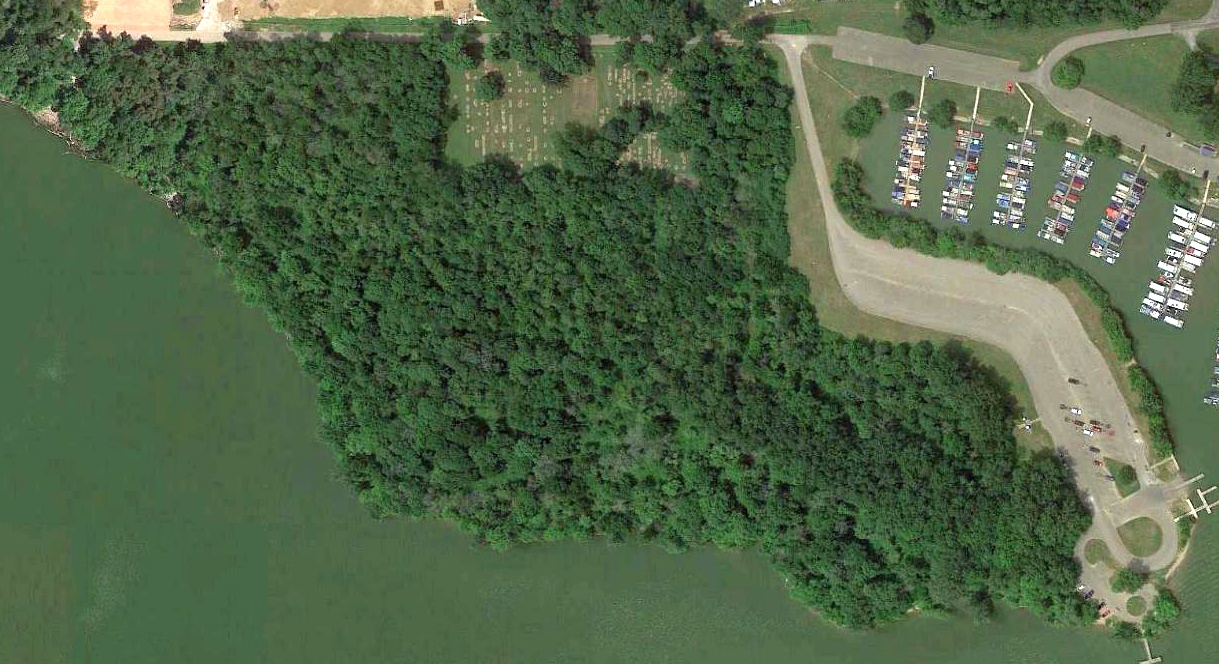
A 2018 aerial photo showed no trace remaining of Pleasant Hill Landing Strip, with the runway having been covered by woods.
Thanks to Robert Koontz for pointing out this airfield.
____________________________________________________
Circleville Municipal Airport / Elsea Airport, Circleville, Ohio
39.619, -82.942 (South of Columbus, OH)
Elsea Airport, as depicted on the October 1948 Huntington Sectional Chart.
The earliest reference which has been located to Circleville Airport was in an article
entitled “Airport plans win sanction” in the 3/22/34 Circleville Herald (courtesy of Dennis Thompson).
It reported, “Start of construction of the 'Circleville Municipal Airport' about April 1
was assured today when it was announced state officials had approved plans for the local port.
The airport will be located on land owned by S.C. Elsea, north of the city limits between the C&O and Norfolk & Western railroad tracks.”
However, those plans may not have come to fruition,
as Circleville Airport was not depicted at all on 1934/35/36/40/46/47 Huntington Sectional Charts.
The earliest depiction which has been located of the airport on the north side of Circleville was on the October 1948 Huntington Sectional Chart.
It depicted Elsea Airport as having a mere 1,800' unpaved runway.
The earliest photo which has been located of Elsea Airport was a 1956 ODoT aerial view (courtesy of Dennis Thompson).
It depicted Elsea as having a northwest/southeast grass runway, with 10 light single-engine aircraft near some small buildings on the east side.
A 1960 ODoT aerial view (courtesy of Dennis Thompson) depicted Elsea in the same physical configuration as the 1956 photo, but the number of planes seen had decreased to only 2.
A 1964 aerial view looking southwest (courtesy of Dennis Thompson) at Elsea Airport showed 10 light single-engine aircraft parked near the hangar.
A 1964 aerial view looking west (courtesy of Dennis Thompson) at Elsea Airport showed 10 light single-engine aircraft parked near the hangar.
The last aeronautical chart depiction which has been located of Elsea Airport was on the February 1966 Huntington Sectional Chart.
It depicted Elsea as having a 2,000' unpaved runway.
Elsea Airport was evidently closed (for reasons unknown) at some point in 1966,
as it was no longer depicted on the August 1966 Huntington Sectional Chart.
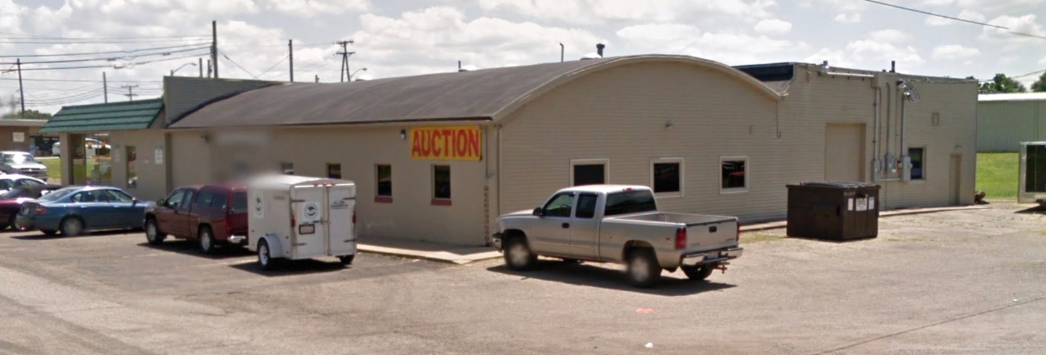
A 2015 photo looking southeast showed the former Elsea Airport hangar & office having been reused as an auction facility, with a Subway sandwich shop built onto the side facing the road.
A 2021 aerial view looking northwest showed the former Elsea Airport hangar & office remaining, but no sign of the runway remained recognizable.
Thanks to Dennis Thompson for pointing out this airfield.
____________________________________________________
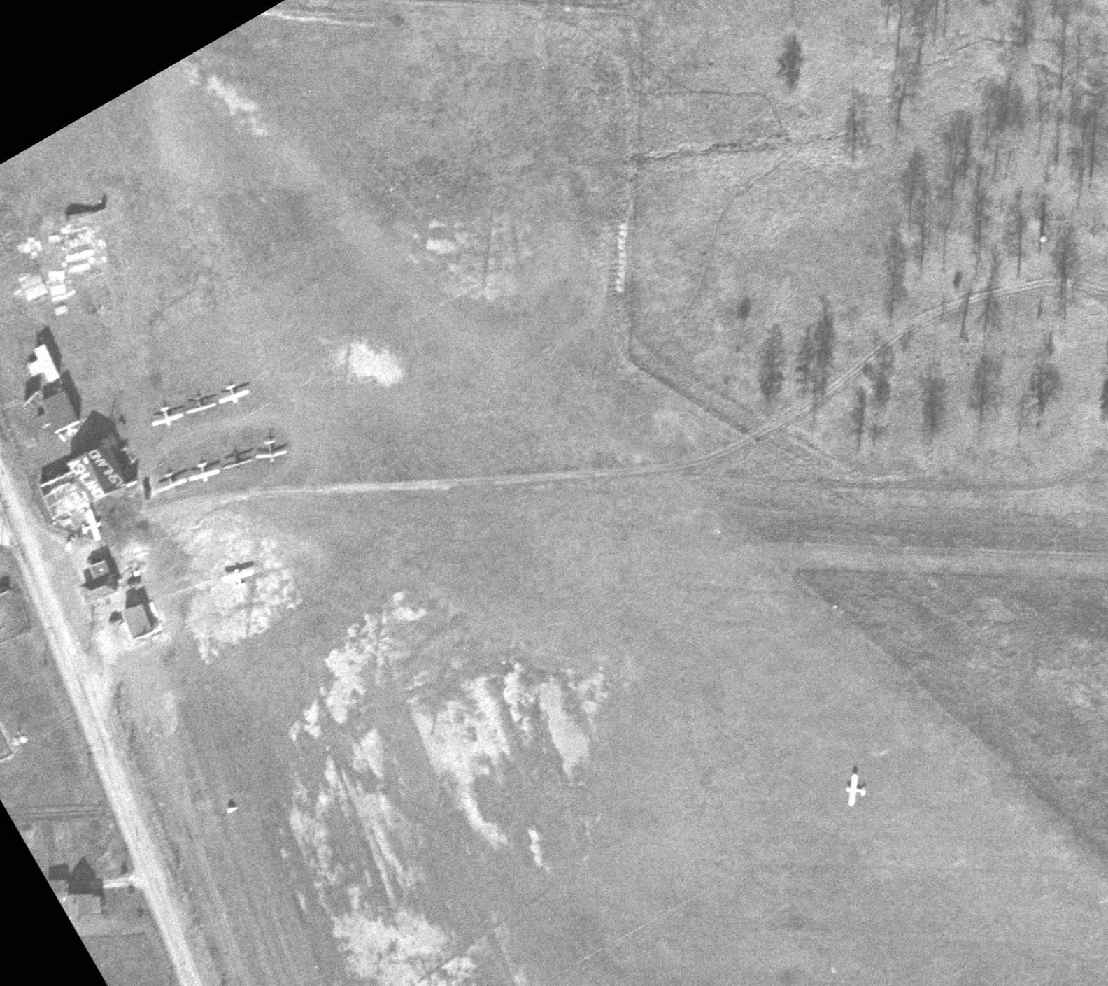
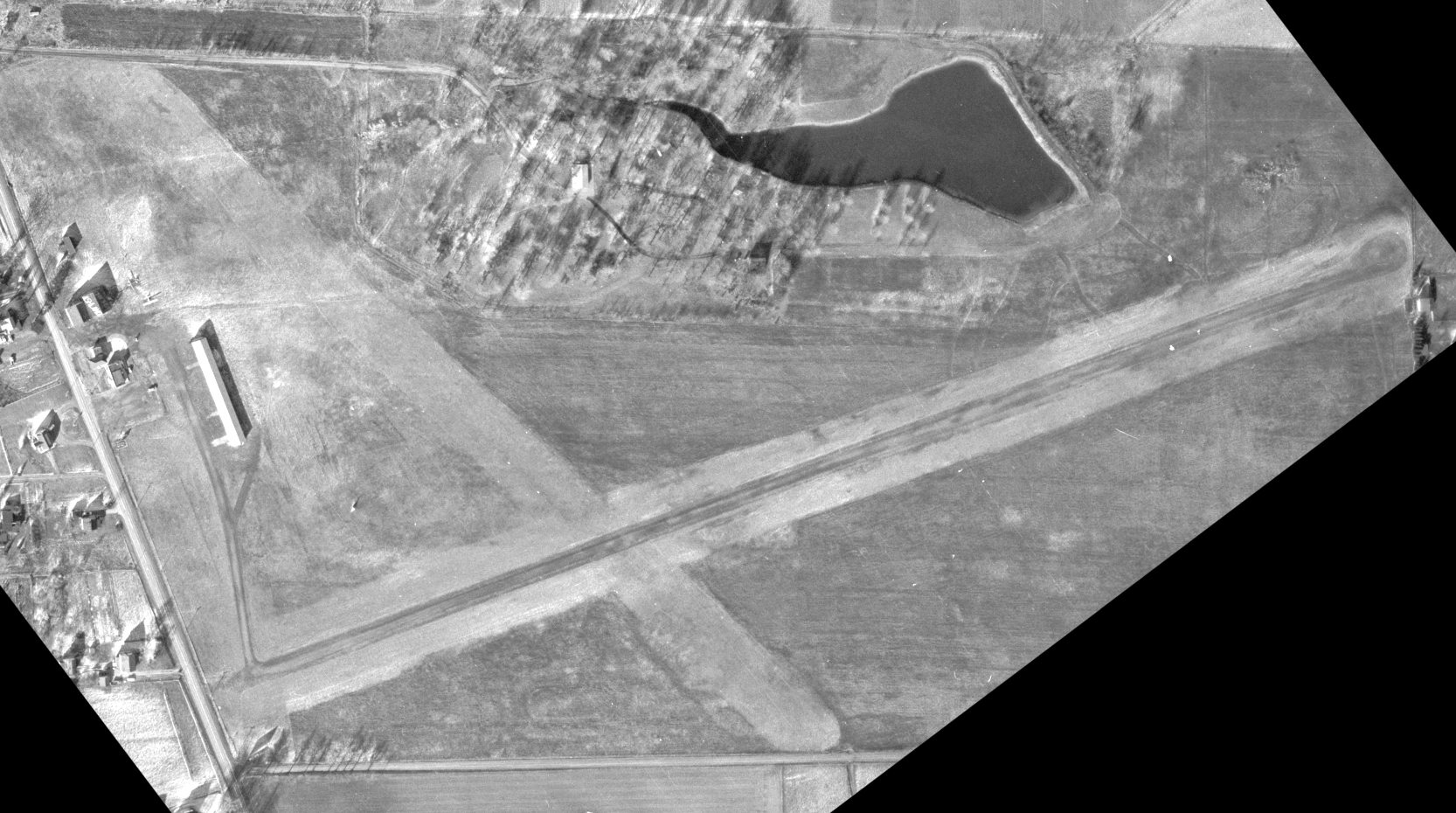
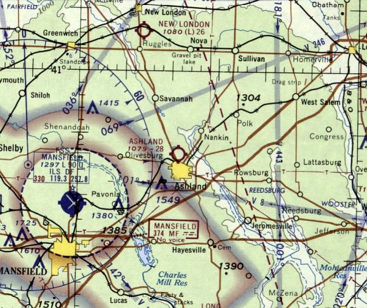
Ashland Municipal Airport (original location), Ashland, Ohio
40.893, -82.328 (Southwest of Cleveland, OH)
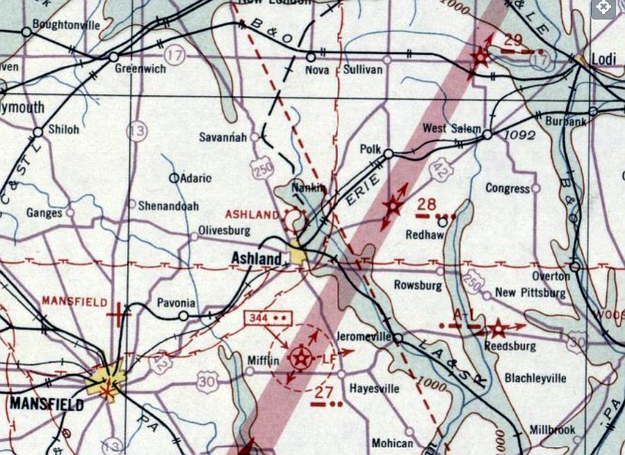
Ashland Airport, as depicted on the May 1932 Cleveland Sectional Chart.
Ashland's original airport was located adjacent to the north side of town.
According to Dennis Thompson, “There are numerous small articles about the airport dating from 1931 when it was built.”
The earliest depiction which has been located of Ashland Airport was on the May 1932 Cleveland Sectional Chart.
It depicted Ashland as a commercial/municipal airport.
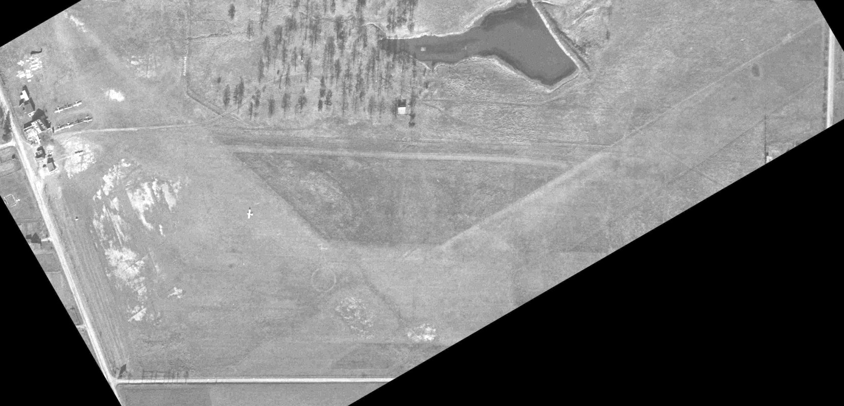
The earliest photo which has been located of Ashland Airport was a 1946 ODoT aerial view (courtesy of Dennis Thompson).
It depicted Ashland as having 2 grass runways with an airport circle marking at the intersection.
A closeup of the 1946 ODoT aerial view (courtesy of Dennis Thompson) showed Ashland Airport to have 9 light planes parked near the hangars on the west side, and 1 light plane on the runway.
One of the hangars was painted with the airport name on both sides of the roof.
A 1959 aerial view showed that Ashland Airport had gained another long hangar at some point between 1946-59, and 1 light single-engine plane was parked outside.
Dennis Thompson reported, “It was listed in the 1960 Ashland County Rural Directory as Bal-Rone Inc, Ashland Airport.”
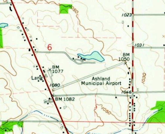
The 1961 USGS topo map depicted Ashland Municipal Airport as having a single paved northeast/southwest runway,with a taxiway leading to a ramp with several small buildings on the west side.
The last photo which has been located showing a plane at the original Ashland Airport was a 1965 ODoT aerial view (courtesy of Dennis Thompson).
It showed a similar airport configuration as the 1959 photo, and 1 light single-engine plane was parked outside.
The last aeronautical chart depiction which has been located of the original Ashland Municipal Airport was on the May 1967 Cleveland Sectional Chart.
It depicted Ashland as having a 2,800' unpaved runway.
The original Ashland Municipal Airport was evidently closed at some point in 1967,
as it was no longer depicted on the November 1967 Cleveland Sectional Chart.
Dennis Thompson reported, “Land for the new airport was purchased in 1967 & the Ashland County Airport [to the east] replaced this one a few years later.”
A 1968 ODoT aerial view of Ashland Airport (courtesy of Dennis Thompson) showed that a few of the smaller buildings had been removed at some point between 1965-68, and there were no planes visible.
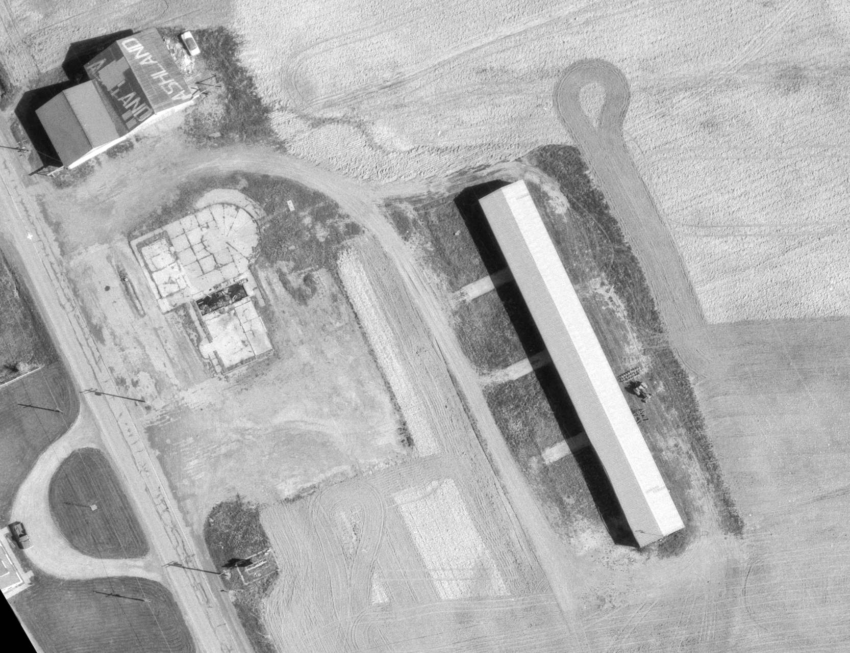
A 1970 ODoT aerial view of Ashland Airport (courtesy of Dennis Thompson) showed that most of the hangars remained.
A 1972 aerial view of Ashland Airport showed that 2 of the hangars remained.
A 1981 aerial view of Ashland Airport showed that both hangars had been removed.
A 1997 aerial photo showed that several buildings had been built over the western end of the former Ashland Airport.

A 2018 aerial view showed no recognizable trace remaining of the original Ashland Municipal Airport.
Thanks to Dennis Thompson for pointing out this airfield.
____________________________________________________
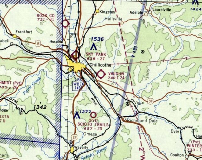
Vaughn Airport, Chillicothe, Ohio
39.316, -82.897 (South of Columbus, OH)
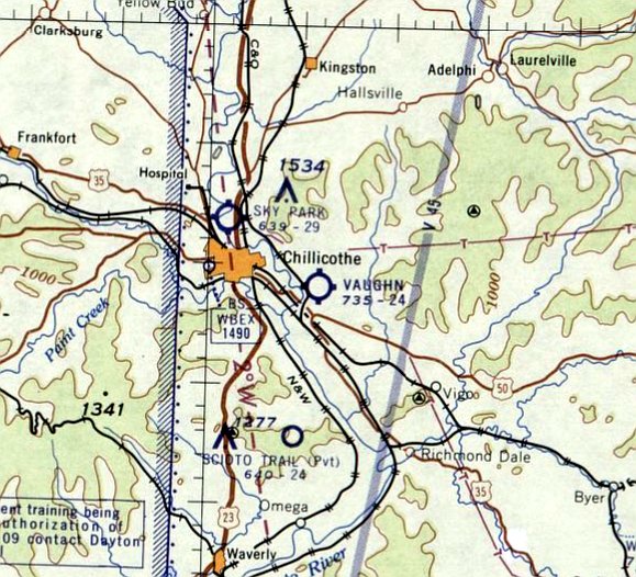
Vaughn Airport, as depicted on the July 1960 Huntington Sectional Chart.
This small general aviation airport was evidently established at some point between 1959-60,
as it was not yet depicted on the 1959 Huntington Sectional Chart.
The earliest depiction which has been located of Vaughn Airport was on the July 1960 Huntington Sectional Chart.
It depicted Vaughn as having a 2,400' unpaved runway.
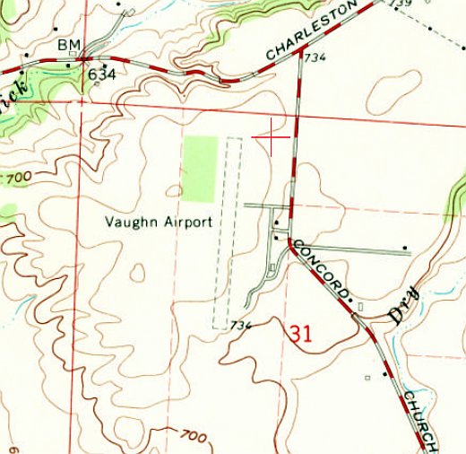
The earliest topo map depiction which has been located of Vaughn Airport was on the 1960 USGS topo map.
It depicted Vaughn as having a single north/south unpaved runway.
The last aeronautical chart depiction which has been located of Vaughn Airport was on the February 1969 Huntington Sectional Chart.
It depicted Vaughn as having a 2,400' unpaved runway.
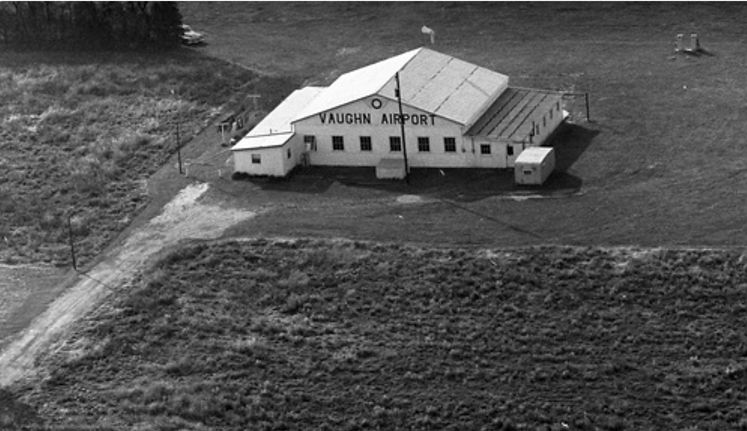
The earliest photo which has been located of Vaughn Airport was a 1970 aerial view (courtesy of Dennis Thompson).
It depicted a single hangar painted “Vaughn Airport”.
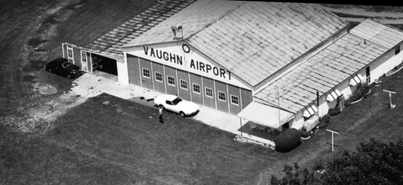
A 1975 aerial view (courtesy of Dennis Thompson) depicted a single hangar painted “Vaughn Airport”, with a stylish 1970s Corvette parked in front.
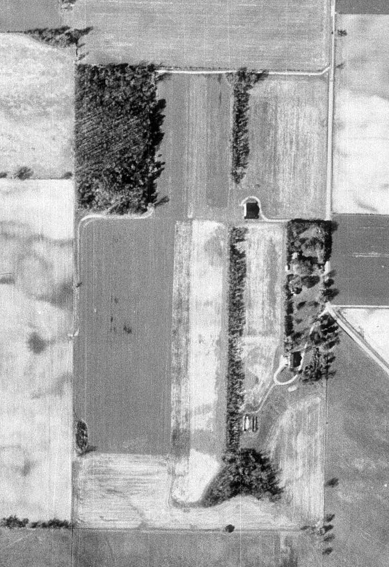
A 1988 ODoT aerial view (courtesy of Dennis Thompson) depicted Vaughn Airport as having a single unpaved north/south runway, with a single hangar on the northeast side.
There were no aircraft visible on the field.
Vaughn Airport's hangar was evidently removed at some point between 1988-94, as it was no longer seen on a 1994 aerial photo.
Vaughn Airport was still depicted on the 1995 USGS topo map.
Vaughn Airport was no longer depicted on the 2013 USGS topo map.
The Vaughn Airport hangar foundation was still visible on a 2015 aerial photo.
A 2021 aerial view looking southwest showed the former Vaughn Airport runway remained clear,
but a building had been constructed at some point between 2015-2021 over the former hangar foundation.
Thanks to Dennis Thompson for pointing out this airfield.
____________________________________________________
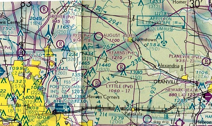
Kearns Airport (OH74), Johnstown, OH
40.094, -82.717 (Northeast of Columbus, OH)
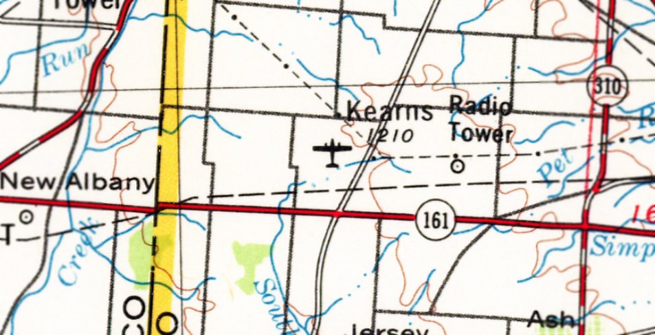
Kearns Airport, as depicted on the 1966 USGS topo map.
This small private airfield was evidently established at some point between 1959-66,
as it was not yet depicted on a 1959 aerial photo.
The earliest depiction which has been located of Kearns Airport was on the 1966 USGS topo map.
Kevin Korterud reported, “Kearns Airport... They used to hold Waco fly-ins there.”
The earliest aeronautical chart depiction which has been located of Kearns Airport was on the 1976 Sectional Chart.
It depicted Kearns as a private airfield having a mere 1,700' unpaved runway.
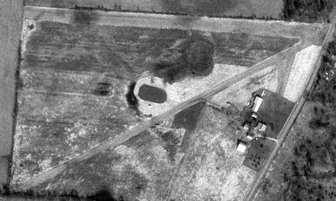
The only photo which has been located showing an aircraft at Kearns Airport was a 1995 aerial view.
It depicted Kearns as having 2 unpaved runways, with several buildings & 1 light single-engine aircraft on the east side.
The last aeronautical chart depiction which has been located of Kearns Airport was on the July 2008 Sectional Chart.
It depicted Kearns as a private airfield having a mere 1,700' unpaved runway.
Kevin Korterud reported, “I talked with the widow that owned the property.... her husband was an airline pilot; he gave up the airport as the insurance got too high.”
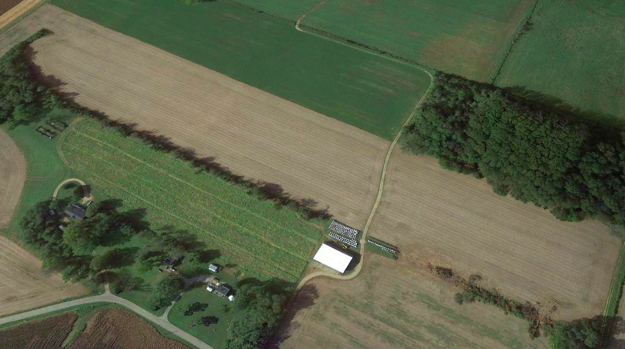
Kearns Airport was evidently closed at some point between 2008-2018, as a 2018 aerial view showed the Kearns Airport runways had been removed.
A 5/17/20 photo by Kevin Korterud looking along the former Kearns Airport runway.
A 5/17/20 photo by Kevin Korterud of the former Kearns Airport hangar.
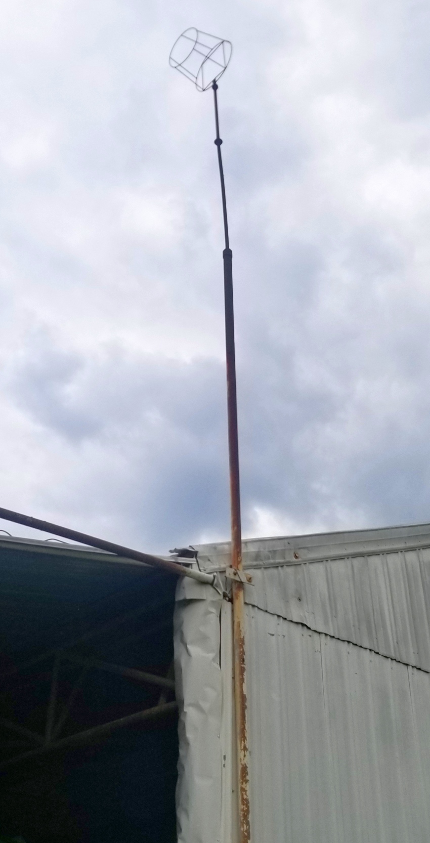
A 5/17/20 photo by Kevin Korterud of the windsock frame which remains atop the former Kearns Airport hangar.
A 5/17/20 photo by Kevin Korterud of the door to the former Kearns Airport hangar.
A 9/11/22 photo by Kevin Korterud of the Kearns Airport windsock pole, in the debris burn pile.
Kevin reported, “The much talked-about Intel chip plant broke ground this week. This likely means the complete end to what was Kearns Airport.
The house is abandoned & the T-hangars destroyed as part of land clearing for supporting facilities south of the Intel plant.”
Thanks to Kevin Korterud for pointing out this airfield.
____________________________________________________
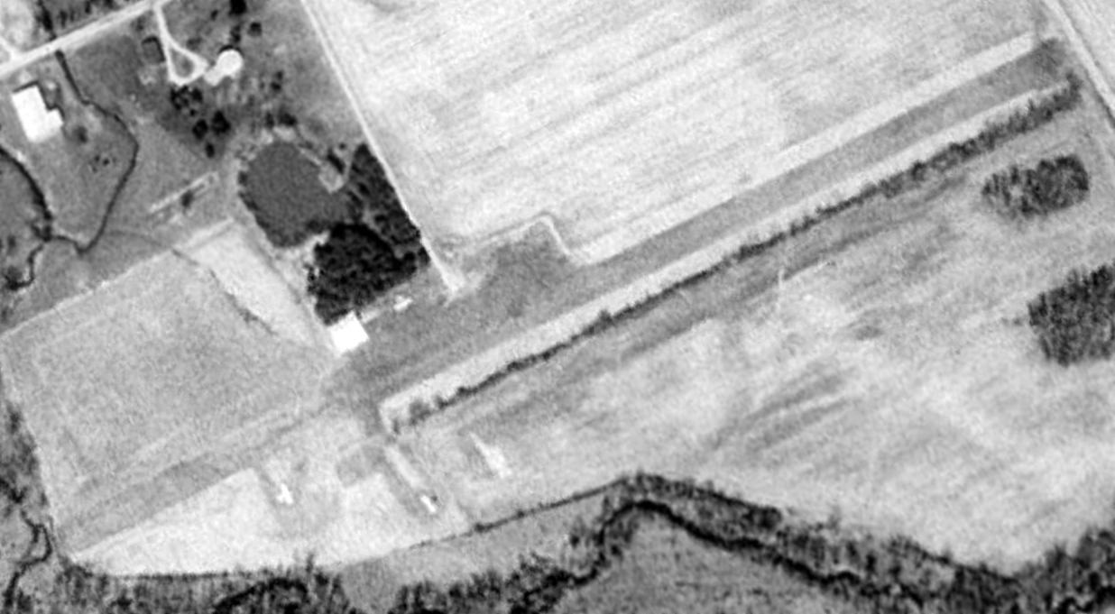
Plain City Airport, Plain City, OH
40.163, -82.782 (Northwest of Columbus, OH)
Plain City Airport, as depicted on the January 1948 Cleveland Sectional Chart.
According to John Burrows, “Plain City Airport was in opened in 1946, built by Bob Chapman, whose family owned several businesses including the first Ford dealership in Plain City.”
Plain City Airport was not yet depicted on the July 1947 Cleveland Sectional Chart.
The earliest depiction which has been located of Plain City Airport was on the January 1948 Cleveland Sectional Chart.
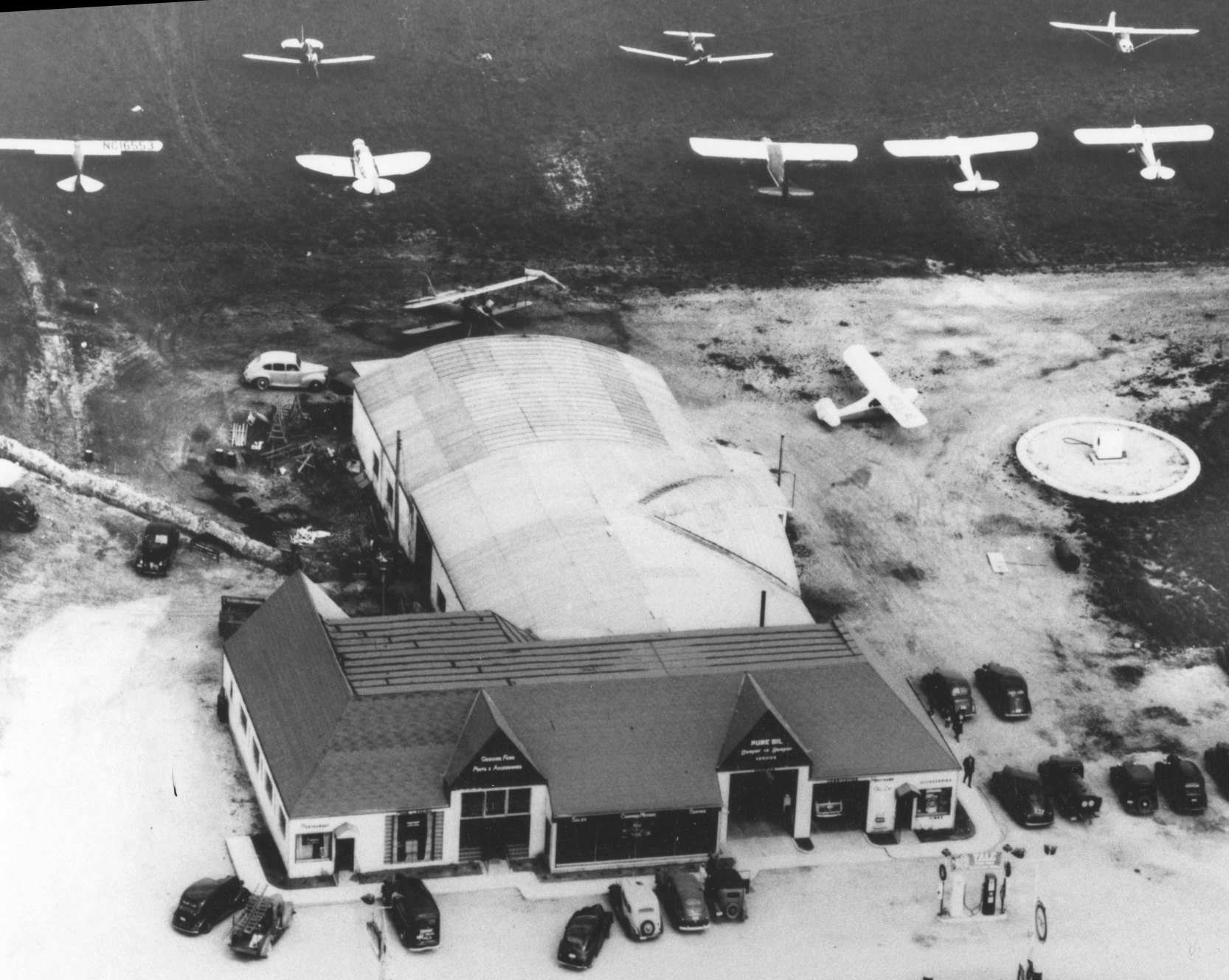
The earliest photo which has been located of Plain City Airport was a circa late 1940s aerial view (courtesy of the Plain City Library).
It depicted 9 single-engine monoplanes & a biplane parked around an arch-roof hangar.
The building attached to the back end of the hangar had (from left to right) the Airport Restaurant, the Ford Agency, and the Houchard Oil Company.
A 1953 aerial view depicted 5 light aircraft parked at Plain City Airport.
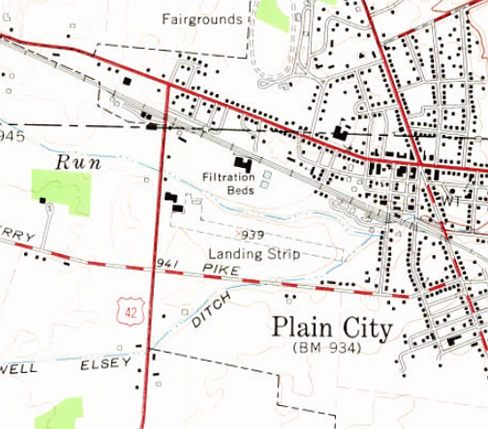
The earliest topo map depiction which is available of Plain City Airport was on the 1961 USGS topo map.
It depicted a single unpaved northwest/southeast runway, generically labeled as “Landing Strip”, with several buildings on the northwest side.
The last photo which has been located showing aircraft at Plain City Airport was a 1981 aerial view.
It depicted 6 light aircraft parked near the hangar on the northwest side.
According to John Burrows, “Plain City Airport... I believe it closed some time in the mid-1980s.”
The last aeronautical chart depiction which has been located of Plain City Airport was on the July 1988 Cincinnati Sectional Chart.
It depicted Plain City Airport as a private airfield having a 2,100' unpaved runway.
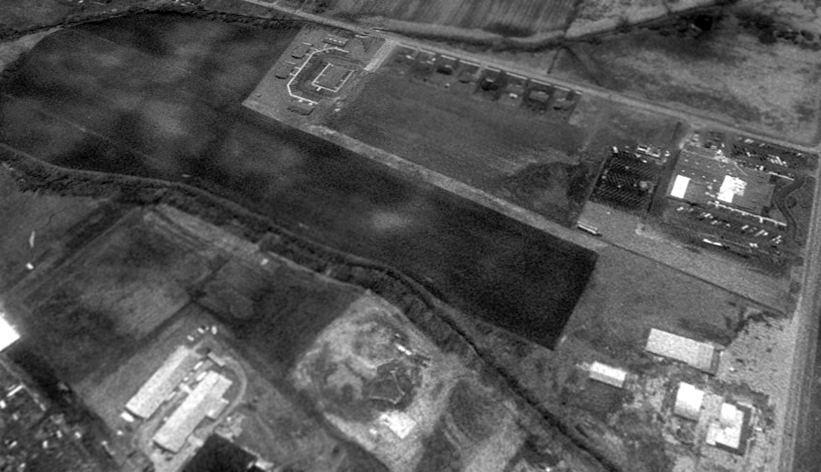
Plain City Airport was evidently closed by 1994, as a 1994 aerial view looking southeast showed houses had been built adjacent to the south side of the runway, which was no longer distinct for its entire length.
The hangar & former airport restaurant building remained intact on the northwest side.
A 2010 aerial photo showed the hangar & former airport restaurant building were both still intact.
A 2014 aerial photo showed the former airport restaurant building had been removed at some point between 2010-2014,
but the hangar remained standing.
A 2018 aerial view looking southeast at the site of Plain City Airport showed the runway area remained clear, and the hangar remained intact on the northwest side.
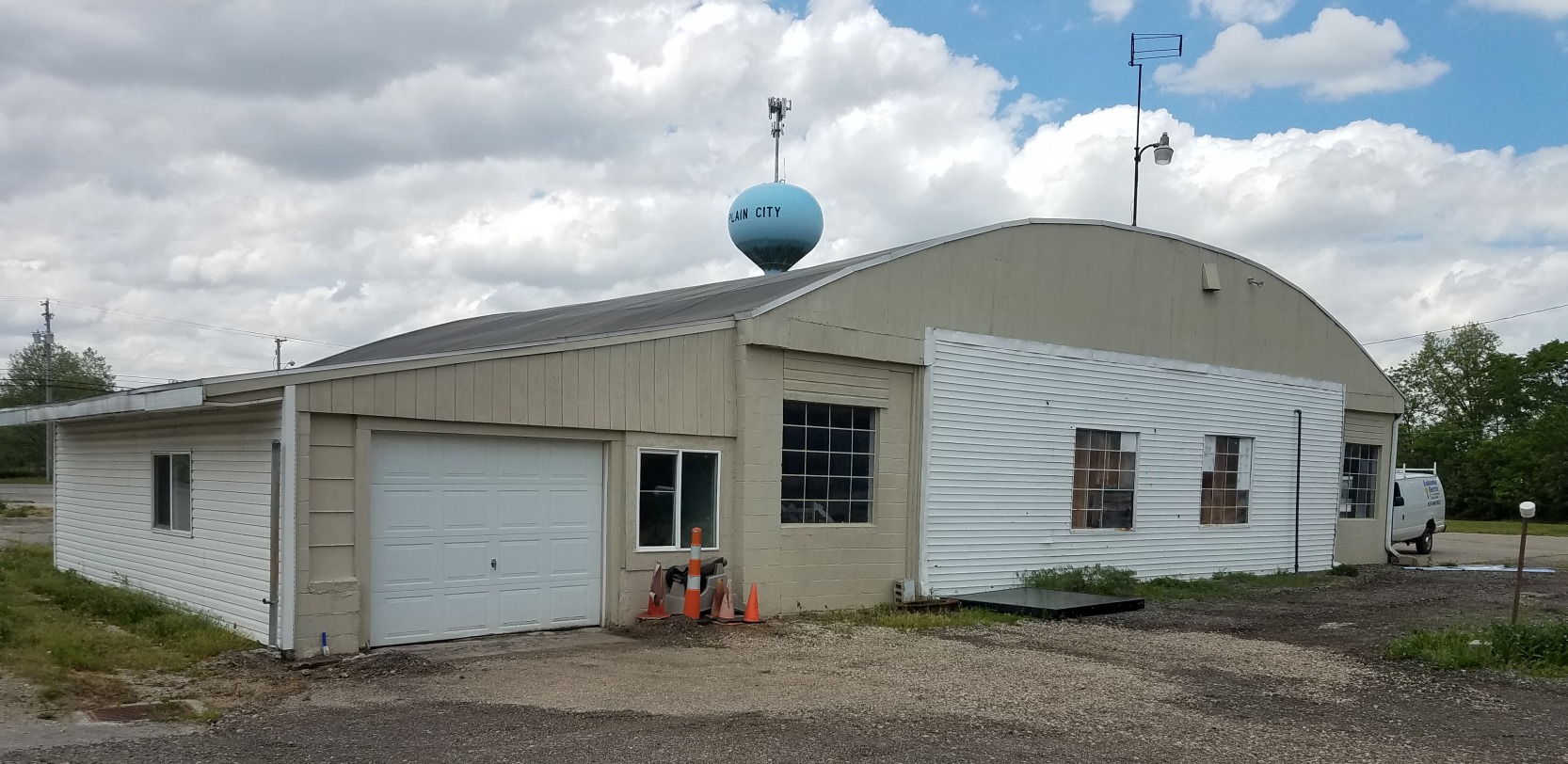
A 5/26/20 photo by Mark Knapp of the former Plain City Airport hangar.
Mark reported, “The front portion of the building housed the restaurant & is now gone.
The hangar was recently a used car dealer, and is currently being renovated. Contractors were there, and had no idea about the history.”
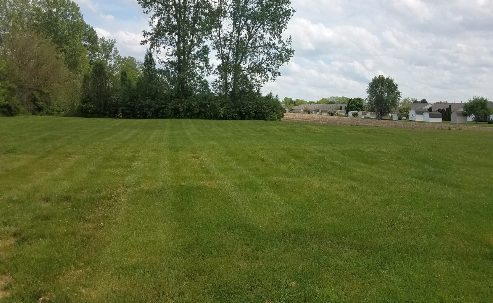
A 5/26/20 photo by Mark Knapp of the former Plain City Airport airfield area.
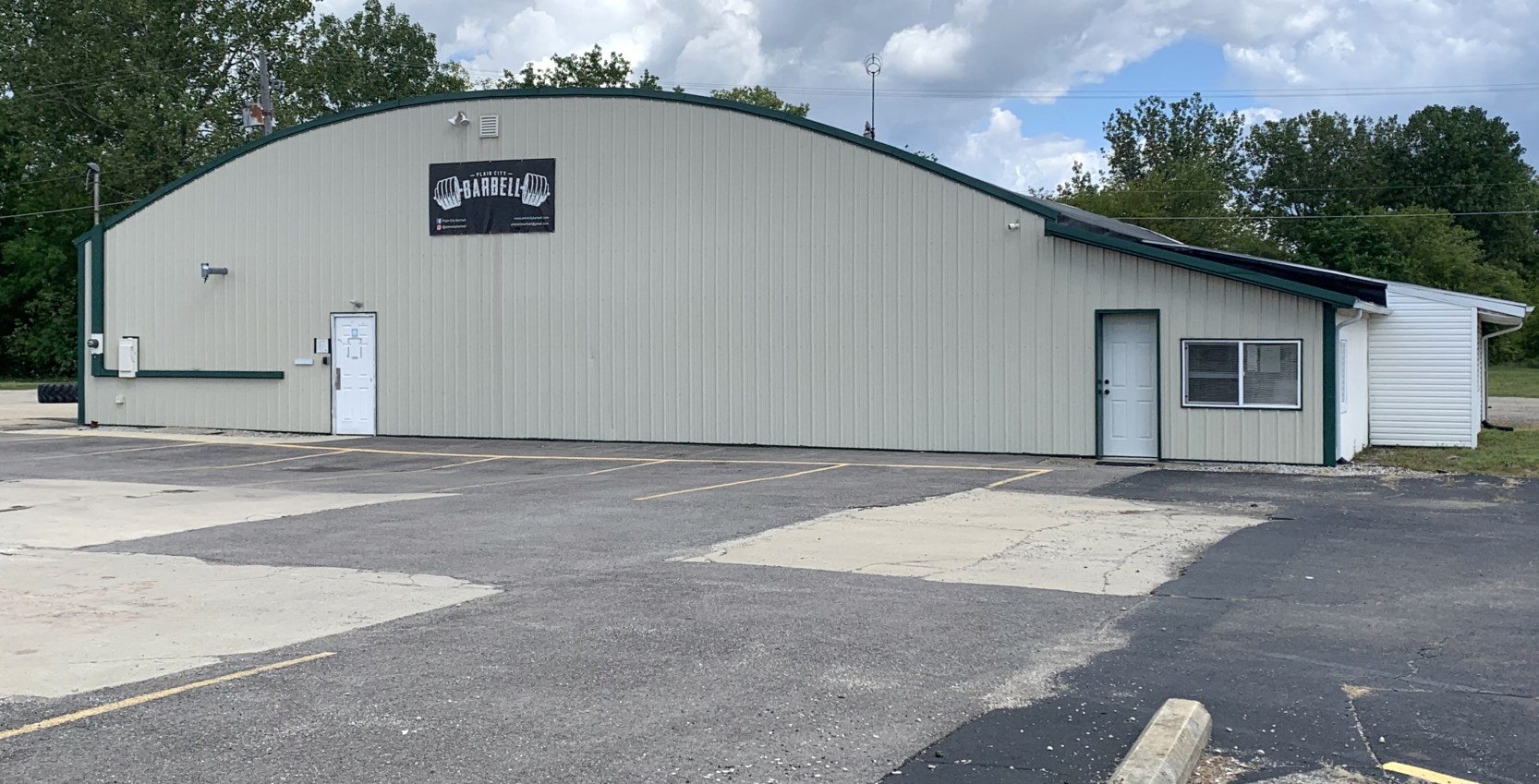
A 9/1/22 photo by Mark Knapp of the former Plain City Airport hangar, now reused as Plain City Barbell.
Note the windsock frame which remains atop the hangar.
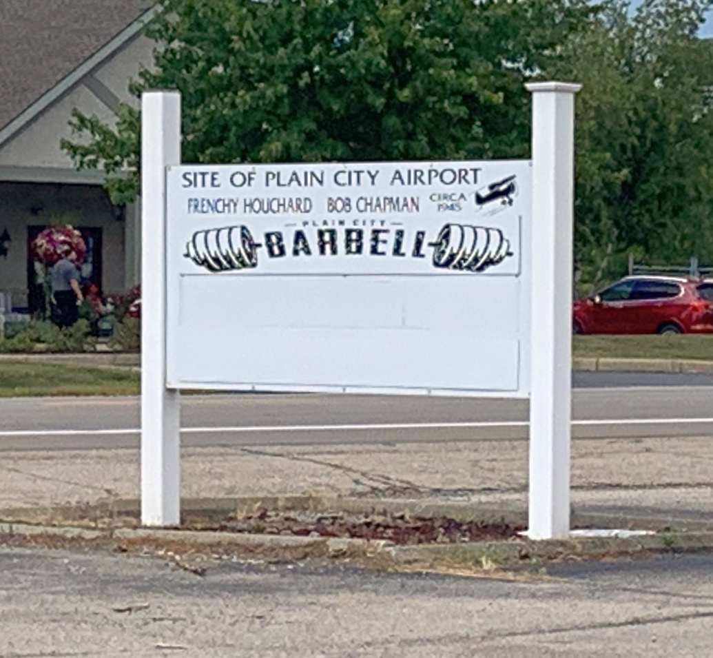
A 9/1/22 photo by Mark Knapp of the Plain City Barbell, which mentions it as the “Site of Plain City Airport”.
Thanks to John Burrows & Mark Knapp for pointing out this airfield.
____________________________________________________
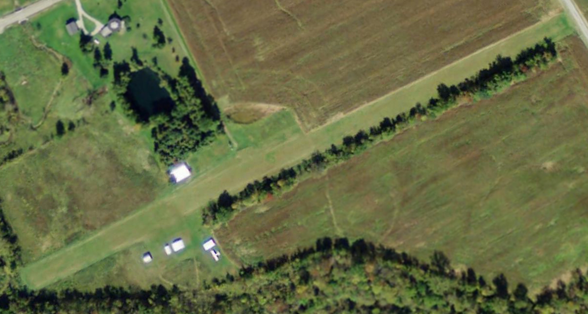
August Acres Airport (OH17), Center Village, OH
40.163, -82.782 (Northeast of Columbus, OH)
August Acres Airport, as depicted on the August 1976 Cincinnati Sectional Chart.
This small general aviation airport was evidently established at some point between 1971-76,
as it was not yet depicted on the February 1971 Cincinnati Sectional Chart (courtesy of Ron Plante) nor a 1971 aerial photo.
The earliest depiction which has been located of August Acres Airport was on the August 1976 Cincinnati Sectional Chart.
It depicted August Acres Airport as having an 1,800' unpaved runway.
According to its FAA Airport/Facility Directory data, August Acres Airport was owned & operated by Paul August. It had a 2,095' turf Runway 9/27.
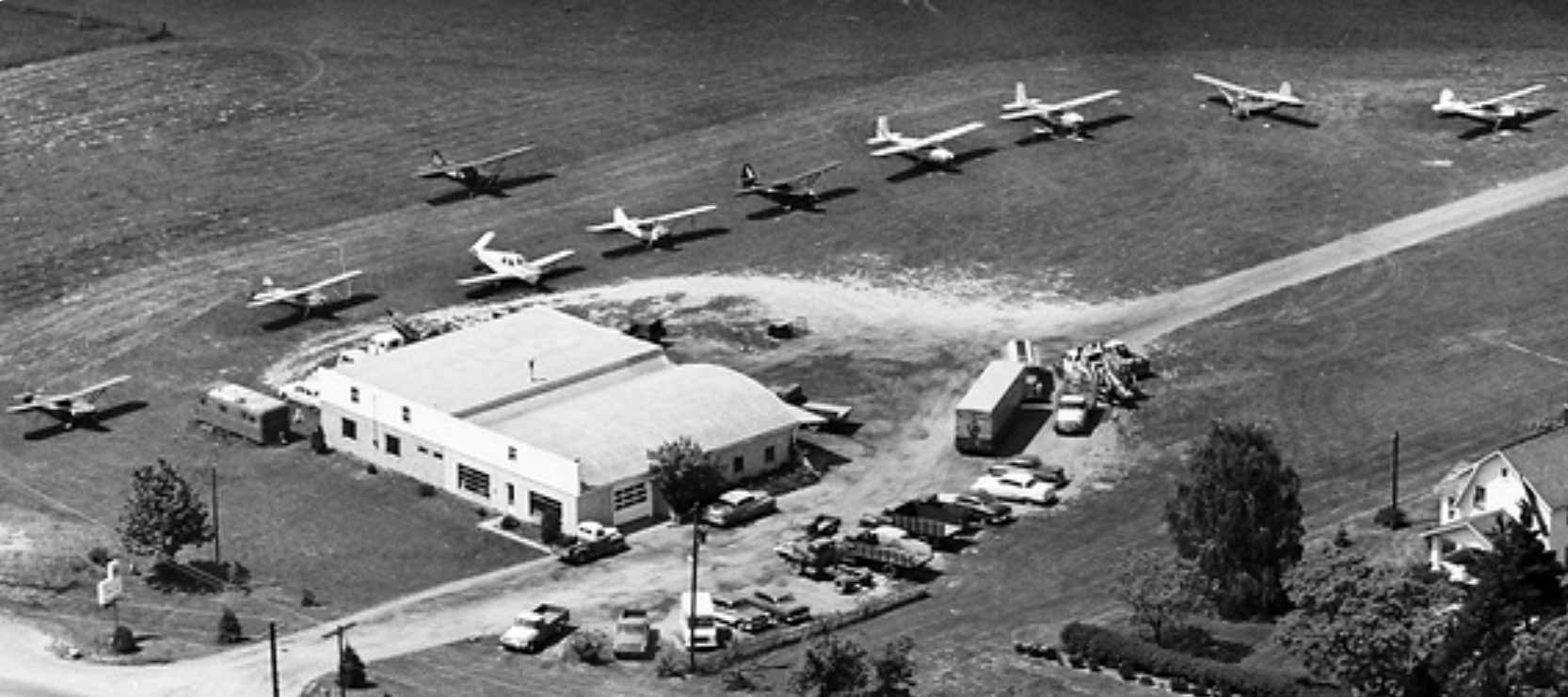
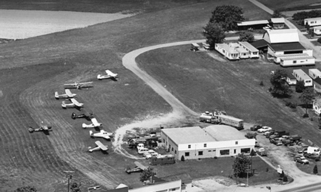
The earliest photo which has been located of August Acres Airport was a 1980 aerial view.
It depicted August Acres Airport as having a single east/west grass runway, with a single small hangar & 7 light single-engine aircraft parked on the west side.
Milton Moos recalled, “I became a member of the association of aircraft owners at August Acres in 1982. There were at least 10 aircraft based there then.
The field was operated by Paul August, the property owner, and Clare 'Buzz' Kosbab, a former Air Force pilot & an IA who at one time taught in the aviation department at Columbus State.
We aircraft owners bought a share of the owner association, I guess to relieve Paul of any liability for any unfortunate occurrence that might happen during flight operations there.
There was a fuel pump on the North side of the field where we self-fueled our aircraft & later got a monthly bill for fuel & tiedown fees.
It was a nice field to fly out of, although short enough to be wary of hot days on takeoff.”
The earliest photo which is available of August Acres Airport was an August 1984 photo by Milton Moos of his “Cessna 150 tied down next to another C150 at the western end of the tree line along the South side of the runway.”
August Acres Airport was not depicted on the 1988 USGS topo map.
The earliest aerial photo which is available of August Acres Airport was a 1998 USGS aerial view.
It depicted August Acres Airport as having a single east/west grass runway, with a single small hangar & 3 light single-engine aircraft parked on the west side.
Milton Moos observed, “My aircraft [Cessna 172L] was the lower-left one where I was tied down before the fabric hangars were built.”
The last photo which has been located showing an aircraft at August Acres Airport was a 2011 aerial view looking northeast, which showed only 1 light single-engine aircraft parked on the west side.
The 2013 USGS topo map depicted August Acres Airport as having a single east/west runway.
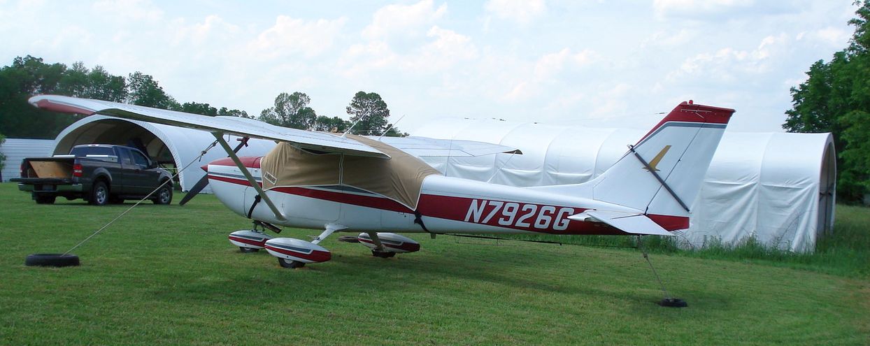
The last photo which has been located showing an aircraft at August Acres Airport was a 5/30/13 photo by Milton Moos of his Cessna 172L in front of 2 fabric hangars.
Milton recalled, “The runway sloped down; there was a difference of 15' elevation downward from east to west. The opening in the trees over the vertical fin is at the western end of the runway, at the lowest elevation by the creek where the ground rose again westward.
On a hot day with an east wind, it took some calculating to make sure that we would clear the wires at the East end of the field.
My Cessna has the Horton STOL stall fences on the wings. I also had the Power Flow Systems muffler for another 100 rpm on takeoff.”
A 2013 aerial view showed August Acres Airport runway & buildings remained intact, but no aircraft were visible on the field.
Milton Moos recalled, “Through the years aircraft left the field, including mine when I sold it in 2014.
At that time, there were 4 ultralights & homebuilt aircraft housed in fabric hangars, plus 2 old ships under long-term restoration in the large hangar on the north side of the runway.”
The last aeronautical chart depiction which has been located of August Acres Airport was on the June 2016 Cincinnati Sectional Chart.
It depicted August Acres Airport as a private field having a 2,100' unpaved runway.
Milton Moos recalled, “Paul August, the owner of the property, passed away & the field was sold to housing developers.”
A 2016 aerial view showed only the main hangar remained standing at the site of August Acres Airport,
with the smaller buildings having been removed between 2015-16.
A 2017 aerial view showed August Acres Airport's main hangar had been removed between 2016-17.
August Acres Airport was evidently closed (for reasons unknown) at some point between 2016-18,
as it was no longer depicted on the June 2018 Cincinnati Sectional Chart.
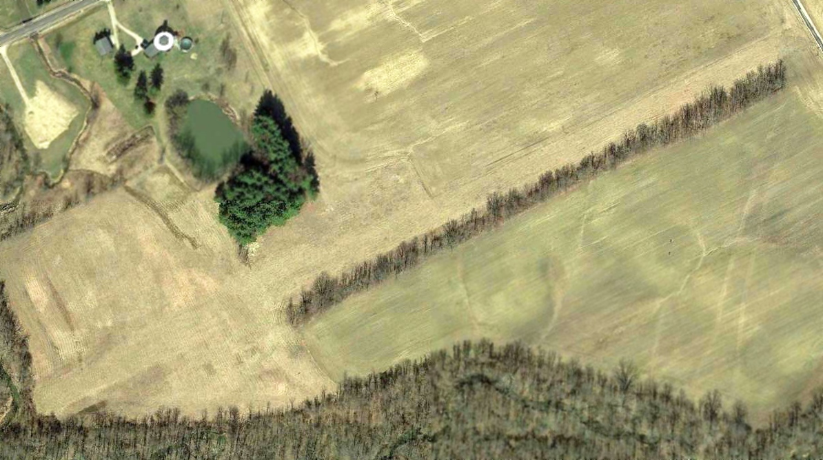
A 2018 aerial view looking northeast at the site of August Acres Airport showed the runway remained clear, but all of the buildings had been removed.
A 5/10/20 photo by Kevin Korterud of the site of August Acres Airport.
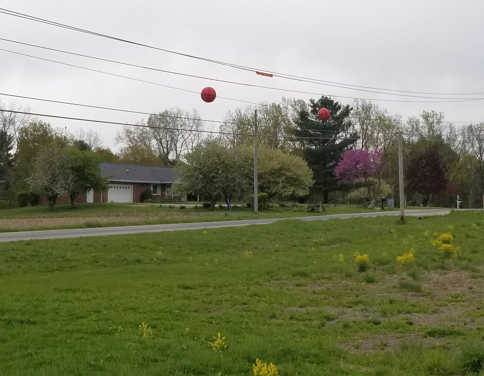
A 5/10/20 photo by Kevin Korterud of powerline warning markers which remain at the site of August Acres Airport.
Milton Moos reported in 2023, “Several homes now occupy the site.”
Thanks to Kevin Korterud for pointing out this airfield.
____________________________________________________
Columbus Southwest Airport (O4I), Galloway, OH
39.912, -83.188 (Southwest of Downtown Columbus, OH)

Columbus Southwest Airport, as depicted on the 1966 USGS topo map.
The date of establishment of Columbus Southwest Airport has not been determined.
According to Bob Seevers, “Ernie Bowers bought it in the 1950s.”
The earliest depiction which has been located of Columbus Southwest Airport was on the 1966 USGS topo map.
It depicted Columbus Southwest Airport as having an unpaved northeast/southwest runway, with several small buildings on the east side.
According to Bob Seevers, “Ernie Bowers' son bought it in 1976.
My dad, brother & I learned to fly there & I worked for flying lessons in the summers of 1975 & 76.”
The earliest photo which has been located of Columbus Southwest Airport was a 1994 USGS aerial view looking northwest.
It depicted Columbus Southwest Airport as having an unpaved northeast/southwest runway, with several small buildings & 7 light single-engine aircraft on the east side.
The last aerial photo which has been located showing aircraft at Columbus Southwest Airport was a 2016 aerial view looking northwest.
The airfield configuration remained the same as seen in 1994, but the number of aircraft visible parked outside had decreased to one.
A 2018 aerial view looking northwest at Columbus Southwest Airport showed the airfield configuration remained the same, but the field was devoid of aircraft.
Bob Seevers reported in 2020, “A storm came through a couple years ago & tore up some hangars.
With insurance not covering, tax money was used for repairs done to tenant hangars & the owner came up short when it came time to pay the county.
My brothers Champ was based there; he sold it a couple months ago to a longtime friend who kept his Luscombe there since the 1970s.
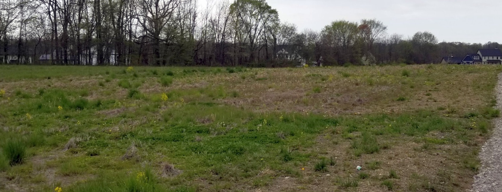
Columbus Southwest Airport will become an abandoned airfield on April 1, sold to a sod farmer.”
A 2020 photo by Bob Seevers, “Looking down 2,380' of Runway 24” at Columbus Southwest Airport.
A 2020 photo by Bob Seevers of the wind tetrahedron at Columbus Southwest Airport. Bob reported, “The last paint job was in 1975, by me!”
A 2020 photo by Bob Seevers of Columbus Southwest Airport, showing “Maintenance hangar left, just a barn center, office to the right.
Before the repair, the entire right side of the office roof was destroyed.”
A 2020 photo by Bob Seevers of Columbus Southwest Airport, showing “What was left after the clean up; my brother's hangar to the right with new roofing.”
A 2020 photo by Bob Seevers of Columbus Southwest Airport, showing “The newest hangar, built in the early 1990s.”
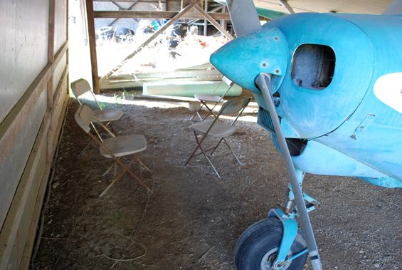
A 2020 photo by Bob Seevers of a Taylorcraft inside a Columbus Southwest Airport hangar.
Bob Seevers reported in 2020, “I did a drive by last week; there were no airplanes, but the hangars are still up.”
Thanks to Bob Seevers for pointing out this airfield.
____________________________________________________
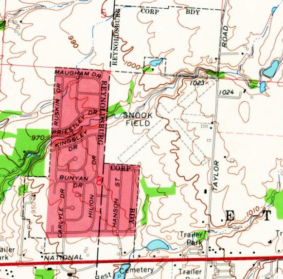
Snook Airport / Snook Field, Reynoldsburg, OH
39.965, -82.773 (East of Columbus, OH)
Snook Airport, as depicted on the July 1947 Cleveland Sectional Chart.
According to Steve McLoughlin, “Harley & his brother Earl 'Buster' Snook lived on a farm on Taylor Road, at the northeast corner of Reynoldsburg.
Harley was a flight instructor at Norton Airport.
After their parents bought the farm in 1935, they cleared a portion of the land to establish Snook's Airfield.
There were 2 hangars & 12 tie-downs, and the 1-story concrete-block building was the office.”
Snook Airport was not yet depicted on the October 1946 Huntington Sectional Chart.
The earliest depiction which has been located of Snook Airport was on the July 1947 Cleveland Sectional Chart.
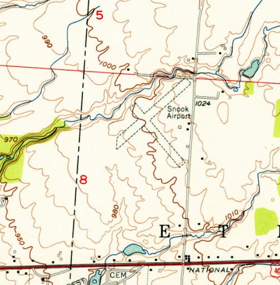
The 1955 USGS topo map depicted Snook Airport as having 2 perpendicular unpaved runways, with 4 small buildings on the east side.
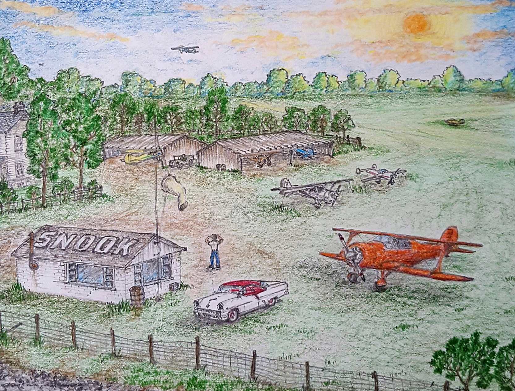
A drawing by Colin Sutphin (courtesy of Steve McLoughlin) of Snook Field, showing Colin's 1955 Mercury Montclair & several light aircraft.
According to Steve McLoughlin, “It's heyday, according to their nephew Glenn Bard, was in the 1950s, and activity gradually dwindled into the 1960s.”
The earliest photo which has been located of Snook Field was a 5/2/63 USGS aerial view.
It depicted Snook Field as having 2 perpendicular unpaved runways, and a few small buildings on the east side.
Only 1 light single-engine aircraft was visible on the field.
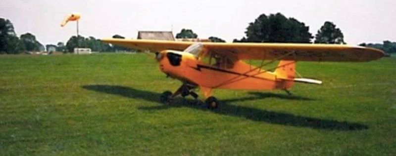
An undated photo of Harley Snook's Piper J-3 Cub, possibly taken at Snook Field.
The 1964 USGS topo map depicted Snook Field as having 2 perpendicular unpaved runways,
with the southwest/northeast runway having been lengthened toward the southwest at some point between 1955-64.
Four small buildings were depicted on the east side.
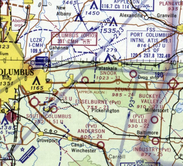
The last aeronautical chart depiction which has been located of Snook Airport was on the February 1969 Huntington Sectional Chart.
It depicted Snook as having a 3,100' unpaved runway.
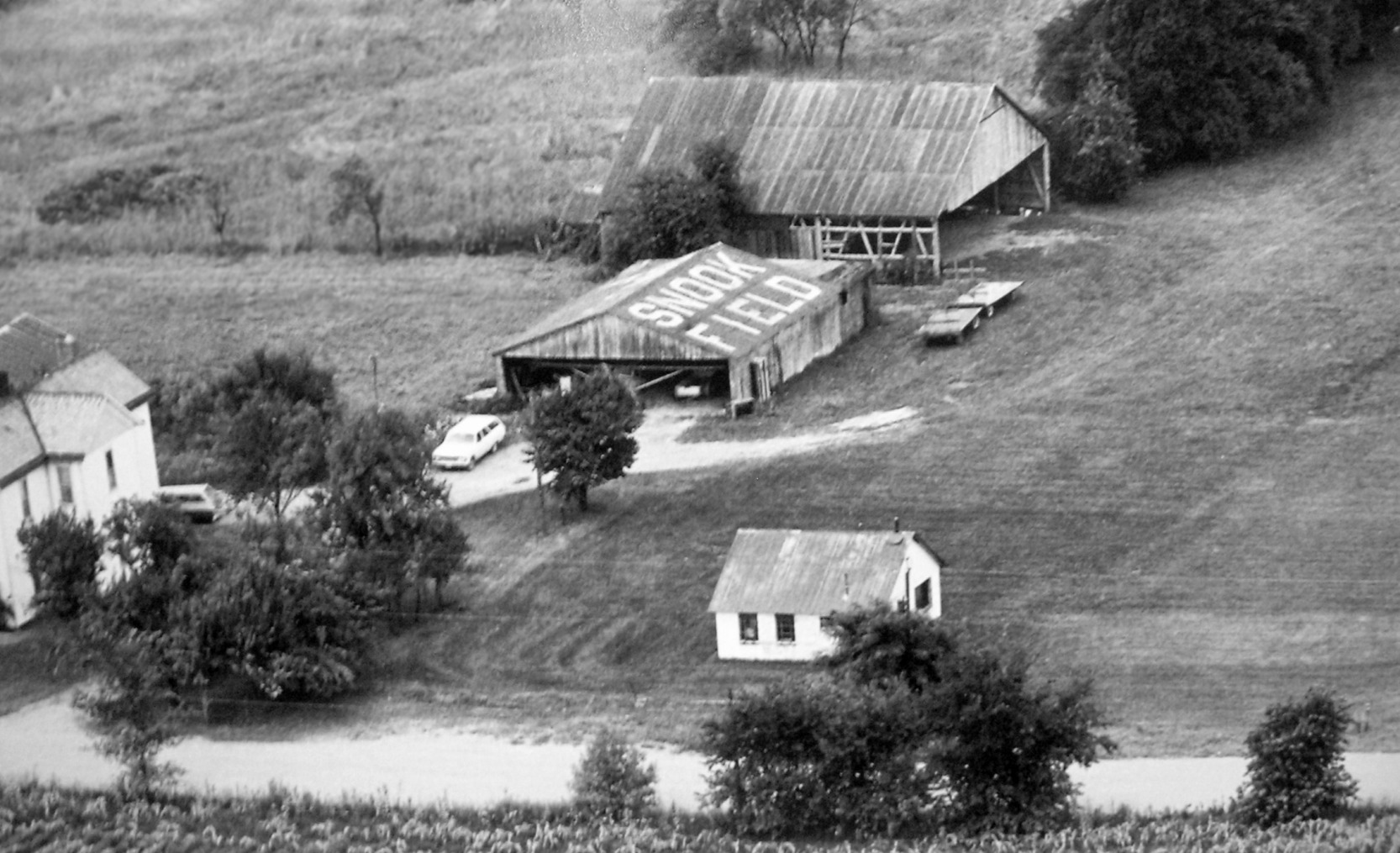
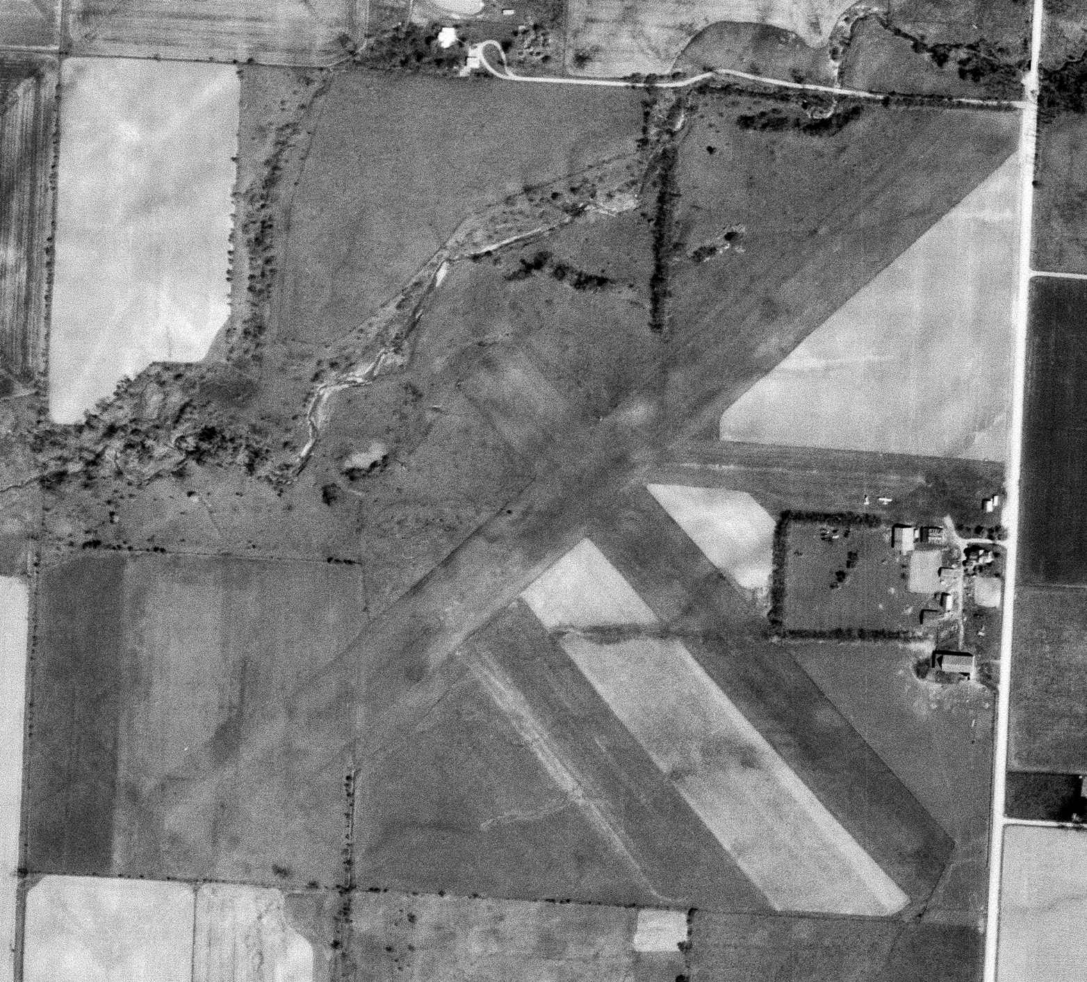
A circa 1969-70 aerial view (courtesy of Glenn Bard, via Steve McLoughlin) of Snook Field, showing 2 hangars, one with a plane inside & “Snook Field” painted on the roof.
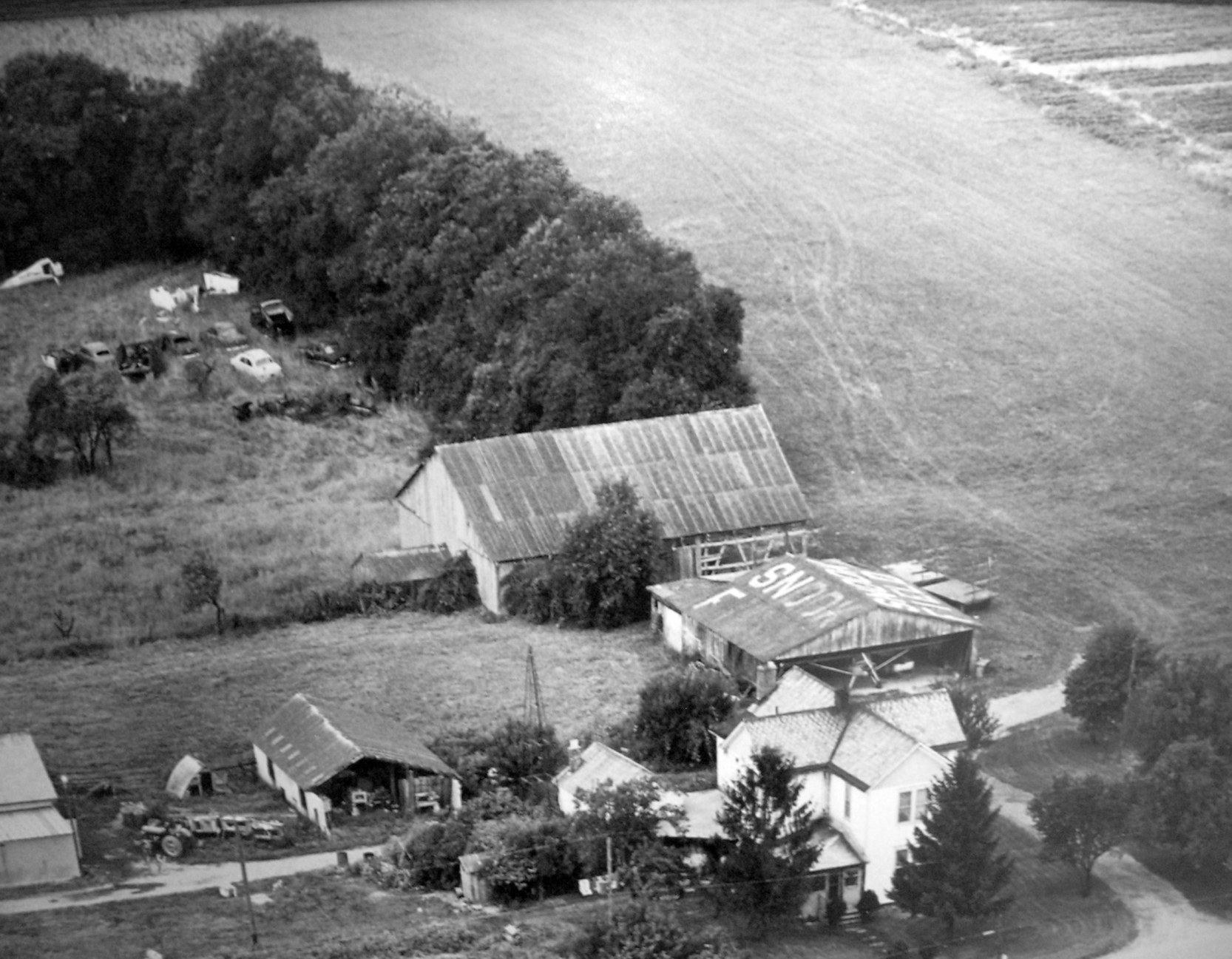
A circa 1969-70 aerial view (courtesy of Glenn Bard, via Steve McLoughlin) of Snook Field, showing 2 hangars, one with a plane inside & “Snook Field” painted on the roof.
Another aircraft fuselage was visible at top-left.
According to Steve McLoughlin, “One runway was kept for Earl to use until the 140 acre farm was sold in 1970.”
Snook Field was no longer depicted on the May 1970 Cleveland Sectional Chart nor on the 1974 USGS topo map.
Kevin Korterud recalled, “Snook Field... In high school I recollect riding dirt bikes there, poking around the old hangars as well as finding a derelict steel-tube fuselage in the high grass.
They also had an old pilots' ready room that was there for a number of years that was demolished when they started the housing development.”
According to Steve McLoughlin, “Extensive residential development followed soon thereafter, with the house & airfield portion being replaced with a subdivision beginning around 1990.”
A 2018 aerial view showed no trace remaining of Snook Field, with housing covering the property.
The site of Snook Field is located west of the intersection of Taylor Road & Kingsley Drive.
Thanks to Steve McLoughlin for pointing out this field.
____________________________________________________
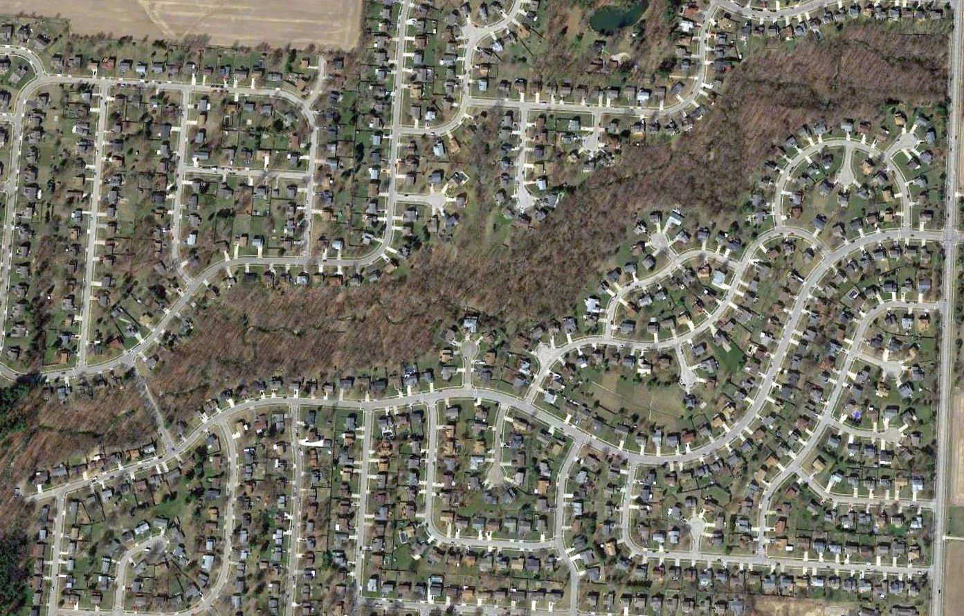
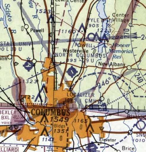
Northway Air Park / North Columbus Airport, Columbus, OH
40.065, -82.961 (North of Downtown Columbus, OH)
Northway Air Park, as depicted on the November 1950 Cleveland Sectional Chart.
This general aviation airport on the north side of Columbus was evidently established at some point between 1947-50,
as it was not yet depicted on the July 1947 Cleveland Sectional Chart.
The earliest depiction which has been located of Northway Air Park was on the November 1950 Cleveland Sectional Chart.
It depicted Northway as having a 3,400' unpaved runway.
The earliest photo which has been located of Northway Air Park was a 1953 aerial view.
It depicted Northway Air Park as having a 4 unpaved runways, with a hangar painted “Northway Airpark” & 7 light aircraft on the southeast side.

The 1954 USGS topo map depicted Northway Air Park as having 4 unpaved runways, with 2 buildings on the south side.
Jim Edgar recalled, “In 1954 or 1955 I remember seeing a few single-engine planes there.
On Morse Road the airport was on the north side.
I vaguely remember a hangar, with faded & flaking paint, but remember the words 'North Columbus Airport'.”
The January 1955 Cleveland Sectional Chart depicted Northway as having a 3,300' unpaved runway.
Northway evidently gained a paved northwest/southeast runway at some point between 1955-57,
as that is how it was depicted on a 1957 aerial photo.
The January 1958 Cleveland Sectional Chart depicted Northway as having a paved 2,800' runway.
It was still depicted as Northway on the May 1958 Cleveland Sectional Chart,.
The last photo which has been located showing Northway Air Park in operation was a 10/28/59 USGS aerial view.
It depicted Northway Air Park as having a paved northwest/southeast runway, along with 3 unpaved runways,
and several hangars & a good number of light planes on the south side.
Jim Edgar recalled, “Around 1959 I remember guys would take their go-karts & radio-controlled model airplanes there to drive the karts & fly their planes
because it was wide open, the noise was not near people to bother them, and it was paved for the karts.
I remember seeing blacktop still there but with the weeds growing up in the cracks.”
The airport was evidently renamed North Columbus Airport at some point between 1958-60,
as that is how it was depicted on the July 1960 Cleveland Sectional Chart.
North Columbus Airport was evidently closed at some point between 1960-63,
as a 1963 aerial view showed the airport name had been removed from the hangar & the field was devoid of aircraft.
The airport otherwise remained intact.
Jim Edgar recalled, “When the developers found open space out there, Northland Shopping Center was started around 1964.
My father-in-law owned Northway Taxi Cab Company, and told that when he bought the Taxi company he could have bought the airport property as well, but passed.
Little did he know then how much that property would end up being worth.”
North Columbus Airport was depicted as an abandoned airport on the May 1965 Cleveland Sectional Chart.
North Columbus Airport was no longer depicted on the 1966 USGS topo map.
A 1971 aerial photo showed no trace remaining of North Columbus Airport, with the site covered by retail buildings & housing.
A 2016 aerial photo showed no trace remaining of North Columbus Airport.
The site of Northway Field is located northwest of the intersection of Morse Road & Cleveland Avenue.
Thanks to Jim Edgar for pointing out this field.
____________________________________________________
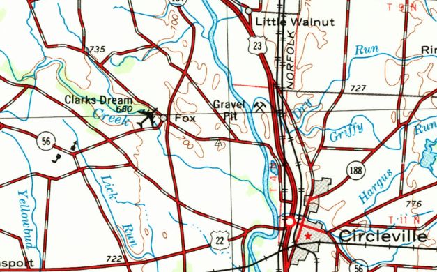
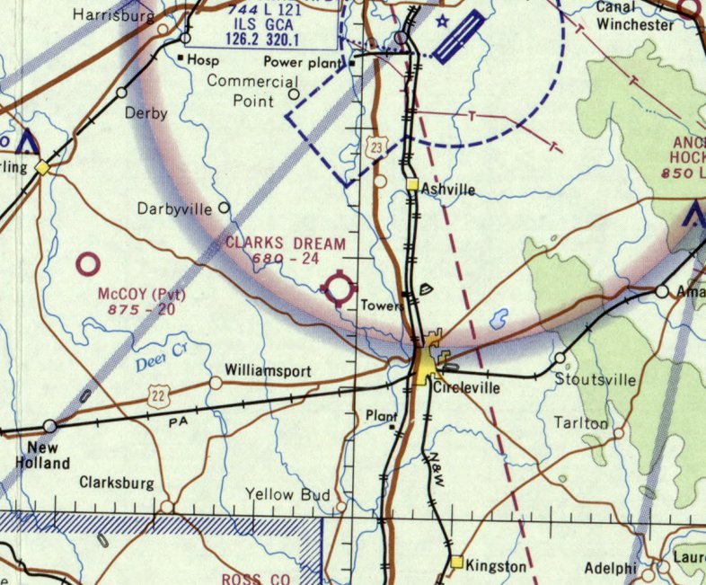
Clark's Dream Airport (03I), Circleville, OH
39.644, -83.017 (South of Columbus, OH)
Clark's Dream Airport, as depicted on the 1967 USGS topo map.
This small general aviation airport was not yet depicted on the 1965 Cincinnati Sectional Chart.
According to its FAA Airport/Facility Directory data, Clark's Dream Airport was activated in March 1967.
The earliest depiction which has been located of Clark's Dream Airport was on the 1967 USGS topo map,
which ironically depicted the little grassroots airfield with a symbol of a 4-engine swept-wing jet.
David Ostrander recalled, “In 1967 Mom (Lucille) & Dad (Leon) moved to Clarks Dream Strip. Mom managed the airstrip.
They had the house trailer from Thomas Field moved to the southeast side of Clark's Dream Strip.
Dad taught flying on evenings & weekends.”
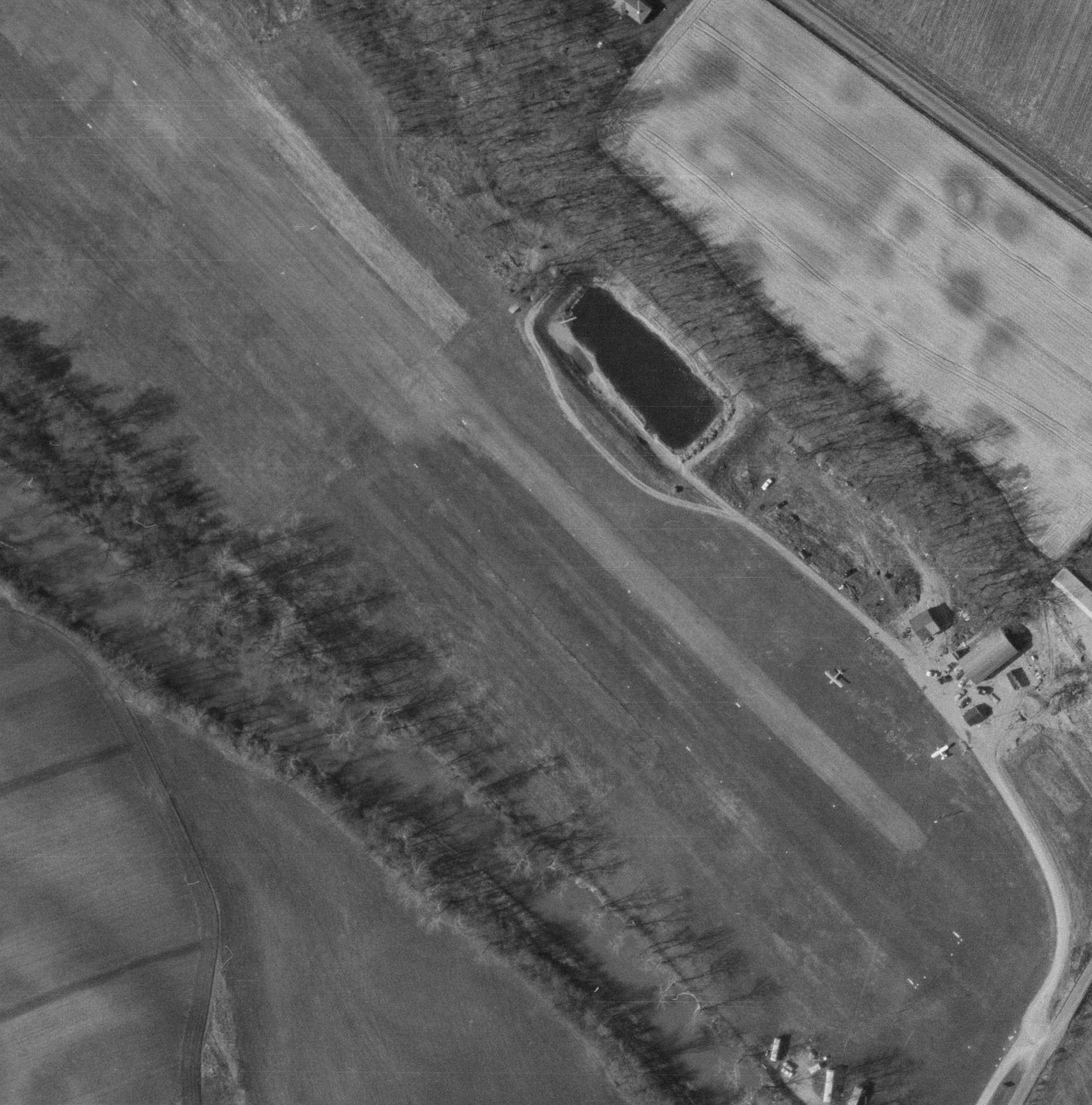
The earliest photo which has been located of Clark's Dream Airport was a 1969 OHDOT aerial view (courtesy of Dennis Thompson).
It depicted Clark's Dream as having a northwest/southeast unpaved runway, with 2 light single-engine aircraft parked near some small buildings on the southeast side.
The earliest aeronautical chart depiction which has been located of Clark's Dream Airport was on the February 1969 Cincinnati Sectional Chart.
It depicted Clark's Dream as having a 2,400' unpaved runway.
A 1994 USGS aerial view looking northeast depicted Clark's Dream as having a northwest/southeast unpaved runway, with 5 light single-engine aircraft parked near some small buildings on the southeast side.
The last photo which has been located which appears to show an aircraft still being operated from Clark's Dream Airport was a 2002 aerial view looking northeast.
It depicted one light single-engine aircraft parked on the grass next to the runway.
An 8/11/07 aerial view by Bob Simmermon looking northwest along the Clark's Dream runway.
A closeup 8/11/07 aerial view by Bob Simmermon looking northwest at the Bonanza parked next to the Clark's Dream runway.
Bob observed, “It doesn't look like that V-tail has been flying in a while.”
A circa 2010 aerial view looking north at the Bonanza parked next to the Clark's Dream runway.
According to its FAA Airport/Facility Directory data, as of 2013 Clark's Dream Airport had total of 3 single-engine aircraft based on the field,
and conducted an average of 48 takeoffs or landings per week.
The owner & manager were listed as Louis McFarland & Joan Savage,
and the field was described as having a single 2,375' turf Runway 13/31 “in good condition”.
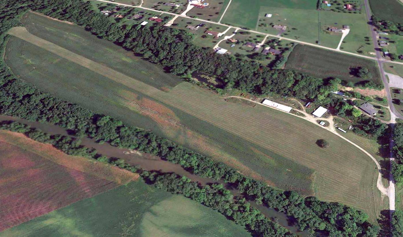
A 2015 aerial view looking northeast showed Clark's Dream Airport to remain in fine condition, with the one Bonanza still parked to the southeast of the runway.
The 2016 Sectional Chart depicted Clark's Dream Airport as a public-use airport having a 2,400' unpaved runway.
An 8/26/16 photo by Randy Coller of the Clark's Dream Airport office & runway.
Airport inspector Randy Coller reported in 2016, “On my summer OH tour, I closed down some airports. Not something I relish or take pride in.”
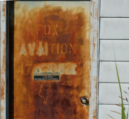
An 8/26/16 photo by Randy Coller of the door to Fox Aviation at Clark's Dream Airport.
Randy observed, “This little place was a hotbed of things aeronautic in its day -
you can tell by the signs on the abandoned office door proclaiming proudly, 'Fox Wing - Wrong Brothers Air Force'.
They must have been quite the group of characters! I'll bet they were a fun bunch.”

An 8/26/16 photo by Randy Coller of the interior of the Clark's Dream Airport office. Randy observed, “Proud memorabilia fall from the walls.”
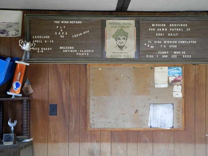
An 8/26/16 photo by Randy Coller of the interior of the Clark's Dream Airport office.
Randy observed, “Tarnished trophies tell tales of heroics & sunburned bulletin boards proclaim stories of 'mission accomplished'.
Ole 'C.K.', the guy who lovingly built it, slipped the surly bonds of earth several years ago.
His son & daughter who inherited the place are now slowly cleaning it out, as fast as their emotions & sentiments will allow,
savoring the memories of each abandoned log book & knick-knack that carries its own story.
The son tends to hang on to the past more than the daughter. He's not in a hurry to let go.
You can tell the old aerodrome still holds great value in their hearts.”
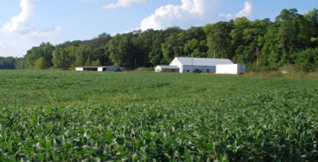
An 8/26/16 photo by Randy Coller looking north at Clark's Dream Airport.
Randy observed, “Clark's Dream, as it was so proudly called, lies abandoned amid the memories.
The carefully graded & tended runway now plowed up & growing a great crop of soybeans instead of young pilots.”
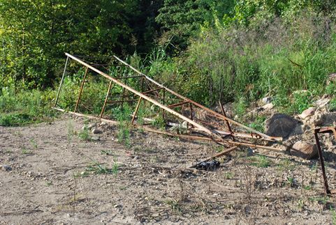
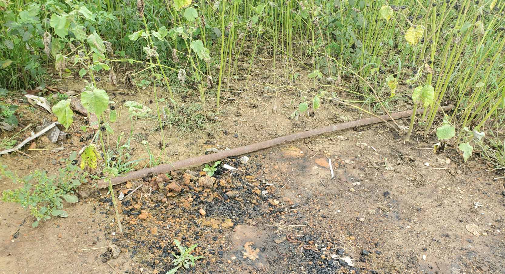
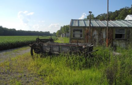
An 8/26/16 photo by Randy Coller of remains at Clark's Dream Airport.
Randy observed, “The old beacon tower, or maybe it was a fancy windsock mast, lies fallen in disarray on it's side,
asleep like the corpse that it is, no longer summoning bold pilots from afar to come visit for a spell.
Ashamed that it can no longer serve its once noble purpose.”
An 8/26/16 photo by Randy Coller of a forlorn Beechcraft Bonanza at Clark's Dream Airport.
Randy observed, “Two rusting hulks, remnants of glory days past, sit in the shadows anxiously awaiting their next flight that will never happen.
The old Bonanza, left to the harsh elements outside, lies buried in mud & weeds,
it's exit blocked by a large piece of concrete in front of the nose gear hints at a tale of a disgruntled unpaid mechanic.”
An 8/26/16 photo by Randy Coller of a forlorn Piper Tri-Pacer at Clark's Dream Airport.
Randy observed, “And there, behind a half-broken hangar door, frozen in time lies an old gem of a plane.
What was her name? They always have a name you know, that mistress of the air.
That proud but forlorn old Tri- Pacer, forever smiling, looking like she may still be capable of flight if she just had one more chance,
anxiously awaits the return of her 4 suitors, those loveable old airport bums who surely are coming back to weave their tales of heroics in the air.
Their places in the circle ready for their return... why haven't they come back to her?
Maybe they will take her for just one more spin... nevermore.
And this old inspector gets a lump in his throat. R.I.P. Clark's Dream.”
Clark's Dream Airport is located west of the intersection of Florence Chapel Pike & Fox Road.
Thanks to Randy Coller for pointing out this airfield.
____________________________________________________
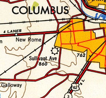
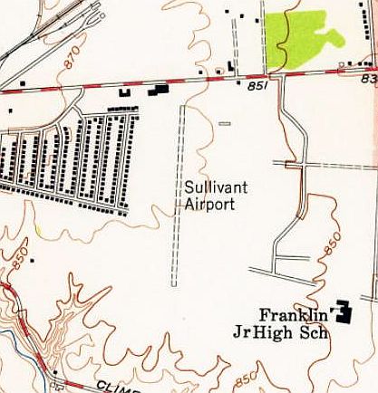
Columbus Airport (original location) / Sullivant Avenue Airport, Columbus, OH
39.94, -83.1 (Southeast of Downtown Columbus, OH)
Columbus Airport, as depicted on the 12/30/30 Commerce Department Airway Bulletin (courtesy of Mike Denja).
The original Columbus Airport was located on the southwest side of Columbus.
The date of establishment of Columbus Airport has not been determined.
The earliest depiction which has been located of Columbus Airport was on the 12/30/30 Commerce Department Airway Bulletin (courtesy of Mike Denja).
However, Columbus Airport was not yet depicted on the April 1933 Cleveland Sectional Chart.
The earliest aeronautical chart depiction which has been located of Columbus Airport was on the February 1935 Cleveland Sectional Chart.
Columbus Airport was evidently renamed Sullivant Avenue Airport at some point between 1935-40,
as that is how it was labeled on the March 1940 Cleveland Sectional Chart.
The earliest photo which has been located of Sullivant Avenue Airport
was a 9/28/43 aerial view looking north from the 1945 AAF Airfield Directory (courtesy of Scott Murdock).
The 1945 AAF Airfield Directory (courtesy of Scott Murdock) described Sullivant Avenue Airport
as a 100 acre irregularly-shaped field having 4 sod runways, the longest being a 3,100' northwest/southeast strip.
The field was said to have 3 concrete hangars, the largest measuring 90' x 80', and to be owned & operated by private interests.
Sullivant Avenue Airport, as depicted on the 1947 USGS topo map.
Sullivant Avenue Airport, as depicted on the July 1947 Cleveland Sectional Chart.
The 1953 Huntington Sectional Chart depicted Sullivant Avenue Airport as having a 3,100' unpaved runway.
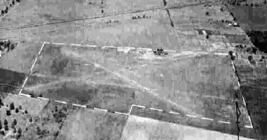
A 1953 aerial view depicted Sullivant Airport as having 2 unpaved runways in an X-shape,
with a few small hangars & 5 light aircraft on the north side.
A 1954 aerial view looking west depicted a significant change in the configuration of Sullivant Avenue Airport,
with a new paved north/south runway having replaced the multiple unpaved runways (traces of which were still visible).
Several hangars & a dozen light planes were visible on the north side of the field.
The 1955 USGS topo map depicted Sullivant Airport as having a single north/south runway, and one small buildings on the northeast side.
A 1957 aerial view showed over a dozen light planes parked on the north side of Sullivant Avenue Airport,
which had 1 paved north/south runway.
The last aeronautical chart depiction which have been located of Sullivant Avenue Airport was on the May 1958 Cleveland Sectional Chart (courtesy of Ron Plante).
It depicted Sullivant Avenue Airport as having a 3,100' unpaved runway.
Sullivant Avenue Airport evidently closed at some point between 1958-60,
as it was no longer depicted on the July 1960 Cleveland Sectional Chart.
Like thousands of other small general aviation airports,
Sullivant Avenue Airport fell prey to rising property values as residential development increased,
as a 1963 aerial photo showed that it had been covered by a subdivision, but some possible airport buildings (former hangars?) remained on the north side.
The 1965 USGS topo map (according to Dan Schneider) showed that Sullivant Avenue Airport had been covered by a subdivision.
A 2010 aerial view showed houses covering the Sullivant Avenue Airport site.
An August 2021 photo looking southwest at a building along the north side of the Sullivant Avenue Airport site which appears to also have been visible in a 1953 aerial photo, and may have been an airport building.
The site of Sullivant Avenue Airport is located south of the intersection of Sullivant Avenue & Holly Hill Drive.
Thanks to Dan Schneider for pointing out this airfield.
____________________________________________________
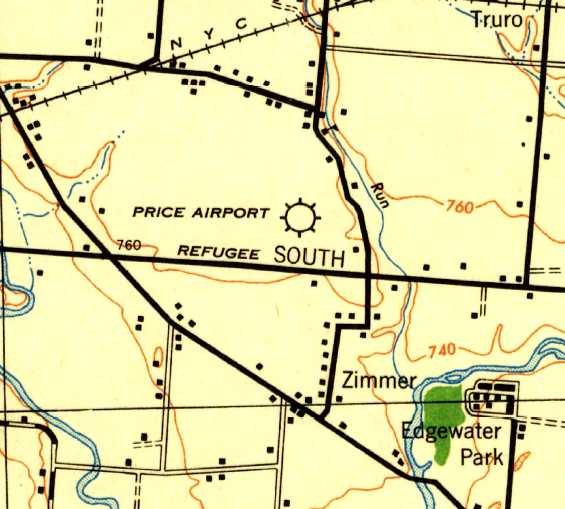
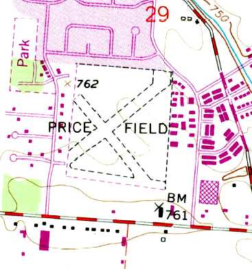
Price Airport / Price Field, Columbus, OH
39.92, -82.9 (Southeast of Downtown Columbus, OH)
Price Airport, as depicted on the June 1942 Huntington Sectional Chart.
Price Airport was apparently established at some point between 1941-42,
as it was not yet depicted on the October 1941 Huntington Sectional Chart.
The earliest depiction which has been located of Price Airport was on the June 1942 Huntington Sectional Chart.
It depicted Price as a commercial/municipal airport.
The earliest topo map depiction which has been located of Price Airport was on the 1943 USGS topo map.
The earliest photo which has been located of Price Field was a 9/28/43 aerial view looking north from the 1945 AAF Airfield Directory (courtesy of Scott Murdock).
It depicted Price Field as having an open grass landing area.
The 1945 AAF Airfield Directory (courtesy of Scott Murdock) described Price Field
as a 100 acre irregularly-shaped field having 4 sod runways, the longest being a 2,200' northeast/southwest strip.
The field was said to have a single 105' x 37' metal hangar, and to be owned & operated by private interests.
According to Wesley Conn, “Price Field was an 88 acre square field. It provided flight training under the GI Bill.
They had grass runways in the summer & dirt in the winter. They had corner-to-corner runways.
The southeast was a little further north to clear the hangar. They also had east/west & north/south [runways].
I soloed on the north heading which had electric lines on the approach.”
Wesley continued, “I was just a kid hanging around the airport all day, almost every day.
W.W. Cohen was the manager. I think he leased the property from the owner,
who lived in a house in the woods on the southwest corner of the property.
They had 6 or 8 Aeronca Champions, a J-3, a J-4, 1941 Bellanca Cruiser with a 90 horse Le Blond radial engine.
Chief Pilot was Harry Jorden. He also taught the ground school.
Another instructor was Ken Prutsman, and there was Col. Frank Ward, he was Commanding Officer of the air wing of the OH National Guard.
He couldn’t get enough flying on duty so he worked as flight instructor in his off time.”
Wesley continued, “The G.W. Holms Company in Columbus bought & reconditioned a few N3Ns & kept of them at Price Dield.
Dail Matheni got his flight training there & later become the company pilot for Holmes.
Zack Mosley, creator of Smiling Jack comics, tied down his purple SR-7 there for a few weeks. This was quite a spectator draw.
A couple of years went buy & I got hired as a line boy at 35 cents an hour.
Charley Britt was the chief mechanic & the A&E. I finally started my flight training.
The airplane cost me $3/hour, and the instructor $2/hr.
Col. Ward was my instructor & he wouldn’t take the $2 instructor's fee. All the money I made went to flying.
I do not have pictures of all this – I wish I did, but what teenager back in those days would be doing with a camera?”
The 1953 Huntington Sectional Chart depicted Price Field as having a 2,000' unpaved runway.
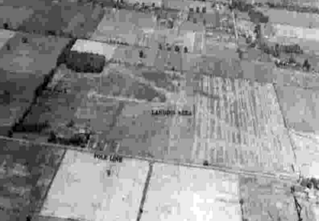
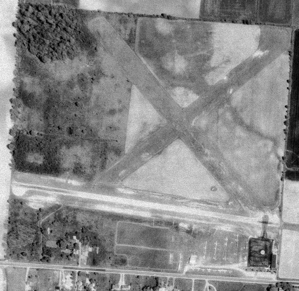
A 3/1/53 USGS aerial view showed Price Field to have 3 grass runways, with a small building & 10 light planes on the southeast side.
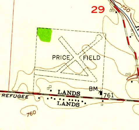
The 1955 USGS topo map showed Price Field to have 3 unpaved runways & several small buildings along the south side.
Susan Rodda recalled, “My father, Eugene 'Whitey' Jost, built a hangar at the opposite end of the field from the original hangar at Price Field in the late 1950s
to take over the maintenance, repair, rebuilding & inspection services from the Fixed Base Operator of the field at that time.
He became the FBO of the entire field around 1960 as Jost Aero Services.
Also around that time, the services for the Lockbourne Flying Club was moved to Price Field.
He used Cessna aircraft to provide flying lessons, rentals & rides to the public.
Within a couple of years he added a Stearman biplane he had rebuilt to tow banners for advertising for local businesses & for rides for the public.
For a couple years Geraldine Mock became a partner & the business became Jost & Mock Aero Services.
During that time, he fitted out one of the planes for her solo flight around the world.”
In 1961 Jerry Mock became the first woman licensed by OH to manage an airport, Price Field, a job she held for about a year.
On Sundays she was there alone, which meant fueling airplanes, tying them down, and even doing despised household chores like making coffee.
“The male instructors did not like a woman telling them what to do”, Mock recalled. “I did not worry about it & ignored them.”
Susan Rodda recalled, “Sometime after that, he became sole operator again & replaced his Cessnas with Pipers.
He had at least one twin-engine part of that time.”
The last photo which is available showing Price Field still in operation was a 5/6/63 USGS aerial view.
The east/west runway appeared more distinct than the others, and there were several dozen light aircraft on the southeast side.
A 2nd hangar (on the middle of the south side of the field) had been added at some point between 1953-63.
The last aeronautical chart depiction which has been located of Price Field
was on the August 1965 Huntington Sectional Chart (courtesy of Ron Kunse).
It depicted Price Field as having a 2,200' paved east/west runway.
Susan Rodda recalled, “Around 1965 [Eugene 'Whitey' Jost] moved the entire operation [Jost Aero Services] to Port Columbus, leaving Price Field.”
A 1971 aerial view depicted 19 light aircraft on the southeast side of Price Field.
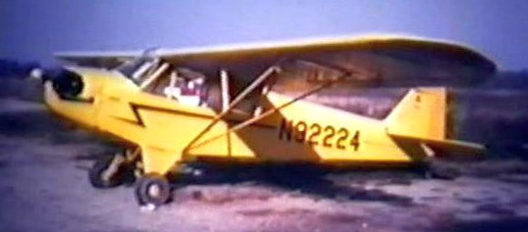
The last photo which has been located showing Price Field still in operation was a 1972-73 photo by Tom Williams of a Piper J3 Cub.
Tom recalled, “The most fun airplane to fly was this J3 Cub.”
Tom Williams recalled, “Price Field... I got my Private Pilot License at this little field of potholes & gravel (smile).
We used the east/west runway 95% of the time.
Bob Boston was the Operator & my main Flight Instructor. A tough Instructor, but his training saved my life an a few occasions.
I have fond memories flying at Price Field. Many a Pilot got their license there.
One day I arrived for my one hour lesson from Bob.
His wife said that he was in the hangar & that I should preflight a Cessna 150 & that he would be with me soon.
Well, I finished my preflight & was sitting there waiting. Suddenly Bob came running past me into the office.
I thought that there was a fire, so I ran into the office. There they were (him & his wife) trying to catch a wild raccoon, swamping about.
The raccoon was in the ceiling & was a little too heavy for the thin panels & fell through on top of the desk where his wife was working.
I can’t remember how, but they caught him & threw him into the bushes.
Laugh - training went well that day, just the same.”
Tom continued, “Due to complaints of the new homeowners around Price Field the Fixed Base Operator was closed down
and my friend Eric Weber & I ferried the remaining aircraft down to Lancaster Airport.
Price Field was evidently closed at some point between 1972-76,
as it was no longer depicted on the August 1976 Cincinnati Sectional Chart (courtesy of Mitchell Hymowitz).
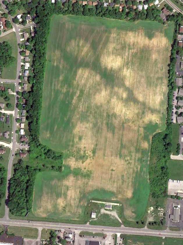
The last depiction which has been located showing Price Field was on the 1985 USGS topo map.
It depicted Price Field as having 3 unpaved runways & several small buildings along the south side.
The 1994 USGS topo map no longer depicted Price Field, just a clearing,
but the 2 hangars remained depicted on the southeast side.
A 1994 USGS aerial photo depicted 2 hangars remaining on the south & southeast side.
A 2002 aerial photo showed the hangar on the southeast side had been removed at some point between 1994-2002.
A 5/28/10 aerial view showed the site of Price Field remained clear, with 1 hangar remaining on the south side.
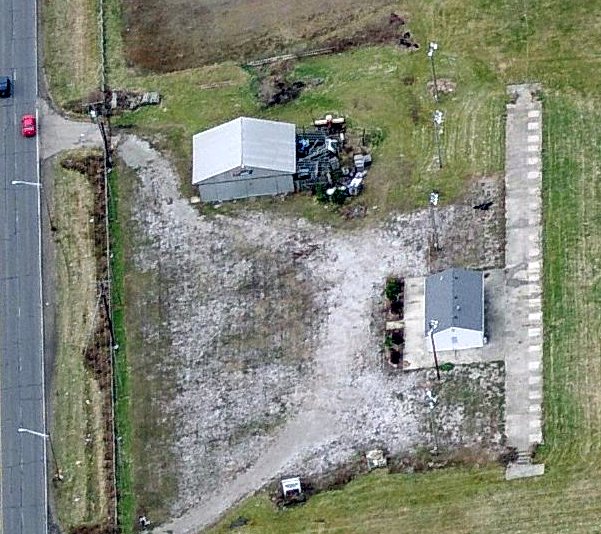
A circa 2011 aerial view looking west at a hangar which remains standing along the south side of the Price Field site.
The hangar on the southeast side had been removed.
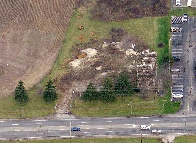
A circa 2011 aerial view looking north at the remains of the ramp & the hangar foundation on the southeast side of the Price Field site.
Wesley Conn reported in 2013, “The [southeast] hangar is gone now but looking close,
the concrete floor can still be seen as well as the round circle of the gas island.”
An October 2022 photo looking northwest at a hangar which remains standing along the south side of the Price Field site.
The site of Price Field is located northwest of the intersection of Refugee Road & Courtright Road.
____________________________________________________
(Original) Springfield Municipal Airport, Springfield, OH
39.9, -83.73 (Northeast of Dayton, OH)
Springfield Airport, as depicted on the 1928 Air Navigation Map (courtesy of Chris Kennedy).
The original airport for the town of Springfield was located approximately 4.5 miles southeast of the town.
The date of construction of the original Springfield Airport has not been determined.
The earliest depiction of the field which has been located
was on the 1928 Air Navigation Map (courtesy of Chris Kennedy).
The 1934 Air Pilots Register (courtesy of Michael Banks)
depicted Springfield as having 2 macadam runways:
a 2,850' northeast/southwest strip & a 2,450' east/west strip.
A number of buildings were depicted on the northeast corner of the field.
The February 1934 Huntington Sectional Chart depicted Springfield Municipal Airport as a commercial/municipal airport.
The earliest photo which has been located of Springfield Municipal Airport
was an undated aerial view in The Airport Directory Company's 1937 Airport Directory (courtesy of Bob Rambo).
The directory depicted Springfield Municipal as having 2 macadam runways:
a 2,660' northeast/southwest strip & a 2,375' east/west strip.
Several buildings were located east of the runway intersection.
The April 1944 US Army/Navy Directory of Airfields (courtesy of Ken Mercer) described Springfield Airport as having a 2,700' runway.
The field was said to conduct "Extensive training."
A circa 1943-45 aerial view looking north from the 1945 AAF Airfield Directory (courtesy of Scott Murdock)
depicted Springfield Municipal Airport as having 2 grass runways, with 2 hangars on the east side.
The 1945 AAF Airfield Directory (courtesy of Scott Murdock) described Springfield Municipal Airport
as a 126 acre irregularly-shaped field having 2 gravel runways, the longest being a 2,700' northeast/southwest strip.
The field was said to have 3 hangars, the largest being a 80' x 60' metal structure.
Springfield Municipal was described as being owned by the City of Springfield & operated by private interests.
According to Durward Lewis, “There was a great deal of flying activity at the old airport,
as the operator ran a CPT [Civilian Pilot Training] program during the war.”
The last photo to be located showing Springfield Municipal Airport in operation was an 8/25/46 aerial view (from the ODOT archives, courtesy of Dennis Thompson).
It depicted Springfield Municipal as having 2 paved runways, with 2 hangars & 10 light single-engine aircraft on the east side.
Note that a trap shooting range was located adjacent to the south side of the southwest runway end.
The last depiction which has been located of the original Springfield Municipal Airport was on the October 1947 Huntington Sectional Chart.
The original Springfield Municipal Airport was apparently abandoned at some point between 1947-48,
as it was no longer depicted on the October 1948 Huntington Sectional Chart.
It instead depicted a new Springfield Airport on the southwest side of the town, which was built with much longer runways.
The original Springfield Airport property (to the southeast of the town) was reused as a fairgrounds.
Phil Brust recalled, “When I was five (1951), my parents took me to a circus at the fairgrounds.
There was an abandoned B-25 or B-26 still on the property
and my father boosted me up into the cockpit (tragic how surplus equipment was treated back then).
So the airport had been converted to fairgrounds by 1951.”
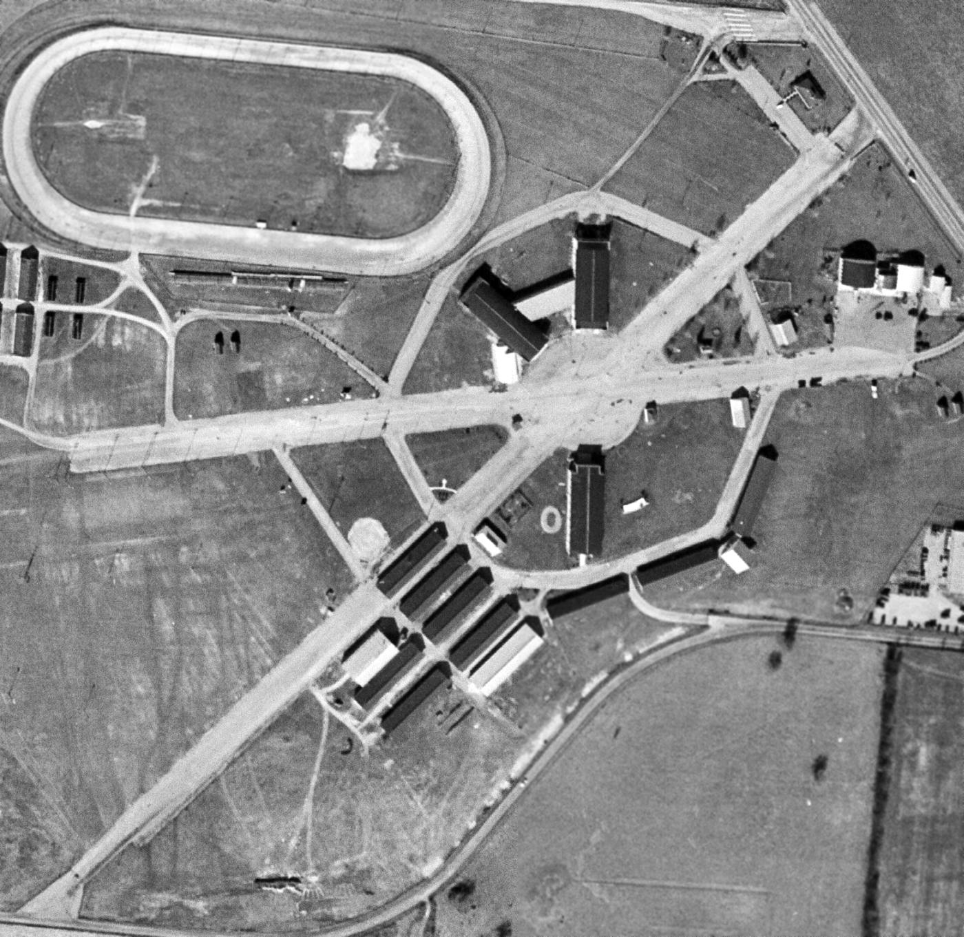
A 1/19/59 USGS aerial view of the site of the original Springfield Municipal Airport showed the 2 paved former runways were still completely intact,
and at least 2 original hangars (the arch-roofed buildings in the northeast corner of the photo) still remained standing.
A large number of more recent buildings had been constructed for the fairgrounds around the runways (including one built over the runway).
The 1962 USGS topo map labeled the site of the airport as the Clark County Fairgrounds.
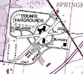
The former runways of the Springfield Airport were still quite recognizable on the 1995 USGS topo map.
Dave Noordeloos reported in 2004, "I was on a trip in Springfield a few weeks ago
and stumbled on the Clark County Fairgrounds while on the way back to the highway.
I noticed some old hangars & a very wide concourse for the fairgrounds & pulled in."
Durward Lewis reported in 2005, “The runways are still there.”
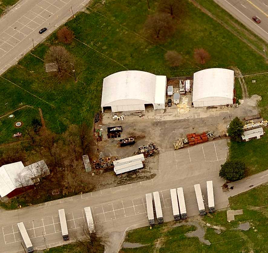
A circa 2006 aerial view looking north at the 2 hangars which remain at the site of the original Springfield Municipal Airport.
The pavement of the 2 former runways is also visible at the top & bottom.
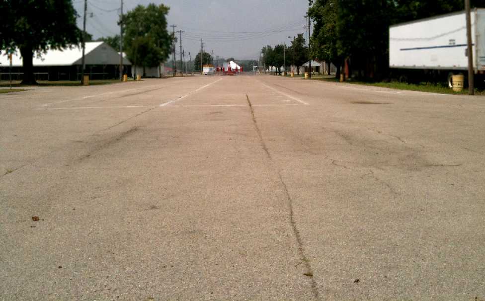
A July 2011 photo by Tom Townsend looking west along the former Springfield Municipal Airport runway.
Tom reported, “It is now the site of the Clark County Fairgrounds.
I looked up & down both runways for any sign of light fixtures, but if they were there, they've long been paved over.
The runways are both still there in their entirety, but used for parking, the midway, and a building has been built on one of them.”
Chris Mokren reported in 2014, “They are in the process of tearing down the hangars at the original Springfield airport.
The one on the right is now completely gone & they have started on the left one.
The plan, from what I have heard, is they want to build a hotel on that site.”
A March 2014 photo by Chris Mrocken of the demolition of the original Springfield Municipal Airport hangars.
Chris observed, “All that is left is the concrete floor.”
A 2016 aerial view looking north at the site of the original Springfield Municipal Airport, showing the very recognizable runways which remain.
A March 2022 photo by looking northeast along the former Springfield Municipal Airport runway, now reused by the fairgrounds.
The site of the original Springfield Municipal Airport is located west of the intersection of Interstate 70 & Route 41.
____________________________________________________
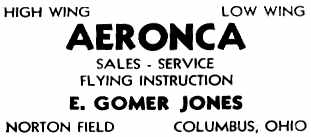
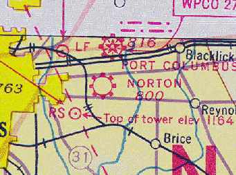
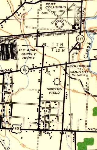
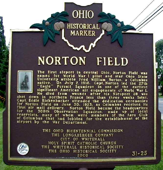
Columbus Air Terminal / Norton Field, Columbus, OH
39.97, -82.88 (South of Port Columbus Airport, OH)
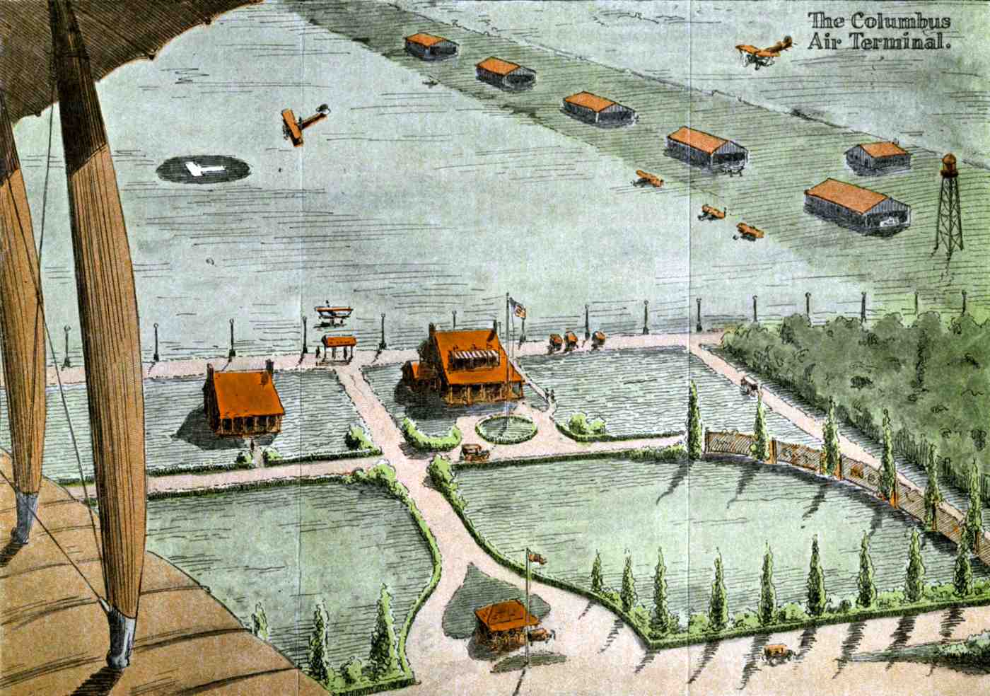
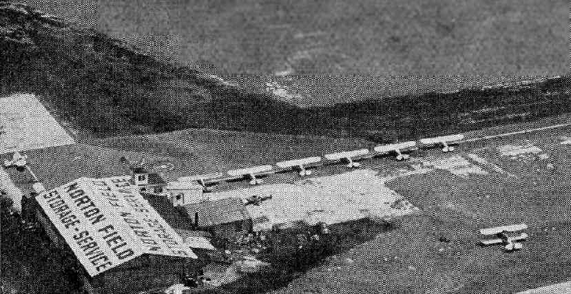
An artist's conception looking south at the planned Columbus Air Terminal from a 1923 Aero Club of Columbus promotional flyer (courtesy of Tom Heitzman).
According to the Fall 2000 "OH Aviation News" (via Billy Spiropoulos), the genesis of Norton Field began with the formation of the Aero Club of Columbus,
shortly after the end of the First World War.
After the first convention of Associated Aero Clubs of Ohio in 1920,
various members set about the serious business of getting an airfield established in the Columbus area.
A 100-acre property was located & a 10 year lease was secured from Jim Lamp & paid for by the Pure Oil Company.
A 1923 Aero Club of Columbus promotional flyer (courtesy of Tom Heitzman) described their plans for the Columbus Air Terminal,
said to be located “on East Broad Street, 6 miles from the OH State Capitol & adjoining the Columbus Country Club.”
This property was then provided to the War Department.
For $1/year as the community’s part of the deal,
Columbus' airfield was equipped by the War Department with 2 steel hangars, a fueling dock & a beacon light on a tower.
Regulations stated an Army field must be named after a deceased flyer.
An outstanding local person eminently fit the need for the name.
Fred Norton was an outstanding Ohio State University student athlete
who had gone on to become a member of the 27th "Eagle" Pursuit Squadron in France,
and was posthumously awarded the Distinguished Service Cross & the French Croix de Guerre with Palm.
Thus, Norton Field was named for this heroic pilot who was also the first Ohio State graduate to be killed in the war.
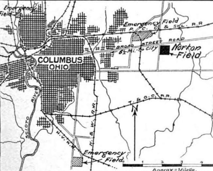
The earliest depiction which has been located of Norton Field was in the 6/15/23 Commerce Department Airway Bulletin (courtesy of Mike Denja).
Note that it also depicted 3 other “Emergency Fields” around Columbus.
Norton Field was described as a 1,100' east/west by 1,000' north/south “present landing area”,
leased & operated by the Army Air Service.
It was noted that “Two large steel hangars are contemplated in the northwest corner at a later date.”
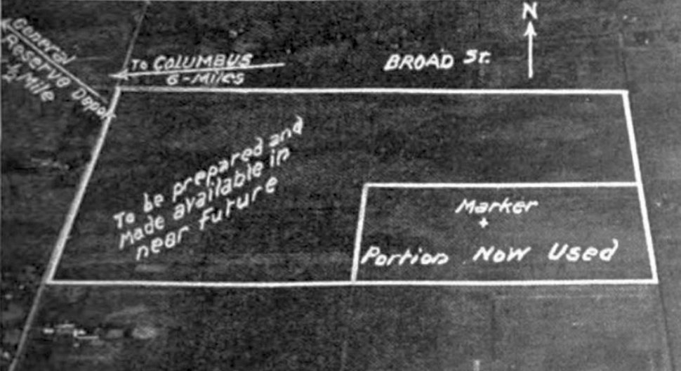
The earliest photo which has been located of Norton Field was an undated aerial view looking north from the 6/15/23 Commerce Department Airway Bulletin (courtesy of Mike Denja).
It depicted Norton Field as a small rectangular outline (noted as “Marker + portion now used”),
in the southeast portion of a larger rectangular area along with a larger area noted as “To be prepared & made available in near future.”
Norton Field was dedicated on 6/30/23.
A 7/13/23 aerial view looking northeast at Norton field, taken only 2 weeks after the field's dedication.
The Aero Club clubhouse can be seen at lower-left, and 2 hangars erected by the Army can be seen at top-left, along with 5 aircraft.
The Army furnished aircraft to establish the 108th Observation Squadron, to be used by Army pilots.
Although the squadron was administered under Ft. Hayes
it also accommodated any civilian flying activities that adhered to the Army’s regulations.
The Aero Club secured a WW1 surplus barrack from Ft. Hayes purchased for $1 to later be refurbished for use as a clubhouse.
The Army was experimenting in establishing model airways (a scheduled military air service over established air routes) & the ability to conduct operations at night.
Thus the 1st Lighted Airway (which later became the model for the airways system of the US)
was established with beacon lights between McCook & Norton Fields.
The experiments were flown regularly to perfect aviation lighting systems & night flying.
Experiments in aerial photography at night were also conducted.
Over the succeeding 6 years, many prominent pilots utilized this airfield including Jimmy Doolittle, Charles Lindbergh, and Orville Wright.
In 1928, a Columbus native & Ohio State University student Curtis LeMay obtained a commission in the Army
and while awaiting his application to Army flight school took unofficial instructional flights at Norton Field.
He went on to flight training in the fall of 1928 as a National Guard Officer
and after graduation was recommissioned as an Army Pursuit Pilot at Selfridge Field.
While there he arranged to return to serve at Norton Field as Assistant Engineering & Operations Officer in order to complete his final quarter at Ohio State.
He later went on to fame as the Cold War commander of the Strategic Air Command (SAC).
Charles Lindbergh returned to Norton Field on 5/29/28 as a Technical Advisor for Transcontinental Air Transport in surveying a cross country train-plane route.
He found the field to be too small for TAT’s needs & recommended the city find a larger facility adjacent to the railroad tracks.
This brought about the construction of Port Columbus in 1929.
In 1929 the Army set up & conducted a large scale mock war maneuver of Red & Blue Army & Air Forces between the cities of Dayton & Columbus.
Between May 15th & 25th air fleets composing more than 200 aircraft (the largest up to this date)
were based at Wilbur Wright Field & Norton Field, and were employed in mock air warfare in this maneuver.
Norton Field, as depicted on the 12/30/30 Commerce Department Airway Bulletin (courtesy of Mike Denja).
The Army remained at Norton Field for 2 more years until relocating to larger facilities at Port Columbus in June 1931,
effectively abandoning Norton Field.
Harold Distelhorst came to the rescue of Norton Field in October 1931 & took over the operation.
In so doing he promoted & hosted such aviation activities as Air Carnivals, Air Shows, Air Races
and several times did emergency medical flights in the romantic years of civil aviation.
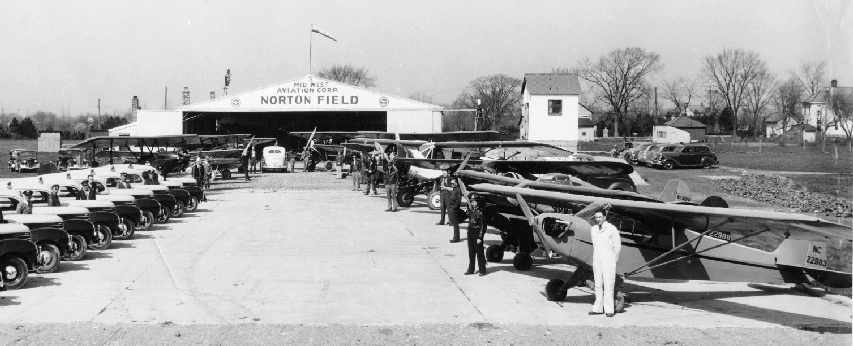
Distelhorst kept vigorous activity at the airport until the Denton family of Northway Cab Company took control in 1936.
The Denton family & Herb Stump set up the Mid West Aviation Corporation,
which operated Norton Field through the WW2 days.
Norton Field, as depicted on the February 1935 Cleveland Sectional Chart.
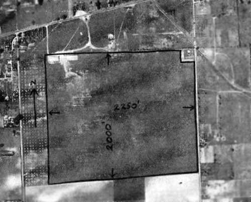
An undated aerial view from The Airport Directory Company's 1937 Airport Directory (courtesy of Bob Rambo)
depicted Norton Field as a square grass field with 2 buildings at the northwest corner.
The Airport Directory Company's 1937 Airport Directory (courtesy of Bob Rambo)
described Norton Field as consisting of a 2,250' x 2,000' rectangular sod field.
A single hangar was said to be in the northwest corner, with "Norton Field" painted on the roof.
An advertisement for Norton Field from The Airport Directory Company's 1937 Airport Directory (courtesy of Bob Rambo).
Norton Field was depicted as a commercial airport on the June 1939 Huntington Sectional Chart (courtesy of Chris Kennedy).
An aerial view looking north at Norton Field from The Airport Directory Company's 1941 Airport Directory (courtesy of Chris Kennedy).
The field was described as a 100 acres square sod field.
A hangar was said to have "Norton Field Midwest Aviation Corp." painted on the roof.
During the Second World War, Norton Field conducted a very active training program,
under the government sponsored War Training Service & Civilian Pilot Training programs,
utilizing a large fleet of training aircraft.
These government programs provided an introduction to the regular Army & Navy pilot training programs.
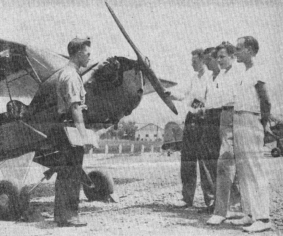
A circa 1941-42 photo (courtesy of Mark Hess) of Carl McGary, instructor at Norton Field,
in front of a Piper Cub with students Walter Beaver, Keith Fields, Bernard Hatch, and and Bob Chew.
along with the taxicabs of the Northway Cab Company also owned by the Denton family.
Norton Field, as depicted on the 1943 USGS topo map.
A November 1943 photo (courtesy of Steve McLoughlin) of instructors at Norton Field in front of a Piper J3 Cub.
Norton Field was described by the April 1944 US Army/Navy Directory of Airfields (courtesy of Ken Mercer) as having a 2,800' unpaved runway,
and it was listed as conducting Army flight operations.
Parks Aircraft Company purchased the Norton Field property from the Lamp family in 1944.
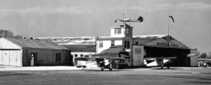
A 1945 view of several Pipers in front of the Norton Field control tower & hangar (courtesy of the Whitehall Historical Society).
An aerial view of Norton Field from the Haire Publishing Company's 1945 Airport Directory (courtesy of Chris Kennedy).
The directory described Norton Field as having a 2,200' x 2,000' sod field, with a single hangar.
The manager was listed as Herman Swingle,
and the operator was listed as the Northway Flying Service.
The last aeronautical chart depiction which has been located of Norton Field was on the July 1947 Cleveland Sectional Chart.
The Denton family moved their operation from Norton to their new field in 1947.
After the move Norton Field continued to be used for the operations
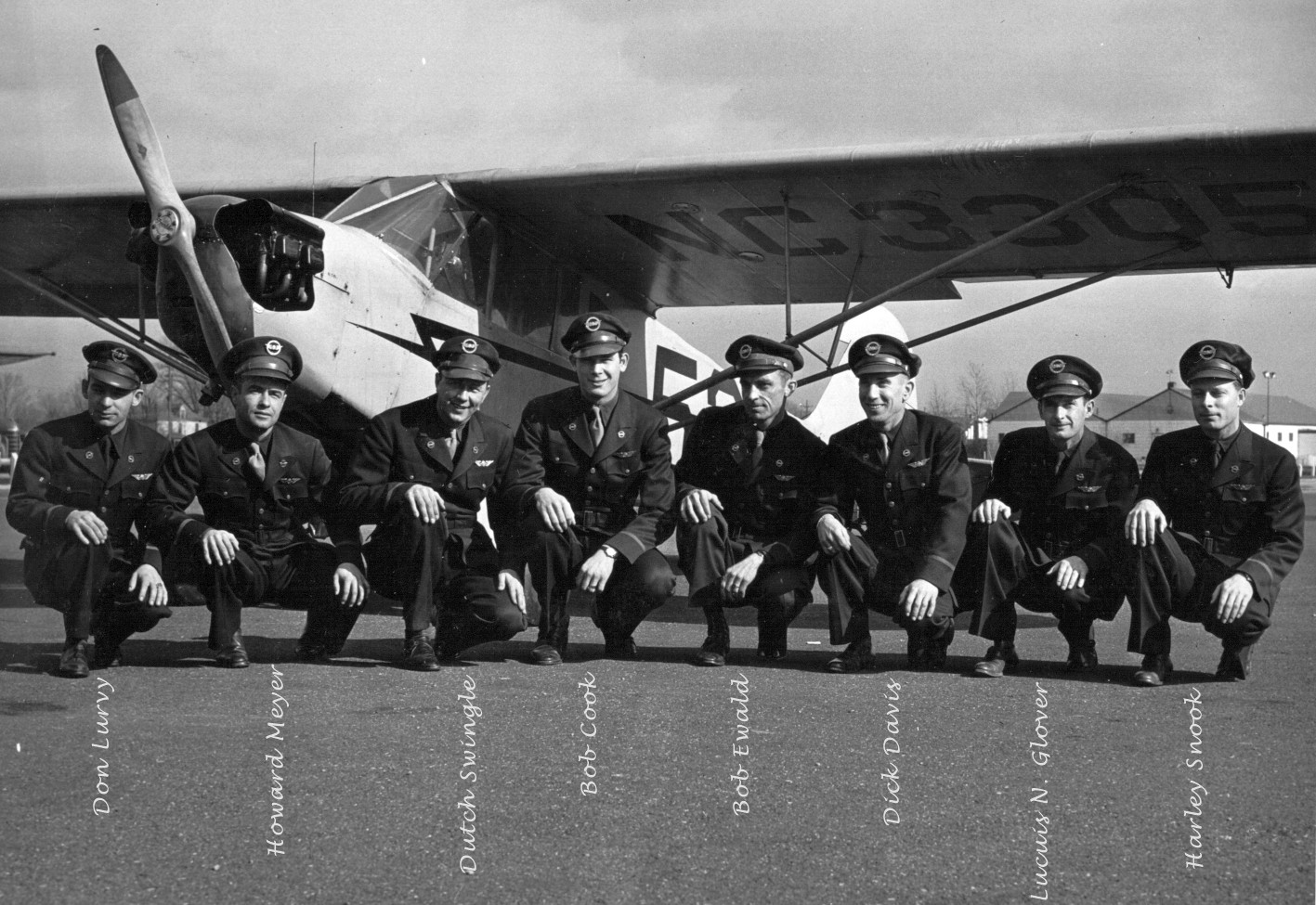
of H. R. "Dutch" Swingle (who operated a flight training school) & Vern Acheson of the Columbus Aircraft & Sales Company.
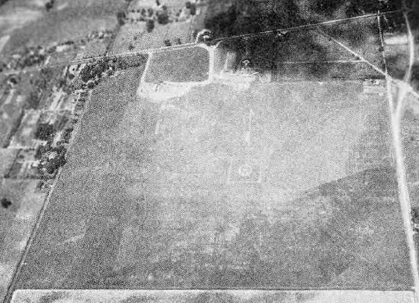
A 9/1/48 USGS aerial view showed Norton Field remaining intact, but there were no aircraft visible on the field.
The last photo which has been located showing Norton Field in operation
was a 1949 aerial view of several aircraft parked next to the Norton Field hangar (courtesy of the OH Historical Society).
Steve McLoughlin reported “I have a newspaper clipping from around 1949 that reports about the last flight out of Norton Field, and mentioned that the property would be developed.”
The date of closure of Norton Field has not been determined, but the airfield property was sold to become a housing subdivision on 11/16/49.
According to Steve McLoughlin, “That ultimately included the Norton Homes Addition, a park, and a few businesses along East Broad Street.”
Norton Field was no longer depicted on the November 1950 Cleveland Sectional Chart.
A 3/1/53 USGS aerial view showed housing covering the site of Norton Field,
but amazingly the hangar on the northwest corner remained standing, on which the lettering “Norton Field” was still legible.
The control tower reportedly survived longer than the rest of the airfield buildings,
but the last remaining original Norton Field building was demolished in December, 1979.
The original role of the site of Norton Field has been somewhat remembered,
as the 1994 USGS topo map depicted a "Norton Field Playground" at the location of the former airfield,
and some of the residential streets on the site have names including "Norton Lane",
"Rickenbacker Avenue", "Langley Avenue", and Wright Avenue".
The 1994 USGS aerial photo showed that the site of Norton Field had been covered by a housing development,
and not a trace of the airport remained visible.
The Ohio Bicentennial Commission dedicated a Norton Field Historical Marker at the site on 6/24/00.
A 2004 photo by Christopher Trott of the Norton Field historical plaque.
A 2004 photo by Christopher Trott of the site of Norton Field.
Christopher reported, "They are trying to sell the field that's still there for retail development.
I don't know how long or if it'll be sold & developed, but that's the last signs of Norton Field as it is."
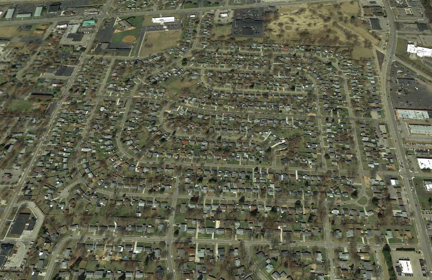
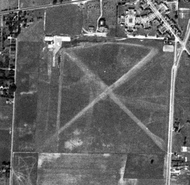
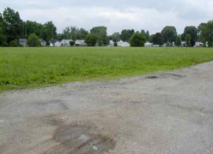
As seen in a 2018 aerial view looking north, the site of Norton Field has been covered by a housing development, and not a trace of the airport remains visible.
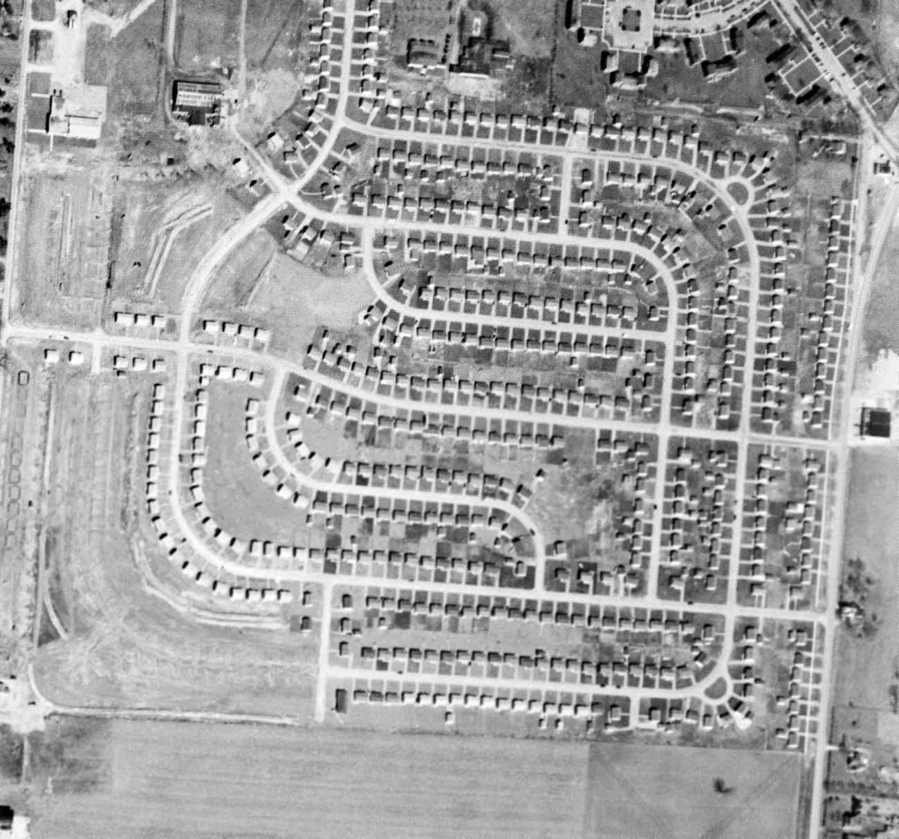
Joseph Biser reported in 2018, “I live in the Norton Field subdivision. The remaining open field has been used to build the Whitehall Branch of the Columbus Public Library.
There is still a small clump of trees that cover the foundation of the last remaining hangar, but it is very small. Not much left at all.”
The site of Norton Field is located southwest of the intersection of East Broad Street & Hamilton Road.
Thanks to Billy Spiropoulos for pointing out this field.
____________________________________________________
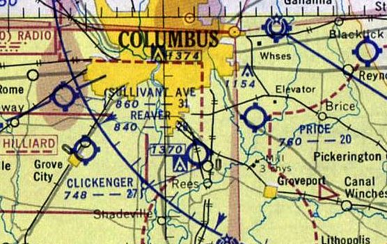
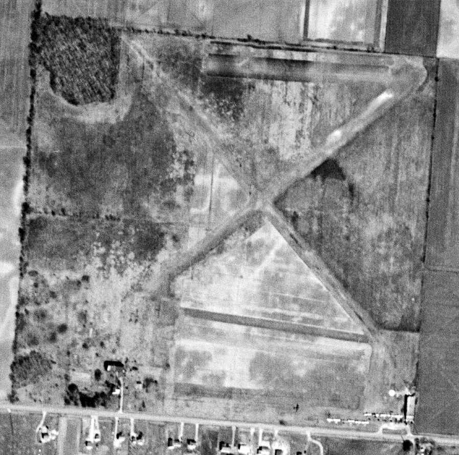
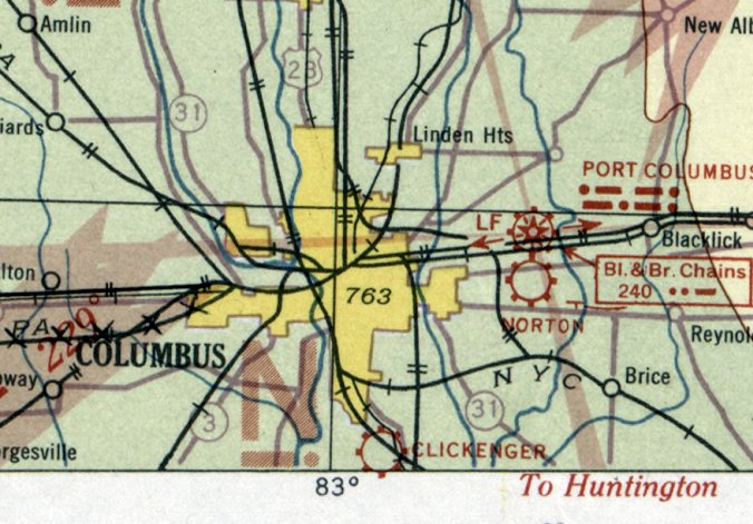
Clickenger Airport / South Columbus Airport (4I2), Columbus, OH
39.88, -82.97 (North of Rickenbacker Airport, OH)
Clickenger Airport, as depicted on the 12/30/30 Commerce Department Airway Bulletin (courtesy of Mike Denja).
This small general aviation field was originally named Clickenger Airport.
The date of construction of Clickenger Airport has not been determined.
The earliest depiction which has been located of Clickenger Airport was on the 12/30/30 Commerce Department Airway Bulletin (courtesy of Mike Denja).
The 12/30/30 Commerce Department Airway Bulletin (courtesy of Mike Denja) described Clickenger Airport as a commercial airport owners & operated by Buckeye Airways.
It was said to consist of a 120 acre rectangular sod field, measuring 3,200' north/south.
Two small buildings were depicted on the northwest side.
The earliest aeronautical chart depiction which has been located of Clickenger Airport was on the December 1932 Cleveland Sectional Chart,
which depicted it as a commercial/municipal airport.
The Airport Directory Company's 1933 Airport Directory (courtesy of Chris Kennedy)
described Clickenger as a commercial airport having 3 graded earth runways within a 3,200' x 1,900' rectangular field.
A hangar was said to have "Clickenger Airport" painted on the roof.
The Airport Directory Company's 1938 Airport Directory (courtesy of Chris Kennedy)
described Clickenger as an "Auxiliary" airfield having 2 sod runways, with the longest being a 2,640' north/south strip.
A hangar was said to be located along the north side of the field.
The June 1939 Huntington Sectional Chart (courtesy of Chris Kennedy) depicted Clickenger as an auxiliary airfield.
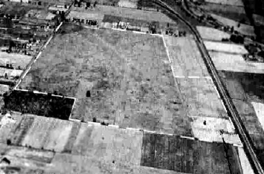
The earliest photo which has been located of Clickenger Airport
was a 9/28/43 aerial view looking north from the 1945 AAF Airfield Directory (courtesy of Scott Murdock).
It depicted Clickenger as an irregularly-shaped grass field with several hangars along the northwest side.
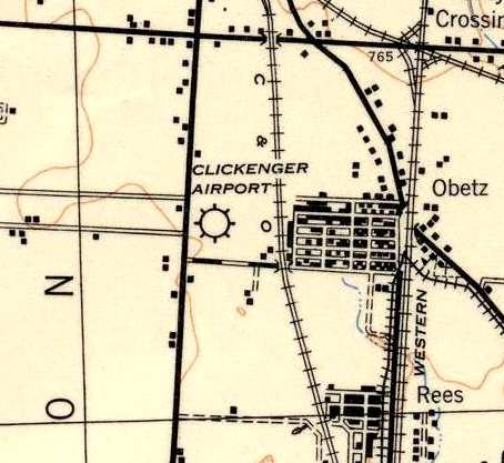
Clickenger Airport, as depicted on the 1943 USGS topo map.
The 1945 AAF Airfield Directory (courtesy of Scott Murdock) described Clickenger Airport
as a 40 acre rectangular field having a 2,600' x 1,600' sod all-way airfield.
The field was said to have a single 80' x 48' wood & concrete block hangar.
Clickenger was described as being owned & operated by private interests.
Clickenger Airport was described by the 1944 US Army/Navy Directory of Airfields (courtesy of Ken Mercer)
as having a 2,600' runway.
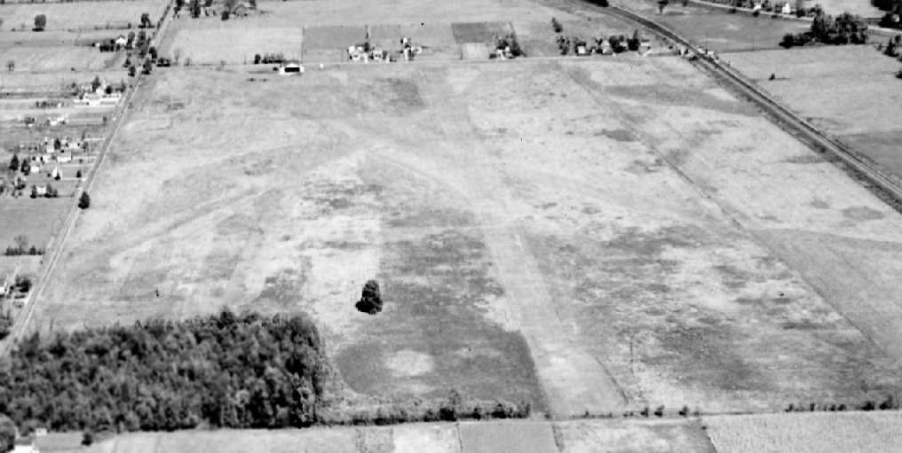
A 1945 aerial view looking north at Clickenger Airport (courtesy of Don Johnson).
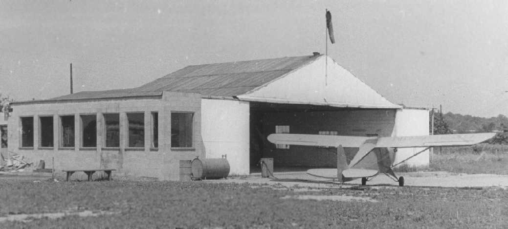
A 1946 photo of a Porterfield Collegiate in front of a hangar at Clickenger Airport (courtesy of Don Johnson).
David Ostrander recalled, “Sometime after 1948 my mother (Lucille) started working for Vern Atchison at Clickenger Airport as airport manager.”
Richard Christ recalled, “I was stationed at Lockbourne AFB from 1951-54.
During that time I joined the SAC Flying Club which was based at Clickenger Airport, and obtained my private license (1952).
During the time I was there, Vern Atchison was the manager/FBO owner
and the Strategic Air Command Flying Flub was one of his best customers.
The club charged it's members $4/hr dual for flying the planes they had and $2/hr for solo, using instructors who were also members.
My license cost about $125 total! Almost unbelievable compared to todays costs.
I assume that Vern made a fair amount of money by selling fuel to us & on the maintenance of our airplanes.
I was one of the earlier members when the club had only a J3 Cub & an Aeronca Champ
but the membership grew fast, and they added several more Champs & a new Mooney Mite.
The Mooney was a blast to fly but the club didn't keep it too long because on 2 occasions it was landed gear up
by newly licenced & inexperience members & had to be shipped back to the Mooney factory for repairs.
Thank goodness I wasn't one of them.
I still have an 8x10 photo of myself standing in front of it when the club auctioned it off.
$1 per ticket, and 6 for $5 according to the sign.
The demise of the airport was inevitable because of the city growing around it.
The railroad yards off the end of the main runway were always a worry in case of an engine failure, because of nowhere to land safely.”
The 1953 Huntington Sectional Chart depicted Clickenger as having a 2,700' unpaved runway.
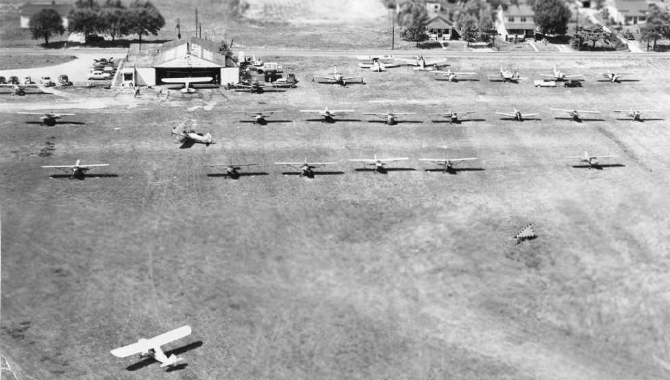
A 1953 aerial view looking north at Clickenger Airport depicted dozens of light planes parked on the grass in front of a hangar.
David Ostrander recalled, “The hangar burned shortly after 1953 & the whole operation moved to Price field.
I used to ride my bicycle to Clickenger after school & flew with anyone who had an empty seat.
I flew with Bernie Chupka, Norm Crabtree & an instructor name 'Mac' McLoud. Mac had a printing shop across Williams Road from the hangar.
My mother had an encounter with General Curtiss Lemay wen he insisted on renting one of the Aero Club planes even though all were scheduled.
My mother was acquainted with 'Jerry' Mock but not impressed.”
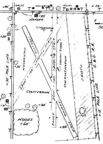
The layout of Clickenger Airport, as depicted in the 1955 OH Airport Directory (courtesy of Stephen Mahaley).
The directory described Clickenger as having 3 runways, with the longest being a 2,750' northwest/southeast strip.
A single hangar was depicted on the north side of the field. The operator was listed as Jones Flying Service.
A 1957 aerial view depicted Clickenger Airport as having 3 grass runways,
with a total of 13 light aircraft parked around a building on the northwest side of the field.
Susan Rodda recalled, in the 1960s “My father, Eugene 'Whitey' Jost, became the Fixed Base Operator for South Columbus.”
By 1962, it had been renamed South Columbus Airport, which is how it was listed in the 1962 AOPA Airport Directory.
It was described as having a single gravel runway, and the operator was listed as Jones Flying Service.
The August 1965 Huntington Sectional Chart (courtesy of Ron Kunse) depicted South Columbus Airport as having a 3,000' unpaved runway.
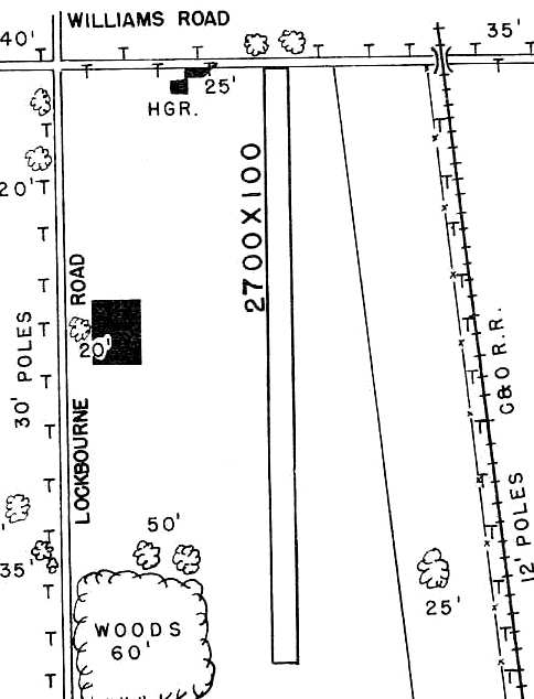
The layout of South Columbus Airport, as depicted on the 1966 OH Airport Directory (courtesy of Chris Kennedy).
It depicted the field as having a single 2,700' unpaved north/south runway.
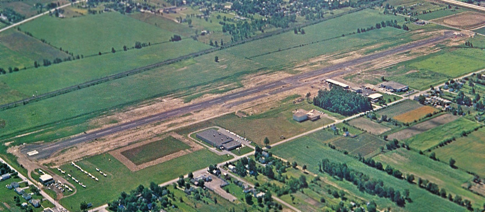
An undated aerial view looking southeast at South Columbus Airport from the October 1968 issue of “The Flyer” magazine (courtesy of Daun Yeagley).
It showed a dramatic difference compared to the 1966 airport directory, with South Columbus' previous unpaved runway having been replaced with a longer paved runway,
which extended considerably farther south than the previous airport boundary.
Over a dozen light planes were parked near the hangar on the northwest side (bottom-left).
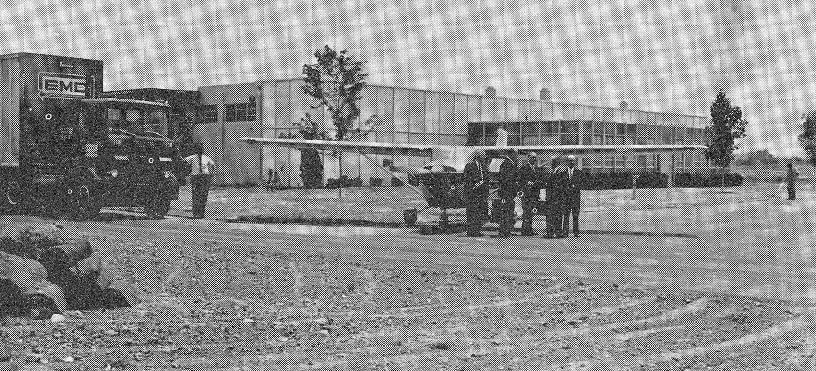
An undated photo of a Cessna at South Columbus Airport from the October 1968 issue of “The Flyer” magazine (courtesy of Daun Yeagley).
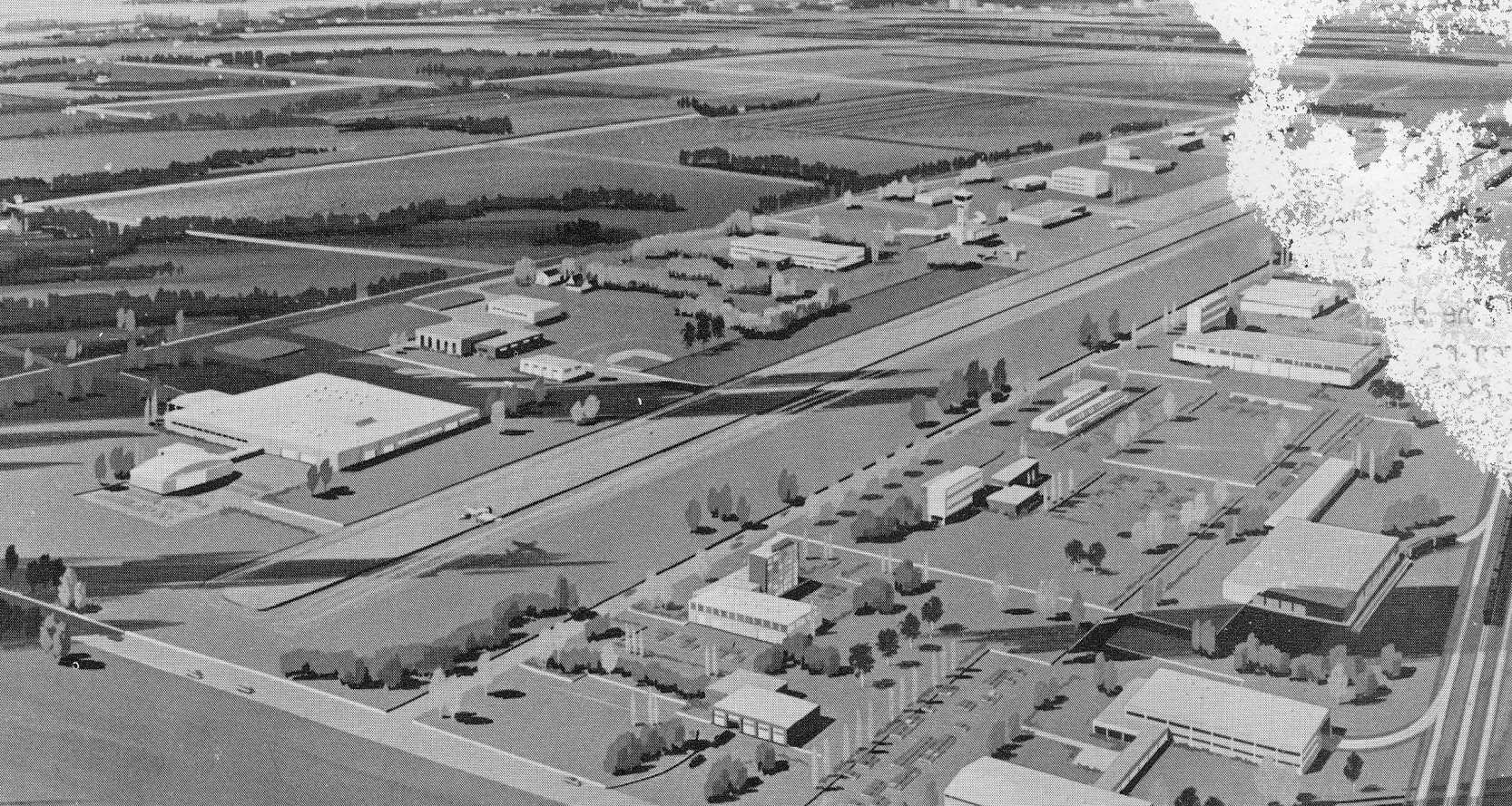
An artists conception of Lockbourne Industrial Park, planned to be built on either side of South Columbus Airport, from the October 1968 issue of “The Flyer” magazine (courtesy of Daun Yeagley).
It depicted a control tower, which was evidently never built.
A 1971 aerial view depicted South Columbus Airport as having a single north/south paved runway,
The original hangar remained on the northwest side, but had been replaced by a much larger group of hangars on the west side of the new runway.
The last aeronautical chart depiction which has been located of South Columbus Airport
was on the August 1976 Cincinnati Sectional Chart (courtesy of Mitchell Hymowitz).
It depicted South Columbus as having a north/south paved 5,100' runway.
The 1982 AOPA Airport Directory (courtesy of Ed Drury) described South Columbus Airport as having a 5,150' asphalt Runway 18/36.
The operator was listed as E.C. Aviation.
John Berryman recalled, “I begin my flight training at the old South Columbus Airport as a 15 year old in 1987.
At that time it was already in decline but there were active pilots who kept their aircraft hangared there
as well as the FBO 'American Aviation Services' where I trained.
It was ran by a man named Bob Maroldy who had recently retired from the Army & just opened it when I flew there.
As a matter of fact I worked as a ground crewman on the banner towing planes
during the Ohio State Football games in exchange for flying time.
When I returned briefly in 1993 to get a picture of the plane I trained with,
the FBO was closed & a friend of his still had one of the planes & was trying to get investors to revitalize the airport.
But this was highly unlikely as that area had become mostly industrial
and Bolton Field & Don Scott are 2 class D airports very close by, much more convenient to get to.
However, I do believe that there were people who wanted to see the airport fail & had their eyes on the land.”
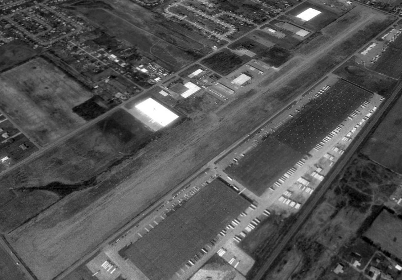
The last photo which has been located showing South Columbus Airport still open was a 1994 USGS aerial view looking northwest.
A total of 9 single-engine aircraft were visible parked on the ramp.
The airfield consisted of a single paved 5,400' runway, and a ramp on the west side with at least 3 hangars.
Unfortunately, by this time, development around the field had become extensive,
with several large industrial buildings having been built immediately along the east side of the runway.
South Columbus Airport was evidently closed (for reasons unknown) at some point between 1994-99,
as it was depicted as an abandoned airfield on the July 1999 Cincinnati Sectional Chart (courtesy of Ron Plante).
A 2002 aerial photo showed 2 large buildings had been built over the central portion of the former South Columbus Airport runway,
and a housing development had been built over the southern portion of the runway.
However, about half of the runway remained intact on the northern end,
complete with the circular turn-around characteristic of a runway at the north end.
The remaining runway portion was evidently being used to store trailers or containers.
The former terminal building also remained intact.
At some point after the airport closed, the former main hangar was apparently reused as the “Airport Tennis Club”.
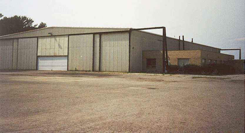
A 2003 photo by Billy Spiropoulos of the former main Hangar of South Columbus Airport.
Billy observed, “The place is indeed an industrial park now.
It had an eerie, desolate, decrepit atmosphere, even though there are several businesses operating on the site."
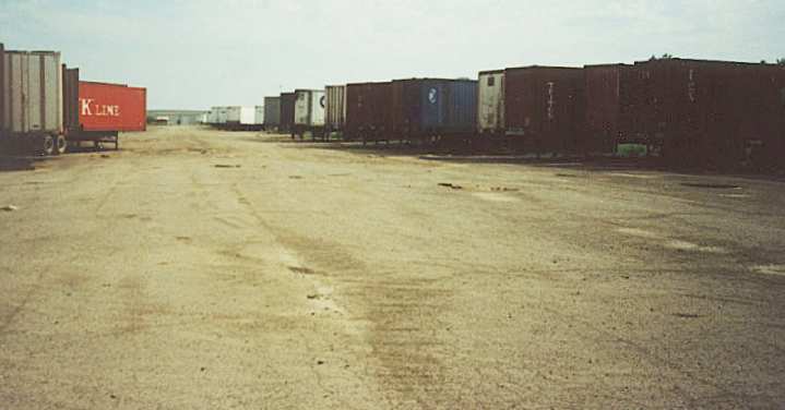
A 2003 photo by Billy Spiropoulos of the South Columbus Airport runway.
Billy observed, "The runway is all cracked up & potholed, with endless rows of cargo trailers parked on it,
but still plainly evident as you look down its length."
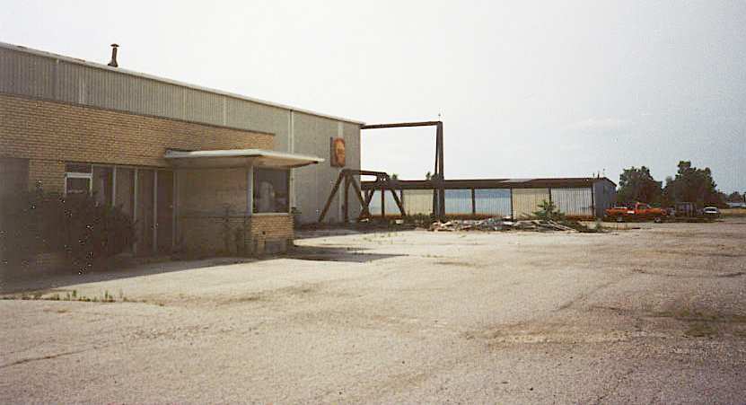
A 2003 photo by Billy Spiropoulos of the former main Hangar of South Columbus Airport.
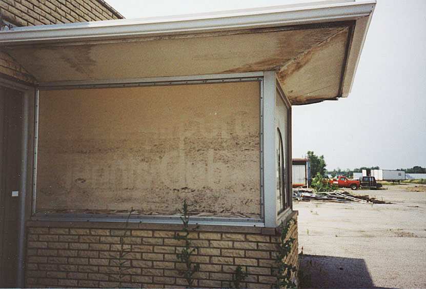
A 2003 photo by Billy Spiropoulos of a former office attached to the South Columbus Airport main hangar.
Note the faded lettering on the windows, which apparently used to read, "Airport Tennis Club".
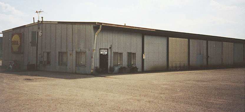
A 2003 photo by Billy Spiropoulos of the former Hangar 6 at South Columbus Airport.
Billy Spiropoulos noted, "I spotted the ramp & the remaining hangars as well.
The 2 narrow buildings are rusty sheetmetal with numbers still on the walls;
each of the 2 smaller hangars still has an older style Shell Oil logo hanging on it."
An "artsy" 2003 photo by Billy Spiropoulos of one of the many junked autos resting at the former South Columbus Airport,
one of Detroit's finest, an early 1970s Ford Torino.
Billy noted, "The ramp area is littered with abandoned older cars (for example: two 1970 or '71 Ford Torinos,
rusty but still complete & still sitting on old-fashioned bias-ply tires)."
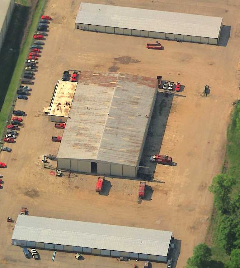
A circa 2006 aerial view looking south at the 3 former hangars which remain at the former South Columbus Airport.
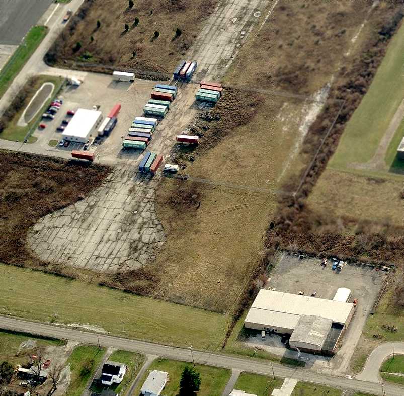
A circa 2008 aerial view looking south at the north end of the former South Columbus Airport runway.
The darker-colored portion of the building at bottom-right is a former hangar from Clickenger Airport (predating South Columbus Airport),
which dates back to at least 1955.
A 2014 aerial view looking northwest showed the majority of the South Columbus Airport site has been redeveloped,
but a 2,000' portion of the north end of the runway remains intact, including a circular turn-around pad.
A 4/21/15 photo by Tink Schaffer of “the old street sign going into a solid waste yard still there at Lockborune”, for “South Columbus Airport Road”.
A 2019 photo looking northeast at the former South Columbus Airport main hangar.
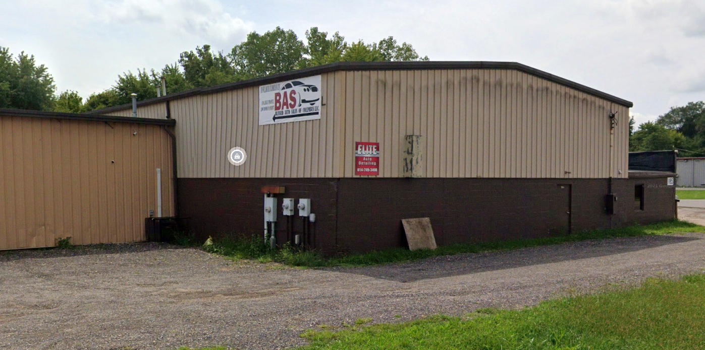
A 2021 photo looking southwest at a former Clickenger Airport hangar, which dates back to at least 1955.
The site of South Columbus Airport is located southeast of the intersection of Lockbourne Road & East Williams Road.
____________________________________________________
Since this site was first put on the web in 1999, its popularity has grown tremendously.
If the total quantity of material on this site is to continue to grow,
it will require ever-increasing funding to pay its expenses.
Therefore, I request financial contributions from site visitors,
to help defray the increasing costs of the site
and ensure that it continues to be available & to grow.
What would you pay for a good aviation magazine, or a good aviation book?
Please consider a donation of an equivalent amount, at the least.
This site is not supported by commercial advertising –
it is purely supported by donations.
If you enjoy the site, and would like to make a financial contribution,
you
may use a credit card via
![]() :
:
Please consider checking the box to make a monthly donatation.
For a mailing address to send a check, please contact me at: paulandterryfreeman@gmail.com
If you enjoy this web site, please support it with a financial contribution.
please contact me at: paulandterryfreeman@gmail.com
If you enjoy this web site, please support it with a financial contribution.
____________________________________________________
This site covers airfields in all 50 states.