Abandoned & Little-Known Airfields:
New Jersey: Atlantic City area
© 2002, © 2024 by Paul Freeman. Revised 3/13/24.
This site covers airfields in all 50 states: Click here for the site's main menu.
____________________________________________________
Please consider a financial contribution to support the continued growth & operation of this site.
Atlantic City Municipal Airport / Bader Field (revised 3/13/24) - Crab Island Fish Factory Airfield (revised 3/13/24) - Crescent Airfield (revised 12/22/13)
Forked River Airport (revised 3/13/24) - Manahawkin Airport (revised 1/19/22) - Piney Hollow Airfield (revised 3/13/24)
Pleasantville - Somers Point Airport / Nordheim Flying K Airpark (revised 1/19/22) - Smithville Airport (revised 2/25/22)
____________________________________________________
Piney Hollow Airfield (80N), Monroe, NJ
39.595, -74.901 (Northwest of Atlantic City, NJ)
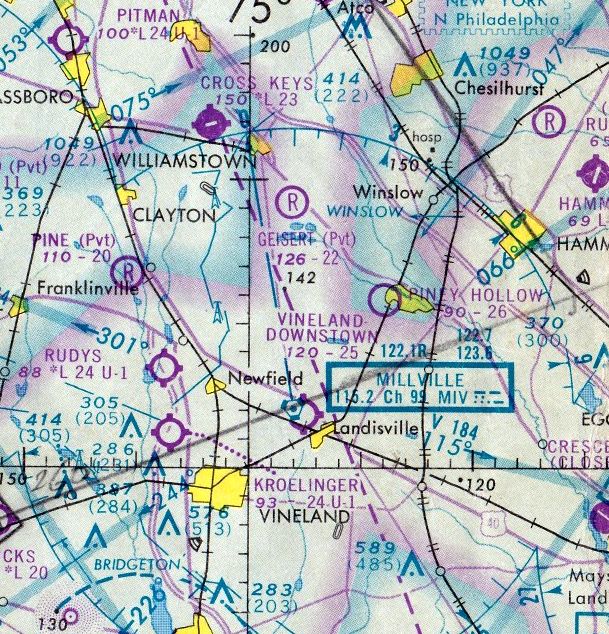
Piney Hollow Airfield, as depicted on the March 1974 Washington Sectional Chart (courtesy of Jonathan Westerling).
This small general aviation airfield in rural NJ was evidently established at some point between 1973-74,
as it was not yet depicted on the 1970 Washington Sectional Chart
nor listed in the 1973 NJ Airport Directory (according to Philip Kineyko).
The earliest depiction which has been located of Piney Hollow Airfield was on the March 1974 Washington Sectional Chart (courtesy of Jonathan Westerling).
It depicted Piney Hollow Airfield as having a 2,600' unpaved runway.
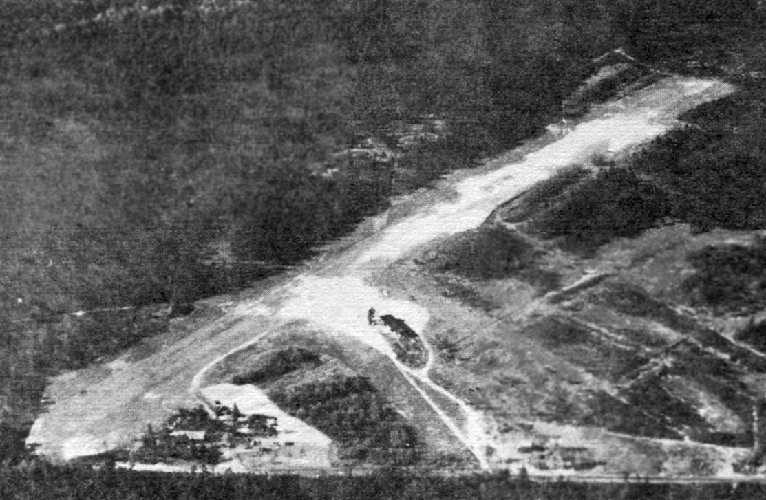
The earliest photo which has been located of Piney Hollow Airfield was an undated aerial view looking north from the 1979 NJ Airport Directory (courtesy of Philip Kineyko).
It described Piney Hollow Airfield as having a 2,750' turf Runway 3/21, with a small building on pictured to the southeast.
The manager was listed as Thomas Webb.
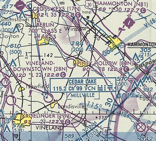
The last aeronautical chart depiction which has been located of Piney Hollow Airfield was on the March 1994 Washington Sectional Chart.
It depicted Piney Hollow Airfield as having a 2,800' unpaved runway.
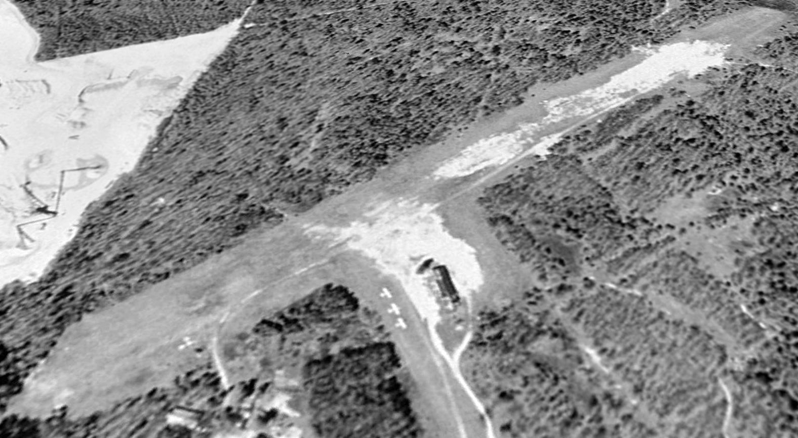
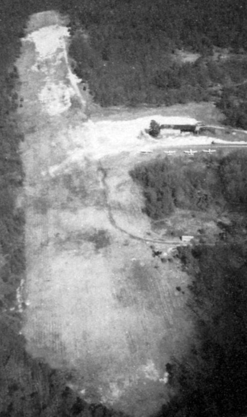
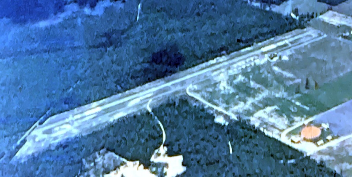
The earliest photo which has been located showing aircraft at Piney Hollow Airfield was a 1995 USGS aerial view looking northwest.
It depicted 3 light single-engine aircraft parked next to a building on the east side, along with possibly one other aircraft next to the southwest runway edge.
The 1995 NJ Airport Directory (courtesy of Philip Kineyko) described Piney Hollow Airfield
as having a 2,760' turf Runway 4/22, and listed the manager as Thomas Webb.
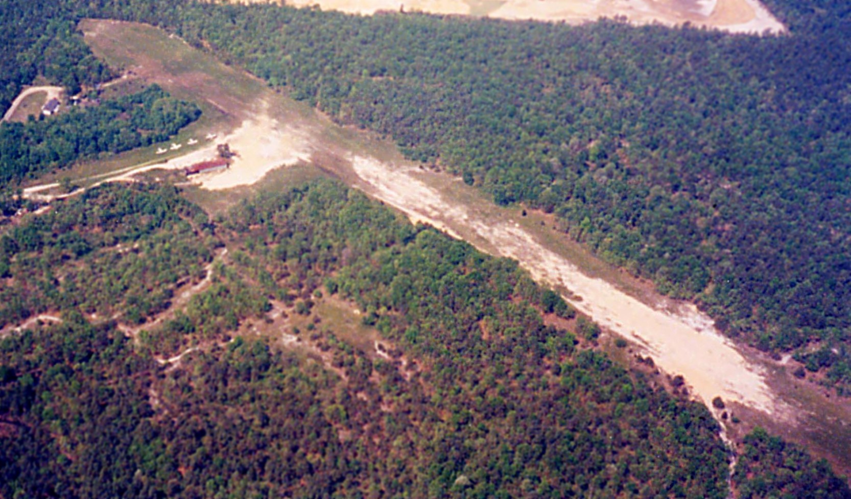
An undated aerial view looking northeast at Piney Hollow Airfield from the 1998 NJ Airport Directory (courtesy of Philip Kineyko).
It described Piney Hollow Airfield as having a 2,760' turf Runway 4/22,
with 4 light single-engine aircraft seen parked near a small building to the southeast.
The last photo which has been located showing aircraft at Piney Hollow Airfield was a 1998 aerial view looking west by Philip Kineyko of www.FlyinPhilsPhotos.com.
It depicted 4 light single-engine aircraft parked next to a building on the east side.
Philip recalled, “I only overflew it since I didn't want to risk a landing on that type of field in my Skyhawk. I should've done a low pass, though.
I was mainly intrigued with this southern New Jersey field because of its name and that it was such a 'podunk' airport (my late father & uncle used to call small airports by that name).”
Piney Hollow Airfield was evidently closed at some point between 1998-2002,
as it was no longer depicted on the 2002 Washington Sectional Chart (courtesy of Jonathan Westerling),
as a 2002 aerial view showed the northern portion of the runway had been dug out by a sand mining operation, a portion of which was flooded.
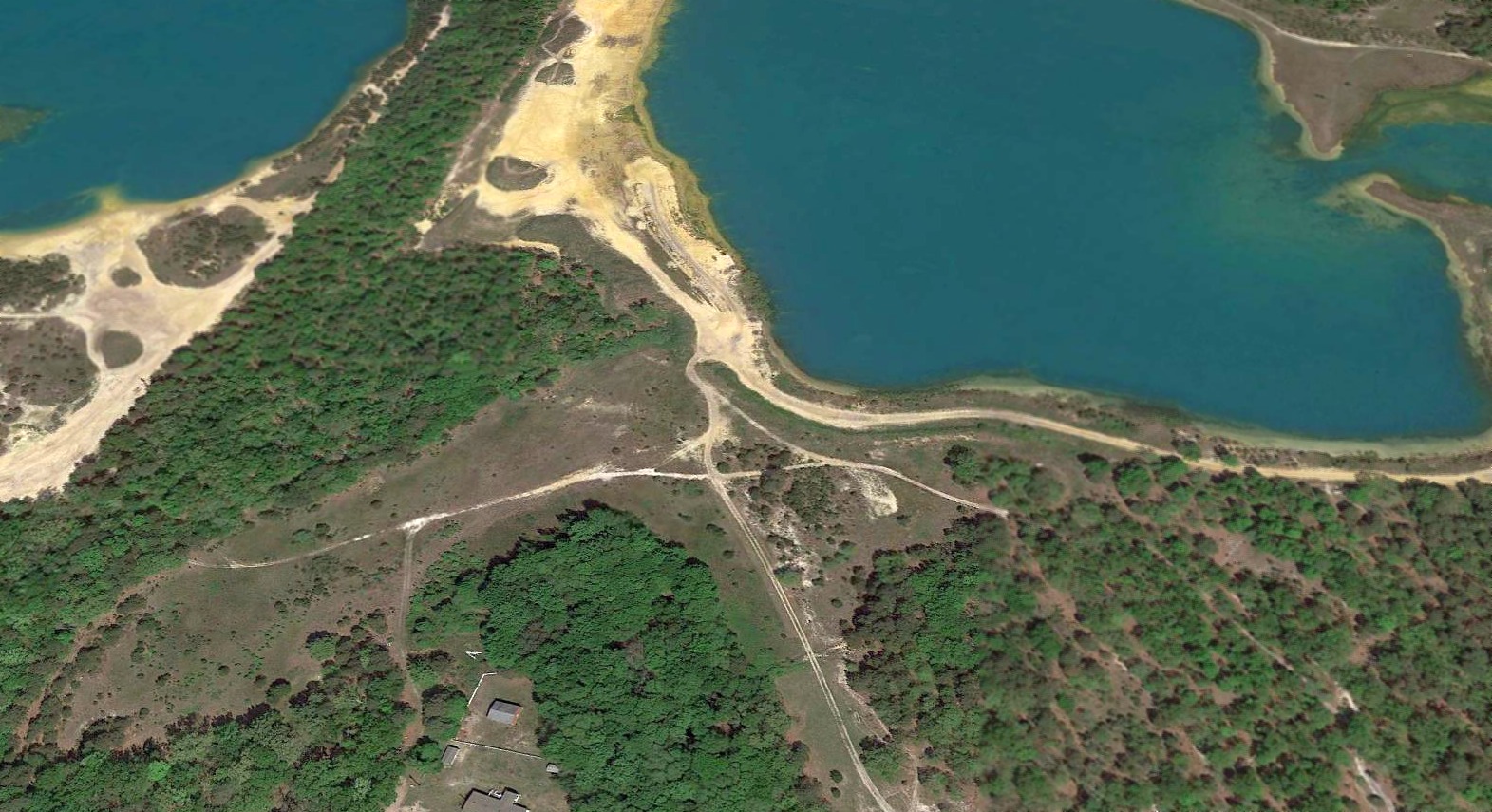
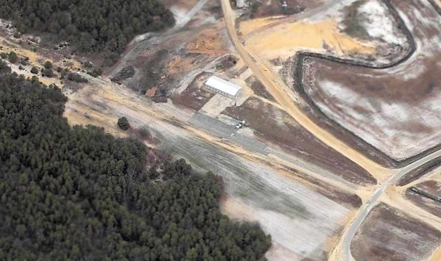
A 2016 aerial view looking northwest at the site of Piney Hollow Airfield shows the majority of the property covered by a flooded sand mining pit,
but the southwest portion of the former runway remained recognizable.
Thanks to Philip Kineyko for pointing out this airfield
____________________________________________________
Crab Island Fish Factory Airfield, Tuckerton NJ
39.518, -74.338 (Northeast of Atlantic City, NJ)
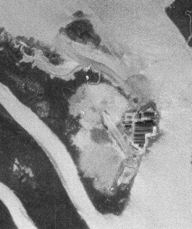
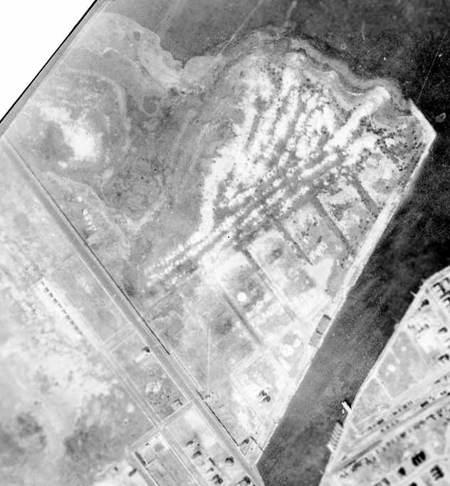
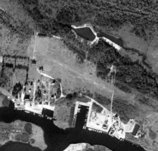
A low resolution 10/1/56 USGS aerial view barely depicted the Crab Island Fish Factory Airfield to the west of the factory buildings.
A remote island along the NJ coast contained a large industrial fish processing plant, which eventually included its own airfield.
According to the Necessity For Ruins, “In the 1890s, Joseph Wharton doted over his menhaden reduction plant,
giving it a 'great deal of detailed attention' & moving boilers from his unproductive glass operations in the Pine Barrens to his facility on Crab Island.”
A 1931 aerial photo depicted the Crab Island Fish Factory but not yet any airfield.
The earliest reference which has been located to the Crab Island Fish Factory Airfield came from Lee Oldershaw,
who recalled, “In the middle 1940s I fished there with my Dad & saw a few [Piper] J-3 or PA-12 Super Cruisers operate out of there.”
USGS topo maps from the 1940s/50s/60s depicted the “Fish Factory” buildings but did not depict an airfield.
The Fish Factory Airfield also was not depicted on Washington Sectional Charts from the 1940s/50s/60s.
The earliest depiction which has been located of the Crab Island Fish Factory Airfield was a 1956 aerial view.
It depicted a very short (1,000') unpaved northwest/southeast runway, just to the west of the fish factory buildings.
What may have been a few small hangars were visible on the east side of the runway, but no aircraft were visible on the field.
According to the Necessity For Ruins, “The Crab Island facility passed from Wharton to a series of fish product companies of scant profitability such that it was shuttered in the late 1960s.
By this time the plant on Crab Island was processing imported fish from Louisiana.
A skeleton crew existed on the site until the American Farm Products Company went under & it was sold to the NJ Department of Environmental Protection in 1974.
The odoriferous ‘stinkhouse‘ on Crab Island, as it was known to locals, burned in the 1980s & the site gradually reclaimed by the reedy grasses.
Towering above the marsh, the fish factory is visible from 8 miles out in Brigantine, a ruin to industrial fishing.”
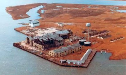
A circa 2010-2017 aerial view looking west at the ruins of the Crab Island Fish Factory, with the runway visible behind the buildings.
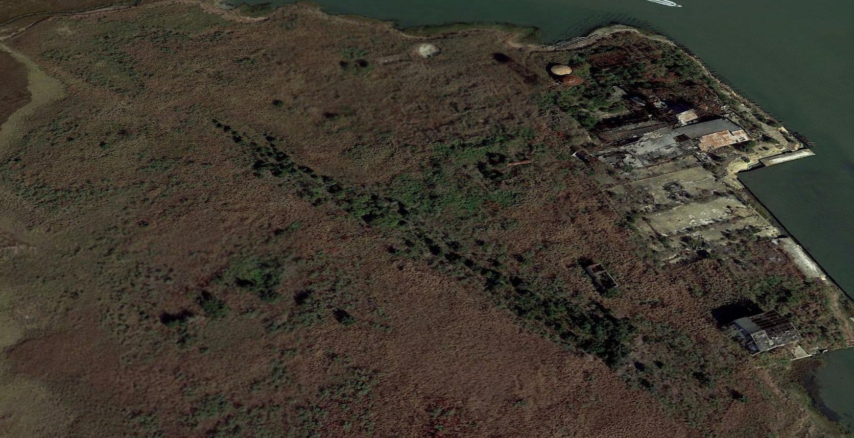
A 2017 aerial view looking northeast showed the remains of the Crab Island Fish Factory runway (from top-left to bottom-right), with the ruins of the factory on the right.
What may have been a former hangar is at bottom-right.
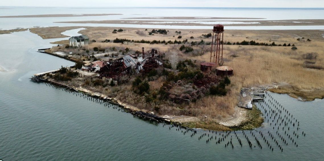
A 2020 aerial view looking west at the ruins of the Crab Island Fish Factory, with the runway visible behind the buildings.
Thanks to Lee Oldershaw for pointing out this airfield
____________________________________________________
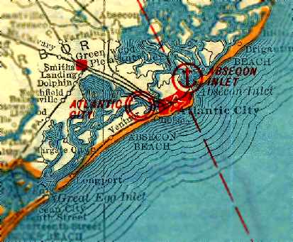
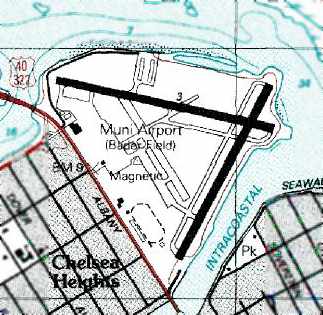
Atlantic City Municipal Airport / Bader Field, Atlantic City, NJ
39.36, -74.46 (Southeast of Philadelphia, PA)
A 1920 aerial view of the site of Atlantic City Municipal Airport (courtesy of Chris Kennedy).
The photo did not appear to depict any obvious signs of an airfield, but it had supposedly been in operation since the preceding year.
According to Wikipedia, “Bader Field was opened in 1910 & was authorized to provide passenger service in 1911.
It was the first U.S. municipal airport with facilities for both seaplanes & land-based airplanes.
The first known usage of the term "air-port" appeared in a newspaper article in 1919, in reference to Bader Field.
The term was coined by Robert Woodhouse & referred to the 'Flying Limousines', a seaplane passenger service between Atlantic City & NY.”
According to the FAA, “Admiral Robert E. Perry, the discoverer of the North Pole, was a member of the committee that sponsored the airport.”
The earliest photo which has been located of the site of the Atlantic City Municipal Airport was a 1920 aerial view (courtesy of Chris Kennedy).
The photo did not appear to depict any obvious signs of an airfield, even though it had supposedly been in operation since the preceding year.
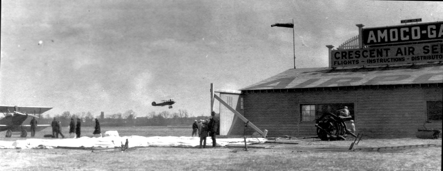
A circa 1920-25 photo of planes, spectators, and the hangar of Crescent Air Service at Bader Field / Atlantic City Municipal Airport (courtesy of Mark Maxwell).
According to Kathleen Baxter, “Bader Field was developed by B. George Ulizio,
a real estate broker & promoter who ended up living in Haddonfield near my parents.
To promote Atlantic City, George arranged for temporary training facilities to be built at Bader Field
for Jack Dempsey's training camp prior to the Dempsey-Carpentier fight [in 1921].”
According to the FAA, “On 7/8/22 the city purchased the airport from private owners.
Athletic fields were created & named for Edward Bader, the mayor of the resort.
The size of the airport remained the same for many years due to the inland waterway & the state highway on the southeast side.”
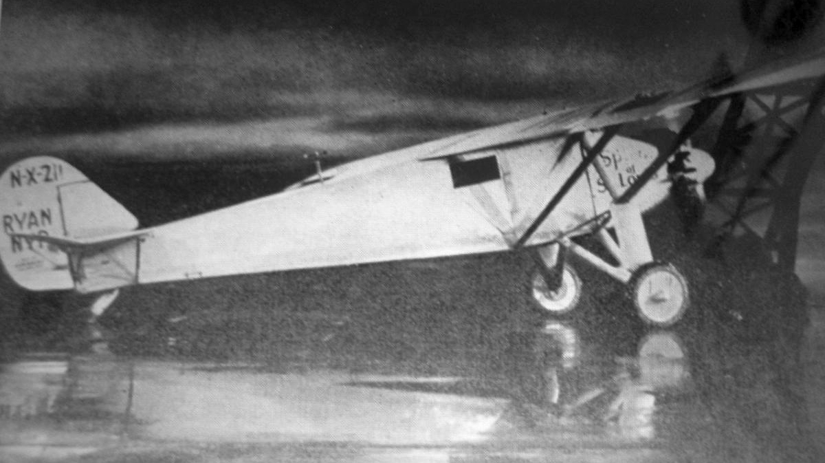
An October 1927 photo of Charles Lindbergh's Ryan NYP “Spirit of St Louis” at Bader Field.
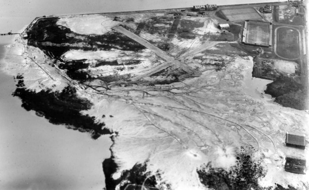
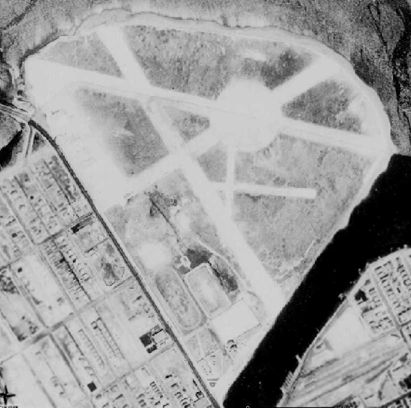
A 11/18/28 aerial view looking east at Bader Field,
showing 2 paved runways, a hangar at the east side with “Bader Field” painted on the roof, and 2 hangars at the southwest corner.
The field presumably had been flooded, with much of it covered by sand.
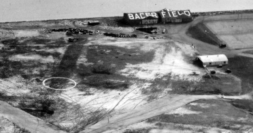
A closeup from the 11/18/28 aerial view looking east at Bader Field of the hangar at the east side with “Bader Field” painted on the roof.
The earliest map depiction which has been located of the Atlantic City Municipal Airport
was on the 1930 Rand McNally Air Trails Map (courtesy of Chris Kennedy).
According to the FAA, the Spirit of St. Louis landed at Bader Field.
A 1931 aerial view of Bader Field, showing 3 unpaved runways, along with what appeared to be 2 smaller previous runways.
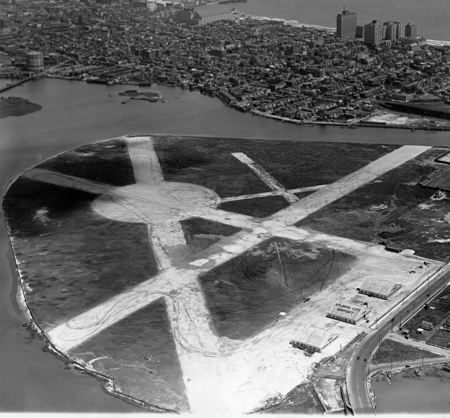
An 8/9/32 aerial view looking east at Atlantic City Municipal Airport (from the Dallin Aerial Survey Collection, courtesy of the Hagley Museum & Library),
showing 3 unpaved runways, along with what appeared to be 2 smaller previous runways.
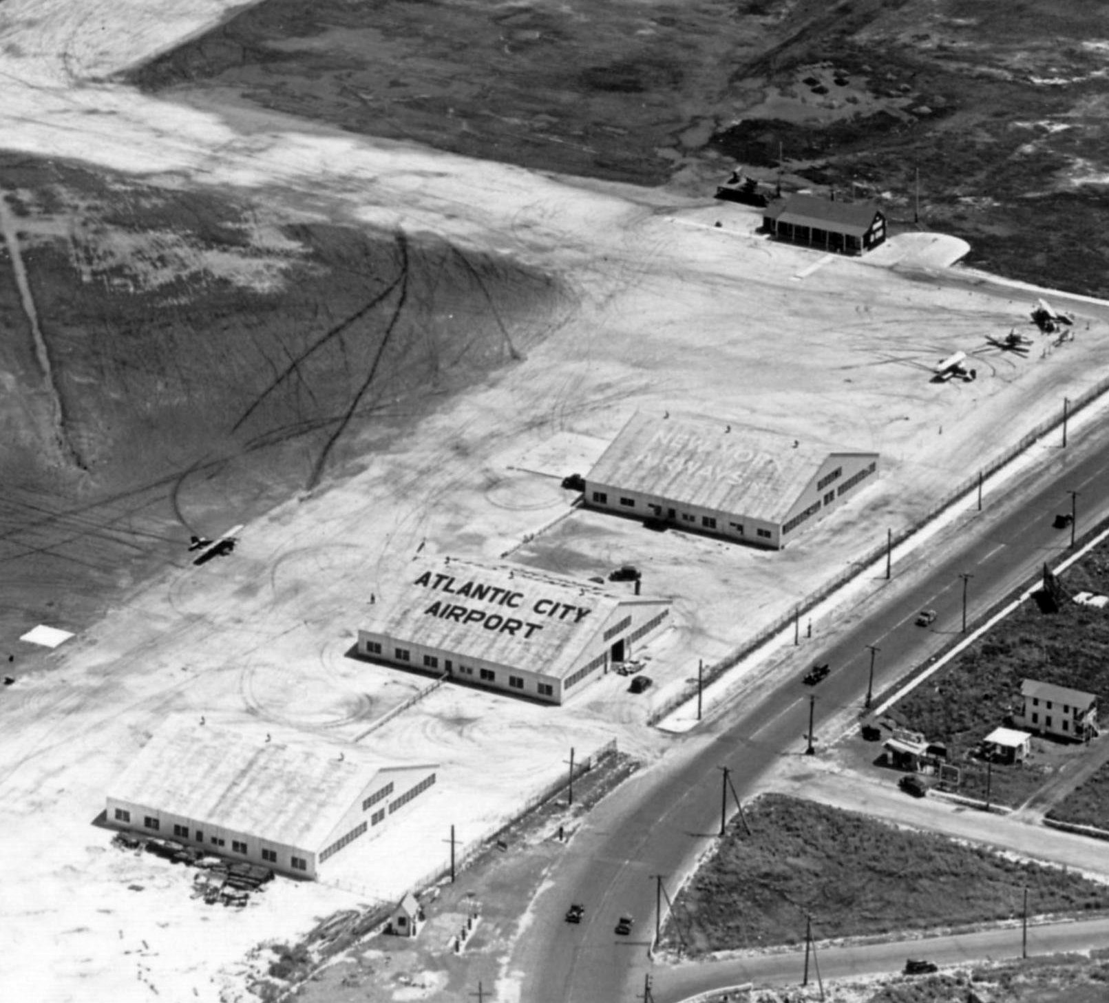
A closeup from the 8/9/32 aerial view looking east at Atlantic City Municipal Airport (from the Dallin Aerial Survey Collection, courtesy of the Hagley Museum & Library),
showed that 3 fairly substantial hangars had been added along the northwest side of the field.
One had “Atlantic City Airport” painted on its roof, and another had “New York Airways”. Four single-engine aircraft were also visible.
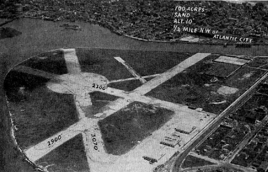
An aerial view looking east at Atlantic City Municipal Airport,
from The Airport Directory Company's 1933 Airports Directory (courtesy of Chris Kennedy).
Three fairly substantial hangars were pictured along the northwest side of the field,
one marked with “Atlantic City Airport” on its roof.
Three planes were parked on the ramp to the right of the hangars,
and what appears to be a control tower was located in the grass field just above them.
The directory described Atlantic City as having 3 gravel runways, with the longest being the 3,070' east/west strip.
Note the presence of what appeared to be an older set of perpendicular runways,
set at an angle to the larger set of runways.
The operators were listed as Eastern Air Transport & Philadelphia Air Service,
and the airport supervisor was listed as H.B. Baldwin.
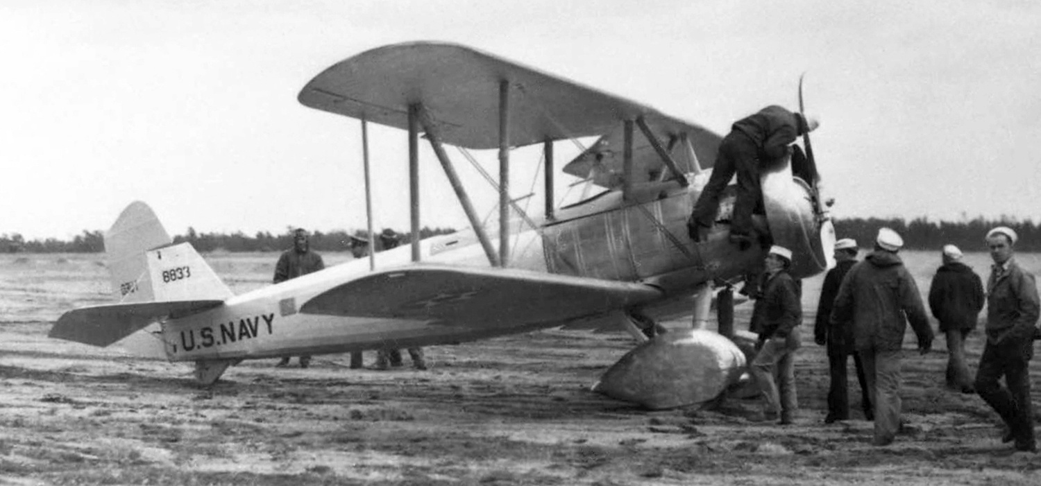
An April 1933 photo by Rudy Arnold of Navy Vought O3U-1 Corsair A8833 being prepared for a search & rescue mission from Atlantic City Municipal Airport following the crash of the airship USS Akron.
Atlantic City Municipal Airport was depicted as a commercial/municipal airfield on the 1935 Washington Sectional Chart.
The Airport Directory Company's 1937 Airports Directory (courtesy of Bob Rambo)
described Atlantic City Airport as having 3 gravel runways, with the longest being the 3,070' east/west strip.
Three fairly substantial hangars were pictured along the northwest side of the field.
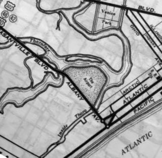
A 1938 street map (courtesy of Kevin Walsh) labeled Atlantic City Municipal Airport generically as “The Airport”.
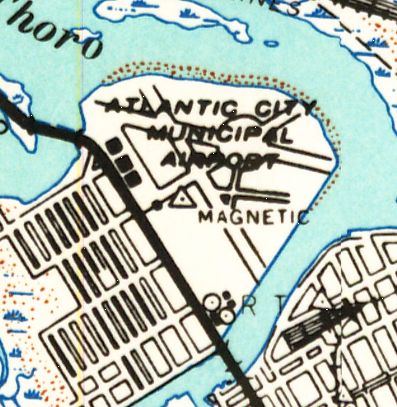
The 1940 USGS topo map depicted Atlantic City Municipal Airport as having 3 runways & 3 hangars along the northwest side of the field.
According to the FAA, “In 1941, one week before Pearl Harbor, the Civil Air Patrol (CAP) was founded at Bader Field.”

A July 1941 aerial view looking east at Bader Field.
All 3 of the large hangars on the northwest side of the field were still standing,
but the former control tower appears to have been removed at some point between 1933-41.
According to Mark Hess, “The first Civil Air Patrol Coastal Patrol Base #1 in 1942 was located here.”

A 8/29/42 photo of the Bader Field operations building (courtesy of Wayde Minami).
Wayde Minami recalled, “I am the MD ANG historian. Bader Field... One of our units was stationed there at the time.
Behind the operations building is a radio trailer.”
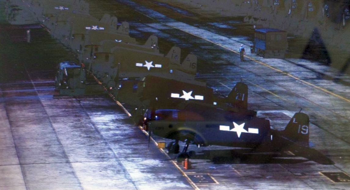
A WW2 photo of Grumman TBF Avenger torpedo bombers at Bader Field.
According to the book “U.S. Naval Air Stations of WW2” by Mel Shettle, Bader Field was used by the Navy in WW2
in the period before Naval Air Station Atlantic City (to the northwest, in Egg Harbor) was completed (in 1943).
After the opening of NAS Atlantic City, Bader Field continued to serve as an Outlying Landing Field for the main station.
CASU 23 had 29 SNJ Texans based there & the fighter squadrons pilots conducted all proficiency instrument flying from Bader Field.
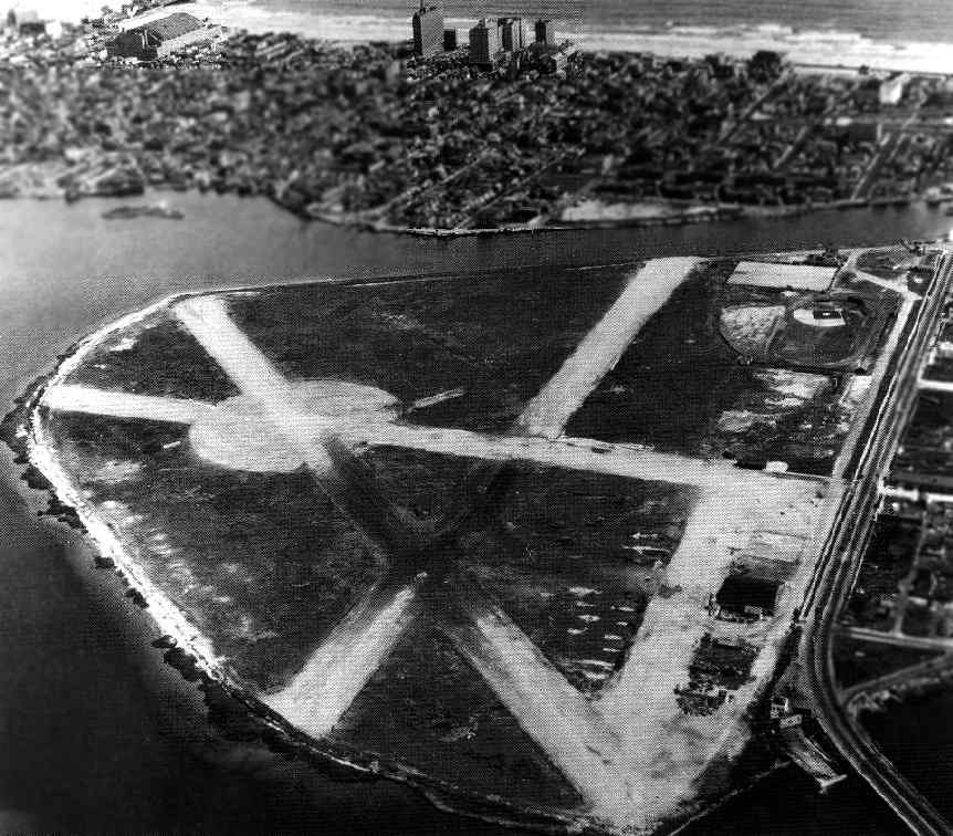
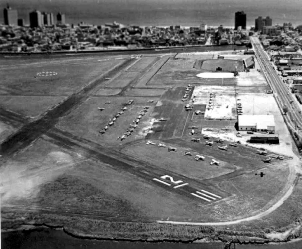
A WW2-era aerial view looking southeast at Bader Field (National Archives photo).
Note that 2 of the large hangars on the west side of the field had evidently been removed at some point after 1941.
The April 1944 US Army/Navy Directory of Airfields (courtesy of Ken Mercer)
described Bader Field as having a 3,100' unpaved runway.
According to the FAA, “The municipal stadium was opened at Bader Field on 10/22/49 at a cost of $350,000.”
Henry Dasser recalled, “When I was about 11 or 12 [1952] I spent several years during the summer at Bader Field
putting banners together for Knocky & his pilots.
The memories of those days are priceless, I could spent a lot of time talking about the wonderful & sometimes interesting times I had there.
In Bader Field he [Knocky] had the Naval N3Ns.
As I remember he had some association with the original development of this aircraft in Philadelphia.
He had I believe 3 of these at Bader Field & they had heavy use during the summer season of banner towing.”
A 1957 aerial view showed that 1 large hangar still remained standing on the northeast side of Bader Field.
According to Mark Maxwell, “Back in the end of the 1950s, a U.S. Navy plane tried to make an emergency landing on Runway 16, but wound up in the canal.
I believe it was a 4-engine C-54 & was supposed to be carrying someone from the Navy Department.
They were supposed to land at NAS Atlantic City, now Atlantic City International Airport but it was fogged in as was Philadelphia area airports.
My father was working in Atlantic City at the time & just happened to have his movie camera in the car.
He took a few minutes of film from the Albany Avenue bridge, but it was fairly dark.
You can just make out a couple of USN divers: one the fuselage & swimming around the plane.
Rumors were it was the Secretary of the Navy with secret papers aboard.”
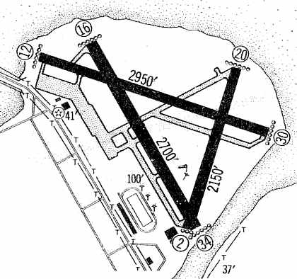
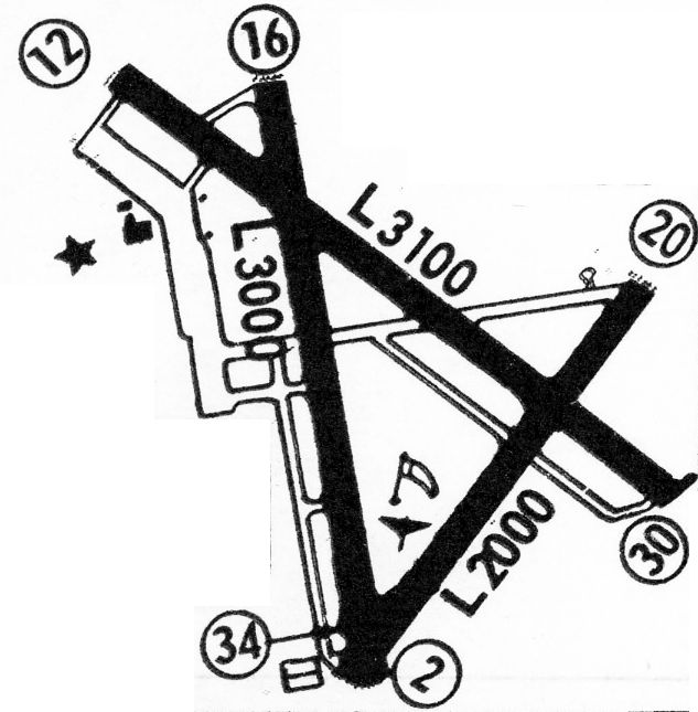
The 1960 Jeppesen Airway Manual (courtesy of Chris Kennedy)
depicted Bader Field as having 3 paved runways,
with the longest being the 2,950' Runway 12/30.
Only a single building was depicted along the ramp on the west side of the field.
The Municipal Stadium was also depicted along the southwest portion of the airport property.
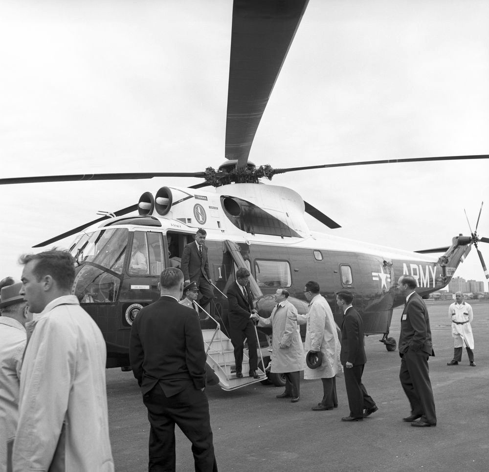
A 5/8/62 photo of President John Kennedy disembarking from an Army VH-3 Sea King
and shaking hands with United Automobile Workers of America President Walter Reuther upon arriving at Bader Field.
A 1963 aerial view depicted the field in much the same configuration as that depicted in 1957.
The 1968 Flight Guide (courtesy of Robert Levittan) depicted Bader Field as having 3 paved runways,
with the longest being the 3,100' Runway 12/30.
Only a single building was depicted along the ramp on the west side of the field.
According to the FAA, “During the 1960s & 1970s,
Allegheny Commuter flew out of Bader with scheduled flights to Philadelphia or New York.
These were the last of the major commercial carriers to fly in or out of Bader,
and the demise of the airport began shortly after their departure.
The control tower was removed, fuel trucks no longer were made available,
and mechanical problems had to be handled by a mechanic from another airfield.”
The FAA article continued, “Every U.S. President from Theodore Roosevelt through Gerald Ford
flew into Bader Field at some point in their administration.”
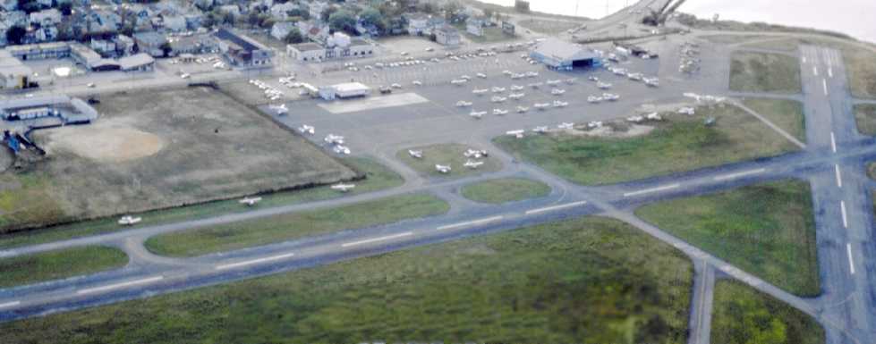
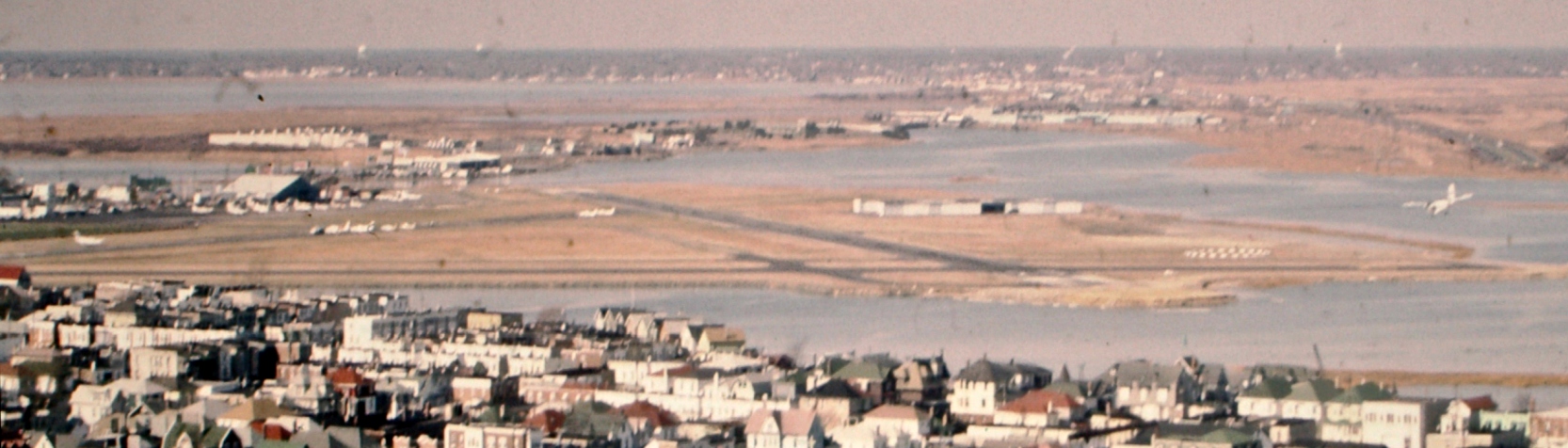
A late 1960s / early 1970s aerial view by Paul Thorn looking southeast at Bader Field.
A 1970 aerial view depicted Bader Field with a total of over 30 light aircraft parked on its west side.
Two rows of T-hangars had also been constructed at some point between 1963-70 on the north side of the field.
Lee Oldershaw recalled, “In 1970 I flew a Comanche 250 into Bader Field for the day with my 8 months pregnant wife & another couple.
After a day on the boardwalk, we walked back & couldn't get the Comanche started. Not a pop.
We walked to the city to rent a car. The Hertz office wouldn't rent us a car as nobody had a credit card.
My wife said, 'Well I'll just have the baby here then.' We got a car.
The next day I drove down with my mechanic & found the starting points in the magneto had broken. We jury-rigged it to start & flew to Belmar, NJ.”
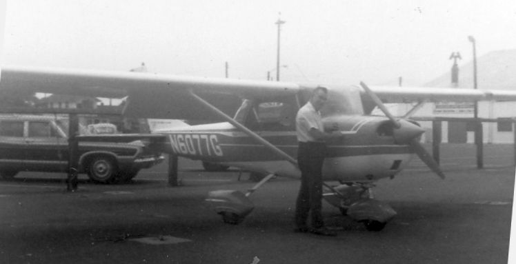
A circa 1971 photo of N6077G, a 1969 Cessna 150K, serial #15071577 at Bader Field.
A September 1978 aerial view by Paul Thorn looking northwest at Bader Field,
showing dozens of light aircraft parked on the ramp around the hangar on the northwest side of the field.
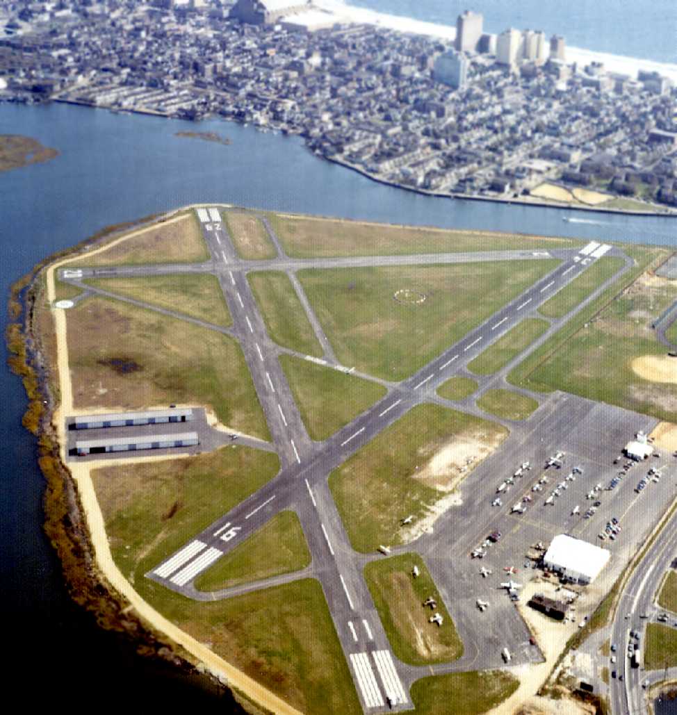
A 1970s aerial view looking south depicted Bader Field at perhaps its zenith of usage, with a total of over 50 light aircraft parked on its west side.
The large hangar also still remained standing on the northwest side of the field.

A 2/9/81 USGS aerial view depicted Bader Field with a total of over 20 light aircraft parked on its west side.
The March 1981 Washington Sectional Chart (courtesy of Ron Plante)
depicted Bader Field as having a 2,900' paved runway.
An August/September 1982 aerial view by Jack Kenton looking northwest depicted Bader Field
as having several aircraft parked along the west side, and one twin-engine high-wing aircraft in the pattern (at right).
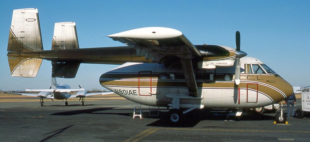
A February 1985 photo of an obscure Israeli Aircraft Industries Arava 101B at Bader Field.
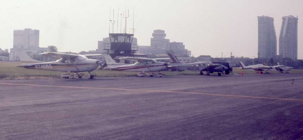
A June 1985 photo by Paul Thorn showing 4 light aircraft in front of Bader's control tower.
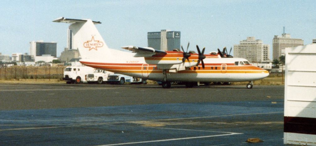
A June 1986 photo of perhaps the largest aircraft to operate from Bader Field: a 4-engine De Havilland Canada DHC-7-102 of casino operator Resorts International.
Jeff Doran recalled, “I learned to fly at Bader in 1986, and my first solo was to Runway 11.
There was flight training at Bader until about 1988-89. The FBO was known as 'Atlantic City Air Taxi'.
Eventually, the operation shut down & moved to Atlantic City International Airport,
and became known as 'Midlantic Jet', and they are still in business today [2006].
When they were at Bader, the rental fleet consisted of 2 Cessna 150s & a Cessna 172.
They gave up flight training after a couple accidents involving students. The control tower was in operation until early 1987.”
Bob Jarvis recalled, “I started at Bader Field as a Junior Operations Officer in 1987 after I got out of the Air Force. I had spent the 8 eight years as an USAF Fire/Rescueman.
Operations officers at the time consisted of 2 men who logged landings, did aeronautic checks, and responded to crashes & fires on the airport using the City’s Oshkosh T-6 callsign Rescue-1.
The logged landings were to make sure our boss Pan Am Management Systems got the city's chair from our FBO.
I stayed a whole month before I left. I returned to Bader as an Operations Officer in 1990.
We no longer wore blazer style uniforms; we sore standard firefighter duty uniforms complete with badge.
They had built us a platform in the backroom (built as the fire station bunkroom). Again logging aircraft landings.
For a while after the ATC contract expired we would rotate out to the tower to log the landings.
We were acquired by Johnson Controls. And shortly after took over as the FBO with an Exxon contract.
The city had been itching to get rid of the airport ever since an aircraft crashed & its engine landed on then Councilman, later mayor Jim Whelen’s front yard.
After that you could only take of Runway 4 & land on Runway 22.”
Bob continued, “We could keep the status quo at the airport (making sure the runway & taxiway lights stayed on); that’s why we did the aeronautical checks.
We reported any dead lights to maintenance who would change them in the morning.
We rented out the Old South Jersey Airways Terminal to the ACPD Vice Squad.
Initially we worked out of the old FBO offices in the main hangar but we eventually moved the FBO Office to the Fire Station.
Cabbies would sit in the old dayroom waiting for a fare. One of the Offices was converted to a pilot’s lounge.
We ran a shuttle van out to the aircraft pick up the pilots & passengers, collect their landing fees, pickup the fuel truck & refuel the aircraft.
When I re-started working at Bader their were 2 commuter airlines, one special charter for Bally’s, and sometimes 50 private landings a day.
Fight nights we would have to close of taxiways to park fixed-wings & helicopters.
The airport was still certified for seaplanes & I saw one Grumman land during my time there.
I remember when Donald separated from Ivana, they went out to his private helicopter & covered over her gold-leafed name with duct tape.”
According to Wikipedia, “Scheduled commercial airline service at the airport ended in 1990,
when Allegheny Airlines moved to the larger Atlantic City International Airport.”
Bob Jarvis recalled, “By the time I left in 1993 there were no commuter airlines left.
We did our best to promote the airport but we weren’t allowed to spend any money on it.
I put together a 2-fold brochure with the history of the airport complete with some old photos we’d found.
We lowered the landing fee from $20 to $5 & cut the fuel prices WAY down dropping them like $4/gallon.
I got out while the getting was good. I don’t suppose they operated that way for very long before after I left.”
The 1995 USGS topo map depicted Bader Field as having 2 paved runways,
with a single hangar along the northwest side of the field.
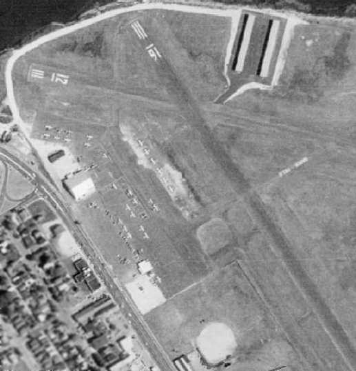
The 1995 USGS aerial photo depicted the field somewhat differently than the topo map of the same year:
one of the rows of T-hangars along the north side of the field had been removed at some point between 1970-95,
(leaving only 1 row of T-hangars still standing),
and the last hangar on the west side of the field had been removed at some point between 1970-95.
A total of 12 light aircraft were visible parked outside on the airport's ramp.
Paul Freeman flew into Bader Field in the late 1990s, to find that the field was a mere shadow of its former self.
Local political interests had driven away any fixed base operators or other businesses based at the airport,
so as to speed up the date at which point the airport property could be redeveloped for non-aviation uses.
A former fire station building on the southeast corner of the airport
was sporadically used over the following years as a terminal building of sorts.
But eventually the city government ended this arrangement as well,
forcing a trailer parked on the ramp to become the only building supporting airport operations at all.
Bader Field's FAA Airport/Facility Directory data showed that for the year ending 1/4/01, Bader Field conducted a total of 10,683 takeoffs & landings.
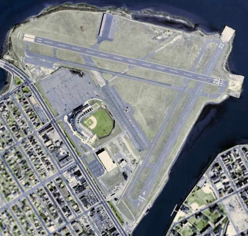
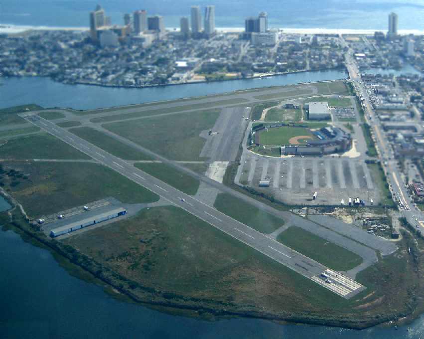
A 2002 aerial photo showed that the track along the southern part of the airport land had been removed,
but just to the north a minor-league baseball stadium had been built,
taking over even more of the airport property for non-aviation purposes.
A total of only 3 light aircraft were visible parked outside on the airport's ramp.
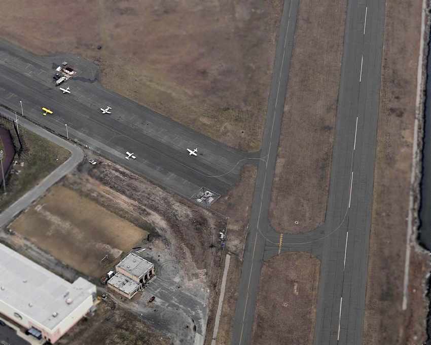
A circa 2005 aerial view looking north at Bader's ramp,
showing a small number of single-engine aircraft parked in front of a mere trailer which served as the only terminal building by that point.
Dan Ford observed in 2005, “The airport is in rough shape.
I made several calls on UNICOM for a traffic & wind report, however there was no response.
As soon as the gear was on the ground there was a call from the UNICOM asking if we needed gas or a taxi.
I would have liked to talked to him 10 minutes prior to that!
Otherwise, it was very nice being close to the boardwalk – an easy walk to several hotels & beach.
A taxi was $8 from the boardwalk to the airport.”
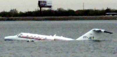
A May 2005 photo of a Cessna Citation CJ2 which ended up in the bay after overrunning the runway at Bader Field.
Ironically, an examination of the cockpit after the accident showed that the pilot had an approach plate affixed to his control column
which clearly described Bader Field as “closed to jet aircraft”.
The aircraft was registered in Denmark, and the pilot was not familiar with the field.
Bruce Payne observed in 2005, “An excellent location. Fun Runway 22 right traffic final takes you over Taj Mahal Casino.
A 15-minute walk down to the Boardwalk.”
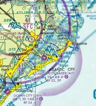
The 2006 Washington Sectional Chart depicted Bader field as having 2 paved runways, with the longest being 2,900'.
In the airport's last year of operation (2006), the FAA Airport/Facility Directory data for Bader Field
described it as having 2 asphalt runways: 2,948' Runway 11/29 & 2,595' Runway 4/22.
The field was said to have 10 aircraft based on the field (all single-engine),
and the field was said to conduct a total of 29 takeoffs or landings per day.
The remarks indicated that the field was closed to jet aircraft. South Jersey Air was listed as the Fixed Base Operator.
John Hannon recalled, “My 1st dual night cross-country included a landing at Bader.
My instructor really piqued my interest after he enthusiastically asked if I'd ever seen this historical airport.
We landed at Bader, shut down, and stretched our legs at the seemingly abandoned field.
A baseball game was being played at the stadium next door otherwise it would have been really creepy.
Soon it was time to depart from Runway 11.
We contacted Atlantic City International while still on the ground,
as Bader was a satellite airport in New Jersey's only class C airspace, and soon we were off.
A slight right turn while climbing out assured us we'd miss Bally's & Caesar's casinos as we headed toward the ocean.”
John Majane observed in 2006, “It has been announced that the City after many years has won their battle & historic Bader Field will be closed in September.
Very sad indeed the greed won over.”
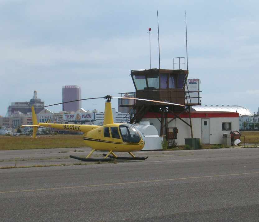
A July 2006 photo by Karl Metz of a Robinson R-44
in front of the former control tower which remained at Bader Field (though no longer used).
Karl remarked, “After hearing that Bader was going to close
my nephew John & I flew down just to say 'been there done that' before it closed.”
It was announced in August of 2006 that Bader Field would be closed in September,
when the FAA grant assurances would run out.
AOPA President Phil Boyer said, in the end "the gambling interests were stronger than the aviation interests."
Also not helping the airport's chances for future survival was the fact that the former head of the New Jersey Aviation Association, Tom Carver,
was by then the Executive Director of the Casino Reinvestment Development Authority,
which offered to pay for studies & consultants to the city to turn the airport into something else.
Local Atlantic City politicians had doomed the airport to a state of disrepair,
even to the point the city was cited by the FAA for poor repairs to Bader's runways, driving away business from the airport.
As pilots & businesses fled, says Boyer, so to went any political clout Bader Field had.
"All politics are local," said Boyer.
"A national organization like AOPA can have some influence on local politicians,
but ultimately they respond to the loudest & most influential voices among their voters."
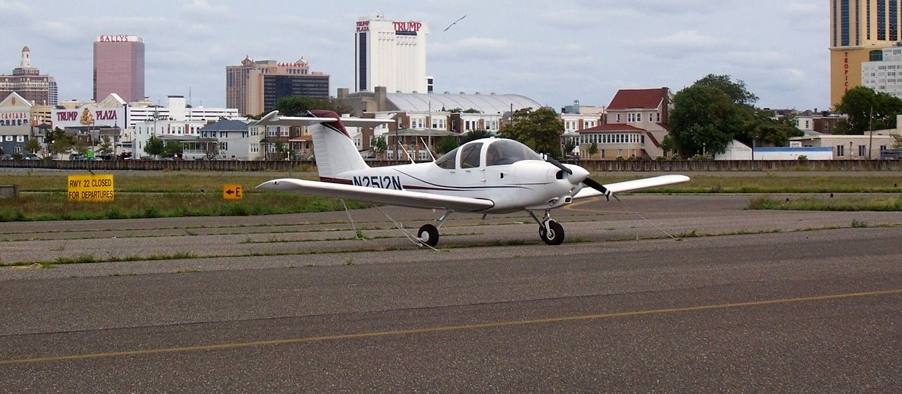
An 8/31/06 photo of N2512N, a 1979 Piper PA-38-112 Tomahawk, serial #38-79A0856, taken at Bader Field a mere month before the airport's closure.
John Hannon recalled, “After getting my private certificate, I kept telling my girlfriend that we just had to go to Bader.
I wanted her to feel the excitement of landing on that field, surrounded by so much water.
Then one day, after hearing about the pending closure, I saw the NOTAM,
stating the permanent closure would take place one minute after midnight on 9/30/06.
On September 28, we departed our home field in a rented Cessna 152,
flying down the shoreline to my last, and her first, time to Bader.
I decided to land on Runway 11 for the view of the Atlantic City skyline on final.
We had packed some hard boiled eggs & a sandwich
and ate them near the spot where my instructor & I had parked a couple years before.
A Skyhawk landed a few minutes after us, but the pilot did not exit his craft.
There was no ballgame this time and even though it was daytime, the place was lonely.
It was not long until the Skyhawk departed & 10 minutes later we decided to do the same.
It is always hard for pilots to see the loss of another general aviation airport.
Being a member of the Civil Air Patrol & knowing this was the birthplace of our fine organization made this one even harder.”
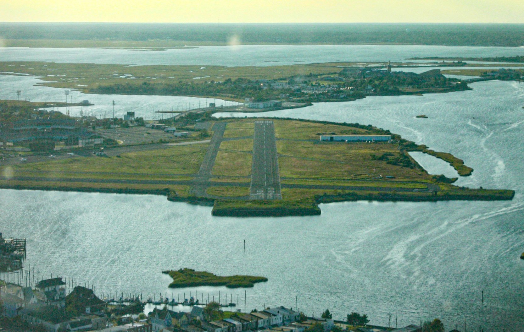
A 9/28/06 aerial view by Gregg McAdams, looking west from final approach to Bader Field's Runway 29, on the last day of Bader Field's fixed-wing flight operations.

A 9/28/06 photo of Gregg McAdams's Piper PA28 landing at Bader Field on the last day of the airport's fixed-wing flight operations, with the Trump Taj Mahal & other casinos in the background.
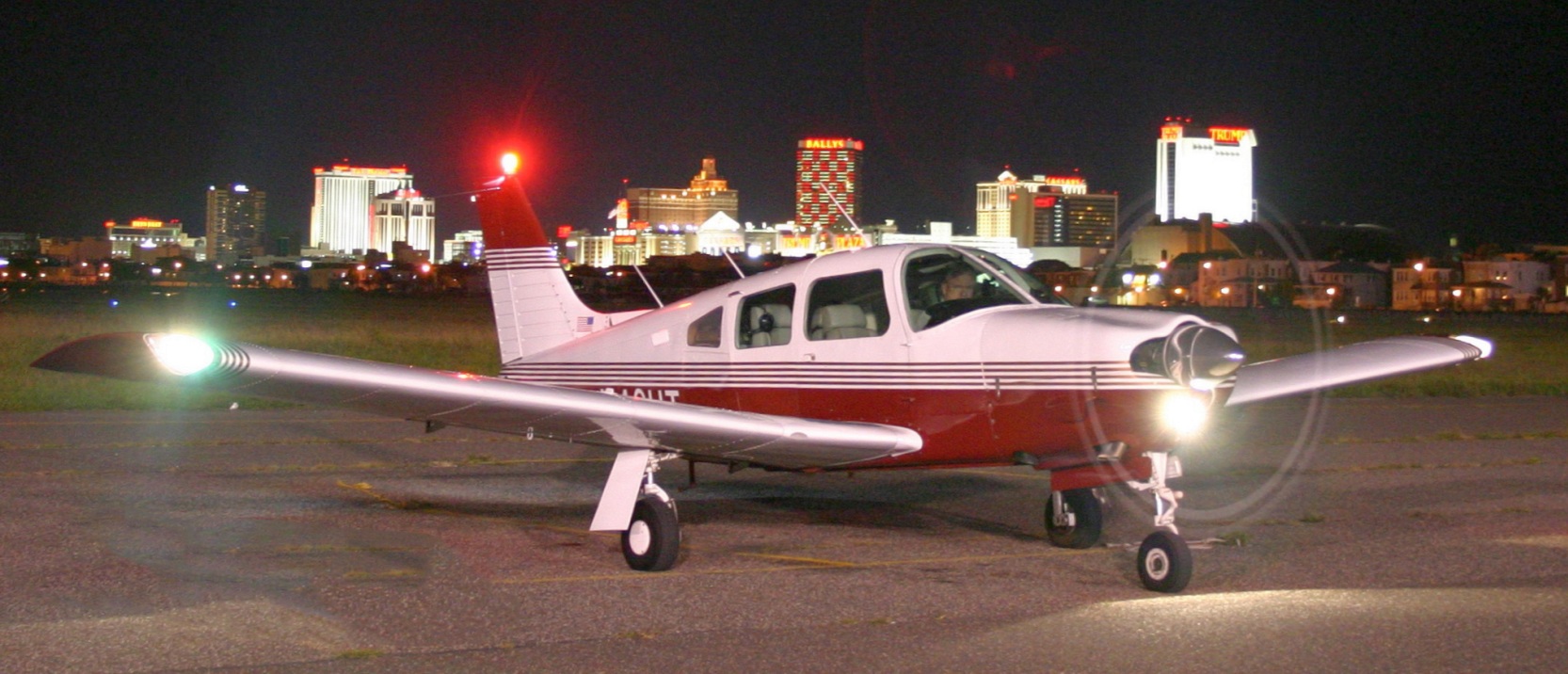
A 9/28/06 photo of Gregg McAdams in N46UT, his 1973 Piper PA-28R-200, preparing to depart Bader Field, with the casinos in the background.
A 9/30/06 aerial view by Jeff Doran looking southeast at Bader Field.
Jeff observed, “At approximately 1pm, you can see City crews have already stripped the runway numbers,
in preparation for the big yellow 'X'.”
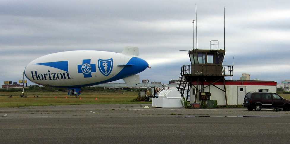
The last photo which had been located of an aircraft at Bader Field was a 10/5/06 photo of a Horizon advertising blimp behind the control tower.
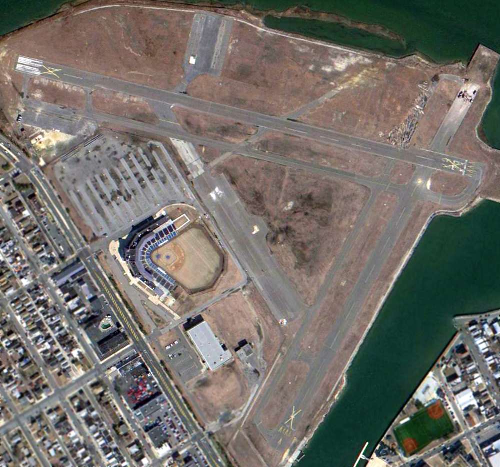
A 2/24/13 aerial view shows that 7 years after Bader Field was closed, absolutely nothing has been done to redevelop the property.
Local government officials were in such a hurry to close the airport, yet the property sits completely idle,
with all of the aviation infrastructure intact yet wasting away.
Anton Sederquist remarked, “It's quite maddening.
It seems as if all they (Atlantic City municipal government) have done to the place since closure is mark the runways with the big yellow X's.”
A 2013 photo (courtesy of Jim Valvo) of the Bader Field control tower, restored & on display in the nearby NAS Wildwood Museum.
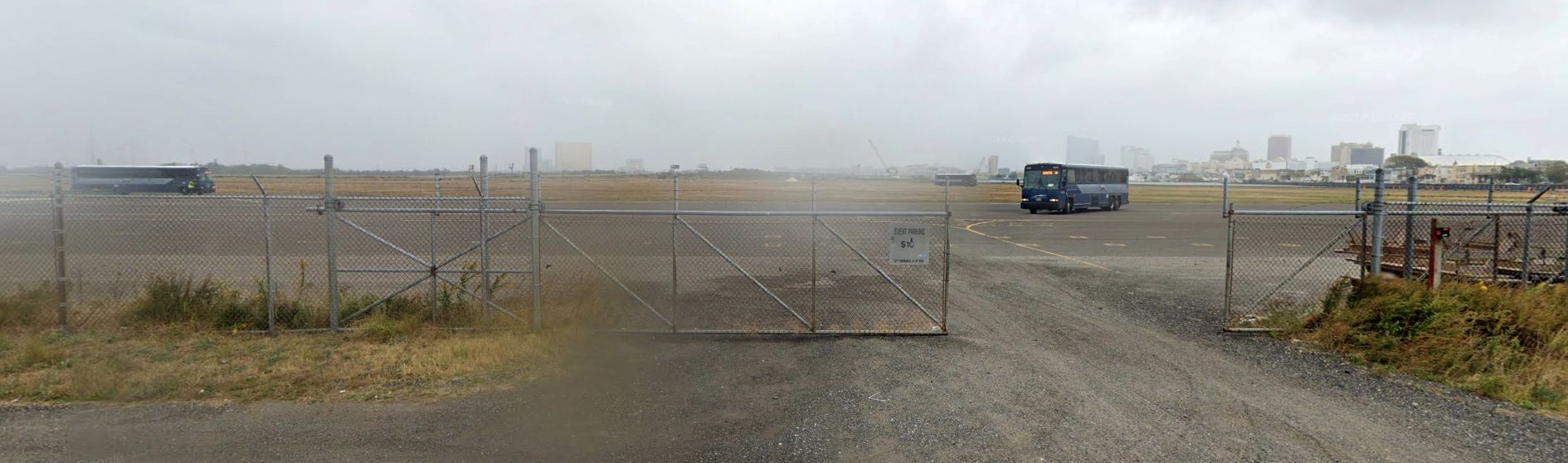
A 2019 photo looking northeast at Bader Field's ramp.
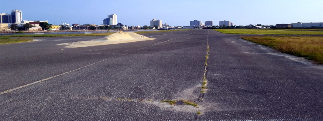
An 8/2/19 photo by Steve Boggess looking south along Bader Field's former Runway 22.
Steve reported, “I drove on the old taxiways & parts of the old runways to get the shots, and the ride was pretty smooth, at least at 10-15mph, so I would imagine they would work in an emergency.”
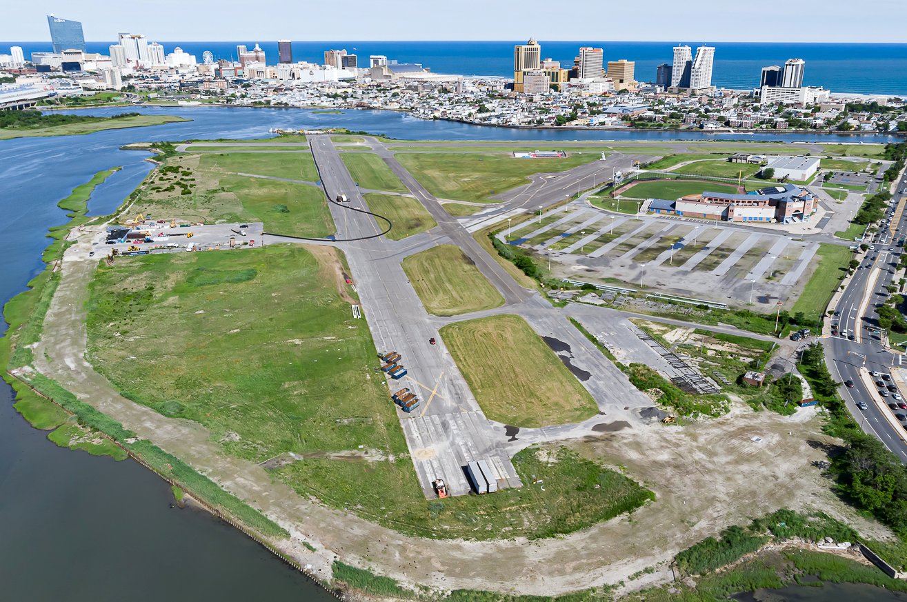
A June 2021 aerial view by Chris Gimmillaro looking southeast at Bader Field.
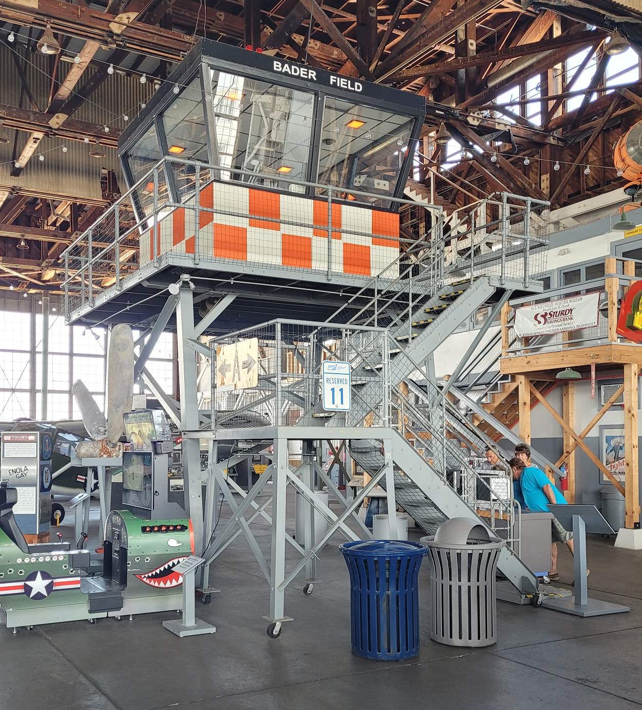
A 7/31/21 photo by Steven Boggess of the Bader Field control tower, restored & on display at the NAS Wildwood Museum.
Bob Jarvis reported in 2020, “It’s a shame it sits there decaying & they can’t figure out that the best use for an airport is as an airport.”
____________________________________________________
Forked River Airport, Forked River, NJ
39.84, -74.17 (Northeast of Atlantic City, NJ)
Forked River was depicted as an auxiliary airfield on the October 1933 Washington Sectional Chart.
The date of establishment of this small general aviation airport has not been determined.
A 1931 aerial photo depicted an open grass field with several small buildings on the west & south sides,
which could have been the start of the airport.
Forked River was not yet depicted on the May 1932 Washington Sectional Chart,
nor listed among active airfields in The Airport Directory Company's 1933 Airport Directory (according to Chris Kennedy).
The earliest depiction which has been located of Forked River Airport was on the October 1933 Washington Sectional Chart.
It depicted Forked River as an auxiliary airfield.
The 1934 Department of Commerce Airport Directory (courtesy of Chris Kennedy)
described Forked River as a commercial auxiliary airport,
consisting of a rectangular 2,000' x 1,000' sod field.
A hangar was said to be marked with “Forked River”.
The 1935 Washington Sectional Chart depicted Forked River as a commercial/municipal airfield.
According to Karl Metz, “In the early 1900's Forked River was a sporting destination for people from NY & PA who like to hunt & fish.
Walking distance from the airfield was Eno's Hotel & Casino.”
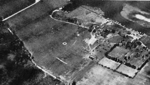
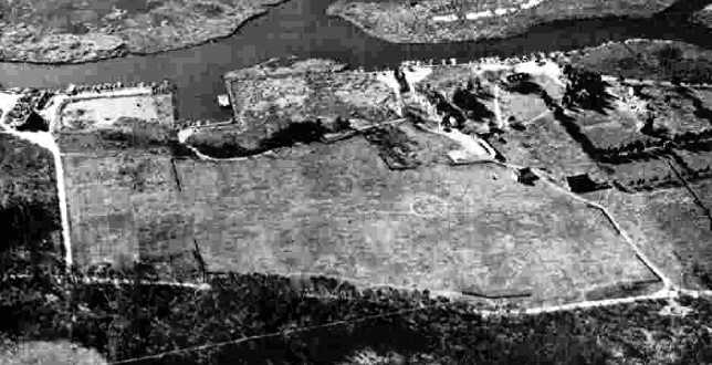
An aerial view of the Forked River Airport, from The Airport Directory Company's 1937 Airports Directory (courtesy of Bob Rambo).
The directory described Forked River as a commercial airport, consisting of a 35-acre rectangular sod field,
measuring 2,500' east/west by 1,000' north/south.
A single hangar was pictured, which was said to be marked with the airport's name.
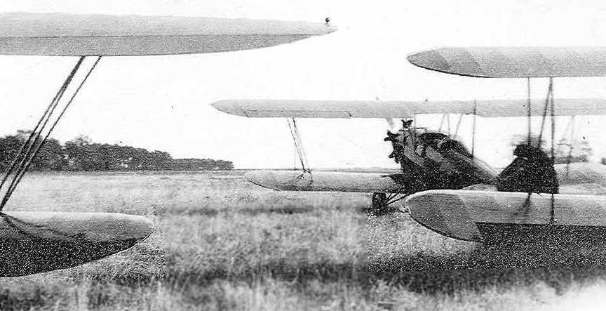
An undated (circa 1930s?) photo of several (unidentified) biplanes at Forked River Airport (courtesy of Karl Metz).
“The airplanes look to be facing east towards Barnegat Bay.”
A 12/2/40 aerial view looking south from the 1945 AAF Airfield Directory (courtesy of Scott Murdock)
depicted Forked River Airport as an open grass field.
A 1940 aerial photo depicted Forked River Airport as an irregularly-shaped grass field with an airport circle marking,
and what appeared to be a hangar with lettering on the roof on the west side.
The April 1944 US Army/Navy Directory of Airfields (courtesy of Ken Mercer)
described Forked River Airport as having a 2,500' unpaved runway.
The 1945 AAF Airfield Directory (courtesy of Scott Murdock) described Forked River Airport
as a 38 acre irregularly-shaped property having an all-way sod field measuring 1,200' north/south.
The field was said to have a single 60' square wood & tile hangar,
and to be owned by private interests, but not currently in operation (it may have been temporarily closed during the war).
The article “Lacey Township: A brief history” from the 12/20/01 issue of the Asbury Park Press
said “The Forked River Airport was opened in 1945”,
but this may have meant the field re-opened after WW2.
Forked River was depicted as an auxiliary airfield on the 1945 Washington Sectional Chart (courtesy of John Voss).
The 1947 Washington Sectional Chart depicted Forked River as having an 1,800' unpaved runway.
The runway may have been slightly lengthened within the next 2 years,
as the October 1948 Washington Sectional Chart (according to Chris Kennedy)
depicted Forked River as having a 2,000' unpaved runway.
The 1948 USGS topo map depicted an open clearing & several buildings at the location of Forked River Airport,
but did not label the site as an airfield of any kind.
Karl Metz recalled, “The Hotel burned down in July of 1952 & the Casino later was turned into the Captains Inn Restaurant.
It is my understanding that the airfield was also used for mosquito spraying.”
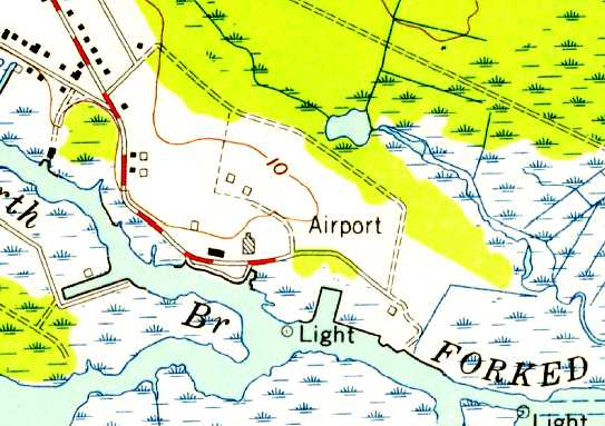
The 1953 USGS topo map depicted Forked River as an open area with 2 buildings along the west side, labeled simply as “Airport”.
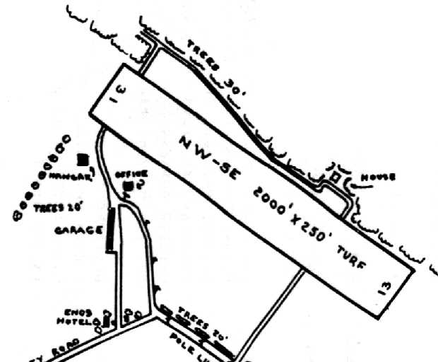
The 1955 NJ Airport Directory (from Hugh Hamill, courtesy of Harry Silvers) depicted Forked River Airport as having a single 2,000' turf Runway 13/31,
with a hangar & office on the west side.
It listed the operator & manager as Dan Shargas.
A 1956 aerial photo depicted Forked River Airport as an irregularly-shaped grass field with an airport circle marking, and a hangar on the west side.
A northwest/southeast runway trace was visible in the center of the airfield.
The 1957-58 Aviation Week Airport Directory (courtesy of Chris Kennedy) described Forked River as a public-use airport,
having a single 2,000' unpaved runway, oriented northwest/southeast.
The field was said to offer storage, minor repairs, and fuel, an the manager was listed as Dan Shargas.
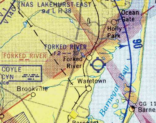
The last depiction which has been located of Forked River as an active airport
was on the August 1957 Washington Sectional Chart (courtesy of Chris Kennedy).
It depicted Forked River as having am 2,000' unpaved runway.
A hand-written note on the 1955 NJ Airport Directory (from Hugh Hamill, courtesy of Harry Silvers)
indicated for Forked River Airport: “10/1/58 closed until further notice.”
A 12/14/59 USGS aerial view depicted Forked River Airport as having a northwest/southeast unpaved runway.
According to Karl Metz, “I believe the airfield was closed in the 1950s or 1960s,
not to long after that the state of NJ determined that it was a Superfund clean up site from the DDT used in spraying.”
The Forked River Airport was no longer listed among active airfields in the 1960 Jeppesen Airway Manual (according to Chris Kennedy),
listed in the 1962 AOPA Airport Directory.
However, the airport evidently continued to operate, as a 1963 aerial view depicted 3 single-engine aircraft parked around the hangar on the west side.
The runway also appeared to have a narrow paved strip running down its middle.
The Forked River Airport was not depicted at all on the 1964 Washington Sectional Chart.
According to Richard Kenyon, “While Forked River was officially abandoned,
there were spraying operations based there as late as 1965.
I vividly recall a photo in the now-defunct Newark Evening News of a spray biplane
that ended up inverted as a result of a 'wind gust' encountered on landing.
The wheels were pointed skyward, but, as I recall, the article noted that no one had been injured in the accident.
However, I was out that same evening in a Myers OTW, dicing with the 3 sprayers in a mock dogfight over Monmouth County before they broke off,
probably due to low fuel, and headed to the airport.”
A 1972 aerial view showed that the hangar had been removed at some point between 1963-72, but the runway remained intact.
The 1973 USGS topo map no longer labeled the property as an airport.
A 1986 aerial photo showed that trees were encroaching on the former runway.
In 1998, the former airport property was reopened as Eno's Pond County Park.
Karl Metz reported in 2005, “Some of the park's walking trails have broken-up concrete on them, part of which I was told are the old runway.”
In a 9/21/10 aerial photo, the paved trail which runs from the northwest to the southeast is the remnant of the Forked River runway.
According to an EPA document, the location of the Forked River Airport was northeast of the present-day intersection of East Lacey Road & Port Street.
____________________________________________________
Manahawkin Airport (72N), Manahawkin, NJ
39.7, -74.28 (Northeast of Atlantic City, NJ)
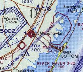
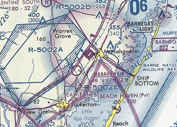
Manahawkin Airport, as depicted on the 1970 Washington Sectional Chart (courtesy of John Clifford).
This general aviation airport was located southeast of the intersection of the Garden State Parkway & Route 72.
The Lakeside Speedway was adjacent to the west side of the airport.
Manahawkin Airport was apparently built at some point between 1956-63,
as a 1956 aerial view showed nothing at the site except forest.
The earliest depiction of Manahawkin Airport which has been located was a 1963 aerial view.
It was evidently taken while the field was still under construction,
as it depicted a clearing having been built for a single northeast/southwest runway, but it did not depict any other improvements.
Lee Oldershaw recalled, “Manahawkin Airport was first known as the Manahawkin Fly-In-Drive-In & was a 3,000' dirt strip with a hump in the middle.
It was active as early as 1963. There was a drive-in theater adjacent to it & you could park at the rear of the theater & watch the movie from your cockpit.
It had no lights but the diner adjacent to the highway flew an illuminated American flag to show wind direction.
When landing at night with your landing light it was proper to make a low pass first to make sure nobody was parked over the hump in the middle to the southwest necking.
Departing after the movie required the same caution.”
Manahawkin Airport was not yet depicted on the 1967 Washington Sectional Chart (courtesy of Mike Keefe)
or in the 1968 Flight Guide (courtesy of Robert Levittan).
The earliest aeronautical chart depiction of Manahawkin Airport which has been located
was on the 1969 Washington Sectional Chart (according to Chris Kennedy),
which described Manahawkin as having a 3,200' unpaved runway.
According to Manahawkin resident Jim, Manahawkin Airport has been in existence since at least the late 1960s.
According to Bob Zambelli, "I used to fly into the Manahawkin Airport to visit friends on Long Beach Island.
Within seconds after arrival, a little old lady would show up to collect the fee!"
The 1970 Washington Sectional Chart (courtesy of John Clifford) depicted Manahawkin as having a single 2,700' paved runway.
The 1972 Flight Guide (according to Chris Kennedy) described Manahawkin Airport as having a single 2,700' paved Runway 4/22,
with displaced thresholds on both ends of the runway.
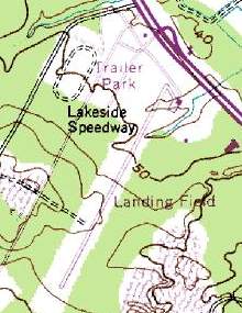
The 1972 USGS topo map depicted Manahawkin
as having a small parking apron & a single building at the northern end of the runway.
A 1972 aerial photo depicted Manahawkin as having a single paved northeast/southwest runway,
with a taxiway leading to a ramp with a single hangar on the northeast side.
There were no aircraft visible on the field.
An undated aerial view looking northwest from the 1979 NJ Airport Directory depicted Manahawkin Airport as having a single 2,735' asphalt Runway 4/22,
with a taxiway leading to a ramp with a hangar on the northeast side.
The manager was listed as Jack Powell.
The last aeronautical chart depiction which is available showing Manahawkin Airport
was on the March 1981 Washington Sectional Chart (courtesy of Ron Plante).
It depicted Manahawkin as having a 2,700' paved runway.
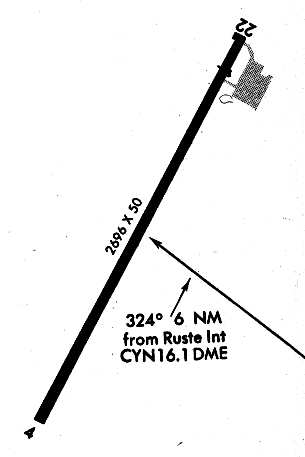
Manahawkin Airport, as depicted on a 1986 Approach Plate (courtesy of John Clifford).
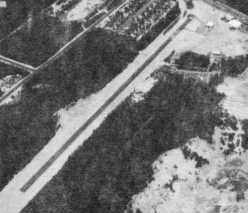
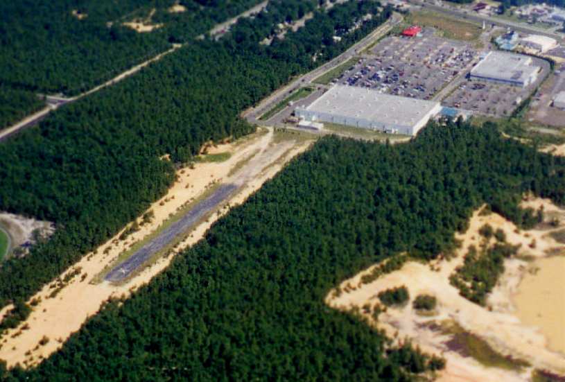
A 8/11/87 aerial view looking northeast by Charles Findeisen (courtesy of Harry Silvers)
showed Manahawkin Airport to have 10 light aircraft parked on the northeast side of the little airport.

The last photo which has been located showing Manahawkin Airport still in operation
was an undated aerial view from the 1991 NJ Airport Directory (courtesy of Harry Silvers).
The directory described Manahawkin as having a single 2,720' asphalt Runway 4/22, and listed the manager as Gym Wilson.
Manahawkin Airport was still depicted as an active airfield on the 1991 Washington Sectional Chart (courtesy of Mike Keefe).
The Manahawkin Airport property was sold at some point between 1991-93 to build a Wal-Mart.
It was no longer depicted at all on the 1993 Washington Sectional Chart (courtesy of Mike Keefe).
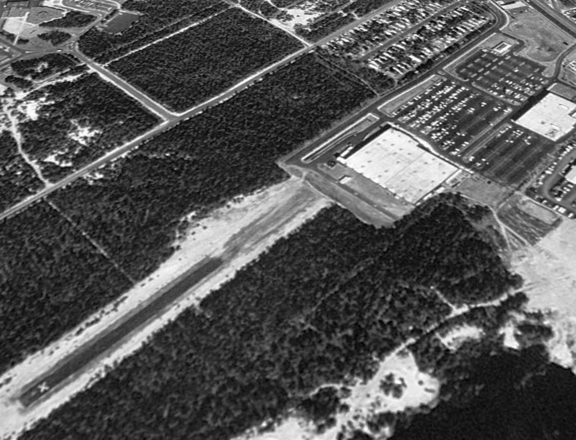
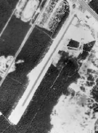
A 1995 USGS aerial view looking northwest showed the northern end of the Manahawkin Airport runway had been obliterated by the Wal-Mart building & parking lots,
but a 1,300' portion of the runway pavement still existed at the south end (complete with a closed runway "X" marking).
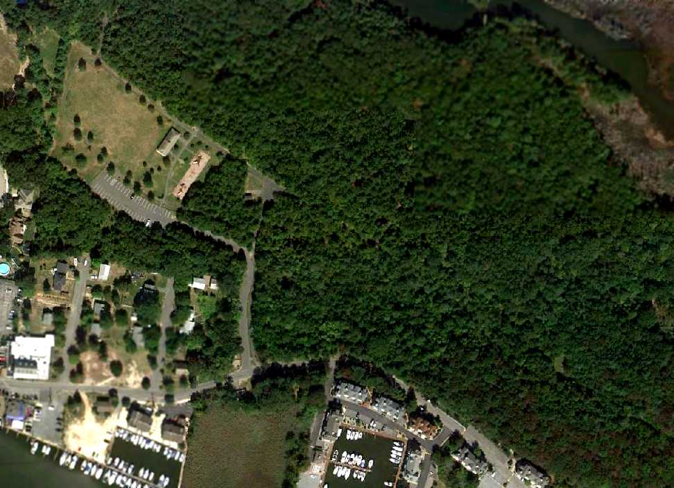
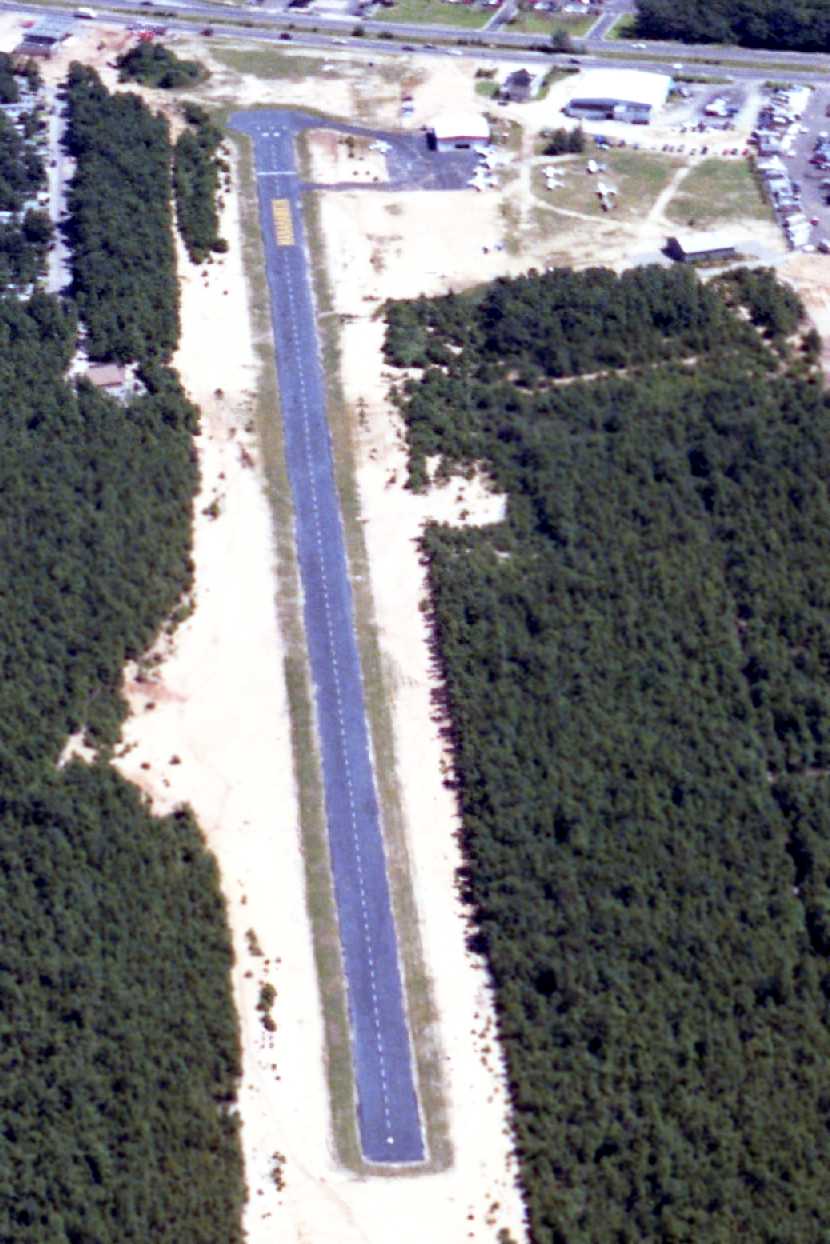
A 1997 aerial view looking north at the sad remains of Manahawkin Airport by Philip Kineyko.
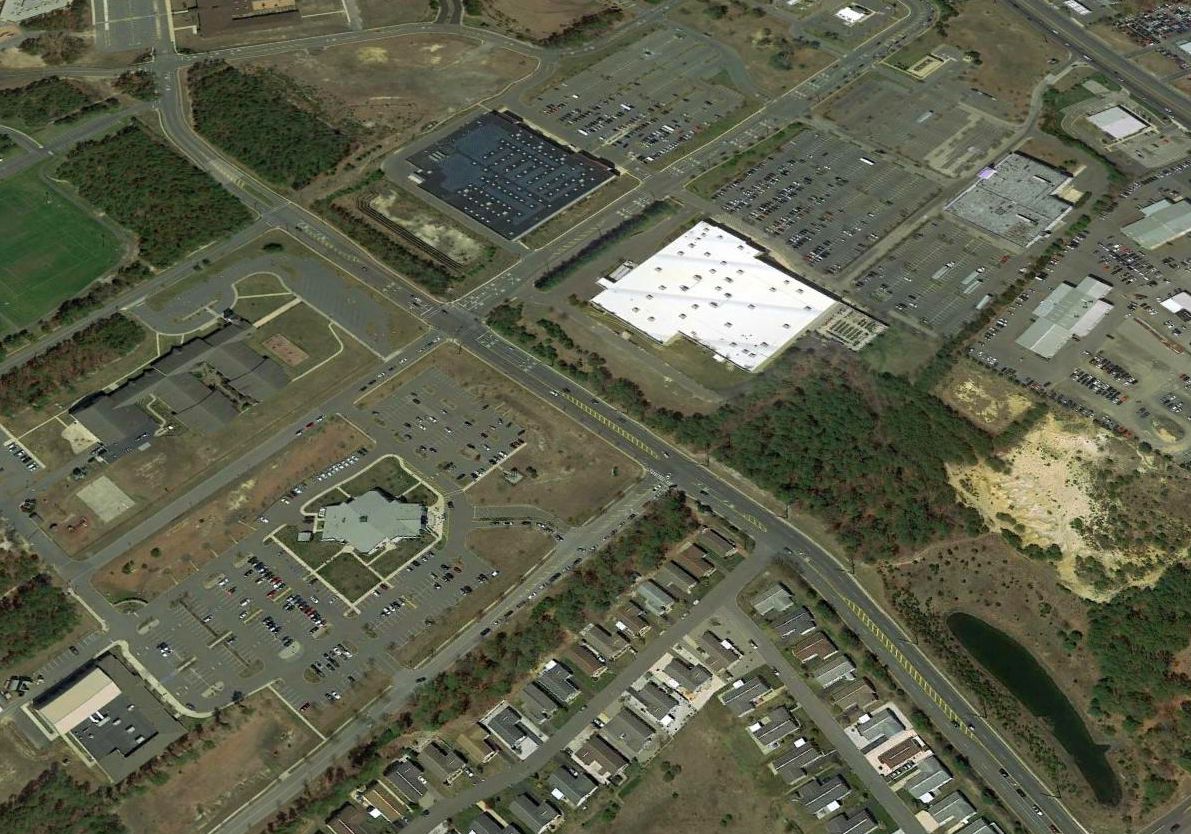
A 2016 aerial view looking northwest showed McKinley Avenue had been built over the middle of the Manahawkin Airport site,
and buildings had covered the southern portion, erasing the last trace of the little airport.
____________________________________________________
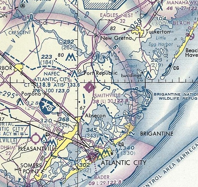
Smithville Airport (3N9), Smithville, NJ
39.49, -74.47 (Northeast of Atlantic City International Airport, NJ)
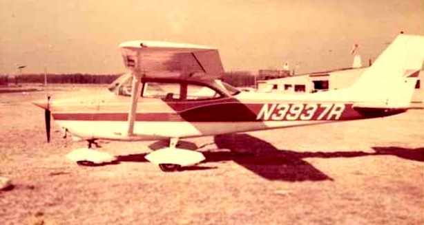
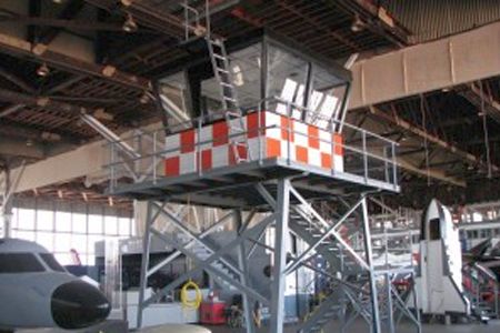
A circa 1968-70 photo of Leonard Scull's Cessna 172 at Smithville Airport (courtesy of Aidan Brainard).
Note the hangar in the background with the observation platform.
Yet another vanished New Jersey general aviation airport, replaced by more houses.
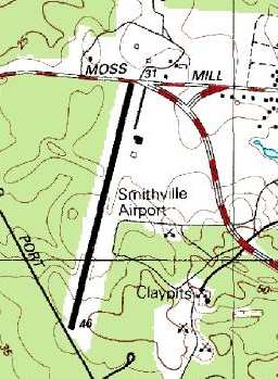
Smithville Airport was located southeast of the intersection of East Moss Mill Road & Old Port Republic Road.
Smithville Airport was apparently built at some point between 1963-69,
as a 1963 aerial view showed nothing at the site except forest.
Smithville Airport was not yet depicted on the 1967 Washington Sectional Chart (according to Mike Keefe).
Paul Thorn recalled, "I flew over it when it was being built with my uncle, back about I think 1965-68."
Smithville Airport was not yet depicted in the 1968 Flight Guide (courtesy of Robert Levittan)
or on the 1969 USGS topo map.
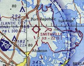
The earliest aeronautical chart depiction of Smithville which has been located
was on the 1969 Washington Sectional Chart (according to Chris Kennedy),
which depicted Smithville Airport as having a 2,200' unpaved runway.
The 1970 Washington Sectional Chart (courtesy of John Clifford)
depicted Smithville Airport as having a 2,200' unpaved runway.
A 1970 aerial view depicted Smithville as having a single unpaved northeast/southwest runway
and a half-dozen light aircraft & one small building along the northeast side.
A closeup from the 1970 aerial view showed the Smithville hangar,
with a dozen light aircraft parked along the northeast side of the runway.
Aidan Brainard recalled of Smithville, “My grandfather (Leonard Scull) was taught to fly at this airport by Wayne Kiser.
Through the Cessna dealership, he purchased two new planes:
a 172 purchased in 1971 and then a 177 in 1975 or early 1976.
My love of flying was developed at this airport.
I remember the small friendly feel of the place and have distinct memories of flying to & from the airport
or doing touch & go practice with my PopPop.”
Smithville's runway was apparently paved at some point between 1970-72,
as the 1972 NJ Airport Facilities Map (courtesy of Ed Drury)
described the "Smithville Inn" Airport as having a 2,200' paved runway.
It was apparently operated in conjunction with the Smithville Inn, a nearby historic restaurant.
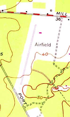
The 1972 USGS topo map depicted Smithville as having a single northeast/southwest runway, labeled simply “Airfield”, and a single small building on the northeast side.
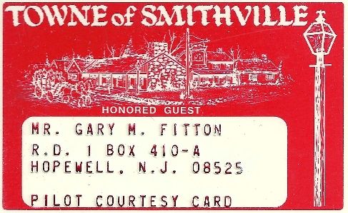
A circa 1970-75 Pilot Courtesy Card from the Towne of Smithville (courtesy of Gary Fitton).
Gary recalled, “The Smithville Inn had courtesy cards available to pilots, since the airport was right next door.
You showed your card to the receptionist and you were pretty much guaranteed immediate seating, line or no line.”
According to Paul Thorn, "In 1973 I went to work at the airport as an all-around worker,
fueling planes, cutting grass, driving people down to the Smithville Inns in a small bus, an ex-jitney from Atlantic City.
The airport was originally owned by Fred & Ethel Noyes,
who also owned the Historic Towne of Smithville,
which at the time had three large restaurants, and many small village shops.
A lot of people, especially on weekends, would fly into the airport,
and then go down to the village to eat at one of the restaurants.
We would take them down & pick them back up in the small bus.
The town was about a mile from the airport on US Route 9."
Thorn continued, "The airport was managed by Wayne Kiser,
and had a Cessna Pilot Center for flight training,
and also was a Cessna dealer selling airplanes.
The training fleet consisted of a 1972 Cessna 150, a 1973 Cessna 150,
and if memory serves me right, a 1973 Cessna 172.
The managers owned a Cessna Cardinal 177, which was also used for training."
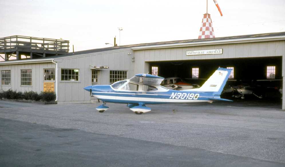
Thorn continued, "The building that has Smithville painted on it was a hangar, offices, and work shop,
with an observation deck on the top of the roof.
I met my now ex-wife there, she was the airport secretary.
There was a full time flight instructor on duty, a mechanic for doing annual inspections,
and the manager, Wayne Kiser was an FAA flight examiner with whom you could take your check ride.
Hard to believe, but I learned to fly during this time for $3 / hour, the cost of the fuel for the plane at that time.
This was just before the 1970s gas crunch hit, and avgas was still very cheap.
I left the airport for another job about late 1974, but returned months later to work there once again.
The date is fuzzy in my memories, but either during the time I left, or just after,
ABC Television bought the Towne of Smithville which included the airport, for $7 million,
which at the timed seemed like a lot of money."
Thorn continued, "My boss Wayne Kiser had also bought a Cessna C402 about a year before ABC bought the airport,
and started using it for charter work, especially flying ABC executives around,
and performers who performed at the summer theater which was located next to the airport in the large fields.
I can remember him flying Barbra Eden in for a performance, also Joel Grey."
Thorn continued, "When the C402 was purchased,
a new steel hangar was put up next to the main hangar to keep the C402 in.
We had an Exxon fuel truck, and fuel pumps, and carried 80 octane & 100/130 octane fuel.
This was before 100LL came into being."
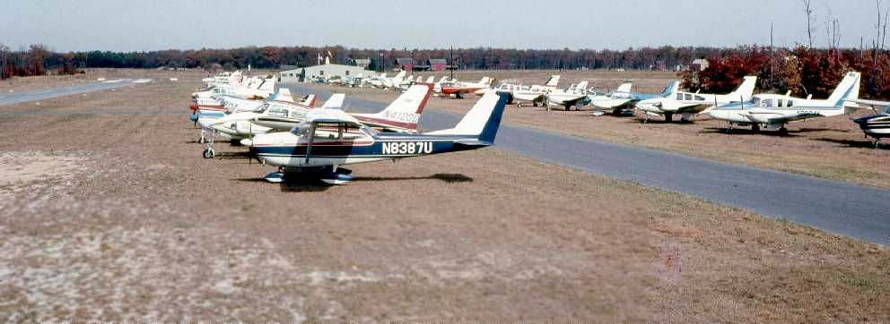
A 1974 photo by Paul Thorn, “of all the planes parked was a day when we had a fly-in” at Smithville.
A 1974 photo by Paul Thorn, of a Cardinal in front of Smithville's hangar.
A Beechcraft Sierra had an accident at Smithville on 7/23/75 (according to the NTSB).
Paul Thorn, recalled, “A Beechcraft Sierra landed long,
far down the runway, ran out of runway, and when he got to the wire fence separating the road from the airport property,
the plane tried to go through it, but the right wing was torn off,
and the plane stopped with it's nose sticking out on the road.
I jumped in the fuel truck, and drove down to the end of the airport & to the plane.
The pilot was OK, along with his 3 passengers.
The bad part was that his friend had loaned him the plane for the day,
because this pilot's plane was in the shop.
The owner of the wrecked plane was the ABC Television's science editor, Jules Bergman,
who used to be on TV a lot
As I remember, we put the wrecked plane in the hangar, ordered a new wing, and repaired it."
Paul continued, "The friendly atmosphere of the airport seemed to change after ABC bought it.
My boss was always more on edge, we never knew what ABC corporate head would fly in for lunch or dinner.
It was also during this period or shortly after, that the runway was extended on both ends,
I believe to better accommodate the C402's landings & takeoffs.
During my time there, we would have about 10 students learning to fly at any given time,
also about 4 planes kept in the hangar, and about 8 or 9 tied down outside.
On a clear Sunday in the summertime, we could have upwards of 70-100 transient planes come & go to eat dinner.
Paul continued, "The airport had a free VASI system put in by the FAA
in return for allowing use of the airport for experimenting in painting touchdown markers on the runway.
I can remember that the FAA would fly approach after approach in a Cherokee 140 or 180 with a paint trial on the runway,
then have it erased, and start over again with a new painted touchdown markers.
The airport was very close to the Atlantic City International Airport,
that houses the National Aviation Facilities Experimental Center.
Thus I believe this is why they wanted to use Smithville Airport.
It was close to home base, about 8 miles."
Paul continued, "Runway lights were added before I went to work there by a friend of my family, named Elliot Johnson.
He was a electrician/contractor, and donated the lighting system.
He used to commute a lot from Virginia to the airport, and wanted lights for when he arrived late at night.
I left the airport for better work in about 1975, and lost touch with it's demise after that."
A July 1977 aerial view by Jack Kenton looking northwest at Smithville Airport.
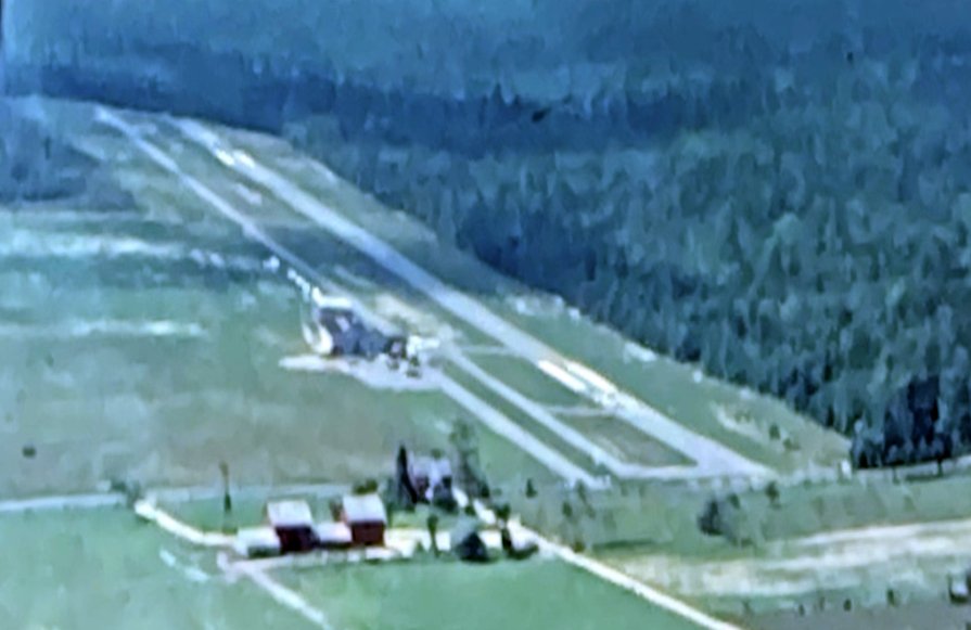
A July 1977 aerial view by Jack Kenton looking southwest at Smithville Airport.
The last aeronautical chart depiction which has been located of Smithville Airport was on the March 1978 Washington Sectional Chart (courtesy of Ron Plante).
It depicted Smithville as having a single 3,000' paved northeast/southwest runway.
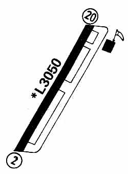
The 1979 Flight Guide (courtesy of Chris Kennedy) depicted Smithville as having a single 3,050' paved Runway 2/20,
and a parallel taxiway on the east side.
A single building (a hangar?) was depicted on the northeast corner of the field.
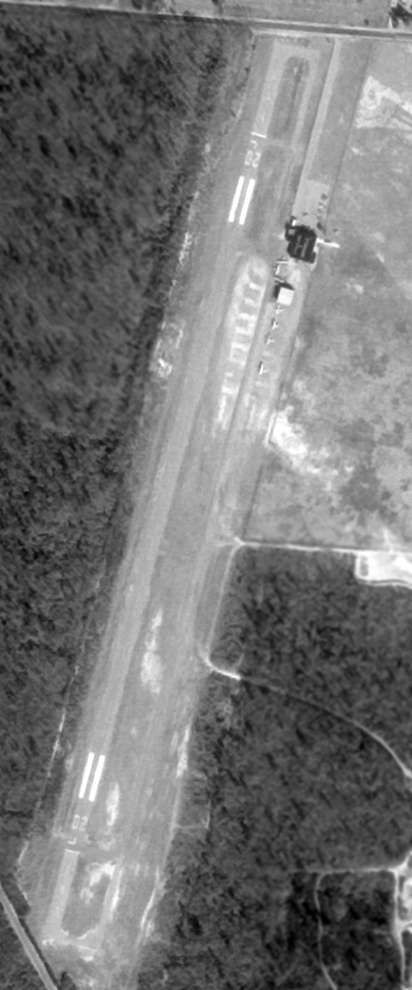
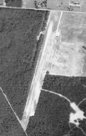
The last photo which has been located showing Smithville Airport still intact was a 2/13/81 USGS aerial view.
The airport's closure had presumably already been announced by that point, as the number of aircraft visible on the field had markedly dropped to only 5.
Mark Maxwell, recalled, “In 1980 my wife wanted to go out to Smithville because the weather was nice & we could let our 3-year old son feed the ducks & geese by the lake.
We were headed home past the Smithville Airport & noticed an airplane sitting by the field office & the sign about air tours.
Of course a 3-year old wants to see the plane so we drove in to the office & asked how much a flight cost.
We had spent most of our cash at the town, so I only had enough for one of us to go (Mark Jr. was free).
They couldn't accept credit cards because it was their last day of operation before closing for good.
The pilot said, 'You know, this will be the last flight out of here before I take my plane to another airport, so tell your wife she can go along too... no extra charge!'
So we got into the last paying flight from Smithville Airport for a 20 minute tour of the bay & see Atlantic City from the air.”
The Smithville Airport was evidently closed by 1981, as the 1981 USGS topo map labeled it "Airfield (Abandoned)"
and it was depicted as an abandoned airfield on the March 1981 Washington Sectional Chart (courtesy of Ron Plante).
As still depicted on the 1995 USGS topo map, the airfield consisted of a single 3,000' runway,
with 2 buildings (hangars) northeast of the runway.
Aeronautical charts from the late 1990s didn't depict Smithville Airport at all (even as an abandoned airfield).
Darrell Stark recalls that "There were many times in the past that I would bicycle by the airport...
ride down the runway & explore the abandoned buildings."
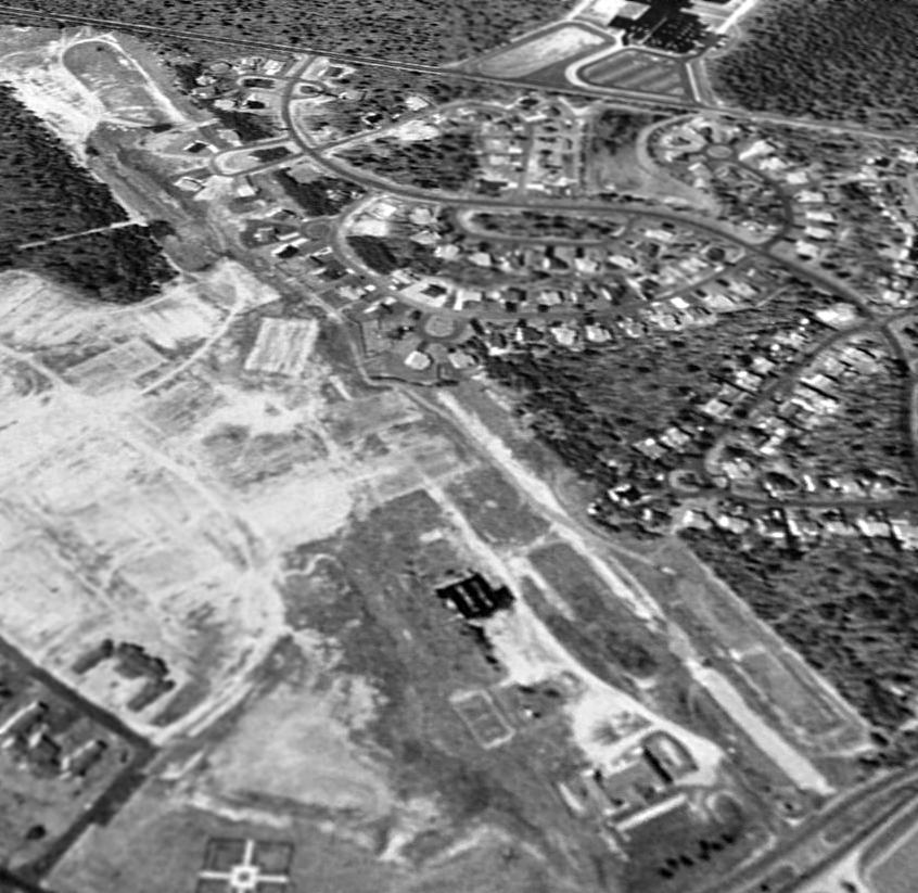
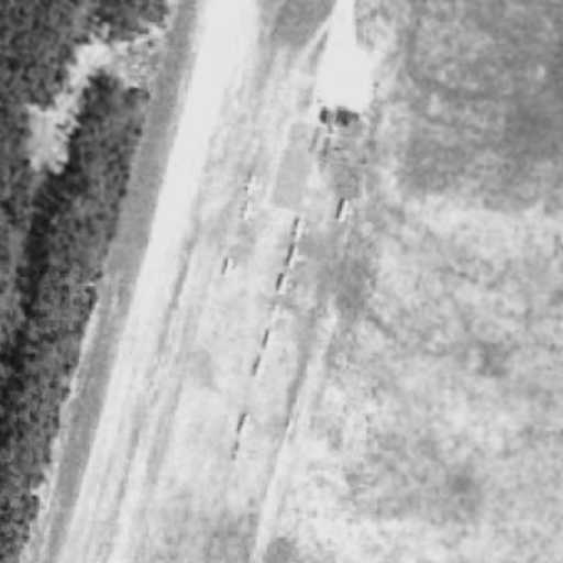
In a 1995 USGS aerial view looking southwest, a housing development had already covered the middle portion of the former Smithville Airport runway,
but recognizable portions of the runway still remained at the north & south ends.
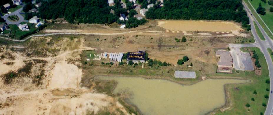
In a 1997 aerial photo (by Philip K.) of the north end of the former Smithville Airport, only traces of the former runway were still apparent,
but the hangar still stood, with "Smithville" still painted on both sides of the roof. How sad.
Paul Thorn observed, "I now go to a doctor whose office is down the street past the site of the now vanished Smithville Airport.
It makes me sad to see homes sitting on the spot that was the runway.
You would never know that an airport used to be there, unless you're familiar with the past of the area."
A circa 2001-2005 USGS aerial photo shows that the site of the former Smithville Airport
has been thoroughly covered with houses & a recreation center,
and the former hangar has been removed – leaving not a trace of the former airport.
____________________________________________________
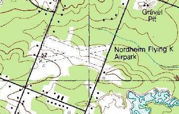
Pleasantville - Somers Point Airport / Nordheim Flying K Airpark (1N6), Cardiff, NJ
39.39, -74.61 (Southwest of Atlantic City International Airport, NJ)
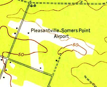
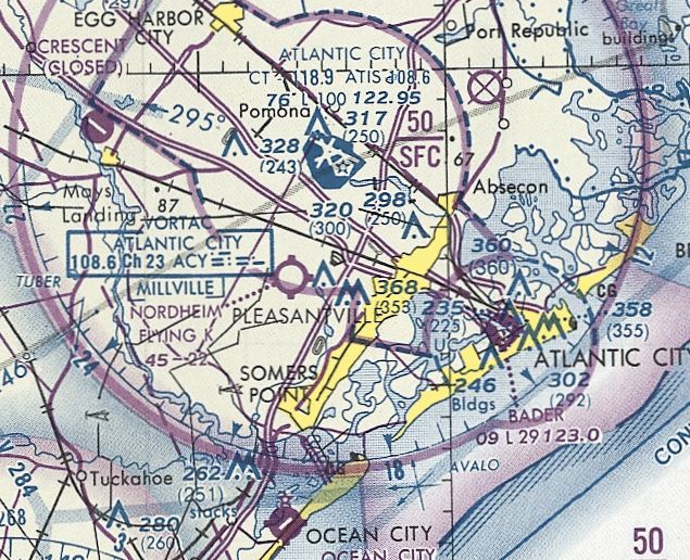
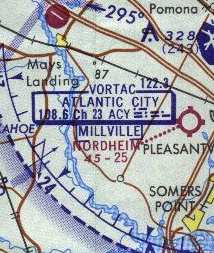
Pleasantville - Somers Point Airport, as depicted on the 1952 USGS topo map.
This general aviation field was located just the south of the Atlantic City NAS / International Airport.
It was apparently built at some point between 1931-51, as it was not yet depicted on a 1931 aerial photo.
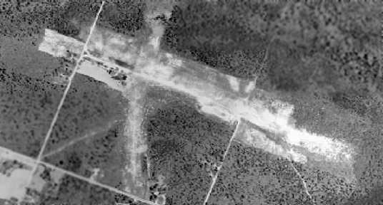
The earliest depiction which has been located of Pleasantville - Somers Point Airport was a 1951 aerial photo.
It depicted a single unpaved southeast/northwest runway, with a small hangar & 3 single-engine planes on the south side.
Pleasantville - Somers Point Airport was not yet depicted on the January 1952 Washington Sectional Chart.
The earliest depiction which has been located of Pleasantville - Somers Point Airport was on the 1952 USGS topo map.
It depicted Pleasantville - Somers Point Airport as having 2 unpaved runways.
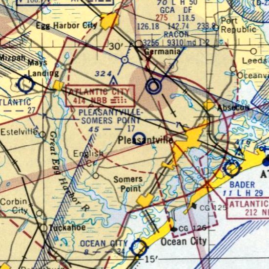
The earliest aeronautical chart depiction which has been located of Pleasantville - Somers Point Airport was on the July 1952 Washington Sectional Chart.
It depicted "Pleasantville - Somers Point" Airport as having a 1,700' unpaved runway.
The 1955 NJ Airport Directory (courtesy of Harry Silvers) depicted Pleasantville Somers-Point Airport as having 2 sod runways,
and listed the operator & manager as Clarence Egan.
Paul Thorn recalled, "This is a vanished airport that is close to my heart.
I grew up 2 miles from this airport, back during the late 1950s.
I talked to my father (who is a pilot), and he puts the date of the airport being built to just after WW2.
The airport was originally owned by a man named Clarence Egan, who also built it himself."
Paul Thorn recalled, "The east/west runway was much longer than it was in later years, about 2,500' or 2,600' long.
A short north/south runway existed too.
"As far as we know, the property on the other side of the now existing Ridge Avenue,
was not owned by Clarence Egan or Knocky Knordheim, but only 'borrowed'.
Back during those days, the airport was located in a very rural area,
and people didn't seem to mind lending Clarence the extra ground for his runway.
Clarence Egan's nickname was 'Captain Egan', he was a sea captain, owning a large fishing boat in Atlantic City."
The earliest photo which is available of the Somers Point Airport is a 1957 aerial view.
It depicted the field as having a single unpaved northeast/southwest runway,
along with the beginnings of a north/south & northeast/southwest strip which had been added at some point between 1951-57.
Paul Thorn recalled, "My personal memory goes back to about 1958-59, when I was about 4 to 5 years old.
My father was a mechanic, and would do maintenance on Captain Egan's airplanes in return for flight time.
Egan owned a Piper J-3 Cub & a Taylorcraft.
He also owned other planes, but I can't remember them.
My father always flew the J3 Cub, because this is what he learned to fly in back in 1946 up in Moorestown,
another long vanished airport in NJ.
Although the Cub is meant to be flown from the back seat because of weight & balance,
my father was a lightweight at about 140 lbs, and would fly it from the front seat.
As a little boy, I spent many an hour in the back seat of that yellow J3.
I loved flying, but not landing, and as a 4-5 year old, I would look at the floor when he would land,
and not look up until I felt the ground.
Paul continued, Captain Egan lived on the field, he had a two story home located alongside the runway,
and there was a small hangar that housed the Cub, and I believe one other plane.
I can remember an Aeronca Champ, and a Beech Bonanza being tied down at the airport when I was a little boy,
and the airport dog was a German Sheppard."
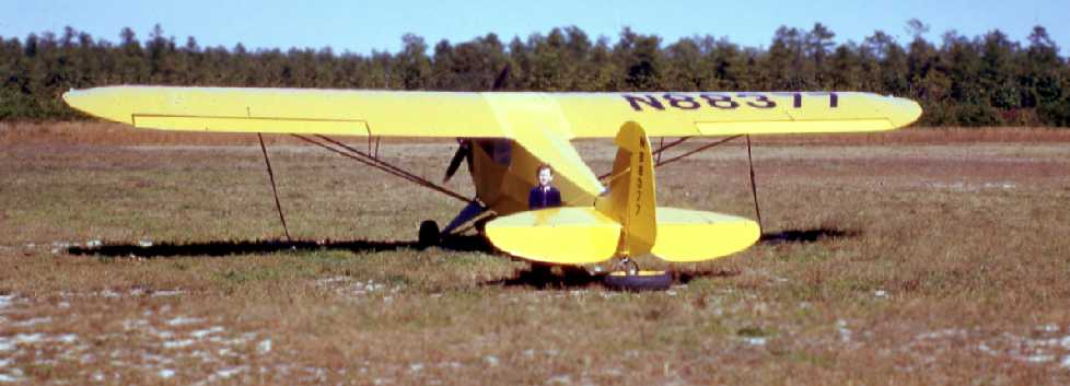
A 1960 photo of Paul Thorn in front of a Piper J3 Cub, at “Egans, before Harry Knordheim bought it.”
'Pleasantville - Somers Point' Airport was apparently still open as late as 1961,
as the 1963 AOPA Airport Directory (courtesy of Chris Kennedy)
included an entry for it which was noted as "Latest report, 1961".
It described the field as having a single 2,525' sand Runway 12/30,
being unattended, and listed the operator as Mary Egan.
According to Paul Thorn, Captain Egan's house at the airport
"was destroyed in the early 1960s by a forest fire which consumed most of the South Jersey woods that year.
I'm not sure, but I believe that Captain Egan had died before this fire,
and never saw it happen, however his daughter was still living in the house at the time.
She later rebuilt a small home on the other side of the airport property.
Captain Egan's daughter sold the airplanes that he owned, after his death."
The airport then went through a few years of closure,
as no airfield here was depicted on the February 1962 Washington Sectional Chart (according to Chris Kennedy).
A 1963 aerial view showed that the north/south runway was much more distinct than was shown in the 1957 aerial view.
Paul Thorn recalled, "I think Knocky Knordheim bought the airport shortly after this in the mid-1960s.
Knocky was an old banner flyer who used to fly banners from Bader Field in Atlantic City during the 1940s & 1950s.
He flew Stearmans, and about any other plane that came along.
Knocky was a flight instructor, and rented a C150 from his airport,
and later on he would rent an Aeronca Champ that he rebuilt to any pilot that could master the tailwheel plane.
He used to sell 80 octane fuel, and knew how to recover fabric airplanes, and rebuild airplanes.
He did not live on the airport property, but lived in Margate, NJ.
I can remember flying out of there when I was about 13 years old
with my uncle in a C150 he rented from Knocky."
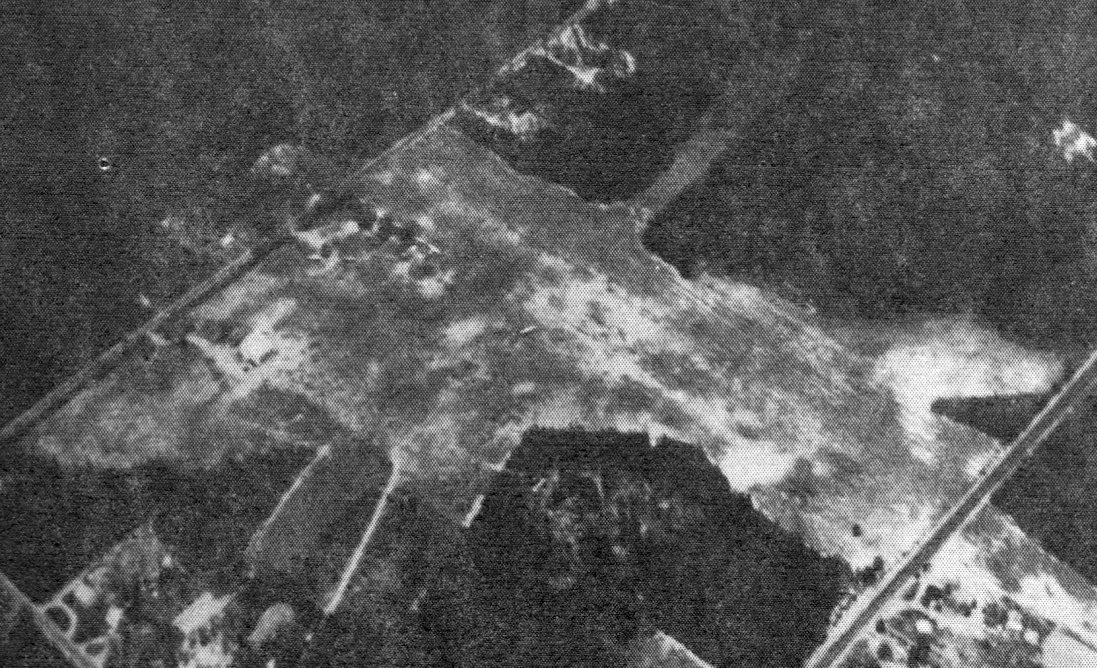
Nordheim Airpark was depicted on the 1970 Washington Sectional Chart (courtesy of John Clifford)
as having a 2,500' unpaved runway.
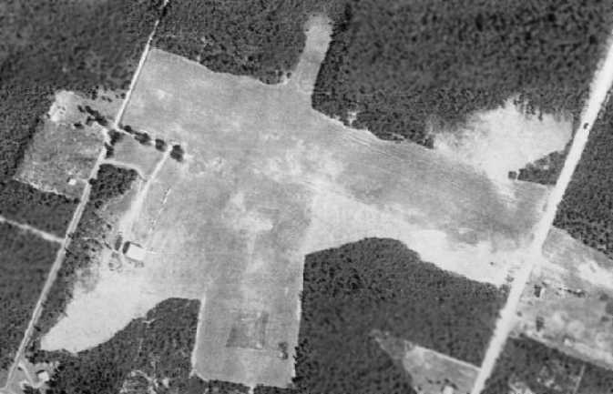
A 1970 aerial view depicted Nordheim as having 3 grass runways, with the northeast/southwest strip being much more distinct than was shown in the 1963 aerial view.
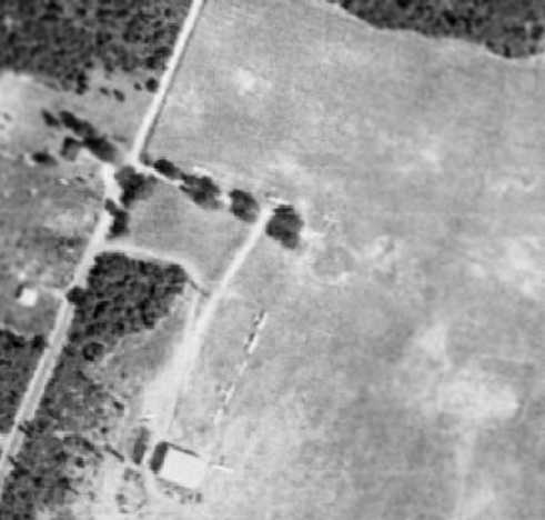
A closeup from the 1970 aerial view depicted a total of 9 light aircraft parked outside on the west side of the Nordheim Airport.
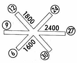
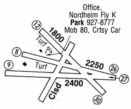
Nordheim was described by the 1971 Flight Guide (according to Chris Kennedy)
as having three turf runways: 2,400' Runway 9/27, 1,600' Runway 6/24, and 1,800' Runway 12/30.
Paul Thorn recalled, "In 1971, my father bought a 1946 Aeronca Champ, and started keeping it at the airport.
After I had got my license at Smithville, I would fly my dad's Aeronca from this airport.
Knocky owned the airport at this time,
and had already built a good size hangar on the south side of the airport.
A couple of years later, he cut a northeast/southwest runway, which ran past his hangar.
A 1971 photo by Paul Thorn of a Navion at Nordheim.
Nordheim Flying K Airpark, as depicted in the 1972 Flight Guide (courtesy of Chris Kennedy).
A November 1973 photo by Paul Thorn of a Piper Tri-Pacer taking off at Nordheim.
A December 1974 photo of Paul Thorn at Nordheim, “Landing on what we called the 'short runway', ran north & south, cut out into the surrounding woods.”
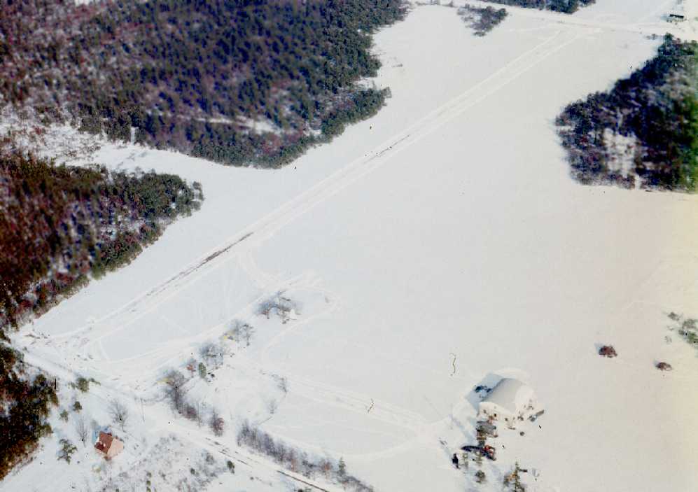
A circa 1970s aerial view by Paul Thorn looking northeast at Nordheim after a snowstorm.
According to Paul Thorn, "During the 1970s this airport boomed, and had about 10-15 airplanes tied down at it.
I would say that during the late 1970s he allowed banners planes to operate out of the airport, for a fee."
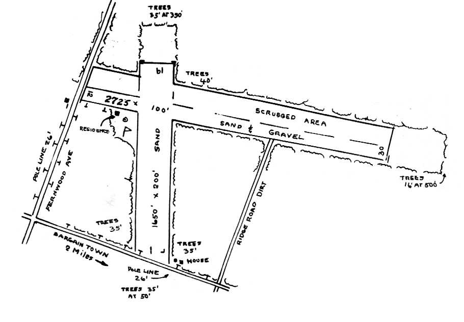
An undated aerial view looking northwest from the 1979 NJ Airport Directory depicted Nordheim Flying K Airport as having a single 1,700' turf Runway 9/27.
The manager was listed as Harry Nordheim.
Kevin Sabol recalled, “My grandfather's airfield was the Flying K, Harry K. Nordheim.
My brothers, cousins, and I spent lots of time with ‘Pop’ at the field in the 1970s & 1980s - mowing the field, helping rebuild his antique cars, and general putzing around.
My mother & father tell stories of Pop's banner flying days - he ended up in the NJ Aviation hall of Fame.”
The last aeronautical chart depiction which has been located of Nordheim Flying K Airpark
was depicted on the March 1981 Washington Sectional Chart (courtesy of Ron Plante).
It depicted Nordheim Flying K as having a 2,200' unpaved runway.
Nordheim Flying K Airpark, as depicted in the 1985 Flight Guide (courtesy of Chris Kennedy).
The last photo which has been located showing Nordheim Flying K still in operation
was a 12/7/87 aerial view looking east by Charles Findeisen (courtesy of Harry Silvers).
It showed 6 single-engine aircraft parked on the west side of a snowy little airfield.
Paul Thorn recalled, "A few years after Harry 'Knocky' Knordheim bought the airport,
a township road was cut through, leaving the runway only 1,700' long.
Knocky died about 1990-92."
According to pilot Wendell Long, Flying K was still in operation as late as 1992,
when it was used to operate banner-towing planes which would overfly nearby beaches.
However, Nordheim was apparently closed within the next year,
as the 1993 Washington Sectional Chart (courtesy of Mike Keefe)
no longer depicted Nordheim at all (not even as an abandoned airport).
Curiously, though, the Class C Airspace surrounding nearby Atlantic City International Airspace
still had a "cutout" over the site of Nordheim (on the 215 radial from ACY, 4 DME),
even though Nordheim Airport itself was no longer depicted.
The current Sectional chart shows that this cutout over Nordheim has been since removed.
As depicted on the 1995 USGS topo map, the airfield consisted of two 1,800 unpaved runways.
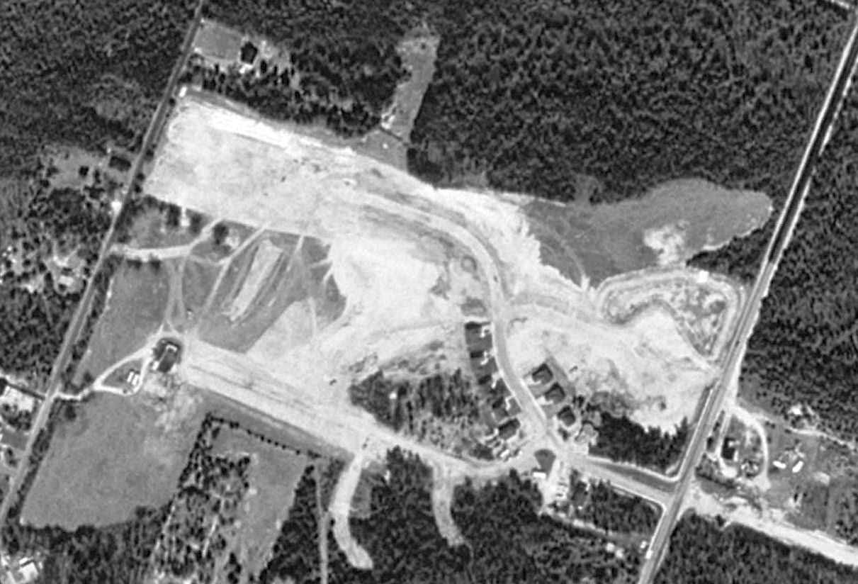
A 1995 USGS aerial view showed the cleared area of the 2 former Nordheim Flying K Airpark runways was still visible,
but a housing development had started to be built on the south side of the airport property.
According to Paul Thorn, "[Knocky's] son, who was also a pilot, and lived in Florida, sold the airport around 1995.
The airport soon was developed as a housing development,
with $200,000 homes being built about what seems like 10 feet apart.
The only thing that I can recognize today when I ride in by those houses,
is a large oak tree that the developer left standing.
Next to it is a home standing where my father parked his Aeronca Champ, under the shade of that large oak.
Other than that nothing is left of the old 'Flying K'."
Ray Hurley reported in 2004 that "on Oakland Avenue right next to Nordheim Flying K Airpark
is Victor Plumbo's Air, Car & Boat Museum
which is open on Thursday during the Summer months.
Victor is a pilot & has a few airplanes that he flew out of Nordheim Flying K."
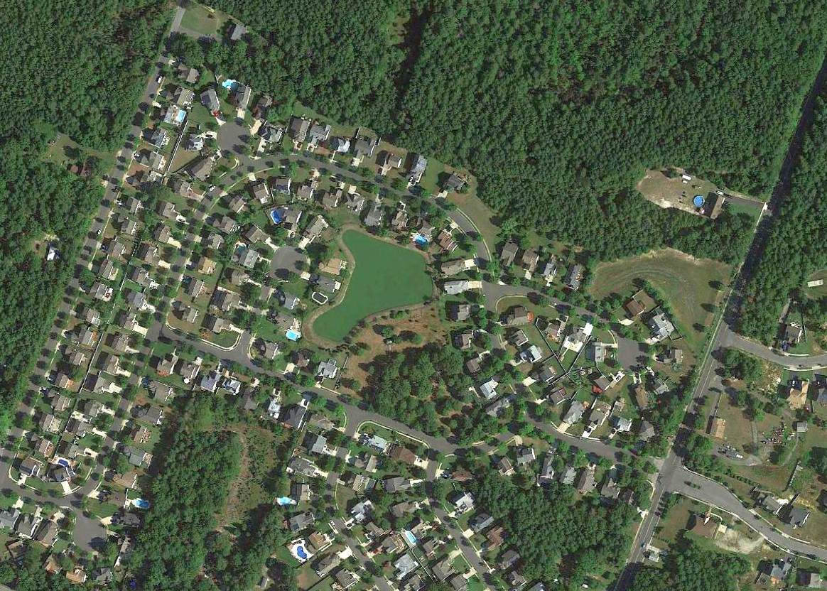
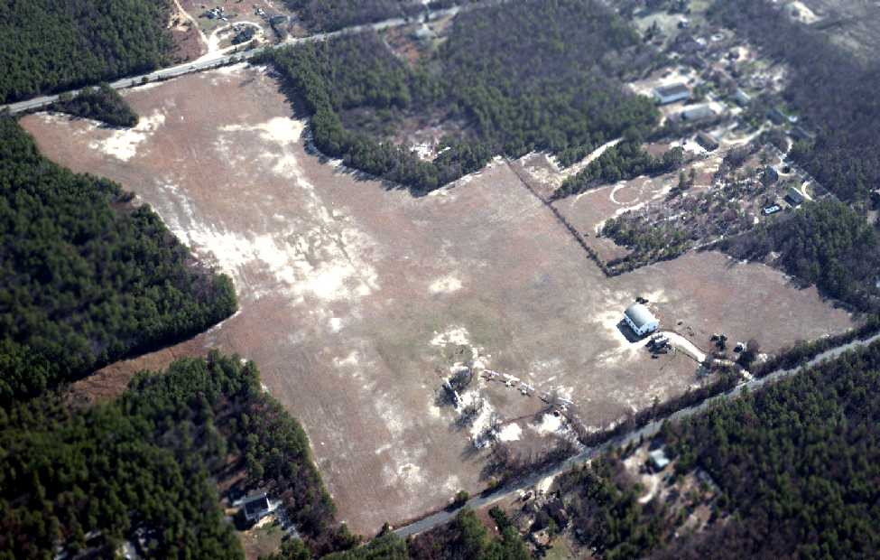
A 2016 aerial view showed no trace remaining of Nordheim Flying K Airpark.
The site of the Nordheim Flying K Airpark is located northwest of the intersection of Ridge Avenue & Oakland Avenue.
____________________________________________________
Crescent Airport, Mays Landing, NJ
39.48, -74.73 (Northwest of Atlantic City, NJ)
A 1963 aerial view depicted the Crescent Airfield as having a single paved northwest/southeast runway,
with a taxiway leading to a ramp on the southwest side of the field.
According to Ernest Geisert, this airfield "started as a duster strip in the late 1950s or early 1960s.
I started dusting in 1955 for Downstown Aero Crop Service & still work for them.
Before the strip was built we had to ferry about 15 miles to dust the cranberry bogs."
The Crescent Airfield was built at some point between 1957-63,
as a 1957 aerial photo did not yet depict any sign of an airfield.
The earliest depiction of the Crescent Airfield which has been located was a 1963 aerial view.
It depicted Crescent as having a single paved northwest/southeast runway,
with a taxiway leading to a ramp on the southwest side of the field.
Wallace Murray recalled, "In 1965 I received a call from Lewis Colasurdo of Hammonton, NJ.
He was in the mortgage & investment business
and he also had a 600 acre blueberry plantation, called Packo Plantation.
Mr. Calasurdo was expanding his business holdings in NY & FL
and needed an airplane to commute between Hammonton & NY.
We started using a Beech Baron & I operated out of Aero-Haven,
in the meantime the duster strip at the plantation was being converted to a hard surface, lighted,
with a large hangar with full office facilities, and we also had our own fuel."
Neither the 1965 USGS topo map nor the 1967 Washington Sectional Chart did not yet depict any airfield at this location.
Wallace Murray recalled, "By the time the field was finished we were operating a Beech Queen Air 80.
All of Mr. Caolasurdo's business was now included in Crescent Holding Company,
Packo Plantation was changed to Crescent Properties & the duster strip became Crescent Airport."
According to Ernest Geisert, "They flew produce out of there with DC-3s for a short time. It was always a private farm strip."
Wallace Murray recalled, "By 1968 Mr. Colasurdo became immersed in a lawsuit with the Securities & Exchange Commission
and was incarcerated for a number of years & as a result I lost my job.
To my knowledge the strip was never used again & gradually deteriorated back to sand."
However, the Crescent Airport continued to be depicted as an active airfield on aeronautical charts for a few more years.
The earliest aeronautical chart depiction of the Crescent Airfield which has been located
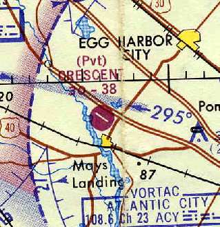
was on the 1969 Washington Sectional Chart (courtesy of Chris Kennedy).
It depicted Crescent as a private airfield with a single 3,800' paved runway.
The 1970 Washington Sectional Chart (courtesy of John Clifford) described Crescent in the same manner.
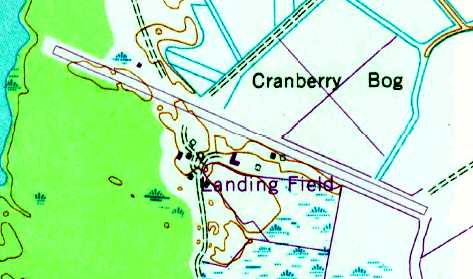
The earliest topo map depiction of the Crescent Airfield which has been located was on the 1972 USGS topo map.
It depicted a single northwest/southeast paved runway, labeled “Landing Field”, with several small buildings along the south side.

The Crescent airfield was apparently closed at some point between 1970-75,
as it was labeled "Crescent (Closed)" on the 1975 Washington Sectional Chart (courtesy of Ed Drury).
It was depicted as an abandoned airfield on the 1991 Washington Sectional Chart (courtesy of Mike Keefe).
However, the field may have had some later use (under a different name)
as it was labeled "Atlantic Blueberry Company Airstrip" on the 1995 USGS topo map.
According to Ernest Geisert, "They now use helicopters for spraying so they don't need the runway."
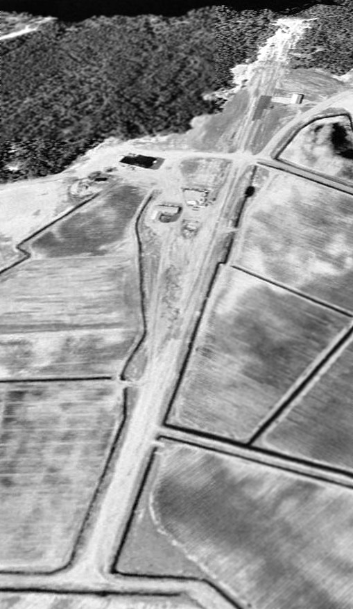
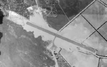
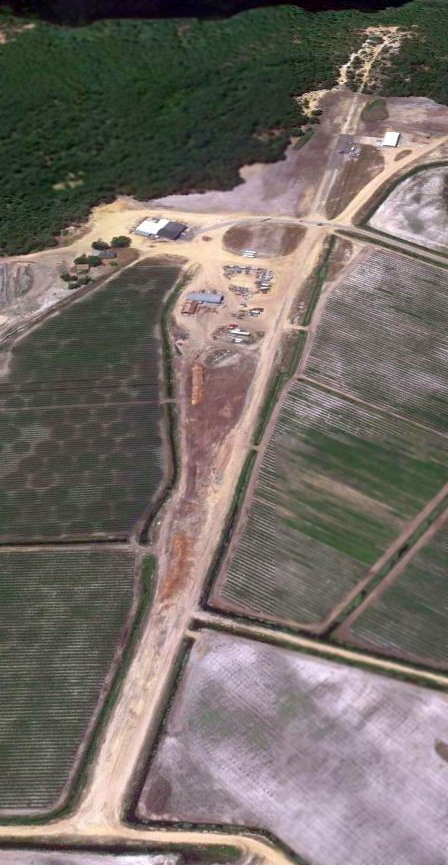
A 3/13/95 USGS aerial view looking northwest at the Crescent airfield.
A 2003 aerial photo looking south at the former Crescent Airport by Jeff Doran.
He reported, "The runway no longer appears paved, except for a short section."
Wallace Murray reported in 2004, "The hangar is still standing."
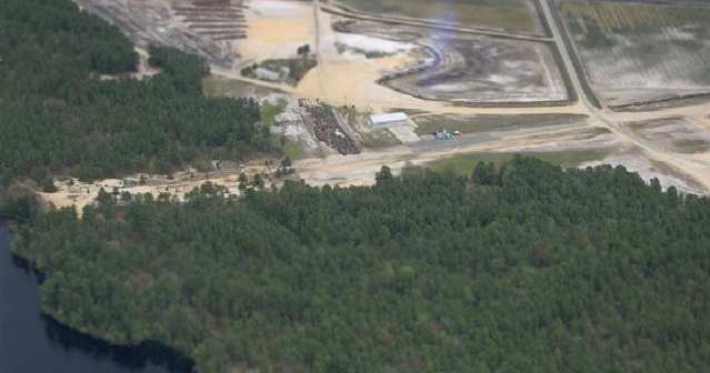
A circa 2006 aerial view looking north at the former Crescent Airport, showing the former hangar which remains standing,
as well as the remains of the runway.
A 6/1/11 aerial view looking northwest at the Crescent airfield showed the runway outline remained recognizable though most of the pavement had been removed.
____________________________________________________
Since this site was first put on the web in 1999, its popularity has grown tremendously.
If the total quantity of material on this site is to continue to grow,
it will require ever-increasing funding to pay its expenses.
Therefore, I request financial contributions from site visitors,
to help defray the increasing costs of the site
and ensure that it continues to be available & to grow.
What would you pay for a good aviation magazine, or a good aviation book?
Please consider a donation of an equivalent amount, at the least.
This site is not supported by commercial advertising –
it is purely supported by donations.
If you enjoy the site, and would like to make a financial contribution,
you
may use a credit card via
![]() :
:
Please consider checking the box to make a monthly donatation.
For a mailing address to send a check, please contact me at: paulandterryfreeman@gmail.com
If you enjoy this web site, please support it with a financial contribution.
please contact me at: paulandterryfreeman@gmail.com
If you enjoy this web site, please support it with a financial contribution.
____________________________________________________
This site covers airfields in all 50 states.