Abandoned & Little-Known Airfields:
Eastern Michigan
© 2002, © 2023 by Paul Freeman. Revised 3/13/23.
____________________________________________________
Please consider a financial contribution to support the continued growth & operation of this site.
Baker Airport / River Tower Airport (revised 12/7/22) - Trott Brothers Airport / Almont Municipal Airport (revised 3/13/23)
____________________________________________________
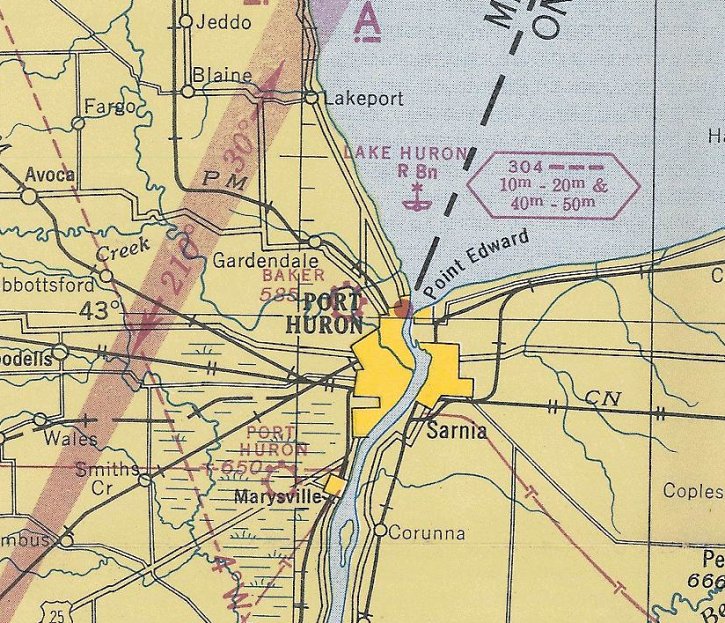
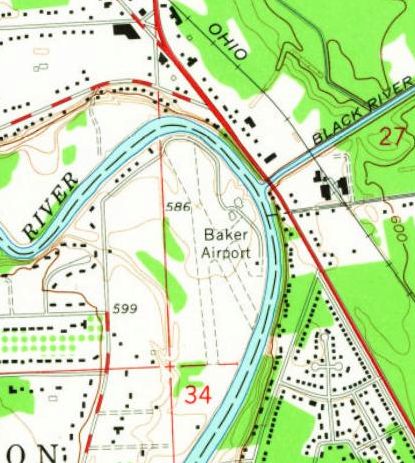
Baker Airport / River Tower Airport, Port Huron, MI
43.014, -82,453 (Northeast of Detroit, MI)
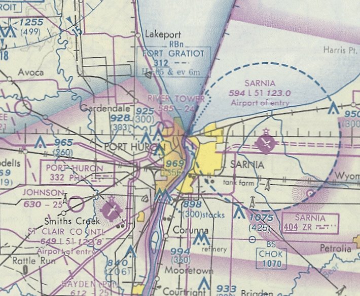
Baker Airport, as depicted on the October 1943 Detroit Sectional Chart.
Photo of the airport while in use is not available.
This small general aviation airport was evidently established at some point between 1940-43,
as it was not yet depicted on the April 1940 Detroit Sectional Chart.
The earliest depiction which has been located of Baker Airport was on the October 1943 Detroit Sectional Chart.
According to the article “Blue Water Memories” in the 9/27/15 The Times Herald (courtesy of Mike Denja),
in 1945, “Three Detroiters were slightly injured Thursday night in a crash landing of a 4-passenger Fairchild airplane at Baker Airport after failing to gain altitude in the takeoff.”
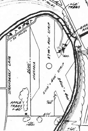
The 1947 MI Airport Directory (courtesy of Mike Denja) depicted Baker Airport as having 3 unpaved runways, with the longest being the 2,700' north/south strip.
A few small hangars were depicted on the northeast side.
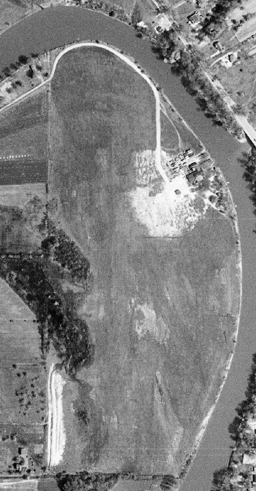
The earliest photo which has been located of Baker Airport was a 5/15/54 aerial view (courtesy of Mike Denja).
It depicted 2 grass runways, with several buildings on the northeast side, near which appeared to be a number of boats stored, but no aircraft.
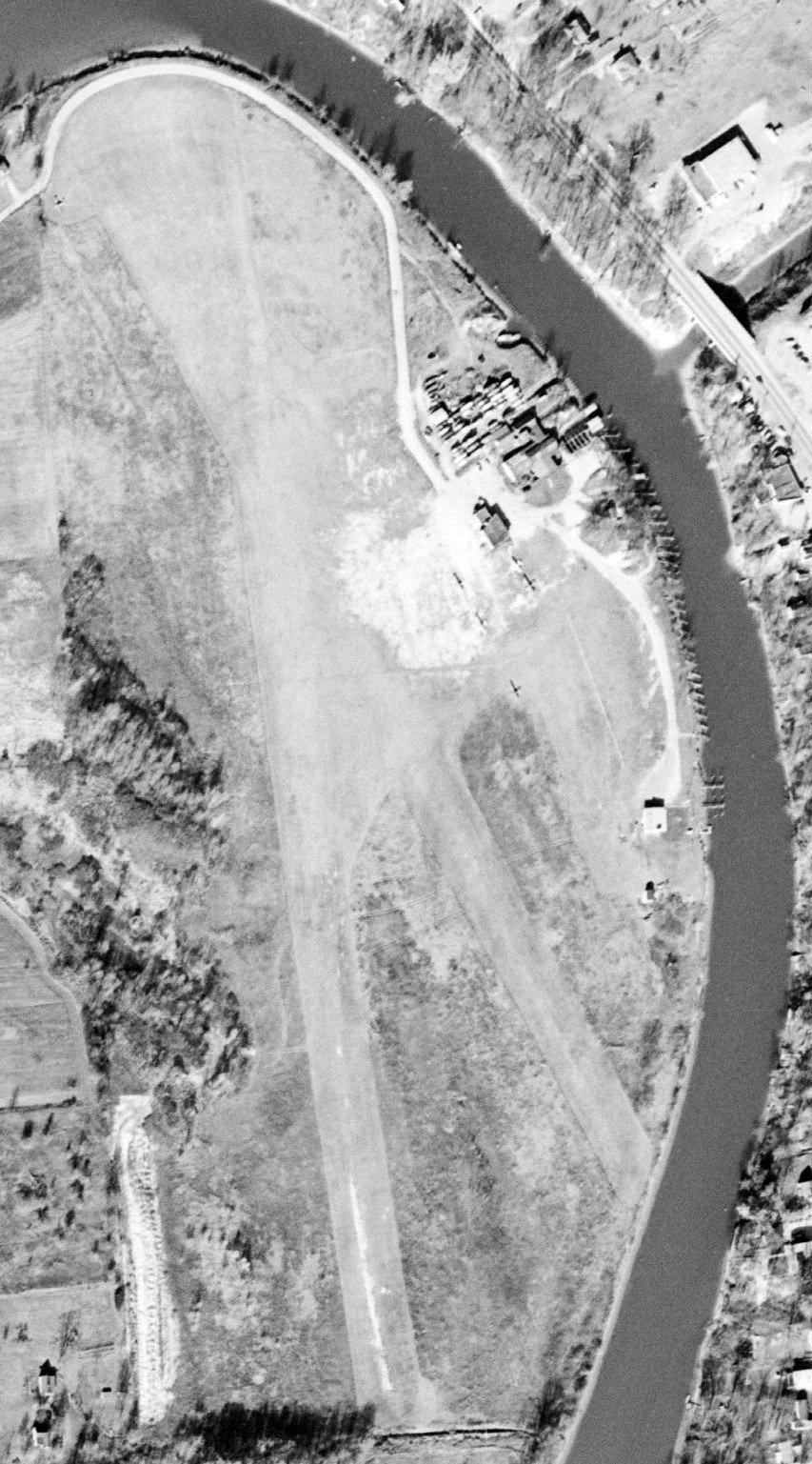
The earliest photo which has been located showing aircraft at Baker Airport was an 11/12/58 aerial view (courtesy of Mike Denja).
It depicted 5 light single-engine planes parked near the buildings on the northeast side.
The 1961 USGS topo map (courtesy of Mike Denja) depicted Baker Airport as having 2 unpaved runways,
with the northeast/southwest runway presumably having been abandoned at some point between 1947-61.
Three small buildings were depicted on the northeast & east sides.
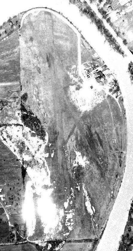
A 1961 aerial view (courtesy of Mike Denja) depicted Baker Airport as having 2 unpaved runways.
No aircraft were visible on the field, but a number of boats were apparently stored on the field around the buildings on the northeast side.
A 1964 aerial view depicted several light single-engine aircraft parked next to the hangar on the northeast side of Baker Airport.
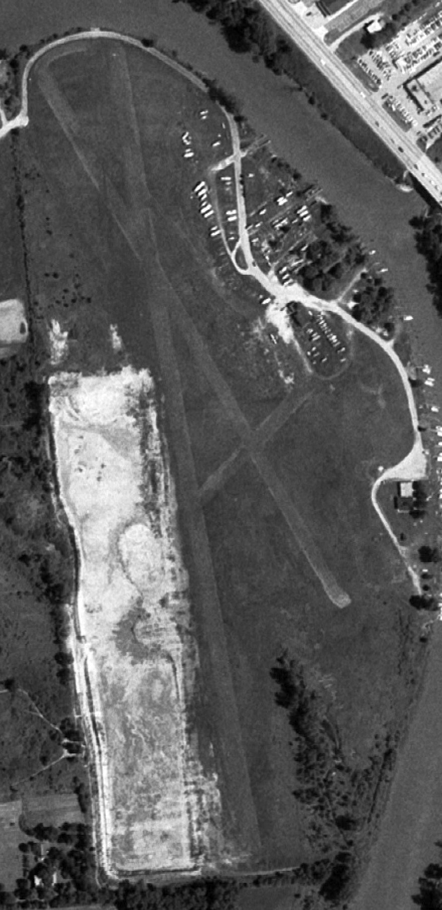
The last photo which has been located showing Baker Airport in operation was a 9/6/76 aerial view (courtesy of Mike Denja).
It depicted 1 light single-engine plane parked near the buildings on the northeast side.
The May 1977 Detroit Sectional Chart (courtesy of Mitchell Hymowitz) depicted Baker Airport as having a 2,500' unpaved runway.
Michael Eastman reported, “Harold Baker, owner of Baker Airport, passed away about 1978,
During that time a control tower had been constructed, but never put into use.
A report on the local radio station mentioned that North Central Airlines was considering servicing Port Huron from Baker's Field along with service to Bad Axe.
I'm assuming deregulation nixed this plan since no further development occurred at Baker's Field.
Obviously, a paved runway would be required for airline operations.
Airplane activity seemed to die off around 1979 with the runway growing over.”
Michael continued, “Around 1978 local businessman Arnold Chickonowski purchased Baker's Field.
John Staiger kept his airplane at the airport & in return kept the grass cut on the runway.”
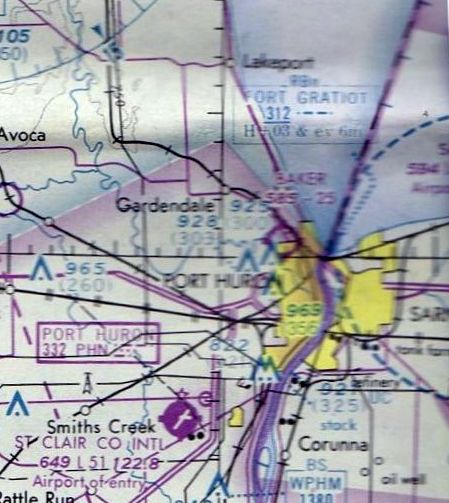
At some point between 1977-81 the airport was renamed River Tower Airport,
as that is how it was labeled on the May 1981 Detroit Sectional Chart (courtesy of Ron Plante).
It depicted River Tower Airport as having a 2,400' unpaved runway.
According to Michigan Aviation (courtesy of Mike Denja), “River Tower Airport was abandoned 9/4/81.”
A 1985 aerial view (courtesy of Mike Denja) showed that the River Tower Airport runways remained clear,
but what appeared to be a large number of boats were stored around the hangar, and no aircraft were visible.
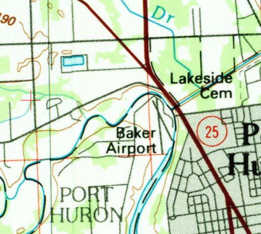
The last labeled map depiction which has been located of Baker Airport was on the 1990 USGS topo map.
It depicted Baker Airport as having 2 runways.
Baker / River Tower Airport evidently was abandoned (for reasons unknown) at some point between 1981-93,
as it was no longer depicted on the October 1993 Detroit Sectional Chart (courtesy of Ron Plante).
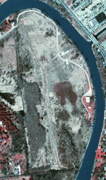
A 1998 MI DNR aerial view (courtesy of Mike Denja) showed roads & paths having been built over the Baker / River Tower Airport site.
The orientation of the north/south runway was only barely recognizable, but the hangars had been removed.
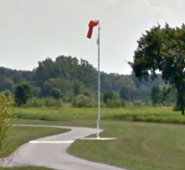
An August 2013 photo looking southeast (courtesy of Mike Denja) shows the last remaining trace at the site of Baker Airport – its windsock has been preserved by the park which occupies the site.
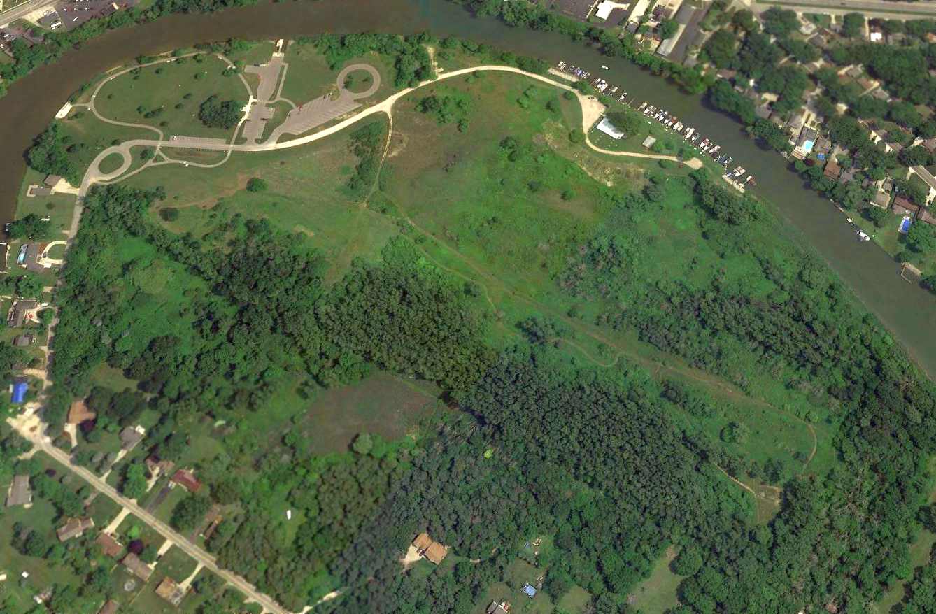
A 2015 aerial view looking northeast showed more roads & parking lots had been built over the site of Baker Airport.
As of 2015, street maps label the site of Baker Airport as Bakers Field Park.
Michael Eastman reported in 2020, “The rotating beacon for the airport is now in the possession of the Henry Ford Museum in Dearborn.”
The site of Baker Airport is located at the northeast end of Strawberry Lane.
Thanks to Mike Denja for pointing out this airfield.
____________________________________________________
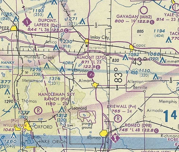
Trott Brothers Airport / Almont Municipal Airport, Almont, MI
42.94, -83.062 (Northeast of Detroit, MI)
Trott Brothers Airport, as depicted on the December 1949 Detroit Sectional Chart.
According to “Almont: The Tale of Then & Now” (courtesy of Michael Denja), Trott Brothers Airport was built in 1947 by Frank & Robert Trott
on the family farm after their dad purchased the land.
Trott Brothers Airport was not yet depicted on the December 1948 Detroit Sectional Chart.
The 1948 Airport & Business Flying Directory (courtesy of Michael Denja)
described Almont Airport as a private field having 2 unpaved runways, measuring 2,500 northeast/southwest & 1,800' northwest/southeast.
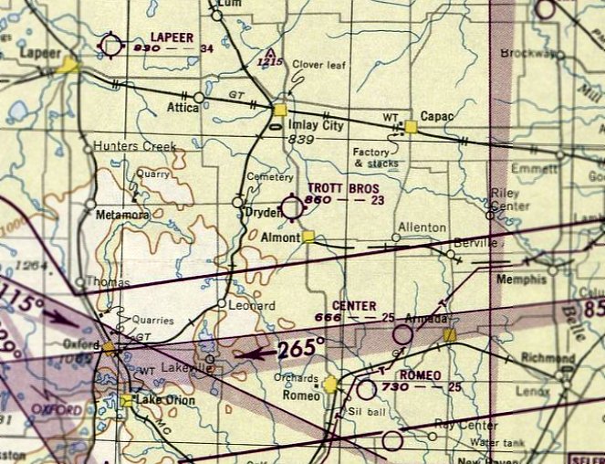
The earliest depiction which has been located of Trott Brothers Airport was on the December 1949 Detroit Sectional Chart.
It depicted Trott Brothers Airport as having a 2,300' paved runway.
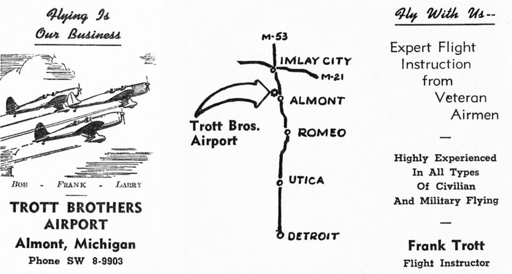
An undated business card for Trott Brothers Airport (courtesy of Frank Trott’s daughters, via Mark Cryderman).
The Trott brothers operated the airport until 1952, when it was leased.
A 1956 Flying Magazine article (courtesy of Michael Denja) described how Frank Trott
served as a pilot for the Ligon Brothers business aircraft based at Trott Brothers Airport.
The earliest photo of Almont Airport which has been located was on a 5/1/67 USGS aerial photo,
which depicted it as having 2 grass runways, with a few small buildings & 2 single-engine planes on the east side.
Mark Cryderman reported, “Almont Airport brings special memories.
It was owned by my cousins, the Trotts, whose farm can be seen at the west end.
My father taught me to love aviation & he was taught to fly, at this airport, by cousin Frank Trott.
Frank had a 4 digit pilot's license, taught bomber pilots during WW2 & flew DC-3s for Republic Airlines.
I spent fun times as a kid at this airport & have many funny & crazy stories!”
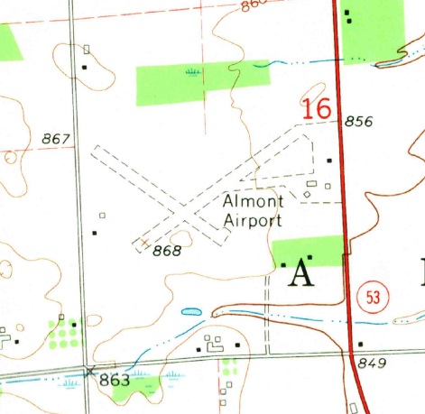
The 1968 USGS topo map (courtesy of Mike Denja) depicted Almont Airport
as having 2 unpaved runways, with 4 small buildings on the east side.
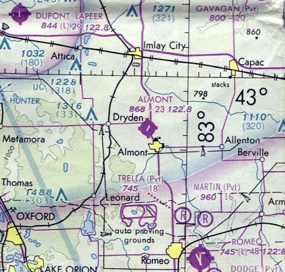
The May 1977 Detroit Sectional Chart (courtesy of Mitchell Hymowitz) depicted Almont Airport as having a 2,300' paved runway.
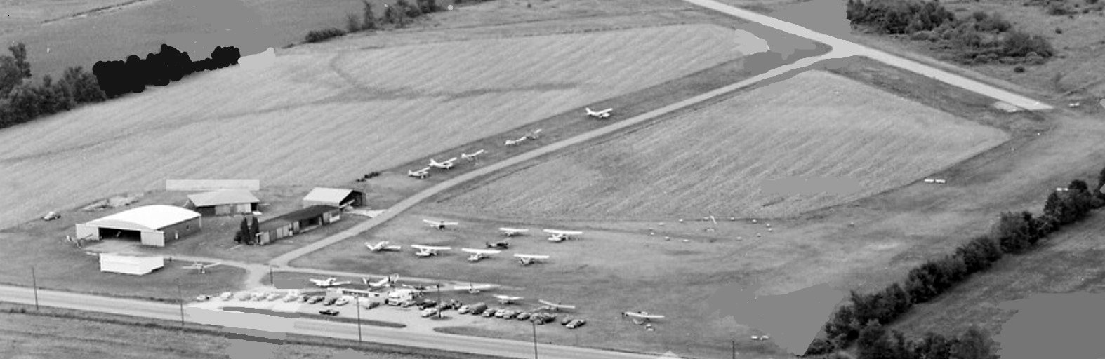
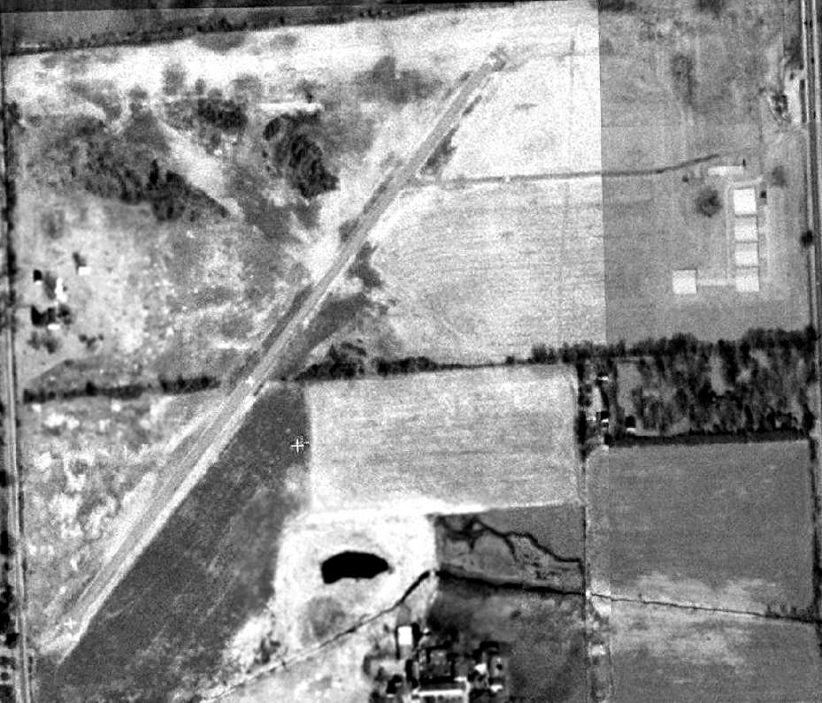
The last photo which has been located showing Almont Airport in operation was a 1982 aerial view looking southwest (courtesy of Mike Denja).
It depicted Almont as having a paved northeast/southwest runway & a crosswind grass runway,with several hangars on the east side.
Almont was apparently quite popular for a small airport, with over 2-dozen light single-engine aircraft visible on the field.
The 1983 USGS topo map depicted the Almont “Municipal Airport” as having a single northeast/southwest runway.
Wade Lawrence recalled, “Almont Airport... It had a paved strip & grass, and used to be a center for ultralights in the 1980s.
I landed there many times for gas.”
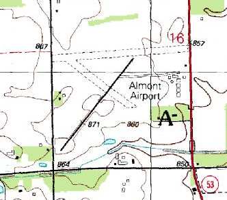
The 1991 USGS topo map depicted Almont Airport
as having a single paved northeast/southwest runway, along with 2 unpaved runways.
A taxiway led to several small buildings (hangars?) along the east side.
The last aeronautical chart depiction which has been located of Almont Airport was on the October 1993 Detroit Sectional Chart (courtesy of Ron Plante).
It depicted Almont Airport as having a 2,300' paved northeast/southwest runway.
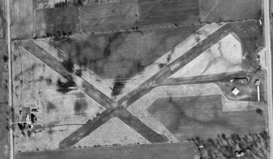
The Almont Airport was evidently closed (for reasons unknown) at some point between 1993-99,
as the 3/28/99 USGS aerial photo depicted the paved runway as being marked with 3 closed-runway “X” symbols.
The airfield otherwise remained intact.
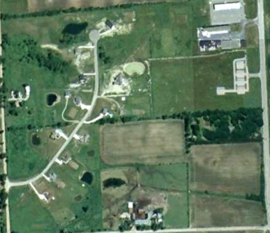
At some point between 1999-2006 the majority of the Almont Airport runway was covered by a residential street,
as shown in a 2006 aerial view, but the northeast portion of the runway remained recognizable.
The hangars appeared to remain intact on the east side of the field.
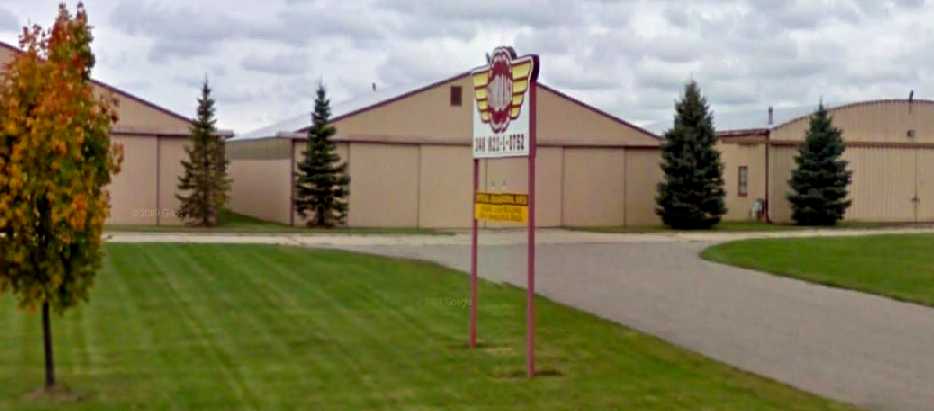
A circa 2006-2010 photo (courtesy of M. Hoshaw) looking west at the former hangars, now reused as “Almont Airport Storage”.
M. Hoshaw reported in 2011, “Almont Airport... If you drive by it on Van Dyke (in Michigan) you can still see the hangars.
It even says something like 'Almont Airport hangars' or something to that effect.”
The site of Almont Airport is located northeast of the intersection of Tubspring Road & Shoemaker Road.
____________________________________________________
Since this site was first put on the web in 1999, its popularity has grown tremendously.
If the total quantity of material on this site is to continue to grow,
it will require ever-increasing funding to pay its expenses.
Therefore, I request financial contributions from site visitors,
to help defray the increasing costs of the site
and ensure that it continues to be available & to grow.
What would you pay for a good aviation magazine, or a good aviation book?
Please consider a donation of an equivalent amount, at the least.
This site is not supported by commercial advertising –
it is purely supported by donations.
If you enjoy the site, and would like to make a financial contribution,
you
may use a credit card via
![]() :
:
Please consider checking the box to make a monthly donatation.
For a mailing address to send a check, please contact me at: paulandterryfreeman@gmail.com
If you enjoy this web site, please support it with a financial contribution.
please contact me at: paulandterryfreeman@gmail.com
If you enjoy this web site, please support it with a financial contribution.
____________________________________________________
This site covers airfields in all 50 states.