Abandoned & Little-Known Airfields:
Central Michigan
© 2002, © 2024 by Paul Freeman. Revised 4/30/24.
This site covers airfields in all 50 states: Click here for the site's main menu.
____________________________________________________
Please consider a financial contribution to support the continued growth & operation of this site.
Acme Skyport (revised 8/27/22) - Au Gres Airport (revised 12/7/23) - Davis Airport (revised 6/7/23) - Dudley Airport (added 5/28/20) - Lippert Airport / Lumberjack Land Airport (revised 9/23/22)
Mason Airport / Kelleys Airport (revised 10/2/22) - Miller Airport / Nartron Field (revised 8/26/21) - Poschke's Harbor Beach Airport (revised 9/13/22) - Sharrar Airport / Alma Airport (revised 4/14/22)
St Johns Airport / Wings Airport / Dickinson Airport (revised 4/30/24) - Standish City Airport / Standish Industrial Airport (revised 5/4/23)
Sugar Loaf Resort Airport / Sugar Loaf Wallace G. Fryer Airfield (revised 3/12/24) - Vanderbilt Airport (revised 5/26/20) - Yuba Airport (added 2/26/23)
____________________________________________________
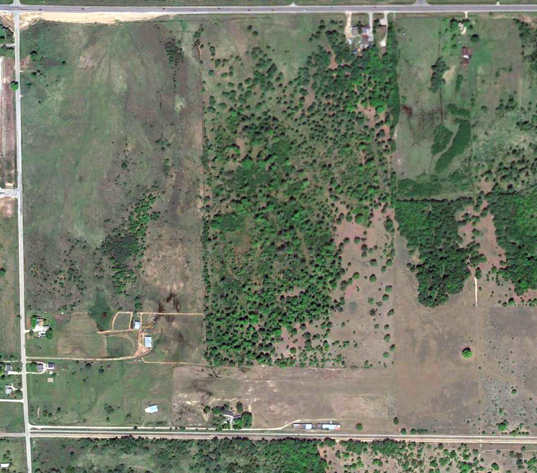
Sugar Loaf Resort Airport / Sugar Loaf Wallace G. Fryer Airfield (Y04), Cedar, MI
44.908, -85.815 (Northwest of Detroit, MI)
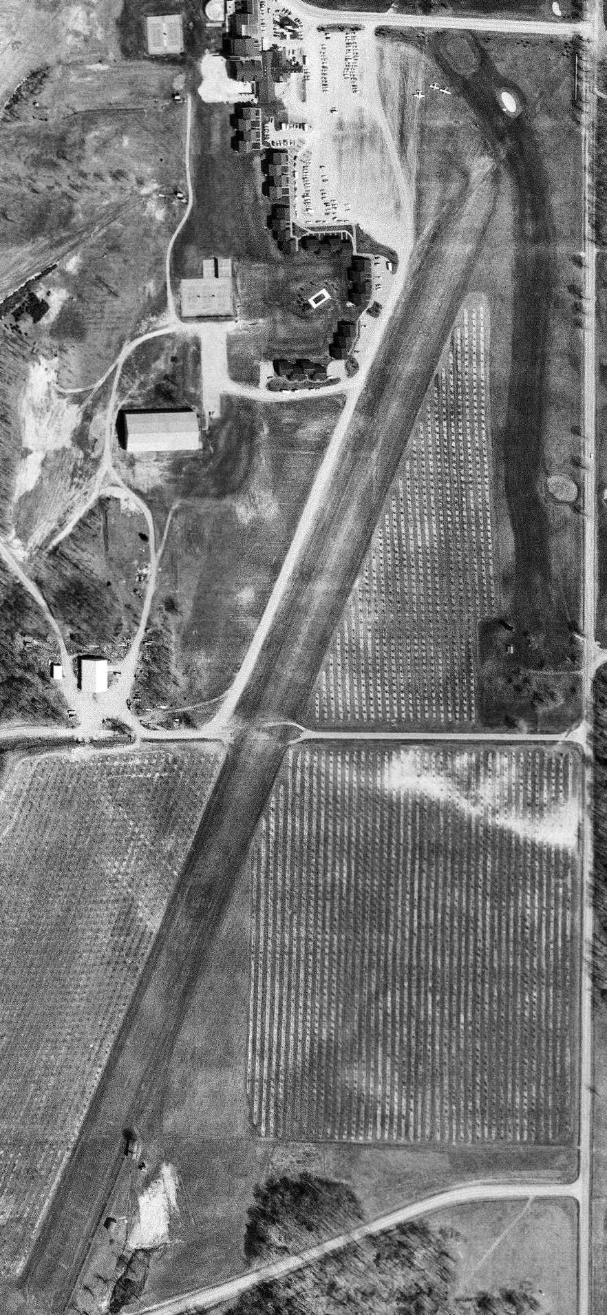
Sugar Loaf Airport, as depicted on a 4/30/77 USGS aerial view (courtesy of Mike Denja).
According to the Sugarloaf Townhouses website, in “1947, three Leelanau County men, Stanley Ball, Hans Teichner, and Art Huey, opened the Sugar Loaf Winter Sports Club”,
which eventually included downhill skiing runs.
A 1954 aerial photo did not yet depict any airfield at this location.
According to the Sugarloaf Townhouses website, “In 1962 Jim & Pat Ganter reopened it as Sugar Loaf Resort, eventually adding a hotel, indoor tennis, a golf course, and a 3,500' paved airstrip.”
Sugar Loaf Airport was not yet depicted on the 1971 Green Bay Sectional Chart.
The earliest photo which has been located of Sugar Loaf Airport was a 4/30/77 USGS aerial view (courtesy of Mike Denja).
It depicted a single grass northeast/southwest runway, with no hangars or other aviation facilities, but 3 light aircraft were parked on the grass to the northwest.
A 1981 aerial view continued to show Sugar Loaf having an unpaved runway.
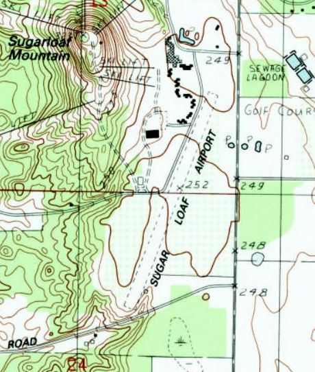
The earliest topo map depiction which has been located of Sugar Loaf Airport was on the 1983 USGS topo map.
It depicted a single unpaved northeast/southwest runway.
Sugar Loaf apparently gained a paved runway at some point between 1981-87,
as a 1987 aerial view showed the runway having been paved with asphalt.
The earliest dated photo which is available of Sugar Loaf Airport was a 1993 aerial view looking southwest.
It depicted Sugar Loaf Resort as having a single paved northeast/southwest runway.
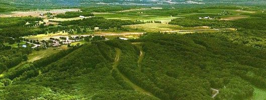
An undated aerial view looking southeast depicted Sugar Loaf Resort Airport in the background behind the ski runs of Sugar Loaf Mountain.
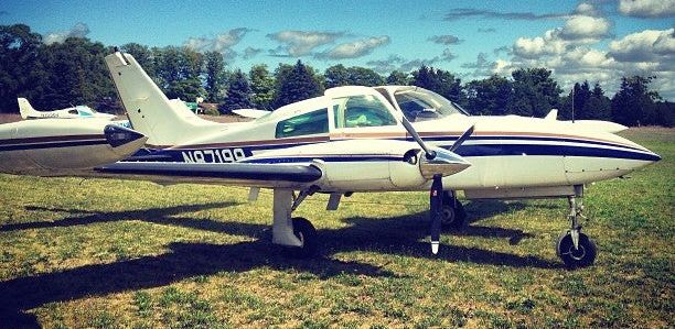
The only photo which is available showing aircraft at Sugar Loaf Resort Airport was an undated photo of a Cessna 310 & a few other light aircraft.
The earliest aeronautical chart which has been located of Sugar Loaf Airport was on the January 1994 Green Bay Sectional Chart (courtesy of Ron Plante).
It depicted Sugar Loaf Resort as a public-use airport having a single 3,500' paved northeast/southwest runway.
According to FAA Airport/Facility Directory data, Sugar Loaf Resort Airport had a single 3,519' asphalt Runway 2/20, but in “poor condition”, with “extensive pavement cracking”.
The manager was listed as Dan Hyde.
According to the Sugarloaf Townhouses website, “In 2000 the Sugar Loaf Resort closed.”
The last aeronautical chart which has been located of Sugar Loaf Airport was on the May 2018 Green Bay Sectional Chart.
It depicted Sugar Loaf as a public-use airport having a single 3,500' paved northeast/southwest runway.
Grace Yakuber recalled, “The airport was still usable after the resort's closure.
I think it was still in operation when I came to town in 2018, as I recall starting school here for aviation & the airport was still having traffic buzz up & around it.”
Sugar Loaf Airport was evidently closed at some point between 2018-2020,
as it was no longer depicted on the November 2020 Green Bay Sectional Chart.
According to the Sugarloaf Townhouses website, “In 2020, the resort was sold by Jeff Katofsky to an undisclosed buyer, whose agent is located in the Leland area.
In late 2021 & early 2022, the resort building along with all outbuildings & amenities including all skiing facilities were razed & the land was returned to its natural state.
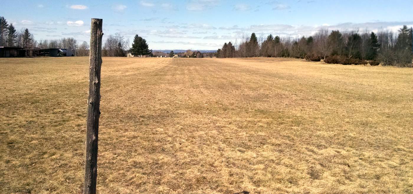
The only amenity remaining is the runway.
As of the second half of 2023, the owner has not expressed any future plans he has for the property.”
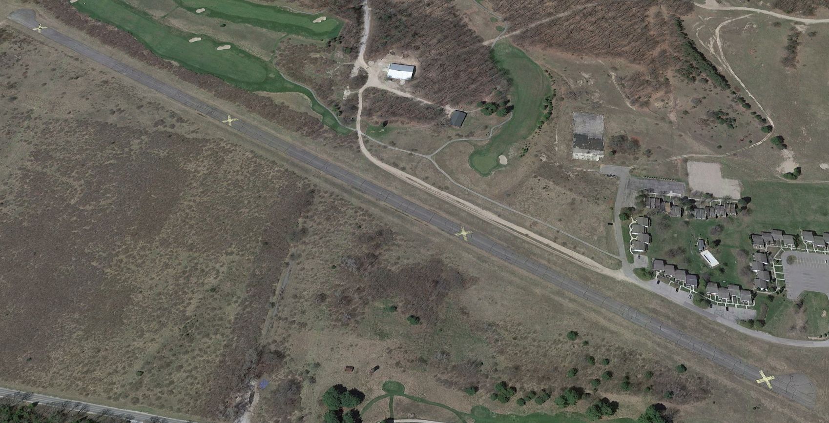
A 2022 aerial view looking southwest showed Sugar Loaf Resort Airport remained intact but with yellow closed-runway “X” symbols.
As of 2023, street maps labeled the property as Sugar Loaf Wallace G. Fryer Airfield.
Thanks to Grace Yakuber for pointing out this airfield.
___________________________________________________
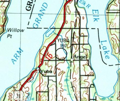
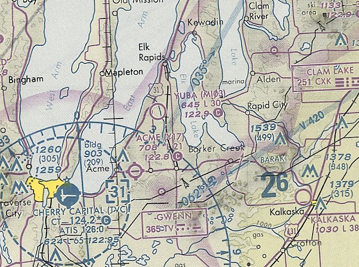
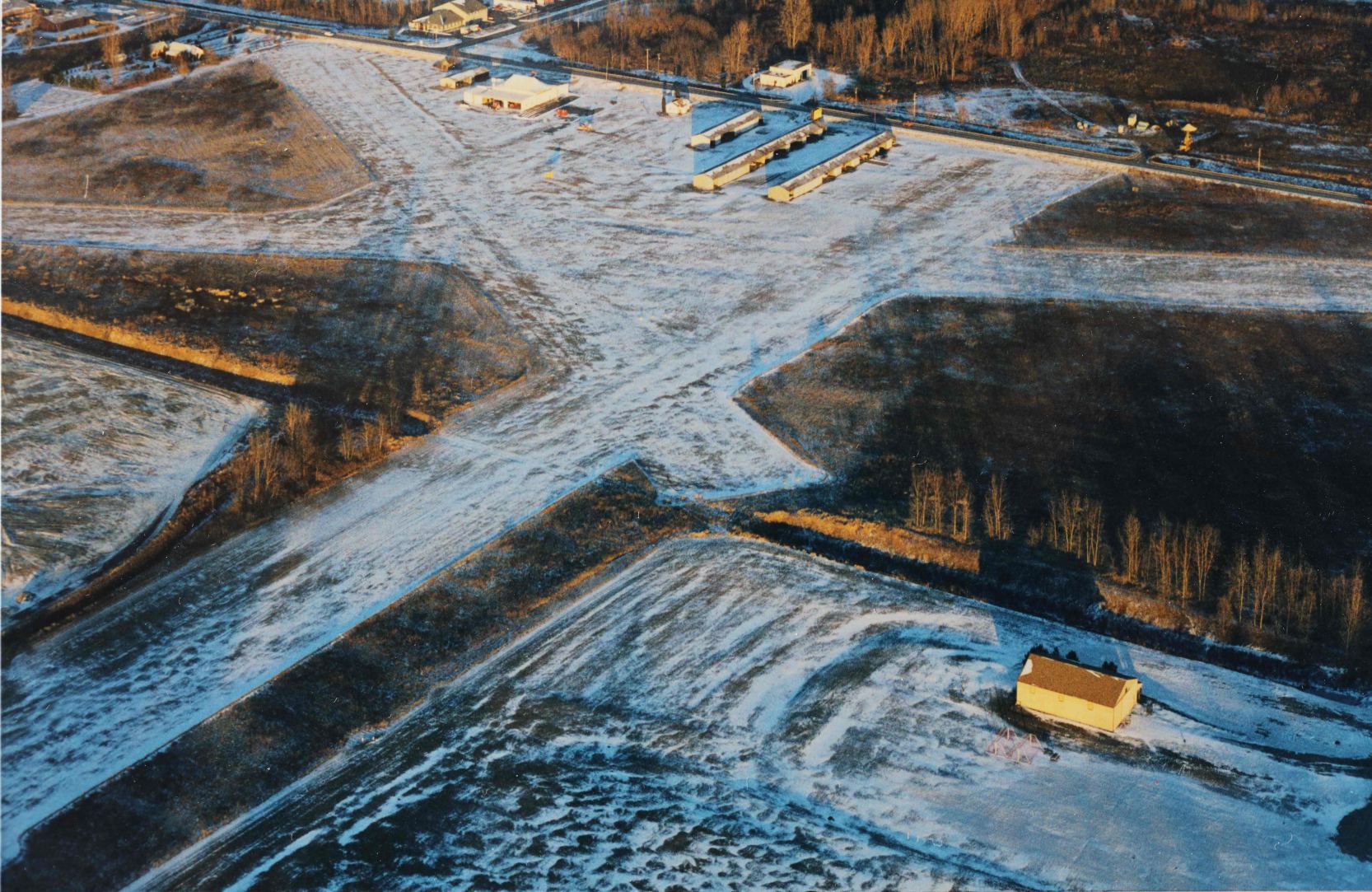
Yuba Airport (MI03, 34E), Yuba, MI
44.841, -85.432 (Northwest of Detroit, MI)
Yuba Airport, as depicted on the 1989 USGS topo map.
Yuba Airport was not yet depicted on the 1971 Green Bay Sectional Chart.
According to its FAA Airport/Facility Directory data, Yuba Airport was activated in June 1988.
The earliest depiction which has been located of Yuba Airport was on the 1989 USGS topo map.

The earliest photo which has been located of Yuba Airport was a 1993 aerial view looking southwest.
It depicted Yuba as having a single grass north/south runway, with a paved ramp & a small hangar on the northwest side.
The earliest aeronautical chart which has been located of Yuba Airport was on the 1993 MI Aeronautical Chart (courtesy of Marc Boudreau).
It depicted Yuba as having a 3,000' unpaved runway.
The 1994 Green Bay Sectional Chart depicted Yuba Airport as having a 3,000' unpaved runway.
The only photo which has been located showing an aircraft at Yuba Airport was a 2011 aerial view looking southwest.
It depicted 1 light single-engine aircraft parked near the hangar.
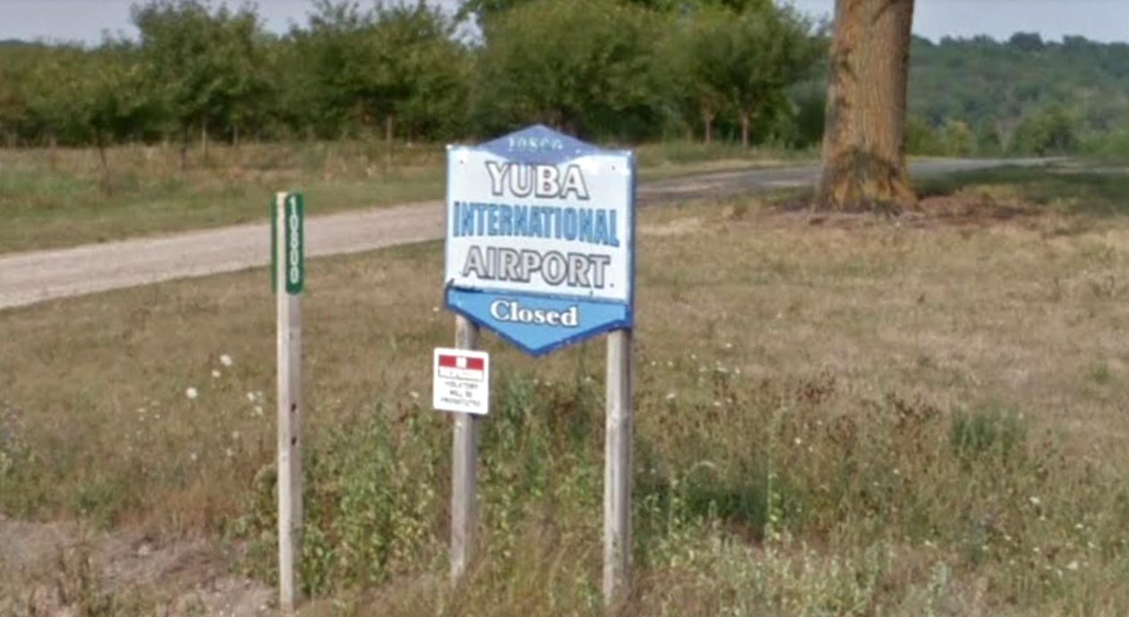
A 2018 photo (courtesy of Mike Denja) of the sign for “Yuba International Airport” also indicated the airport was closed.
The last aeronautical chart which has been located of Yuba Airport was on the November 2020 Green Bay Sectional Chart.
It depicted Yuba as having a 3,000' unpaved runway.
A 2020 article (courtesy of Mike Denja) reported that Traverse City College had been selected for an unmanned aircraft training program,
with the intent to use Yuba Airport to conduct drone flight training.
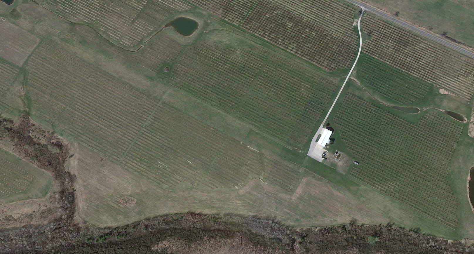
A 2022 aerial view looking southwest showed Yuba Airport remained intact but without any sign of recent aviation use.
Mike Denja reported in 2023, “I never saw an aircraft there & then the last few years it became an Unmanned Aerial Systems experimental facility with drones only & finally closed.”
As of 2023, Yuba Airport is no longer depicted on the Green Bay Sectional Chart.
Thanks to Mike Denja for pointing out this airfield.
___________________________________________________
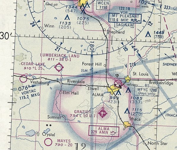
Lippert Airport / Lumberjack Land Airport, Riverdale, MI
43.431, -84.847 (Northwest of Detroit, MI)
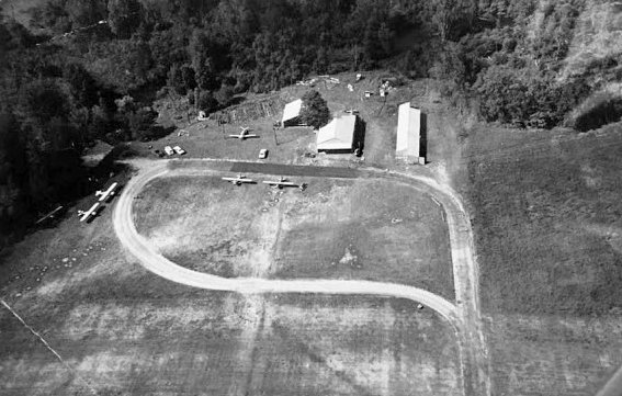
A circa 1961-69 aerial view looking north at 5 light single-engine planes & 3 small hangars at Lippert Airport (courtesy of Eric Lippert).
No airport was yet depicted at this location on a 1956 aerial photo or the 1960 Milwaukee Sectional Chart.
Eric Lippert reported that his father, Orville Lippert, established Lippert Airport in circa 1961-63.
Eric recalled, “He bought 275 acres.”
The earliest depiction which has been located of Lippert Airport was a circa 1961-69 aerial view (courtesy of Eric Lippert)
looking north at 5 light single-engine planes & 3 small hangars on Lippert Airport's north side.
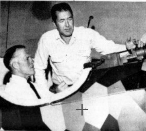
A circa 1961-69 photo of Lippert Airport operator Orville Lippert showing his WW1 Fokker DV11 to Governor Romney (courtesy of Eric Lippert).
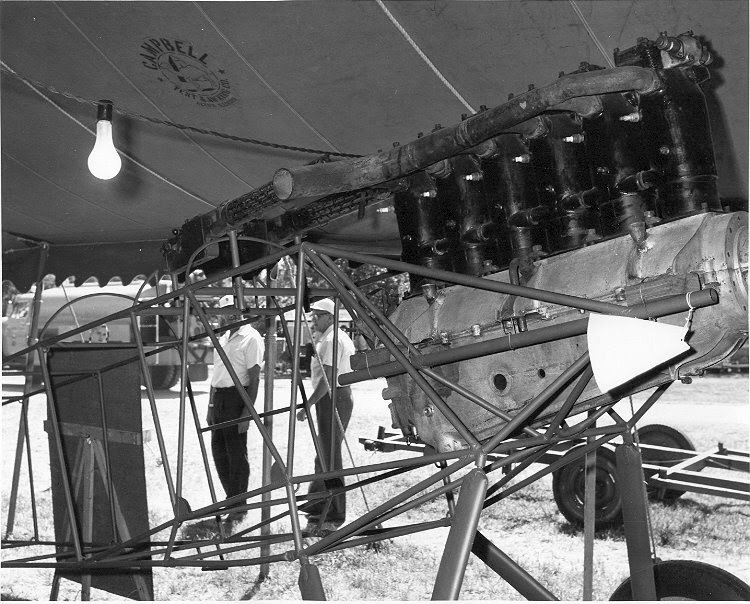
A circa 1961-69 photo of an unidentified aircraft at Lippert Airport (courtesy of Eric Lippert).
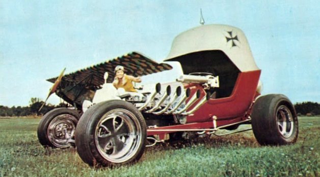
A circa 1961-69 photo of fanciful German-themed hot rod in front of an unidentified aircraft at Lippert Airport (courtesy of Eric Lippert).
A circa 1961-69 photo of a variety of 5 light general aviation planes at Lippert Airport (courtesy of Eric Lippert).
Eric Lipper recalled, “We had over 600 airplanes show up at an airshow.
The FAA went crazy; said 'You are not a commercial airport; you can't have that many airplanes here.' He said, 'Oh ok I'll go tell them all to leave.'
That freaked them out worse. He said, 'Sit down I'll handle it; I'll put Mom on radio calling N-numbers or names or however,
but next he has flags like on an aircraft carrier, he sent one off to right, the one off to left, like launching them off an aircraft carrier & cleared the field.”
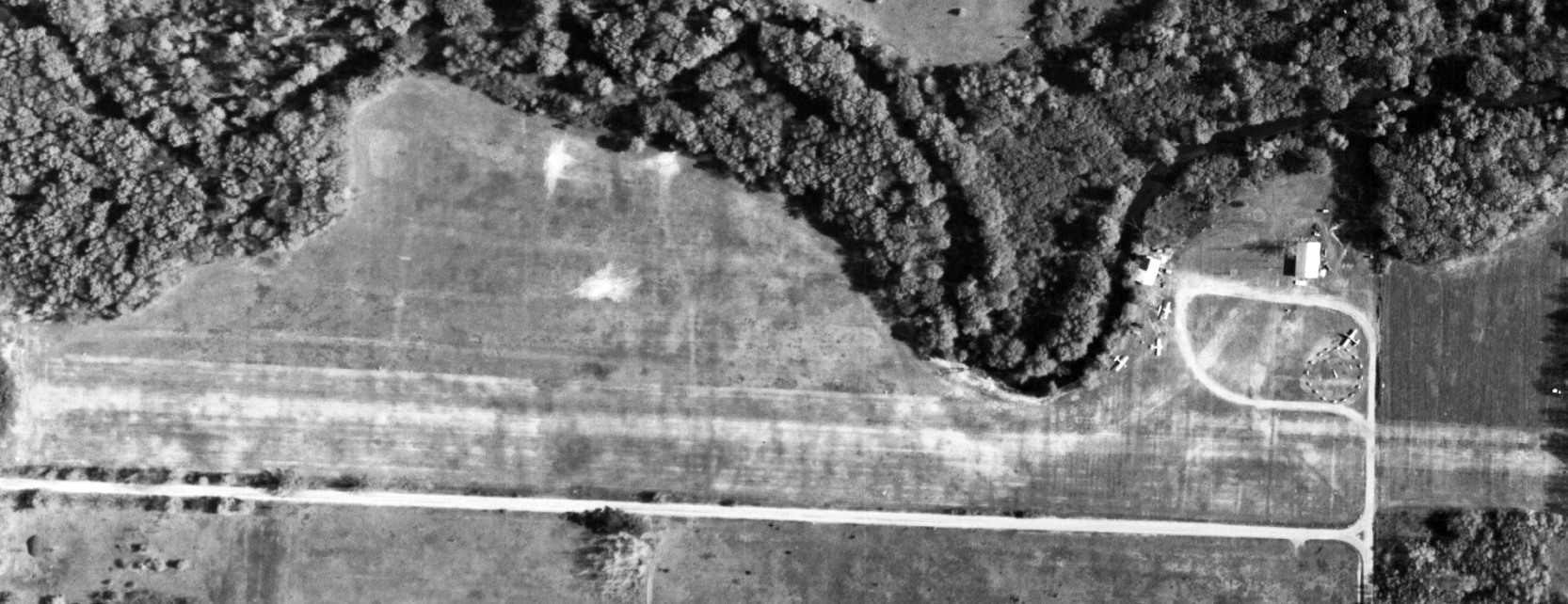
A 5/2/63 aerial photo (courtesy of Mike Denja) depicted Lippert Airport as having a single unpaved east/west runway, with 1 hangar & 4 light single-engine planes on the northeast side.

The earliest aeronautical chart depiction which has been located of Lippert Airport was on the 1965 Milwaukee Sectional Chart.
It depicted Lippert as having a 2,300' unpaved runway.
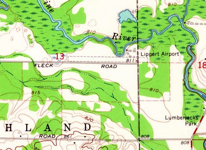
The earliest topo map depiction which has been located of Lippert Airport was on the 1965 USGS topo map.
It depicted Lippert Airport as having a single unpaved east/west runway & 2 small buildings on the northeast side.
Eric Lippert recalled, his father “made huge L-shaped runways [oriented] north/south & east/west so people could find it from sky.
It had a windsock & a base-station aircraft radio in the house; no lights or electronics.”
Eric reported that his father operated Lippert Airport through 1969.
A helicopter accident “kinda was end of airshows & put the FAA on warpath.
We moved, split up the property, and ran tress & fences across the runways so no planes could land.”
The May 1970 Milwaukee Sectional Chart depicted Lippert Airport as having a 3,800 unpaved runway, considerably longer than the 1965 depiction.
Lippert Airport was evidently renamed Lumberjack Land Airport at some point between 1970-71,
as was what was indicated in the 6/24/71 Airmen's Information Manual (courtesy of Mike Denja).
But it also said “Airport closed until further notice.”
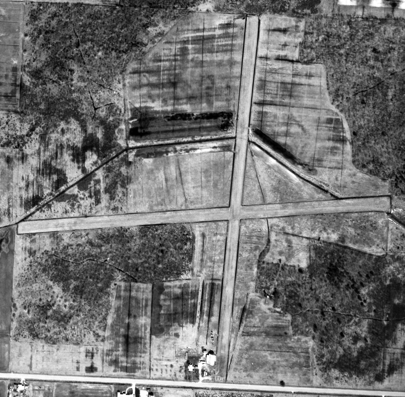
The last photo which has been located showing Lippert / Lumberjack Land Airport Airport in operation was a 5/18/72 aerial view (courtesy of Mike Denja).
It depicted Lippert Airport as having 2 unpaved runways, with 3 small hangars & 3 light single-engine planes on the north side.
The last aeronautical chart depiction which has been located of Lumberjack Land Airport was on the 1974 Detroit Sectional Chart, which depicted it with a 3,800' unpaved runway.
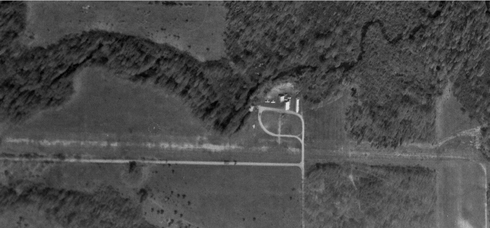
Lumberjack Land Airport was evidently closed (for reasons unknown) at some point between 1974-81,
as it was no longer depicted on the May 1981 Detroit Sectional Chart (courtesy of Ron Plante).
A 1981 aerial view, evidently taken after Lumberjack Land Airport's closure,
showed the field consisted of the east/west unpaved runway & a possible north/south unpaved runway to the east.
Three small hangars remained on the east side, but no planes were visible.
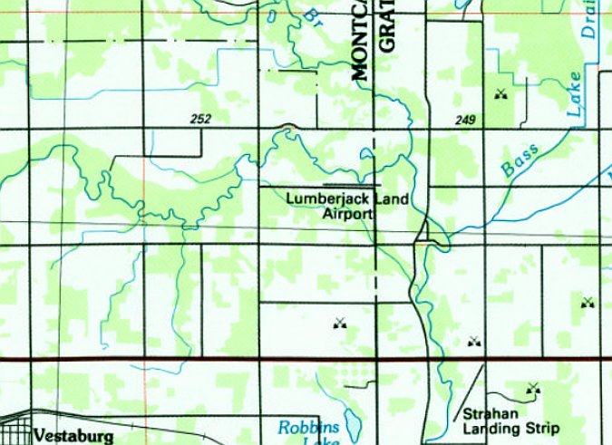
The 1985 USGS topo map still depicted Lumberjack Land Airport as having a single east/west runway.
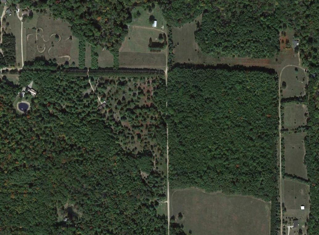
A 2014 aerial view showed the 2 unpaved runways & 1 hangar remained at the Lumberjack Land Airport site.
Thanks to Eric Lippert for pointing out this airfield.
____________________________________________________
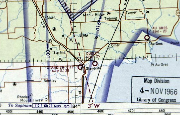
43.986, -83.916 (Northwest of Detroit, MI)
Dudley Airport, as depicted on a 5/3/66 USGS aerial view (courtesy of Mike Denja).
This small general aviation airport was evidently established at some point between 1965-66,
as it was not yet depicted on the 1965 Green Bay Sectional Chart.
The earliest depiction which has been located of Dudley Airport was a 5/3/66 USGS aerial view (courtesy of Mike Denja).
It depicted Dudley Airport as having 2 unpaved runways & a few small buildings on the southwest side.
There were no aircraft visible on the field.
The earliest aeronautical chart depiction which has been located of Dudley Airport was on the December 1966 Green Bay Sectional Chart.
It depicted Dudley Airport as having a 2,500' unpaved runway.
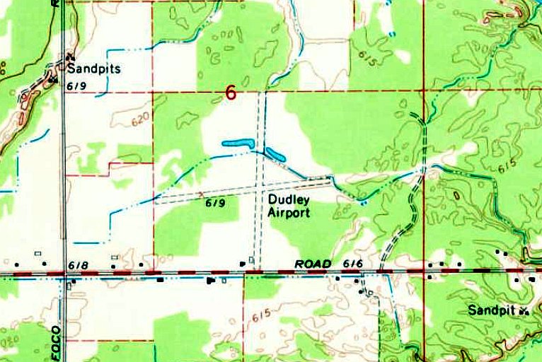
The earliest topo map depiction which has been located of Dudley Airport was on the 1967 USGS topo map.
It depicted Dudley Airport as having 2 unpaved runway & 2 small buildings on the southwest side.
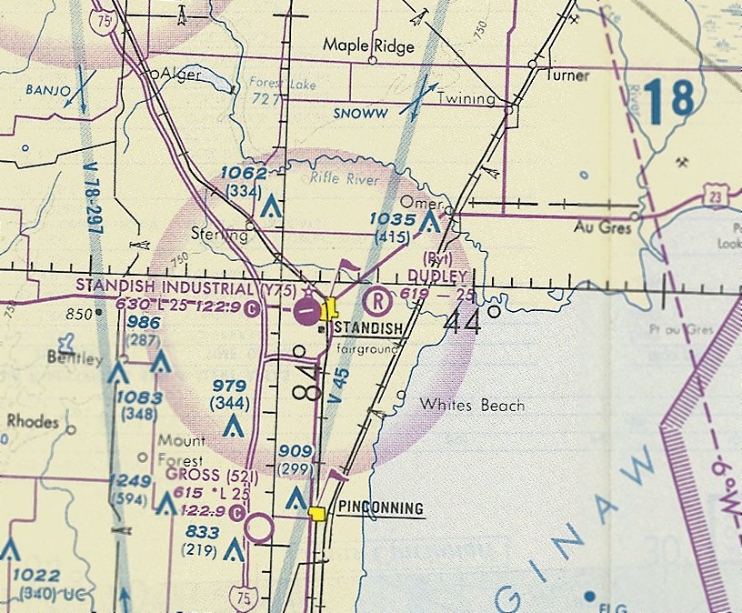
The last aeronautical chart depiction which has been located of Dudley Airport was on the December 1993 Green Bay Sectional Chart (courtesy of Ron Plante).
It depicted Dudley as a private airfield having a 2,500' unpaved runway.
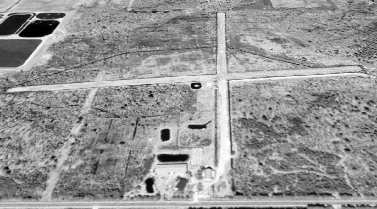
The earliest photo which has been located of Dudley Airport was a 1999 USGS aerial view looking north.
It depicted Dudley Airport as having 2 unpaved runway & 2 small buildings on the southwest side.
There were no aircraft visible on the airport.
Dudley Airport was evidently closed (for reasons unknown) at some point between 1993-2013,
as it was no longer depicted on the 2013 USGS topo map or the 2016 Detroit Sectional Chart.
A 2018 aerial view looking north showed the runways & buildings of Dudley Airport remained intact.
Thanks to Mike Denja for pointing out this airfield.
____________________________________________________
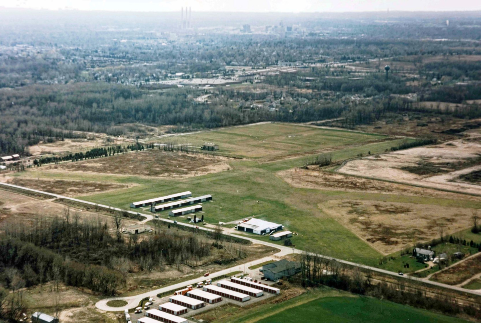
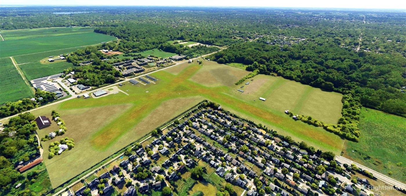
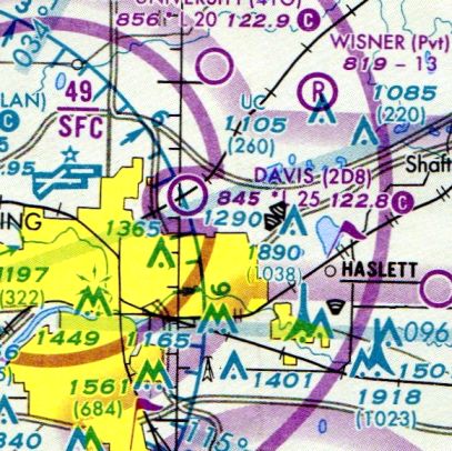
Davis Airport (2D8), East Lansing, MI
42.774, -84.488 (Northwest of Detroit, MI)
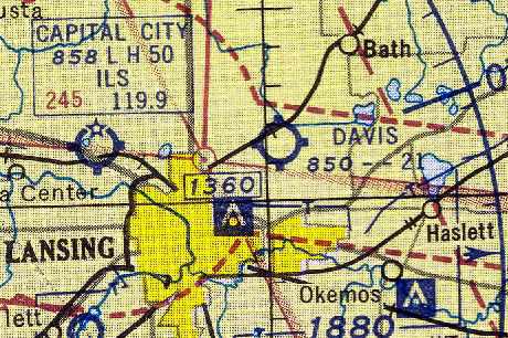
Davis Airport, as depicted on the November 1954 Milwaukee Sectional Chart (courtesy of Chris Kennedy).
According to Ed Rothwell, “Davis Airport was opened in 1948 by the renowned aviator Art Davis.
It was a popular place for locals to hangar their airplanes. It was managed by the Sheren family, who provided flight training, fuel, repair, and other services.”
Davis Airport was not yet depicted on the December 1948 Milwaukee Sectional Chart (according to Chris Kennedy).
The earliest depiction of Davis Airport which has been located was on the November 1954 Milwaukee Sectional Chart (courtesy of Chris Kennedy).
It depicted Davis as having a 2,100' unpaved runway.
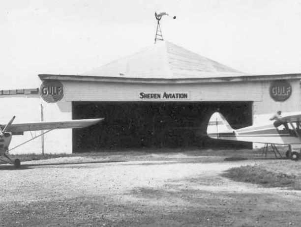
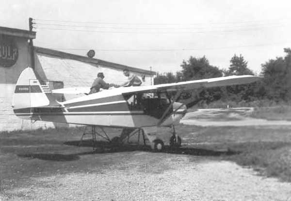
A July 1962 photo by John Mathieson of the Sheren Aviation hangar at Davis Airport.
John Mathieson recalled, “I used to fly out of Davis Airport.
It was owned back in the 1960s by Art Davis, a local farmer & long time barnstormer. Dale Sheren was the fixed base operator.”
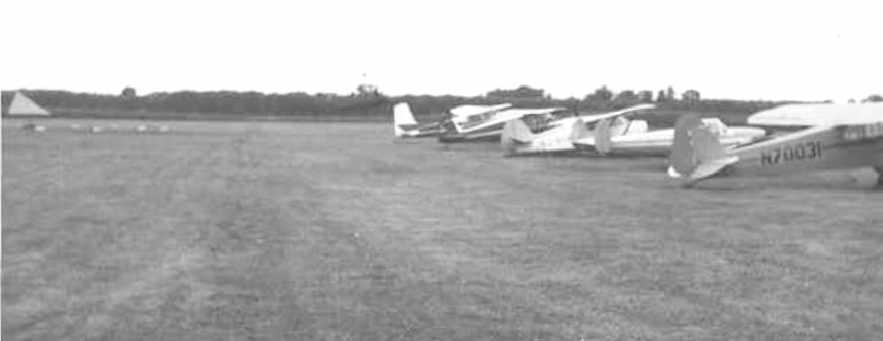
A circa 1960s photo by John Mathieson of 5 planes on the Davis Airport flightline.
A circa 1960s photo by John Mathieson of a Piper Tri-Pacer being serviced next to the Sheren Aviation hangar at Davis Airport.
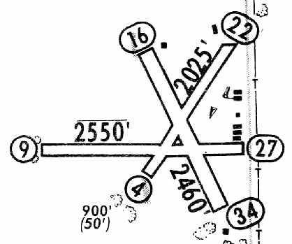
The 1965 Jeppesen Airway Manual (courtesy of Chris Kennedy) depicted Davis as having 3 unpaved runways, with the longest being the 2,550' Runway 9/27.
Six buildings were depicted on the east side of the field. The manager was listed as Dale Sheren.
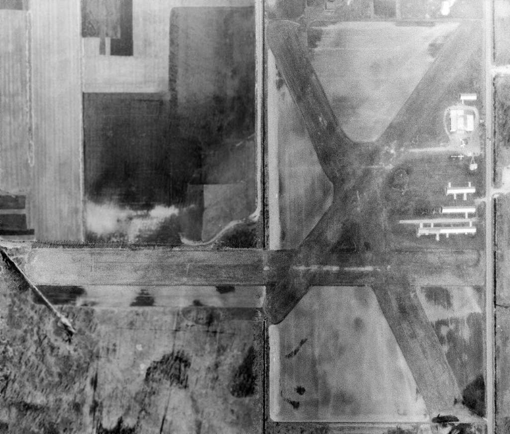
A 4/1/70 USGS aerial view depicted Davis as having 3 grass runways, 5 hangars, and 3 single-engine aircraft.
The 1972 USGS topo map depicted Davis as having 3 unpaved runways.
Ted Dyson recalled, “My time flying out of Davis airfield... All of the runways were sod, short, and quirky, but as a no-time pilot I did not know any better.
I flew a little Tri-Champ (7539E) a couple times a week putting all of my income from my first job into the lessons.
All of the runways had their quirks... Runway 27 was the main runway & it had a fairly busy road right at the threshold.
The road was about 10' higher than the runway & I remember my instructor telling me that I needed to be careful to time my approaches to avoid the wind from the semis as they went by the runway.
He was not joking. Between the elevated road & the height of the trailer, it would have been easy to clip the top of the trailer if you were not paying attention.
Runway 34 had a big tree right at the threshold. We did not land on it very often but when we did, we needed to do an off-set approach with a last second jog to the runway to get around the tree.
Runway 22 had a big clump of bushes right at the departure end of the runway.
My instructor was an artillery spotter pilot just back from Vietnam & he had some different ideas about what a good takeoff was.
One time, going off of Runway 22 he said 'Let me have this takeoff.'
He flew the plane in ground effect & only after I screamed 'DAN, THE BUSHES' did he convert all that extra speed into altitude.
The winter of 1972/73 was wet rather than cold/snowy & Davis was closed for most of the winter.”
Leonard Rahilly recalled, “I used to fly out of Davis Airport - approximately 1976-89.
I bought the 1957 Champion 7FC that was used by Dale Sheren for primary training & in which I got my private [pilot's] license.
I believe it was put up for sale after Dale died, in anticipation of a new FBO coming in.
After I recovered the plane, I stored it in half of the big hangar.
It was definitely a part of many local student pilots' lives & probably of some who rented it after they got their licenses.
I knew Art Davis a little bit, because he would sometimes come in & sit in the office.
I could tell you the little bit I gleaned from seeing him, hearing about him, and very, very occasionally, talking with him.
I also flew with the FBO that took over after Dale Sheren died.
[They used a] C-152 for primary, C-172 for commercial & instrument.”
Leonard continued, “Davis Airport was almost on a line with Capital City Airport's east/west runway, so the pattern altitude was only 800'.
There WERE some pretty big planes passing right over Davis.
Fortunately, Capital City was several miles to the west, and I don't think there was ever any danger of a collision with Davis traffic as long as the latter did what it was supposed to.
It was one of those places where you could meet a lot of local pilots if you wanted to, and it was OK to hang around the office a bit.
You could pump your own gas & then go in and pay.
In the late 70s, when I started lessons at Davis, Art Davis would occasionally come in to the office, although I believe he did not fly any more at that point.
He was not a talkative fellow, at least not to us neophytes.”
John Yurkon recalled, “Since Davis was close to MSU I started flying there in 1978.
I enjoyed flying out of Davis even though the approaches over the trees or power lines, depending on the runway in use, could make your passengers nervous.”
Ron Nelson recalled Davis Airport, “I housed my plane there (Stinson 108-3)
and took my lessons & received my license there in the late 1970s / early 1980s.
At that time there were 10-15 planes housed in the hangars near Runway 9/27.
There was also a larger hangar used by the field operators to house their trainers (they had 2) & an on-site mechanic.
When I flew out of Davis it was well maintained & a lot of fun to hang out at.”
The 1982 AOPA Airports USA directory (courtesy of Ed Drury)
described Davis Airport as having 3 turf runways, with the longest being the 2,600' Runway 9/27.
The field was said to offer fuel, hangars, tiedowns, charter, flight instruction, and aircraft rental.
The operators were listed as Sheren Aviation & Community Aviation.
Claus Buchholz recalled, “My first visit to Davis was to seek aerobatics instruction.
In Winter & Spring of 1987, Community Aviation's excellent instructor taught me precision fun flying in his 152 Aerobat.
Later I earned my instrument rating, commercial license, and CFI there, and became an instructor at their flight school.
It was a great place for flying & for hangar flying. I have never found that sense of community at any other airport since.
I hangared my Citabria there from the day I bought it in 1987 until the sad day the airport closed. Davis Airport is missed.”
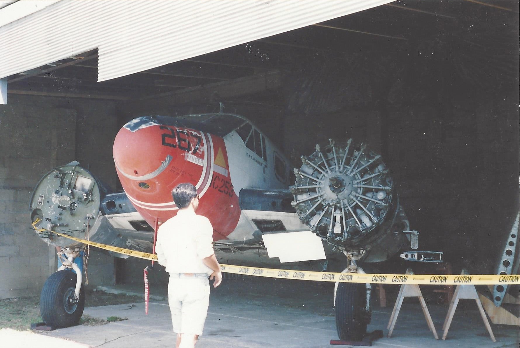
A late 1980s photo by John Yurkon of a Beech C-45 Expediter (hopefully in the process of being restored) inside a Davis Airport hangar.
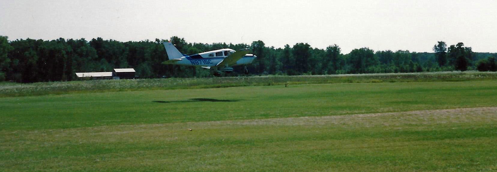
A late 1980s photo by John Yurkon of a Piper Cherokee landing on a pristine grass runway at Davis Airport.
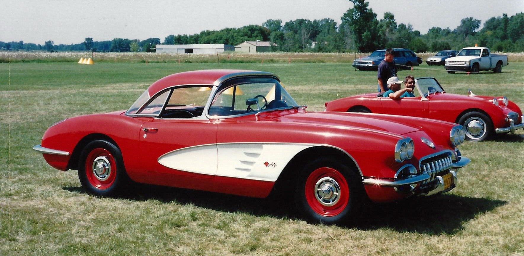
A late 1980s photo by John Yurkon of a beautiful 1st generation Chevrolet Corvette at Davis Airport.
John recalled, “Davis hosted other activities such as vintage auto shows.”
A 1993 USGS aerial photo showed no aircraft parked outside at Davis Airport.
The last airport directory listing which has been located of Davis Airport was in the 1996 MI Airport Directory (courtesy of Ed Rothwell).
It depicted Davis as having 3 unpaved runways, with the longest being the 2,553' Runway 9/27.
Several small buildings were depicted on the east side of the field, and the manager was listed as Edith Sheren.
Two 1998 photos by Claus Buchholz of his Citabria at Davis Airport.
A circa late 1990s photo by Robert Miller (courtesy of Claus Buchholz) looking northeast at a snowy Davis Airport.
A circa late 1990s photo by Robert Miller (courtesy of Claus Buchholz) looking southwest at Davis Airport.
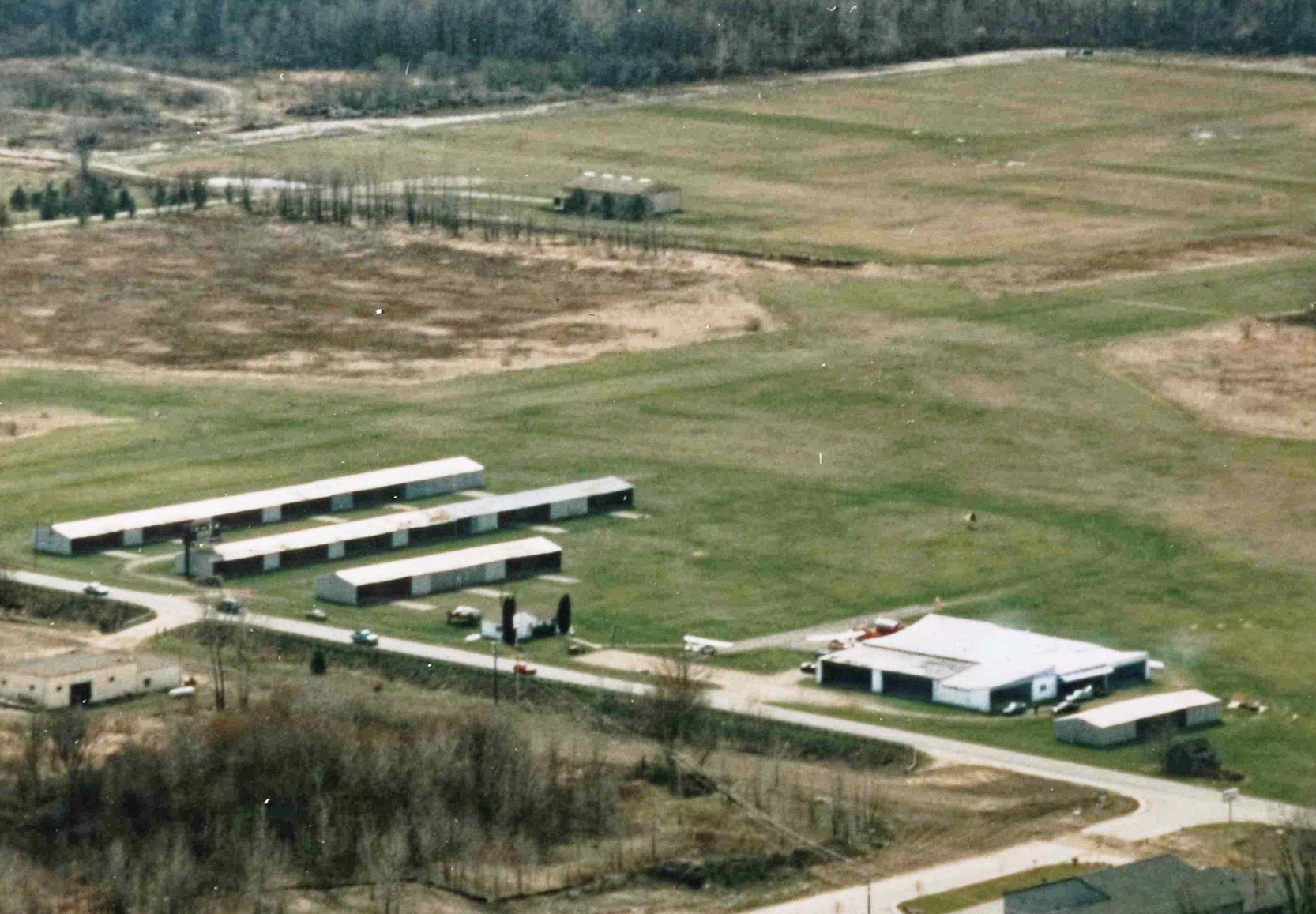
A closeup from the circa late 1990s photo by Robert Miller (courtesy of Claus Buchholz) looking southwest showing 2 light single-engine aircraft parked near the Davis Airport hangars.
A flight simulation scenery depiction by Ed Rothwell looking southeast at Davis Airport.
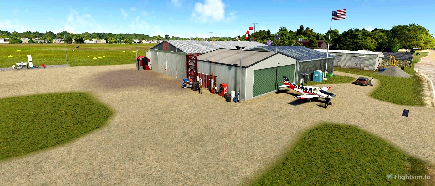
A flight simulation scenery depiction by Ed Rothwell of a Beech Bonanza in front of the Davis Airport hangars.
The March 1999 Detroit Sectional Chart (courtesy of Richard Finley) depicted Davis as having a 2,500' unpaved runway.
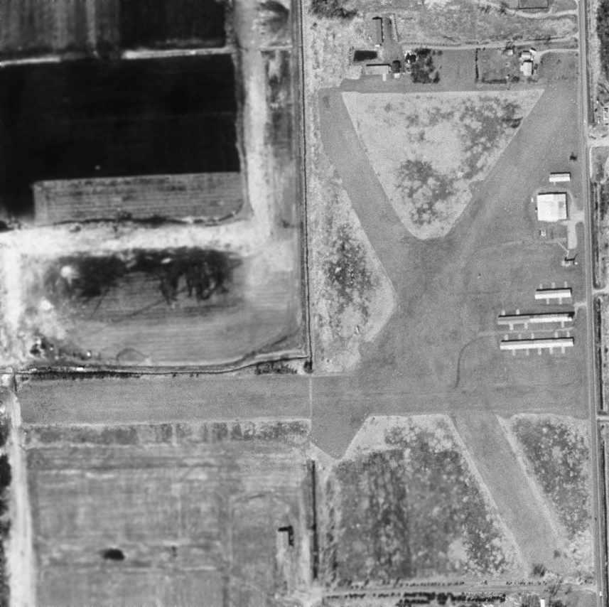
In the 1999 USGS aerial photo, Davis Airport unfortunately appeared to be a little airport on its last legs, with not a single aircraft visible on the field.
The field was otherwise still intact, though, with 3 clear grass runways & 5 hangars.
Davis Airport was “closed permanently, effective 4/5/00”, according to the MI Bureau of Aeronautics (courtesy of Chris Kennedy).
According to Ron Nelson, “The field was closed because the land was sold off
for apartment buildings that are used primarily by Michigan State University students (a couple of miles south),
a small strip mall & some individual houses just north of the site.”
A 2005 aerial photo showed houses had covered the site of Davis Airport.
A 2015 aerial photo showed no obvious trace remaining of Davis Airport.
However, Joel Bence observed, “You can see the remains of the fuel pump parking pad & some of the foundation for the largest hangar.
It's the only white spot in the grass field along the road on the right hand side.”.
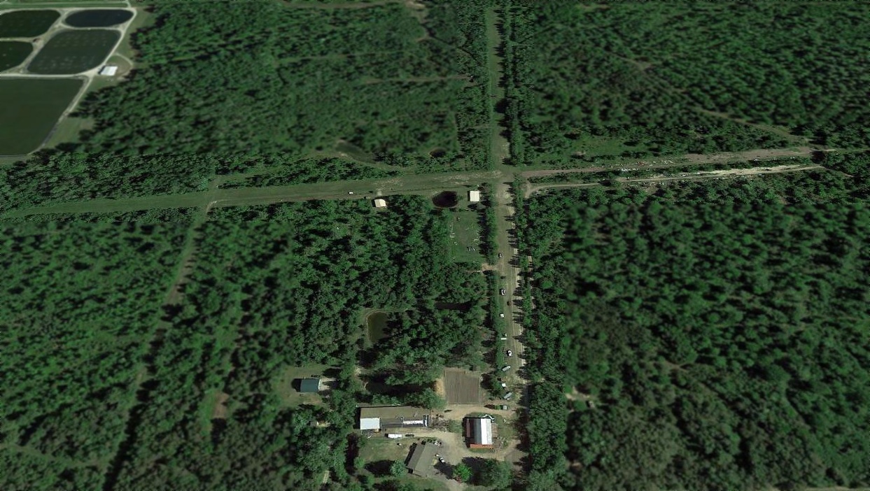
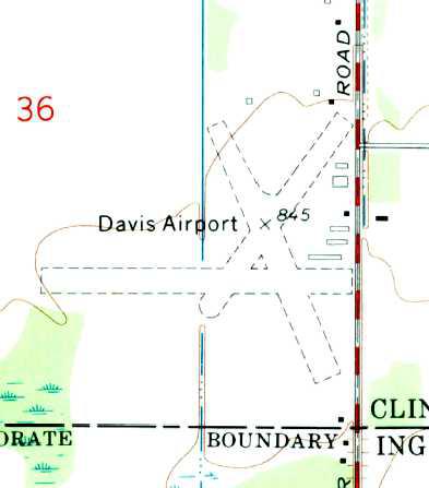
The site of Davis Airport is located northwest of the intersection of Coleman Road & Chandler Road.
____________________________________________________
St Johns Airport / Wings Airport / Dickinson Airport, St Johns, MI
42.975, -84.6 (Northwest of Detroit, MI)
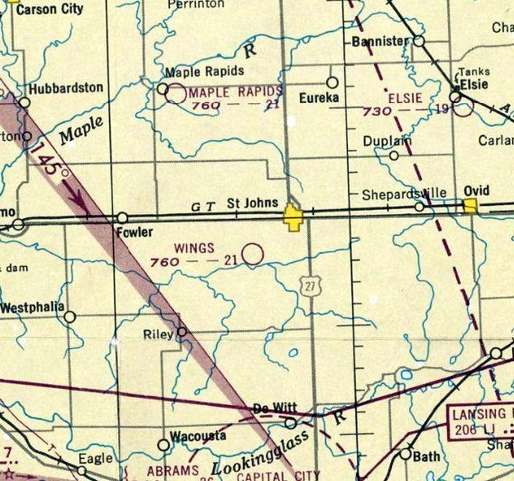
Wings Airport, as depicted on the June 1947 Milwaukee Sectional Chart.
The date of establishment of this small general aviation airport has not been determined.
The earliest reference which has been located of St Johns Airport was an article entitled “St. Johns is set for model meet” in the 4/16/40 Lansing State Journal (courtesy of Bill Grasha).
It described how a model airplane contest was to be held at the St. Johns Airport.
However, St Johns Airport was not yet depicted on the February 1941 Milwaukee Sectional Chart.
St Johns Airport still not depicted on the December 1946 Milwaukee Sectional Chart.
An article entitled “Down the runways” in the 4/13/47 Lansing State Journal (courtesy of Bill Grasha)
described how the St. Johns Airport was owned by Floyd Wing.
Wesley Clark was said to operation the C & M Flying Service at the airport.
The earliest depiction which has been located of Wings Airport was on the June 1947 Milwaukee Sectional Chart,
which depicted Wings as having a 2,100' unpaved runway.
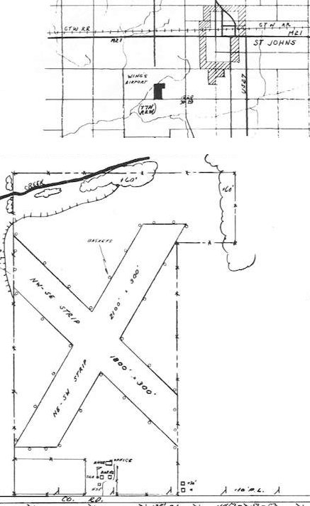
The 1947 MI Airport Directory (courtesy of Bill Grasha) depicted Wing's Airport as having 2 unpaved runways in an X-shape,
measuring 2,100' southwest/northeast & 1,800' northwest/southeast.
A hangar, office, and a few other small buildings were depicted on the south side.
Wings Airport was still depicted on the December 1948 Milwaukee Sectional Chart.
The airport was renamed St Johns Airport at some point between 1948-49,
as that is how it was labeled on the June 1949 Milwaukee Sectional Chart.
An article entitled “St. Johns Man Must Return $17,250 to VA” in the 7/21/53 Lansing State Journal (courtesy of Bill Grasha)
described how Wesley Clark, former flying instructor of C & M Flying Service, pled guilty to charges of defrauding the VA.”
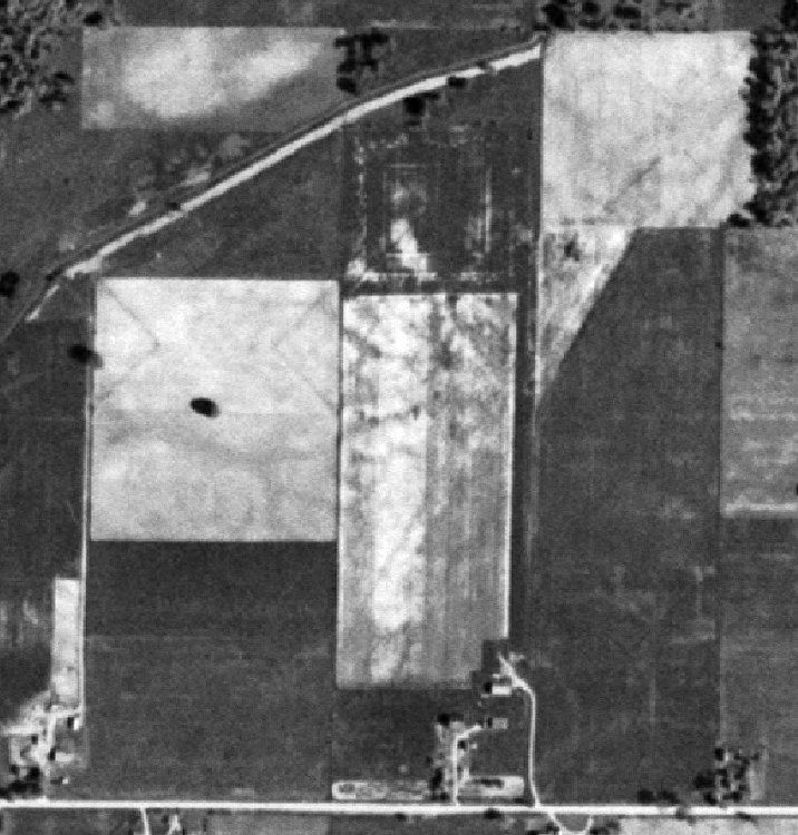
The earliest photo which has been located of St. Johns Airport was a 1953 aerial view (courtesy of Mike Denja).
It showed the faint trace of St. Johns Airport having 2 unpaved runways, with a few small buildings on the southeast side.
St Johns Airport was still depicted on the November 1954 Milwaukee Sectional Chart.
St Johns Airport was evidently closed at some point between 1954-55,
as it was no longer depicted on the May 1955 Milwaukee Sectional Chart.
There was no recognizable sign of an airfield on a 1956 aerial photo.
St Johns Airport was still not depicted on the May 1960 Milwaukee Sectional Chart.
An article entitled “St. Johns Airport to be Improved” in the 7/7/60 Lansing State Journal (courtesy of Bill Grasha)
described how Charles Dickinson presented “a plan to revitalize the old Wings Airport.”
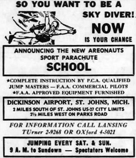
The airport was evidently reopened under the name of Dickinson Airport at some point between 1960-64,
as that is how it was labeled in a 7/16/64 advertisement for skydiving (courtesy of Bill Grasha).
It was depicted as Dickinson Airport on the May 1965 Milwaukee Sectional Chart.
The 1965 USGS topo map depicted Dickinson Airport with a very different runway configuration than its previous iteration,
with 2 perpendicular unpaved runways, with a few small buildings on the southeast side.
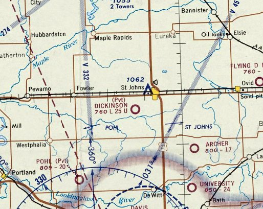
The last aeronautical chart depiction which has been located of Dickinson Airport was on the May 1970 Milwaukee Sectional Chart.
It depicted Dickinson as a private airfield having a 2,500' unpaved runway.
The last reference which has been located of Dickinson Airport was an article entitled “Air Tour Set Saturday” in the 10/7/71 Lansing State Journal (courtesy of Bill Grasha).
It said “Farmers will get a birds-eye view of soil conservation practices during an air tour...
flights will being at the Charles Dickinson Airport.”
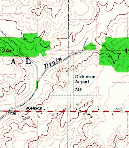
The last depiction which has been located of Dickinson Airport was a 1973 aerial view (courtesy of Mike Denja).
It depicted Dickinson Airport as having 2 perpendicular unpaved runways, with a few small buildings on the southeast side.
There were no aircraft visible on the field.
Dickinson Airport was evidently closed at some point between 1971-74, as it was no longer depicted on the 1974 USGS topo map.
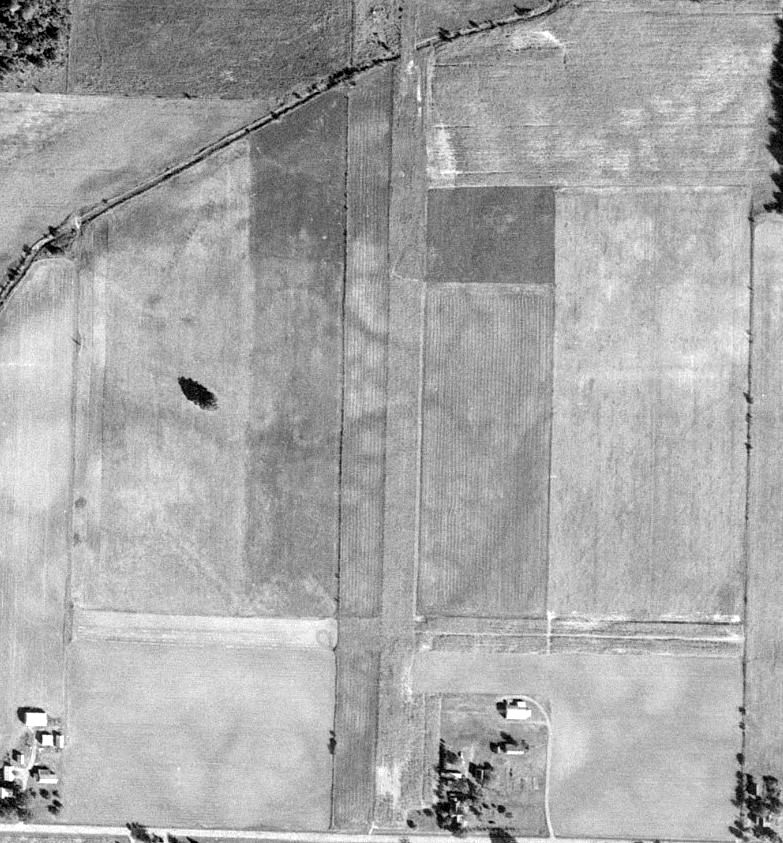
There was no recognizable sign of an airfield on a 1981 aerial photo.
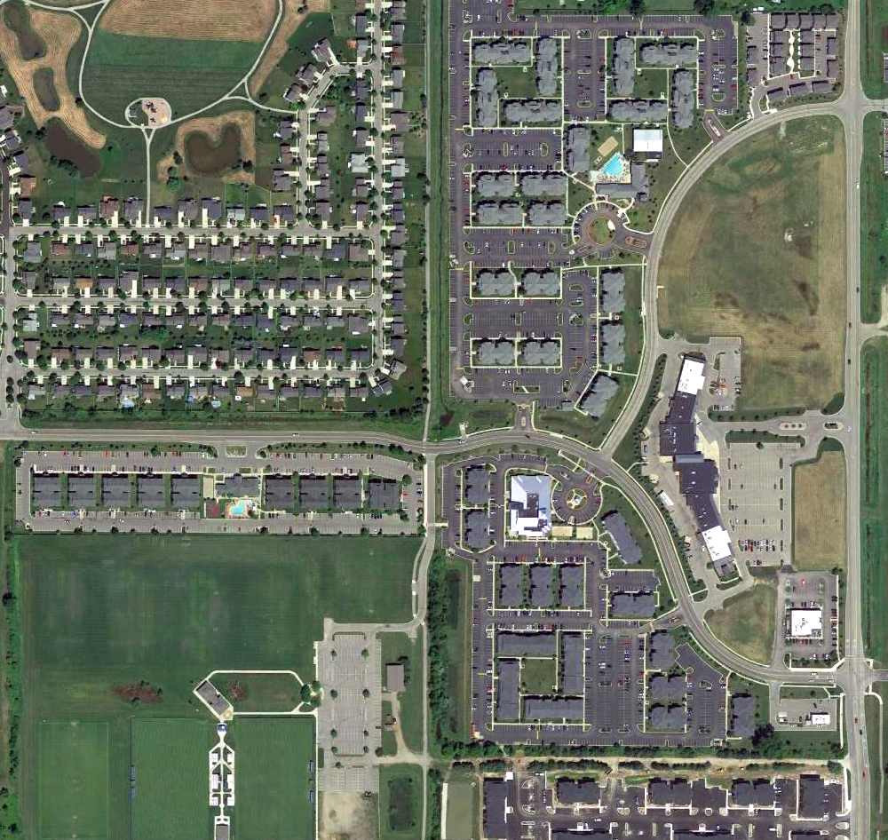
A 2015 aerial view looking north showed no trace of Dickinson Airport.
The site of Dickinson Airport is located south of the intersection of West Townsend Road & Airport Road, appropriately enough.
Thanks to Bill Grasha for pointing out this airfield.
____________________________________________________
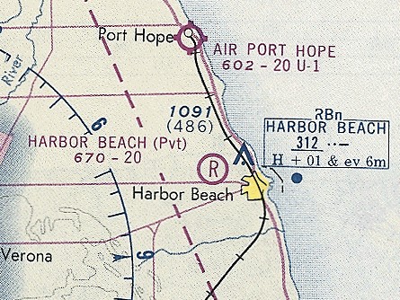
Poschke's Harbor Beach Airport, Harbor Beach, MI
43.848, -82.698 (North of Detroit, MI)
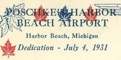
A postmark commemorating the 7/4/31 dedication of Poschke's Harbor Beach Airport (courtesy of Bill Grasha).
According to “Harbor Beach 1837-1996” (courtesy of Bill Grasha), “In 1928 Otto Poschke bought a farm west of Harbor Beach & planned to build a home & an airport.
In 1929, forty acres of this land were plowed, leveled, and seeded for the airport.
The aviation field was 80 rods square.
An airport hangar was constructed near the road & a 40' steel flagpole was erected at the back of the property.
Poschke's Harbor Beach Airport was dedicated on 7/4/31 & was the only airport in Huron County.”
The earliest aeronautical chart depiction which has been located of Poschke's Harbor Beach Airport was on the August 1933 Detroit Sectional Chart (courtesy of Mike Denja).
It depicted Poschkes as a commercial/municipal airport.
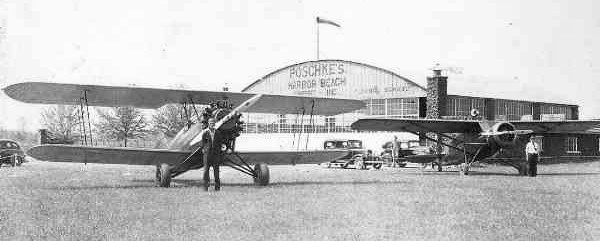
A circa 1930s photo (courtesy of Bill Grasha) of a Bird biplane & Stinson monoplane in front of a large arch-roof hangar marked “Porchke's Harbor Beach Airport”.
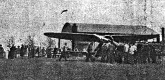
A 1938 photo (courtesy of Mike Denja) of an Airmail biplane at Porchke's Harbor Beach Airport.
According to “Harbor Beach 1837-1996” (courtesy of Mike Denja), “National Air Mail Week, May 15-21, 1938, was observed by a flight from Harbor Beach to Detroit on May 19.
The first air mail flight left Harbor Beach & arrived at Detroit City Airport after stopovers in Port Huron & Mt. Clemens.”
The October 1943 Detroit Sectional Chart (courtesy of Ron Plante) depicted Poschkes as a commercial/municipal airport.
According to “Harbor Beach 1837-1996” (courtesy of Mike Denja), “Bruce Kleinknecht recalls how a man from Saginaw won free flying lessons
as a prize at an air show at Poschke's Airport shortly after World War II.
Bruce mailed a penny postcard to him with an offer of $20 for the prize & quickly received the prize.
Bruce received his flying lessons to solo from Jack Oberski, operator of the airport at that time.
Mr. Poschke sold the airport to Carl Gerstenschleger, Sr. in the mid-1940s.”
The 1947 MI Airport Directory (courtesy of Bill Grasha) depicted Harbor Beach Airport as having 2 unpaved 2,000' runways in an X-shape,
with a hangar on the south side.
A 5/28/53 USGS aerial view showed the Harbor Beach Airport runways remained clear, and the hangar roof was still painted with a checkerboard pattern.
But there were no aircraft visible on the field.
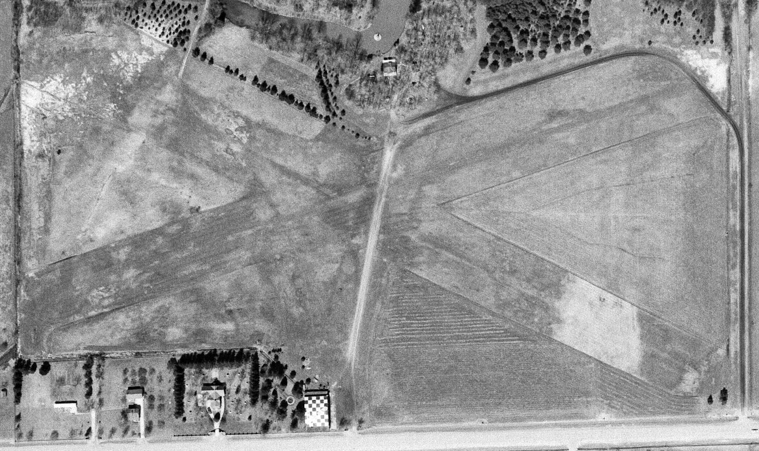
A 4/11/68 aerial view (courtesy of Mike Denja) showed the Harbor Beach Airport runways remained clear, and the hangar roof was still painted with a checkerboard pattern.
But there were no aircraft visible on the field.
A 1969 aerial view showed the Harbor Beach Airport runways remained clear, and the hangar roof was still painted with a checkerboard pattern.
But there were no aircraft visible on the field.
The last aeronautical chart depiction which has been located of Harbor Beach Airport was on the November 1974 Detroit Sectional Chart (courtesy of Ron Plante).
It depicted Harbor Beach as a private airfield having a 2,000' paved runway.
According to “Harbor Beach 1837-1996” (courtesy of Mike Denja), “The last pilot to use the airfield was Bob Arnold with his AT6.
It was closed in the late 1970s.”
Harbor Beach Airport was no longer depicted on the May 1981 Detroit Sectional Chart (courtesy of Ron Plante).
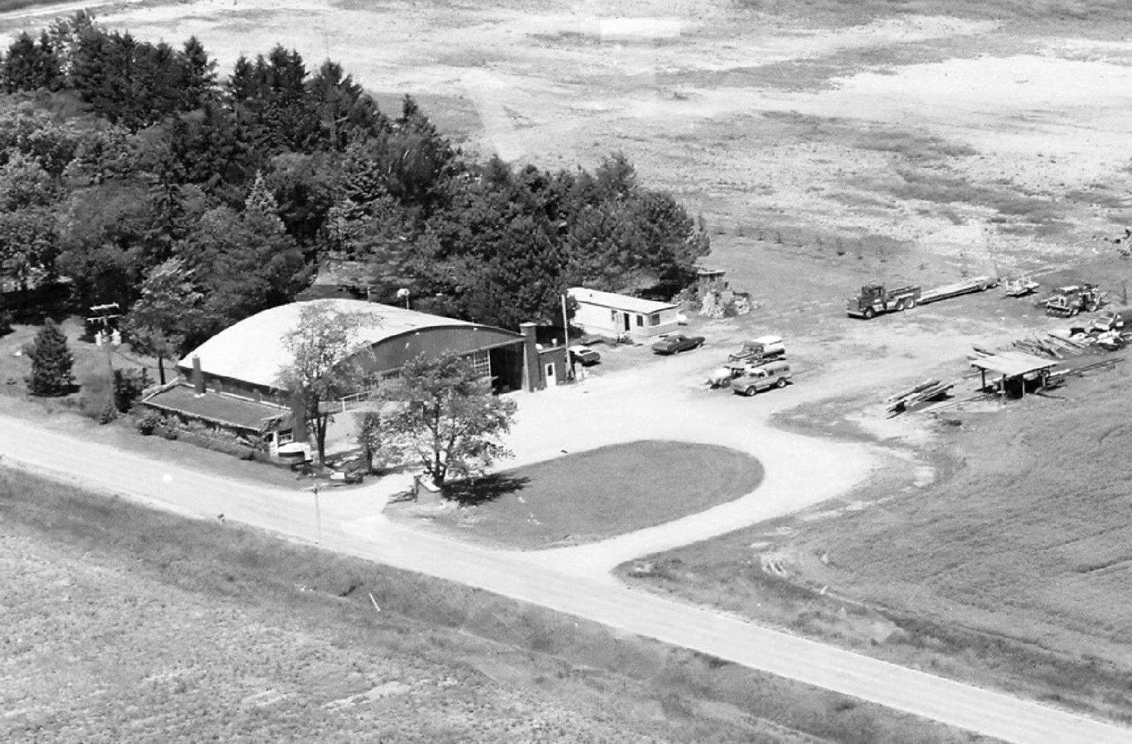
A 1983 aerial view looking northwest (courtesy of Mike Denja) showed the Harbor Beach Airport hangar remained intact,
but there was no sign of recent aviation use.
According to “Harbor Beach 1837-1996” (courtesy of Mike Denja), “What was once an airfield is currently being used as farmland.
The brick fence & hangar are still there as reminders of days gone by.”
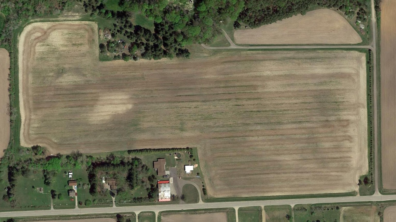
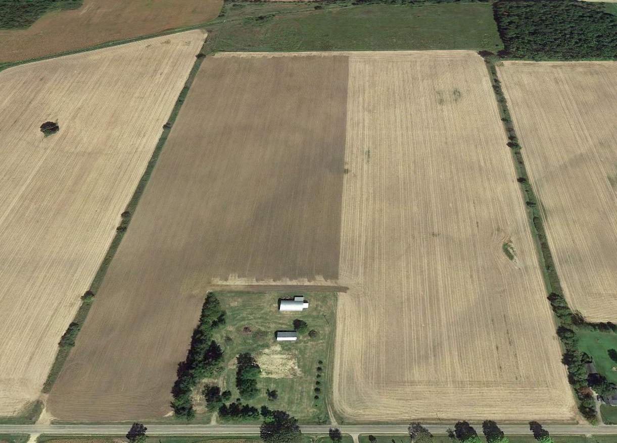
A 2016 aerial view of the site of Harbor Beach Airport shows that the runway area remains clear, though the runways themselves are no longer recognizable, with the area having been returned to cultivation.
The airport's hangar remains standing along the south side, amazingly after 85 years. The hangar roof's checkerboard pattern is still recognizable, though faded.
The site of Harbor Beach Airport is located northeast of the intersection of Section Line Road & Stafford Road.
Thanks to Bill Grasha for pointing out this airfield.
____________________________________________________
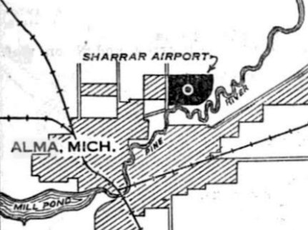
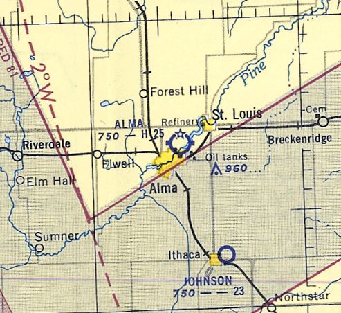
Sharrar Airport / Alma Airport, Alma, MI
43.391, -84.643 (Northwest of Detroit, MI)
Sharrar Airport, as depicted on the the 2/2/29 Commerce Department Airway Bulletin (courtesy of Mike Denja).
According to greatlakespilot.com, “The first airport in the Alma area was in an open field near Superior Street just north of the old Total Refinery.
On 2/23/28, the growth & safety of aviation was the topic of conversation at the Alma Chamber of Commerce.
The second airport was the old Alma Airport or what was called Sharrar Field that most of the local people remember on Bridge Street behind the high school.
The north/south runway was short & not used much.
The east/west runway had the Pine River on the east & Bridge Street on the west.
Also the concrete plant constructed in the early 1950s to the west made it impossible for the runway to be expanded.”
According to greatlakespilot.com, “On 5/17/28 an aviation club was started.
H. H. Keating, the manager of the Saginaw District of Standard Oil was in town in the interest of aviation in Gratiot County.
It was decided to form this club & establish a drive to find at least 100 members.
Sharrar Field was really just a cow pasture with about 2,600' of runway.
The barn had been converted into a hangar. It needed a lot of work to have bigger planes land there.
Some of the first members were F.J. Lobdell, W.A. Barton, Gordon Brown, W.F. Renolds, Frank Parker & George Sharrar.
The money raised by the membership pushed work on the field to make it the best in Gratiot County.
The field was fine to fly small 2-place airplanes in & out but it didn’t work for larger ones.
Dr. Jack Sanders used to fly a Stout Tri Motor & said it was difficult to land on a short runway.
Plans were perfected & on 6/20/28 a Board of 10 directors were chosen.
Renolds & Murphy were elected as secretary & Treasurer. The rest of the board consisted of Babcock, Swartout, Faunce, Rodenmocker, Housel, and Parker.
Just a few months later, disaster struck when the hangar caught fire & burned.
Three airplanes burned, two of which belonged to W.A. Barton & Gordon Brown who had done much to promote aviation in this area.
The fire loss was a severe blow. Gordon’s plane was a Great Lakes.”
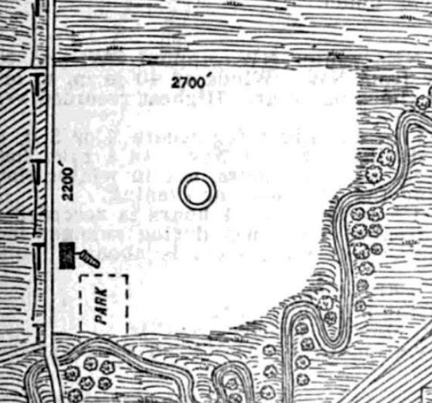
The earliest depiction which has been located of Sharrar Airport was on the 2/1/29 Commerce Department Airway Bulletin (courtesy of Mike Denja).
It described Sharrar Airport as a commercial airport owned by George Sharrar & operated by the Alma St. Louis Aviation Club.
The field was said to consist of a 110 acre square-shaped loam field measuring 2,700' x 2,200'.
A single hangar on the southwest corner was said to have “Alma Airport” marked on its roof.
According to greatlakespilot.com, “On 6/6/29, the airport was finally ready to land larger aircraft despite the rains interfering with grading operations.
The field was completed & an all-steel hangar was erected. Planes were already using it & plans for an aviation day were in the making.
It was thought to be the best field in the state because it was high & dry which assured safe landings & easy takeoffs.
It was used for many years.”
The earliest aeronautical chart depiction which has been located of Sharrar Airport was on the June 1931 Sectional Chart (courtesy of Mike Denja).
It depicted Sharrar as a commercial/municipal airport.
Sharrar Airport was still depicted on Sectional charts through 1935 (according to Mike Denja).
It may have briefly closed at some point between 1935-36,
as it was no longer depicted on the 1936 Sectional Chart (according to Mike Denja).
The airport apparently reopened under the name of Alma Airport at some point between 1936-37,
as that is how it was depicted on the 1937 Sectional Chart (according to Mike Denja).
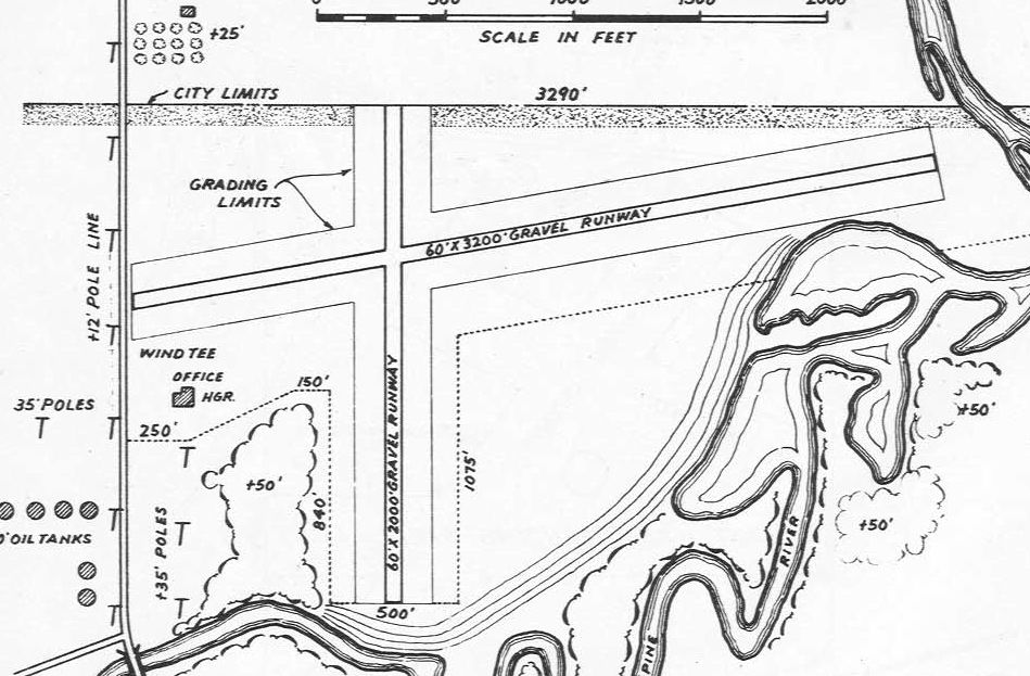
The earliest airport directory listing which has been located of Alma Airport was in the 1947 Michigan Airport Directory (courtesy of Bill Grasha).
It depicted Alma Airport as having 2 gravel runways: measuring 3,200' east/west & 2,000' north/south.
An office & hangar sat the southwest of the runway intersection.
The May 1953 Milwaukee Sectional Chart depicted Alma Airport as having a 2,500' paved runway.
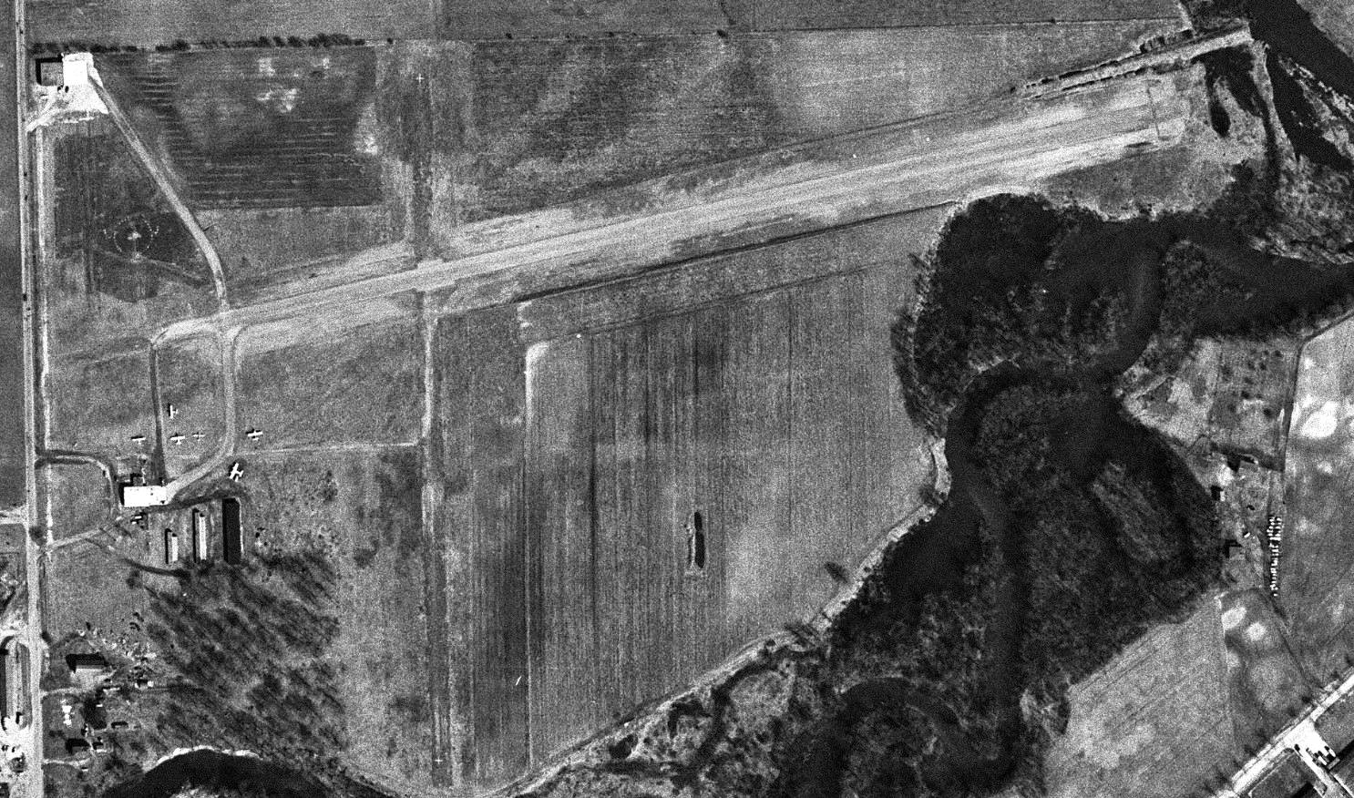
The earliest photo which has been located of Alma Airport was a 5/5/54 aerial view (courtesy of Mike Denja).
It depicted Alma Airport as having 2 unpaved runways, with 8 light planes parked near a few small buildings on the northwest & southwest sides.
The last depiction showing Alma Airport still in operation was on the 1959 USGS topo map.
According to greatlakespilot.com, “In the late 1950s / 1960s an idea of a new airport was being thrashed about.
We had 2,600' of runway but needed 5,000-6,000' to land even larger planes that were being built.”
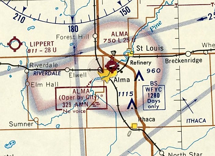
The last aeronautical chart depiction which has been located showing Alma Airport as open was on the December 1968 Milwaukee Sectional Chart (courtesy of Mike Denja).
It depicted Alma Airport as having a 2,500' paved runway.
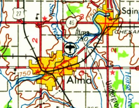
According to greatlakespilot.com, “Finally a compromise to build an airport between Alma & Ithaca was settled. It was dedicated in 1969.”
The original Alma Airport was presumably closed upon the opening of the new airport,
as subsequent Sectional Charts depicted Alma Airport as abandoned.
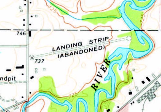
The 1973 USGS topo map depicted Alma Airport as a single unpaved northeast/southwest runway, labeled as “Landing strip (abandoned)”.
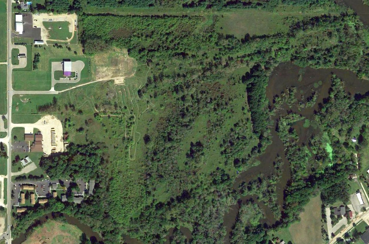
A 9/21/15 aerial view of the site of Alma Airport (courtesy of Bill Grasha).
Bill Grasha observed that the location of the former east/west runway is occupied by a road named Willow Run Drive, maintaining an aviation theme on the property.
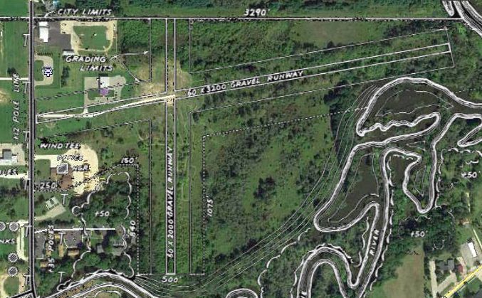
The 1947 MI Airport Directory depiction of Alma Airport, overlaid by Bill Grasha over a 9/21/15 aerial view of the site.
The aviation history of the Alma Airport site has been commemorated, as 2022 street maps show the “Runway Disc Golf Course” occupying the property.
Thanks to Bill Grasha for pointing out this airfield.
____________________________________________________
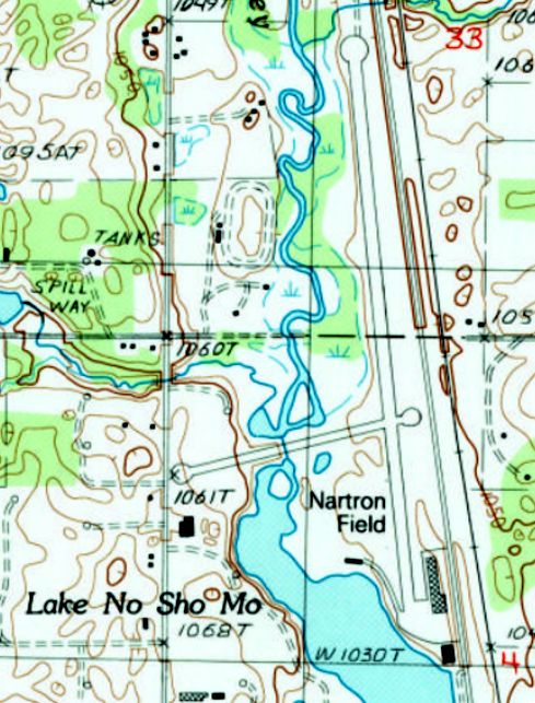
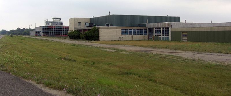
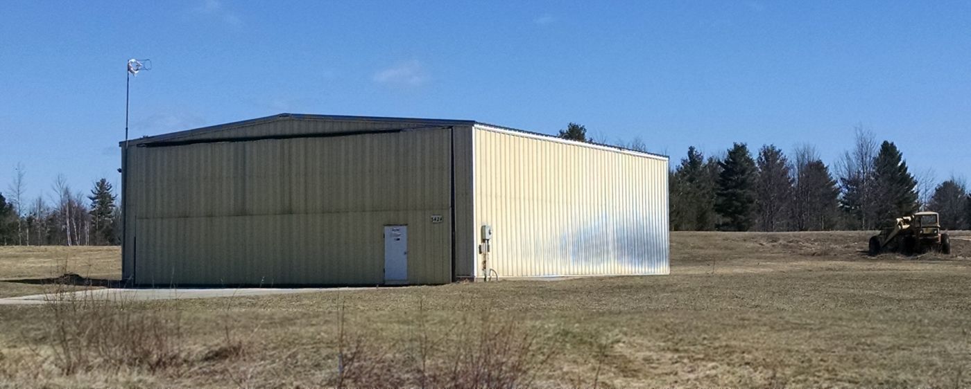
Miller Airport / Nartron Field (RCT), Reed City, MI
43.9, -85.517 (Northwest of Detroit, MI)
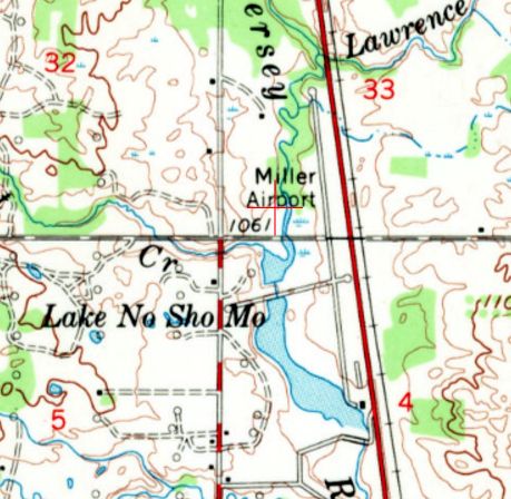
Miller Airport, as depicted on the 1959 USGS topo map.
According to its FAA Airport/Facility Directory data, Miller Airport was activated in August 1956.
It was reportedly named after Jim Miller, founder of Miller Industries, one of the town's biggest employers,
who manufactured various glass & aluminum products.
According to the book “Reed City Boy” by Timothy Bazzett, Miller Auditorium was where they hosted the "Crystal Ball",
which was a big social event for Reed City, with a sit-down dinner catered by the Osceola Hotel & music by the Les Elgart Orchestra.
According to the book “One Hundred Going on Two Hundred: Reed City Centennial” by Marjorie White,
“Many residents will remember the excitement caused by the Dawn Patrols held at Miller Airport, generally around Labor Day.
It was great fun watching the many planes land that arrived here for the event."
There was also a popular pancake breakfast afterward.
The earliest depiction which has been located of Miller Airport was on the 1959 USGS topo map.
It depicted Miller Airport as having 2 paved runways, with 2 buildings on the southeast side.
According to Wikipedia, “Miller Airport... was purchased by Nartron Corporation in the 1979 to house its engineering & manufacturing operations.
Advanced Product Development & Wire Products Assembly occurred at this location until the late 1980s.
These operations have since been moved to another location”, presumably Nartron's Corporation's facility just to the north of the airport.
The 1987 USGS topo map depicted Nartron Field as having 2 paved runways, and a ramp with 2 buildings on the southeast corner.
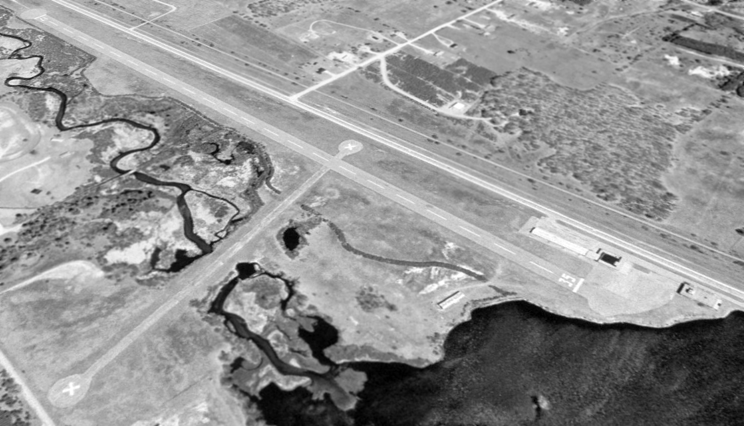
The earliest photo which has been located of Nartron Field was a 1999 USGS aerial view looking northeast.
Runway 17/35 was marked as an active runway, but the crosswind runway had been pained with closed-runway “X” symbols.
Two buildings & a ramp were located on the southeast side, but there were no aircraft on the field.
Nartron Field's FAA Airport/Facility Directory data said that it conducted a total of 5 takeoffs or landings in the year of 2013.
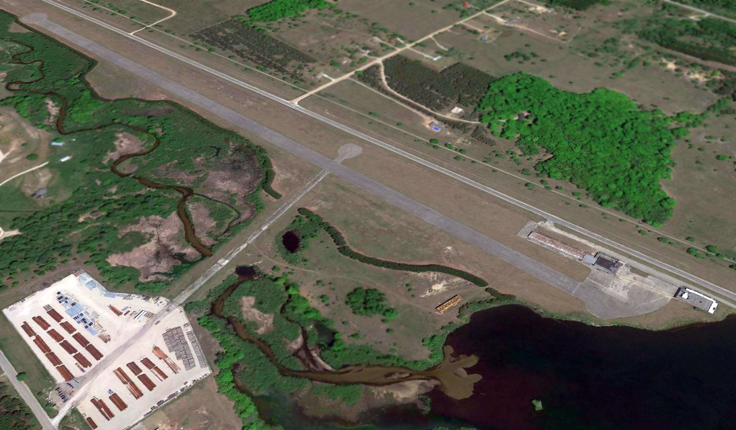
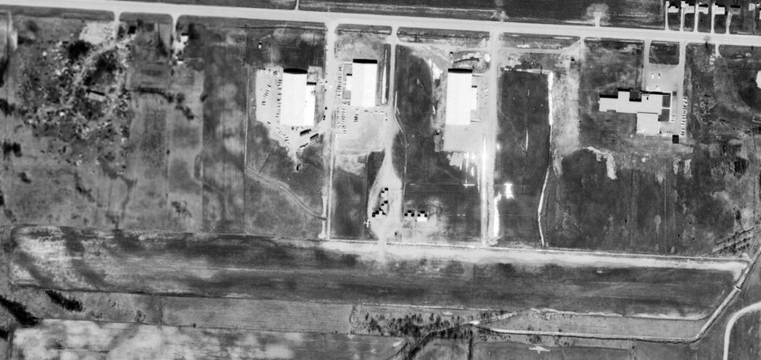
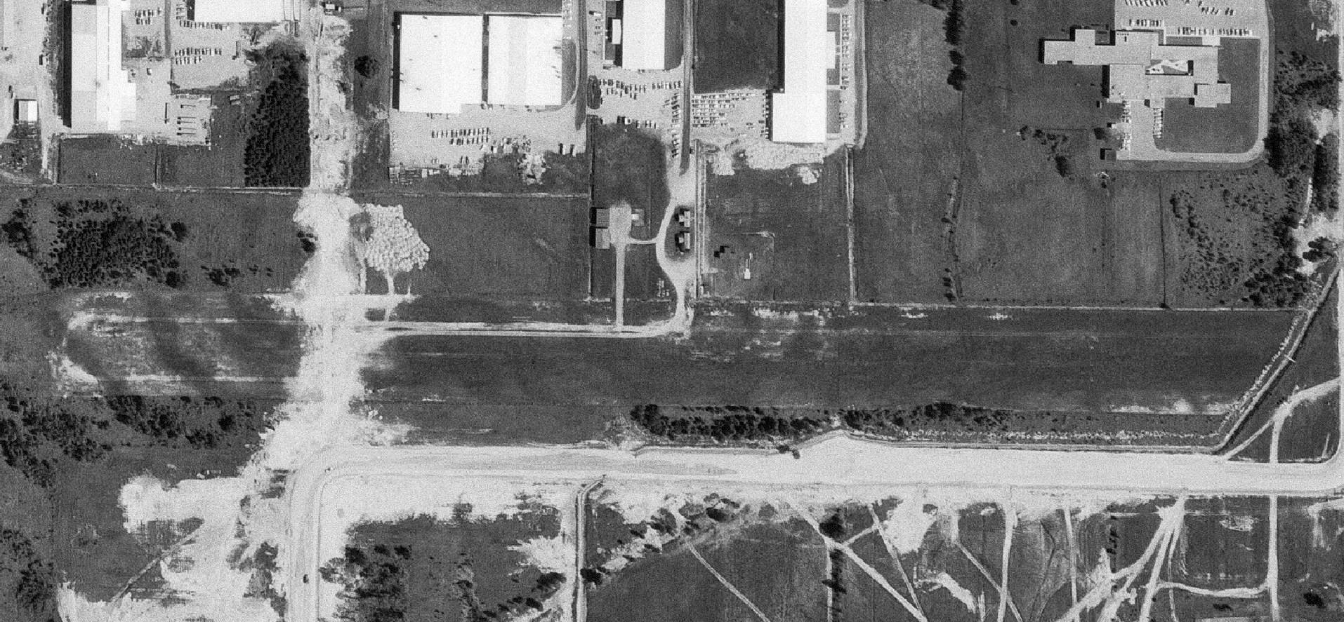
A 2016 aerial view looking northeast showed Nartron Field to be intact though deteriorated.
The runway markings had been removed from Runway 17/35, and a storage lot for industrial equipment had been built on the western end of the former crosswind runway.
Two buildings & a ramp were located on the southeast side, but there were no aircraft on the field.
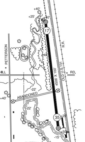
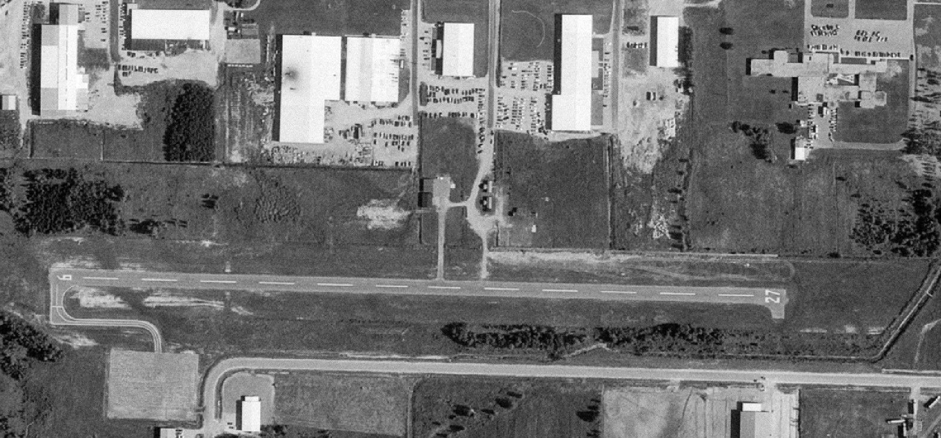
The 2016 MI Airport Directory depicted Nartron Field as having a single 4,506' paved Runway 17/35,
with an abandoned crosswind runway.
The manager was listed as Norman Rautiola.
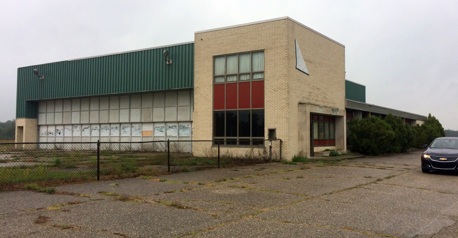
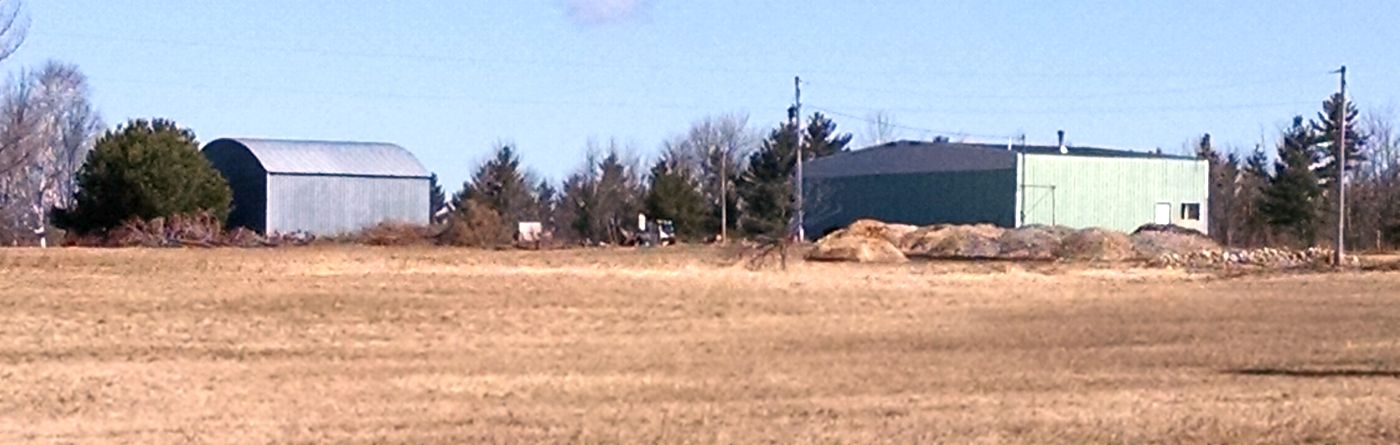
A September 2016 photo of Nartron Field's buildings.
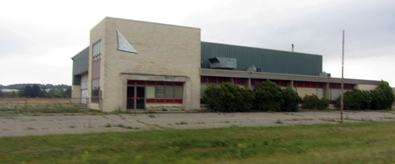
A September 2016 photo of a Nartron Field building.
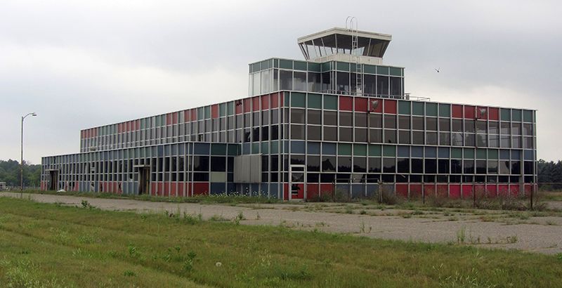
A September 2016 photo of the Nartron Field control tower.
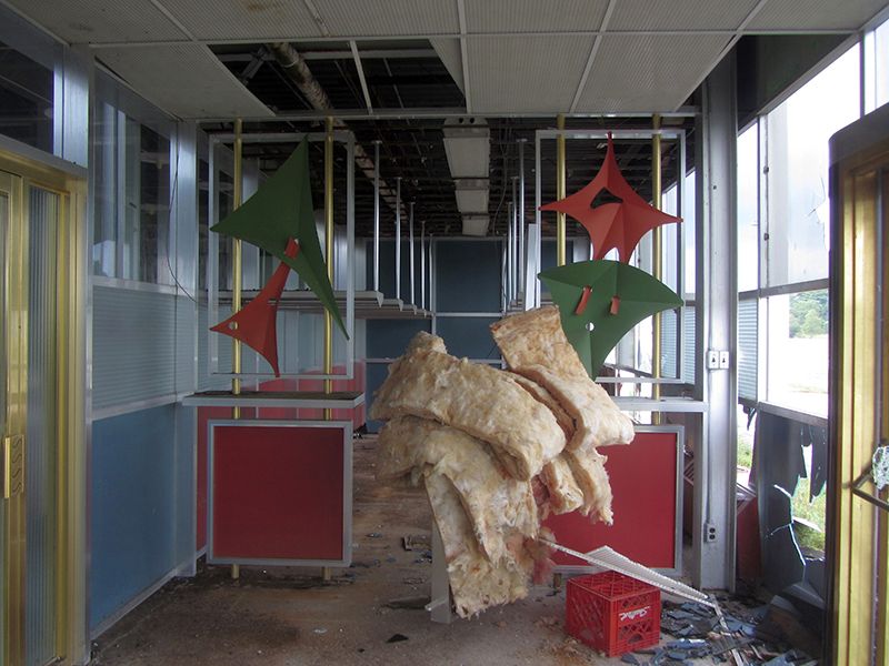
A September 2016 photo of some Eisenhower-era decor that graced the entryway to the Nartron Field building.
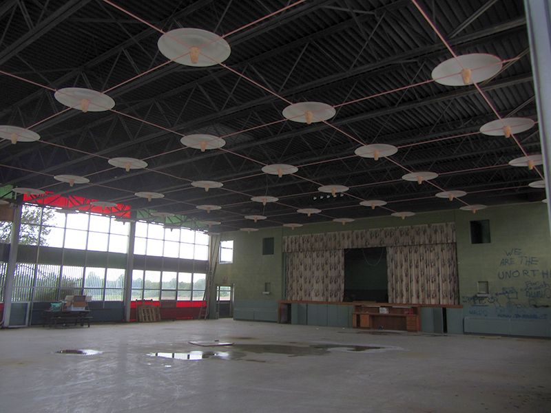
A September 2016 photo of the interior of a Nartron Field building, presumably the former Miller Auditorium.
According to Wikipedia, as of 2017, “The only runway, 17/35, is in poor condition & the surface is cracked & scattered with stones. Vegetation grows through cracks.
An abandoned runway intersects runway 17/35. Its direction is approximately 8/26, it is roughly 2,500' long, and its surface is asphalt, in extremely poor condition.”
As of 2017, Nartron Field's FAA Airport/Facility Directory data described it as having a single 4,506' asphalt Runway 17/35, “in poor condition”.
The owner & manager was listed as Norman Rautiola.
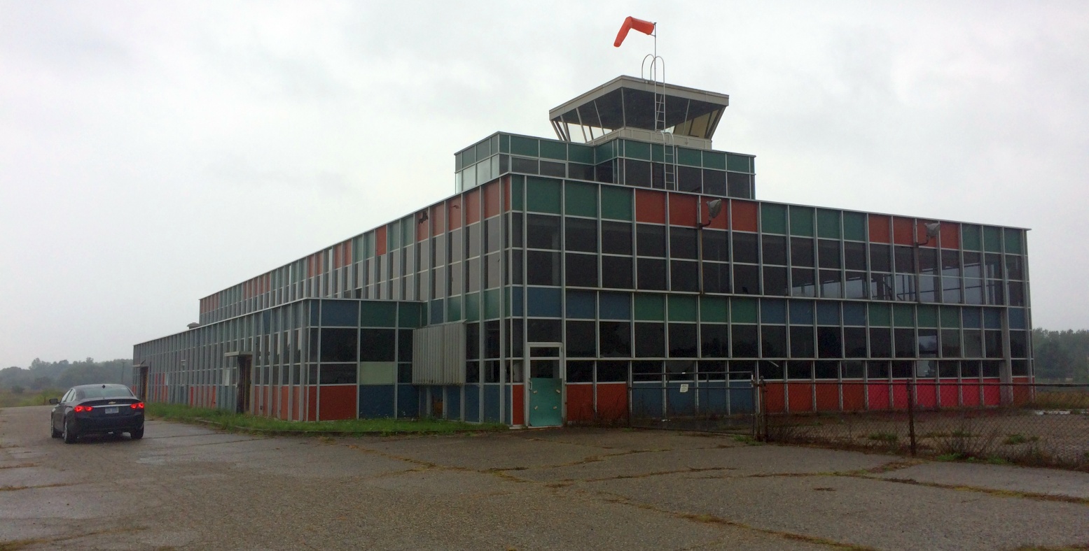
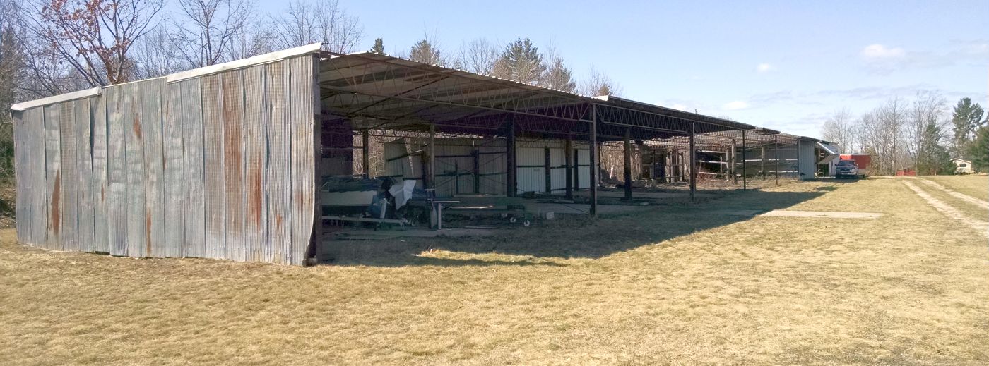
A 9/4/17 photo by Matt Franklin of the Nartron Field terminal & control tower.
Matt reported, “This place is cool given how much of it is still there. I believe it’s claim to fame is that it once had scheduled service, which is a little ungainly given the proximity of the terminal to the runway.”
A 9/4/17 photo by Matt Franklin of a Nartron Field hangar.
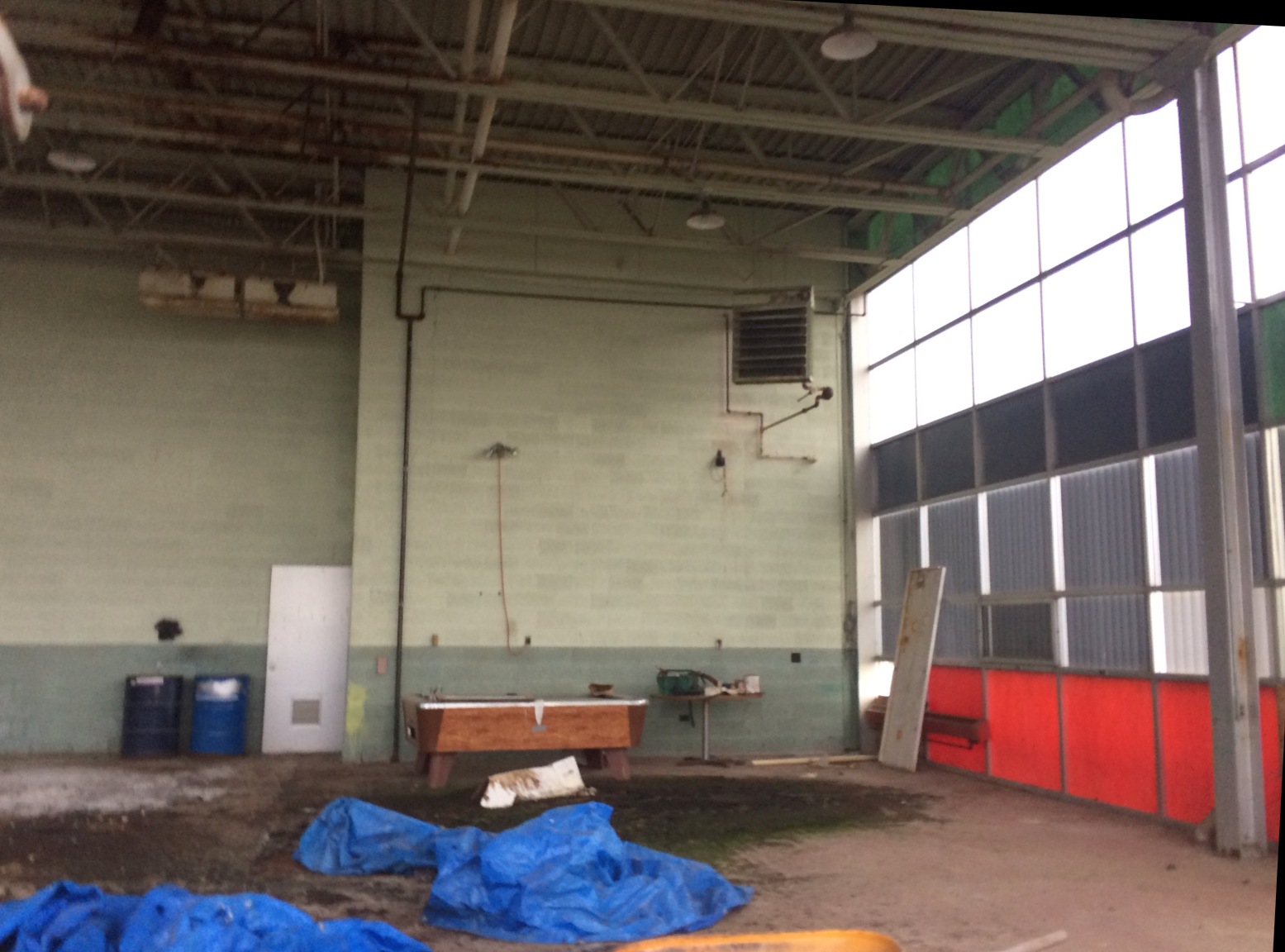
A 9/4/17 photo by Matt Franklin of the interior of a Nartron Field hangar – complete with a pool table.
Matt reported, “It’s currently a bit moldy. Windows are broken & you can see some vandals got inside, but still in better condition than the stuff I come across in New Mexico.”
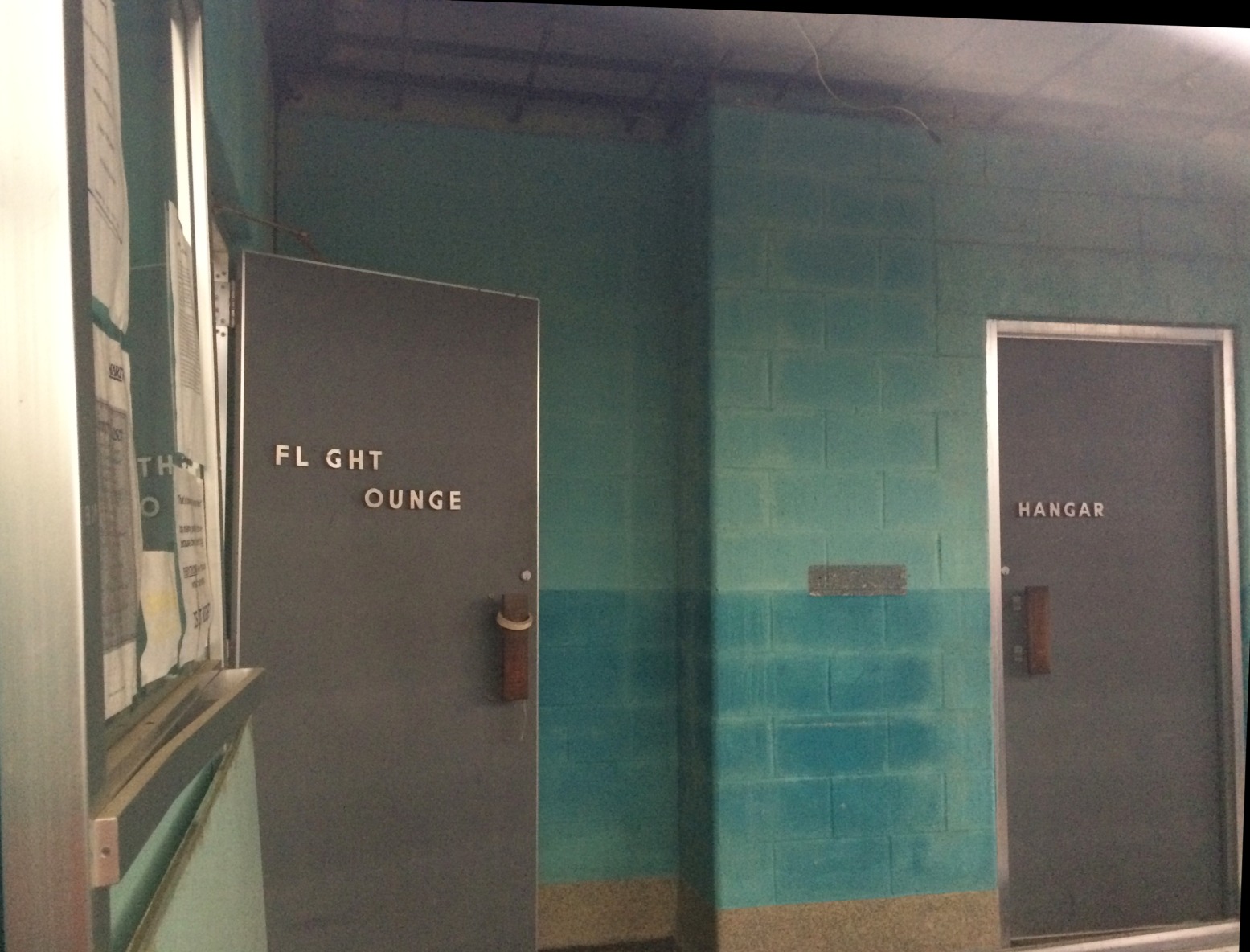
A 9/4/17 photo by Matt Franklin of the entrance to the Nartron Field Flight Lounge.
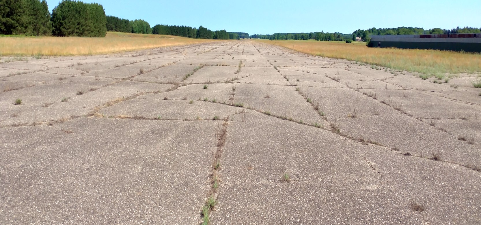
A July 2019 photo by Chris Robeson looking north along Nartron Field's runway.
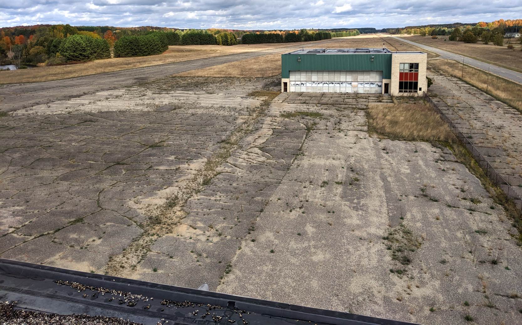
An October 2019 photo by Chris Robeson looking north from Nartron Field's control tower, showing the runway, ramp, and hangar.
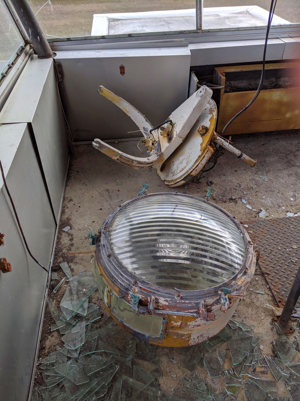
An October 2019 photo by Chris Robeson of the remains of Nartron Field's rotating beacon light, inside its control tower cab.
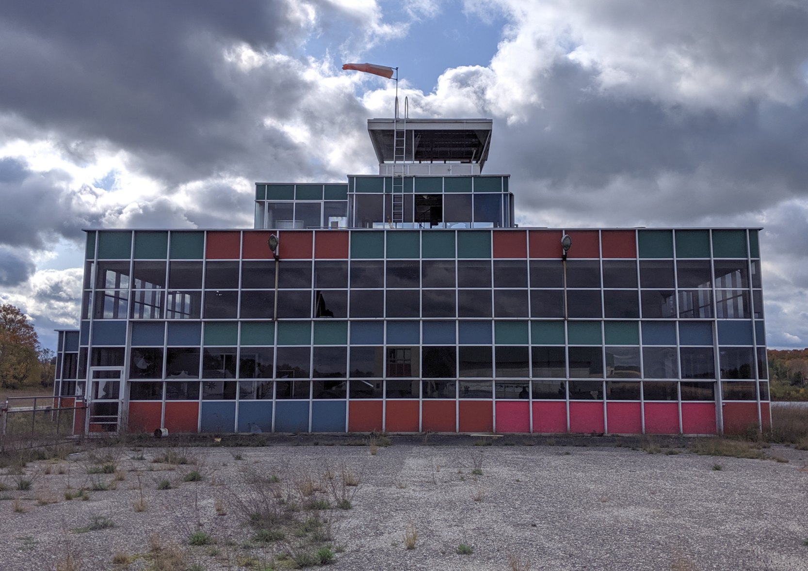
An October 2019 photo by Chris Robeson of Nartron Field's control tower.
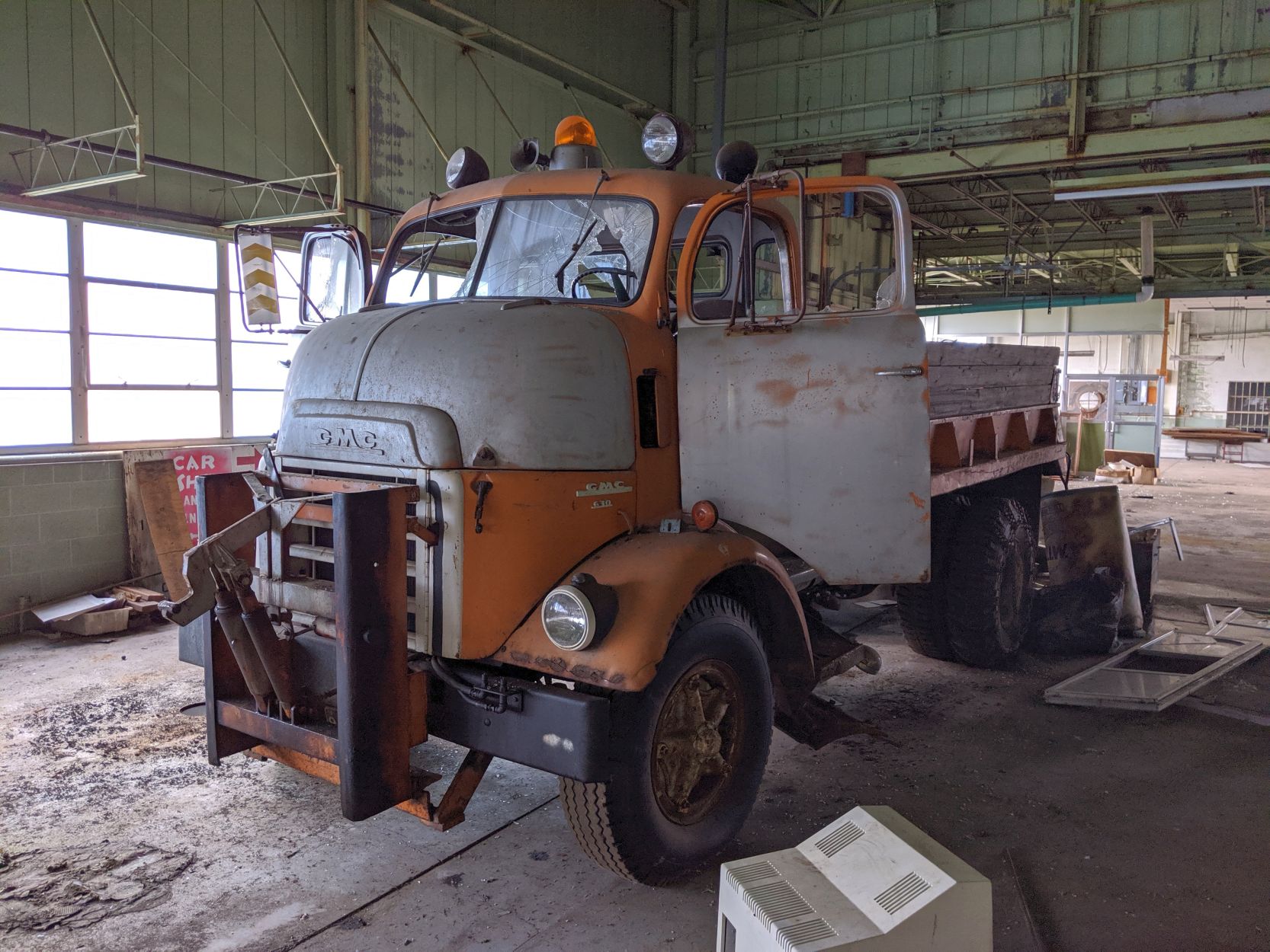
An October 2019 photo by Chris Robeson of a vintage GMC truck inside Nartron Field's hangar.
Nartron Field is located southwest of the intersection of Old Highway 131 & West 6 Mile Road.
____________________________________________________
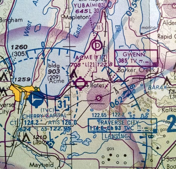
44.766, -85.471 (Northwest of Detroit, MI)
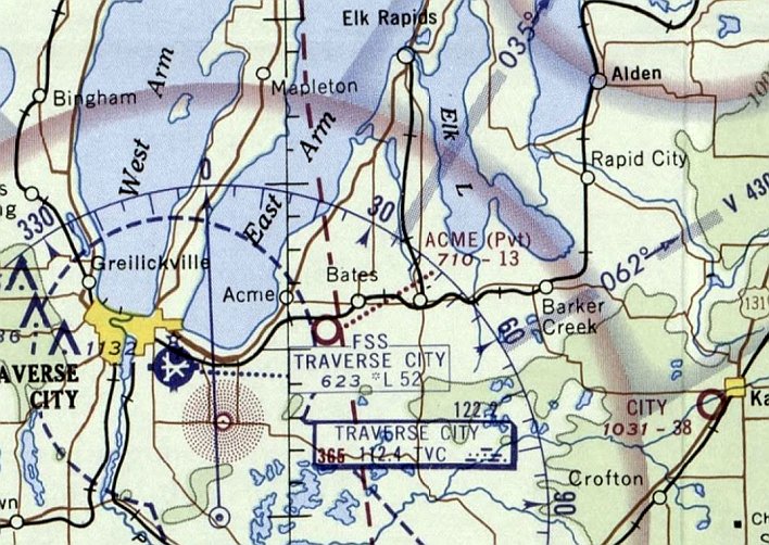
Acme Skyport, as depicted on the December 1968 Green Bay Sectional Chart (courtesy of Mike Denja).
The earliest depiction which has been located of Acme Skyport was on the December 1968 Green Bay Sectional Chart (courtesy of Mike Denja).
It described Acme as a private airfield having a single 1,300' turf runway.
According to the Yorkburg Manor website (courtesy of Marc Boudreau), “Willard & Isabelle Ritter... In 1969 they developed an airport on the back of the farm that was known as the Acme Skyport.”
Marc Boudreau recalled, “Acme Skyport... I used to take my students over there from nearby TVC for soft field practice.
There is a shorter private East/West runway that, oddly enough, was not technically connected to the North/South runway.
Called Gramp's Acres or something similar on the charts, it was not part of the public-use portion.
There was only one owner, but I just always assumed he preferred the public not use the rather short East/West runway.
There was a difference in elevation between the south end of the North/South runway & the East/West one, which was a little lower. Uneven terrain between them, as well.
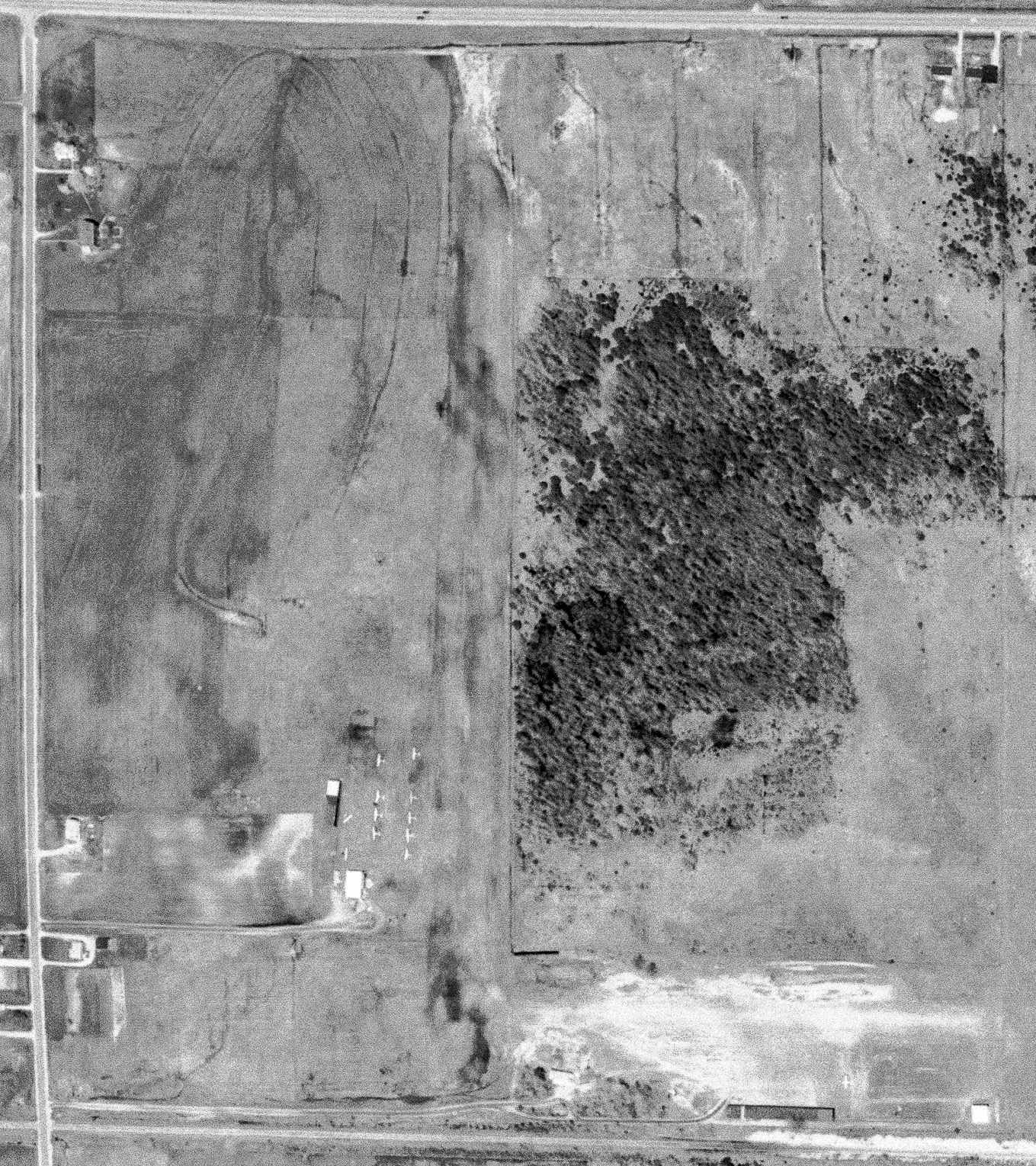
The earliest photo which has been located of Acme Skyport was a 5/17/78 aerial view (courtesy of Mike Denja).
It depicted 11 light single-engine planes parked near a few small buildings to the west of the north/south runway,
and 1 light single-engine plane parked near a few small buildings to the south of the east/west runway.
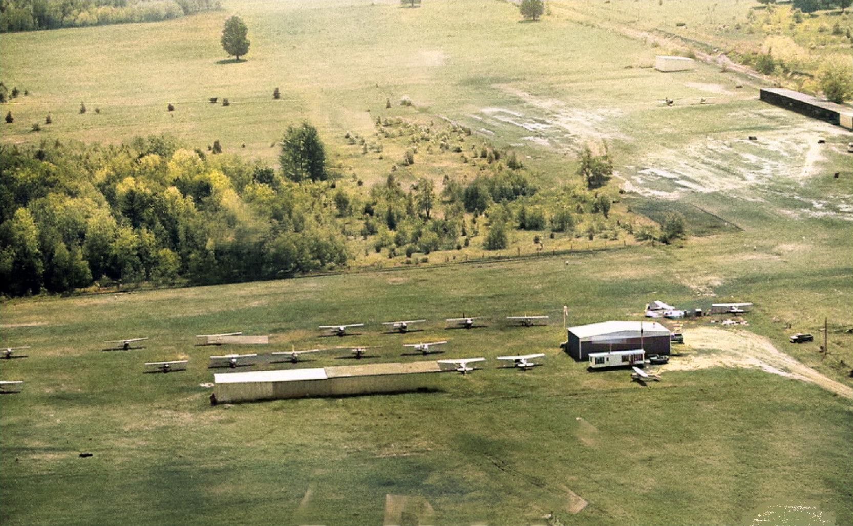
A 1980 aerial view (colorized by Mike Denja) depicted Acme Skyport perhaps at the zenith of its popularity, with 20 light single-engine planes parked among the hangars.

The earliest topo map depiction which has been located of Acme Skyport was on the 1983 USGS topo map.
It depicted Acme Skyport as having 2 perpendicular unpaved runways,
with a few small buildings on the southwest & south sides.
The 1989 USGS topo map depicted “Acme” Airport as having 2 perpendicular runways.
The March 1990 Airport/Facility Directory (courtesy of Marc Boudreau) described Acme Skyport as having 2 runways: 18/36 & 9/27.
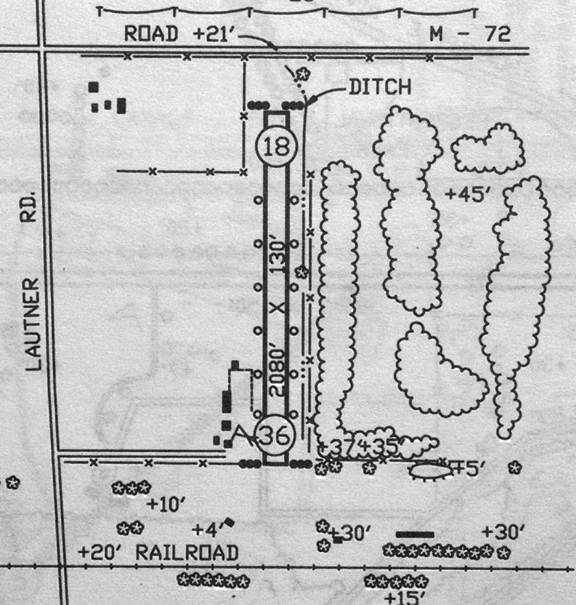
The 1992 MI Airport Directory (courtesy of Marc Boudreau) depicted Acme Skyport as having only a single 2,080' Runway 18/36, and cautioned that the E/W runway was closed.
The last photo which has been located showing aircraft at Acme Skyport was a 1993 USGS aerial view.
It depicted Acme Skyport as having 2 perpendicular unpaved runways, with 4 light single-engine aircraft visible parked to the southwest of the Runway 18/36.
The last aeronautical chart depiction which has been located of Acme Skyport was on the 1993 MI Aeronautical Chart (courtesy of Marc Boudreau).
It depicted Acme as having a 2,100' unpaved runway.
Acme Skyport was evidently closed (for reasons unknown) at some point between 1993-97,
as it was no longer depicted on the 1997 Michigan Aeronautical Chart (according to Marc Boudreau).
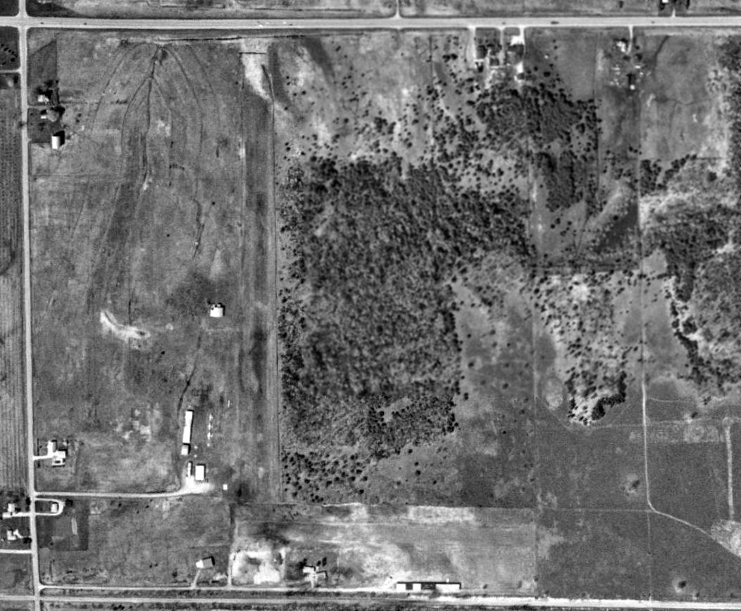
A 2015 aerial view showed Acme Skyport to remain intact, though devoid of aircraft.
A 3/20/16 photo by Marc Boudreau at Acme Skyport, “Looking west on Runway 27. The far end is not visible due to the sloping terrain.
It looks like it might possibly still be maintained for someone's private use.
The main North/South runway is no longer usable.”
A 3/20/16 photo by Marc Boudreau at Acme Skyport, “of dilapidated hangers on the southeast side of the airport.”
No aircraft are visible, and a boat is stored in one hangar.
Mark reported, “A couple old hangers remain northwest of the 'intersection' & one 'newer' hanger south of the intersection with a concrete apron,
although I remember 2 former metal T-hangar type buildings for maybe 5-6 airplanes each.
One was located Northwest of the 'intersection', and another fairly dilapidated one south, both parallel to their respective runways.”
A 3/20/16 photo by Marc Boudreau at Acme Skyport, “Looking northeast from the threshold of Runway 9 towards the 2 hangars to the northwest of the runway intersection.
The hangars shown to the north of these 2 separate hangers on the 1992 Michigan Airport Directory are no longer extant.”
A 3/20/16 photo by Marc Boudreau at Acme Skyport, “of the hangar on the southwest side, with windsock frame.”
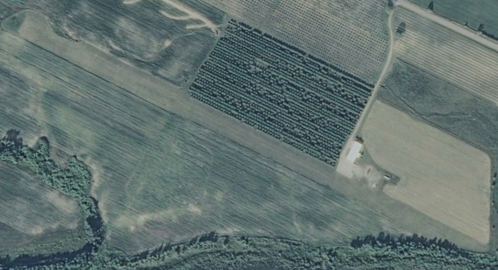
As of 2016, Acme Skyport was no longer depicted on aeronautical charts.
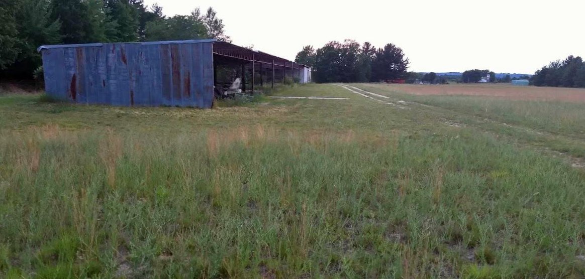
John Gerty reported in 2018, “Acme Skyport... There was an airplane stored in the south hangar. They had it out last summer (2017) about the time the property was put up for sale.
In nearly 4 years of living near the Skyport I had never seen the plane. However, the east/west runway has been consistently mowed & minimally maintained.
There is a new windsock on that same south hangar & the Acme Skyport sign has been renewed with a fresh graphic.
The property is now for sale; just under 14 acres including several hangars. There are bushes & small trees growing on the north/south runway.”
A 7/8/19 photo by John Gerty of the Acme Skyport hangar.
John reported, “I was walking the TART Trail which runs along the south side of the property next to a long, low hangar shed.
The building is rather derelict, with much of the roof deck either collapsed or missing.
The south wall & roof frames are still present & appear mostly sound.”
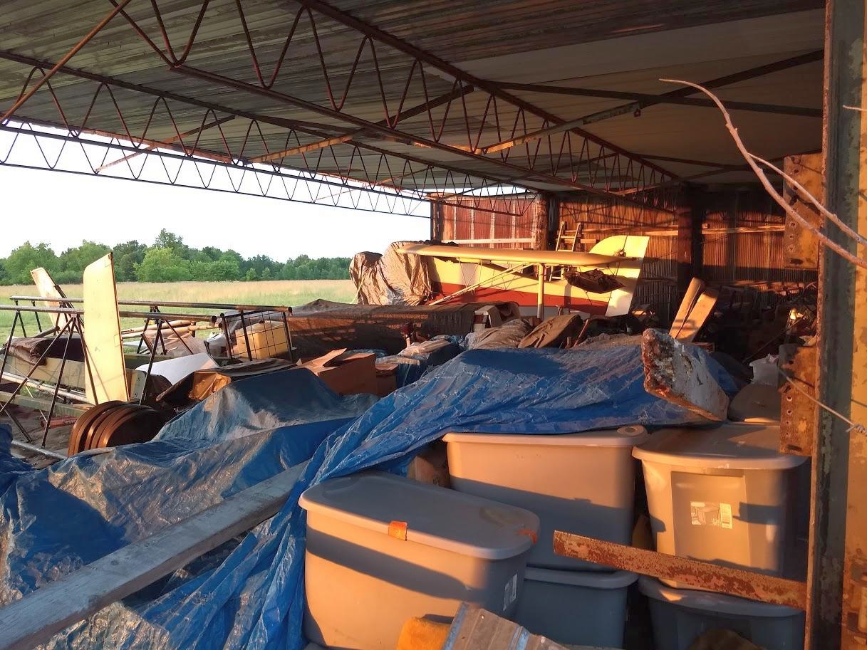
A 7/8/19 photo by John Gerty of the interior of the Acme Skyport hangar.
John reported, “There a couple of small motorboats, a folding-wing aircraft, and some airframe parts are sheltered beneath some remnant roofing at the east end of the structure.”
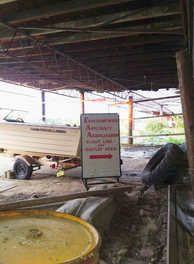
A 7/8/19 photo by John Gerty of “a very sad sign about a past EAA show” inside the Acme Skyport hangar.
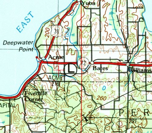
The site of Acme Skyport is located southeast of the intersection of Lautner Road & Route 72.
Thanks to Marc Boudreau for pointing out this airfield.
____________________________________________________
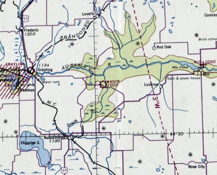
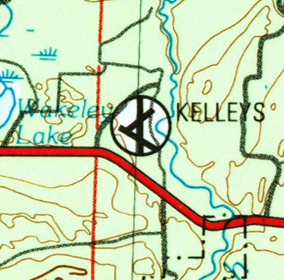
Mason Airport / Kelleys Airport (0MI3), Grayling, MI
44.63, -84.48 (Northwest of Detroit, MI)
Mason Airport, as depicted on the December 1942 Green Bay Sectional Chart.
Photo of the airport while in use has not been located.
Mason Airport was not yet depicted on the June 1942 Green Bay Sectional Chart.
According to its FAA Airport/Facility Directory, this small general aviation airport in Northern MI was activated in July 1942.
The earliest depiction which has been located of Mason Airport was on the December 1942 Green Bay Sectional Chart.
It depicted Mason as a commercial/municipal airport.
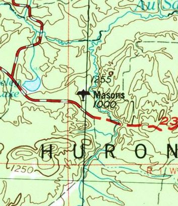
“Masons” Airport, as depicted on the 1954 USGS topo map.
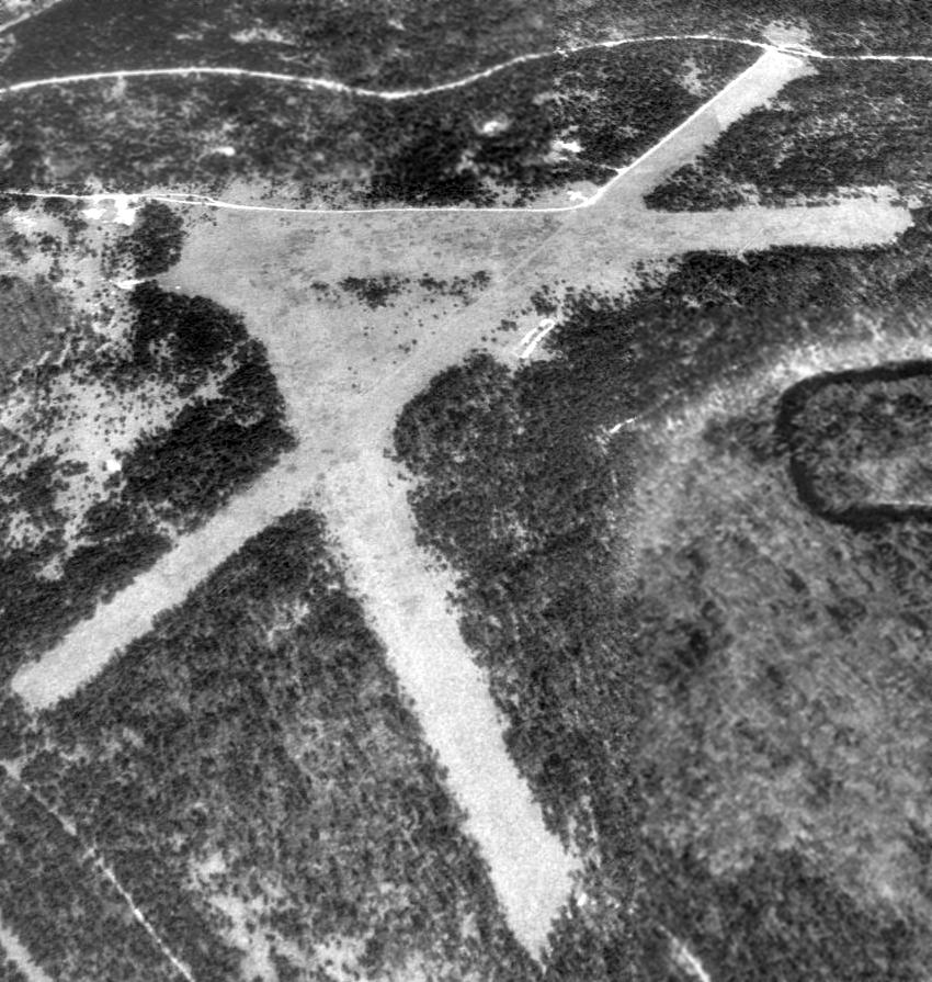
The earliest photo which has been located of Mason Airport was a 5/16/60 aerial view (courtesy of Mike Denja) depicted the field as having 3 unpaved runways,
with a single T-hangar on the northwest side, but there were no planes visible.
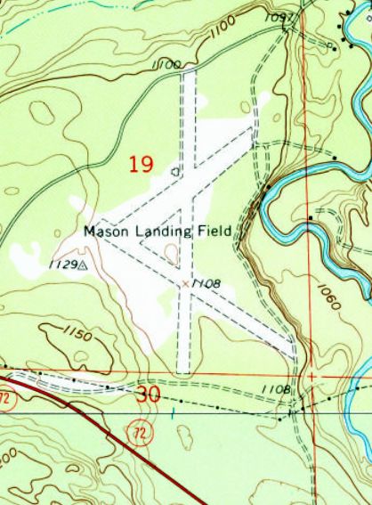
The 1963 USGS topo map depicted “Mason Landing Field” as having 3 unpaved runways.
There were no buildings depicted on the field.
It was still depicted as Mason Landing Field on the 1983 USGS topo map.
At some point between 1983-89 it was evidently renamed Kelleys Airport, as that is how it was labeled on the 1989 USGS topo map.
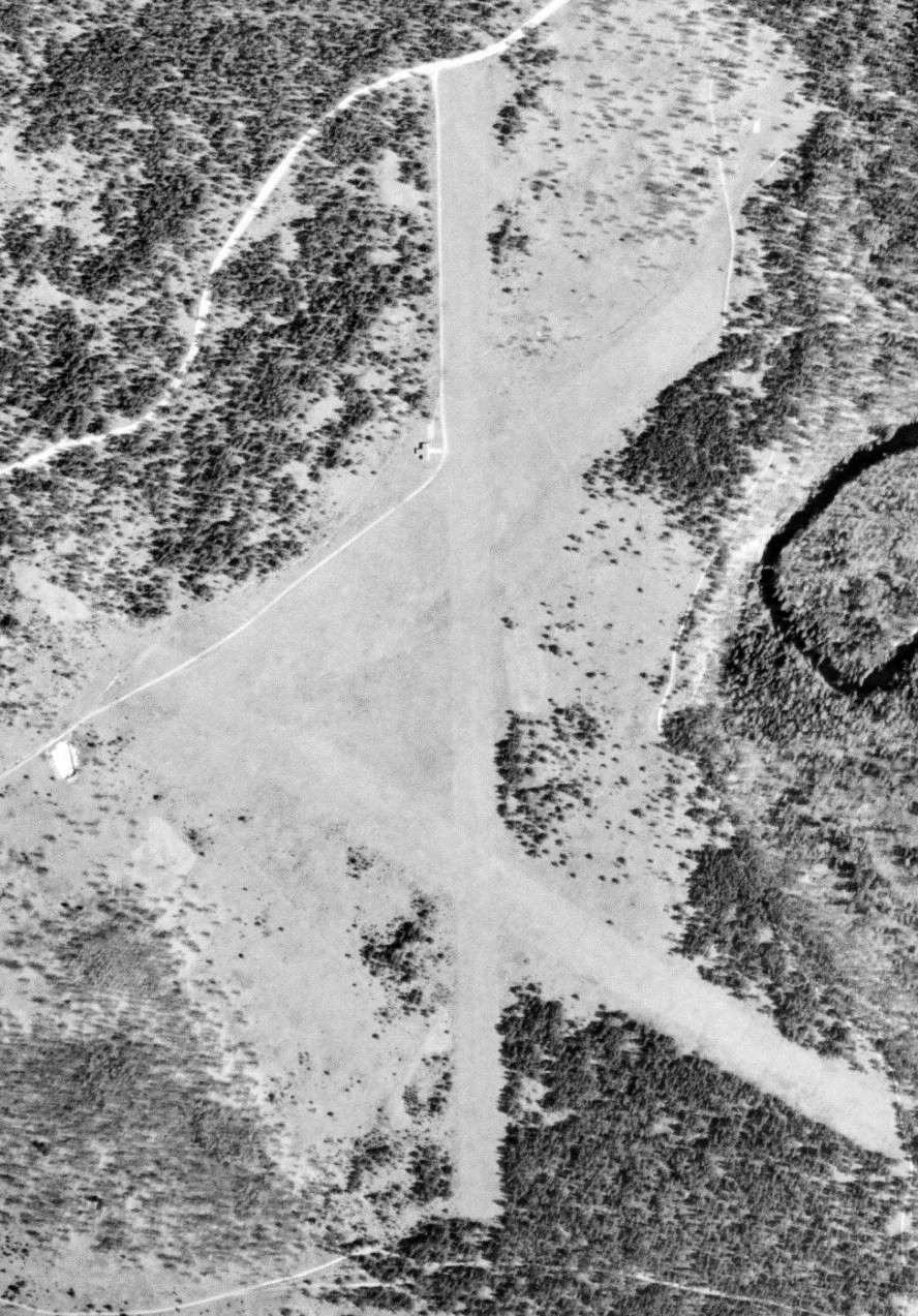
A 1992 USGS aerial view looking northwest showed Kelleys Airport remained intact, but without any sign of any recent aviation usage.
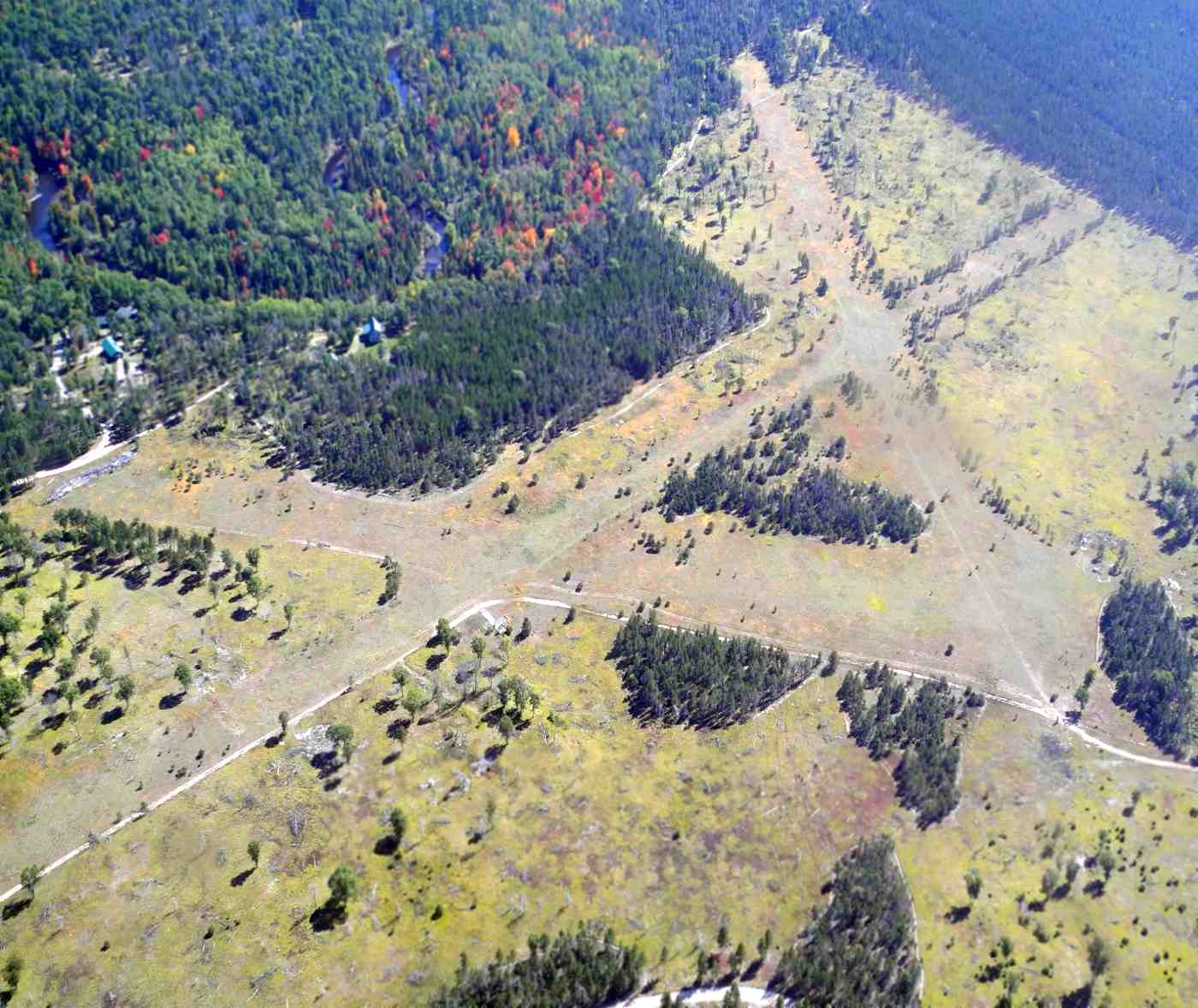
A 9/23/14 aerial view looking southeast by Randy Coller showed Kelleys Airport remained intact, but without any sign of any recent aviation usage.
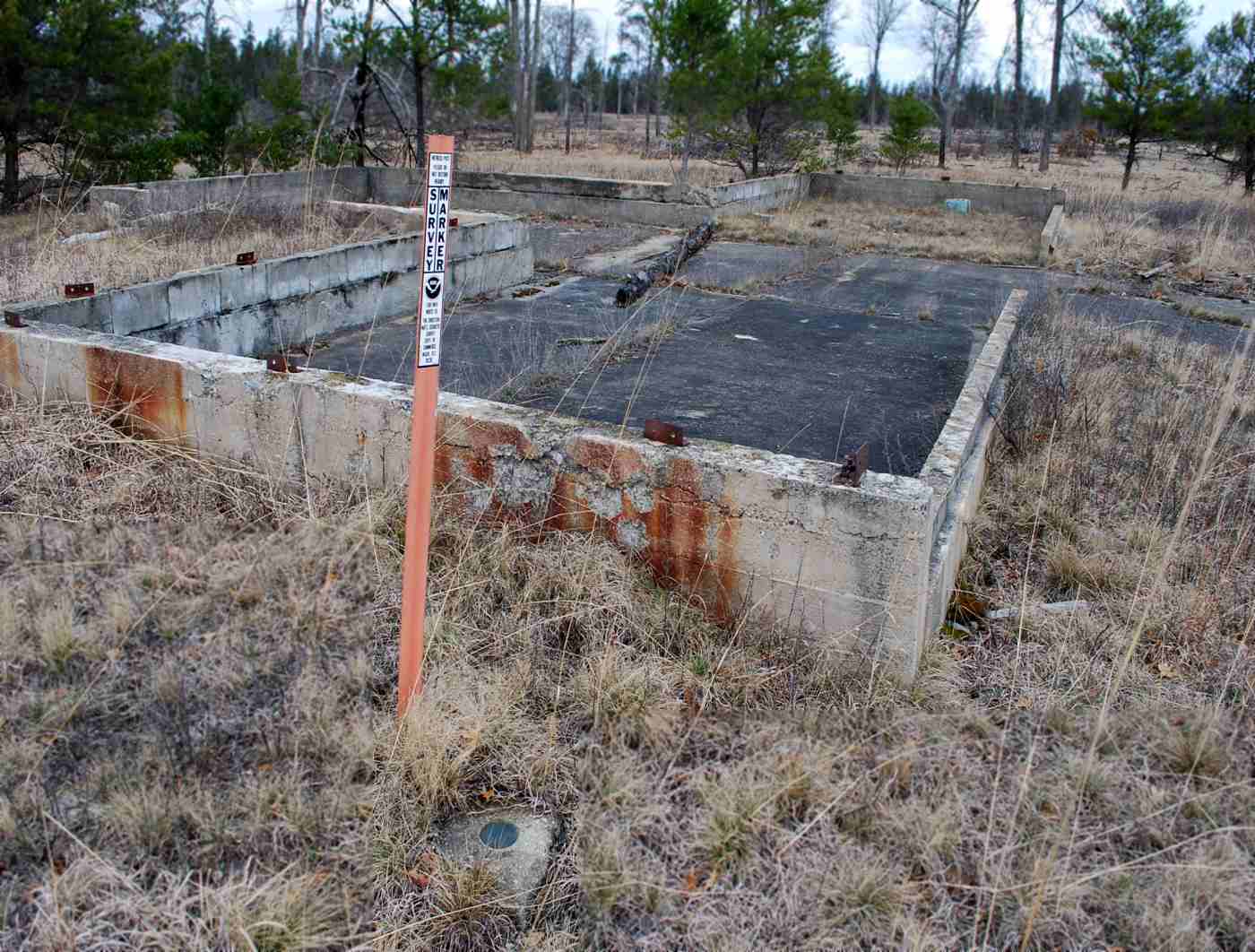
A 9/23/14 photo by Randy Coller of the foundation of a T-hangar on the northwest side of Kelleys Airport.
Randy Coller reported, “I walked the entire length of one runway & most of the length of the 2nd runway. The runways overgrown with trees - no markings, no windsock.
Automobile tire ruts on the runway. Trees are growing on the runways. No based aircraft. No evidence of use.
The airport is unsuitable for aircraft. Markers on the runway indicate property is owned by U.S. Forest Service.”
A 4/21/15 photo by Randy Coller of a USGS survey marked next to the foundation of a T-hangar on the northwest side of Kelleys Airport.
As of 2015, the FAA Airport/Facility Directory described Kelleys Airport as having 3 turf runways, with the longest being 3,700' Runway 18/36.
The owner was listed as James Kelley.
However, Randy Coller reported, “I called the U.S. Forest Service on 5/13/15.
They verified that the site is owned by the Forest Service & they wish to have the site abandoned as an airport.
They have no intention of opening it as an airport.”
The site of Kelleys Airport is located northeast of the intersection of Oxbow Road & Route 72.
Thanks to Randy Coller for pointing out this airfield.
____________________________________________________
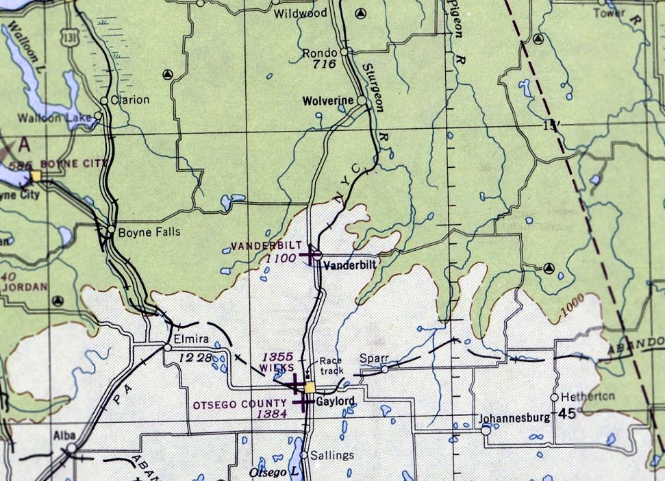
Vanderbilt Airport, Vanderbilt, MI
45.15, -84.67 (Northwest of Detroit, MI)
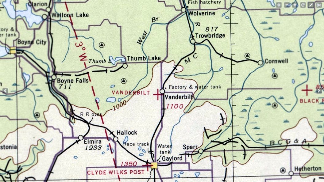
Vanderbilt Airport, as depicted on the October 1936 Sectional Chart (courtesy of Mike Denja).
The original airport for the town of Vanderbuilt was located adjacent to the west side of the town.
The date of establishment of Vanderbilt Airport has not been determined.
The earliest depiction which has been located of Vanderbilt Airport was on the October 1936 Sectional Chart (courtesy of Mike Denja),
which depicted it as an auxiliary airfield located adjacent to the west side of the town.
The 1938 Commerce Department “Descriptions of Airports & Landing Fields in the U.S.” (courtesy of Mike Denja)
described Vanderbilt Airport as a municipal field located ¼ mile west of Vanderbilt on the south side of U.S. Highway 27.
Vanderbilt was said to have 2 sandy runways in a cross shape,
measuring 1,800' north/south & 1,400' northeast/southwest.
The last aeronautical chart depiction which has been located of Vanderbilt Airport was on the June 1946 Sectional Chart (courtesy of Mike Denja),
which depicted it as an auxiliary airfield located adjacent to the west side of the town.
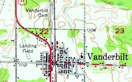
The 1954 USGS topo map (courtesy of Mike Denja) depicted Vanderbilt Airport
as a single unpaved northwest/southeast runway adjacent to the west side of the town, labeled simply as “Landing Field”.
Note that this is a different runway configuration than described in 1938, so this may have been located in a slightly different spot.
Vanderbilt Airport was evidently closed at some point between 1946-55,
as the 1955 USGS topo map showed the property had been covered by the new Interstate 75.
The earliest photo which has been located of Vanderbilt Airport was a 10/24/52 USGS aerial view.
It showed traces of a grass northwest/southeast runway, with an airport circle marking in the center.
But what appeared to be a football field had been constructed on the south end of the runway,
and there was no indication of any recent aviation use.
A 2014 aerial view showed no trace of Vanderbilt Airport, with Interstate 75 covering the site.
Aaron Matelski reported in 2015 of Vanderbilt Airport, “The only thing [that] remains is the old ring for the wind sock.”
The site of Vanderbilt Airport is located northwest of the intersection of West Main Street & Lafayette Street.
Thanks to Mike Denja for pointing out this airfield.
____________________________________________________
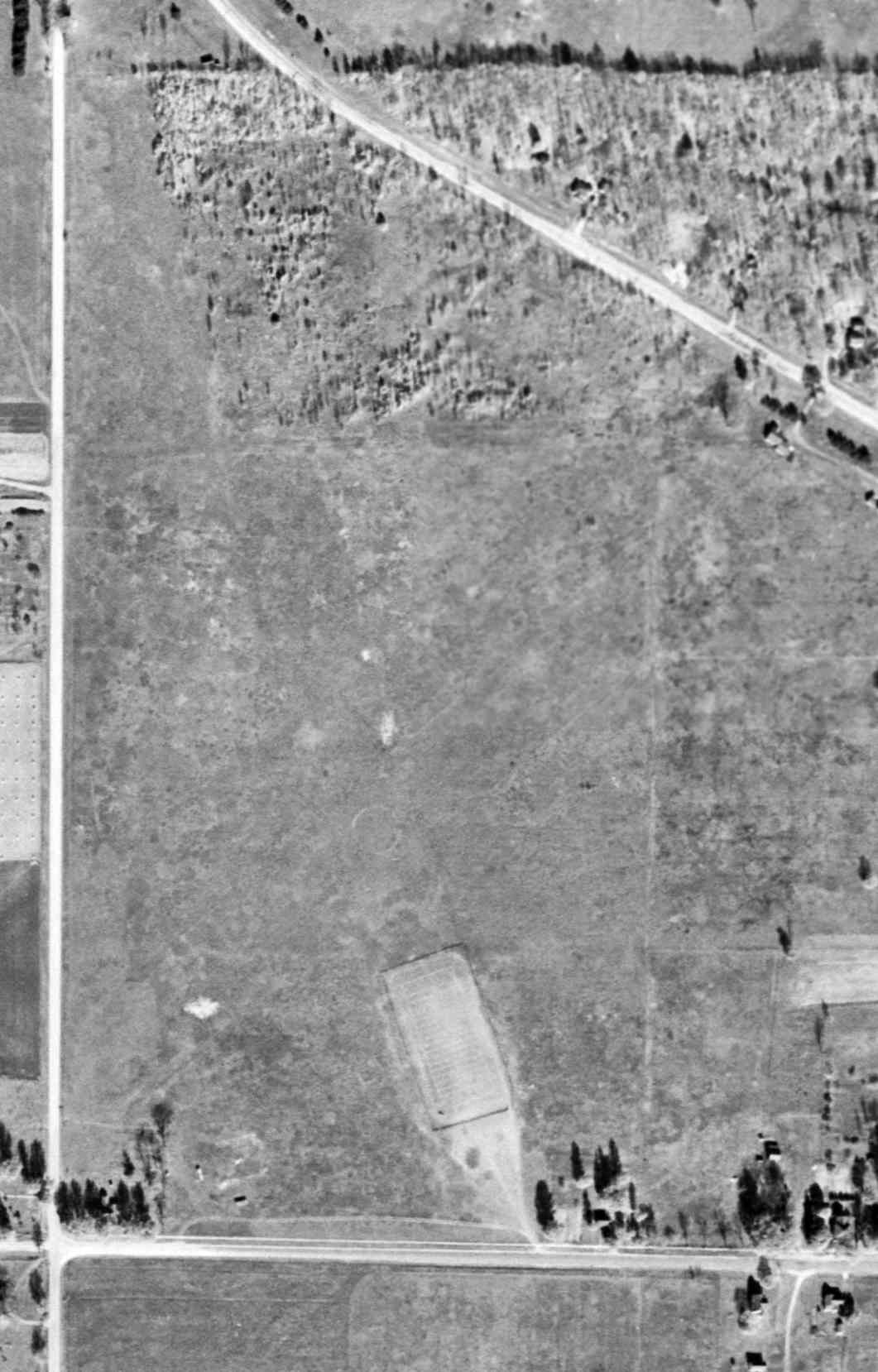
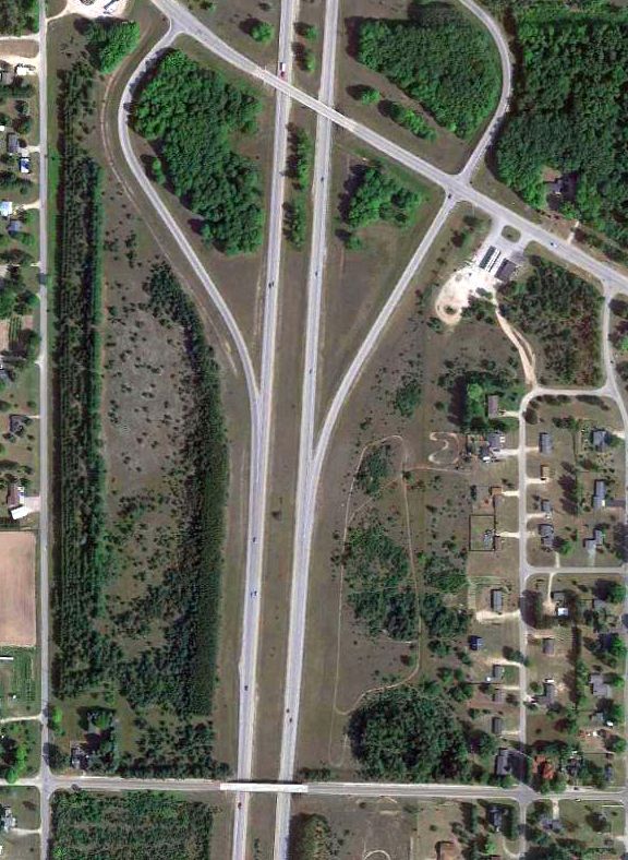
Standish City Airport / Standish Industrial Airport (Y75), Standish, MI
43.98, -83.975 (Northwest of Detroit, MI)
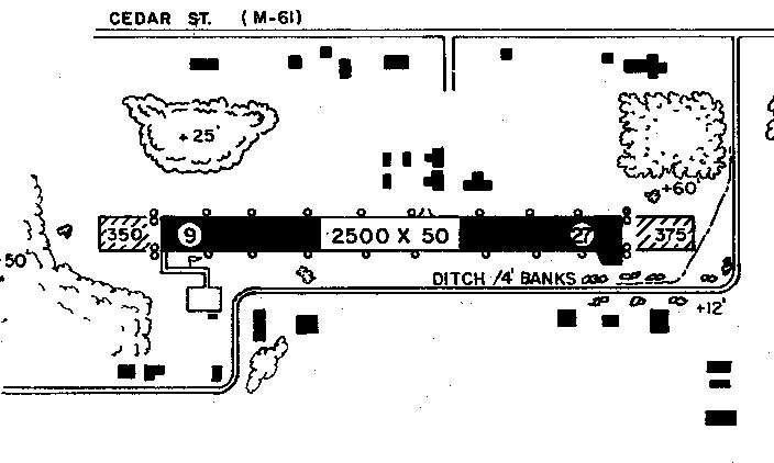
Standish City Airport, as depicted on the May 1965 Green Bay Sectional Chart (courtesy of Mike Denja).
This small general aviation airport was evidently established at some point between 1945-65,
as it was not listed among active airfields in the 1945 AAF Airfield Directory (courtesy of Scott Murdock).
The earliest depiction which has been located of Standish City Airport was on the May 1965 Green Bay Sectional Chart (courtesy of Mike Denja).
It depicted Standish City Airport as having a 2,800' unpaved runway.
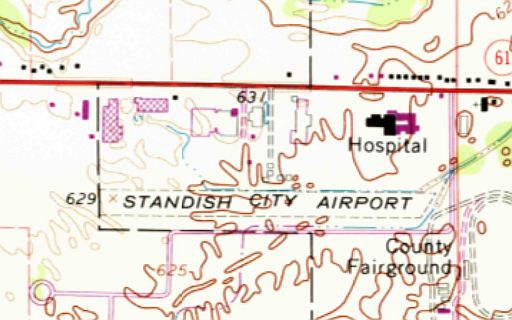
The earliest topo map depiction which has been located of Standish City Airport was on the 1967 USGS topo map.
It depicted Standish City Airport as having a single unpaved east/west runway, with a few small buildings on the north side.
The earliest photo which has been located of the Standish City Airport was a 5/21/66 USGS aerial view (courtesy of Mike Denja).
It depicted Standish as having a single east/west runway, with 1 single-engine aircraft & 5 T-hangars on the north side.
A 6/4/73 aerial view (courtesy of Mike Denja) depicted Standish Airport evidently during construction of its new paved runway.
The 1974 USGS topo map depicted Standish City Airport in the same fashion as the 1967 topo map.
An 8/2/76 aerial view (courtesy of Mike Denja) depicted Standish Airport's new paved Runway 9/27, and new paved southwest ramp, but no aircraft were visible on the field.
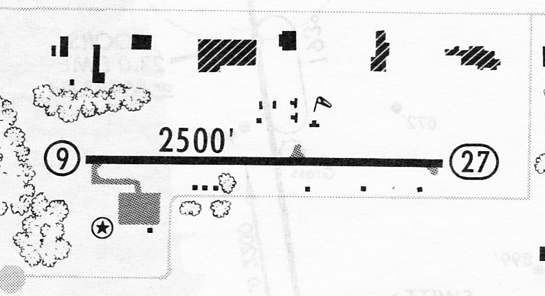
A 7/8/83 airport directory (courtesy of John Kielhofer) depicted Standish Industrial Airport as having a single 2,500' paved Runway 9/27, with a ramp & 1 small building on the southwest side,
and several T-hangars on the north side.
The 1985 USGS topo map labeled it as “Municipal Airport”.
The 1987 MI Airport Directory (courtesy of William Willyard) depicted Standish Industrial Airport
as having a single 2,500' paved Runway 9/27, with a ramp & 1 small building on the southwest side, and several T-hangars on the north side.
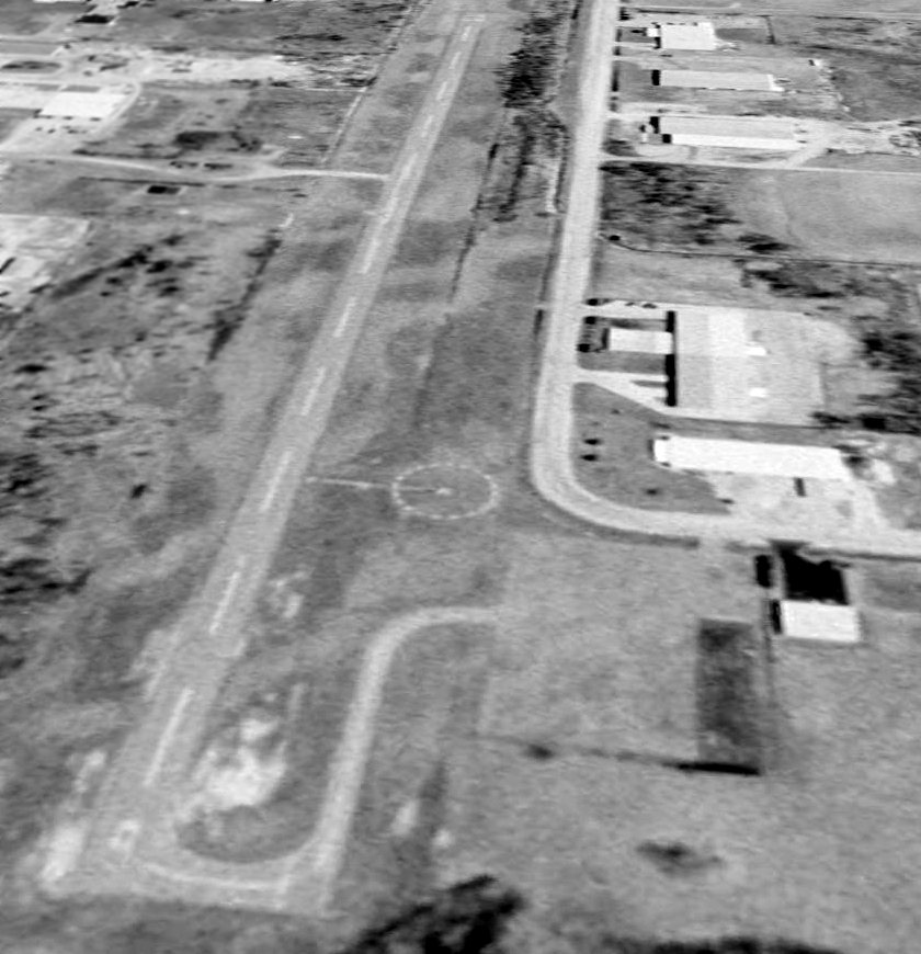
A 4/9/99 USGS aerial view looking northeast depicted Standish City Airport as having a single paved Runway 9/27, with a paved ramp on the southwest side.
The only photo which has been located showing an aircraft at Standish Airport was a 5/31/05 aerial view looking northeast,
which showed one single-engine aircraft on the ramp.
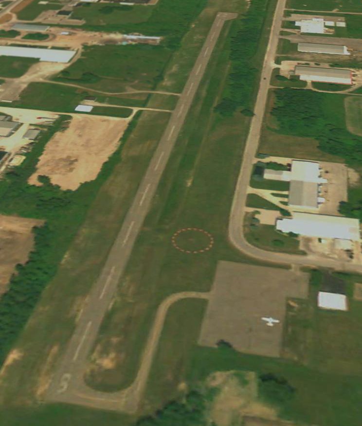
A 10/9/13 aerial view showed closed-runway “X” symbols painted on the Standish runway.
A large quantity of unknown objects were being stored on the runway & the ramp.
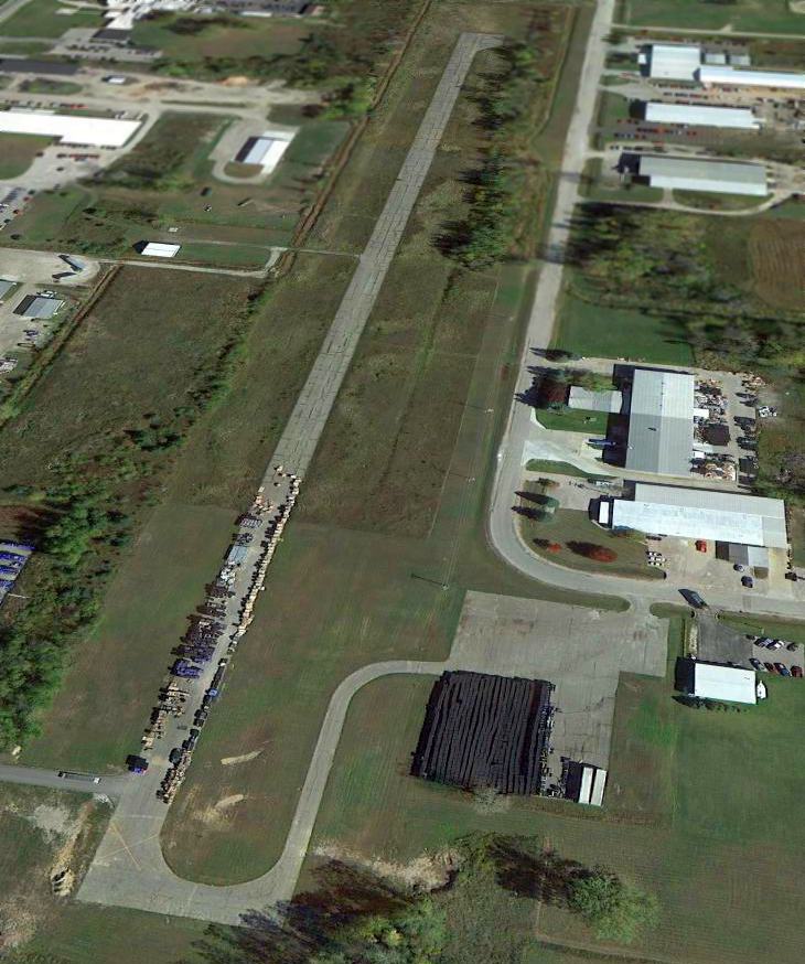
According to Wikipedia, Standish Industrial Airport was closed possibly in 2006.
According to its last FAA Airport/Facility Directory data, Standish Industrial Airport was owned by the City of Standish, and the manager was Greg Norgan.
It had a single 2,500' asphalt Runway 9/27, “in fair condition”.
Standish Industrial Airport is located southwest of the intersection of West Cedar Street & Airpark Drive.
____________________________________________________
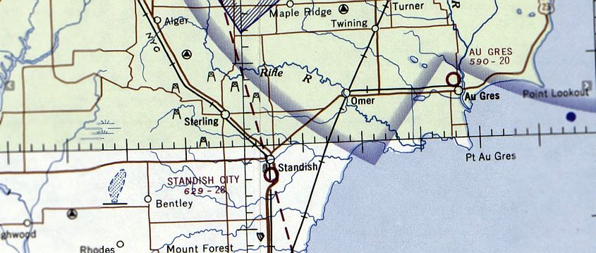
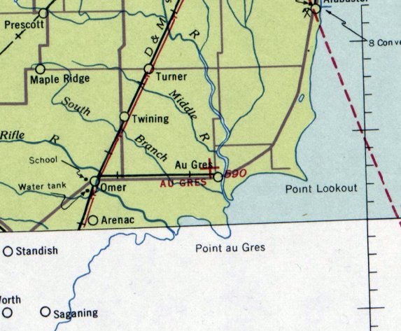
Au Gres Airport (3Y7), Au Gres, MI
44.053, -83.7 (North of Detroit, MI)
Au Gres Airport, as depicted on the February 1939 Green Bay Sectional Chart.
Photo of the airport while open has not been located.
The Au Gres Airport was dedicated on 7/4/36, according to a postmark commemorating the occasion (courtesy of Mike Denja).
Au Gres Airport was not yet depicted on the October 1936 Green Bay Sectional Chart.
The earliest listing of Au Gres Airport which has been located was in The Airport Directory Company's 1937 Airports Directory (courtesy of Bob Rambo).
It described Au Gres as having two 2,000' grass runways.
The Airport Directory Company's 1938 Airports Directory (courtesy of Chris Kennedy) described Au Gres in the same manner.
The earliest depiction which has been located of Au Gres Airport was on the February 1939 Green Bay Sectional Chart.
It depicted Au Gres as an auxiliary airfield.
The 1946 MI Airport Directory (courtesy of Doug Ranz) depicted Au Gres as having two 2,000' turf runways.
The 1963 AOPA Airport Directory (courtesy of Chris Kennedy) described Au Gres as having two 2,000' sod runways: 4/22 & 13/31.
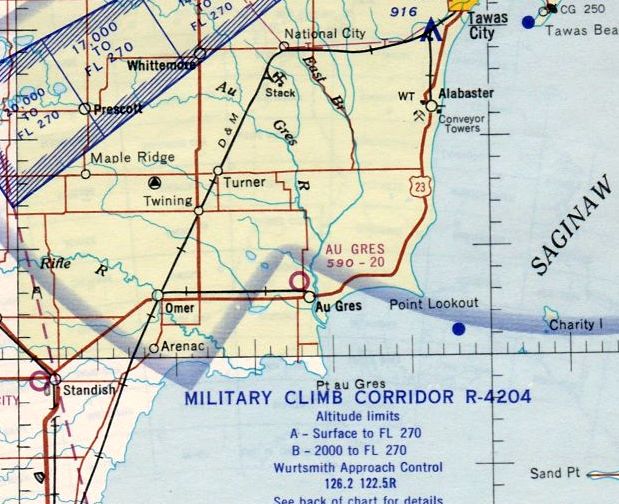
The last aeronautical chart depiction which has been located of Au Gres Airport
was on the May 1965 Lake Huron Sectional Chart (courtesy of Ron Kunse).
It depicted Au Gres as having a 2,000' unpaved runway.
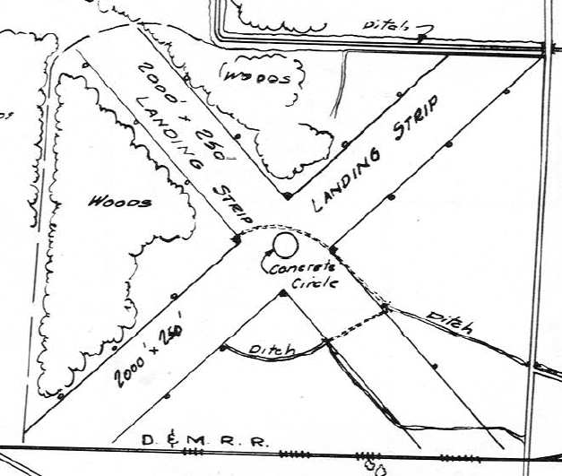
The last depiction which has been located showing Au Gres Airport while in operation was on the 1976 USGS topo map (courtesy of Mike Denja).
It depicted Au Gres Airport as having 2 unpaved runways, with a single building on the northeast side.
The 1982 AOPA Airport Directory (courtesy of Ed Drury)
described Au Gres as having two 2,000' sod runways: 5/23 & 14/32.
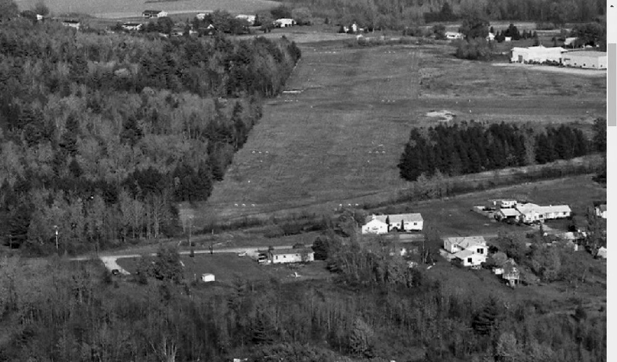
A 1982 aerial view looking northeast (courtesy of Mike Denja) depicted Au Gres Airport as remaining intact, but it was not apparent if the airport remained open by that point.
Au Gres Airport evidently closed (for reasons unknown) at some point between 1982-86,
as it was not listed in the 1986 Flight Guide (according to Chris Kennedy).
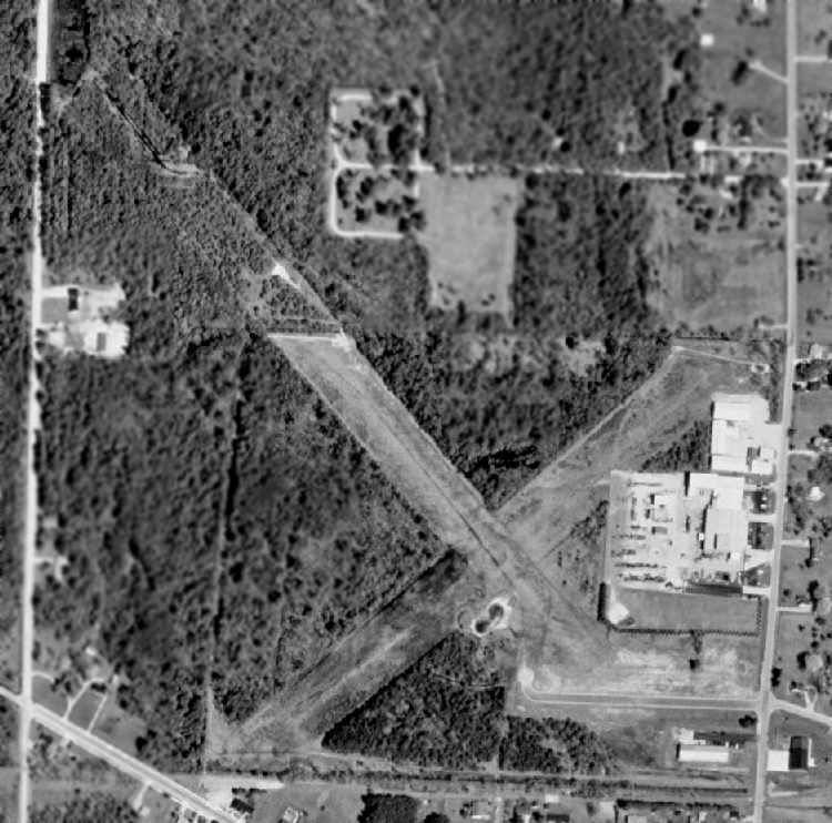
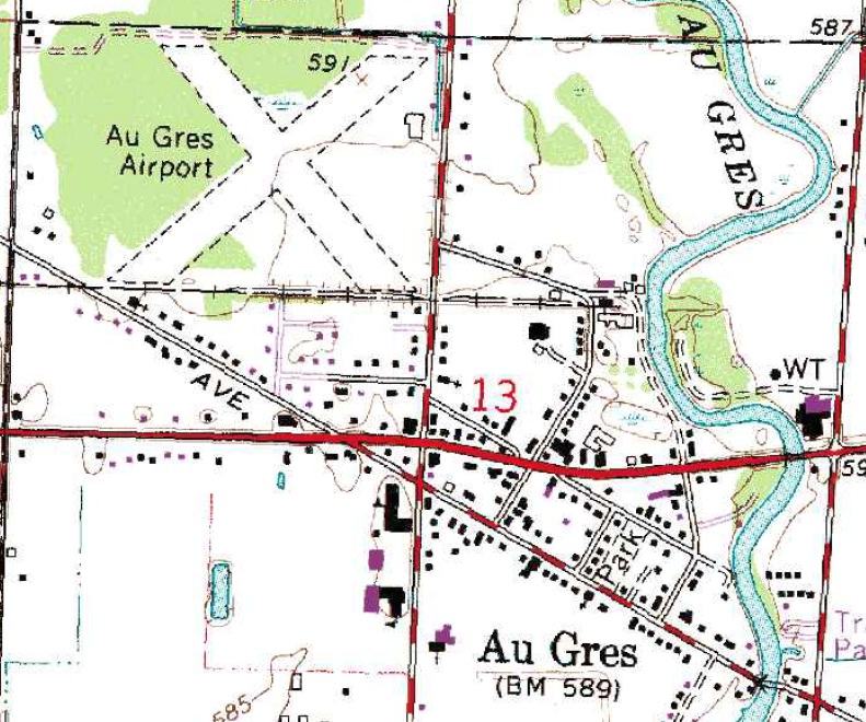
By the time of the 1998 USGS aerial photo, several buildings had been built over the eastern portion of Au Gres Airport,
and a new street had been built over a portion of the southeast end of Runway 14/32.
However, the outline of the majority of both runways still remained quite recognizable.
The “Old Airport Disc Golf Course” was established in 1999 on the site of Au Gres Airport.
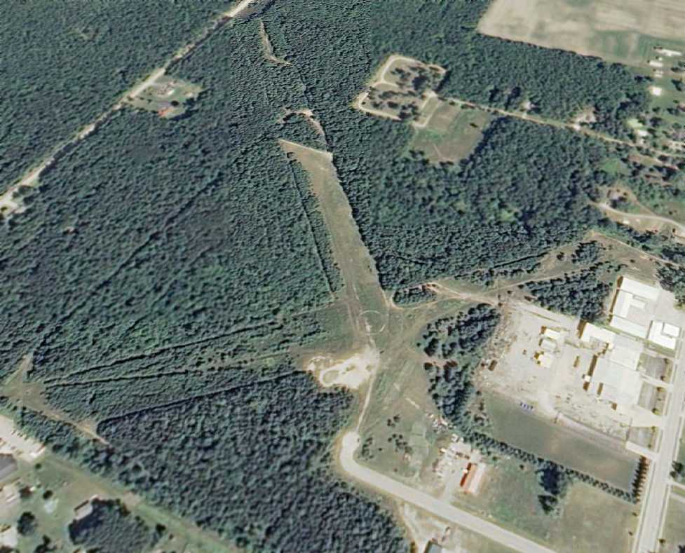
In a 7/26/10 aerial view looking northwest, the outline of the majority of both Au Gres Airport runways still remained quite recognizable.
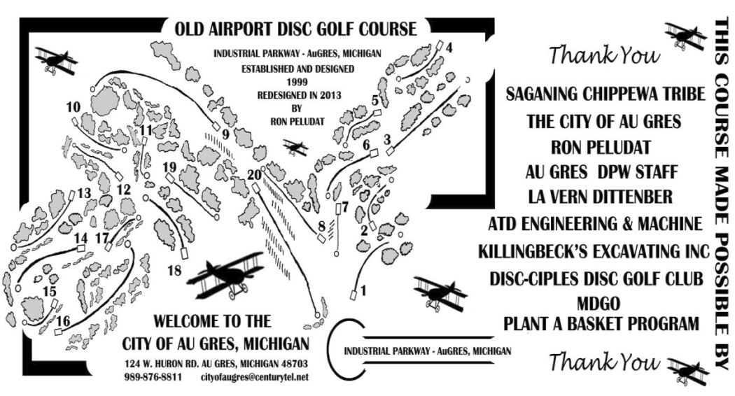
A 2013 map of the “Old Airport Disc Golf Course” located on the site of Au Gres Airport (courtesy of Mike Denja).
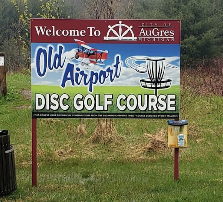
A 2019 photo of sign for the “Old Airport Disc Golf Course” on the site of Au Gres Airport.
The site of Au Gres Airport is located northwest of the intersection of North Court Street & West Cherry Street.
____________________________________________________
Since this site was first put on the web in 1999, its popularity has grown tremendously.
If the total quantity of material on this site is to continue to grow,
it will require ever-increasing funding to pay its expenses.
Therefore, I request financial contributions from site visitors,
to help defray the increasing costs of the site
and ensure that it continues to be available & to grow.
What would you pay for a good aviation magazine, or a good aviation book?
Please consider a donation of an equivalent amount, at the least.
This site is not supported by commercial advertising –
it is purely supported by donations.
If you enjoy the site, and would like to make a financial contribution,
you
may use a credit card via
![]() :
:
Please consider checking the box to make a monthly donatation.
For a mailing address to send a check, please contact me at: paulandterryfreeman@gmail.com
If you enjoy this web site, please support it with a financial contribution.
please contact me at: paulandterryfreeman@gmail.com
If you enjoy this web site, please support it with a financial contribution.
____________________________________________________
This site covers airfields in all 50 states.