Abandoned & Little-Known Airfields:
Hawaii: Kauai island
© 2001, © 2022 by Paul Freeman. Revised 12/25/22.
____________________________________________________
Please consider a financial contribution to support the continued growth & operation of this site.
Kealia Landing Strip (added 12/25/22) - Kekaha Airstrip (added 12/24/22) - Port Allen Airport / Burns Field (4/20/18)
____________________________________________________
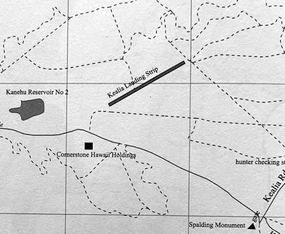
Kealia Landing Strip, Kealia, HI
22.132, -159.336 (Eastern coast of Island of Kauai, HI)
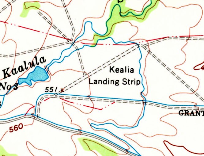
Kealia Landing Strip, as depicted on the 1963 USGS topo map.
Photo of the airfield while in use has not been located.
This small airfield on the southwest side of Kauai was evidently established at some point between 1960-63,
as it was not yet depicted on the November 1960 Hawaiian Islands Sectional Chart.
The earliest depiction which has been located of Kealia Landing Strip was on the 1963 USGS topo map,
which depicted a single northeast/southwest unpaved runway.
The earliest aeronautical chart depiction which has been located of Kealia Landing Strip was on the December 1964 Hawaiian Islands Sectional Chart.
It depicted Kealia Landing Strip as a private airfield having a single 1,900' paved northeast/southwest runway.
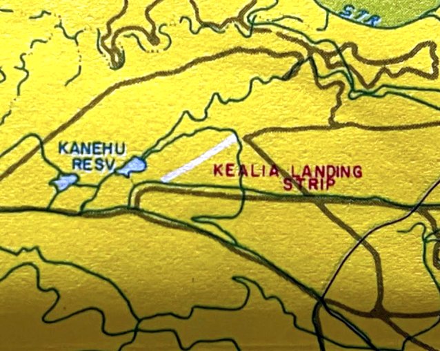
A circa 1980s map (courtesy of Kevin Walsh) depicted Kealia Landing Strip as having a single northeast/southwest runway.
The last aeronautical chart depiction which has been located of Kealia Landing Strip was on the June 1983 Hawaiian Islands Sectional Chart (courtesy of John Voss).
It depicted Kealia Landing Strip as a private airfield having a single 1,900' paved northeast/southwest runway.
Kealia Landing Strip was evidently closed (for reasons unknown) at some point between 1983-93,
as it was no longer depicted on the May 1993 Hawaiian Islands Sectional Chart (courtesy of Ron Plante).
A 2010 map (courtesy of Kevin Walsh) depicted Kealia Landing Strip as having a single northeast/southwest runway.
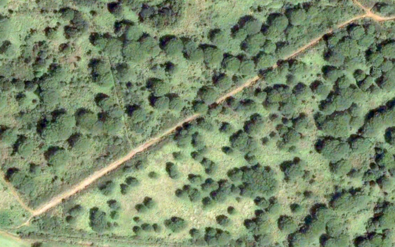
The earliest photo which is available of the Kealia Landing Strip was a 2003 aerial view.
It depicted a single northeast/southwest unpaved deteriorated runway.
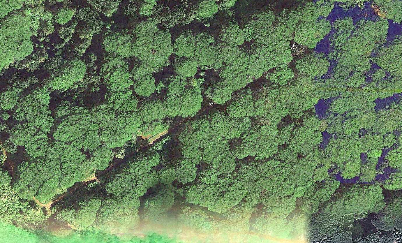
A 2013 aerial view of the site of the Kealia Landing Strip. Kevin Walsh observed, “It has been obliterated by an overgrown forest canopy.”
Thanks to Kevin Walsh for pointing out this airfield.
____________________________________________________
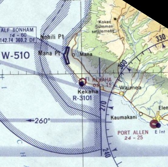
21.995, -159.749 (Southwestern coast of Island of Kauai, HI)
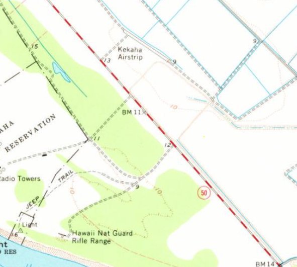
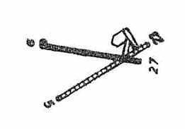
Kekaha Airstrip, as depicted on the 1963 USGS topo map.
Photo of the airfield while in use has not been located.
This small airfield on the southwest side of Kauai was evidently established at some point between 1960-63,
as it was not yet depicted on a 1950 aerial photo or the November 1960 Hawaiian Islands Sectional Chart.
The earliest depiction which has been located of Kekaha Airstrip was on the 1963 USGS topo map,
which depicted a single small northwest/southeast runway.
The earliest aeronautical chart depiction which has been located of Kekaha Airstrip was on the December 1964 Hawaiian Islands Sectional Chart.
It depicted Kekaha Airstrip as having a mere 1,500' unpaved runway.
The earliest photo which has been located of Kekaha Airstrip was a 1966 aerial view,
which depicted a single small northwest/southeast runway.
The last aeronautical chart depiction which has been located of Kekaha Airstrip was on the December 1967 Hawaiian Islands Sectional Chart.
It depicted Kekaha Airstrip as having a mere 1,500' unpaved runway.
Kekaha Airstrip was evidently closed (for reasons unknown) at some point between 1967-68,
as it was no longer depicted on the December 1968 Hawaiian Islands Sectional Chart.
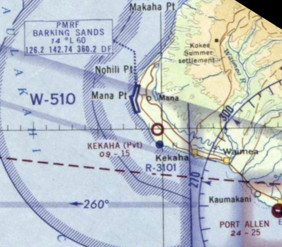
A circa 1980s map (courtesy of Kevin Walsh) depicted Kekaha Airstrip as a single small northwest/southeast runway.
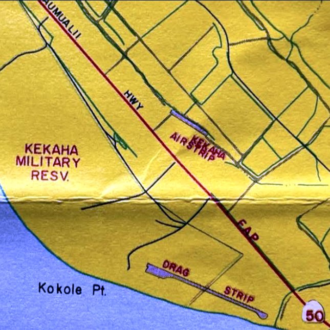
Kevin Walsh noted, “Oddly, the dragstrip [to the south] seems to have been custom-built for that purpose, and was not an abandoned airstrip.”
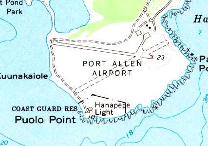
Kekaha Airstrip, as depicted on a circa 2000 map (courtesy of Kevin Walsh).
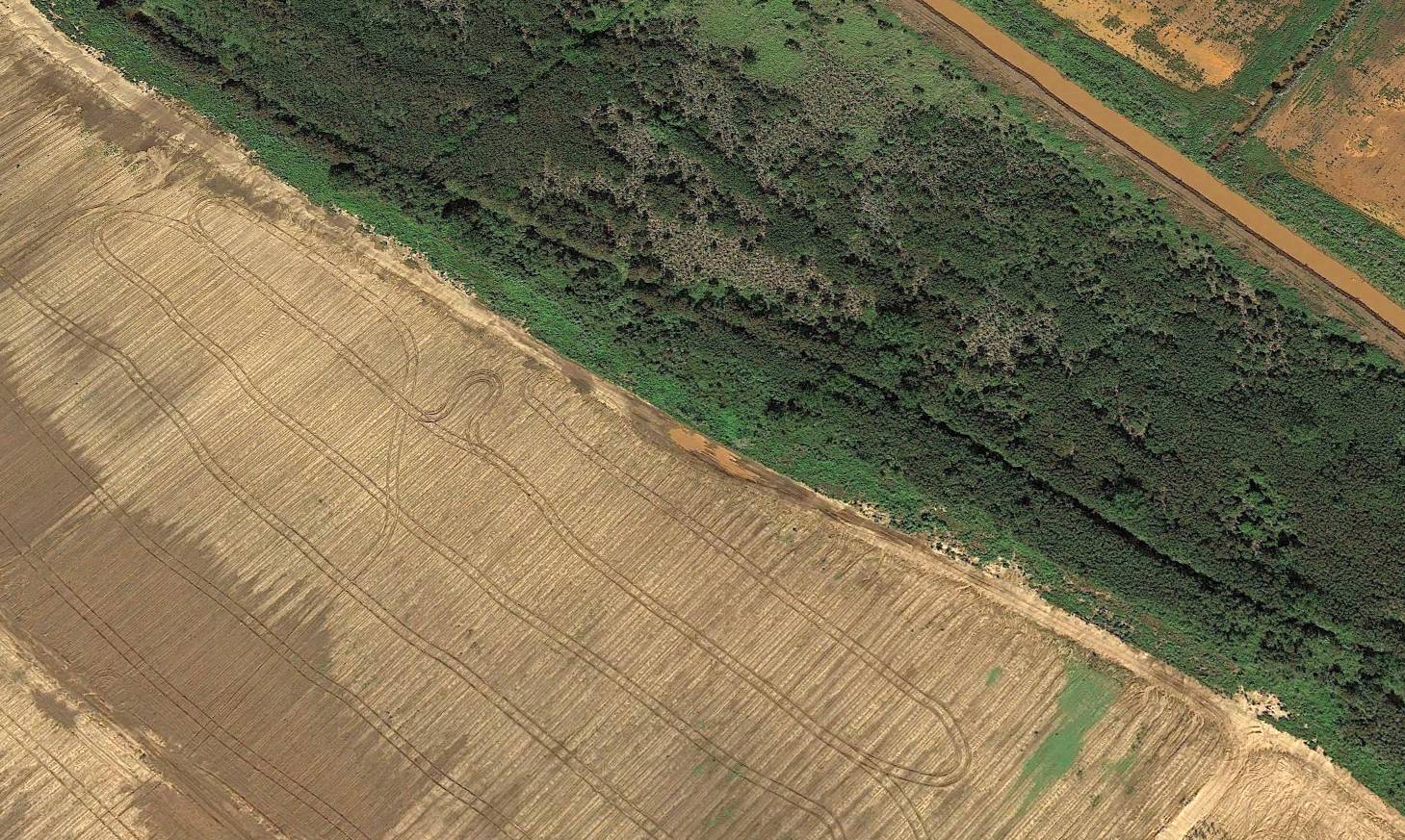
The earliest photo which is available of the Kekaha Airstrip was a 2005 aerial view looking north.
It depicted the deteriorated remains of a single small northwest/southeast runway.
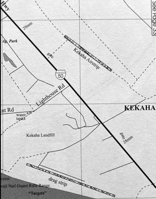
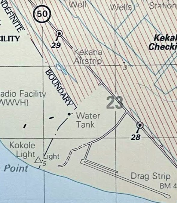
A 2010 map (courtesy of Kevin Walsh) depicted Kekaha Airstrip as a single small northwest/southeast runway.
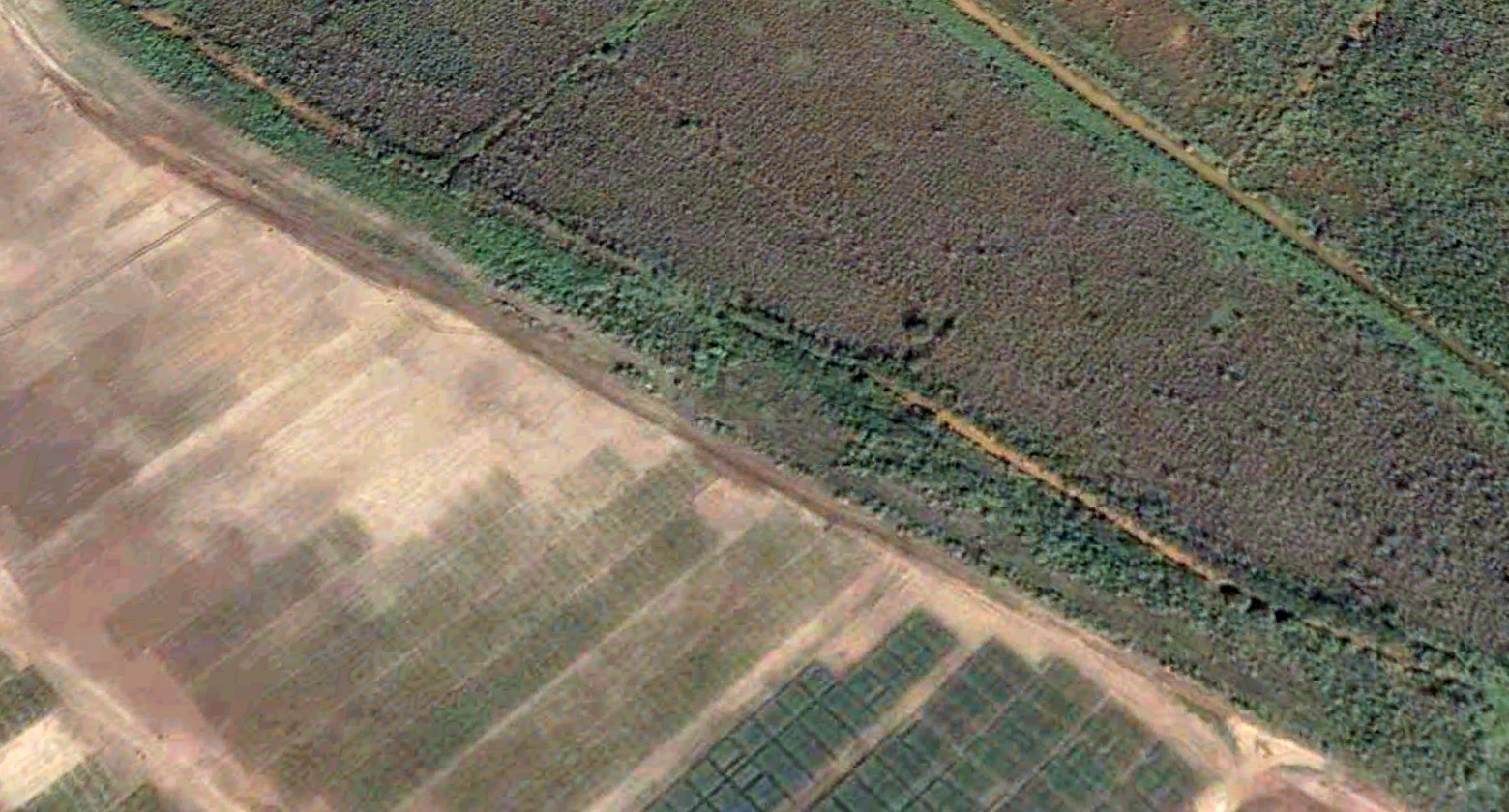
An October 2011 photo looking northeast showed no sign of Kekaha Airstrip.
A 2013 aerial view looking north depicted no trace remaining of the Kekaha Airstrip.
Thanks to Kevin Walsh for pointing out this airfield.
____________________________________________________
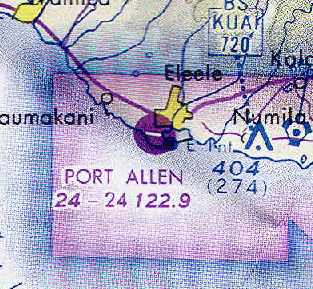
Port Allen Airport / Burns Field (PAK), Hanapepe, HI
21.9, -159.6 (Southern coast of Island of Kauai, HI)
A March 1929 aerial view looking northwest at the Port Allen Airport, showing an open grass field.
This small airfield was originally known as the Auxiliary Flying Field at Port Allen Military Reservation,
and was one of the first airfields on Kauai, opening in 1929.
The earliest photo which has been located of the Port Allen Airport was a March 1929 aerial view.
It depicted simply an open grass field.
Port Allen served as a military airfield in the 1930s & became a Territorial Airport in 1931.
A circa 1930s aerial view showed Port Allen Airport to have 2 grass runways,
measuring 3,000' east/west & 2,700' northeast/southwest.
One aircraft was visible on the field, along with a single small building on the northeast side.
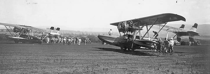
A circa January 1932 postcard photo (courtesy of Richard Wheeler) of 2 Sikorsky S-38 amphibians at Port Allen Airport.
According to Richard Wheeler, the “postcard was mailed 1/30/32.
The card was sent by Clyde De Vinna who was an Oscar winner for cinematography at the 2nd annual Oscar Award show in 1930.
He says he flew in on one of these 'fine ships' & was there to scout film locations for a movie.
De Vinna was one of the first cinematographers who favored location shooting as opposed to studio filming as was the norm at that time.”
An order issued by General Douglas MacAurthur in 1933 renamed the field as Burns Field,
in honor of a pilot killed in WW1.
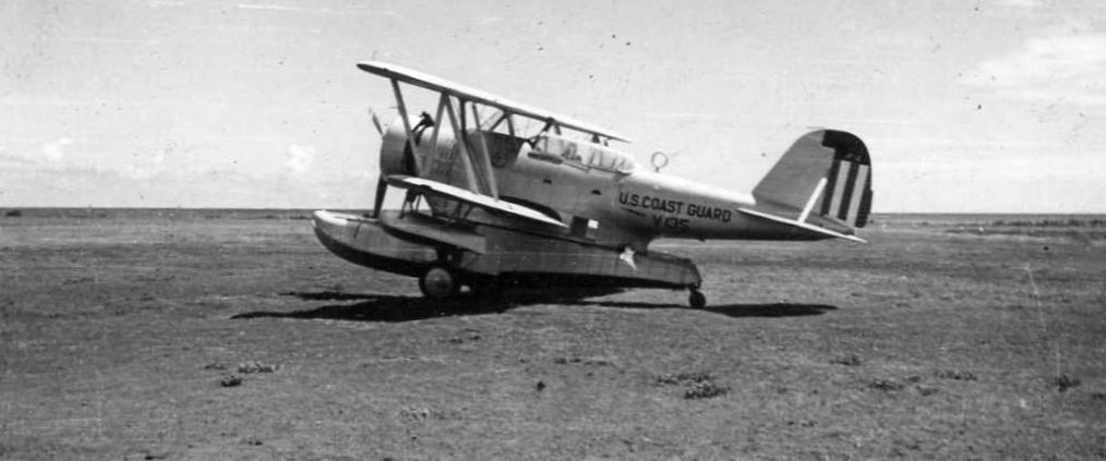
A 1939 photo (courtesy of Larry Enzler) of a Coast Guard Grumman J2F Duck at what appears to be Burns Field.
Larry reported, “An acquaintance at work gave me these 2 photographs. I believe that her uncle took them while in military service.”
The top border appears to say “Burns Field Kauai”, and 1939 is written along the bottom border.
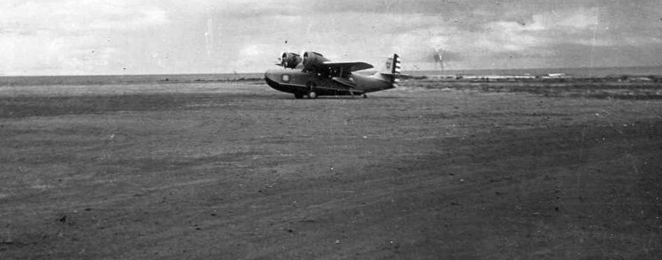
A 1939 photo (courtesy of Larry Enzler) of a Coast Guard Grumman JRF Goose at what appears to be Burns Field.
Larry reported, “An acquaintance at work gave me these 2 photographs. I believe that her uncle took them while in military service.”
The top border appears to say “Burns Field Kauai”, and 1939 is written along the bottom border.
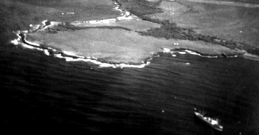
A 9/4/41 aerial view looking west at Burns Field,
(courtesy of Dave Fahrenwald of Hawaiian Aviation History)
showed the field to have 2 runways with a cluster of small buildings just northeast of the runway intersection.
Note what appears to be one aircraft at the far end of the east/west runway (top center of photo)
and another aircraft just to the right of the runway intersection.
Inexplicably, the April 1945 V-450 Hawaiian Islands U.S. Navy Aviation Chart (courtesy of Chris Kennedy)
did not depict any airfield at Port Allen, just an emergency seaplane anchorage.
The September 1947 Hawaiian Islands Sectional Chart described Port Allen Airport as having a 3,000' paved runway.
Small fixed-wing commercial aircraft used Port Allen Airport until 1950 when they switched to Lihue Airport.
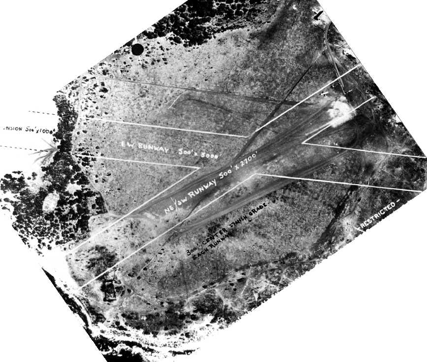
Port Allen Airport was depicted in the airfields diagram
on the October 1954 Hawaiian Islands Sectional Chart (courtesy of Chris Kennedy)
as having a 2,500' asphalt Runway 9/27 & an unpaved Runway 5/23.
A 3/3/55 aerial view looking southwest at Port Allen Airport as having a paved Runway 9/27,
a turf “rough” crosswind runway, a large hangar, and a few smaller buildings.
In the 1950s, the airport included a large hangar, 2 small hangars,
a small airport terminal building & another small building complex.
Port Allen was listed among active airports in the 1962 AOPA Airport Directory,
with a 2,500' paved runway, and the operator listed as "Hawaii Aeronautics Commission".
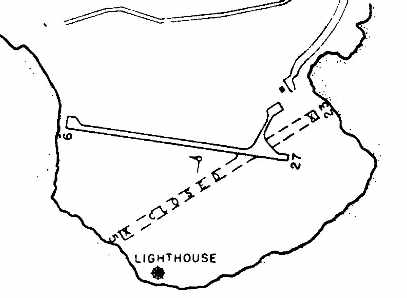
The 1963 USGS topo map depicted Port Allen Airport as having a paved Northwest/Southeast runway,
as well as an unpaved crosswind runway, along with 3 small buildings on the northeast side.
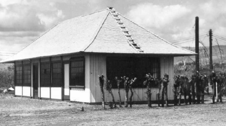
A circa 1970s photo of a terminal building at Port Allen Airport.
The December 1977 Hawaiian Islands Sectional Chart (courtesy of Chris Kennedy)
depicted the Port Allen Airport as having a single 2,400' paved runway.
A 1977 USGS aerial photo of Port Allen Airport (from the Lihue Public Library, courtesy of Jonathan Westerling).
The 1981 Hawaii Airports & Flying Safety Guide (courtesy of Jonathan Westerling)
depicted Port Allen as having a single 2,480' paved Runway 9/27,
along with a closed crosswind runway.
As of the 1990s, no buildings remained at Port Allen Airport,
just 2 runways on a barren wind-swept peninsula,
and there were also no aircraft based at Port Allen.
What few structures remained at Port Allen after most operations moved to Lihue Airport
were most likely destroyed when Hurricane Iniki ravaged the Island of Kauai in 1992.
However, Port Allen Airport could experience a renaissance in the future.
The Hawaii State Government has released a plan that attempts to
encourage Kauai helicopter tour operators to consolidate at Port Allen.
To encourage this, facilities at Port Allen would be improved,
including the construction of up to 4 aircraft hangars & 8 aircraft parking aprons,
public waiting facilities & access road pavement to reduce dust.
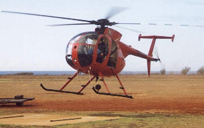
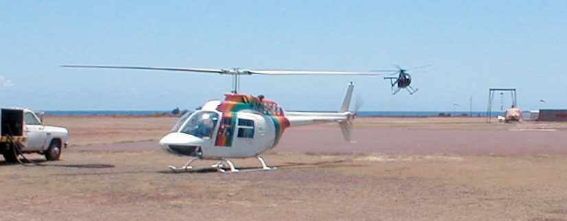
A 1999 photo by Paul Freeman of a Hughes 500D of Interisland Helicopters landing at Port Allen.
Paul Freeman flew from Port Allen Airport in 1999
on a Hughes 500D of Interisland Helicopters on an aerial tour of the Island of Kauai.
Their tour is highly recommended, as they fly the 500D with no doors, for a spectacular view.
Even the Interisland Helicopters aircraft is not based at Port Allen,
but rather in a small hangar one mile north,
and at the end of the day the 500D is towed on a trailer down a public road to their hangar.
The airfield at Port Allen Airport consists of 2 paved runways & a helicopter parking apron.
The only remaining active runway, 9/27, is 2,450 ft long.
Unfortunately, the plans which had been previously proposed in the 1990s to revitalize Port Allen Airport
have been stymied by the residents surrounding the airport (what a surprise!),
according to an January 2001 article by Anthony Sommer.
It described how in 2000 the State Airports Division had asked Kauai County
for permits to put up a fuel tank & office building at Burns Field.
The construction at Burns Field was done to accommodate Air 1 Helicopters,
which provide all helicopter services to both the Kauai Fire Department
and Kauai Police Department under a contract with the county.
Air 1, owned by Ken D'Attilio, is paid between $50,000-$100,000 annually,
depending on how many missions it flies.
Air 1 also provides tours & takes construction crews to remote work sites.
On December 10, 2000, Air 1 was forced to move out of property next to Burns Field
that it had been leasing for many years.
Then in 2001 the Kauai County Planning Department hit the state Aviation Division with a citation
for allowing the construction of a fuel tank & office building without county permits at Burns Field.
All of the other helicopter companies on Kauai
are based either at Lihue Airport or the privately-owned Princeville Airport.
D'Attilio said the best he could do was to get on a waiting list for Lihue Airport.
"What was I going to do? I have employees, I have customers, I've got to operate from somewhere.
I did what I checked out to be legal," he said.
D'Attilio said the "office building" is a mobile home
and that he was told by Kauai Police they consider it a vehicle rather than a building.
South shore residents were divided on upgrading Port Allen Airport.
Some said it would increase tourism spending; others said it would provide only noise & dust.
Strong opposition came from Hawaiians who use the salt ponds adjacent to the airport.
Even though the airport has existed for more than 70 years without any fuel spills polluting the salt ponds,
Wilma Holi, whose family has gathered salt at the ponds for generations, sued the state.
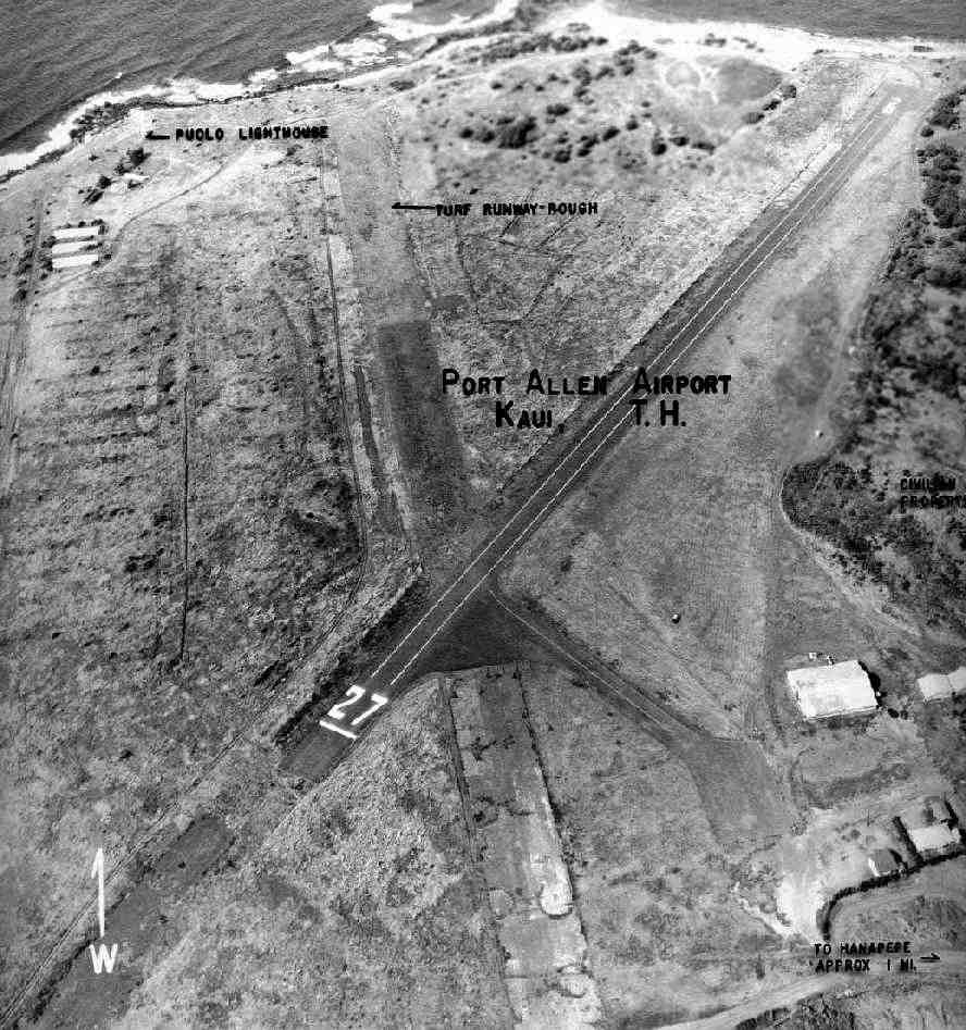
A June 2004 photo looking northeast at Port Allen Airport.
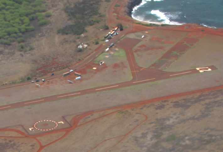
A June 2004 close-up looking northeast at the ramp at Port Allen Airport.
Jonathan Westerling visited Port Allen Airport in 2004.
"That this is truly an interesting airport.
It is unattended, and there are no planes based at the airport,
however there are at least 12 takeoffs & landings every hour due mostly to the helicopter tours.
There are 2 tour operators running flight operations out of Port Allen
which combined use 5 aircraft constantly throughout the day.
There is also a powered hand gliding operation at Port Allen.
There are no remnants of the old cross runway that I could find."
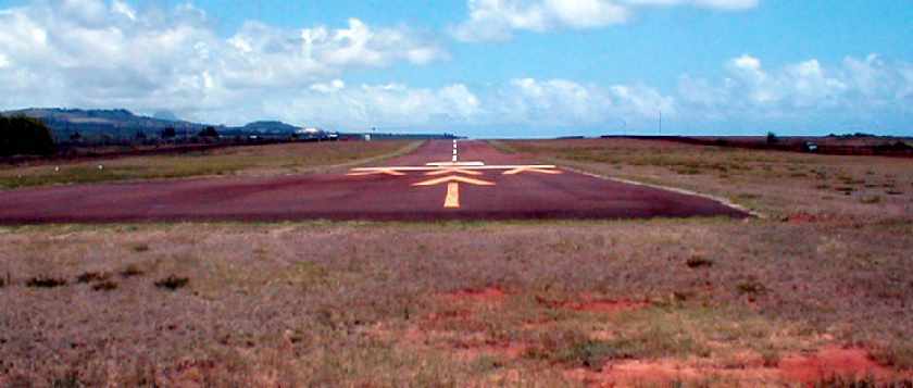
A 2004 photo of Port Allen's Runway 9 by Jonathan Westerling.
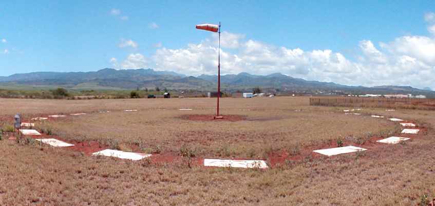
A 2004 photo of Port Allen's windsock by Jonathan Westerling.
The trailers on the far side of the airport are the entire extent of any buildings on the field.
A 2004 photo by Jonathan Westerling of a typical scene at the Port Allen Airport:
simultaneous takeoffs & landings by the 2 tour companies
(a Bell 206 of Bali Hai in the foreground, along with the Hughes 500 "Air1" of InterIsland landing in the background).
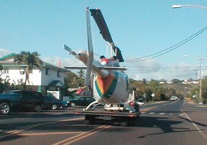
A 2004 photo by Jonathan Westerling of one of Bali Hai's Bell 206 Jet Rangers being towed to its off-airport hangar at the end of the day.
Jonathan reported, "Even though this happens every evening,
the sight of a helicopter roaming the streets of Kauai got plenty of stares from curious onlookers."
Sadly, this Jet Ranger was destroyed a few months later in a crash that was fatal for all onboard.
Unfortunately, as of 2004, improvements will not yet be coming to Port Allen Airport.
According to the State of Hawaii's Steve Takashima (via Jonathan Westerling),
"None of the improvements in the master plan
has been funded as of yet & there are current plans to implement the improvements."
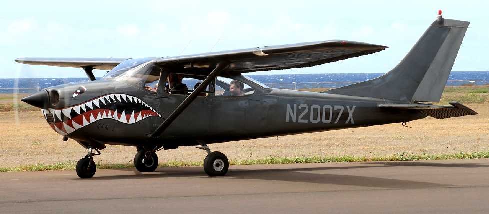
A 7/28/10 photo of a fancifully-painted Cessna 182H taking up a load of skydivers from Port Allen Airport.
Bill Jacobs reported, “This past November [2010] we took a Hughes helicopter ride out of Port Allen.
Other than helicopters, it was pretty quiet airport!”
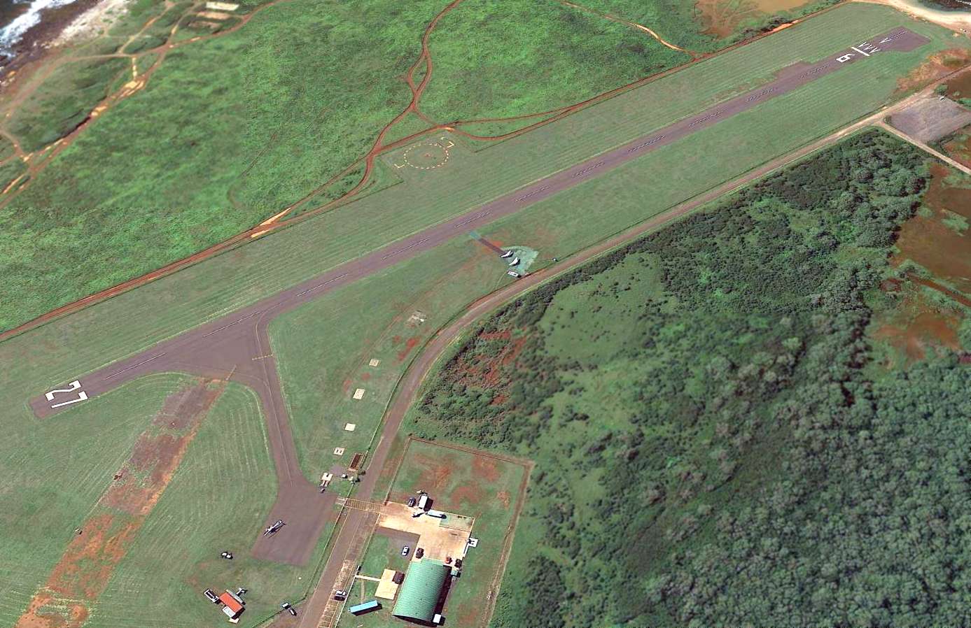
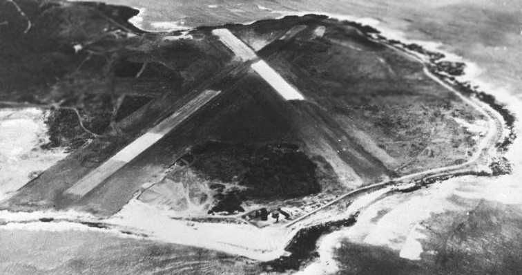
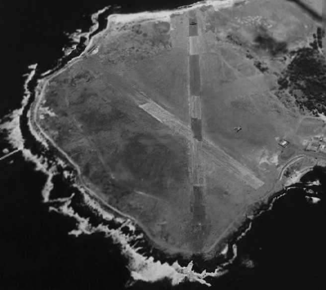
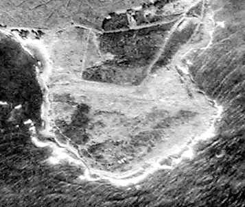
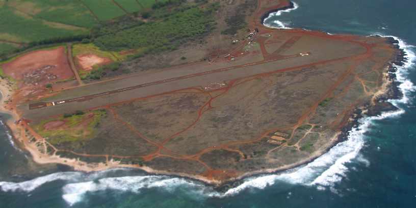
A 2013 aerial view looking southwest at Port Allen Airport.
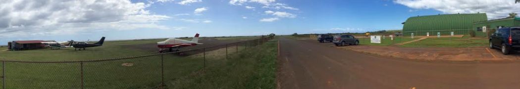
A panoramic November 2014 photo by Timothy Williamson of Port Allen Airport.
Timothy reported, “The only activity I saw there was a couple helicopter outfits & a few small planes.”
See also: http://www.geocities.com/Pentagon/Barracks/5963/BurnsFieldPortAllen.html
____________________________________________________
Since this site was first put on the web in 1999, its popularity has grown tremendously.
If the total quantity of material on this site is to continue to grow,
it will require ever-increasing funding to pay its expenses.
Therefore, I request financial contributions from site visitors,
to help defray the increasing costs of the site
and ensure that it continues to be available & to grow.
What would you pay for a good aviation magazine, or a good aviation book?
Please consider a donation of an equivalent amount, at the least.
This site is not supported by commercial advertising –
it is purely supported by donations.
If you enjoy the site, and would like to make a financial contribution,
you
may use a credit card via
![]() :
:
Please consider checking the box to make a monthly donatation.
For a mailing address to send a check, please contact me at: paulandterryfreeman@gmail.com
If you enjoy this web site, please support it with a financial contribution.
please contact me at: paulandterryfreeman@gmail.com
If you enjoy this web site, please support it with a financial contribution.
____________________________________________________
This site covers airfields in all 50 states.