
Abandoned & Little-Known Airfields:
California: Northwestern Sacramento area
© 2002, © 2024 by Paul Freeman. Revised 11/4/24.
This site covers airfields in all 50 states: Click here for the site's main menu.
____________________________________________________
Please consider a financial contribution to support the continued growth & operation of this site.
For the 6th year, the CA pages of this website are sponsored by the California Pilots Association:
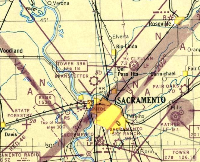
Branstetter Airport / Natomas Airport (revised 12/21/23) - Capitol Sky Park (revised 11/4/24)
____________________________________________________
Capitol Sky Park, West Sacramento, CA
38.584, -121.524 (West of Sacramento, CA)
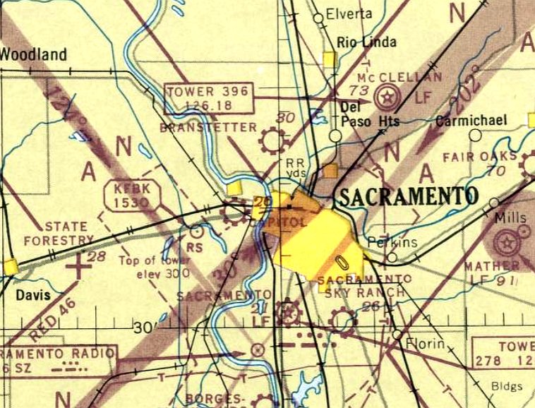
Capitol Sky Park, as depicted on the August 1947 Sacramento Sectional Chart.
This small general aviation airport was located in West Sacramento,
just across the Sacramento River from downtown Sacramento.
According to the book "Two Hours By Crow" by Howard & Judith Campbell (courtesy of Wings of History),
“John 'Jack' Rich returned from World War II & set up this aviation site in 1946.
The turf runway was partially paved in oiled earth for 2,000' of its 3,000', and there were 10 hangars in a single row on the south side along with major repair facilities.
A short 900' grass north/south runway was opened in 1947, but soon closed as the planes were getting faster.”
Capitol Sky Park was not yet depicted on the February 1947 Sacramento Sectional Chart.
The earliest depiction of Capitol Sky Park which has been located was on the August 1947 Sacramento Sectional Chart.
It depicted "Capitol" as a commercial/municipal airport.
The 1948 Sacramento Sectional Chart (courtesy of Jonathan Westerling) depicted "Capitol" as having a 2,400' unpaved runway.
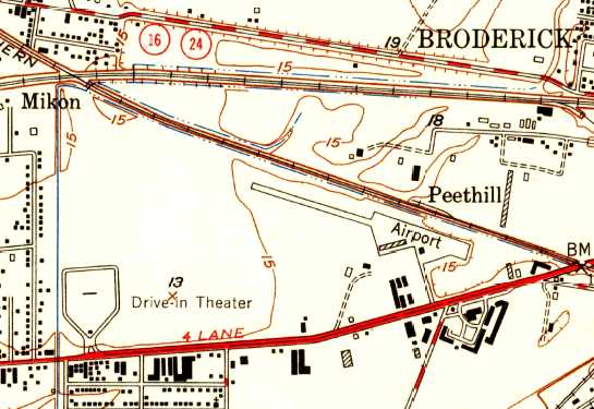
A 1948 USGS topo map depicted the Capitol Sky Park as having a single paved northwest/southeast runway, with a ramp & 2 buildings on the southeast side.
A 1948 USGS topo map depicted the Capitol Sky Park as having a single paved northwest/southeast runway, with a ramp & 2 buildings on the southeast side.
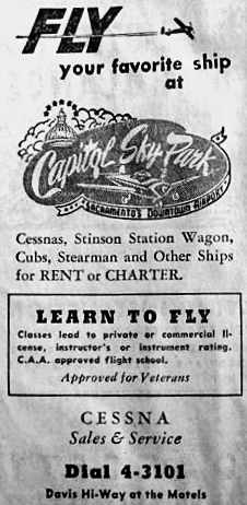
A September 1948 telephone book advertisement for the Capitol Sky Park (courtesy of Dann Shively).
According to the book "Two Hours By Crow" by Howard & Judith Campbell (courtesy of Wings of History), “There was even a restaurant on the field in 1949.
As the eatery was soon dropped from the listing, we must assume that it wasn't profitable.
Lights were available upon pilot request & both 80 & 91 octane fuel was sold on the field.
Flight training was offered & another not-too-common feature was a couple of Link Trainers for instrument training were available in the facility.
These were the first flight simulators & were operated by a vacuum system & an unbelievably complicated set of multiple gear boxes
that copied the movements of the pilot in his tiny 'flying' box onto a flat desk under the watchful eye of the instructor.
The desk was covered with an aerial chart & the front wheel of a three-wheeled 'crab' would print out the path flown by the student.
There were some weekends that the strip was turned into a race-track for 'jalopies' on this pseudo drag strip.
The local Wing of the Air Scouts met here & a Curtiss C-46 Commando was flown in for a clubhouse.”
The 1949 Sacramento Sectional Chart (courtesy of Chris Kennedy) depicted "Capitol" as having a 2,400' unpaved runway.
A spring 1949 Bureau of Reclamation aerial view (from the Yolo County Archives, courtesy of Fred Pierini, via Curtis Caroll, via Dann Shively, enhanced by Bill Grasha)
depicted Capitol Sky Park as having 2 runways.
Curtis reported, “Fred Pierini... learned to fly there in the late 1940s & then worked as a mechanic through most of the 1950s.
He mentioned a north/south crosswind runway. It was basically just cleared brush & existed up until the land along West Capitol Avenue was sold & developed in the early 1950s.
This is probably one of very few photos that actually shows the seldomly-used runway.”
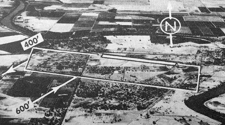
An undated aerial view looking north at Capitol Sky Park from the 1950 Air Photo Guide (courtesy of Kevin Walsh).
The guide described Capitol Sky Park as having a 3,000' blacktop & turf Runway 9/27, and listed the managers as J.L. Rich & R.D. Watts.
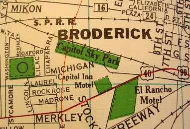
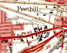
"Capitol Sky Park" was depicted on a 1950 street map (courtesy of Dann Shively)
as a rectangular property running northwest/southeast along the south side of the Sacramento Northern Railroad tracks.
Dann Shively met the daughter of the former owner of the Capitol Sky Park.
He remarked, "During the 1950s it was a thriving airport as it was literally blocks from the State Capitol."
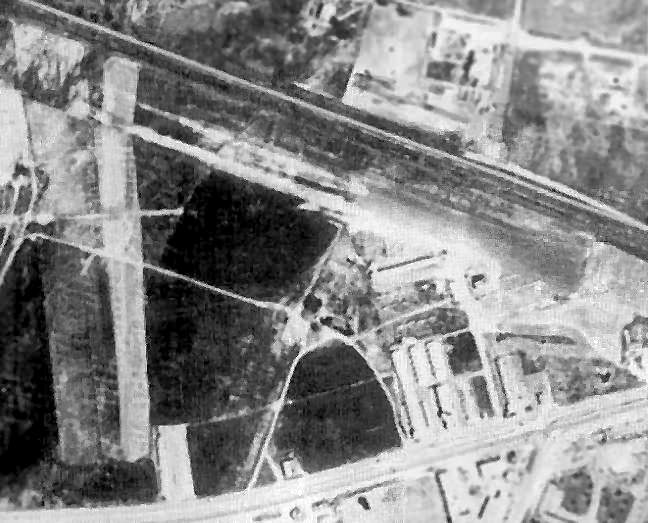
A 9/28/52 aerial view of Capitol Sky Park (from the UCSB Library) depicted the field as having a northwest/southeast runway,
with a large number of light planes parked on the southeast side.
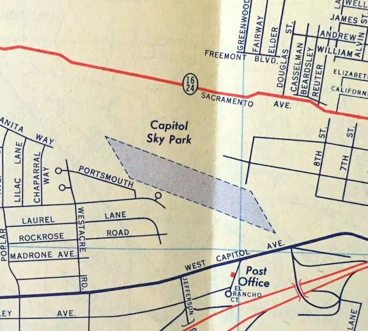
Capitol Sky Park, as depicted on a 1955 street map (courtesy of Kevin Walsh).
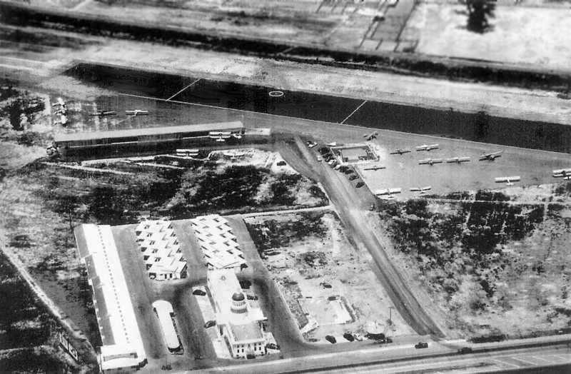
A circa 1950s aerial view looking west at Capitol Sky Park (courtesy of Curtis Carroll, enhanced by Bill Grasha), with a total of 18 biplanes & monoplanes visible on the field.
Note the gold-domed Capitol Inn in the foreground.
A 1957 aerial view depicted Capitol Skypark as having a single unpaved northwest/southeast runway.
A few small buildings were located at the southeast corner, around which were parked several dozen light aircraft.
According to the book "Two Hours By Crow" by Howard & Judith Campbell (courtesy of Wings of History),
“In the very late 1950s, Jack leased the field to Bob Watts.”
The last depiction which has been located of Capitol Skypark was on the March 1960 Sacramento Sectional Chart,
which depicted "Capitol" as having a 3,000' unpaved runway.
According to Curtis Carroll, “It reputedly was the busiest private airport in the country by the late 1950s, just before it was moved.”
The partners moved the FBO to Executive [Sacramento Executive Airport] in 1960 & a trailer park & bowling alley was built on the site.”
By the time of the September 1960 Sacramento Sectional Chart, Capitol Sky Park was no longer depicted at all.
According to the book "Two Hours By Crow" by Howard & Judith Campbell (courtesy of Wings of History),
“Bob Watts closed it in 1961 when he sold off the land for a mobile home park.
The rerouting of Federal Highway 80 into Sacramento had cut off his eastern approach.
These varied activities could not hold off the progress of the highway system.”
A 1964 aerial view showed that houses had covered the eastern portion of Capitol Skypark, but the western half of the runway remained intact.
A 2003 aerial view (courtesy of Dann Shively) showed that no trace remained of the Capitol Sky Park.
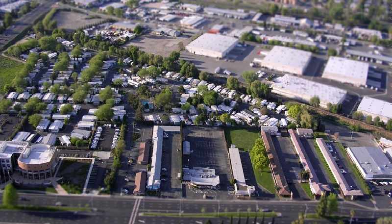
A 2007 aerial photo by Dann Shively, looking north at the site of Capitol Sky Park.
Dann reported, "The runway was situated parallel to the railroad tracks. There's a mobile home park located there now.
The mobile home park covers most of what was the airport. You can see by the trees along the tracks it's been there for a while.
The street that runs parallel to the tracks was approximately where the strip was.
The large building at the left side of the picture is the West Sacramento City Hall.
The remnants of the old Capitol Inn are still there although the building went through a major renovation at some point
removing, among other things, the state capitol look-a-like dome.”
A 2016 aerial view shows no trace remaining of Capitol Sky Park.
The site of Capitol Sky Park is located northeast of the intersection of Jefferson Boulevard & West Capitol Avenue.
____________________________________________________
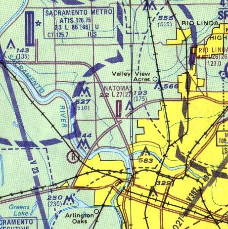
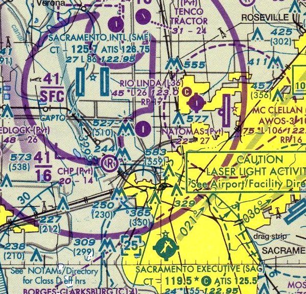
Branstetter Airport / Natomas Airport (Q96), Sacramento, CA
38.637, -121.516 (Northwest of San Francisco, CA)
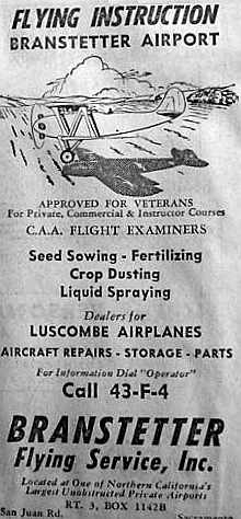
A June 1946 telephone book advertisement for the Branstetter Flying Service (courtesy of Dann Shively).
This general aviation airfield was reportedly opened in 1945, under its original name of Branstetter Airport.
The earliest reference to Branstetter Airport which has been located
was an advertisement for Branstetter Flying Service in a June 1946 telephone book (courtesy of Dann Shively).
However, Branstetter Airport was not yet depicted on the February 1947 Sacramento Sectional Chart.
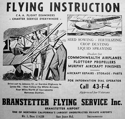
A March 1947 telephone book advertisement for the Branstetter Flying Service (courtesy of Dann Shively).
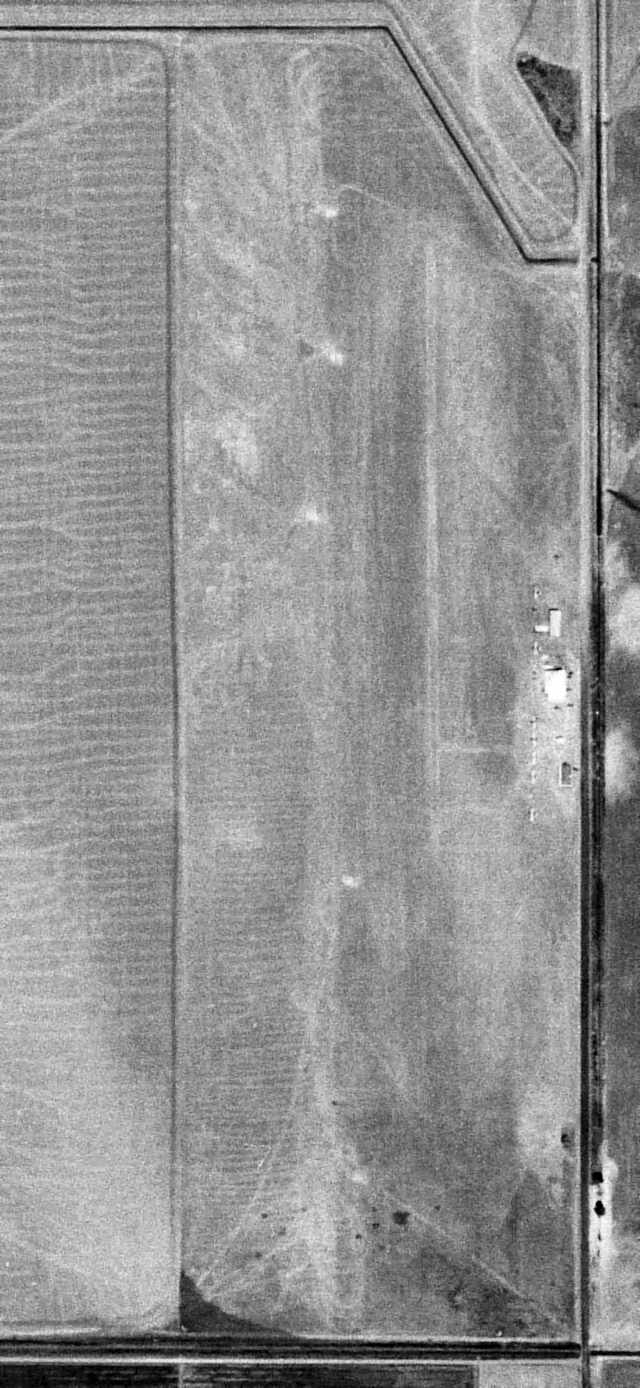
The earliest photo which has been located of Branstetter Airport was a 8/5/47 USGS aerial view (enhanced by Bill Grasha).
It depicted the field as having a north/south unpaved runway, with a few small buildings & a few small aircraft along the east side.
The earliest aeronautical chart depiction of Branstetter Airport which has been located was on the August 1947 Sacramento Sectional Chart,
which depicted Branstetter as a commercial/municipal airport.
The 1948 & 1949 Sacramento Sectional Charts depicted Branstetter as having a 3,000' unpaved runway.
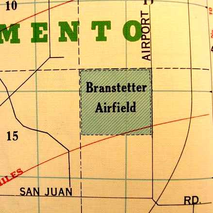
A 1950 street map (courtesy of Dann Shively) depicted "Branstetter Airfield" simply as a square outline on the west side of Airport Road,
without showing any other airfield details.
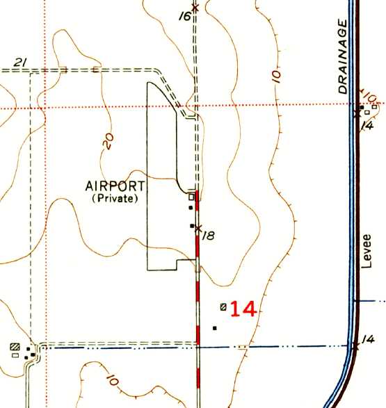
The 1950 USGS topo map depicted “Airport (Private)” as having a single north/south runway, with 3 small buildings along the southeast side.
Branstetter was still depicted on the 1957 Sacramento Sectional Chart (according to Chris Kennedy),
but by then the listed runway length had decreased to only 1,800'.
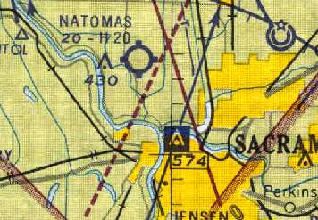
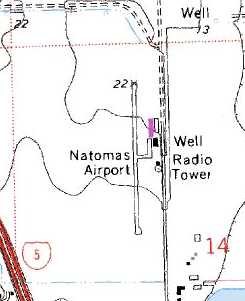
The field was apparently renamed Natomas Airport at some point between 1957-61,
as that is how it was depicted on the 1961 Sacramento Sectional Chart (courtesy of Chris Kennedy).
The runway had also been paved, and was 2,000' long.
The 1962 AOPA Airport Directory described Natomas as having a single 2,000' macadam Runway 16/34.
According to local pilot Don Rodrigues,
Natomas Airport was the home of the American Aero Club, run by Russ Kilmer.
The airport's operator was Sacramento Aero Services.
Natomas Airport was depicted on the 1967 Sacramento Sectional Chart (courtesy of John Voss)
with a single 2,000' asphalt runway.
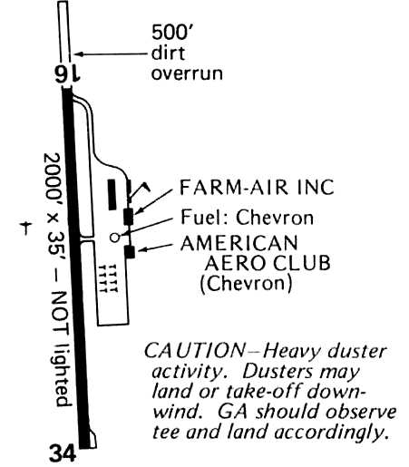
A 1978 Flight Guide (courtesy of Chris Kennedy) listed the operators at Natomas
as American Aero Club & Farm-Air Inc.
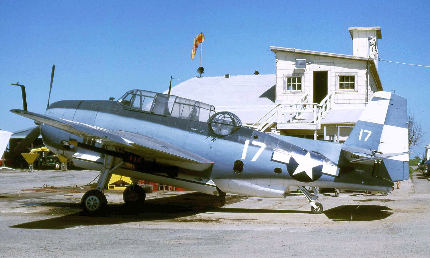
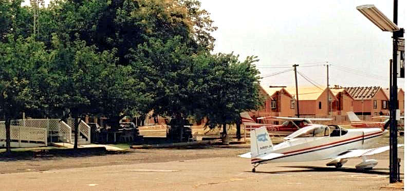
An April 1981 photo by Jay Sherlock of Grumman TBM-3E N93818 (ex USN 53818) in front of the Natomas Airport hangar.

An April 1981 photo by Jay Sherlock of Stearman N2S-2 N5055V at Natomas Airport.
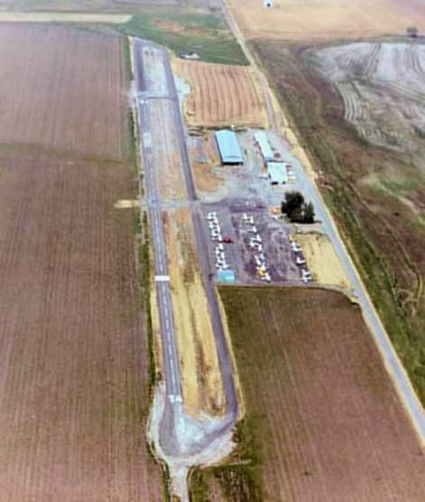
A 1982 aerial view looking north at Natomas Airport (copyright by John Hockenbury, used by permission, enhanced by Bill Grasha).
Natomas Airport's runway had apparently been lengthened by 1987,
as it was depicted as 2,700' on the 1987 CA Aeronautical Chart (courtesy of John Voss).
Sheryl Borsoff recalled, “I lived at the Natomas Airport for a year while finishing up my degree at Sacramento State.
There was an apartment over a large hangar next to the ground school classrooms.
We just had a fireplace for heat & the faucets ran off into the yard. This was in 1993.
This was the nicest place that I have ever lived in my life.
Large front room windows facing the runway, complete privacy after dark,
the airport dog, Gyro, came to live with me, he was a roommate, not a pet.
Helicopters would come out at night sometimes so students to practice flying them.
I had a few scary moments looking out my bedroom window, at a seemingly out of control copter,
just being taken over by the instructor at the last minute.
They did not know that there was a young woman & a dog & 2 cats watching them from a window above the hangar.”
Sheryl continued, “There were little barn owls that lived inside the smaller hangars.
One night there was an incredible thunderstorm, no rain, just such noise & winds,
the dog & I went out to experience it for a few minutes, before we got blown back in.
A very hot, violent Summer Valley storm. It was incredible living there.
I shall remember it always.”
Sheryl continued, “When I would come home from classes and my job, Gyro would be waiting for me,
I would open the passenger door to my truck, and he would run & jump in.
One of the pilots that kept his GA aircraft there took Gyro when the airport office closed.
In fact, he paid for the vet bill when Gyro had heartworms, and I took care of him.
Gyro slept in my arms & coughed up blood all over my hair & shoulders every night.
However, we both survived quite famously.”
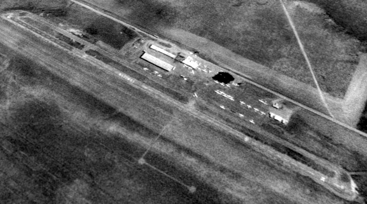
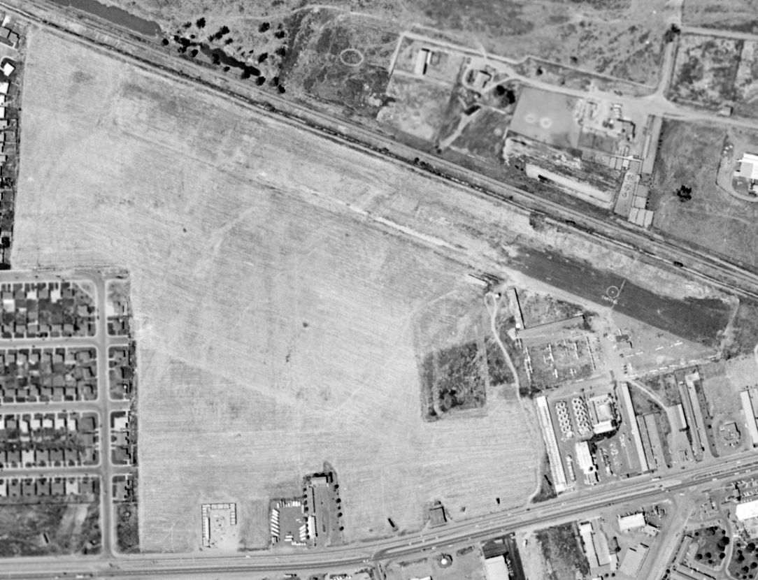
A 1993 aerial view looking northeast showed Natomas Airport to be quite well used, with a few dozen light aircraft visible.
The 1995 USGS topo map depicted Natomas Airport as having a single north/south runway, with 3 small buildings along the east side.
A 2000 aerial view by Jack Kenton (enhanced by Bill Grasha) looking southwest at Natomas Airport.
A 2000 photo by Jack Kenton (enhanced by Bill Grasha) of a Cessna 182 & Beech Bonanza in front of the Natomas Airport hangar.
Alison Robinson recalled, “The Cessna 182 & Bonanza were just 2 of the planes in the fleet of American Aero Club.”
Alison Robinson recalled, “Sacramento Aero Services was my Dad Russell Kilmer's company. The T-6 belonged to the owner Farm Air.”
A 2000 photo by Jack Kenton (enhanced by Bill Grasha) showing the houses encroaching at Natomas Airport.
Jack recalled, “The guy refueling my plane told me the field would close the next day or so.”
For several years, Natomas developers were trying to get the airport shut down, citing it was not part of the master plan for the community.
Pilots say it's a shame they couldn't reach a compromise.
Natomas Airport was reportedly closed in 2000,
even though it continued to be depicted as a private airfield on aeronautical charts for several more years.
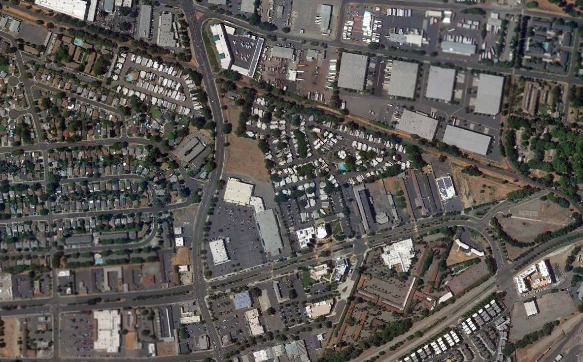
The Arco Arena (where the Sacramento Kings play) was built immediately north of the airfield site.
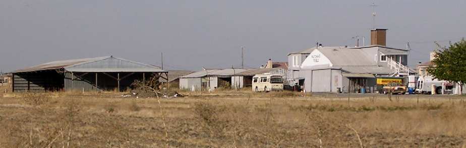
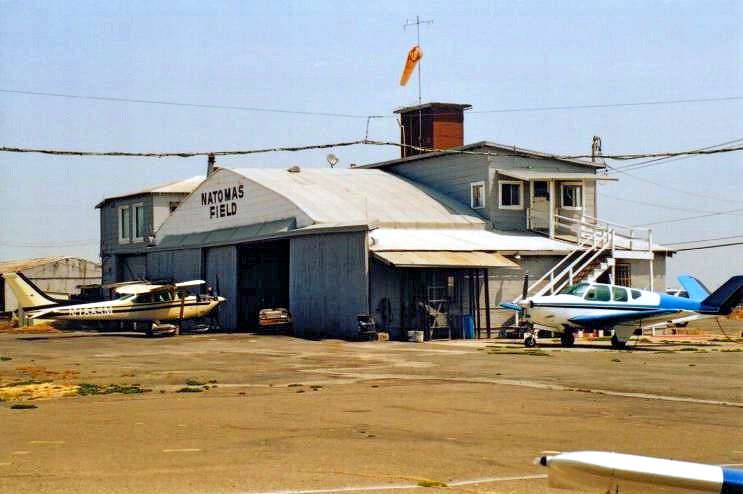
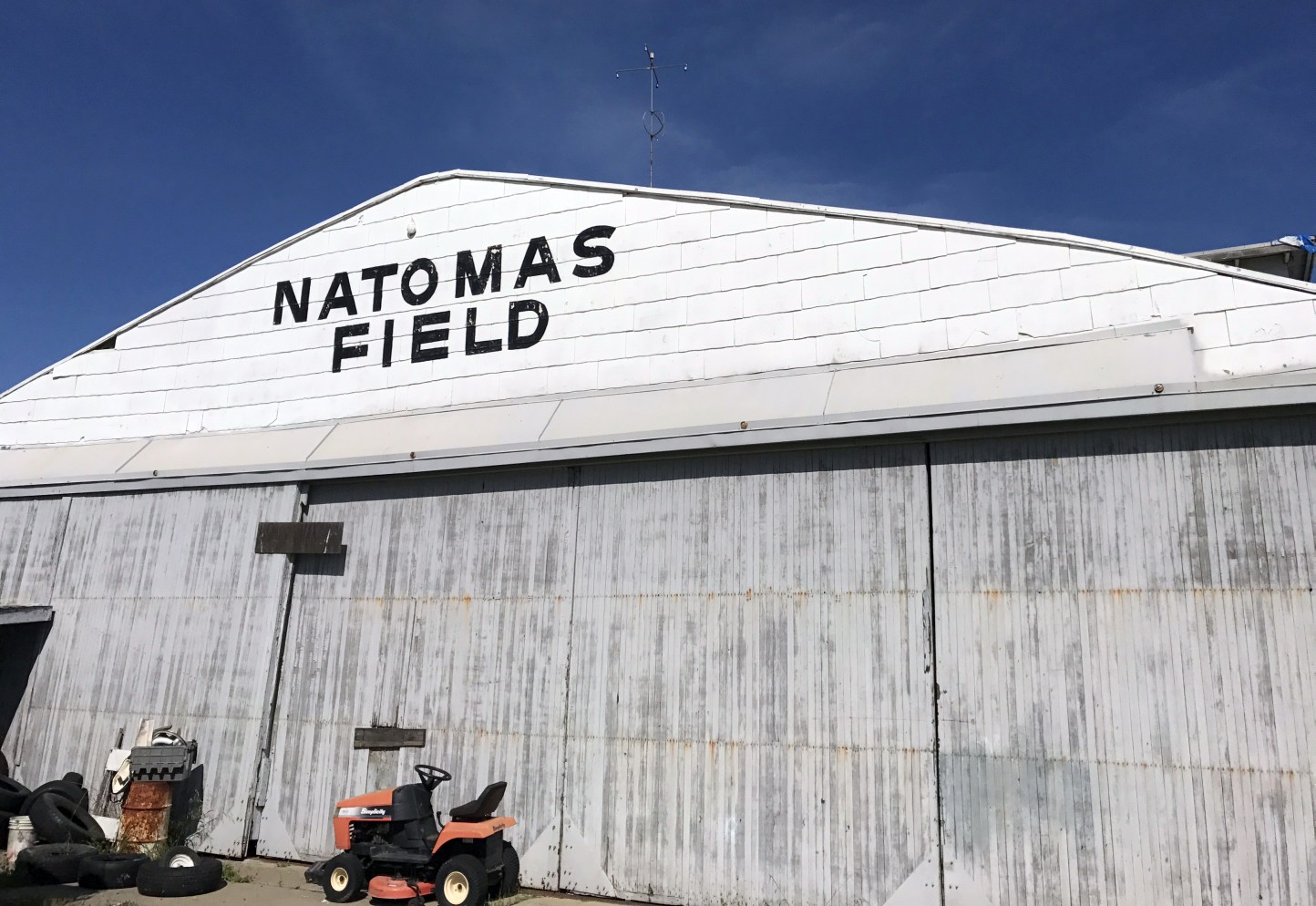
A 2003 photo by Dann Shively of the hangars which remains at Natomas.
Note the "Natomas Field" legend on the white portion of the hangar at right.
Dann reported, “That whole area is a hotbed of residential development.
On one of the aerial shots you can see houses encroaching from the east.
There are the very early stages of site preparation going on around the airport property.
But the airport boundaries are partially fenced off & the road closed to what used to be the office."

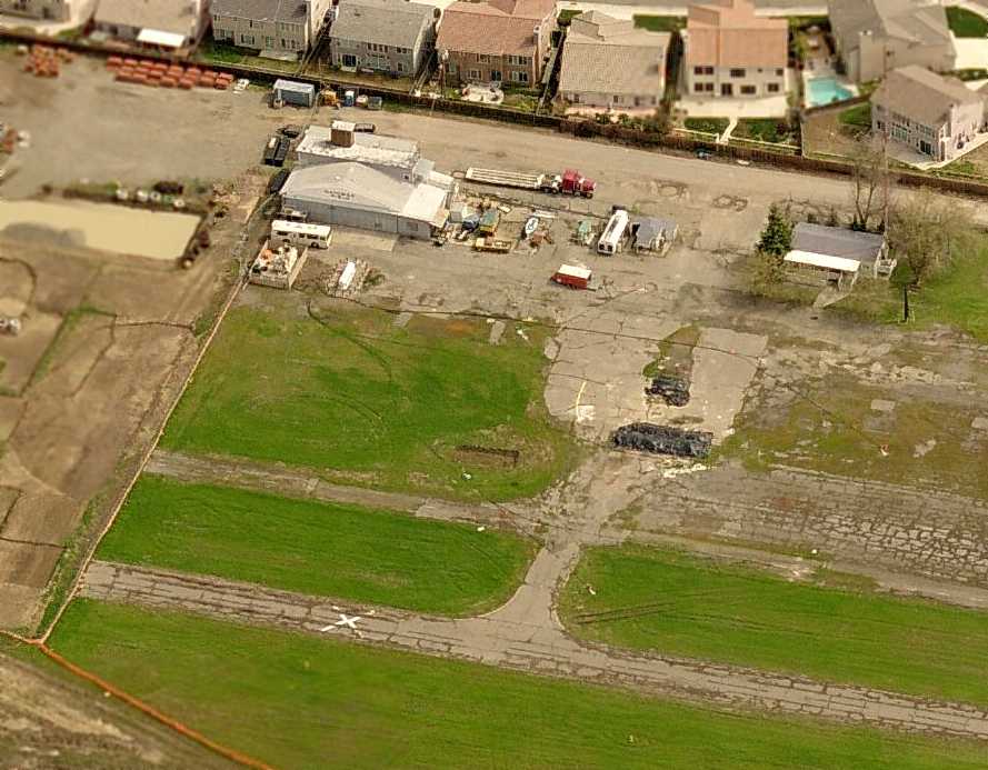
A 2003 photo by Dann Shively, looking north along the remains of the former Runway 34.
Note the painted-out "34" runway numbers, just in front of the closed-runway "X".
The large building on the left is ARCO Arena, home of the Sacramento Kings.
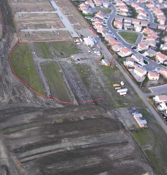
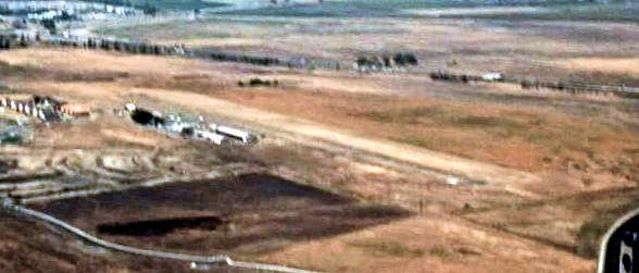
A January 2006 aerial view by Dann Shively, looking northeast at the rapidly-disappearing remains of Natomas Airport,
with several hangars, a portion of the ramp, and a portion of the paved runway (including one closed-runway “X” symbol) still visible.
Dann remarked, “Development is quickly encroaching north, west and south.
Part of the runway is now gone as site preparation continues.
An orange fence marks what's left of the old airport.
How long the buildings will last isn't known right now.”
A sad sight for anyone who appreciates the value of aviation -
the remains of a nice little airport, with the jammed-in new houses that have caused its demise.
Could those houses be possibly crammed in any closer together?
The photo is circa 2006, looking east at the hangar, other buildings, runway, and taxiway remains.
Inexplicably, Natomas Airport continued to be depicted on the March 2006 San Francisco Sectional Chart,
even though photos show it had ceased to exist as an operating airport before that.
Dann Shively reported in 2007, “Natomas Airport is shrinking daily.”
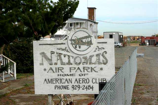
A 2007 photo by Scott Seeba of a sign for the “Natomas Air Park, Home of American Aero Club”.
Scott reported, “Natomas airport is shrinking quickly; the runway was recently ripped out & houses are encroaching on the buildings that are still standing
(basically just one hangar & a small office).”
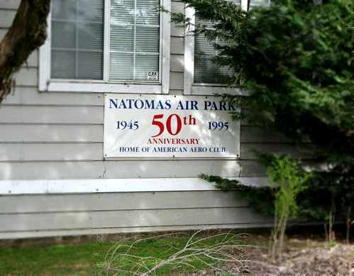
A 2007 photo by Scott Seeba of a sign for the “Natomas Air Park, 50th Anniversary, 1945-1995, Home of American Aero Club”.
Sean Wendland reported in 2014, “Natomas Airport has continued its legacy in flight.
Every Thursday on the outskirts of the old runway there's a large group of radio-controlled [model] airplane enthusiasts
that meet up at night & fly the largest nighttime combat sessions in the country, and they do this weekly.
It's getting quite famous in the RC airplane community but I thought it might be interesting information for the history of that airport after full-size aircraft stopped,
we took over the site & aviation, though on a smaller scale, is alive & well in that old field.
Someday soon the construction will resume & chase us out, but for now Natomas Field still flies.”
Jim Heffelfinger reported in 2015, “My mother-in-law lives in the development just north of the Natomas Field site.
There are still 2 buildings left from the original airport.”
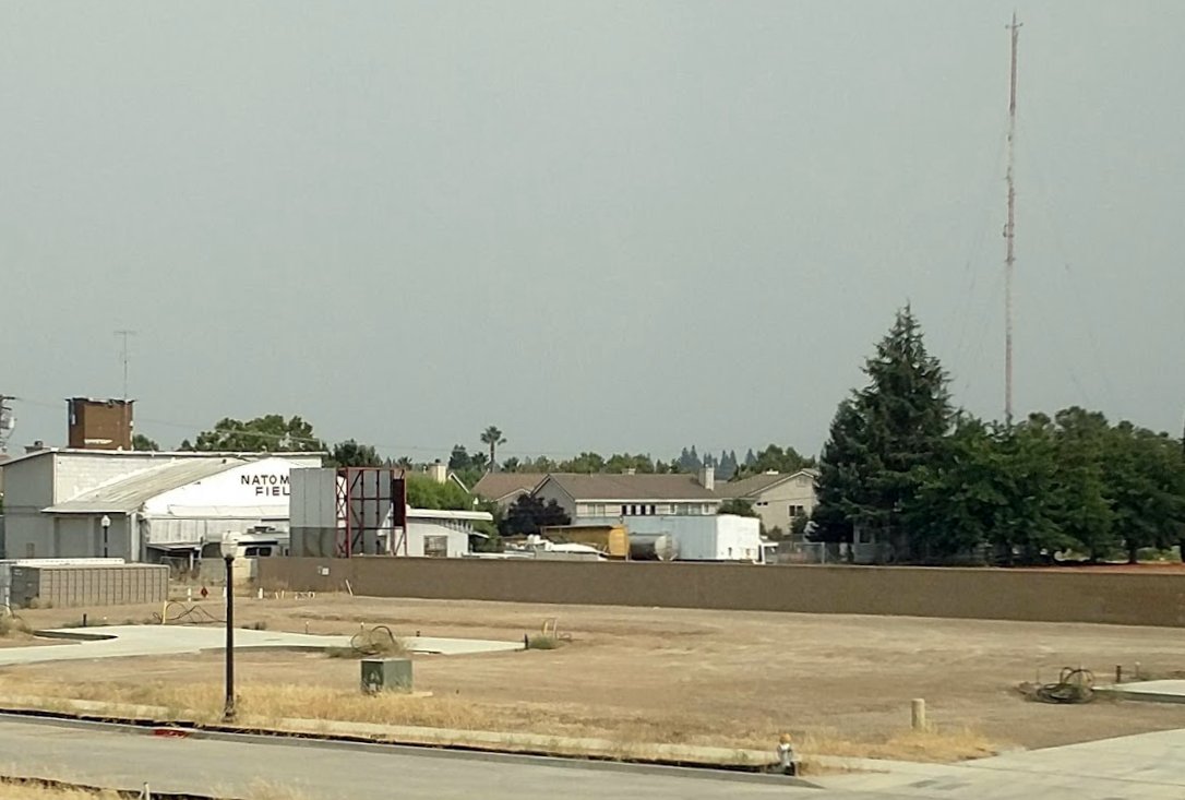
Natomas Airport was no longer depicted on the August 2016 San Francisco Sectional Chart.
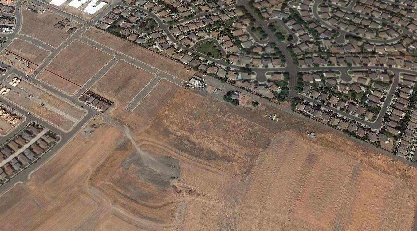
A sad 2016 aerial view looking northeast at the site of Natomas Airport, showing all of the runway having been removed, but 2 airport buildings still standing.
A 4/14/17 photo by Rich Seghieri of the former Natomas Field hangar.
Rich reported, “Pretty sad site now. The old hangar still remains including the skeleton of the windsock.”

A 4/14/17 photo by Rich Seghieri at the site of Natomas Field, showing “Fuel pumps & an old fuel truck are still there. Heartbreaking.”
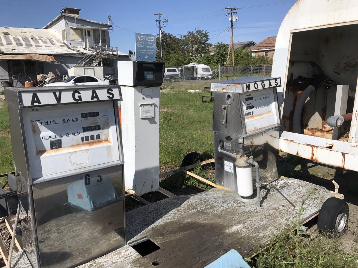
A 4/14/17 photo by Rich Seghieri of fuel pumps which remain at the site of Natomas Field.
A 2022 photo by Oz Angst looking southeast at the Natomas Airport hangar, “outside a model home window. It is now severely boxed in.
I was hoping to find a way to access the building, but it seems challenging.”
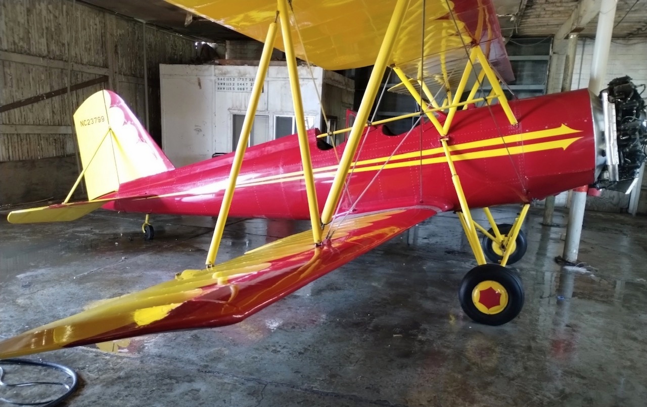
A 2022 photo by Gonzalo Curiel of NC23799, 1939 Meyers OTW Serial #2, which sits inside the former Natomas Airport hangar.
Gonzalo reported, “My friend knows the daughter of the Natomas Airfield owner; all that is left is the old hangar.
What no one knew was this beauty was entombed inside. The building is caving in on itself & they are using old telephone poles to support it especially the hangar door.
In a couple weeks we will meet there to remove the wings & rescue this beauty.”
The site of Natomas Airport is located west of Airport Road, north of the intersection of Interstates 5 & 80.
See also: KOVR News 8/17/00.
____________________________________________________
Since this site was first put on the web in 1999, its popularity has grown tremendously.
If the total quantity of material on this site is to continue to grow,
it will require ever-increasing funding to pay its expenses.
Therefore, I request financial contributions from site visitors,
to help defray the increasing costs of the site
and ensure that it continues to be available & to grow.
What would you pay for a good aviation magazine, or a good aviation book?
Please consider a donation of an equivalent amount, at the least.
This site is not supported by commercial advertising –
it is purely supported by donations.
If you enjoy the site, and would like to make a financial contribution,
you
may use a credit card via
![]() :
:
Please consider checking the box to make a monthly donatation.
For a mailing address to send a check, please contact me at: paulandterryfreeman@gmail.com
If you enjoy this web site, please support it with a financial contribution.
This site covers airfields in all 50 states.