Abandoned & Little-Known Airfields:
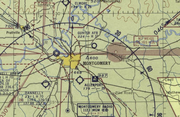
Alabama: Montgomery area
© 2002, © 2024 by Paul Freeman. Revised 11/2/24.
This site covers airfields in all 50 states: Click here for the site's main menu.
____________________________________________________
Please consider a financial contribution to support the continued growth & operation of this site.
Craig Aux AAF #1 / Selfield Aux AAF / Selma Municipal Airport (revised 2/11/20) - Craig Army Auxiliary Airfield #2 / Furniss Field (revised 8/17/21)
Craig Army Aux Airfield #3 / Henderson Field / Henderson Airport (revised 2/11/20) - Griel Aux AAF #1 / Tallassee Airport / Reeves Airport (revised 2/22/20)
Kennedy Field / Tuskegee Institute #1 (revised 7/29/21) - Linden Airfield / Freddie Jones Field (revised 11/10/23) - Mallard Airport (revised 3/10/20) - Martin Field (added 3/3/22)
Montgomery Municipal Airport (Original) / Gunter Field (revised 11/27/21) - Mt. Meigs Field / Gunter Auxiliary Army Airfield #4 (revised 8/11/21)
Perry County Airport (revised 3/12/20) - Pine Hill Municipal Airport (revised 3/9/20) - Reeves Airport (2nd location) / Tallassee Municipal Airport (added 7/20/19)
Shorter Army Auxiliary Airfield #2 (revised 7/28/21) - Taylor Field / Gunter Aux AAF #5 (revised 12/14/21) - Tuskegee AAF / Sharpe Field (revised 11/2/24)
Uniontown Airport (revised 7/29/21) - Valley Airport (revised 8/17/21) - Wilheller Airport / Skyharbor Airport (revised 8/11/21)
____________________________________________________
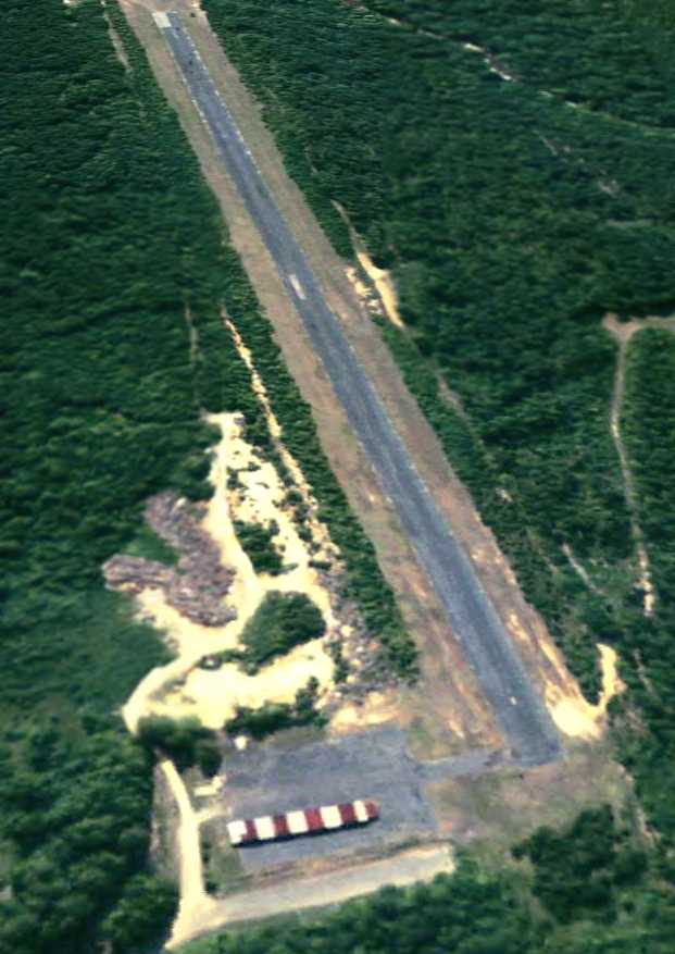
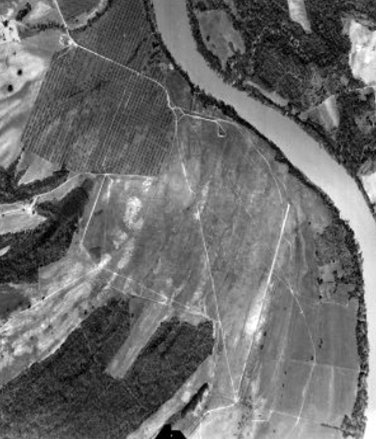
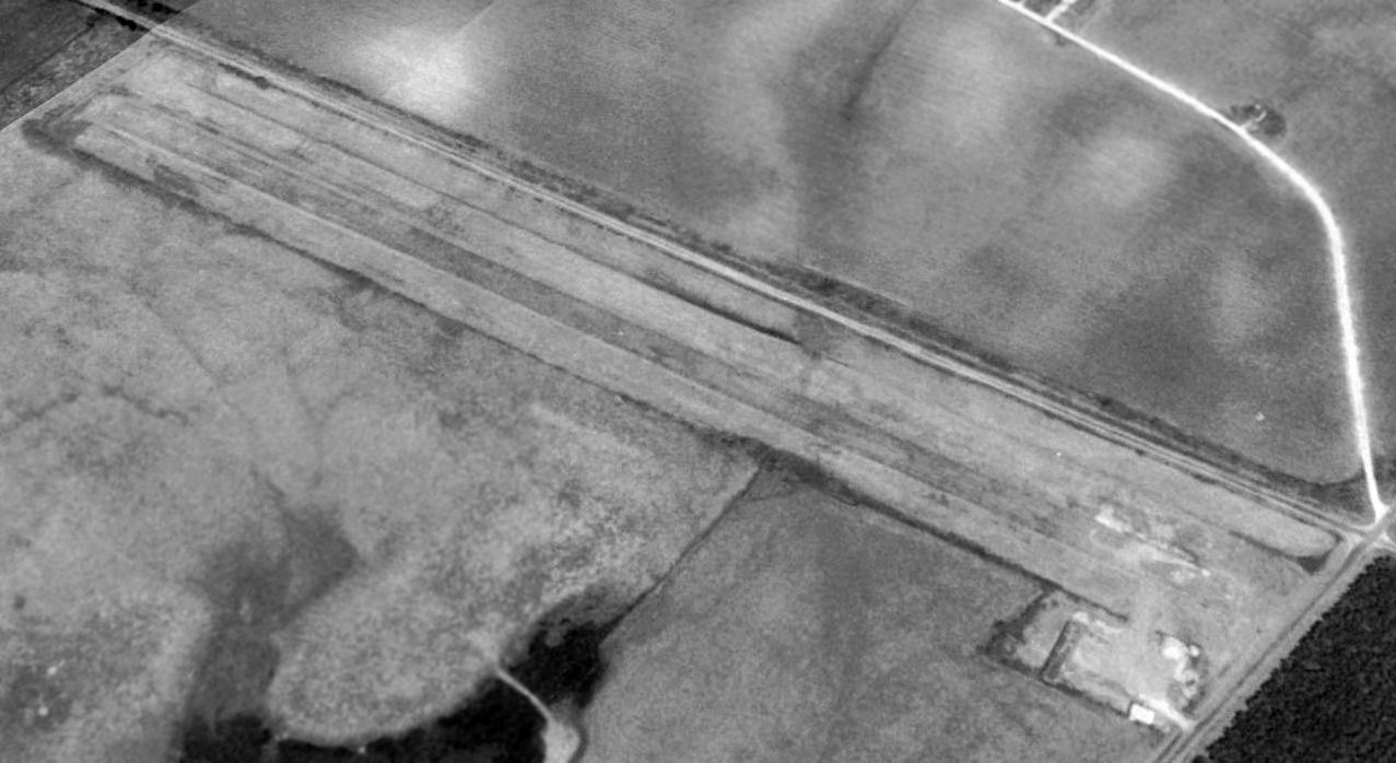
32.158, -87.448 (Southwest of Montgomery, AL)
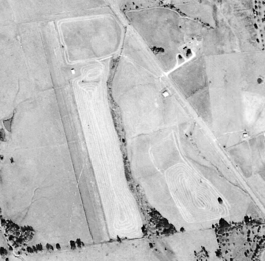
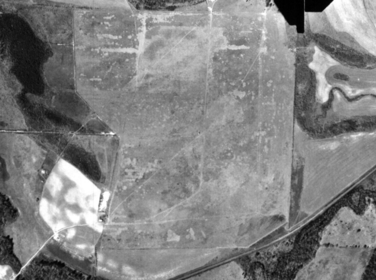
Martin Field, as depicted on a 1959 aerial view (courtesy of Rob Grant).
This small general aviation airport was evidently built at some point between 1955-59,
as it was not yet depicted on a 1955 aerial view (courtesy of Rob Grant).
The earliest depiction which has been located of Martin Field was a 1959 aerial view (courtesy of Rob Grant).
It depicted a single unpaved northwest/southeast runway, with a single small building (a hangar?) on the northeast side.
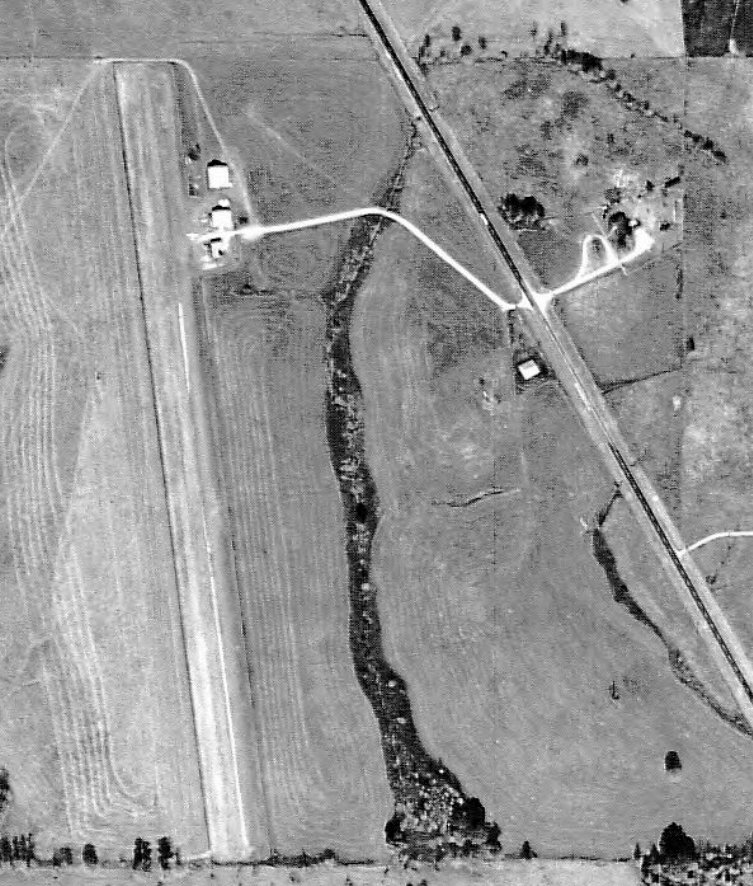
The earliest depiction which has been located showing aircraft at Martin Field was a 1965 aerial view (courtesy of Rob Grant).
It depicted 1 light single-engine aircraft parked on the northeast side, along with 2 larger hangars which had been added at some point between 1959-65.
The earliest aeronautical chart depiction which has been located of Martin Field was on the April 1965 Birmingham Sectional Chart (courtesy of Rob Grant).
The Aerodromes table described Martin Field as having a single 2,600' turf runway.
The 1971 Wilcox County Highway Map (courtesy of Rob Grant) depicted Martin Field as having a single northwest/southeast runway.
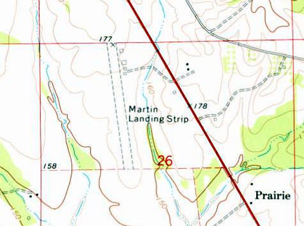
The earliest topo map depiction which has been located of Martin Field was on the 1974 USGS topo map.
It depicted “Martin Landing Strip” as having a single northwest/southeast unpaved runway, and 4 small buildings on the northeast side.
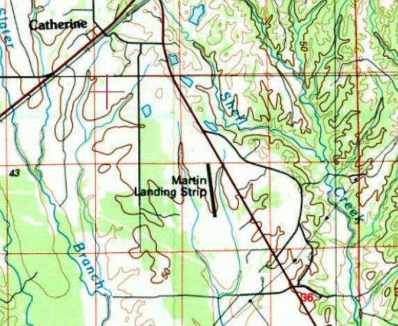
The 1987 USGS topo map depicted “Martin Landing Strip” as having a single northwest/southeast runway.
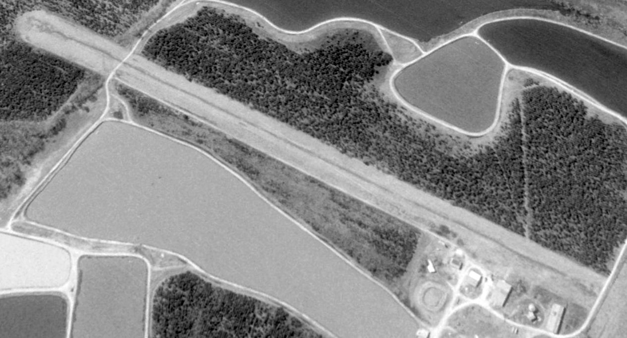
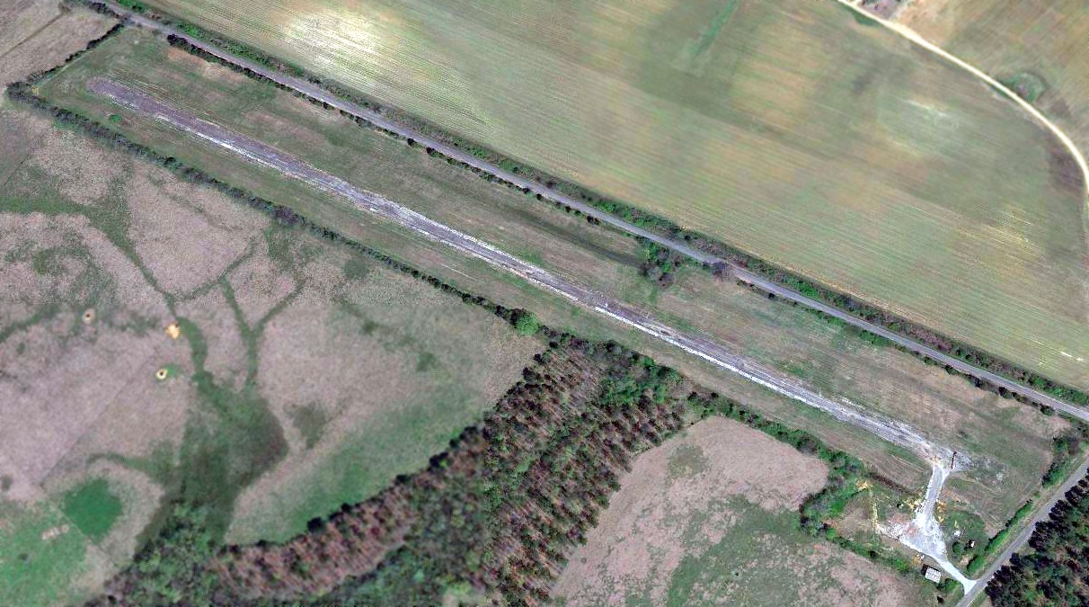
A 1997 aerial view looking southwest showed Martin Field's runway remained intact.
The surrounding land had been converted to aquaculture at some point between 1982-97.
Martin Field may have been closed (for reasons unknown) at some point between 1987-2007,
as it was no longer shown on the 2007 Wilcox County Highway Map (courtesy of Rob Grant).
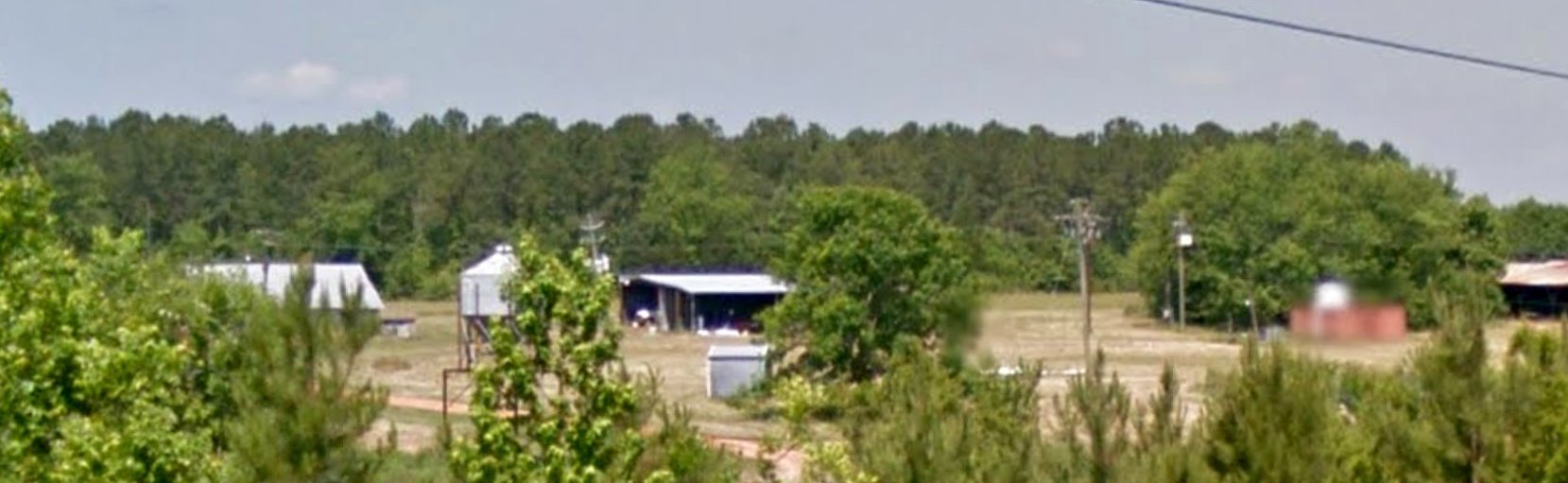
A May 2014 photo of the Martin Field buildings (courtesy of Rob Grant) did not show any sign of aviation use.
The last USGS GNIS depicting Martin Field was 8/2014. Operations appear to have ceased by 2015.
A 2019 aerial view looking southwest showed Martin Field's runway & buildings remained intact, but with no sign of recent aviation use.
Thanks to Rob Grant for pointing out this airfield.
____________________________________________________
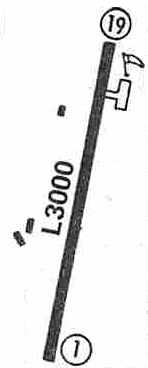
Linden Airfield / Freddie Jones Field (70A), Linden, AL
32.27, -87.72 (West of Montgomery, AL)
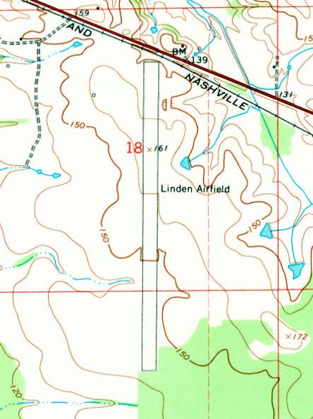
Linden Airfield, as depicted on the 1968 USGS topo map.
This small general aviation airport was evidently built at some point between 1957-67,
as it was not yet depicted on a 1955 aerial view or the 1957 USGS topo map.
The earliest depiction which has been located of Linden Airfield was a 1967 aerial photo.
It evidently depicted the start of construction of Linden Airfield, with a clearing having been made for a single north/south runway.
Linden Airfield was not yet depicted on the October 1968 Birmingham Sectional Chart.
The earliest map depiction which has been located of Linden Airfield was on the 1968 USGS topo map.
It depicted Linden Airfield as having a single north/south unpaved runway.
There were no buildings or any other improvements depicted on the airfield.
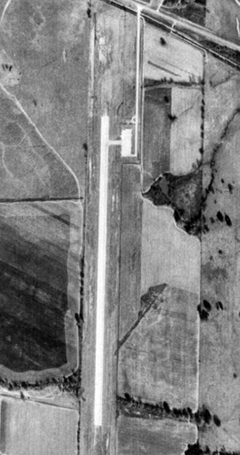
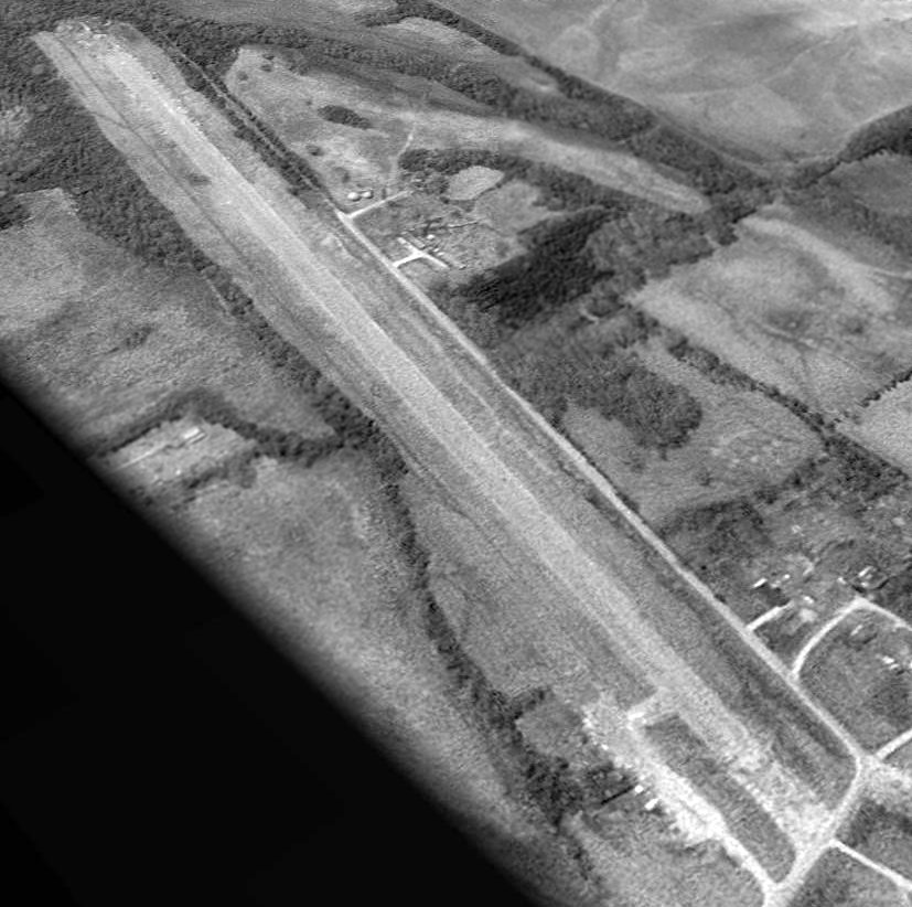
The earliest photo which has been located of Linden Airfield was a 1973 aerial view (courtesy of Rob Grant).
It depicted Linden Airfield as having a single north/south paved runway, with a paved ramp on the northeast side.
There were no aircraft visible on the field.
In 1974, Linden native Fred Jones, while serving as a Delta Airlines pilot, was killed by a hijacker who intended to kill President Richard Nixon.
The Linden Airport was subsequently renamed in Jones' honor.
A 1981 aerial photo depicted Freddie Jones Field as having a single north/south paved runway,
with a paved ramp & 1 small building on the northeast side.
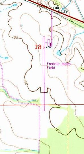
The 1986 USGS topo map depicted Freddie Jones Field as having a paved runway, and a small ramp & one small building on the northeast side.
A 1992 aerial view looking southwest showed Freddie Jones Field devoid of aircraft.
A 2006 aerial view still depicted Freddie Jones Field as being marked as an active runway.
According to its FAA Airport/Facility Directory data, Freddie Jones Field consisted of 51 acres, within which was a single 3,390' asphalt Runway 18/36.
For the year ending 5/3/10, Freddie Jones Field conducted an average of 108 general aviation takeoffs or landings per month.
Freddie Jones Field was evidently closed (for reasons unknown) at some point between 2010-2011,
as a 2011 aerial view showed closed-runway “X” symbols having being painted on both runway ends.
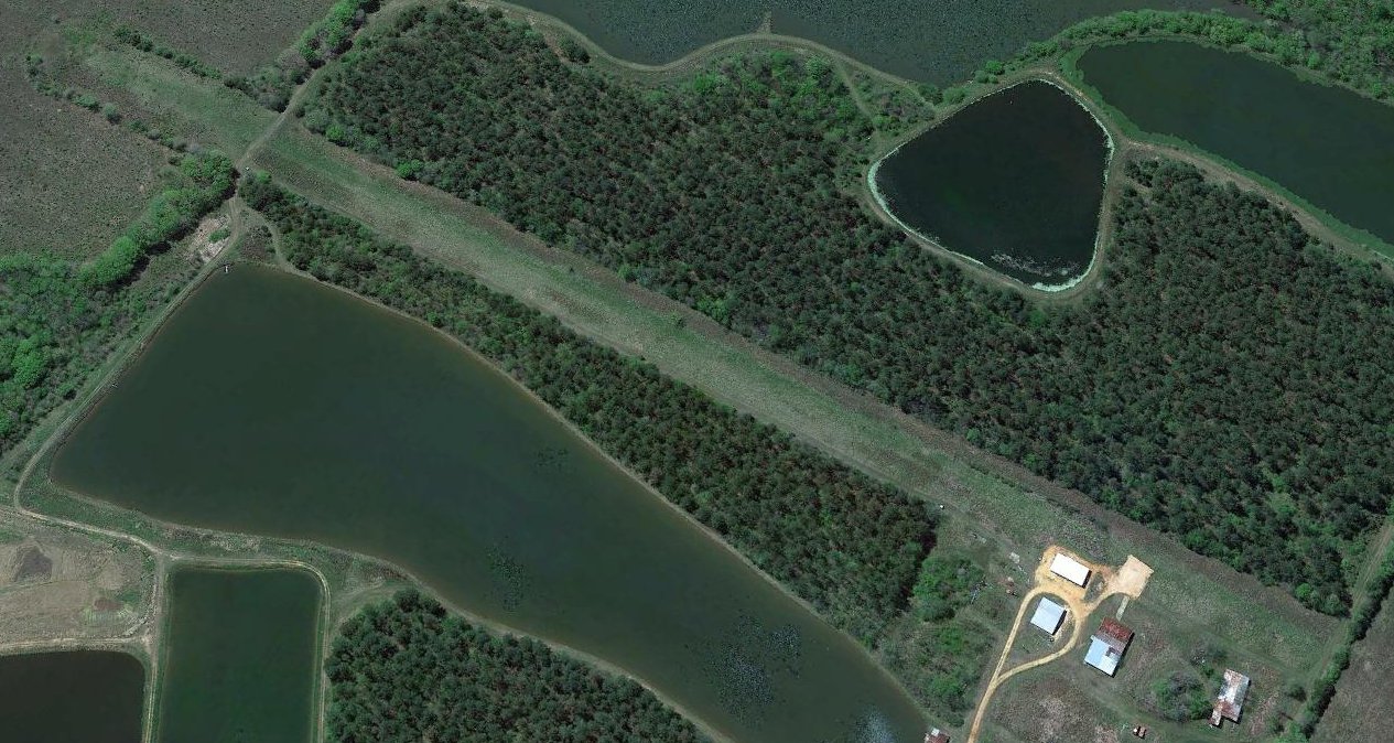
A 2015 aerial view looking southwest showed Freddie Jones Field as remaining intact though deteriorated.
Freddie Jones Field was depicted as an abandoned airfield on the 2016 Atlanta Sectional Chart.
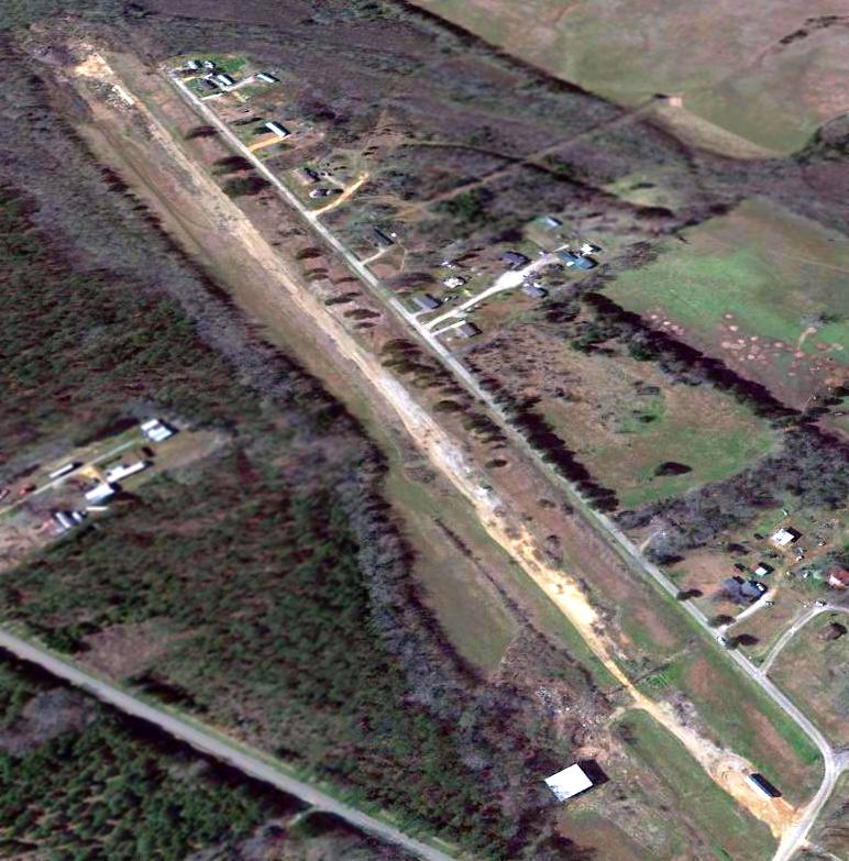
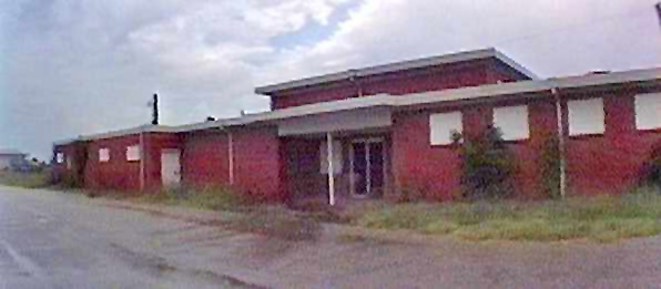
A 2023 photo looking southwest at former hangars at the Freddie Jones Field site.
Freddie Jones Field is located south of the intersection of Route 28 & Airport Road.
Thanks to John Knight for pointing out this airfield.
____________________________________________________
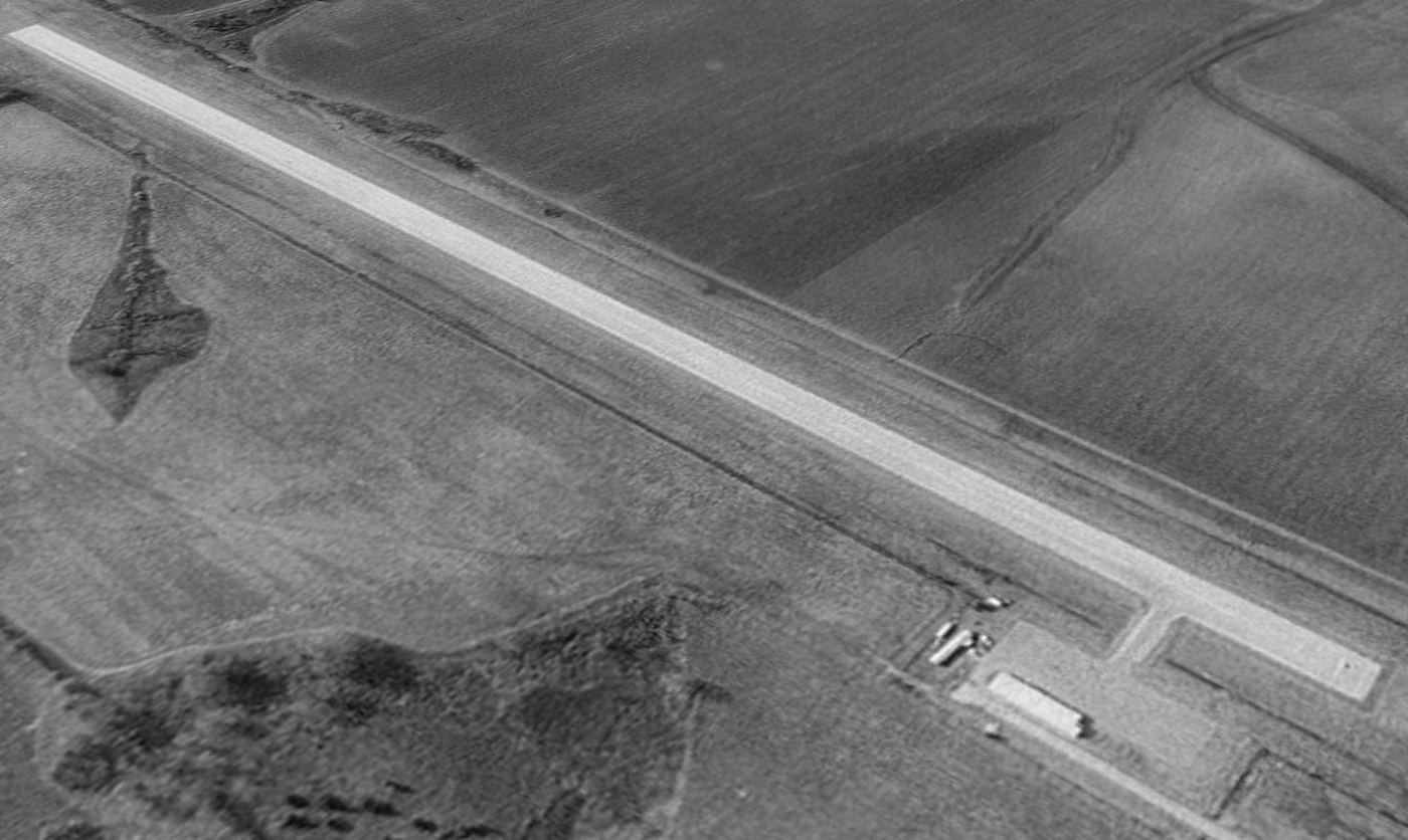
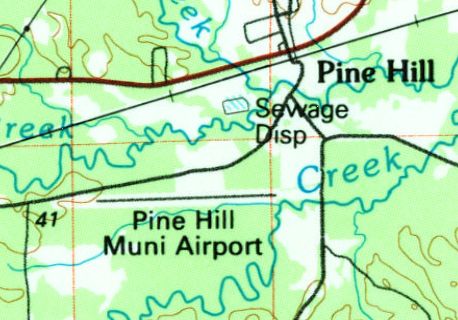
Pine Hill Municipal Airport, Pine Hill, AL
31.969, -87.595 (Southwest of Atlanta, GA)

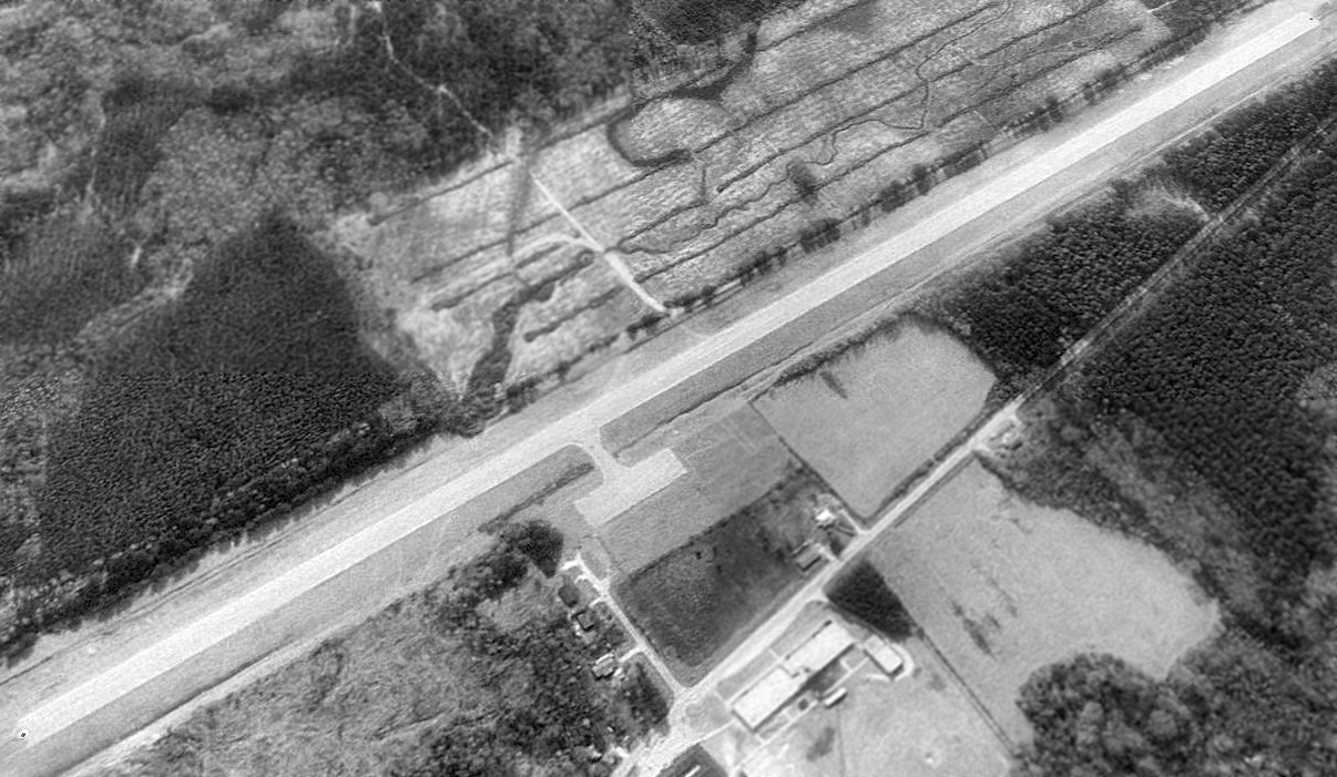
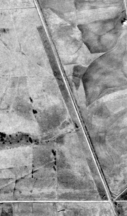
Pine Hill Municipal Airport, as depicted on a 2/11/72 USGS aerial view.
This small general aviation airport was evidently built at some point between 1957-72,
as it was not yet depicted on the 1957 USGS topo map.
Pine Hill Municipal Airport was not yet depicted on the October 1968 Birmingham Sectional Chart.
The earliest depiction which has been located of Pine Hill Municipal Airport was on a 2/11/72 USGS aerial photo.
It depicted Pine Hill as having a single east/west paved runway with a small ramp on the north side.
There did not appear to be any buildings on the airfield, nor any aircraft.
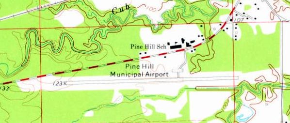
The earliest topo map depiction which has been located of Pine Hill Municipal Airport was on the 1973 USGS topo map.
It depicted Pine Hill as having a single east/west paved runway with a small ramp on the north side.
The 1986 USGS topo map depicted Pine Hill Municipal Airport as having a single east/west paved runway.
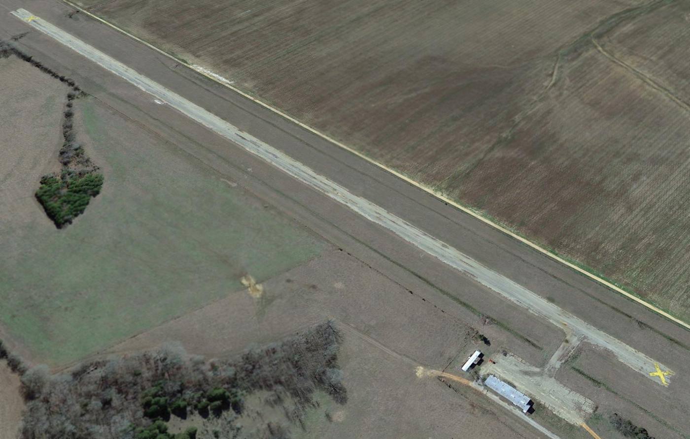
A 1992 aerial view looking southwest showed Pine Hill Airport to be in an unchanged configuration compared to the 1972 photo,
but still devoid of any aircraft.
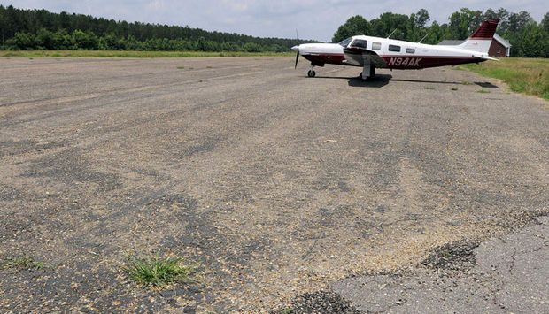
The only photo which has been located showing an aircraft at Pine Hill Municipal Airport was an undated (2014 or before) photo showing a single Piper Saratoga on the ramp.
Raoul Fenelon reported in 2014, “Pine Hill Municipal is another airport that has disappeared in the last 5 years or so.
One day it showed up on a Sectional [Chart] with an X through it.”
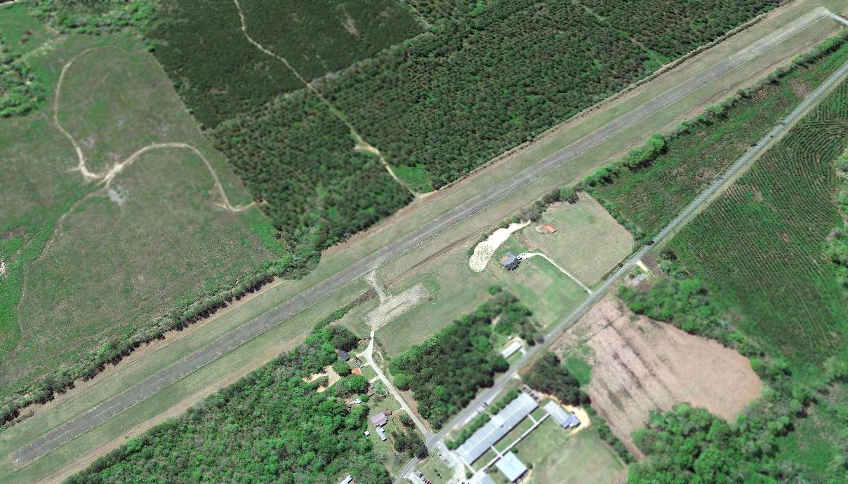
A 2019 aerial view looking southwest showed Pine Hill Airport to be in an unchanged configuration compared to the 1992 photo,
but still devoid of any aircraft.
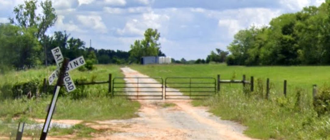
Pine Hill Municipal Airport is located at southwest of the intersection of Route 27 & Jade Lane.
Thanks to Raoul Fenelon for pointing out this airfield.
____________________________________________________
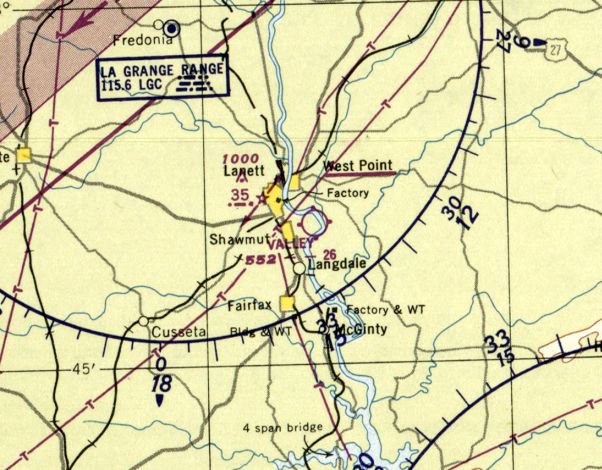
Valley Airport (56A), Lanett, AL
32.85, -85.16 (Southwest of Atlanta, GA)
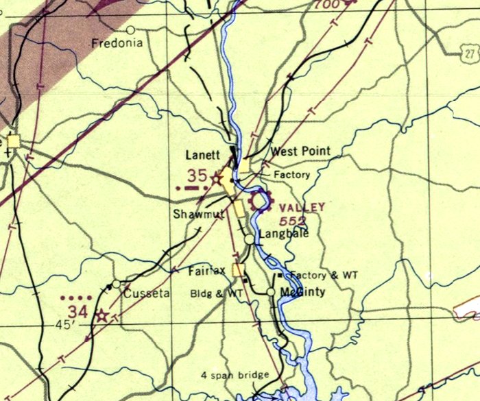
Valley Airport, as depicted on the October 1947 Birmingham Sectional Chart.
This county airport was evidently built at some point between 1946-47,
as it was not yet depicted on a 1/12/42 USDA aerial photo (courtesy of Dallam Oliver-Lee)
listed among active active airfields in the 1945 AAF Airfield Directory (courtesy of Scott Murdock),
nor depicted on the April 1946 Birmingham Sectional Chart.
The earliest depiction which has been located of Valley Airport was on the October 1947 Birmingham Sectional Chart.
It depicted Valley Airport as a commercial/municipal airport.
A 1948 AL DOT map (courtesy of Dallam Oliver-Lee) depicted Valley Airport as having an unpaved northwest/southeast runway.
The February 1950 Birmingham Sectional Chart depicted Valley Airport as having a 2,600' unpaved runway.
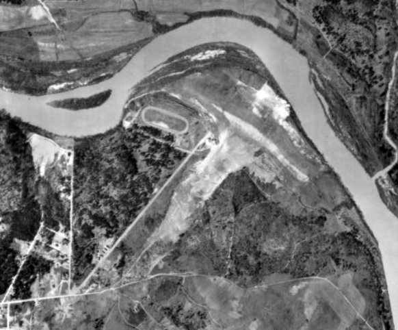
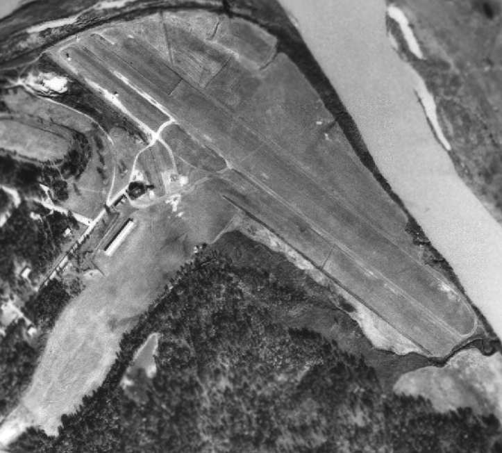
The earliest photo which has been located of Valley Airport was a 1950 aerial view (courtesy of Rob Grant).
It depicted Valley Airport as having 2 unpaved runways, with a few small buildings on the west side.

A 1958 aerial view (courtesy of Rob Grant) depicted Valley Airport as having 2 unpaved runways, with a few small buildings on the west side.
The 1961 Great Smoky Mountains World Aeronautical Chart (courtesy of Chris Kennedy)
depicted Valley Airport as having a 3,100' hard-surface runway.
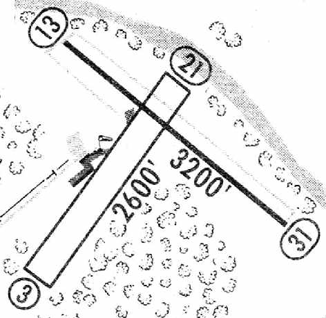
The 1962 AOPA Airport Directory described Valley Airport as having a 3,200' hard top Runway 13/31 & a 2,800' sod Runway 4/22.
A 1964 Soil Conservation Service Photo (courtesy of Thomas Kallsen of the University of AL Map Library)
depicted Valley Airport as having a paved northwest/southeast runway & unpaved crosswind runway.
The 1965 Jeppesen Airway Manual (courtesy of Chris Kennedy)
depicted Valley Airport as having a 3,200' paved Runway 13/31 and a 2,600' unpaved Runway 3/21.
Two hangars were depicted west of the runway intersection. The field was noted to conduct drag races on Sundays.

The last aeronautical chart depiction which has been located of Valley Airport was on the October 1968 Birmingham Sectional Chart.
It depicted Valley Airport as having a 3,100' paved runway.
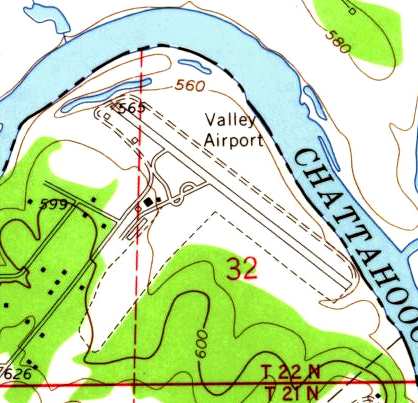
USGS topo map 1969 (courtesy of the University of Alabama Map Library).
By the time of the 1982 AOPA Airport Directory (courtesy of Ed Drury)
Runway 13/31 was the sole remaining runway, as apparently the grass crosswind runway had been abandoned.
It included the note, "Private. Use at own risk."
Valley Airport was still listed as an active airfield in the 1986 Flight Guide (according to Chris Kennedy).
Valley Airport was apparently closed at some point between 1986-98,
as it was not longer depicted at all (even as an abandoned airfield) on 1998 World Aeronautical Charts.
According to Glen Boyd (manager of LaGrange-Callaway Airport), "This was a privately owned airport, built & operated by Fred Robinson.
Fred was a colorful figure, to say the least."
"I was given an interesting bit of trivia about this airport from a Georgia DOT official.
The airport was built on a river bottom in a crook of the Chattahoochee River.
It was on the west side of the river, in Alabama.
Oddly enough, the official legal description for the location of the state line is (roughly)
'the most westerly extent of the floodwaters of the Chattahoochee river'.
For many years the state of Georgia inspected & attempted to regulate & tax this airport.
Based on the comments I got from this state official the entire situation was a real mess for both Georgia & Alabama."
"For many years Fred hosted drag races at his airport on weekends.
The runway had such a side gradient that some regular racers
built one side of their cars higher so the body would sit level left to right."
"Fred Robinson passed away in (to the best of my recollection) the late 1980's.
His sister & nephew were the only surviving relatives. They sold the airport to the City of Lanett.
The hangars are now used as a city equipment barn & the land is used for a walking trail & R/C model flying field."
In the 1997 USGS aerial photo, the paved Runway 13/31 still existed in fine shape,
as well as what appears to have been one former hangar, still standing west of the north end of the runway.
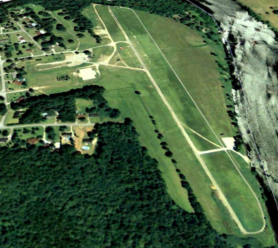
A 6/25/09 aerial view looking northwest at Valley Airport showed the paved Runway 13/31 to remain intact.
The Valley Airport is located at the northeastern terminus of 12th Avenue, along the western bank of the Chattahoochee River.
____________________________________________________
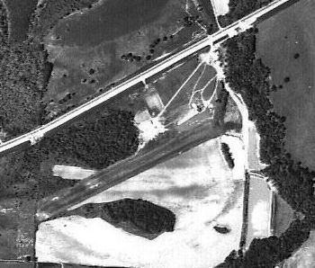
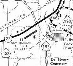
Wilheller Airport / Skyharbor Airport (S63), Selma, AL
32.37, -87.106 (West of Montgomery, AL)
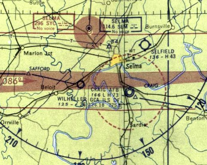
Wilheller Airport, as depicted on the August 1958 Birmingham Sectional Chart.
Wilheller Airport was evidently established at some point in 1958,
as it was not yet depicted on a 1950 AL DOT map (courtesy of Dallam Oliver-Lee)
or the January 1958 Birmingham Sectional Chart.
According its FAA Airport/Facility Directory data, this airport was activated on 1/1/58.
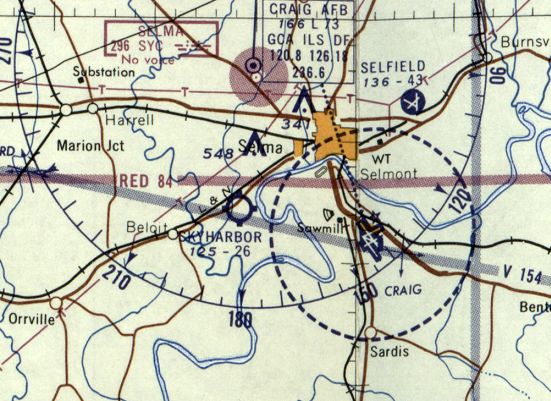
At some point between 1958-60, Wilheller Airport was evidently renamed Skyharbor Airport,
as that is how it was labeled on the February 1960 Birmingham Sectional Chart.
It depicted Skyharbor as having a 2,600' unpaved runway.
The 1965 AL DOT map (courtesy of Dallam Oliver-Lee) depicted Sky Harbor Airport as having a northeast/southwest runway.
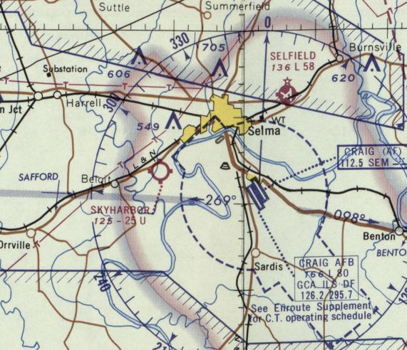
The last aeronautical chart depiction which has been located of Skyharbor Airport
was on the October 1968 Birmingham Sectional Chart.
It depicted Skyharbor as having a 2,500' unpaved runway.
The earliest photo which has been located of Skyharbor Airport was a 4/6/74 USDA aerial view (courtesy of Dallam Oliver-Lee).
It depicted Skyharbor as having a northeast/southwest runway, with a hangar & few light planes on the northeast side.
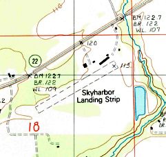
The 1987 USGS topo map (courtesy of Dallam Oliver-Lee) depicted Skyharbor Landing Strip as having an unpaved northeast/southwest runway,
with several small buildings on the northeast side.
The last labeled depiction which has been located of Sky Harbor Airport was on the 1999 AL DOT map (courtesy of Dallam Oliver-Lee).
It depicted Sky Harbor Airport as a private field having a northeast/southwest runway.
As of 1996, Skyharbor's FAA Airport/Facility Directory data listed it as conducting an average of 129 takeoffs or landings per week.
As of 2011, Skyharbor's FAA Airport/Facility Directory data listed its owner & manager as Jacob Jewell.
The field was said to have a single sod 2,500' Runway 6/24,
and to have 14 based aircraft, including 1 multi-engine aircraft.
However Skyharbor's status was listed as “Airport closed indefinitely.”
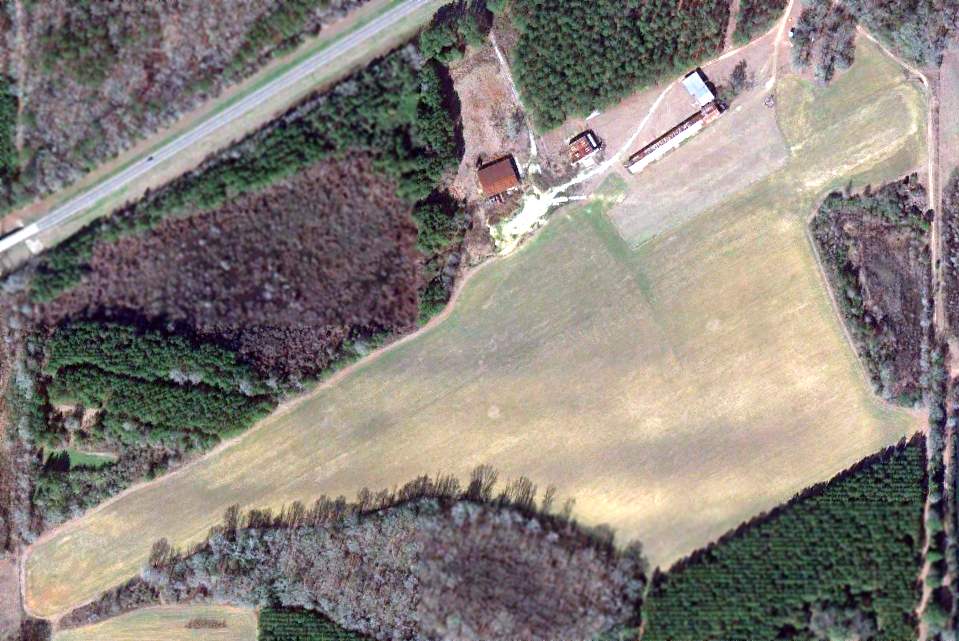
A 1/19/13 aerial photo (courtesy of Dallam Oliver-Lee) depicted Skyharbor as having an unpaved northeast/southwest runway,
with several small buildings on the northeast side.
No planes or other signs of recent aviation use were visible.
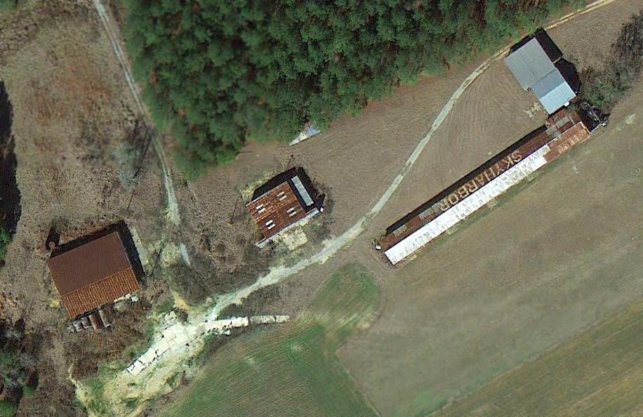
A closeup 1/19/13 aerial photo (courtesy of Dallam Oliver-Lee) showed the name “Skyharbor” painted on the roof of one hangar.
Skyharbor Airport is located south of the intersection of Alden Street & Dallas County 219.
Thanks to Dallam Oliver-Lee for pointing out this airfield.
____________________________________________________
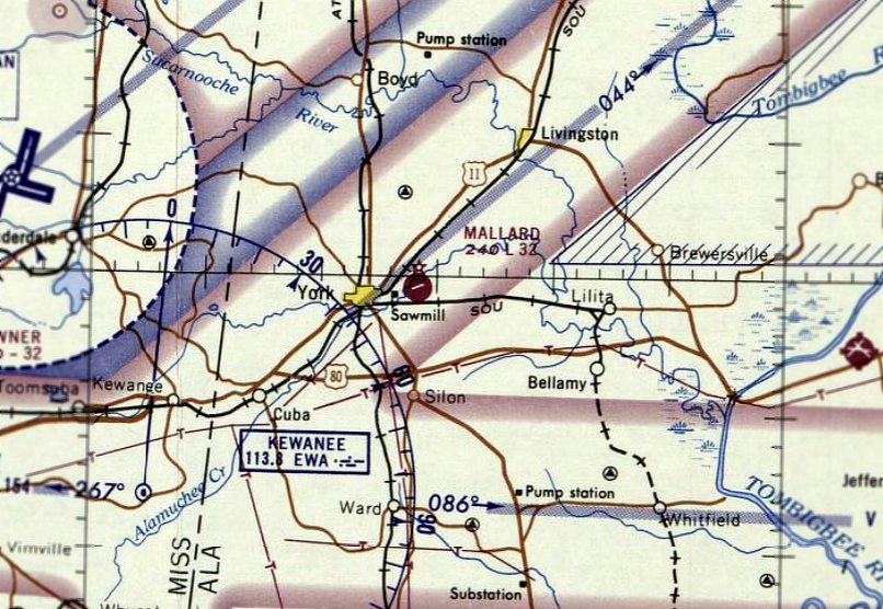
Mallard Airport (23A), York, AL
32.5, -88.27 (West of Montgomery, AL)
Mallard Airport, as depicted on the April 1965 Birmingham Sectional Chart.
Photo of the airfield while in use has not been located.
Mallard Airport was not yet depicted on a 1955 aerial photo or on the February 1961 Birmingham Sectional Chart.
York Municipal Airport – Mallard Field was dedicated on 9/22/63, according to its dedication program (courtesy of Mark Mallard).
It was named in honor of Capt. Ned Mallard, “A York youngster who gave his life for his country in WW2.”
The earliest depiction which has been located of Mallard Airport was on the April 1965 Birmingham Sectional Chart.
It depicted Mallard Airport as having a single 3,200' paved northeast/southwest runway.

The earliest photo which has been located of Mallard Airport was a 1965 aerial photo (courtesy of Rob Grant).
It depicted Mallard Airport as having a single paved northeast/southwest runway,
with a small building, 1 single-engine light aircraft, and a small paved ramp on the northwest side.
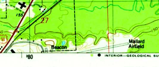
The 1974 USGS topo map depicted “Mallard Airfield” as having a single paved northeast/southwest runway,
with 2 small buildings & a beacon on the northwest side.
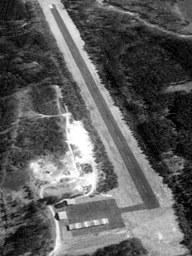
A 1/30/98 USGS aerial view looking east depicted Mallard Airport as having a single asphalt runway, and an asphalt ramp with several small hangars.
No planes were visible on the field.
According to its FAA Airport/Facility Directory listing, Mallard Airport was owned by the City of York,
and the manager was Robert Holycross.
It had a single 3,221' asphalt Runway 7/25, in “poor condition”, and housed 3 single-engine aircraft.
The last photo which has been located showing Mallard Airport still intact was a 6/14/06 aerial view looking east.
Two of the buildings on the ramp had been removed at some point between 1998-2006,
but the airport was otherwise intact.
A sad sight for anyone who appreciates general aviation:
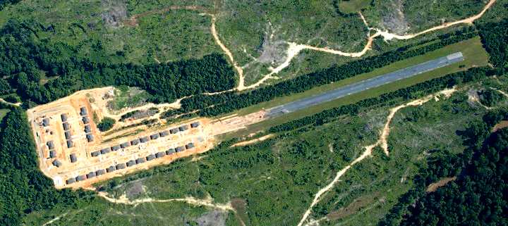
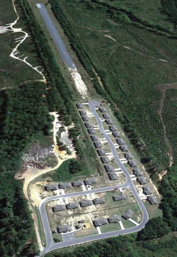
a 2008 aerial view looking north at the spectacle of a housing development starting to cover the former Mallard Airport.
Even if there is demand for new housing, with all of the surrounding undeveloped land, why does this airport need to be destroyed in order to build new houses?
The last photo which has been located of Mallard Airport was a 10/16/11 aerial view looking east.
Construction on the housing development seems to have stopped, with the eastern half of the runway remaining strangely intact.
The site of Mallard Airport is located at the eastern terminus of Mallard Drive.
____________________________________________________
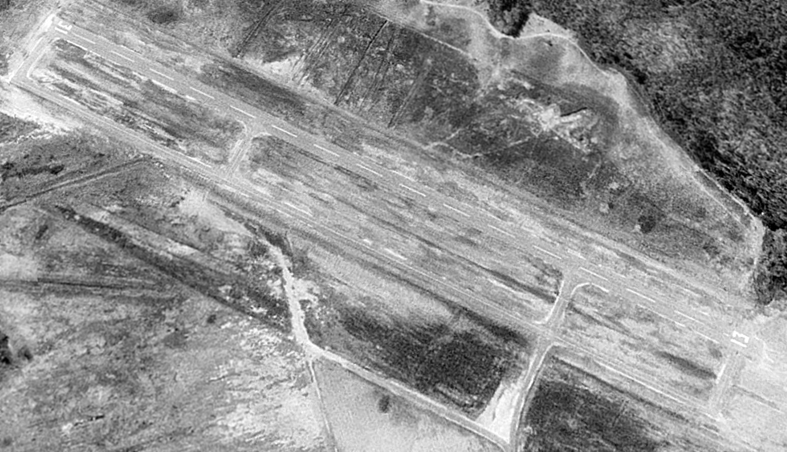
Craig Army Auxiliary Airfield #2 / Furniss Field, Orrville, AL
32.288, -87.093 (West of Montgomery, AL)
Furniss Field, as depicted on a 1941 USAAF aerial photo (courtesy of Dallam Oliver-Lee), showing the field with its original grass airfield configuration.
Photo of the airfield while in use has not been located.
Furniss Field was not depicted all on the 1938 AL DOT map (courtesy of Dallam Oliver-Lee).
It was presumably established in 1941 as one of 6 satellite airfields which supported flight training at nearby Craig Army Airfield,
which conducted pre-flight, specialized, and advanced training for fighter pilots.
The earliest depiction which has been located of Furniss Field was a 1941 USAAF aerial photo (courtesy of Dallam Oliver-Lee).
It depicted Furniss as an irregularly-shaped grass airfield.
Furniss Field evidently gained 2 paved runways (each with their own parallel taxiway) at some point between 1941-42,
as that is how it was depicted on a 9/4/42 aerial view looking east (from the National Archives, courtesy of Brian Rehwinkel).
Furniss Field was not yet depicted on the October 1942 Birmingham Sectional Chart.
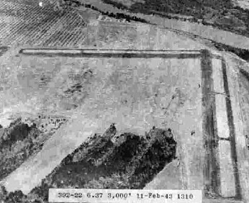
A 2/11/43 aerial view looking north (courtesy of Dallam Oliver-Lee)
depicted Furniss Field as having 2 paved runways each with their own parallel taxiway.
The only aeronautical chart depiction which has been located of Furniss Field was on the April 1945 Birmingham Sectional Chart.
It depicted Furniss as an auxiliary airfield.
Amazingly, a 2/17/50 USDA aerial view (courtesy of Dallam Oliver-Lee) showed no trace remaining of Furniss's 2 paved runways
no more than 7 years after the land was returned to farming.
A 1955 aerial view (courtesy of Rob Grant) showed no trace remaining of Furniss's 2 paved runways.
A 1/19/13 aerial view (courtesy of Dallam Oliver-Lee) showed the property outline remained at the site of Furniss Field.
Thanks to Dallam Oliver-Lee for locating this field.
____________________________________________________
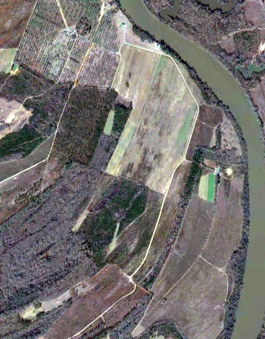
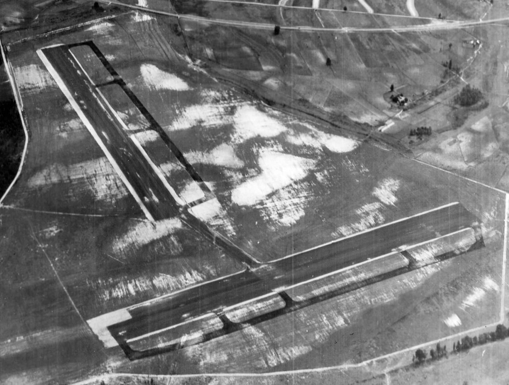
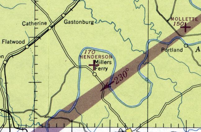
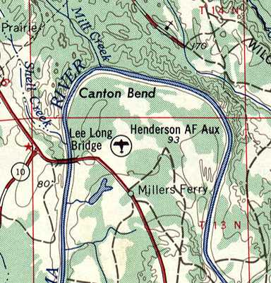
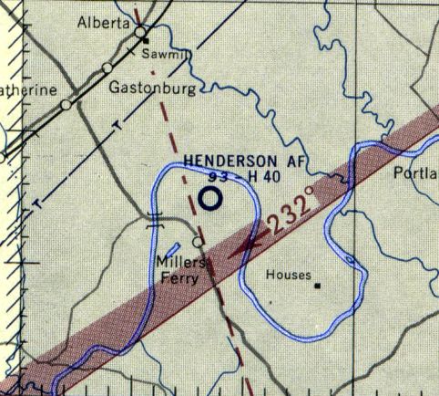
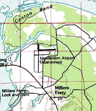
Craig Army Auxiliary Airfield #3 / Henderson Field / Henderson Airport, Miller's Ferry, AL
32.12, -87.373 (West of Montgomery, AL)
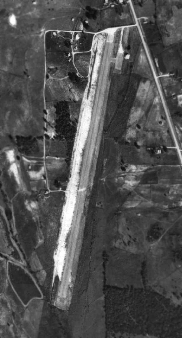
A 9/2/42 aerial view looking southwest at Henderson Field (from the National Archives, courtesy of Brian Rehwinkel).
Henderson Field was evidently established at some point between 1940-42,
as it was not yet depicted on the April 1940 Birmingham Sectional Chart.
It was presumably established during WW2 as one of 6 satellite airfields which supported flight training at nearby Craig Army Airfield,
which conducted pre-flight, specialized, and advanced training for fighter pilots.
The earliest depiction which has been located of Henderson Field
was a 9/2/42 aerial view looking southwest (from the National Archives, courtesy of Brian Rehwinkel).
It depicted Henderson in its initial configuration, with 2 separate paved runways, each with a parallel taxiway, and interconnected by a taxiway.
The earliest aeronautical chart depiction which has been located of Henderson Field
was on the April 1945 Birmingham Sectional Chart, which depicted it as an auxiliary airfield.
The 1945 AAF Airfield Directory (courtesy of Scott Murdock)
described “Craig Field Auxiliary #3 (Henderson Field)” as a 300 acre irregularly-shaped
field having 2 asphalt 4,000' runways, oriented NNE/SSW & WNW/ESE.
The field had apparently been modified at some point between 1942-45, with the northeast/southwest runway lengthened to connect into the northwest/southeast runway.
The field was said to not have any hangars, and was described as being owned by private interests, and operated by the Army Air Forces.
Henderson Field was not depicted all on the 1950 AL DOT map (courtesy of Dallam Oliver-Lee).
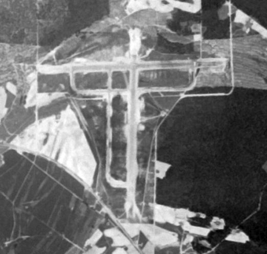
A 4/28/52 USGS aerial view (courtesy of Dallam Oliver-Lee) depicted Henderson Field
as having 2 perpendicular paved runways, each with a parallel taxiway.
The field appeared deteriorated, and there was no indication of recent usage.
The 1953 USGS topo map still depicted “Henderson AF Aux” as a military airfield.
The last aeronautical chart depiction which has been located of Henderson Field
was on the January 1955 Birmingham Sectional Chart.
It depicted Henderson as an Air Force field having a 4,000' paved runway.
A 1/10/59 USDA aerial view (courtesy of Rob Grant) depicted Henderson's north/south runway as more distinct than the east/west runway.
Henderson Field was evidently abandoned at some point between 1955-60,
as it was labeled “Abandoned Airport” on the February 1960 Birmingham Sectional Chart.
Ironically, though, the “Henderson” Non-Directional Beacon (NDB) was still depicted as being operational on the site of the airport.
A 2/24/67 USGS aerial view (courtesy of Dallam Oliver-Lee) showed a single small building (a hangar?)
having been added west of the north end of Henderson's north/south runway.
The 1971 AL DOT map (courtesy of Dallam Oliver-Lee) labeled the field as Henderson Airport.
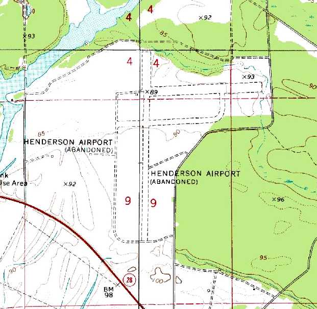
The 1974 USGS topo map depicted “Henderson Airport (Abandoned)”
as having 2 perpendicular runways, each with a parallel taxiway.
The hangar on the west side of Henderson's runway was still visible on a 4/6/74 USDA aerial view (courtesy of Dallam Oliver-Lee).
“Henderson Airport (Abandoned)” was still depicted on the 1986 USGS topo map,
with 2 perpendicular runways, each with a parallel taxiway.
The hangar on the west side of Henderson's runway had been removed by the time of a 3/2/98 USGS aerial view (courtesy of Dallam Oliver-Lee).
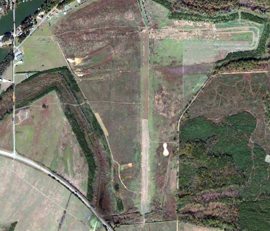
The last photo which has been located of Henderson Airport was a 11/23/12 aerial view (courtesy of Dallam Oliver-Lee),
which showed the outline of the 2 former runways & their parallel taxiways was still quite evident.
Thanks to Mike Smith for pointing out this field.
____________________________________________________
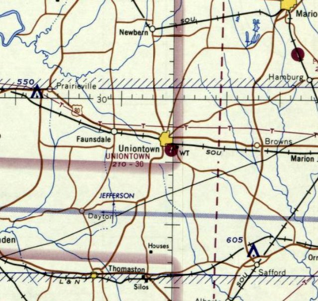
Uniontown Airport, Uniontown, AL
32.43, -87.5 (West of Montgomery, AL)
Uniontown Airport apparently under construction, as seen in a 1965 Soil Conservation Service Photo (courtesy of Thomas Kallsen of the University of AL Map Library).
This small general aviation airport was evidently built at some point between 1962-65,
as it was not yet depicted on the August 1962 Birmingham Sectional Chart (according to Chris Kennedy).
The earliest depiction of Uniontown Airport which has been located was a 1965 Soil Conservation Service Photo (courtesy of Thomas Kallsen of the University of AL Map Library).
In that photo, the airfield consisted of a single 3,300' runway,
a small parking ramp at the northeast corner, and a single building (a hangar?).
According to Billy Singleton, “This & a number of other Alabama airports
were constructed under the Alabama Airport Program for Small Cities.
State Aeronautics Director Asa Roundtree created a program in which small communities
were able to construct airports that were funded on a 50% basis by the State of Alabama without Federal assistance.
'The program is designed to provide small cities with low cost, economical airport facilities,
without heavy cash outlays & without burdensome requirements of a federal project.'
For their part, municipalities could contribute engineering, grading, and materials
as their share of the costs of construction.”
The earliest aeronautical chart depiction which has been located of Uniontown Airport was on the April 1965 Birmingham Sectional Chart.
It depicted Uniontown Airport as having a single 3,000' paved northeast/southwest runway.
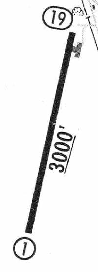
The 1965 Jeppesen Airway Manual (courtesy of Chris Kennedy)
depicted Uniontown as having a single 3,000' paved Runway 1/19,
with a small ramp at the northeast corner.
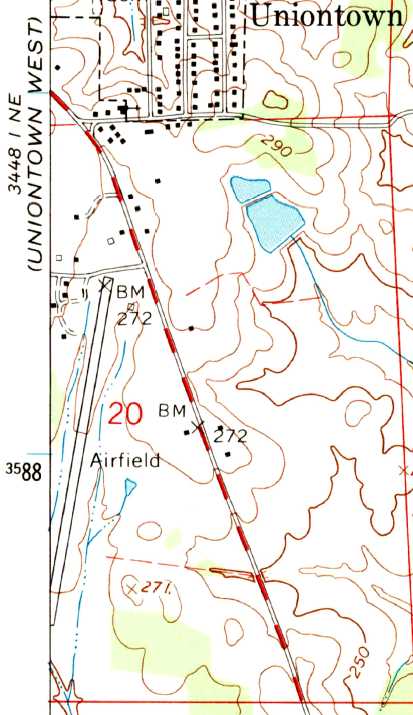
The 1968 USGS topo map depicted Uniontown as having a single northeast/southwest runway with several small buildings on the northwest side,
labeled simply as “Airfield”.
Uniontown Airport was listed in the "Low Use Airports" section of the 1971 Flight Guide (according to Chris Kennedy).
The last aeronautical chart depiction which has been located of Uniontown Airport was on the April 1980 Atlanta Sectional Chart (courtesy of Chris Kennedy).
It depicted Uniontown Airport as having a single 3,000' paved northeast/southwest runway.
The 1980 Flight Guide (courtesy of Chris Kennedy) depicted Uniontown Airport
as having a single 3,000' paved Runway 1/19, with a small ramp at the northeast side of the field,
and several small buildings along the west side.
Uniontown Airport was evidently closed at some point between 1980-86,
as it was labeled "Landing Strip (Abandoned)" on the 1986 USGS topo map.
The reasons for its closure were described by Billy Singleton:
“The problem with this program [the Alabama Airport Program for Small Cities] is that it did not address several important issues.
First was the costs of maintaining the facility.
Many of these communities did not have the revenue base to adequately maintain an airport -
was the airport able to generate sufficient revenue to sustain itself?
Second, in a number of cases, only enough land was secured to construct a 3,000-4,000' runway,
adequate for the period but seriously inadequate as the nature of general aviation operations changed over the years.
Without available land for growth & expansion, the airports became less usable.
In a number of cases, the municipalities were unable to support the airport,
much less provide matching funds to acquire land for growth.
Eventually, several airports in small communities like Uniontown lost their airport license
because of the inability to maintain minimum safety standards.”
A 2/19/92 USGS aerial view looking southwest showed Uniontown Airport consisted of a single 3,300' runway,
with a small parking ramp at the northeast corner.
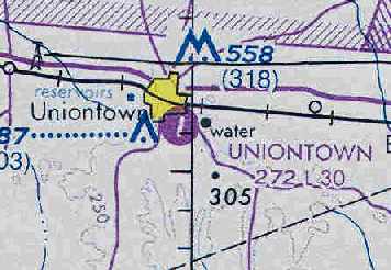
Uniontown Airport was depicted on 2002 aeronautical charts as an abandoned airfield.
A 3/11/13 aerial view looking southwest showed the Uniontown runway remained intact although deteriorated.
Uniontown Airport is located along Airport Road, one mile south of Uniontown on the west side of Route 1.
____________________________________________________
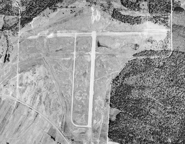
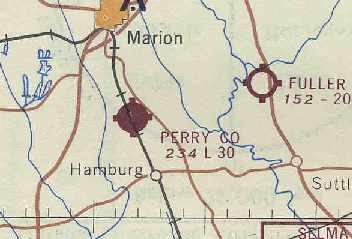
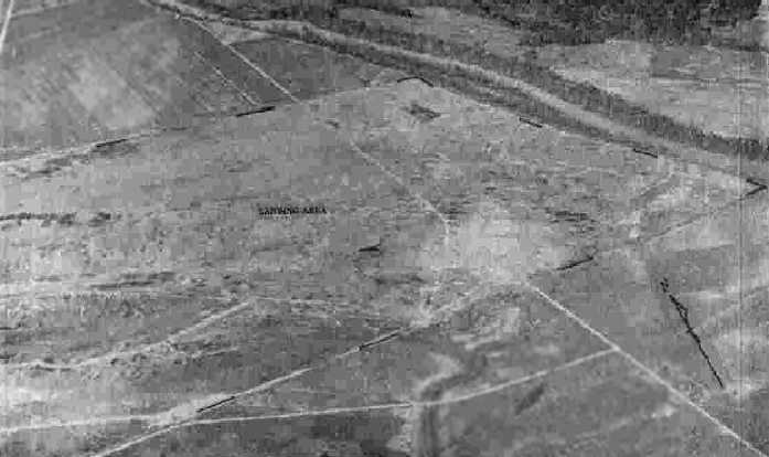
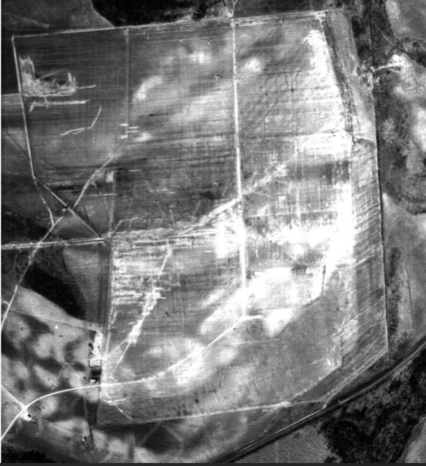
Perry County Airport, Norman, AL
32.56, -87.3 (West of Montgomery, AL)
Possibly the beginnings of the Perry County Airport, as seen on a 1/8/60 USAF aerial photo (courtesy of Dallam Oliver-Lee).
This county airport was evidently built at some point between 1952-60,
as it was not yet depicted on a 3/7/52 USGS aerial photo (courtesy of Dallam Oliver-Lee)
nor depicted on the 1957 USGS topo map (courtesy of Dallam Oliver-Lee).
The earliest depiction which has been located of the Perry County Airport was on a 1/8/60 USAF aerial photo (courtesy of Dallam Oliver-Lee),
which possibly showed the beginnings of a northwest/southeast runway.
Perry County Airport was not yet depicted on the February 1961 Birmingham Sectional Chart.
The earliest aeronautical chart depiction which has been located of Perry County Airport
was on the August 1962 Birmingham Sectional Chart (courtesy of Chris Kennedy).
It depicted the field as having a single 3,000' paved runway.
This 1965 Soil Conservation Service photo (courtesy of Thomas Kallsen of the University of Alabama Map Library)
depicted Perry County Airport as having a single 3,000' paved runway,
with a small paved ramp with 2 small buildings (hangars?) at the southwest end.
Perry County Airport was listed as an active airport in the 1971 Flight Guide (according to Chris Kennedy).
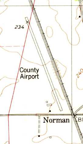
The 1979 USGS topo map depicted the Perry County Airport as having a single northwest/southeast paved runway,
with 3 small buildings on the southwest side.
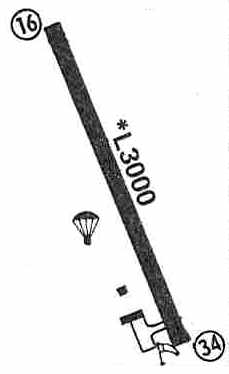
The 1980 Flight Guide (courtesy of Chris Kennedy)
depicted the Perry County Airport as having a single 3,000' paved Runway 16/34,
with a small ramp at the southwest end of the runway with 2 small buildings.
A parachute drop zone was depicted on the west side of the field.
Billy Singleton recalled, “Perry County - I remember using this airport as late as 1980.”
Perry County Airport was still listed as an active airport in the 1986 Flight Guide (according to Chris Kennedy).
The 1990 USGS topo map (courtesy of Dallam Oliver-Lee) still labeled the field as “County Airport”.
Perry County Airport was evidently closed at some point between 1990-95,
as it was labeled “Perry County Airport (Closed)” on the 1995 AL DOT map (courtesy of Dallam Oliver-Lee).
Billy Singleton recalled, “I do know that the county eventually closed the facility because of the transfer of Vaiden Field
(previously Craig Air Force Base Auxiliary)”,
which was closed by the reopened as a civil field.
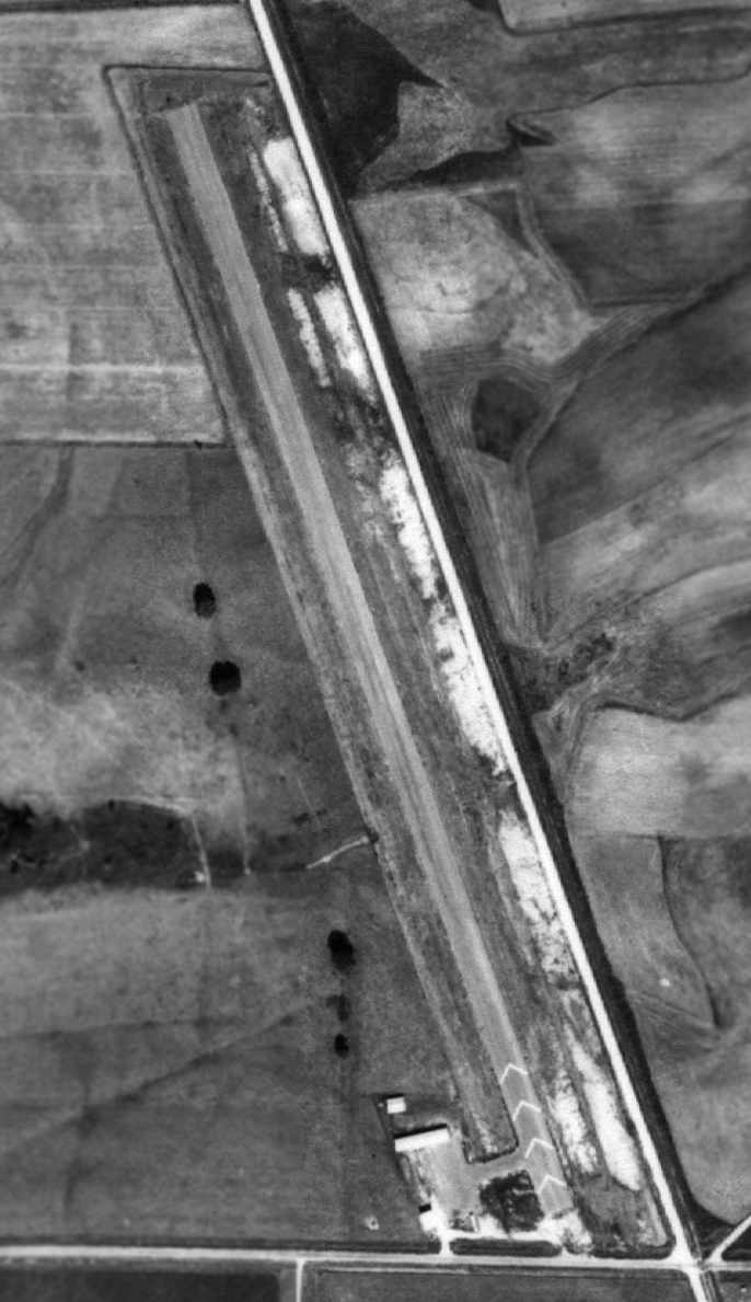
Perry County Airport, depicted in a 1998 USGS aerial view looking northeast.
John Gaspard remarked that this "shows what looks to be a completely abandoned airport, with one building at least trying to stand up.
This is also one of the few airports that went away & didn't die because of homes encroaching."
A 2019 aerial view looking northeast showed the Perry County runway & ramp to remain intact though deteriorated.
Perry County Airport is located adjacent to the west side of the tracks of the Southern Railway, northwest of the intersection of Routes 38 & 35.
____________________________________________________
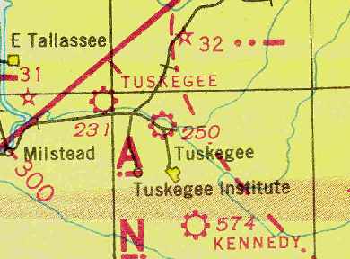
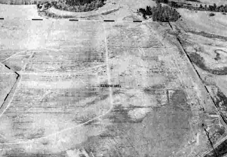
Kennedy Field / Tuskegee Institute #1, Tuskegee, AL
32.35, -85.65 (Southwest of Atlanta, GA)
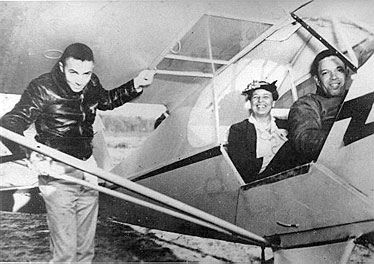
A 3/29/41 photo of First Lady Eleanor Roosevelt being taken for a flight at Kennedy Field in a Piper Cub by Chief Flight Instructor Charles Anderson.
The date of construction of Kennedy Field has not been determined.
It was not yet depicted on the April 1940 Birmingham Sectional Chart.
According to an article entitled “The Tuskegee Airfields” by Daniel Haulman in the June 2014 Air Force Magazine,
“Black pilot training at Tuskegee Institute begun in 1940 with the Civilian Pilot Training Program.
For that purpose, the Institute bought & improved a small private airfield called Kennedy Field, about 5 miles south of the school.
The field was only 55 acres, and had no paved runways, but there were 4 small hangars, populated with Piper Cubs & Waco biplanes.
The most famous event at Kennedy Field was the 3/29/41 visit by Eleanor Roosevelt, the wife of President Franklin Roosevelt.
Chief Flight Instructor Charles Anderson took her for a flight,
and she became an avid supporter of black flight training at Tuskegee Institute.
The first class of 13 black military aviation cadets entered primary flight training at Kennedy Field on 8/21/41,
because Moton Field wasn't finished.
They & their instructors moved to Moton as soon as it was ready for flying operations, in September 1941.”
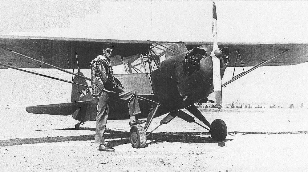
An undated (circa 1940-46) photo of a pilot with an Army Piper Cub L-4 liaison aircraft at Kennedy Field
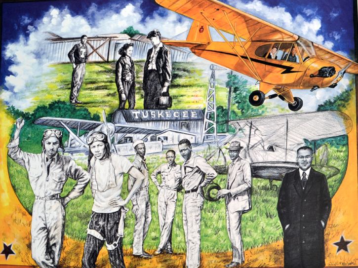
A painting commemorating the Tuskegee Institute flight training operations at Kennedy Field
The earliest aeronautical chart depiction which has been located of Kennedy Field was on the March 1942 Birmingham Sectional Chart.
It depicted Kennedy as a commercial/municipal airport.
A 2/11/43 aerial view looking north (from the National Archives, courtesy of Brian Rehwinkel)
depicted Kennedy Field as an irregularly-shaped grass field with several hangars on the southeast side,
but no aircraft were visible on the field.
The 1945 AAF Airfield Directory (courtesy of Scott Murdock) described “Moton Field Auxiliary (Kennedy Field)”
as a 55 acre L-shaped property having 3 sod runways, the longest being 1,900' north/south.
The field was said to have 4 wood & metal hangars, the largest being 88' wide,
and to be owned & operated by private interests.

The last depiction which has been located of Kennedy Field was on the April 1946 Birmingham Sectional Chart.
It labeled the field as “Tuskegee Institute #1”.
Kennedy Field presumably was abandoned when flight training at its parent airfield Moton Field was discontinued in 1946.
Kennedy Field evidently was not reused for civilian aviation, as it was no longer depicted on the October 1947 Birmingham Sectional Chart
or the 1955 USGS topo map.
A 1972 USGS aerial photo showed the remains of the foundation of a Kennedy Field building.
A 2/16/13 aerial view showed no trace remaining of Kennedy Field.
The site of Kennedy Field is located northeast of the intersection of Route 29 & Route 46.
____________________________________________________
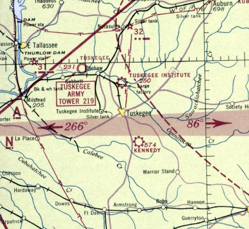
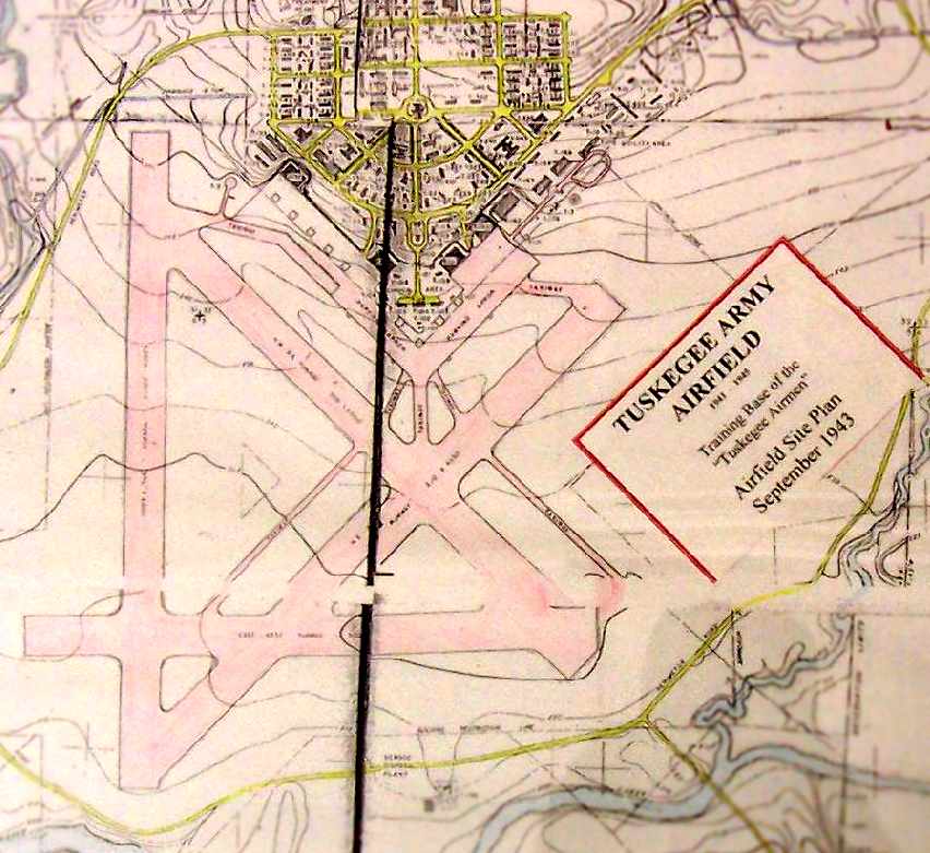
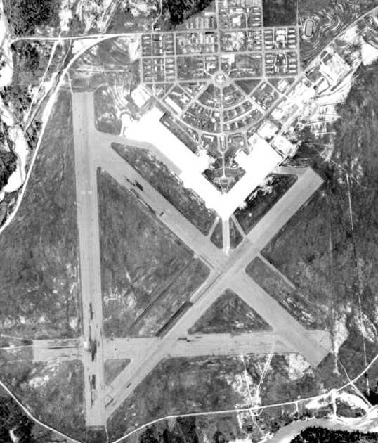
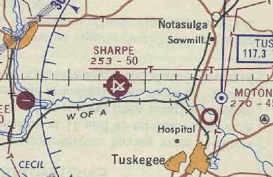
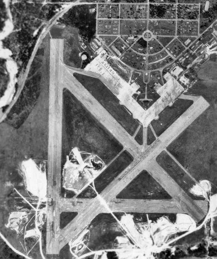
Tuskegee Army Airfield / Sharpe Field (AL73), Tuskegee, AL
32.49, -85.775 (Southwest of Atlanta, GA)
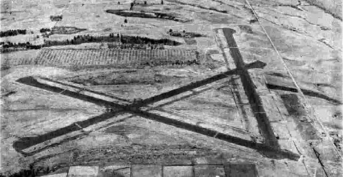
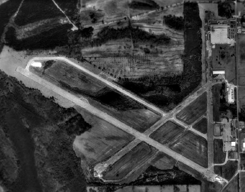
Tuskegee Airfield, as depicted on the August 1942 14M Regional Aeronautical Chart (courtesy of Chris Kennedy).
This base was used during WW2 to train the "Tuskegee Airmen", the Army Air Corps' first group of black pilots.
It was also known as Sharpe Field, and provided advanced training for the graduates of basic flying training from nearby Moton Field.
According to Lou Thole's "Forgotten Fields of America", Volume III, in 1941 the Army acquired a total of 1,650 acres of land for its planned air training base.
The land was acquired from 8 property owners for a total of $74,550. Construction began on 7/12/41.
Training flights began in November 1941, even though construction was nowhere near completion.
A graded (but not yet paved) portion of the north/south runway was used to conduct initial flight training.
The earliest depiction of the Tuskegee AAF airfield which has been located
was on the August 1942 14M Regional Aeronautical Chart (courtesy of Chris Kennedy).
It depicted “Tuskegee” as a commercial or municipal airport.
The October 1942 Birmingham Sectional Chart depicted Tuskegee AAF as a military airfield
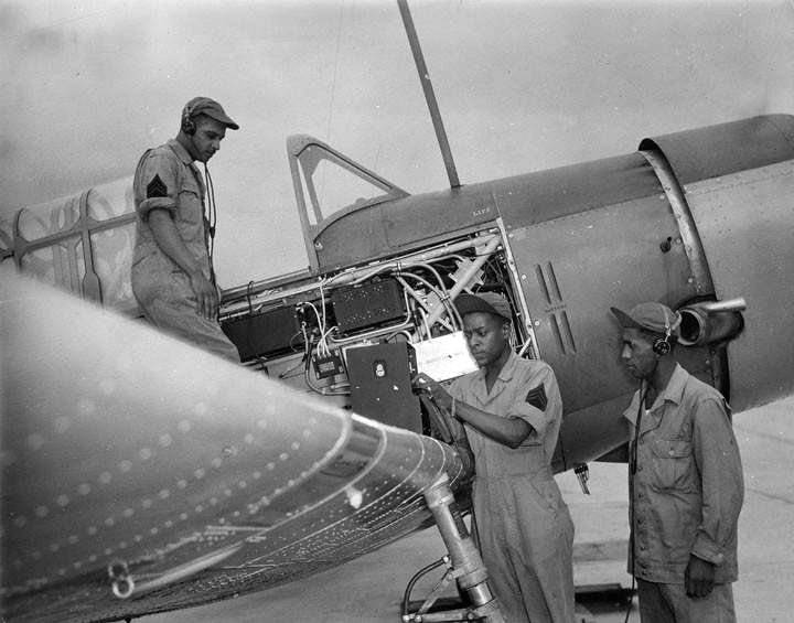
A circa 1942-46 USAAC photo (courtesy of Rob Grant) of African American servicemen testing the frequency of a radio after installing it in a Vultee BT-13 Valiant basic trainer at Tuskegee AAF.
By the end of 1942, Tuskegee AAF had a total of 3,414 personnel.
The earliest aerial photo which has been located of Tuskegee AAF was a 2/11/43 aerial view looking north (from the 1945 AAF Airfield Directory, via Rob Grant).
It showed the base to have 4 asphalt runways & large complex of hangars & other buildings on the north side.
The March 1943 14M Regional Aeronautical Chart (courtesy of Chris Kennedy) labeled the airfield as “Tuskegee Army Flying School”,
and indicated that the field had a control tower.
By September 1943, Tuskegee had 4 runways & a total of 225 buildings.
According to Billy Singleton, “There were 3 large maintenance hangars at Tuskegee AAF.”
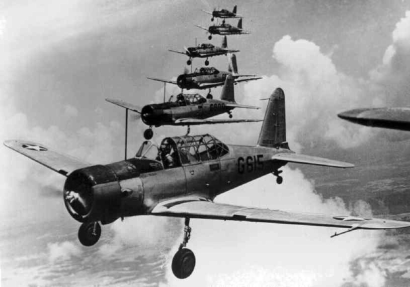
Aircraft used at Tuskegee during WW2 included the Stearman PT-17 biplane basic trainer,
Vultee BT-13 Valiant monoplane advanced trainer, North American AT-6 Texan advanced trainer,
and Curtis P-40 Warhawk (used for fighter transition training).
Twin-engine training commenced at Tuskegee in 1943, at first using the AT-10.
A 5/8/44 aerial view looking south (from the Air Force Historical Research Agency, via Rob Grant)
showed Tuskegee AAF to have 4 asphalt runways & large complex of hangars & other buildings on the north side.
The 1944 US Army/Navy Directory of Airfields (courtesy of Ken Mercer) described Tuskegee AAF as having a 5,000' hard-surface runway/
A 1945 aerial view looking east at Tuskegee AAF.
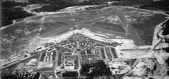
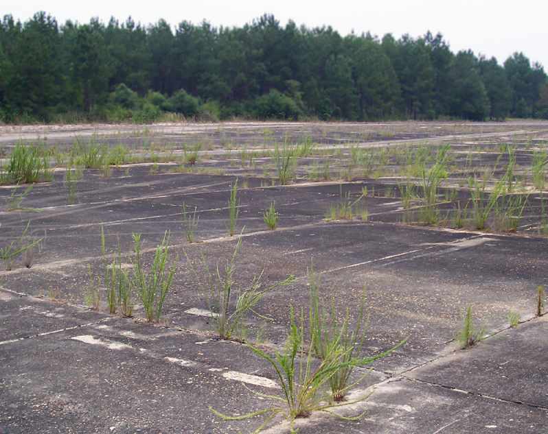
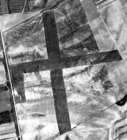
As constructed during WW2, Tuskegee AAF consisted of 4 asphalt runways (the longest being 5,200'),
taxiways, a ramp, and a large number of buildings north of the field.
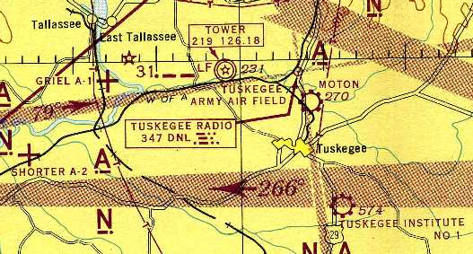
During WW2, Tuskegee AAF had 2 satellite airfields: Griel Auxiliary #1 & Shorter Auxiliary #2.
Tuskegee AAF & a few of its satellite airfields, as depicted on the 1945 Birmingham Sectional Chart (courtesy of Chris Kennedy).
The AT-10 twin-engine trainer was replaced at Tuskegee by the TB-25 Mitchell in 1945.
The last pilot class graduated at Tuskegee in 1946, bringing the total number of pilots trained at the base to 992.
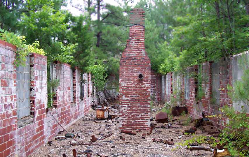
Tuskegee AAF was inactivated in 1946, and the property reverted back to the town of Tuskegee.
Many of the base's buildings were moved into the town, and 2 of the hangars were relocated.
According to Billy Singleton, “One is currently being used as a maintenance hangar at Montgomery Regional Airport,
one is located at Troy, AL, and the third is located at Clanton, AL.
The hangar was moved to Clanton in 1948 as part of the War Assets Administration disposal of military assets.
The cost of moving the hangar was $10,000 & was the responsibility of the community receiving the property.”
A 2/27/50 aerial view of Sharpe Field showed that the hangars had been removed.
Many of the other buildings also appeared to have been removed, with just their foundations visible, but the runways remained in very good shape.
Although the 1962 Birmingham Sectional Chart (courtesy of Chris Kennedy) depicted Sharpe Field as having 4 paved runways (with the longest being 5,000'),
the Aerodromes table included the remark "North/South only usable runway."
Sharpe Field was reopened as a civilian airport at some point between 1945-62,
as that is how it was listed in the 1962 AOPA Airport Directory.
Sharpe Field was described as having a single 5,000' asphalt Runway 18/36,
and the operator was listed as Sharpe Aviation Service.
A 1964 Soil Conservation Service aerial view of Tuskegee AAF (courtesy of Thomas Kallsen of the University of AL Map Library) showed the airfield to be abandoned.
No planes were visible on the ramps, and all of the hangars & the vast majority of the buildings previously located in the former cantonment area north of the airfield had been removed.
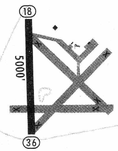
The 1965 Jeppesen Airway Manual (courtesy of Chris Kennedy) depicted Sharpe Field as having a single 5,000' paved Runway 18/36, along with 3 paved abandoned runways.
Three buildings were depicted along the ramp. The manager was listed as George Ehrhardt.
According to Guice Slawson Jr., “In the 1960-70s there was a business there that worked in salvaged aircraft parts,
then at some point there was an unauthorized dump based there that took in some chemicals that required the clean up.
It had also been used as a drag strip, a sand and gravel quarry, and a concrete pipe casting plant.”
The Tuskegee airfield was evidently closed once again at some point between 1965-71,
as it was not listed among active airfields in the 1971 Flight Guide (according to Chris Kennedy).
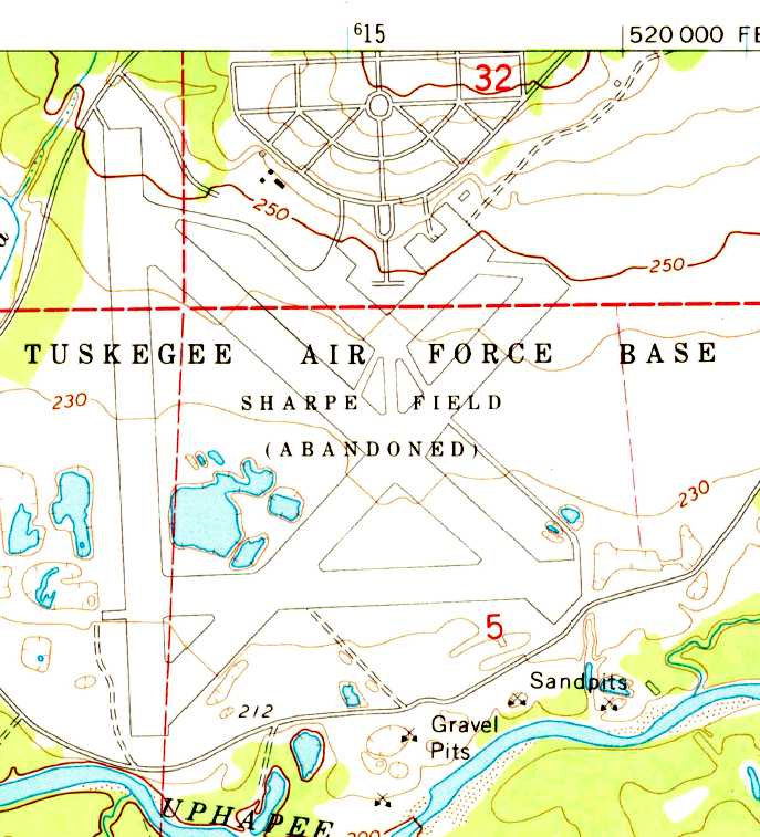
The 1971 USGS topo map depicted the multiple runways, ramps, and streets of the base, labeled “Tuskegee Air Force Base, Sharpe Field (Abandoned)”.
Note that the “Air Force Base” designation is erroneous, as Sharpe Field was abandoned by the military before the creation of the U.S. Air Force,
and was thus an Army Airfield, never an Air Force Base.
In 1976, an attempt was made to reuse the abandoned base as an oil refinery (a curious use for a former airfield), but this did not work out.
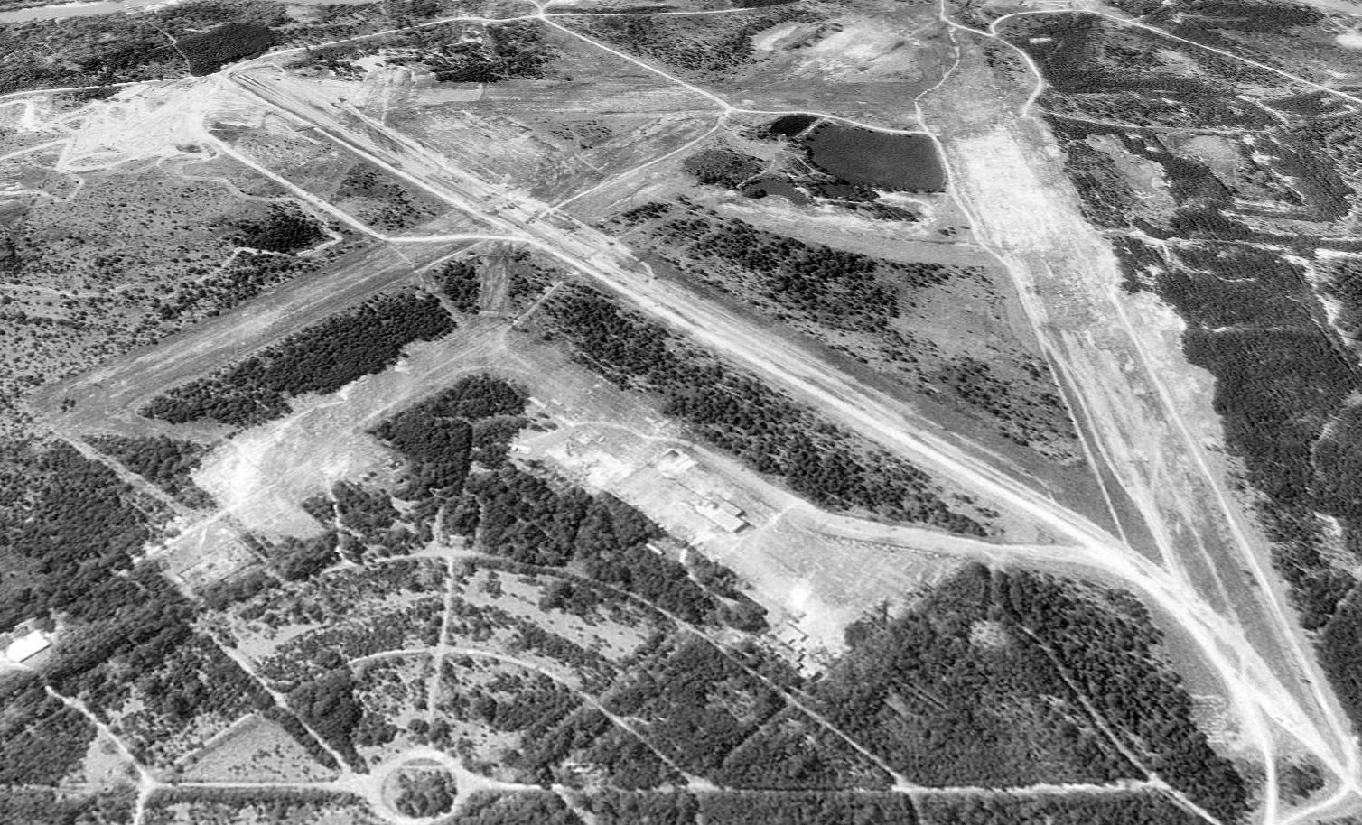
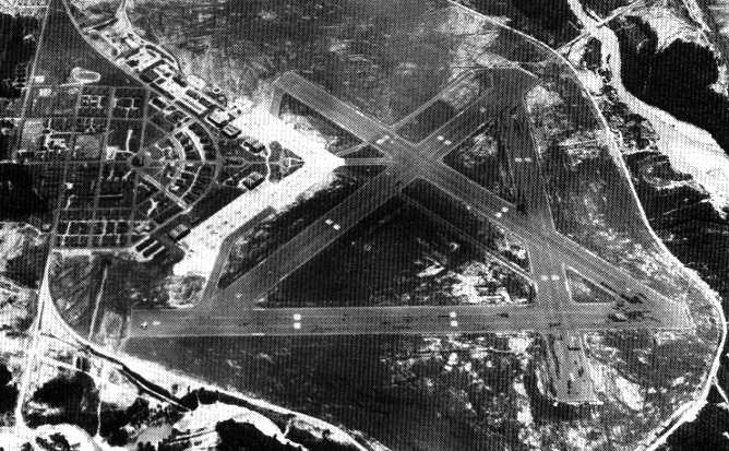
A 1997 USGS aerial view looking south showed much of the remains of Tuskegee AAF had been obscured by growth of trees & brush.
Much of the runway area had been used for surface mining for sand & gravel, with the result that they were considerably deteriorated compared to the 1964 photo.
According to Guice Slawson Jr., “The buildings on the north ramp are the remnants of the pipe mill & the quarry sifting machinery.”
According to Guice Slawson Jr. (son of the property owner in 2009),
a T-hangar was added to the northeast ramp in the “1990s” (it was not yet present in the 1997 aerial photo).
Guice said of Mr. Bradbury (the property owner at the time), “He built the T-hangar, and I think he had a Rockwell Turbo Commander.”
He also reported that the control tower stood at the intersection of the northwest & northeast ramps,
and that the main hangars were located on the northeast ramp.
He reported, “The previous owner said there had been some Superfund clean-up done there in the 1990s.”
Tuskegee AAF was depicted as an abandoned airfield on the 1998 World Aeronautical Chart.
According to Billy Singleton, “The site of Tuskegee AAF was purchased by [the Bradbury Family Partnership] in the year 2000 time frame.
It is strictly a private development.”
However, Pete Crawford pointed out in 2003 that Sharpe Field was once again listed as an active private airfield.
Only one runway was listed as being active, the 5,300' asphalt Runway 14/32.
The owner was listed as the Bradbury Family Partnership, of Woodstock, GA.
The purpose of the airfield having been reactivated is unknown.
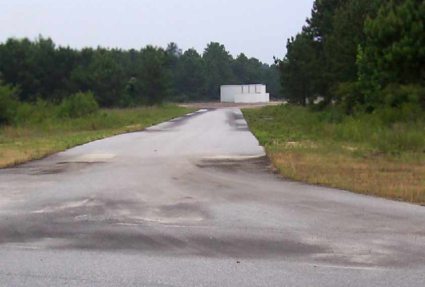
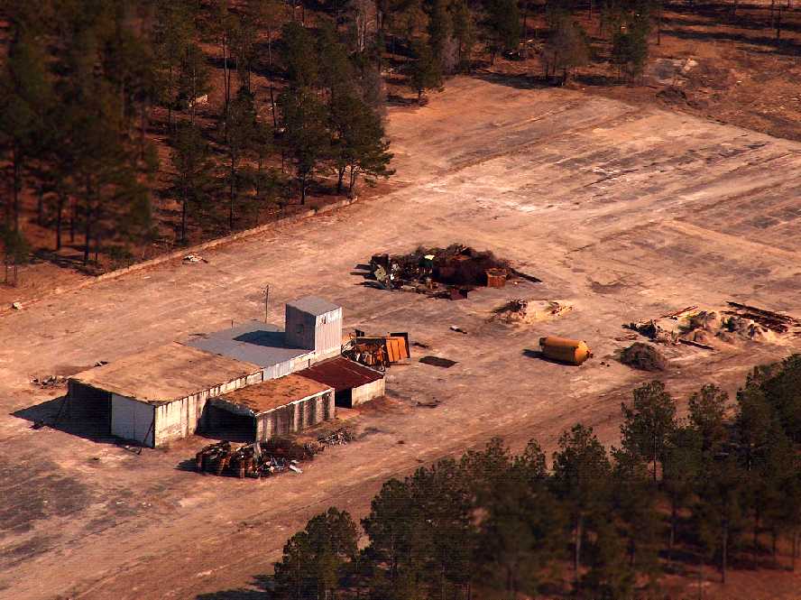
A 2005 photo by Bennie McRae looking northeast along a Tuskegee AAF taxiway,
leading to what appears to be a hangar of relatively recent construction on the northeast ramp.
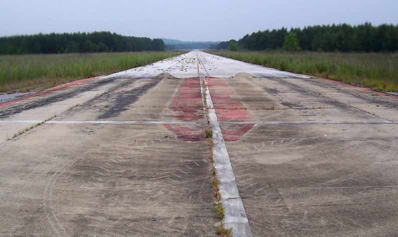
A 2005 photo by Bennie McRae of a former Tuskegee AAF runway.
A 2005 photo by Bennie McRae of the pavement along the former Tuskegee AAF ramp.
Billy Singleton reported in 2005, “The old ramp area was used as an asphalt plant for a number of years.
Some of the equipment can still be seen on the ramp area.”
Robert Grant remarked in 2005, “What I find interesting
is that (probably) most of the history of the Tuskegee Airmen was made at this site,
yet most of the gatherings & celebrations of their past take place at Moton Field,
which I understand was really an auxiliary site to Tuskegee AAF.
I guess that's the only one available to them.
Seems to me that the present owner of Tuskegee AAF could work out a mutually beneficial arrangement
with the National Parks Service to turn over this field for public benefit.”

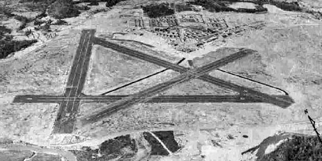
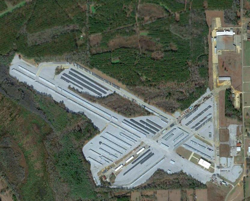
A 2008 aerial view by Jim Azelton looking southeast at Sharpe Field, showing the relatively recent runway pavement added by recent owners.
Jim Azelton reported in 2008, “As for getting permission [to land at Sharpe Field],
I actually tried to quite a while ago & got an automated response that the phone number for the Bradbury Partnership was no longer in service.
However, the other day at work, I mentioned to on of our guys who is from the Auburn area about the site & my desire to land there.
He apparently made some phone calls to an 'old timer' friend of his family who knows the owners of the property.
I went to Tuskegee today - although I decided not to land at the old Tuskegee AAF for safety reasons.
I flew low over it & I might have been able to make it on my own,
but I had a passenger & we were pushing the weight & balance on the plane as it was
and didn't want to push my luck with a narrow, unfamiliar strip.
I wasn't comfortable taking a passenger in there - the field looks a bit 'ratty'.
Maybe another time I can prearrange for someone to meet me on the ground & walk the strip prior to my landing.”
A 2008 aerial view by Jim Azelton looking east at buildings & debris on the Sharpe Field northwest ramp.
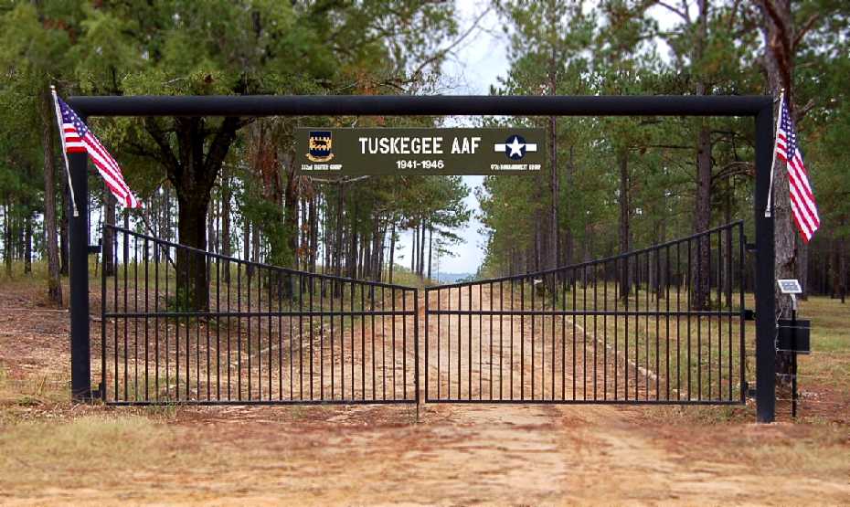
An October 2008 photo by Guice Slawson Jr. of the entrance gate to the former Tuskegee AAF.
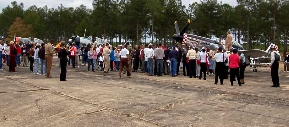
An October 2008 photo by Guice Slawson Jr. of a gathering of aircraft & spectators at Sharpe Field.
Guice reported, “The field was opened for a private gathering of the Tuskegee Airmen & their families
in conjunction with the dedication of the nearby National Park Site at Moton Filed (Tuskegee, AL Municipal Airport).
The picture shows two T-6s & a P-51 that were on display. The picture was taken on the southern ramp, looking east.”
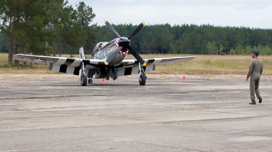
An October 2008 photo by Guice Slawson Jr. on Tuskegee's southern ramp, looking southwest at a P-51 Mustang.
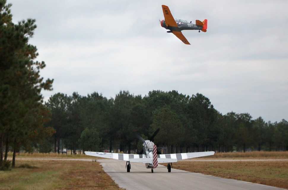
An October 2008 photo by Guice Slawson Jr. of “a T-6 taking off on Runway 14, with the P-51 holding short on the diagonal taxiway” at Tuskegee.
Guice Slawson Jr. reported in 2009 of the Tuskegee AAF property, “My father is a co-owner with 2 partners. They bought it 4-5 years ago.
We bought it from Mr. Bradbury. He had developed it as a quail hunting preserve, but then found another large tract of land closer to home.
We have a Skyhawk that we take over there occasionally, but it is hangared in Montgomery.
A couple of the main buildings from the quarry are still on the ramp,
but we’ve disposed of several truckloads of scrap metal that was abandoned by the various businesses.
The years of having a business operated on that part of the ramp took its toll on the concrete.
We’re doing some work that will hopefully slow down the encroachment of nature there,
like clearing the original street grid & uncovering the building foundations.
I doubt it will be completely open to the public (too many trial lawyers looking for an accident to happen)
but we are trying to make it presentable for limited access to groups with a personal or professional link to the base.”
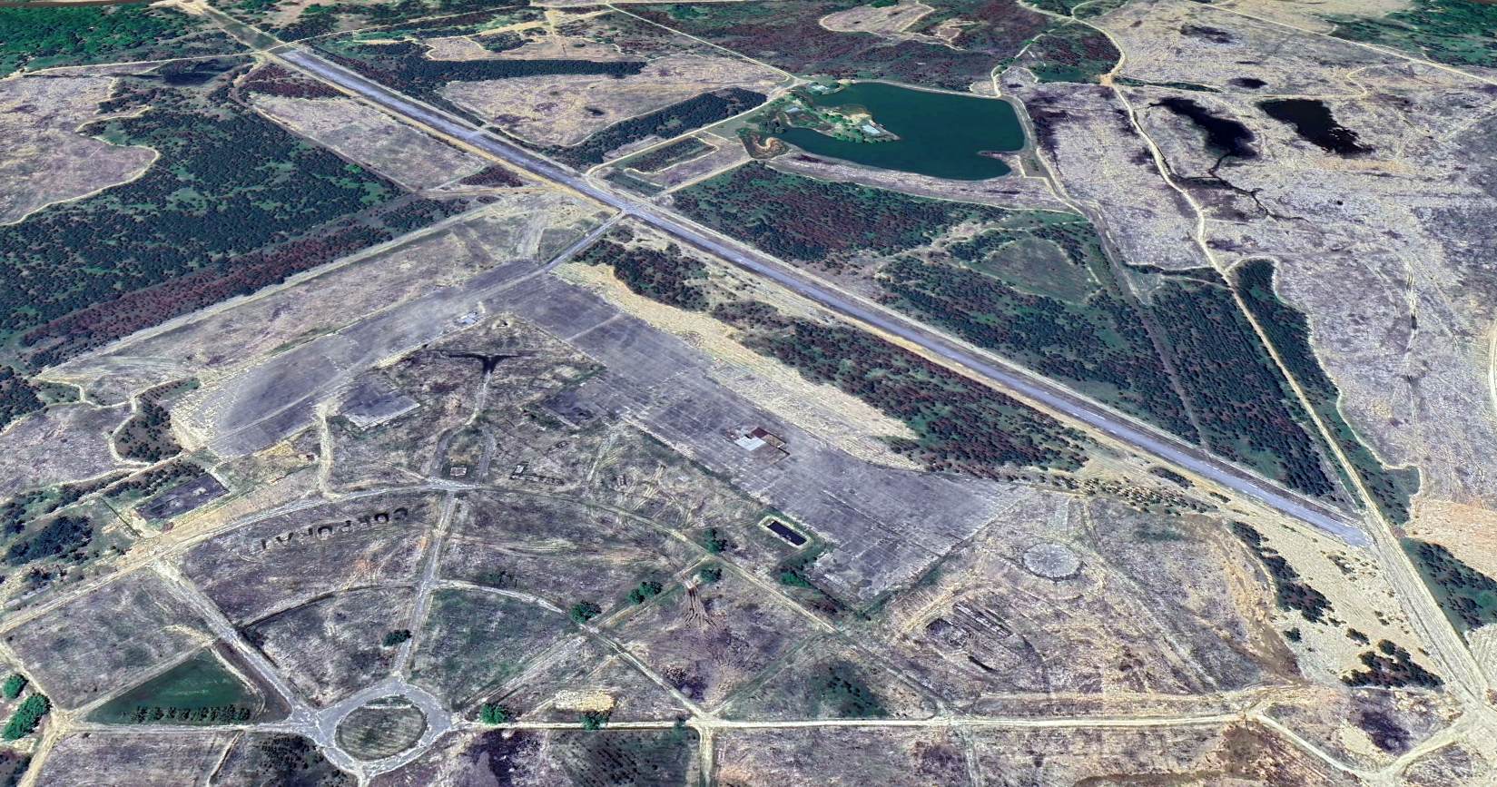
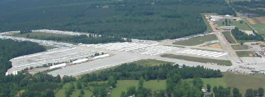
A 2023 aerial view looking south at the remains of Tuskegee AAF, showing the relatively recent runway pavement added by recent owners, as well as the recognizable outlines of the other former runways, ramps, extensive street grids, etc.
What a shame to see such a historic site going largely unacknowledged. Ironic that the Park Service has preserved nearby Moton Field, yet the much larger Tuskegee Army Airfield wastes away.
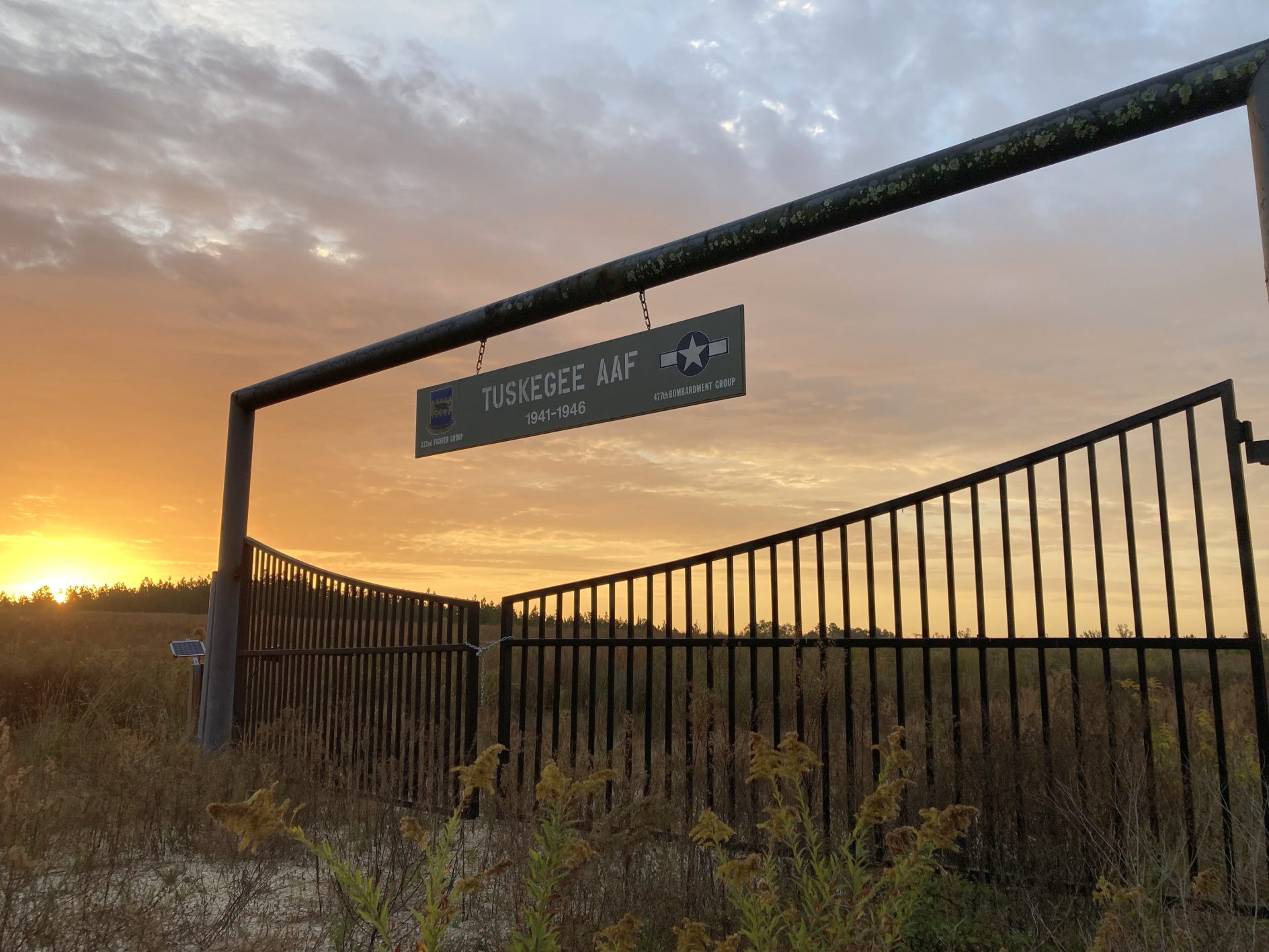
A 2024 photo by Bob Lipske of the entrance gate to the former Tuskegee AAF.
Bob reported, “The 2009 picture of the gate had heavily forested land; now it is just weeds & vines gone wild.”
____________________________________________________
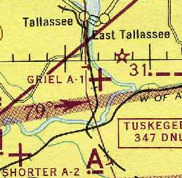
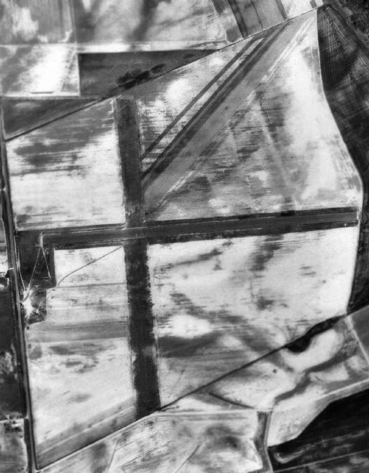
Griel Army Auxiliary Airfield #1 / Tallassee Airport / Reeves Airport (1st location), Tallassee, AL
32.48, -85.89 (Southwest of Atlanta, GA)
A 2/11/43 aerial view looking north from the 1945 AAF Airfield Directory (courtesy of Scott Murdock)
depicted “Tuskegee AAF Auxiliary #1 (Griel Field)” as a rectangular field without any buildings.
Griel Aux AAF #1 was used during WW2 as one of 2 satellite airfields for Tuskegee AAF.
It was named after the original owner of the bulk of the airfield property, which consisted of a total of 325 acres.
The date of construction of this airfield is unknown.
According to Lou Thole's "Forgotten Fields of America", Volume III,
Griel Field was not yet built when its parent field (Tuskegee AAF) commenced training operations, in 1941.
Like many other hastily constructed WW2 satellite airfields, Griel was not usable in wet weather.
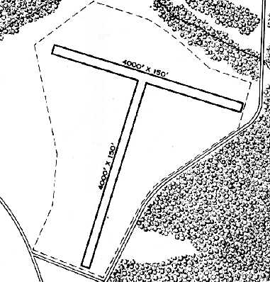
The 1945 AAF Airfield Directory (courtesy of Scott Murdock) described “Tuskegee AAF Auxiliary #1 (Griel Field)”
as a 320 acre irregularly-shaped field having a 5,689' x 3,368' all-way turf landing area.
The field was said to not have any hangars, to be owned by the U.S. Government, and operated by the Army Air Forces.
The earliest aeronautical chart depiction which has been located of Griel Aux #1
was on the 1945 Birmingham Sectional Chart (courtesy of Chris Kennedy).
It depicted the field as an auxiliary airfield, but without any military connection.
A 1951 aerial view (courtesy of Rob Grant) depicted Griel Field as having 2 perpendicular unpaved runways, with a parking area & a small building on the west side.
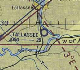
At some point between 1944-54, the Griel airfield was reused as a civil airport,
as it was labeled as "Tallassee" Airport on the August 1954 Birmingham Sectional Chart (courtesy of Chris Kennedy).
and described as having a 2,900' runway.
The 1962 Montgomery Local Aeronautical Chart (courtesy of Chris Kennedy) depicted "Tallassee" Airport as having a 3,000' hard-surface runway.
A 1964 Soil Conservation Service aerial view (courtesy of Thomas Kallsen of the University of Alabama Map Library) depicted Tallassee Airport
as having a paved east/west runway & an unpaved north/south runway.
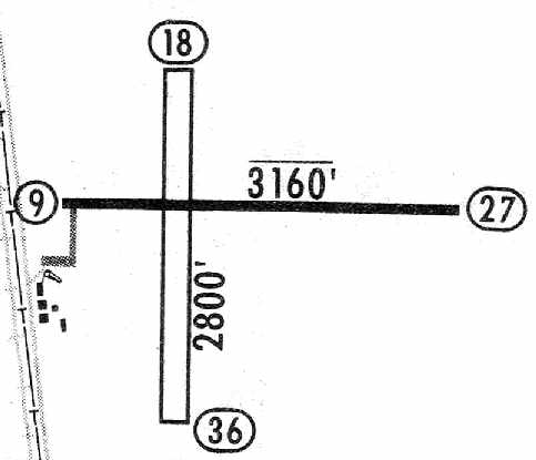
The 1965 Jeppesen Airway Manual (courtesy of Chris Kennedy) depicted Tallassee Airport
as having a 3,160' paved Runway 9/27 & a 2,800' sod Runway 18/36.
A taxiway led to a small cluster of buildings southwest of the runway intersection. The manager was listed as Billy Harper.
It was listed as "Tallassee Municipal Airport" in the 1971 Flight Guide (according to Chris Kennedy).
It was described as having a 3,160' paved Runway 9/27 & a 2,800' turf Runway 18/36.
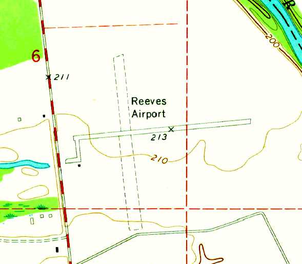
It was evidently renamed Reeves Airport at some point between 1965-71,
as the 1971 USGS topo map labeled "Reeves Airport" as having 2 runways.
It was labeled "Tallassee Municipal Airport" on the 1972 & 1973 USGS topo maps (which only depicted the east/west runway).
The 1981 USGS topo map continued to label it as Reeves Airport.
A 1984 topo map (courtesy of Tyler Krikorian) depicted Reeves Airport as having a single paved Runway 9/27,
with a paved taxiway leading to an aircraft parking ramp & 2 buildings on the southwest side.
However, the airport was not labeled.
Reeves Airport evidently moved to a new site a few miles to the northwest & this field closed at some point apparently between 1981-86,
as it was not listed among active airfields in the 1986 Flight Guide (according to Chris Kennedy).
According to Tyler Krikorian, GKN Aerospace Alabama built an industrial facility over a portion of the original Reeves Airport in the 1980s.
The original Reeves Airport was depicted as an abandoned airfield on late 1990s aeronautical charts.
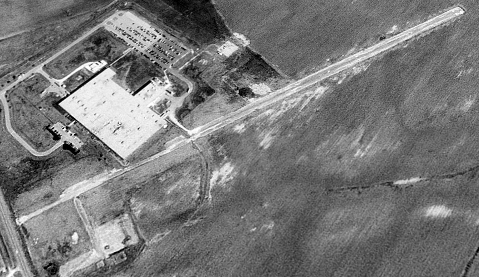
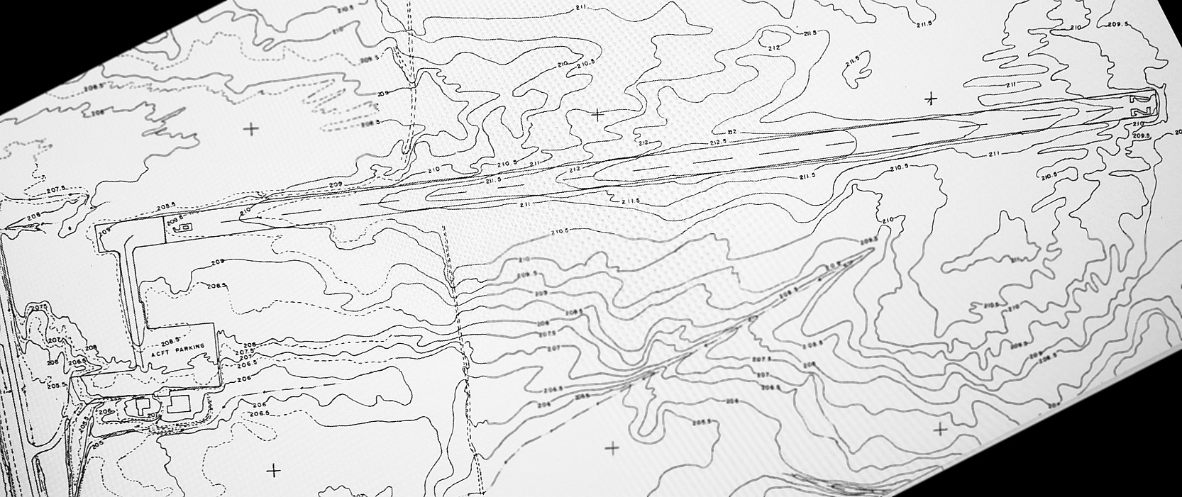
The remains of Griel Field visible in a 1997 USGS aerial view looking northeast were a single 3,100' paved runway & a paved ramp area southwest of the runway.
The GKN Aerospace Alabama industrial facility had been constructed overlaying part of the western portion of the runway.
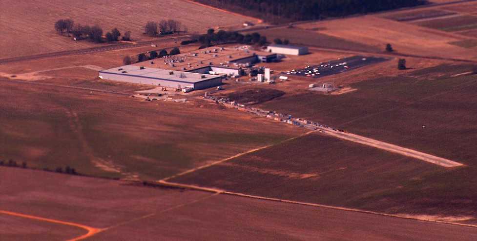
A November 2008 aerial view by Jim Azelton looking northwest at the remains of the Griel/Tallassee airfield.
A 2015 aerial view looking northeast showed the remains of the Griel/Tallassee paved east/west runway & ramp.
A 2/21/20 photo by Tyler Krikorian looking along the remains of Reeves Airport's Runway 27, with the GKN Aerospace Alabama industrial facility in the background.
A 2/21/20 photo by Tyler Krikorian looking west at the remains of Reeves Airport's aircraft parking ramp, with the GKN Aerospace Alabama industrial facility on the right.
A 2/21/20 photo by Tyler Krikorian looking along the remains of Reeves Airport's Runway 9.
____________________________________________________
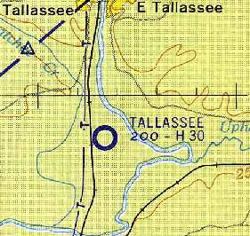
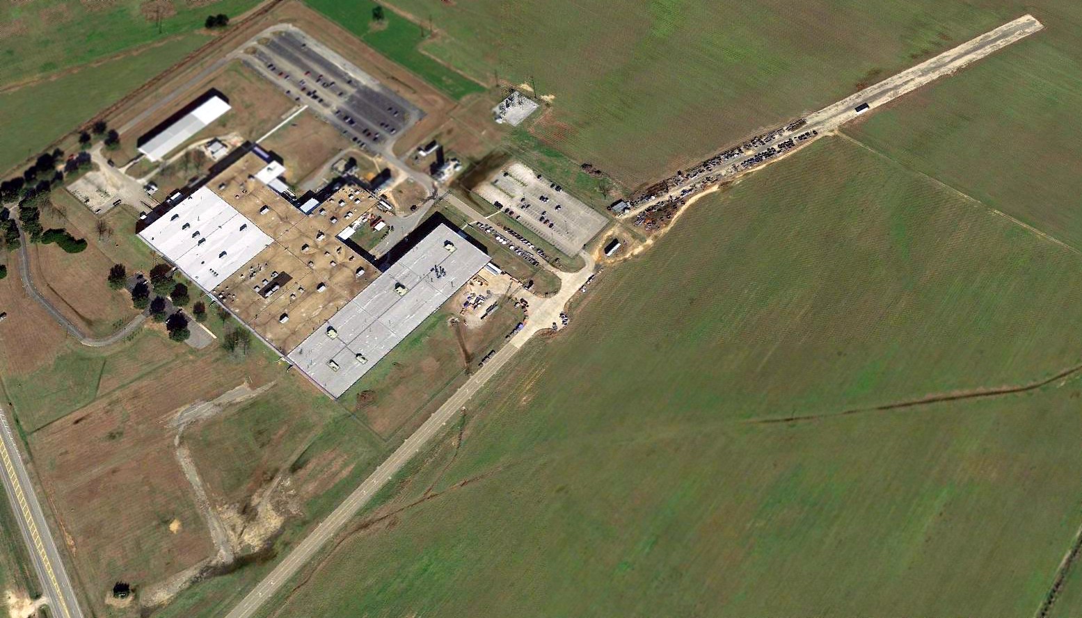
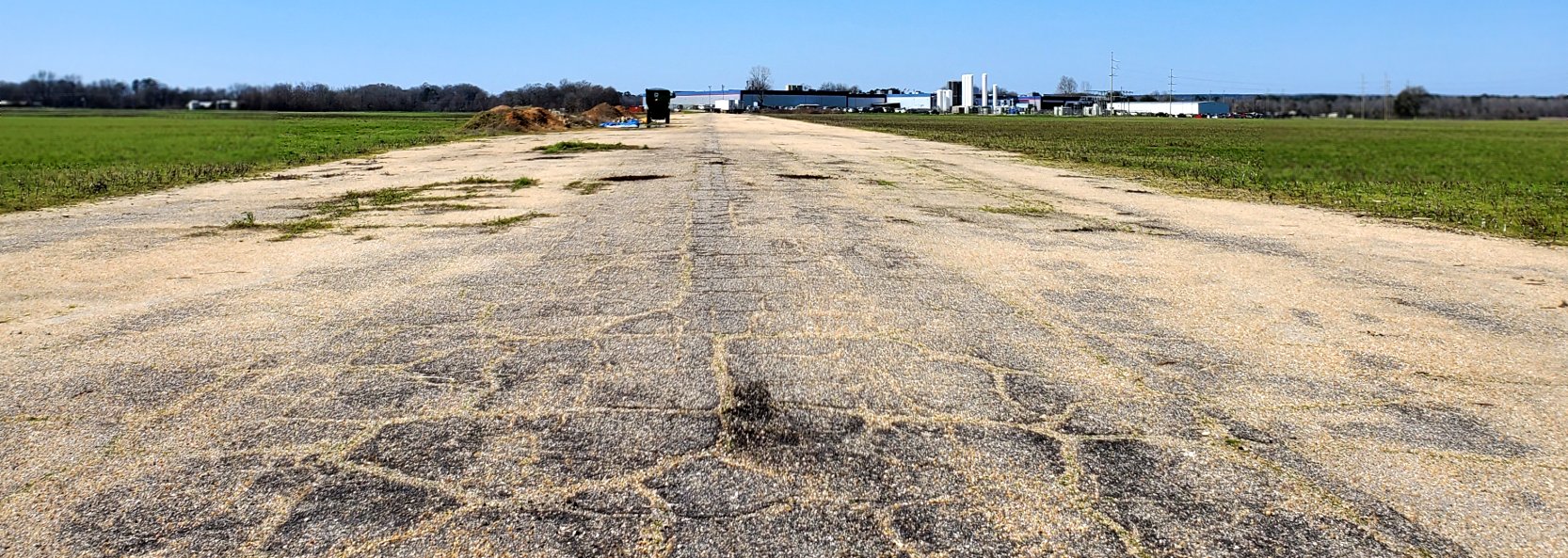
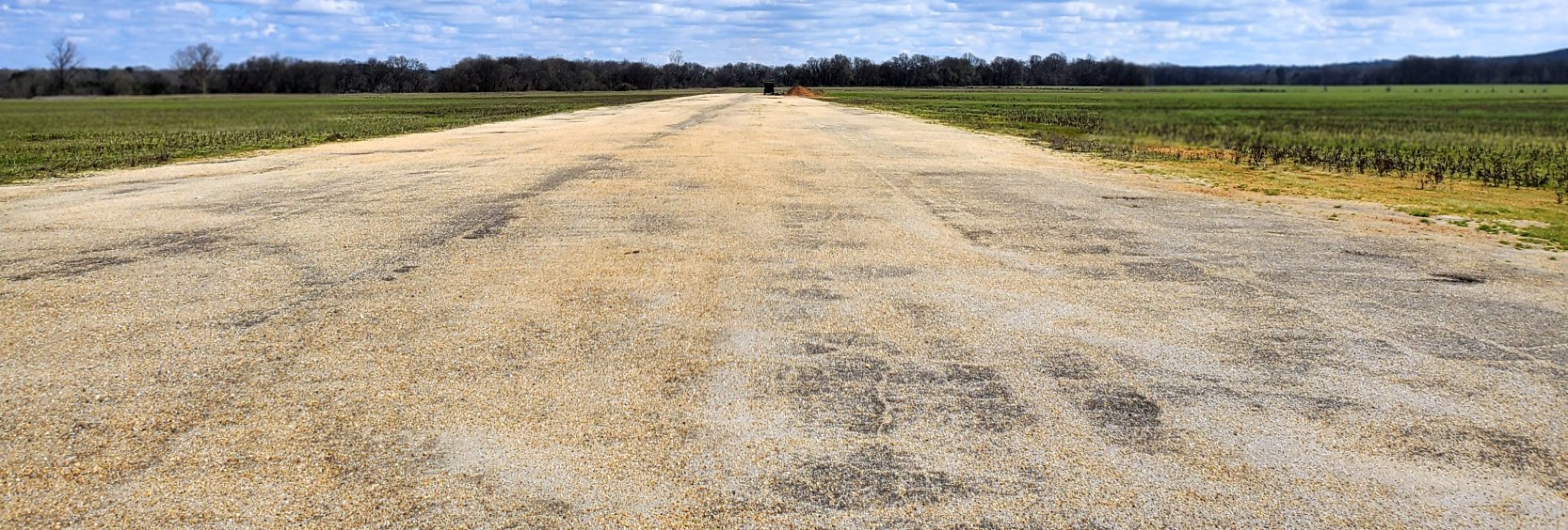
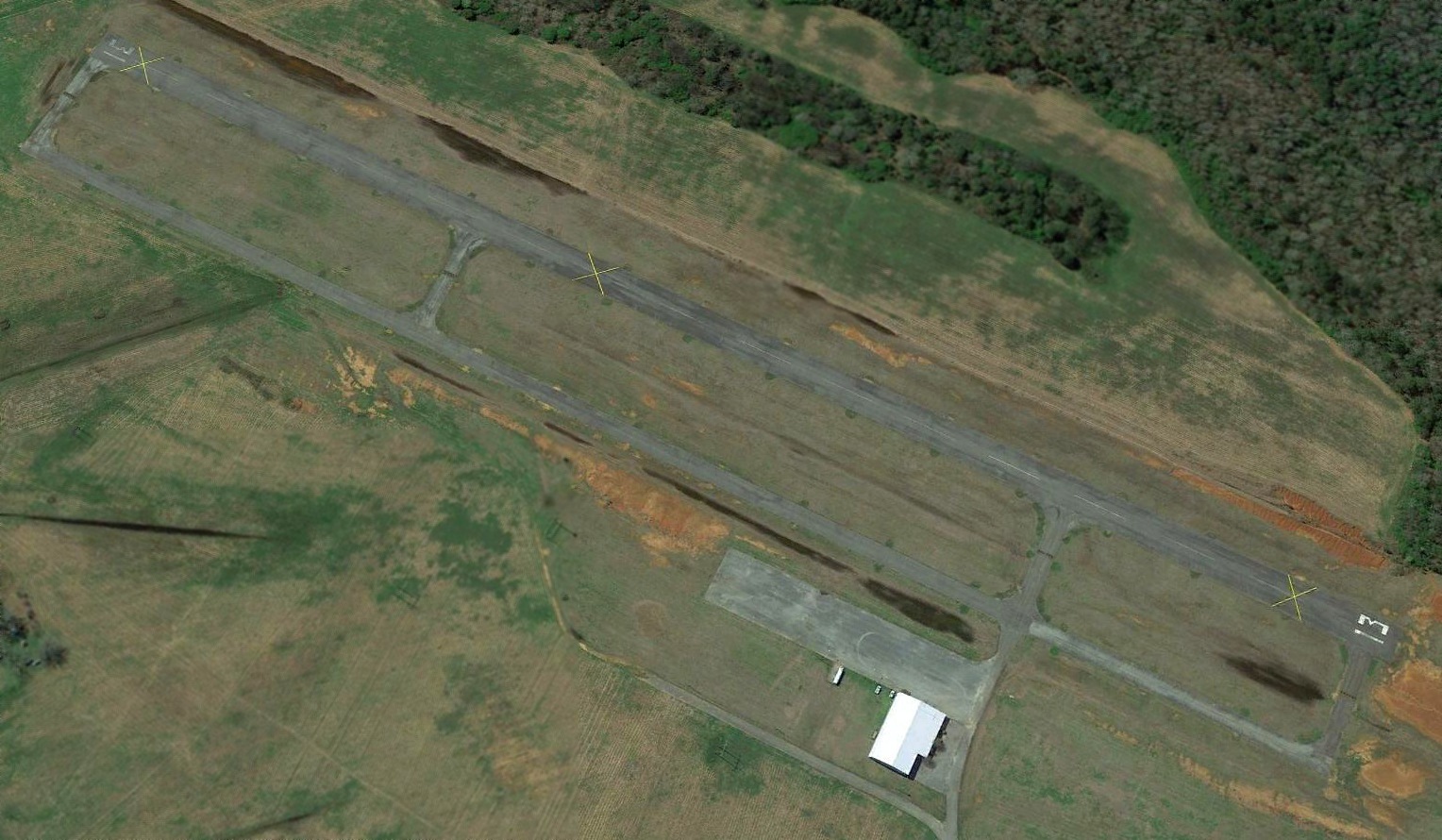
Reeves Airport (2nd location) / Tallassee Municipal Airport, Tallassee, AL
32.516, -85.877 (Southwest of Atlanta, GA)
The 2nd location of Reeves Airport, as depicted on a 1997 USGS aerial view looking south.
The 2nd location of Reeves Airport was evidently established at some point between1984-97,
as it was not yet depicted on a 1981 aerial photo nor on the 1984 USGS topo map.
The earliest photo which has been located of the 2nd location of Reeves Airport was on a 1997 USGS aerial view.
It depicted Reeves Airport as having an asphalt Runway 13/31, with a parallel asphalt taxiway.
However there were no hangars, buildings, ramps, or aircraft visible on the field.
A 2006 aerial view showed that Reeves Airport had gained a ramp & hangar on the north side.
A 2015 aerial view still showed Reeves Airport's Runway 13/31 marked as an active runway.
An article entitled “Tallassee airport set to close at end of 2018” by Morgan Young in the WSFA News (courtesy of John Knight) reported,
“Tallassee Mayor Johnny Hammock confirmed Reeves Airport will close at the end of the year.
Hammock said Tallassee’s municipal airport needed about $70,000 in repairs to meet federal requirements.”
“The repairs were things like cutting trees, sealing cracking, painting, replacing asphalt, updating the runway and things like that,” Hammock said.
According to Hammock, the City only has about $11,000 in its “airport account”. He said the airport is used for private residents & pilots.
Dec. 31 will be the last day of operations for the airport.
A 2019 aerial view looking south showed 3 yellow closed-runway “X” symbols over the Reeves Airport runway.
The airport appeared otherwise to remain intact.
Thanks to John Knight for pointing out this airfield.
____________________________________________________
Shorter Army Auxiliary Airfield #2, Shorter, AL
32.423, -85.957 (Southwest of Atlanta, GA)
A 1941 aerial view (courtesy of Rob Grant) showed 4 biplanes on the north side of Shorter Field.
Shorter Aux AAF #2 was used during WW2 as one of 2 satellite airfields for Tuskegee AAF.
The date of construction of Shorter Field has not been determined,
but its parent field (Tuskegee AAF) commenced training operations in 1941.
The earliest depiction which has been located of Shorter Field was a 1941 aerial view (courtesy of Rob Grant).
It showed 4 biplanes on the north side of a rectangular grass airfield.
A 2/11/43 aerial view looking north from the 1945 AAF Airfield Directory (courtesy of Scott Murdock)
at “Tuskegee AAF Auxiliary #2 (Shorter Field)”.
The 1945 AAF Airfield Directory (courtesy of Scott Murdock) described “Tuskegee AAF Auxiliary #2 (Shorter Field)”
as a 241 acre irregularly-shaped field having a 3,560' x 3,270' all-way turf landing area.
The field was said to not have any hangars,
to be owned by private interests, and operated by the Army Air Forces.
The earliest aeronautical chart depiction which has been located of Shorter Aux #2
was on the 1945 Birmingham Sectional Chart (courtesy of Chris Kennedy).
It depicted Shorter A-2 as an auxiliary airfield.
Shorter Field presumably was abandoned when its parent airfield Tuskegee AAF was closed in 1946,
and presumably Shorter Field was never reused as a civilian airport.
A 1950 aerial view (courtesy of Rob Grant) showed that Shorter Field had been abandoned, with no sign of recent aviation use.
A 1969 USGS aerial photo & the 1973 USGS topo map depicted only gravel pits on the site of Shorter Field.
A 2/16/13 aerial view showed no trace remaining of Shorter Field.
The site of Shorter Field is located north of the intersection of Interstate 85 & Route 138.
____________________________________________________
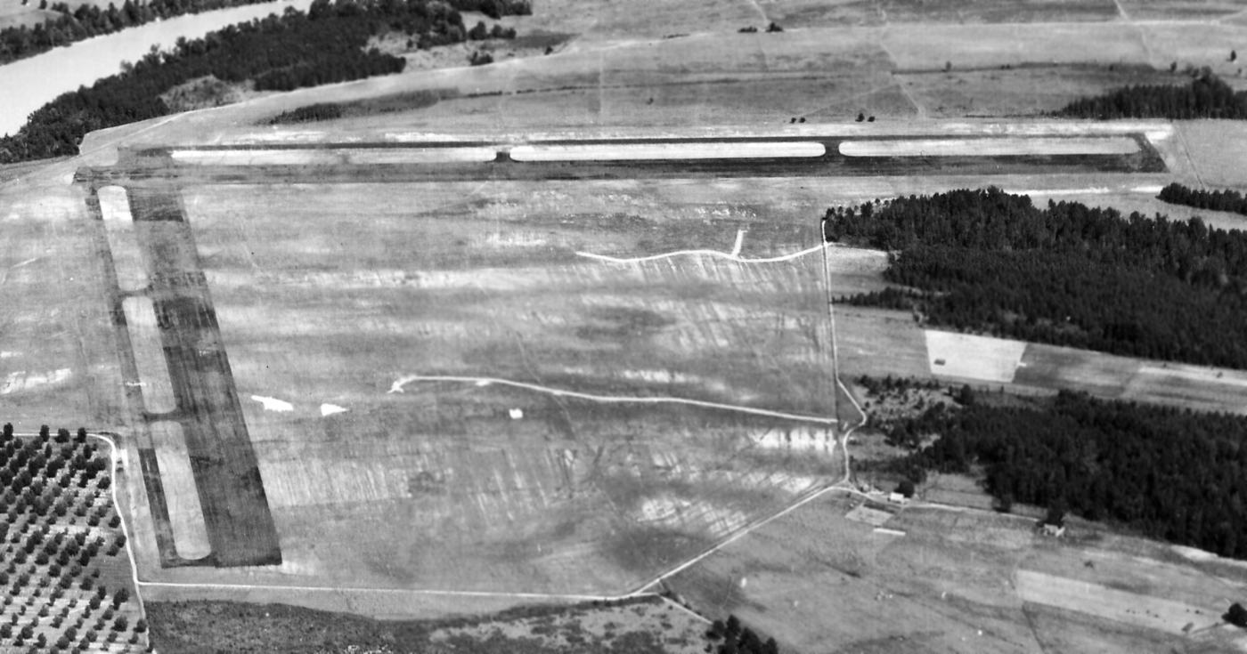
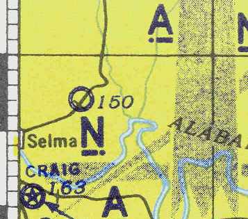
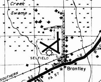
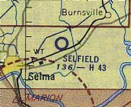
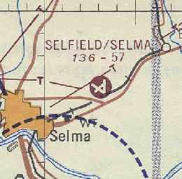
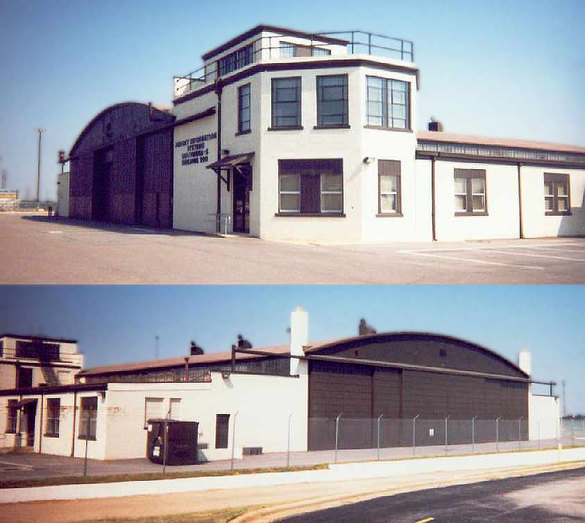
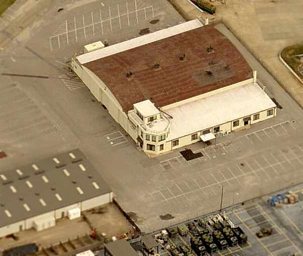
Selfield Army Auxiliary Airfield / Craig Army Auxiliary Airfield #1 / Selma Municipal Airport, Selma, AL
32.44, -86.95 (West of Montgomery, AL)
Selfield, as depicted on a 2/11/43 aerial view looking north (from the 1945 AAF Airfield Directory, courtesy of Rob Grant).
No airfield was yet depicted at this location on the 1937 AL DOT map (courtesy of Dallam Oliver-Lee).
According to Billy Singleton, “Selfield was constructed concurrent with the establishment of Craig Field.
It was originally constructed to replace Legion Field, the original Selma Municipal Airport.
Legion Field was too small to serve the needs of a growing city.
In fact, the military would not let student pilots use Legion Field.”
The Selma airfield was evidently constructed at some point between 1942-43,
as it was not yet depicted at all on the August 1942 14M Regional Aeronautical Chart (according to Chris Kennedy).
The earliest depiction of the Selma airfield which has been located was a 2/11/43 aerial view looking north (from the 1945 AAF Airfield Directory, courtesy of Rob Grant).
It depicted Selfield as having 3 asphalt runways, each with parallel taxiways, and a ramp on the east side.
The earliest depiction of the Selma airfield which has been located
was on the March 1943 14M Regional Aeronautical Chart (courtesy of Chris Kennedy).
It depicted Selma as a military airfield.
It one of 6 satellite airfields which supported flight training at nearby Craig Army Airfield,
which conducted pre-flight, specialized, and advanced training for fighter pilots.
According to Billy Singleton, “The field was always closely tied to operations at Craig
and served as an auxiliary field for a number of years during World War II.”
The 1944 US Army/Navy Directory of Airfields (courtesy of Ken Mercer)
described "Selfield (Aux.) (Selma Airport)" as having a 4,200' hard-surface runway.
"Selma (Aux)" was still depicted as an active military airfield on the April 1945 Birmingham Sectional Chart.
Selfield continued in operation by the military until 1946.
The 1950 AL DOT map (courtesy of Dallam Oliver-Lee) depicted Selfield as having 3 paved runways.
A 2/15/50 USDA aerial view (courtesy of Dallam Oliver-Lee) depicted Selfield as having 3 paved runways,
with a ramp on the east side, but there were no obvious signs of any use of the airfield.
Selfield was reportedly reused by the military for a second period starting in 1950.
According to Billy Singleton, “It was used with the initiation of Undergraduate Pilot Training for the Air Force.
Delta Airlines served Selfield in 1951 with DC-3 aircraft but only stayed through 1952.
This service was followed by Southern Airways but the service was only temporary.”
The Aerodromes table on the August 1954 Birmingham Sectional Chart (courtesy of Chris Kennedy)
described Selfield as a jointly operated (civil & military) airfield.
A 1955 Soil Conservation Service Photo (courtesy of Thomas Kallsen of the University of Alabama Map Library)
showed no obvious signs of any aviation use of the airfield.
The February 1960 Birmingham Sectional Chart depicted Selfield as having 3 paved runways, with the longest being 4,300'.
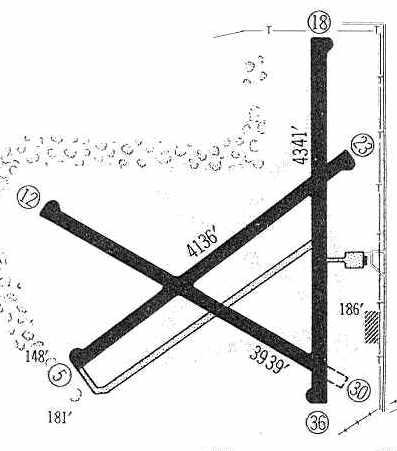
Selfield was depicted in the 1960 Jeppesen Airway Manual (courtesy of Chris Kennedy)
as having 3 paved runways (with the longest being the 4,341' Runway 18/36),
with a small ramp with a single building on the east side.
The remark said "2-way radio required during USAF operations."
Selfield/Selma Airport was described on the Aerodromes table of the 1962 Birmingham Sectional Chart (courtesy of Chris Kennedy)
as being jointly operated, with the remark of "2-way radio required during AF operations."
The longest runway had been lengthened at some point between 1960-62 to 5,700'.
Selma Municipal Airport still evidently had airline service as of 1962, as Sandra Knapp recalled,
“In 1962 an airline was flying out of Selfield because my sister & her little girl left Selfield to meet her husband in Germany.”
Selma Municipal Airport was described in the 1962 AOPA Airport Directory
as having 3 paved runways.
A 10/24/65 USDA aerial view (courtesy of Dallam Oliver-Lee)
appeared to show a large number of Air Force T-41 trainers parked along Selfield's Runway 18/36.
Even after becoming a Municipal Airport, Selfield still continued to see some use by the military.
Jim Ratliff recalled, "Selfield was used by the USAF for T-41 training in 1965-66 while I was in pilot training at Craig AFB."
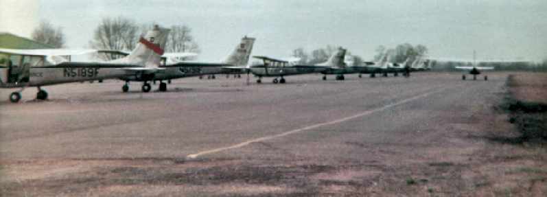
A 1967 photo by Ken Morris of T-41As on the Selfield flightline.
Ken recalled, “I taught primary [flight training] for the USAF starting February 1966-70.”
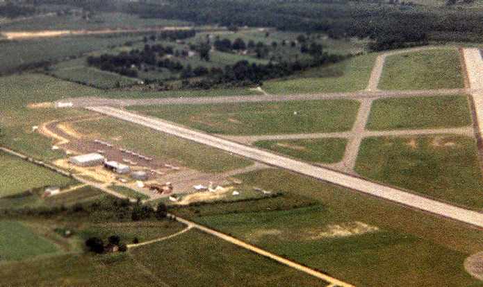
A 1967 aerial view looking southwest at Selfield, taken by Ken Morris from a T-41A.
The last aeronautical chart depiction which has been located of Selfield Airport
was on the October 1968 Birmingham Sectional Chart.
It depicted Selfield as having 3 paved runways, with the longest being 5,800'.
According to Billy Singleton, Selma Municipal Airport was closed in 1978
when the City of Selma relocated the municipal airport to the much larger Craig Field
after it was relinquished by the military.
Selma Municipal Airport was labeled "Abandoned" on the 1982 USGS topo map.
A 1992 photo by Ken Morris (enhanced by Bill Grasha) of the abandoned Selfield terminal building.
![]()
A 1992 photo by Ken Morris (enhanced by Bill Grasha) of the former Selfield beacon tower.
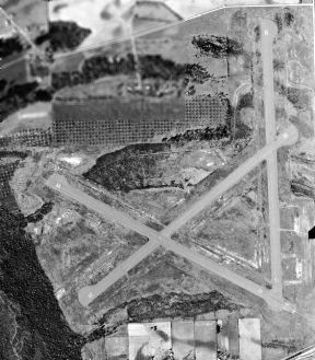
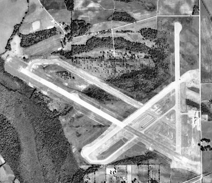
As of the 1997 USGS aerial photo, the airfield still consisted of 3 paved runways (the longest is 5,800'),
which remained in fairly good condition.
Several buildings were located on the ramp on the east side of the field -
it is not known if these were original hangars or if they are of more recent construction.
Several portions of the former runway appear to be used for storage of trailers or other objects.
Selma Municipal was still depicted as an abandoned airfield on 2002 aeronautical charts.
According to Billy Singleton, “Selfield is now used by the Bushhog Corporation for manufacture & storage of its products.”
A 2006 aerial photo by Phil Brooks, looking north at the former Selfield.
Note the huge number of house trailers which are stored on the property by FEMA.
A 1/19/13 aerial view (courtesy of Dallam Oliver-Lee) depicted Selfield as remaining intact, though covered with trailers.
Thanks to Steven McNicoll for information about Selma.
____________________________________________________
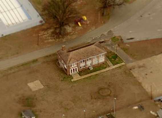
Montgomery Municipal Airport (Original) / Gunter Field, Montgomery, AL
32.41, -86.23 (East of Downtown Montgomery, AL)
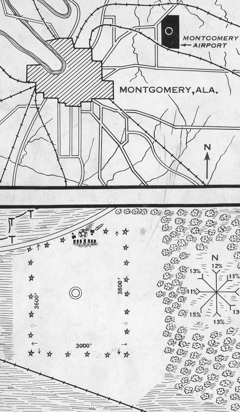
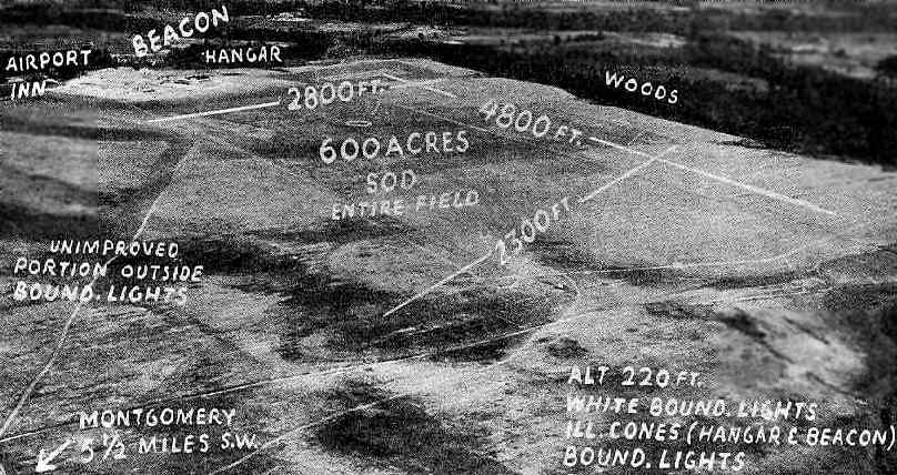
A circa 1929-31 Commerce Department Airway Bulletin depicting the location & layout of the original Montgomery Municipal Airport (courtesy of Rob Grant).
The original Montgomery Municipal Airport was built in 1929 on the northeast side of the city.
Mayor William Gunter was an advocate of aviation,
and the City Commission tried on more than one occasion to have the Municipal Airport renamed Gunter Field.
Mayor Gunter resisted the redesignation, but city residents commonly referred to the airport as Gunter Field.
The earliest depiction which has been located of Montgomery Airport
was a circa 1929-31 Commerce Department Airway Bulletin (courtesy of Rob Grant).
It depicted Montgomery Airport as an irregularly-shaped field, measuring 3,800' along the eastern edge, with a row of buildings & a beacon on the north side.
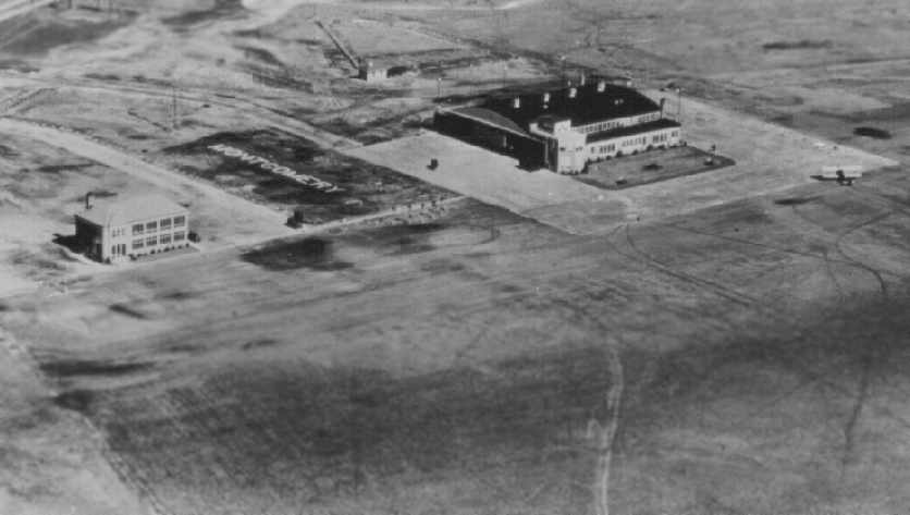
The earliest photo which has been located of Montgomery Airport was a 1930 aerial view looking northwest (courtesy of the U.S. Air Force),
showing its terminal building, hangar, ramp, and one biplane.
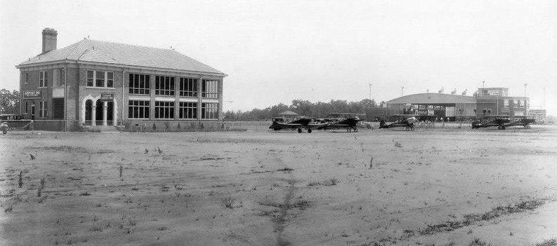
A circa early 1930s photo of the Montgomery Airport terminal building, several planes, and hangar (courtesy of E. V. Haley).
According to Rob Grant, “Ausfeld & Jones were the architects for this building at Gunter Field.”
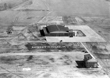
A 1930 aerial view (courtesy of Rob Grant) looking north at the Montgomery Airport hangar & terminal building,
with the name “Montgomery” spelled out in the grass in between.
An undated aerial view looking northeast at the original Montgomery Municipal Airport,
from The Airport Directory Company's 1933 Airport Directory (courtesy of Chris Kennedy).
The directory described the field as having 3 sod runways, with the longest being a 4,500' north/south strip.
At least one hangar was depicted on the north end of the field.
The manager was listed as Lion Mason, and the operators were listed as the Montgomery School of Aeronautics & American Airways.
The earliest aeronautical chart depiction which has been located of the original Montgomery Municipal Airport
was on the April 1933 Birmingham Sectional Chart.
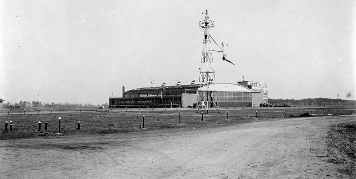
A circa 1933-34 photo of the beacon tower & hangar at Montgomery Municipal Airport (courtesy of Rob Grant).
According to the Air Force's Gunter Annex website, the May 1940 Plan for the Expansion of the of the Air Corps Training Program
called for establishment of a basic flying school in the vicinity of Montgomery.
Colonel Walter Weaver, Commandant of the Air Corps Tactical School at Maxwell Field,
decided that the Montgomery Municipal Airport & adjoining acreage would serve the purpose.
The airport occupied roughly 600 acres of land,
and 4 other plots comprising an additional 400 acres were identified as suitable for the military's needs.
One of the state plots included a newly built hospital for tubercular prisoners that had not been occupied.
In June 1940 the War Department approved the recommendation to lease the land.
Alabama Governor Frank Dixon agreed to lease the land owned by the state for $1 per year.
However, he stipulated that the State could cancel the lease
if the base population fell below 600 for 6 months in any 1-year period.
Colonel Weaver had estimated that the monthly payrolls at the basic flying school would exceed $100,000.
Lease negotiations for the private property & the municipal airport & golf course took longer,
but by 8/28/40 the leases were signed & recorded.
The first increment of military personnel arrived on 27 August 1940
and erected a tent city in front of the headquarters building (the former hospital).
Colonel Aubrey Hornsby was project officer for construction of the field.
He took pains to preserve as much of the pecan grove as possible while building the family quarters.
Construction of the runways which sit below the buildings flanking Turner Boulevard
required movement of 400,000 cubic yards of dirt.
Much of that soil was excavated from the area in front of the base headquarters
and became known as Gunter Bowl.
The first 200 basic flying cadets came to Gunter on 26 November 1940.
By 15 December 1940, the runways were being used by the pilots of 170 airplanes.
After Mayor William Gunter died in late 1940, Colonel Hornsby (the first base commander)
joined efforts by the Chamber of Commerce & the City of Montgomery
to have the installation designated as Gunter Field.
The War Department acceded to their wishes in February 1941.
Bob Morris reported, “In 1941 my father William Morris was a flight instructor at the Air Corps Basic Flying School, Gunter Field.
His pilot's log for 4/12/41, indicates that he made a cross country flight from Gunter Field to Schoen Field (IN), and returned to Gunter Field in a BT-13.”
Construction of the base was essentially complete by July 1941.
British cadets began arriving in August 1941.
The Royal Canadian Air Force also sent cadets to Gunter.
A 1942 aerial view looking east at Gunter Field.
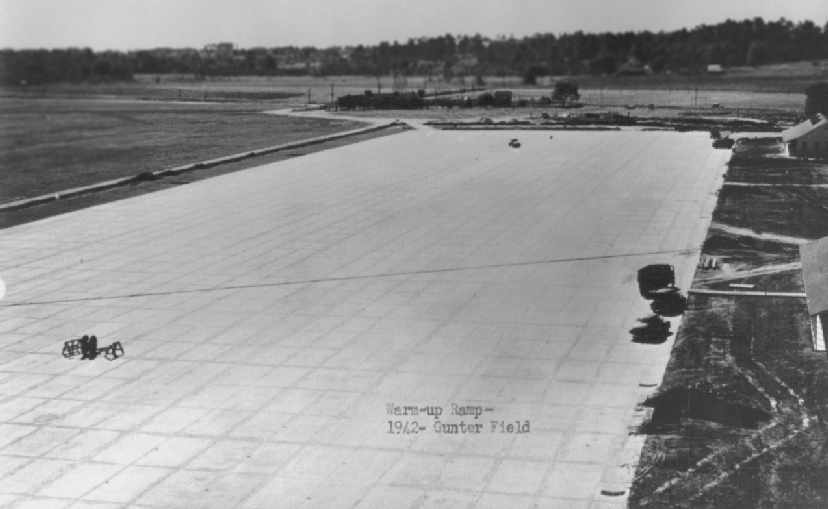
A 1942 photo of Gunter Field's ramp (courtesy of the U.S. Air Force).
In September 1943, French aviators joined the roster of those receiving training at Gunter.
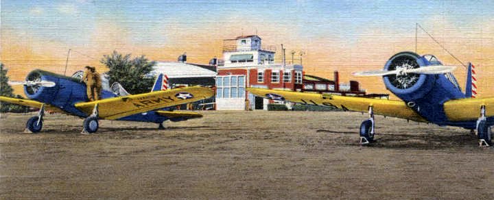
A WW2-era colorized postcard photo of Vultee BT-13 Valiant trainers in front of the Gunter Field Operations Building (courtesy of Rob Grant).
A WW2-era photo of Vultee BT-13 Valiant trainers from Gunter Field (courtesy of the U.S. Air Force).
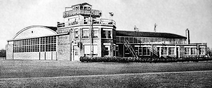
An undated (circa 1940s?) photo (enhanced by Bill Grasha) of a Gunter Field hangar with attached control tower.
A circa 1940-49 aerial view depicted a set of 4 paved runways constructed within Gunter's earlier grass airfield.
A circa 1940-49 aerial view depicted a set of 4 paved runways constructed within Gunter's earlier grass airfield.
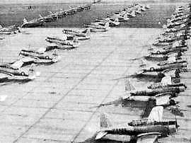
When training peaked in 1944, there were almost 400 aircraft assigned to Gunter.
Aircraft employed in the training program included North American BT-14s, Vultee BT-13s, and AT-6s.
"Gunter, Army" airfield was described by the 1944 US Army/Navy Directory of Airfields (courtesy of Ken Mercer)
as having a 3,500' hard-surface runway,
although the remarks included, "4,800' x 3,600' all-way available."
Gunter Field & a few of its satellite airfields,
as depicted on the 1945 Birmingham Sectional Chart (courtesy of Chris Kennedy).
During WW2, Gunter had 7 satellite airfields:
McLemore Field / Gunter Field Auxiliary #1 (10 miles E of Montgomery, later reused as Kershaw Airport),
Elmore Field / Gunter Field Auxiliary #2 (1.5 SW of Elmore, still in use as Wetumpka Municipal Airport),
Shorter Field / Gunter Field Auxiliary #3 (1.8 NNW of Shorter, of which no remains have been identified),
Mt. Meigs Field / Gunter Field Auxiliary #4 (5 miles SE of Mt. Meigs),
Taylor Field / Gunter Field Auxiliary #5 (12 miles ESE of Montgomery),
Dannelley Field / Gunter Field Auxiliary #6 (7 miles SW on Montgomery, still in use as Montgomery Regional Airport),
and Deatsville Field / Gunter Field Auxiliary #7 (3 miles SW of Deatsville).
When the war ended, U.S. cadets were allowed to withdraw & only French cadets remained.
They transferred to Spence Field, Georgia, in September 1945
and the continuous training begun in 1940 came to an end.
One more contingent of aviator trainees came to Gunter.
On 22 September 1945 Chinese students arrived for pre-flight training.
Their numbers rose to almost 600 but their stay was brief.
The last Chinese students left Gunter on 10 January 1946.
In that month, all of Gunter’s aircraft were transferred to Maxwell Field
and communication facilities shut down.
Assigned military strength dropped to 37 & a busy training field dropped to "stand-by" status.
On 1/13/48 Gunter Field became Gunter Air Force Base.
On 5/1/50 the Air University organized the Extension Course Institute & relocated that unit to Gunter.
The training mission expanded with establishment of a branch of the School of Aviation Medicine at Gunter in October of 1950.
A 1950 aerial photo of Gunter Field depicted the runways without any closed “X” markings,
but there did not appear to be any planes on the ramps at all (according to Chris Kennedy).
Although flying operations at Gunter had reportedly ceased in 1946,
"Gunter AFB" was still depicted as an active airfield on the February 1955 Birmingham Sectional Chart.
It was depicted as having a 3,700' paved runway.
Establishment of the Montgomery Air Defense Sector at Gunter in September 1957 produced the most visible landmark on the base.
The reinforced concrete 4-story blockhouse contained 2 huge computers
which integrated information from the Federal Aviation Administration
and inputs from radar stations along the southeastern coast of the United States.
The Semi-Automatic Ground Environment (SAGE) blockhouses
were intended to provide early notification of & response to the Soviets’ nuclear threat.
Gunter was depicted as an abandoned airport on the February 1960 Birmingham Sectional Chart.

A 1964 photo of Christmas decorations in front of a Gunter Field hangar (courtesy of Rob Grant).
A 1964 aerial photo of Gunter Field depicted all of its runways having closed “X” markings,
except for the easternmost north/south runway (according to Chris Kennedy).
By 1969, technological advances allowed the Air Force to shut down many of the SAGE blockhouses, including the one at Montgomery.
In April 1971 the U.S. government returned 777 acres to the City of Montgomery,
land now occupied by the Gunter Industrial Park & Lagoon Park.
That was the same year that the Air Force Data Systems Design Center moved to Gunter.
In 1972 the Senior Noncommissioned Officer Academy was activated at Gunter.
The release of so much airfield area to the City of Montgomery
resulted in Gunter’s redesignation as an Air Force Station on 1 July 1973.
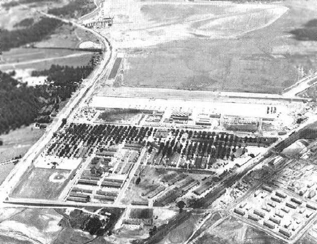
A 1973 Soil Conservation Service photo of the remains of Gunter Field (courtesy of Thomas Kallsen of the University of Alabama Map Library).
Most of the runways & ramps of the former airfield were still extant,
but the redevelopment of the area had begun.
The Air Force Data Systems Design Center took possession of the current headquarters building (888) in April 1977.
On 8/2/79 the building was dedicated to the memory of Major General Vernon Turner, the unit’s first commander.
A circa 1980 aerial view of the remains of Gunter Field (from the wall of main hallway at the Air University Library at Maxwell AFB, courtesy of Ron Plante).
The 1980s were a decade of construction at Gunter.
The contract for construction of the first phase of Building 856 was awarded in April 1985.
The 1987 USGS topo map labeled the western portion of the property as "Gunter Air Force Station",
while the eastern half was labeled "Gunter Industrial Park".
On 4/29/88, Building 856 was dedicated as Moore Hall,
memorializing former commander Brigadier General Donald Moore.
During that month, Gunter was redesignated as an Air Force Base,
a change ceremonially recognized on 27 May with the opening of Turner Gate & the unveiling of a sign bearing the new name.
The unit took beneficial occupancy of Building 856, Phase III in May 1991.
Construction of Building 856 had added almost 200,000 square feet to the unit’s operating space,
but that expansion was only a portion of the transformation of the World War II base.
The Extension Course Institute moved into a new building
and Senior NCO Academy enjoyed a major expansion of its campus.
Turner Boulevard had become Gunter’s Main Street.
The dramatic growth of facilities on Gunter owed much to the advocacy of Congressman William Dickinson.
He believed that survival of the bases in Montgomery depended upon capital investment & he championed new construction.
On 10 March 1992, the Air Force redesignated Gunter Air Force Base as Maxwell Air Force Base, Gunter Annex.
That name change was motivated by a desire to protect both Maxwell & Gunter from the Base Realignment & Closure Commission.
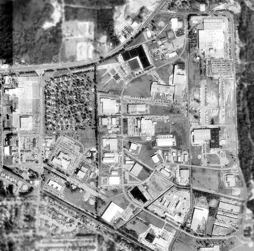
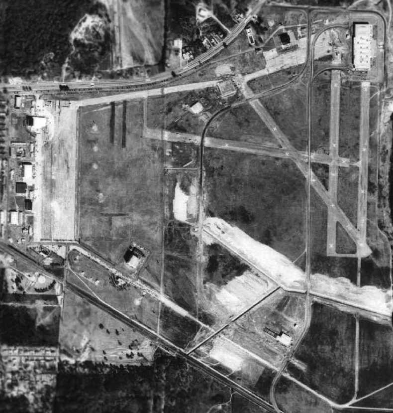
As seen in the 1998 USGS aerial photo, the Gunter Field property had been significantly redeveloped,
with many streets & buildings having been constructed over the former airfield.
However, remaining sections of several former runways were still apparent, in between the buildings,
as well as a large portion of the concrete ramp on the west side of the former airfield.
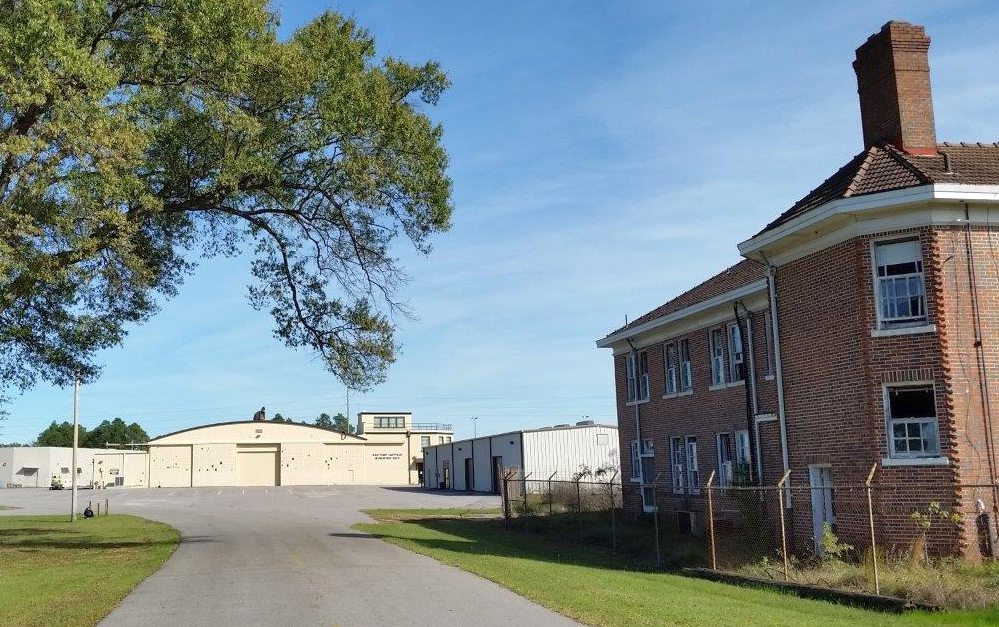
Two 1999 photos by Ron Plante (enhanced by Bill Grasha) of the front & back of the circa 1929 hangar which remained standing at Gunter Field.
The building was labeled “Budget Information Systems”.
A 1999 photo by Ron Plante of the former SAGE blockhouse (Semi Automated Ground Environment, an air defense command center)
which remained standing at Gunter Field.
Charles Presley reported that the 2 buildings depicted in the 1930 photo of Montgomery Municipal Airport are still standing, as of 2005.
"That hangar is the only one left on the base. The terminal on the left is abandoned, but mostly intact."
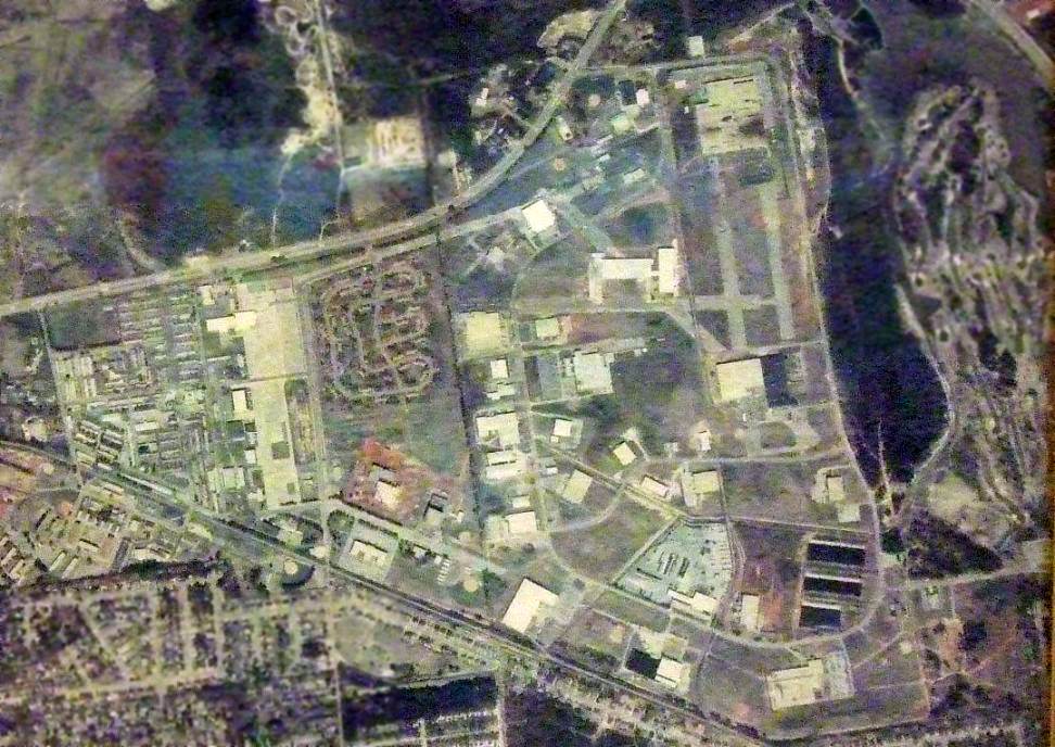
A circa 2006 aerial view looking north at the circa-1929 hangar which remains standing on the northeast side of Gunter Field.
A circa 2006 aerial view looking north at the circa-1929 airport terminal building which remains standing on the northeast side of Gunter Field.
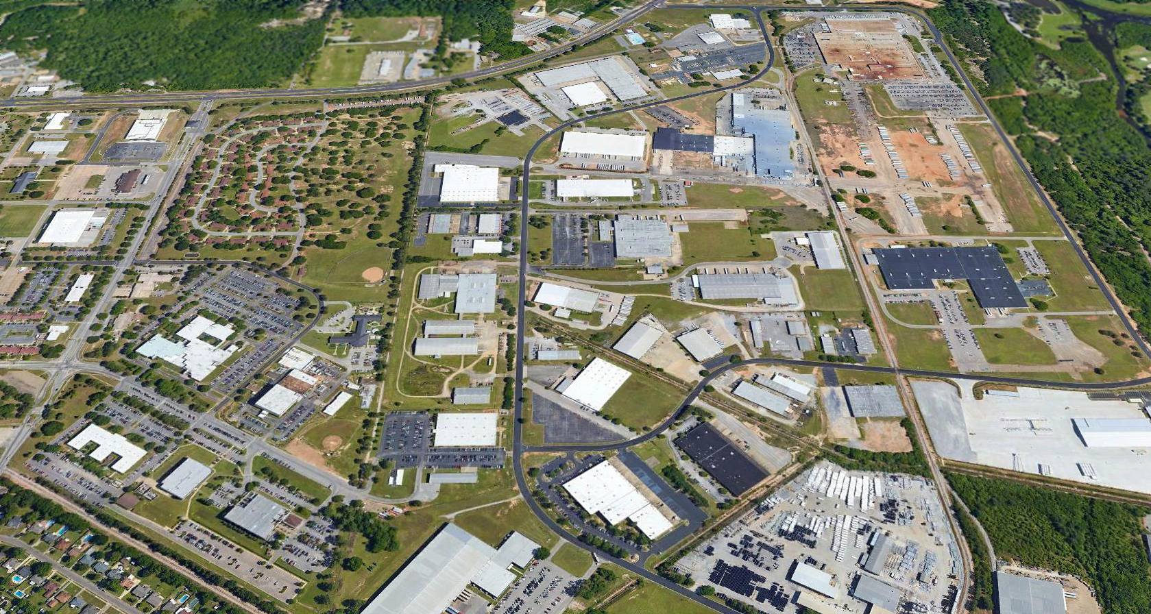
A 2015 aerial view looking north showed that portions of the former Gunter Field runways were still apparent on the northeast side of the site.
A November 2015 photo by Matt Ziemann of the circa-1929 hangar & airport terminal building which remains standing on the northeast side of Gunter Field.
Matt observed, “The good news is that the hangar & old terminal building are still there. The bad news is you can see the dilapidated state they are in. Sad.”
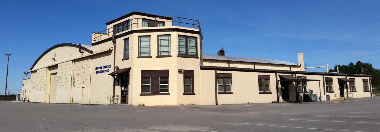
A November 2015 photo by Matt Ziemann of the circa-1929 hangar which remains standing on the northeast side of Gunter Field.
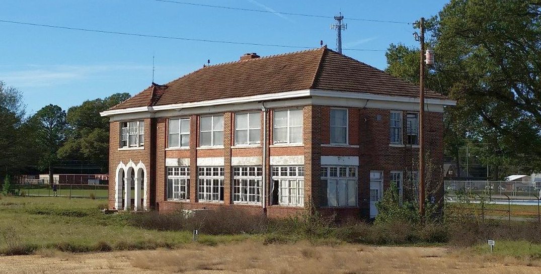
A November 2015 photo by Matt Ziemann of the circa-1929 airport terminal building which remains standing on the northeast side of Gunter Field.
____________________________________________________
Mt. Meigs Field / Gunter Auxiliary Army Airfield #4, Mt. Meigs, AL
32.365, -86.026 (East of Montgomery, AL)
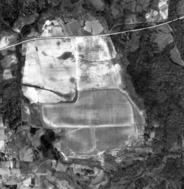
Mt. Meigs Field, as depicted on a 1942 aerial photo (courtesy of Rob Grant).
According to a historical plaque on the site of The Oaks Plantation, “During WWII, an auxiliary landing strip, called Mt. Meigs Field,
was built on the land by Army Corp of Engineers, and was used for training by American, French, and British aviation cadets from Gunter Field
as well as by Tuskegee Airmen from Moton Field.”
Mt. Meigs Field served in this capacity during the Second World War as one of 7 auxiliary airfields which supported flight training operations at Gunter Field.
The earliest depiction which has been located of Mt. Meigs Field was a 1942 aerial view (courtesy of Rob Grant).
It depicted an irregularly-shaped grass airfield with no other improvements.
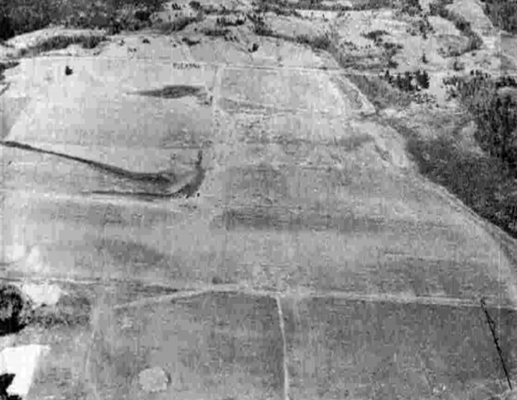
A 2/11/43 aerial view looking north at “Gunter Field Auxiliary #4 (Mt. Meigs Field)” from the 1945 AAF Airfield Directory (courtesy of Scott Murdock)
depicted an irregularly-shaped grass airfield with no other improvements.
The 1945 AAF Airfield Directory (courtesy of Scott Murdock) described “Gunter Field Auxiliary #4 (Mt. Meigs Field)”
as a 333 acre irregularly-shaped property having a 4,650' x 4,500' turf all-way landing field.
The field was said to not have any hangars,
to be owned by private interests, and operated by the Army Air Forces.
Mt. Meigs Field was evidently closed at the end of the Second World War & never reused for civilian aviation.
Mt. Meigs Field was not depicted at all on the 1959 USGS topo map.
A 1992 USGS aerial photo showed the site of Mt. Meigs Field remained a series of undeveloped fields.
A 2006 aerial photo showed that a large portion of the airfield site was being used to mine sand or other materials.
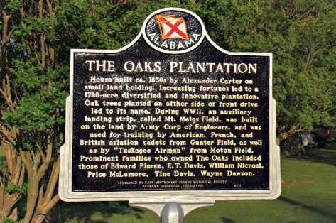
An undated photo of a plaque erected in commemorating the history of The Oak Plantation, including Mt. Meigs Field.
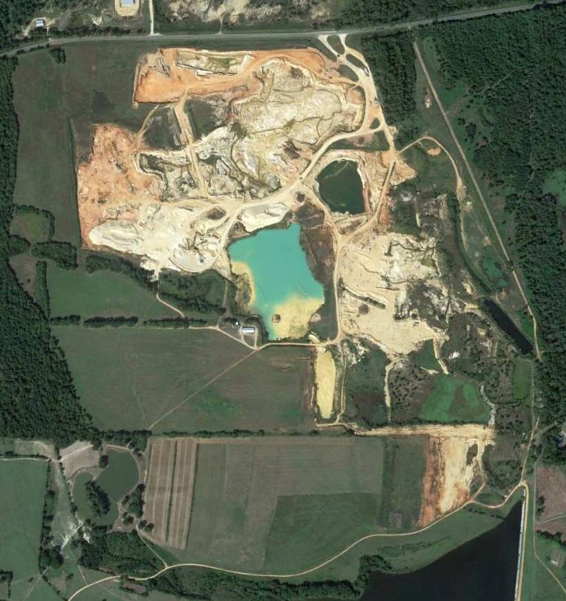
A 9/23/12 aerial photo showed that the outline of the Mt. Meigs Field property remained somewhat recognizable,
but much of the property had been reused for sand mining.
The site of Mt. Meigs Field is located east of the terminus of Avenue of the Oaks.
Thanks to Rob Grant for pointing out this airfield.
____________________________________________________
Taylor Field / Gunter Auxiliary Army Airfield #5, Pike Road, AL
32.3, -86.115 (East of Montgomery, AL)
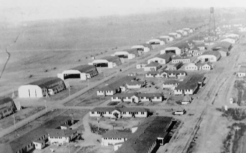
A 1918 aerial view looking northwest along the amazing number of hangars (16 of them) at Taylor Field
(courtesy of the Air University Office of History, via Billy Singleton, restored by Bill Grasha).
Taylor Field was originally constructed as a primary training field of the Army Air Service in 1917.
More than 200 JN-4 & DH-4 aircraft were used at the field during this period.
A total of 16 large hangars were constructed in 1917. The property consisted of a total of 800 acres.
The earliest depiction of Taylor Field which has been located was a 1918 aerial photo (courtesy of Billy Singleton).
It depicted the field as having a very impressive row of no less than 16 large hangars.
A total of 139 pilots completed Taylor Field's 8 week training course, and some went on to serve in France during World War One.
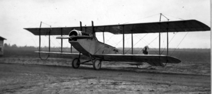
A 1918 photo (courtesy of Rob Grant) of a Curtiss JN-4 Jenny air ambulance biplane at Taylor Field.
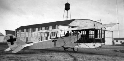
A 1918 photo (courtesy of Rob Grant) of a Curtiss JN-4 Jenny air ambulance biplane in front of a Taylor Field hangar.
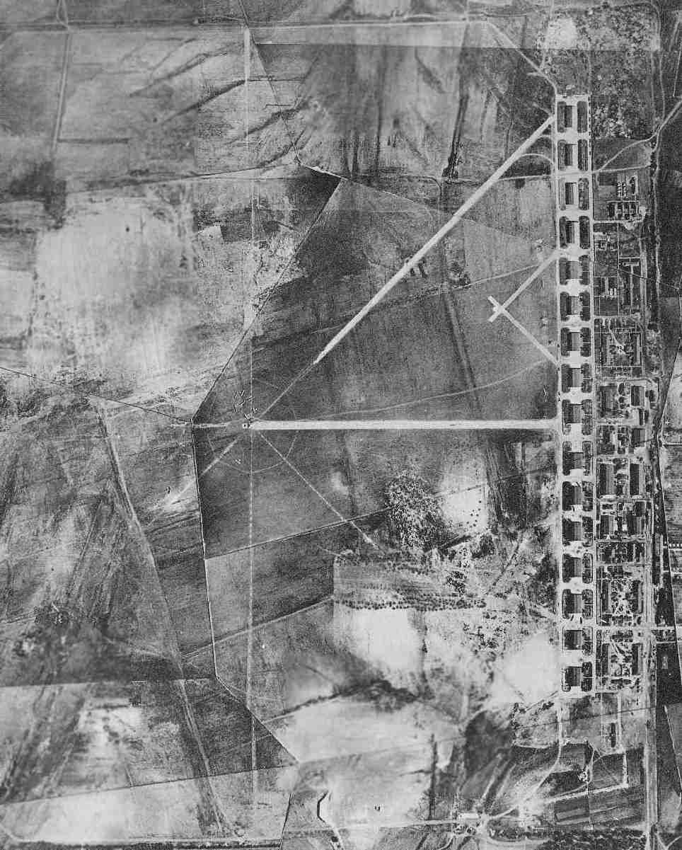
An undated (circa WW1 era) National Archives aerial view (courtesy of Brian Rehwinkel)
showing Taylor Field in operation, with several aircraft visible on the airfield,
and an amazing array of 16 hangars along the east side.
The purpose of the numerous markings along the grass airfield is unknown.
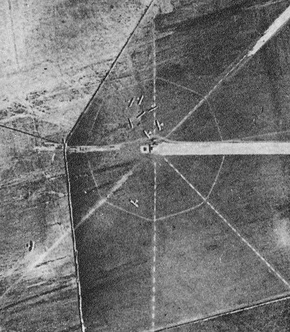
A closeup from the undated (circa WW1 era) National Archives aerial view (courtesy of Brian Rehwinkel)
showing 9 single-engine aircraft arrayed around the bulls-eye marking in the center of Taylor Field's airfield.
Taylor Field was closed after the end of World War One in April 1919, but the military maintained the site.
The earliest map depiction which has been located of Taylor Field was on the 1919 TIB Military Map of the US (courtesy of Jonathan Westerling).
Taylor Field was not depicted at all on the 1937 AL DOT map (courtesy of Dallam Oliver-Lee).
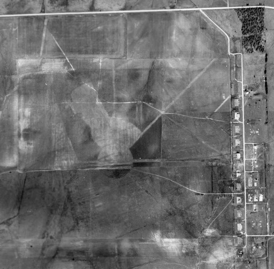
A 1/25/41 National Archives aerial view (courtesy of Brian Rehwinkel) showing the remains of the WW1 Taylor Field facilities.
It appeared as if all 16 of the WW1 hangars had been removed, with their foundations remaining,
and all of the other buildings to the east had been removed, with the street grid remaining.
During the Second World War, Taylor Field was used as one of 7 auxiliary airfields to support flight training operations at Gunter Field.
It was known during WW2 as Taylor Auxiliary Army Airfield #5.
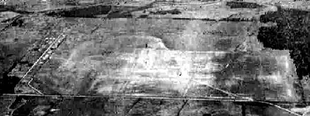
A circa 1942-45 aerial view looking south from the 1945 AAF Airfield Directory (courtesy of Scott Murdock)
depicted “Gunter Field Auxiliary #5 (Taylor Field)” as a grass field with the remains of the WW1 hangars along the east side.
The 1945 AAF Airfield Directory (courtesy of Scott Murdock) described “Gunter Field Auxiliary #5 (Taylor Field)”
as a grass field with the remains of the WW1 hangars along the east side.
as a 484 acre square field having a 5,500' x 4,600' all-way turf landing area.
The field was said to not have any hangars, to be owned by private interests, and operated by the Army Air Forces.
However, Taylor Field was not depicted at all on aeronautical charts during WW2,
such as the Birmingham Sectional Charts from 1941, 1943, 1944, or 1945,
or the 14M Regional Aeronautical Charts from 1941, 1942, 1943, or 1944 (according to Chris Kennedy).
After the end of the Second World War, Taylor Field was closed again in July 1946, and returned to the family of the original property owners.
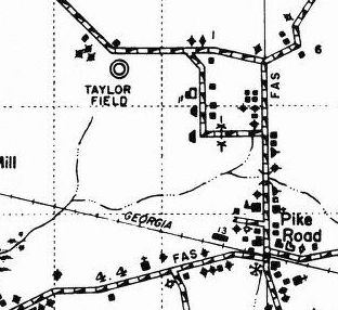
Taylor Field was still depicted on the 1937 AL DOT map (courtesy of Dallam Oliver-Lee).
By the time of the 1958 USGS topo map, only a few buildings were depicted at the site of Taylor Field,
but it was not labeled as an airfield.
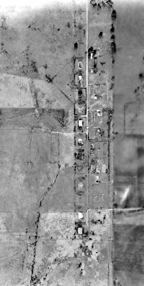
A 1964 aerial photo (from the University of Alabama Map Library) showed several buildings at the site of Taylor Field,
but they might have been constructed over the foundations of the WW1 era buildings.
A 3/6/97 USGS aerial photo (courtesy of Dallam Oliver-Lee) showed the majority of the hangar foundations remained.
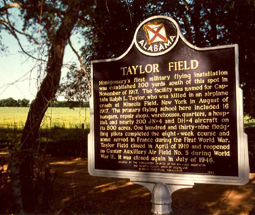
A 2005 photo by Billy Singleton of the historic sign at the site of Taylor Field.
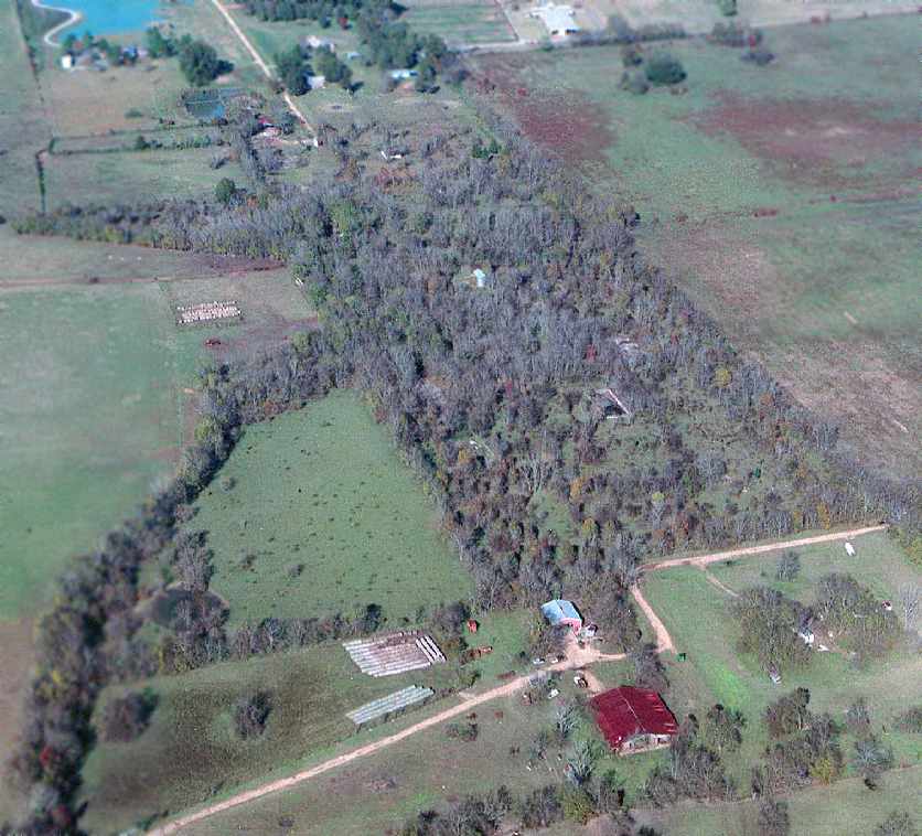
A 2005 aerial photo by Billy Singleton of the site of Taylor Field.
“Not much left except the concrete hangar pads & swimming pool.”
Trees had continued to grow among the foundations, obscuring the last traces of the military airfield.
The red-roofed shed at the bottom had possibly been built over a remaining hangar foundation.
A 6/14/06 aerial view (courtesy of Dallam Oliver-Lee) showed that a street had been built over the northern portion
of Taylor Field's former hangar row at some point between 2005-06.
The southern 2/3 of the row of hangar foundations remained, but obscured by trees.
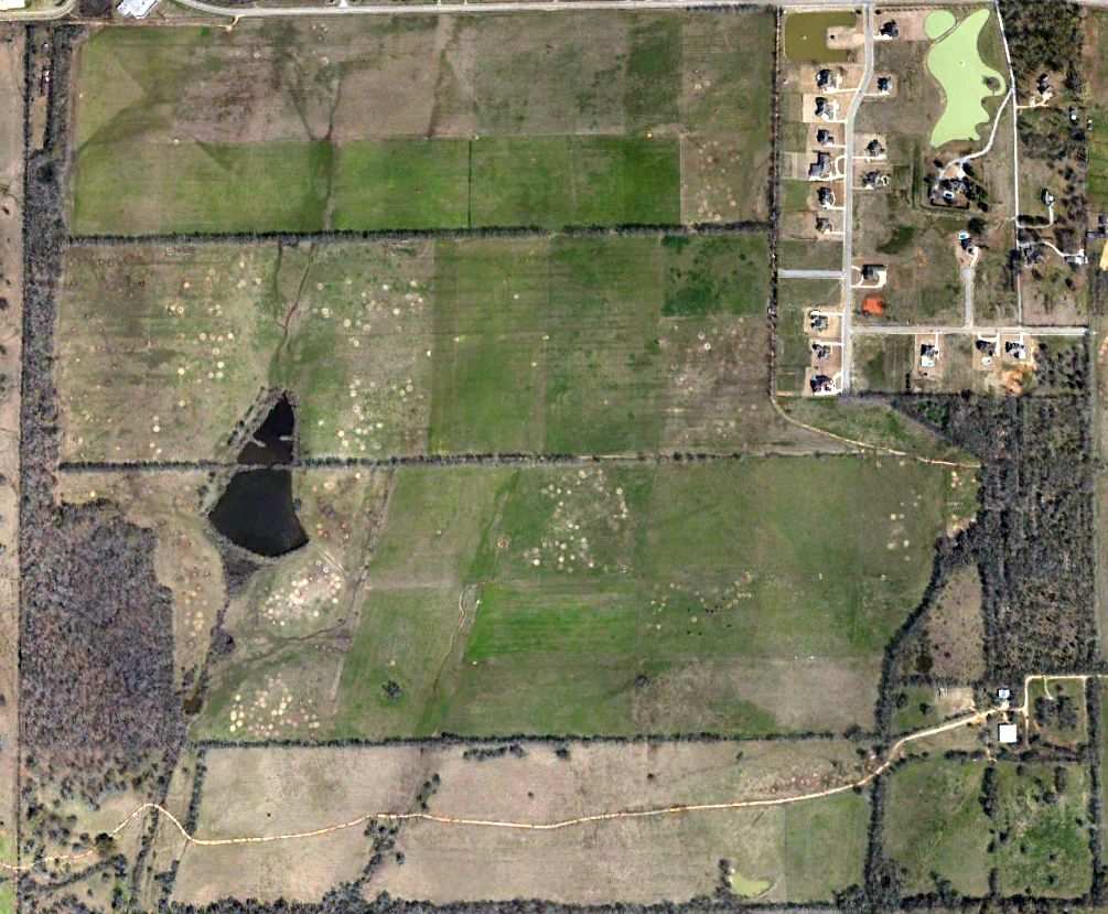
2/17/13 aerial photo (courtesy of Dallam Oliver-Lee) but the majority of Taylor Field remained without redevelopment.
The site of Taylor Field is located south of the intersection of Ray Thornington Road & Foxchase Drive.
____________________________________________________
Since this site was first put on the web in 1999, its popularity has grown tremendously.
If the total quantity of material on this site is to continue to grow,
it will require ever-increasing funding to pay its expenses.
Therefore, I request financial contributions from site visitors,
to help defray the increasing costs of the site
and ensure that it continues to be available & to grow.
What would you pay for a good aviation magazine, or a good aviation book?
Please consider a donation of an equivalent amount, at the least.
This site is not supported by commercial advertising –
it is purely supported by donations.
If you enjoy the site, and would like to make a financial contribution,
you
may use a credit card via
![]() :
:
Please consider checking the box to make a monthly donatation.
For a mailing address to send a check, please contact me at: paulandterryfreeman@gmail.com
If you enjoy this web site, please support it with a financial contribution.
This site covers airfields in all 50 states.